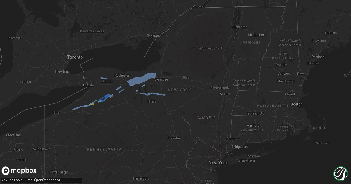
Hail Map in New York on July 29, 2020
Get this storm
July 29 map
$229
one time, instant access
Download today. No call, no setup
Keep the $229
Bought the map and want the full workflow? Apply the entire $229 to a subscription within 7 days. None of it is wasted.
Every map, not just this one
This buys you this map. Subscription and you get every map we run, in the markets you choose from a few cities to whole states to nationwide. Plus real-time alerts the moment a storm fires.
Contact data
Name, contact info, occupancy, even credit band for addresses in the footprint. You go from where it hit to who to call.
Become the source they trust
Unlimited branding weather history reports on demand. You already have the documented answer ready for the property owner, and you are the one who showed up with it.
Property data and RoofTrace estimates
Pull up any address you have got, its value and the exact code rules for that jurisdiction, straight from One Click Code. Then RoofTrace estimates the squares, pitch, and roof value, priced the way you price.
Storm reports in New York
New York
| Date | Description |
|---|---|
| 07/29/20205:53 PM CDT | Storm survey confirmed ef0 tornado damage along the oatka creek from south of wheatland center to south of scottsville. |
| 07/29/20205:52 PM CDT | Two trees down on quaker rd near river rd |
| 07/29/20205:52 PM CDT | Large tree down across south rd near scottsville |
| 07/29/20205:50 PM CDT | Multiple trees and limbs damaged |
| 07/29/20205:50 PM CDT | Large tree down across union st |
| 07/29/20205:46 PM CDT | Several powerlines down |
| 07/29/20205:42 PM CDT | Numerous trees down |
| 07/29/20205:15 PM CDT | Large tree uprooted along oak orchard rd near elba |
| 07/29/20204:55 PM CDT | Trees and wires down |
| 07/29/20204:52 PM CDT | Trees and wires down |
| 07/29/20204:07 PM CDT | Large tree down on hard point rd |
| 07/29/20203:55 PM CDT | Trees and wires down along miller road as per county dispatch feed. Car hit tree but drove away. No known injuries. |
| 07/29/20203:50 PM CDT | Radar estimated time. Tree down on west town line road. |
| 07/29/20203:44 PM CDT | Muliple trees down just north of exit 42 off of i-90. |
| 07/29/20203:43 PM CDT | Large tree down on a home on druid hill park in irondequoit |
| 07/29/20203:42 PM CDT | Tree down on parked car on baycliff dr |
| 07/29/20203:41 PM CDT | Several trees down. Two boats damaged. |
| 07/29/20203:40 PM CDT | Large tree down on powerlines on route 31 |
| 07/29/20203:31 PM CDT | Trees and wires down near friend road and comstock road. |
| 07/29/20203:28 PM CDT | Large tree limbs and wires down near the intersection of route 245 and 247 |
| 07/29/20203:20 PM CDT | Several trees and powerlines down in the city of canandaigua |
| 07/29/20203:17 PM CDT | Large tree down on a parked car on sandy beach dr |
| 07/29/20202:55 PM CDT | Trees and powerlines down |
| 07/29/20202:52 PM CDT | Trees and powerlines down |
| 07/29/20202:35 PM CDT | Many trees down north of nunda |
| 07/29/20202:30 PM CDT | Trees and powerlines down |
| 07/29/20202:14 PM CDT | Trees down |
| 07/29/20202:10 PM CDT | Trees and power lines down on route 39 |
| 07/29/20201:57 PM CDT | Trees down on power lines |
| 07/29/20201:16 PM CDT | Large tree with wires down. |
| 07/29/20201:01 PM CDT | Tree and wires down. |
| 07/29/202012:55 PM CDT | Tree and wire fell on house along state route 394. |
| 07/29/202012:28 PM CDT | Wires down between county route 139 and parish road. |
| 07/29/202012:14 PM CDT | Wires down near brown street and south avenue. |
| 07/29/202012:03 PM CDT | Trees and wires down. |
| 07/29/20201:41 AM CDT | At 641 PM EDT, a severe thunderstorm was located near Oakfield, or 9 miles northwest of Batavia, moving east at 30 mph. HAZARD...60 mph wind gusts and quarter size hail. SOURCE...Radar indicated. IMPACT...Minor damage to vehicles is possible. Expect wind damage to roofs, siding, and trees. Locations impacted include... Byron, Oakfield, Elba and Barre Center. |
| 07/29/20201:37 AM CDT | At 637 PM EDT, a severe thunderstorm was located near Le Roy, or 11 miles east of Batavia, moving east at 25 mph. HAZARD...60 mph wind gusts and penny size hail. SOURCE...Radar indicated. IMPACT...Expect damage to roofs, siding, and trees. Locations impacted include... Henrietta, Le Roy, Avon, Victor, Honeoye Falls, Bristol, Caledonia, Lima, Scottsville and Churchville. This includes the following highways... Interstate 390 between exits 10 and 12. Interstate 90 between exits 47 and 44. |
| 07/29/202012:42 AM CDT | At 542 PM EDT, a severe thunderstorm was located near Oakfield, or 10 miles south of Medina, moving east at 25 mph. HAZARD...60 mph wind gusts and penny size hail. SOURCE...Radar indicated. IMPACT...Expect damage to roofs, siding, and trees. Locations impacted include... Batavia, Le Roy, Pembroke, Byron, Oakfield, Stafford, Alabama, Bergen, Elba and East Bethany. This includes Interstate 90 between exits 48A and 47. |
| 07/29/202012:09 AM CDT | At 508 PM EDT, a severe thunderstorm was located near Weedsport, or 11 miles north of Auburn, moving east at 45 mph. HAZARD...60 mph wind gusts. SOURCE...Radar indicated. IMPACT...Expect damage to roofs, siding, powerlines and trees. Locations impacted include... Clay, Cicero, Lysander, Van Buren, Baldwinsville, North Syracuse, Liverpool, Jordan, Elbridge and Bridgeport. |
| 07/28/202011:56 PM CDT | At 455 PM EDT, a severe thunderstorm was located over Clyde, or 11 miles north of Seneca Falls, moving northeast at 45 mph. HAZARD...60 mph wind gusts and quarter size hail. SOURCE...Radar indicated. IMPACT...Minor damage to vehicles is possible. Expect wind damage to roofs, siding, and trees. Locations impacted include... Fulton, Lyons, Clyde, Central Square, Weedsport, Cato, Hastings, Volney, Constantia and West Monroe. This includes the following highways... Interstate 90 near exit 40. Interstate 81 between exits 32 and 33. |
| 07/28/202011:40 PM CDT | At 440 PM EDT, a severe thunderstorm was located near Irondequoit, moving east at 25 mph. HAZARD...60 mph wind gusts and quarter size hail. SOURCE...Radar indicated. IMPACT...Minor damage to vehicles is possible. Expect wind damage to roofs, siding, and trees. Locations impacted include... Rochester, Irondequoit, Webster, Brighton, Ontario, Penfield, Williamson, Marion, Sodus and Walworth. |
| 07/28/202011:36 PM CDT | At 434 PM EDT, severe thunderstorms were located along a line extending from near Clifton Springs to near Geneva to Potter, moving northeast at 35 mph. HAZARD...60 mph wind gusts and penny size hail. SOURCE...Radar indicated. IMPACT...Expect damage to roofs, siding, powerlines and trees. Locations impacted include... Seneca Falls, Waterloo, Romulus, Fayette, Benton, Potter, Montezuma, Tyre, Kendaia and Canoga. |
| 07/28/202011:20 PM CDT | At 420 PM EDT, a severe thunderstorm was located near Victor, or near Canandaigua, moving northeast at 40 mph. HAZARD...60 mph wind gusts. SOURCE...Radar indicated. IMPACT...Expect damage to roofs, siding, and trees. Locations impacted include... Canandaigua, Newark, Lyons, Palmyra, Victor, Clifton Springs, Clyde, Phelps, Bloomfield and Farmington. This includes Interstate 90 between exits 45 and 42. |
| 07/28/202010:45 PM CDT | At 344 PM EDT, severe thunderstorms were located along a line extending from near Conesus to 7 miles east of Belfast, moving east at 30 mph. HAZARD...60 mph wind gusts and penny size hail. SOURCE...Radar indicated. IMPACT...Expect damage to roofs, siding, and trees. Locations impacted include... Dansville, Naples, Groveland, Springwater, Ossian, Canaseraga, Birdsall, Ossian Center, Hunt Hollow and Swain. This includes Interstate 390 between exits 4 and 5. |
| 07/28/202010:41 PM CDT | At 341 PM EDT, a severe thunderstorm was located over Hemlock, or 10 miles east of Geneseo, moving east at 25 mph. HAZARD...60 mph wind gusts and quarter size hail. SOURCE...Radar indicated. IMPACT...Minor damage to vehicles is possible. Expect wind damage to roofs, siding, and trees. Locations impacted include... Geneva, Canandaigua, Conesus, Bristol, Rushville, Honeoye, Hemlock, Gorham, Canadice and Livonia. |
| 07/28/202010:27 PM CDT | At 326 PM EDT, a severe thunderstorm was located over Warsaw, or 12 miles northwest of Letchworth State Park, moving east at 35 mph. HAZARD...60 mph wind gusts. SOURCE...Radar indicated. IMPACT...Expect damage to roofs, siding, and trees. Locations impacted include... Geneseo, Letchworth State Park, Perry, Warsaw, Avon, Mount Morris, Conesus, Lima, Hemlock and Varysburg. This includes Interstate 390 between exits 6 and 10. |
| 07/28/20209:49 PM CDT | At 248 PM EDT, a severe thunderstorm was located near Ashford Hollow, or 18 miles north of Salamanca, moving east at 30 mph. HAZARD...60 mph wind gusts and quarter size hail. SOURCE...Radar indicated. IMPACT...Minor damage to vehicles is possible. Expect wind damage to roofs, siding, and trees. Locations impacted include... Dansville, Letchworth State Park, Springville, Arcade, Franklinville, Belfast, Rushford, Houghton, Portageville and Yorkshire. This includes Interstate 390 between exits 4 and 5. |
| 07/28/20209:10 PM CDT | At 210 PM EDT, a severe thunderstorm was located 11 miles north of Falconer, or 13 miles northeast of Jamestown, moving east at 30 mph. HAZARD...60 mph wind gusts and quarter size hail. SOURCE...Radar indicated. IMPACT...Minor damage to vehicles is possible. Expect wind damage to roofs, siding, and trees. Locations impacted include... Gowanda, Ashford, Franklinville, Ashford Hollow, Great Valley, New Albion, Dayton, Conewango, Ellington and Leon. |
| 07/28/20208:37 PM CDT | At 136 PM EDT, a severe thunderstorm was located over Ledyard, or 15 miles south of Auburn, moving east at 45 mph. HAZARD...60 mph wind gusts. SOURCE...Radar indicated. IMPACT...Expect damage to roofs, siding, and trees. Locations impacted include... Homer, Locke, Genoa, Ledyard, Preble, Moravia, Scott, Truxton, Cuyler and Sempronius. |
| 07/28/20208:28 PM CDT | At 128 PM EDT, a severe thunderstorm was located near Findley Lake, or 22 miles east of Erie, moving east at 25 mph. HAZARD...60 mph wind gusts and quarter size hail. SOURCE...Radar indicated. IMPACT...Minor damage to vehicles is possible. Expect wind damage to roofs, siding, and trees. Locations impacted include... Jamestown, Lakewood, Falconer, Mayville, Long Point State Park, Jamestown West, Chautauqua Institution, Findley Lake, Chautauqua and Gerry. This includes Interstate 86 between exits 4 and 14. |
| 07/28/20208:26 PM CDT | At 125 PM EDT, a severe thunderstorm was located near Dansville, moving east at 25 mph. HAZARD...60 mph wind gusts. SOURCE...Radar indicated. IMPACT...Expect damage to trees, powerlines and possibly homes. Locations impacted include... Wayland, Cohocton, Prattsburg, Perkinsville, Stony Brook State Park and Atlanta. |
| 07/28/20208:19 PM CDT | At 119 PM EDT, a severe thunderstorm was located over Dansville, moving east at 35 mph. HAZARD...60 mph wind gusts and quarter size hail. SOURCE...Radar indicated. IMPACT...Minor damage to vehicles is possible. Expect wind damage to roofs, siding, and trees. Locations impacted include... Dansville, Naples, Groveland, Springwater, Nunda, Ossian, Canaseraga, Hunt, Dalton and Ossian Center. This includes Interstate 390 between exits 4 and 5. |
| 07/28/20208:10 PM CDT | At 109 PM EDT, a severe thunderstorm was located over Benton, or near Penn Yan, moving east at 45 mph. HAZARD...60 mph wind gusts. SOURCE...Radar indicated. IMPACT...Expect damage to trees, power lines and possibly homes. Locations impacted include... Romulus, Benton, Aurora, Ovid, Interlaken, Dresden, Kendaia, Ferguson Corners, Willard and Sheldrake. |
All States Impacted by Hail Map on July 29, 2020
Cities Impacted by Hail Map on July 29, 2020
- Winona, KS
- Scott City, KS
- Oakley, KS
- Holcomb, KS
- Garden City, KS
- Leoti, KS
- Marienthal, KS
- Penokee, KS
- Hill City, KS
- Morland, KS
- Eads, CO
- Cattaraugus, NY
- East Otto, NY
- Ellicottville, NY
- Little Valley, NY
- West Valley, NY
- Franklinville, NY
- Delevan, NY
- Machias, NY
- Arnold, NE
- Stapleton, NE
- Callaway, NE
- Penn Yan, NY
- Homer, NY
- Interlaken, NY
- Ovid, NY
- Cortland, NY
- Genoa, NY
- Groton, NY
- Cincinnatus, NY
- Locke, NY
- McGraw, NY
- King Ferry, NY
- Lansing, NY
- Dewittville, NY
- Springville, NY
- Mayville, NY
- Sinclairville, NY
- South Dayton, NY
- Conewango Valley, NY
- Cherry Creek, NY
- Bemus Point, NY
- Chautauqua, NY
- Gainesville, NY
- Fillmore, NY
- Castile, NY
- Silver Springs, NY
- Freedom, NY
- Portageville, NY
- Bliss, NY
- Farmersville Station, NY
- Arcade, NY
- Mount Morris, NY
- Nunda, NY
- Hunt, NY
- Geneseo, NY
- Lakeville, NY
- Livonia, NY
- Conesus, NY
- Groveland, NY
- Hemlock, NY
- Springwater, NY
- Wolcott, NY
- Shortsville, NY
- Newark, NY
- Weedsport, NY
- Farmington, NY
- Victor, NY
- Baldwinsville, NY
- Lyons, NY
- Stanley, NY
- Port Byron, NY
- Manchester, NY
- Savannah, NY
- Seneca Falls, NY
- Clifton Springs, NY
- Warners, NY
- Red Creek, NY
- Phelps, NY
- Memphis, NY
- Macedon, NY
- Clyde, NY
- Waterloo, NY
- Montezuma, NY
- Phoenix, NY
- Cato, NY
- Geneva, NY
- Martville, NY
- Canandaigua, NY
- Palmyra, NY
- Jordan, NY
- Basom, NY
- Oakfield, NY
- Elba, NY
- Pierceville, KS
- Ingalls, KS
- Ensign, KS
- Cimarron, KS
- Wichita, KS
- Valley Center, KS
- Colwich, KS
- Maize, KS
- Sterling, KS
- Haven, KS
- Hutchinson, KS
- Lyons, KS
- Windom, KS
- Buhler, KS
- Burrton, KS
- Little River, KS
- Inman, KS
- Nickerson, KS
- Andale, KS
- Mount Hope, KS
- Haysville, KS
- Peck, KS
- Cherokee, OK
- Dacoma, OK
- Carmen, OK
- Alva, OK
- Waynoka, OK
- Belle Plaine, KS
- Wellington, KS
- Selden, KS
- Hoxie, KS
- Palco, KS
- Holly, CO
- Syracuse, KS
- Coolidge, KS
- Lakin, KS
- Kendall, KS
- Sand Springs, OK
- Hominy, OK
- Skiatook, OK
- Terlton, OK
- Cleveland, OK
- Maramec, OK
- Fairfax, OK
- Red Rock, OK
- Glencoe, OK
- Osage, OK
- Pawnee, OK
- Barnsdall, OK
- Morrison, OK
- Prue, OK
- Dorrance, KS
- Wilson, KS
- Osborne, KS
- Natoma, KS
- Damar, KS
- Brookville, KS
- Waldo, KS
- Alton, KS
- Stockton, KS
- Lucas, KS
- Ellsworth, KS
- Bogue, KS
- Luray, KS
- Sylvan Grove, KS
- Kanopolis, KS
- Paradise, KS
- Lenora, KS
- Woodston, KS
- Lincoln, KS
- Bartley, NE
- Moorefield, NE
- Eustis, NE
- Thedford, NE
- Indianola, NE
- Cambridge, NE
- Wilsonville, NE
- Lebanon, NE
- Beaver City, NE
- Maywood, NE
- Hayes Center, NE
- McCook, NE
- Tryon, NE
- Karval, CO
- Rexford, KS
- Wanblee, SD
- Sutherland, NE
- Elm Creek, NE
- Wallace, NE
- Norton, KS
- Stockville, NE
- Holdrege, NE
- Long Valley, SD
- Martin, SD
- Ness City, KS
- Bazine, KS
- Sedgwick, KS
- Bentley, KS
- Curtis, NE
- North Platte, NE
- Gerry, NY
- Pine Ridge, SD
- Seneca, NE
- Wellfleet, NE
- Hershey, NE
- Jennings, KS
- Kadoka, SD
- Overton, NE
- Porcupine, SD
- Goddard, KS
- Elsie, NE
- Alexander, KS
- Kilgore, NE
- Fredericktown, MO
- Farmington, MO
- Brady, NE
- Norcatur, KS
- Arapahoe, CO
- Clayton, KS
- Grainfield, KS
- Quinter, KS
- Gorham, KS
- Clermont, FL
- Broken Bow, NE
- Hendley, NE
- Raymond, KS
- Ellis, KS
- Collinsville, IL
- Troy, IL
- Plymouth, IL
- Larned, KS
- Plainville, KS
- Rosston, OK
- Buffalo, OK
- Ashland, KS
- Rozel, KS
- Park Hill, OK
- Sublette, KS
- Lawrenceville, VA
- Dolphin, VA
- White River, SD
- La Crosse, KS
- Muskogee, OK
- Protection, KS
- Coldwater, KS
- Lingle, WY
- Torrington, WY
- Rush Center, KS
- Hays, KS
- Trenton, MI
- Riverview, MI
- Romulus, MI
- Valentine, NE
- Philip, SD
- Burwell, NE
- Wild Horse, CO
- Kit Carson, CO
- Bunch, OK
- Cookson, OK
- Vian, OK
- Anadarko, OK
- Verden, OK
- Nekoma, KS
- Medina, NY
- McCracken, KS
- Edison, NE
- Honeoye, NY
- Bassett, NE
- Norris, SD
- Parmelee, SD
- Newton, KS
- Holly Springs, NC
- Apex, NC


