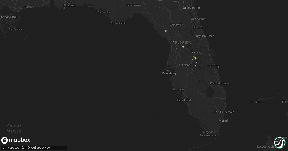
Hail Map in Florida on July 28, 2019
Get this storm
July 28 map
$229
one time, instant access
Download today. No call, no setup
Keep the $229
Bought the map and want the full workflow? Apply the entire $229 to a subscription within 7 days. None of it is wasted.
Every map, not just this one
This buys you this map. Subscription and you get every map we run, in the markets you choose from a few cities to whole states to nationwide. Plus real-time alerts the moment a storm fires.
Contact data
Name, contact info, occupancy, even credit band for addresses in the footprint. You go from where it hit to who to call.
Become the source they trust
Unlimited branding weather history reports on demand. You already have the documented answer ready for the property owner, and you are the one who showed up with it.
Property data and RoofTrace estimates
Pull up any address you have got, its value and the exact code rules for that jurisdiction, straight from One Click Code. Then RoofTrace estimates the squares, pitch, and roof value, priced the way you price.
Storm reports in Florida
Florida
| Date | Description |
|---|---|
| 07/28/20195:57 PM CDT | Emergency management reports a shed completely destroyed along with some palm trees down in beverly hills. Time estimated by radar. |
| 07/28/20194:25 PM CDT | Emergency management reports tree fell on a house at singing forest mobile home park. No injuries. Time estimated by radar. |
| 07/28/20193:24 AM CDT | At 824 PM EDT, a severe thunderstorm was located over Hunters Creek, or near Celebration, moving southeast at 15 mph. HAZARD...60 mph wind gusts and quarter size hail. SOURCE...Radar indicated. IMPACT...Hail damage to vehicles is expected. Expect wind damage to roofs, siding, and trees. Locations impacted include... Orlando, Kissimmee, Bay Lake, Celebration and West Lake Toho. |
| 07/27/20197:42 PM CDT | Delayed report...kissimmee utility authority relayed reports of hail up to quarter size in kissimmee. Time estimated from radar. |
| 07/27/20197:36 PM CDT | Kism awos measures peak wind gust of 56kt/64mph from the nnw |
| 07/27/20197:31 PM CDT | Kism awos measures peak wind gust of 50kt/58mph from the nw |
All States Impacted by Hail Map on July 28, 2019
Cities Impacted by Hail Map on July 28, 2019
- Wildwood, FL
- Sumterville, FL
- Fairfax, SD
- Lake Andes, SD
- Geddes, SD
- Herreid, SD
- Pollock, SD
- Osceola, PA
- Knoxville, PA
- Butte, NE
- Spencer, NE
- Inman, NE
- Platte, SD
- Oneill, NE
- Chambers, NE
- Ewing, NE
- Lakota, ND
- Michigan, ND
- New Haven, MI
- Ray, MI
- Menasha, WI
- Neenah, WI
- Whitney Point, NY
- Gackle, ND
- Fredonia, ND
- Franklinville, NY
- Kimball, SD
- Eureka, SD
- Freeville, NY
- Bowdle, SD
- Freeman, SD
- Corinna, ME
- Dexter, ME
- Saint Albans, ME
- Kennedy, NY
- Falconer, NY
- Gerry, NY
- Conewango Valley, NY
- Sinclairville, NY
- Millerton, PA
- Park River, ND
- Hoven, SD
- Gettysburg, SD
- Powhattan, KS
- Smithwick, SD
- Chamberlain, SD
- Bristow, NE
- Miller, SD
- Gann Valley, SD
- Ree Heights, SD
- Dryden, NY
- Marathon, NY
- New Sharon, ME
- Brillion, WI
- Oelrichs, SD
- Hot Springs, SD
- Chadron, NE
- Hay Springs, NE
- Shinglehouse, PA
- Ulysses, PA
- Coudersport, PA
- Haines City, FL
- Saint Lawrence, SD
- Bridgewater, SD
- Canistota, SD
- Marion, SD
- Linden, MI
- Howell, MI
- Valders, WI
- Manitowoc, WI
- Winfred, SD
- Denham Springs, LA
- Walker, LA
- Salem, SD
- Streeter, ND
- Fort Lauderdale, FL
- Java, SD
- Mound City, SD
- Abbot, ME
- Guilford, ME
- Highmore, SD
- Onida, SD
- Lebanon, SD
- Harford, NY
- Groton, NY
- Richford, NY
- Macomb, MI
- Holly, MI
- Mitchell, SD
- Letcher, SD
- Fulton, SD
- Warwick, ND
- Woodhull, NY
- Addison, NY
- Lapeer, MI
- Randolph, NY
- Netawaka, KS
- Van Etten, NY
- Lockwood, NY
- Saint Francis, ME
- Fenton, MI
- Highland, MI
- Selby, SD
- Ellsworth, NE
- Spencer, SD
- Faulkton, SD
- Zeeland, ND
- Arenas Valley, NM
- Alpena, SD
- Woonsocket, SD
- Grafton, ND
- Green Bay, WI
- New Franken, WI
- Imlay City, MI
- Attica, MI
- Kissimmee, FL
- Owego, NY
- Newark Valley, NY
- Candor, NY
- Chiefland, FL
- Petersburg, ND
- Sanborn, IA
- Tioga, PA
- Lawrenceville, PA
- Tulare, SD
- Redfield, SD
- Cherry Creek, NY
- Jamestown, NY
- Waterford, MI
- West Bloomfield, MI
- Painted Post, NY
- Roscoe, SD
- Smithfield, ME
- Oakland, ME
- Goff, KS
- Kaukauna, WI
- Madison, SD
- Ramona, SD
- Reedsville, WI
- Tappen, ND
- Fowlerville, MI
- Spencer, NY
- Cathay, ND
- Orlando, FL
- Union City, PA
- Athens, ME
- Hilbert, WI
- Horseheads, NY
- Alpine, NY
- Cayuta, NY
- Erin, NY
- Rockham, SD
- Hartland, MI
- White Lake, MI
- Mcville, ND
- Chetek, WI
- Weyerhaeuser, WI
- Saint David, ME
- Madawaska, ME
- Commerce Township, MI
- Horton, KS
- Troy, NY
- Allegany, NY
- Olean, NY
- Brooktondale, NY
- Berkshire, NY
- Howard, SD
- Canova, SD
- Greenleaf, WI
- Whitelaw, WI
- Maribel, WI
- The Villages, FL
- Pettibone, ND
- Bartlett, NE
- Hague, ND
- Strasburg, ND
- Wetmore, KS
- Dunnellon, FL
- Wessington, SD
- Cambridge, ME
- North Anson, ME
- Greenwood, WI
- Loyal, WI
- Appleton, WI
- Combined Locks, WI
- Monticello, MN
- Buffalo, MN
- Fort Thompson, SD
- Wessington Springs, SD
- Bingham, ME
- Floral City, FL
- Tuttle, ND
- Linton, ND
- Harmony, ME
- Colebrook, NH
- Davenport, FL
- Lowman, NY
- Oral, SD
- Luck, WI
- Frederic, WI
- Cumberland, WI
- Shell Lake, WI
- Spooner, WI
- Turtle Lake, WI
- Hertel, WI
- Trego, WI
- Comstock, WI
- Barronett, WI
- Casco, MI
- Fair Haven, MI
- Geneseo, KS
- Little River, KS
- Windom, KS
- Lyons, KS
- Davisburg, MI
- Conde, SD
- Doland, SD
- Raymond, SD
- Mellette, SD
- Turton, SD
- Brentford, SD
- Hitchcock, SD
- Willow Lake, SD
- De Smet, SD
- Yale, SD
- Carpenter, SD
- Iroquois, SD
- Frankfort, SD
- Dell Rapids, SD
- Brandon, SD
- Fedora, SD
- Wentworth, SD
- Beaver Creek, MN
- Garretson, SD
- Colman, SD
- Hartford, SD
- Alexandria, SD
- Larchwood, IA
- Colton, SD
- Steen, MN
- Cavour, SD
- Carthage, SD
- Humboldt, SD
- Sioux Falls, SD
- Lyons, SD
- Artesian, SD
- Wolsey, SD
- Crooks, SD
- Luverne, MN
- Alvord, IA
- Hills, MN
- Doon, IA
- Lake Preston, SD
- Valley Springs, SD
- Baltic, SD
- Lester, IA
- Rock Rapids, IA
- Oldham, SD
- Chester, SD
- Huron, SD
- Montrose, SD
- Renner, SD
- Inwood, IA
- Pukwana, SD
- Trent, SD
- Flandreau, SD
- Egan, SD
- Hawarden, IA
- Rock Valley, IA
- Maurice, IA
- Hudson, SD
- Sioux Center, IA
- Canton, SD
- Alcester, SD
- Fairview, SD
- Ireton, IA
- Garland, ME
- Andover, NY
- Alfred Station, NY
- Scio, NY
- Belmont, NY
- Sanborn, NY
- Niagara Falls, NY
- Valley Falls, NY
- Cropseyville, NY
- Melrose, NY
- Petersburg, NY
- Glencoe, MN
- Silver Lake, MN
- Forest Lake, MN
- Lindstrom, MN
- Scandia, MN
- Grandy, MN
- Cambridge, MN
- Stanchfield, MN
- Braham, MN
- Marine On Saint Croix, MN
- Pekin, ND
- Tolna, ND


