Hail Map in Alabama on July 26, 2017
Get this storm
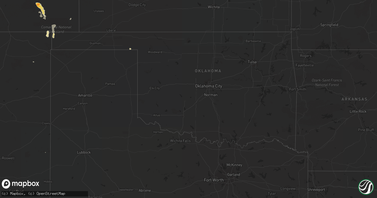
July 26 map
$229
one time, instant access
Download today. No call, no setup
Keep the $229
Bought the map and want the full workflow? Apply the entire $229 to a subscription within 7 days. None of it is wasted.
Every map, not just this one
This buys you this map. Subscription and you get every map we run, in the markets you choose from a few cities to whole states to nationwide. Plus real-time alerts the moment a storm fires.
Contact data
Name, contact info, occupancy, even credit band for addresses in the footprint. You go from where it hit to who to call.
Become the source they trust
Unlimited branding weather history reports on demand. You already have the documented answer ready for the property owner, and you are the one who showed up with it.
Property data and RoofTrace estimates
Pull up any address you have got, its value and the exact code rules for that jurisdiction, straight from One Click Code. Then RoofTrace estimates the squares, pitch, and roof value, priced the way you price.
Storm reports in Alabama
Alabama
| Date | Description |
|---|---|
| 07/26/20176:12 PM CDT | Helicopter flipped over at jack edwards airport in southern baldwin county. Time estimated via radar |
| 07/26/20175:55 PM CDT | Weatherflow site xglf measured a 62mph wind gust with thunderstorm passage. |
| 07/26/20175:49 PM CDT | University of south alabama mesonet site measured a wind gust to 58mph with thunderstorm passage |
| 07/26/20175:12 PM CDT | Shingle damage to a residence on h. Merritt road as well as some limbs down. |
| 07/26/20174:55 PM CDT | Gusts est. 40-50 mph. Police department says trees and power lines down in eufaula. Traffic lights not operational at eufaula ave. & broad st. And randolph ave. & broad |
| 07/26/20174:25 PM CDT | Gusts est. 40-50 mph. Police department says trees and power lines down in eufaula. Traffic lights not operational at eufaula ave. & broad st. And randolph ave. & broad |
| 07/26/20173:41 PM CDT | Emergency manager reports trees down along highway 22 towards orrville. Time approx. From radar. Time corrected. |
| 07/26/20173:34 PM CDT | Power lines reported down on dallas ave. Time approx. By radar. |
| 07/26/20173:31 PM CDT | Emergency manager reports trees down along highway 22 towards orrville. Time approx. From radar. |
| 07/26/20173:29 PM CDT | Emergency manager reports trees down along 1200 block of kings bend rd. Time approx. From radar. |
| 07/26/20173:22 PM CDT | Tree on top of power lines at janelle dr. And cordell st. |
| 07/26/20173:20 PM CDT | Emergency manager reports trees down along co. Rd. 16 and co. Rd. 37. |
| 07/26/20173:17 PM CDT | Trees and power lines reported down along highway 22 and along kyle rd. Time approx. From radar. |
| 07/26/20173:17 PM CDT | Trees down along huggins rd. Time approx. From radar. |
| 07/26/20172:45 PM CDT | Tree on top of power lines at janelle dr. And cordell st. Time amended. |
| 07/26/20172:45 PM CDT | Tree down behind the allcomm wireless near willis creek rd. Overpass. |
| 07/26/20171:30 PM CDT | Emergency manager reports large tree on road and downed power lines at tumlin gap rd. & highway 132. |
All States Impacted by Hail Map on July 26, 2017
Cities Impacted by Hail Map on July 26, 2017
- Boone, CO
- Olney Springs, CO
- Malad City, ID
- Cedar Valley, UT
- Colorado Springs, CO
- La Junta, CO
- Goshen, AL
- Troy, AL
- Cedar City, UT
- Roberts, ID
- Kenton, OK
- Stockton, UT
- Tallula, IL
- Laverne, OK
- Pioche, NV
- Appling, GA
- Grovetown, GA
- Grady, AL
- Luverne, AL
- Las Animas, CO
- Waterloo, IL
- Valmeyer, IL
- Kim, CO
- Walsh, CO
- Florissant, CO
- Mansfield, GA
- Grenville, NM
- Scheller, IL
- Sesser, IL
- Jones, AL
- Andalusia, AL
- Florala, AL
- Randolph, AL
- Elbert, CO
- Peyton, CO
- Monroe, GA
- Cripple Creek, CO
- Tennyson, IN
- Holbrook, ID
- Kansas City, KS
- Hoisington, KS
- Malta, ID
- Ramer, AL
- Myton, UT
- Clayton, NM
- Bruneau, ID
- Forest Home, AL
- Madison, GA
- Rutledge, GA
- Augusta, GA
- Evans, GA
- Selma, AL
- Oakdale, IL
- Oxford, GA
- Covington, GA
- Corinth, MS
- Weston, CO
- Pritchett, CO
- Carlsbad, NM
- New Athens, IL
- Falls Of Rough, KY
- Portage, UT
- Snowville, UT
- West Wendover, NV
- Rexburg, ID
- Midway, AL
- Union Springs, AL
- Mount Pleasant, IA
- Newborn, GA
- Defuniak Springs, FL
- Gadsden, AL
- Lizella, GA
- Hurtsboro, AL
- Manzanola, CO
- Stendal, IN
- Lynnville, IN
- Oakland City, IN
- Winslow, IN
- Fordsville, KY
- Rocky Ford, CO
- Roberta, GA
- Fort Myers, FL
- Dalhart, TX
- Birmingham, AL
- Counce, TN
- Savannah, TN
- Sainte Genevieve, MO
- Opp, AL
- Boonville, IN
- Guffey, CO
- Gonzales, TX
- Springville, AL
- Stratford, TX
- Bonnie, IL
- Mount Vernon, IL
- Hardaway, AL
- Tuskegee, AL
- Estero, FL
- Bonita Springs, FL
- Cocoa, FL
- North Fort Myers, FL
- Punta Gorda, FL
- Brantley, AL
- Dozier, AL
- Weston, ID
- Preston, ID
- Michie, TN
- Marion, AL
- Aguilar, CO
- Montevallo, AL
- Reynolds, GA
- Tatum, NM
- Neillsville, WI
- Plantersville, AL


