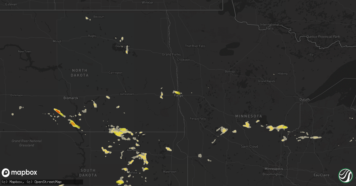
Hail Map on July 26, 2016
Get this storm
July 26 map
$229
one time, instant access
Download today. No call, no setup
Keep the $229
Bought the map and want the full workflow? Apply the entire $229 to a subscription within 7 days. None of it is wasted.
Every map, not just this one
This buys you this map. Subscription and you get every map we run, in the markets you choose from a few cities to whole states to nationwide. Plus real-time alerts the moment a storm fires.
Contact data
Name, contact info, occupancy, even credit band for addresses in the footprint. You go from where it hit to who to call.
Become the source they trust
Unlimited branding weather history reports on demand. You already have the documented answer ready for the property owner, and you are the one who showed up with it.
Property data and RoofTrace estimates
Pull up any address you have got, its value and the exact code rules for that jurisdiction, straight from One Click Code. Then RoofTrace estimates the squares, pitch, and roof value, priced the way you price.
States Impacted by Hail Map on July 26, 2016
Storm reports
Ohio
| Date | Description |
|---|---|
| 07/26/20163:36 PM CDT | Tree down across sr 335 near minford. Time estimated from radar. |
| 07/26/20163:30 PM CDT | Tree down near greenlawn cemetery in portsmouth. Time estimated from radar. |
| 07/26/20163:16 PM CDT | Tree down along dry run rd in west portsmouth. Time estimated from radar. |
| 07/26/20162:54 PM CDT | Tree knocked down along blue creek rd. Time estimated from radar. |
North Dakota
| Date | Description |
|---|---|
| 07/26/20166:26 PM CDT | Passed on via broadcast media. |
| 07/26/20166:25 PM CDT | A local report indicates 1.50 inch wind near FLASHER |
| 07/26/20162:40 PM CDT | A brief /minute or so/ touchdown was reported by a traveller on interstate 94 near mp294...west of valley city...looking northeast across hobart lake. The touchdown app |
| 07/25/20169:40 PM CDT | Measured at fargo airport. |
| 07/25/20169:40 PM CDT | A few large 4 to 6 inch diameter tree branches broken down between edgewood and longfellow in north fargo. |
| 07/25/20169:33 PM CDT | Peak wind of 56 knots measured at the fargo airport /kfar/. |
| 07/25/20169:33 PM CDT | Peak wind of 56 knots measured at the fargo airport /kfar/. |
| 07/25/20167:50 PM CDT | Tornado was on the ground for about a minute. No damage was reported. Information was relayed via social media and broadcast media. Time and location of touchdown were |
| 07/25/20167:45 PM CDT | Winds gusting to an estimated 45 mph. |
Kentucky
| Date | Description |
|---|---|
| 07/26/201612:35 PM CDT | 2 trees down along east bend and green roads near burlington. |
Nebraska
| Date | Description |
|---|---|
| 07/26/20166:41 PM CDT | A local report indicates 1.00 inch wind near MORRILL |
| 07/26/20166:38 PM CDT | Quarter to half dollar in size. |
| 07/26/20162:53 AM CDT | A local report indicates 61 MPH wind near GRAND ISLAND AIRPORT |
| 07/26/20161:27 AM CDT | Power out. Tree limbs down. |
| 07/26/20161:26 AM CDT | Gust front winds associated with a squall line that missed just n and e. |
| 07/26/20161:25 AM CDT | Time est fm radar. |
| 07/26/20161:12 AM CDT | Time est fm radar. |
| 07/26/201612:55 AM CDT | A local report indicates 64 MPH wind near LEXINGTON AIRPORT |
| 07/26/201612:55 AM CDT | Severe damage to trees around town. One tree completely uprooted. Lighted sign blown off subway restaurant. Used time from peak wind gust at the airport. Updated prior |
| 07/26/201612:45 AM CDT | Two large tree limbs approx 6-8 inches in diameter snapped on two separate trees in the same yard. Still attached to the tree but most of the branches laying on the gro |
| 07/26/201612:45 AM CDT | Portion of flat roof on lexington health ctr pealed back 2-4 ft. Pic retrieved from krvn radio website. Time est fm radar. |
| 07/26/201612:42 AM CDT | Trees blown over near hwy 183 and the south loup river. Some trees were not in the best shape prior to being blown over...but nearby branches were also damaged and snap |
| 07/26/201612:40 AM CDT | 3 to 4 inch diameter tree branches snapped off. Report relayed from emergency mgmt. |
| 07/26/201612:30 AM CDT | Thunderstorms came through with damaging winds. Numerous 12 inch diameter branches down over town with power poles snapped and power lines down. Two doors were blown ou |
| 07/26/201612:30 AM CDT | A four inch diameter limb was broken out of an ash tree. |
| 07/26/201612:06 AM CDT | A local report indicates 58 MPH wind near 3 ENE NORTH PLATTE |
| 07/26/201612:00 AM CDT | Several 4 inch and a few 5 inch tree branches down in the city park. |
| 07/26/201612:00 AM CDT | 4 inch to 6 inch tree branches blocking highway 91... Between taylor and burwell. Road was closed while department of roads removed the branches from the highway. |
| 07/26/201612:00 AM CDT | A local report indicates 69 MPH wind near 4 N NORTH PLATTE |
| 07/26/201612:00 AM CDT | Several reports of 2 to 3 inch tree branches down across the city. |
| 07/26/201612:00 AM CDT | A local report indicates 70 MPH wind near TAYLOR |
| 07/25/201611:32 PM CDT | Winds were estimated in excess of 60 mph. |
| 07/25/201611:30 PM CDT | A four inch diameter limb was broken out of an ash tree. |
| 07/25/201610:00 PM CDT | Power lines down in the seneca area due to strong wind gusts. |
| 07/25/20169:45 PM CDT | A local report indicates 60 MPH wind near 26 S MERRIMAN |
| 07/25/20169:43 PM CDT | Winds were estimated at between 60 and 80 mph. |
| 07/25/20169:41 PM CDT | A local report indicates 60 MPH wind near 22 N ELLSWORTH |
| 07/25/20169:30 PM CDT | A local report indicates 60 MPH wind near 26 SSE VALENTINE |
| 07/25/20169:25 PM CDT | Trees snapped and uprooted. |
| 07/25/20169:24 PM CDT | A local report indicates 60 MPH wind near 21 SW MERRIMAN |
| 07/25/20169:22 PM CDT | A local report indicates 60 MPH wind near 20 S VALENTINE |
| 07/25/20169:11 PM CDT | A local report indicates 1.00 inch wind near VALENTINE |
| 07/25/20169:09 PM CDT | A local report indicates 64 MPH wind near 1 ENE VALENTINE |
| 07/25/20169:05 PM CDT | A local report indicates 69 MPH wind near VALENTINE |
| 07/25/20169:03 PM CDT | A local report indicates 66 MPH wind near VALENTINE |
| 07/25/20169:00 PM CDT | Quarter size hail damaged plants in garden. |
| 07/25/20169:00 PM CDT | A local report indicates 66 MPH wind near 1 W VALENTINE |
| 07/25/20168:59 PM CDT | A local report indicates 58 MPH wind near VALENTINE |
| 07/25/20168:55 PM CDT | Winds were estimated at between 40 and 50 mph. |
| 07/25/20168:55 PM CDT | A local report indicates 1.00 inch wind near 9 NNW VALENTINE |
| 07/25/20168:45 PM CDT | Fire department reported pivots blown over and roof blown off garage from straight line winds. Time estimated by radar. |
| 07/25/20168:39 PM CDT | Photo confirmed report. No damage reported at this time. |
| 07/25/20168:36 PM CDT | A local report indicates 1.75 inch wind near 4 SW HAY SPRINGS |
| 07/25/20168:35 PM CDT | A local report indicates 60 MPH wind near 9 NNW VALENTINE |
| 07/25/20168:27 PM CDT | Said that winds were 60+ mph. Had not seen any damage yet. |
| 07/25/20168:22 PM CDT | Sustained at 38 mph. |
| 07/25/20168:20 PM CDT | Winds were estimated at around 50 mph. |
| 07/25/20168:15 PM CDT | Mostly marble sized with some golf balls. Winds estimated at 60+ mph. |
| 07/25/20168:13 PM CDT | Winds were also estimated at between 50 and 60 mph. |
| 07/25/20168:11 PM CDT | A local report indicates 1.00 inch wind near MERRIMAN |
| 07/25/20167:56 PM CDT | A local report indicates 1.00 inch wind near 4 W CHADRON |
| 07/25/20167:50 PM CDT | Estimates 50-60 mph |
Virginia
| Date | Description |
|---|---|
| 07/26/20166:59 PM CDT | Tree down on power line at lawyers rd and stubbs bridge rd |
| 07/26/20166:50 PM CDT | Trees down belmont rd |
| 07/26/20164:32 PM CDT | Two trees down at the intersection of us 340 and us 340 business. |
| 07/26/20164:28 PM CDT | Numerous trees down - possible damage to structures in newport and stanley |
| 07/26/20164:27 PM CDT | Numerous trees down some uprooted and limbs down at riverside camping. |
| 07/25/201610:55 PM CDT | Tree blocking wren rd near midway rd. Time radar estimated. |
| 07/25/201610:42 PM CDT | Tree down on epsons rd. Time radar estimated. |
| 07/25/201610:42 PM CDT | Tree down on mount calvary rd near 40. Time radar estimated. |
| 07/25/201610:00 PM CDT | Power lines down along turkey creek rd. Time radar estimated. |
| 07/25/20169:54 PM CDT | Tree blocking wren rd near midway rd. Time radar estimated. |
| 07/25/20169:42 PM CDT | Tree down on epsons rd. Time radar estimated. |
| 07/25/20169:42 PM CDT | Tree down on mount calvary rd near 40. Time radar estimated. |
| 07/25/20169:39 PM CDT | Large tree down across patterson ave blocking traffic. |
| 07/25/20168:45 PM CDT | Tree downed at the corner of grove and robinson. |
| 07/25/20168:34 PM CDT | Tree down on house along eastbrook road. |
| 07/25/20168:28 PM CDT | Tree blown down on house on spring oaks drive. |
| 07/25/20168:26 PM CDT | One tree down at the intersection of overbrook road and hillsdale road |
| 07/25/20168:26 PM CDT | One tree down on hollins mill road |
| 07/25/20168:24 PM CDT | One tree down on langhorne road |
| 07/25/20167:59 PM CDT | Tree down across road. |
| 07/25/20167:59 PM CDT | Tree down across road. |
| 07/25/20167:48 PM CDT | Tree down across road. |
| 07/25/20167:33 PM CDT | Several large trees down along breaknock road |
| 07/25/20167:19 PM CDT | Trees down lawyers rd and ridge rd |
| 07/25/20167:15 PM CDT | Trees down lawyers rd and hayley mills rd |
Idaho
| Date | Description |
|---|---|
| 07/26/20164:50 PM CDT | 4 to 5 inch diameter tree limbs broken during high winds. |
Washington
| Date | Description |
|---|---|
| 07/25/20168:00 PM CDT | Trees and powerlines down between addy and chewelah. . |
Wyoming
| Date | Description |
|---|---|
| 07/26/20166:20 PM CDT | A local report indicates 1.00 inch wind near 5 E BUFFALO |
| 07/26/20166:05 PM CDT | A local report indicates 1.00 inch wind near 2 E BUFFALO |
| 07/26/20165:50 PM CDT | A local report indicates 1.00 inch wind near 5 NNW BUFFALO |
| 07/26/20165:45 PM CDT | A local report indicates 1.00 inch wind near SADDLESTRING |
West Virginia
| Date | Description |
|---|---|
| 07/26/20165:45 PM CDT | Multiple trees down on route 5 just west of town |
Texas
| Date | Description |
|---|---|
| 07/26/20165:44 PM CDT | Measured at k6r6 asos |
| 07/25/20167:05 PM CDT | 60 mph gust measured by west texas mesonet |
Montana
| Date | Description |
|---|---|
| 07/25/201610:46 PM CDT | . |
| 07/25/201610:32 PM CDT | A local report indicates 62 MPH wind near 11 ENE ZORTMAN |
Michigan
| Date | Description |
|---|---|
| 07/26/20166:45 PM CDT | Observed quarter size hail with some larger hail stones greater than quarter sized. The hail lasted an estimated 5 to 10 minutes. Intense downpour was observed. |
| 07/26/20166:35 PM CDT | Trained spotter observed quarter-size hail this evening. |
Arizona
| Date | Description |
|---|---|
| 07/25/20168:40 PM CDT | Horse camp raws |
South Dakota
| Date | Description |
|---|---|
| 07/26/20166:38 PM CDT | A local report indicates 2.00 inch wind near WIND CAVE VISITORS CENT |
| 07/26/20166:29 PM CDT | . |
| 07/26/20166:20 PM CDT | A local report indicates 1.00 inch wind near 8 NW OKREEK |
| 07/26/20166:08 PM CDT | A local report indicates 1.00 inch wind near 1 SSW DOWNTOWN CUSTER |
| 07/26/20165:35 PM CDT | . |
| 07/26/20165:20 PM CDT | A local report indicates 1.00 inch wind near 3 E WHITE RIVER |
| 07/26/20161:40 PM CDT | . |
| 07/26/20169:55 AM CDT | Lots of nickel hail with some as large as quarters. . |
| 07/25/20168:40 PM CDT | A local report indicates 1.00 inch wind near 2 W HARRINGTON |
| 07/25/20168:15 PM CDT | A local report indicates 60 MPH wind near 5 NW COLOME |
| 07/25/20167:56 PM CDT | A local report indicates 1.00 inch wind near 5 N COLOME |
| 07/25/20167:43 PM CDT | A local report indicates 2.00 inch wind near 3 E OELRICHS |
| 07/25/20167:13 PM CDT | A local report indicates 1.75 inch wind near 5 SE MISSION |
| 07/25/20167:00 PM CDT | . |
North Carolina
| Date | Description |
|---|---|
| 07/26/20166:22 PM CDT | Large oak trees down on whitley and bellamy mill roads. |
| 07/25/20167:43 PM CDT | Tree down. |
| 07/25/20167:06 PM CDT | Tree down on power line. |
Cities Impacted by Hail Map on July 26, 2016
- Roy, MT
- Winnett, MT
- Harrison, NE
- Torrington, WY
- Shamrock, TX
- Buffalo, WY
- Smithwick, SD
- Hot Springs, SD
- Oelrichs, SD
- Edenton, NC
- Culpeper, VA
- Stratford, SD
- Conde, SD
- Andover, SD
- Groton, SD
- Rapidan, VA
- Unionville, VA
- Hurley, WI
- Mercer, WI
- Winner, SD
- Hawk Springs, WY
- Bowdle, SD
- Forbes, ND
- Newcastle, WY
- Lower Brule, SD
- Eckerman, MI
- Paradise, MI
- Alexandria, MN
- Manitowish Waters, WI
- Presque Isle, WI
- Skandia, MI
- Callaway, NE
- Sayner, WI
- Boulder Junction, WI
- Woodruff, WI
- Brewster, NE
- Valentine, NE
- Babb, MT
- Raleigh, ND
- Saint Francis, SD
- Buffalo Gap, SD
- Chadron, NE
- Custer, SD
- Oral, SD
- Hay Springs, NE
- Alliance, NE
- Newberry, MI
- Grand Marais, MI
- Seney, MI
- Browning, MT
- Shenandoah, VA
- Stanley, VA
- Broken Bow, NE
- Chapel Hill, NC
- Tarzan, TX
- Lenorah, TX
- Cushing, MN
- Little Falls, MN
- Pierz, MN
- Fort Ripley, MN
- Randall, MN
- Brainerd, MN
- Kennebec, SD
- Sargent, NE
- Roscoe, SD
- South Hill, VA
- La Crosse, VA
- Rush City, MN
- Hayes, SD
- Midland, SD
- Big Sandy, MT
- Rushville, NE
- Ipswich, SD
- Keystone, SD
- Lamar, CO
- Flasher, ND
- Mission, SD
- Mills, NE
- Grenville, SD
- Peever, SD
- Jackson, OH
- Stone Lake, WI
- Shell Lake, WI
- Sarona, WI
- Spooner, WI
- Hamill, SD
- Gregory, SD
- Cody, NE
- Nashwauk, MN
- Hinckley, MN
- Frederick, SD
- Hermosa, SD
- Miltona, MN
- Eagle Bend, MN
- Havre, MT
- Harwood, ND
- Fargo, ND
- Hertel, WI
- Webster, WI
- Frederic, WI
- Siren, WI
- Gillette, WY
- Presho, SD
- Bird City, KS
- Two Dot, MT
- Wheatland, WY
- Emporia, VA
- Wolsey, SD
- Bethel, OH
- Hamersville, OH
- Glen Flora, WI
- Mechanicsville, VA
- Solen, ND
- Draper, SD
- Murdo, SD
- Warwick, ND
- Jamestown, ND
- Anselmo, NE
- Westerville, NE
- Taylor, NE
- Johnstown, NE
- Ansley, NE
- Burwell, NE
- Arcadia, NE
- Comstock, NE
- Ainsworth, NE
- Chinook, MT
- Summit, SD
- Wood Lake, NE
- Colome, SD
- Rapid River, MI
- Wetmore, MI
- Wheatland, ND
- Glenwood, MN
- Starbuck, MN
- Lowry, MN
- West Union, OH
- Stout, OH
- Blue Creek, OH
- Merriman, NE
- Edgemont, SD
- Dallas, SD
- Hawley, MN
- Watersmeet, MI
- Carpenter, SD
- Crawford, NE
- Ashby, NE
- Holloway, MN
- Appleton, MN
- Long Lake, SD
- Leola, SD
- Aberdeen, SD
- New Richmond, OH
- Moscow, OH
- California, KY
- Amelia, OH
- Ashley, ND
- Winifred, MT
- Winthrop, WA
- Purdum, NE
- Dunning, NE
- Carlos, MN
- Holly, CO
- Sheridan Lake, CO
- Elgin, ND
- Fort Yates, ND
- Strasburg, ND
- Linton, ND
- Reliance, SD
- Yoder, WY
- Tilden, TX
- New England, ND
- Park Hill, OK
- Georgetown, OH
- Denton, MT
- Huron, SD
- Ellendale, ND
- Rustburg, VA
- Cresbard, SD
- Hillman, MN
- Garrison, MN
- Gainesville, TX
- Webster, ND
- Isle, MN
- Mora, MN
- Northville, SD
- Mellette, SD
- Rapelje, MT
- Whitney, NE
- Dunseith, ND
- Thedford, NE
- Tuthill, SD
- Lawrenceville, VA
- Gasburg, VA
- Medina, ND
- Wellington, TX
- Regent, ND
- Sandstone, MN
- Brook Park, MN
- Rudyard, MI
- Kinross, MI
- Phillips, WI
- Kilgore, NE
- Carson, ND
- Lloyd, MT
- Gordon, NE
- Raymond, SD
- Turton, SD
- Doland, SD
- Long Prairie, MN
- Burtrum, MN
- Swanville, MN
- New Johnsonville, TN
- Fort Pierre, SD
- Bumpass, VA
- Partlow, VA
- Spotsylvania, VA
- Richmond, VA
- Pine Ridge, SD
- Wessington, SD
- Saint Lawrence, SD
- Cary, NC
- Durham, NC
- Apex, NC
- Twisp, WA
- Cunningham, TN
- Cumberland Furnace, TN
- Miller, SD
- Dryden, TX
- Kaycee, WY
- Murdock, MN
- Benson, MN
- Brookneal, VA
- Phenix, VA
- Barbeau, MI
- Pickford, MI
- Dafter, MI
- Willow City, ND
- Wood, SD
- White River, SD
- Redfield, SD
- Rockham, SD
- Bassett, NE
- Long Pine, NE
- Lynchburg, VA
- Marsland, NE
- McKenzie, TN
- Jud, ND
- Arnold, NE
- Vivian, SD
- Burke, SD
- Ideal, SD
- Houghton, SD
- Columbia, SD
- Grantsburg, WI
- Pine City, MN
- Bloxom, VA
- Medina, TN
- Milan, TN
- Devils Lake, ND
- Kit Carson, CO
- Ferney, SD
- Mansfield, SD
- Warner, SD
- Holladay, TN
- Bath, SD
- Wahkon, MN
- Onamia, MN
- Hemingford, NE
- Lac Du Flambeau, WI
- Park Falls, WI
- Minocqua, WI
- Pittsboro, NC
- New Hill, NC
- Moncure, NC
- Mott, ND
- Gackle, ND
- Birchwood, WI
- Mullen, NE
- Harrisonburg, VA
- Keezletown, VA
- Mitchell, NE
- Morrill, NE
- Lyman, NE
- New Market, VA
- Sault Sainte Marie, MI
- Crary, ND
- Chetopa, KS
- Parmelee, SD
- Crookston, NE
- Burns, WY
- Sardinia, OH
- Osakis, MN
- Nelson, MN
- Karval, CO
- Lusk, WY
- Martin, SD
- Clarendon, TX
- Holly Springs, NC
- Springbrook, WI
- Ayr, ND
- Vernon, CO
- Anderson, MO
- Camden, NC
- Shawboro, NC
- Hecla, SD
- Brodnax, VA
- Tahlequah, OK
- Lexington, TN
- Steele, ND
- Napoleon, ND
- Kintyre, ND
- Springview, NE
- Hosmer, SD
- Vona, CO
- Barnard, SD
- West Fargo, ND
- Moorhead, MN
- Whitman, NE
- Norris, SD
- Buffalo, ND
- Mineral, VA
- Edgeley, ND
- Flagler, CO
- Broadway, VA
- Lead, SD
- Fredonia, ND
- Westport, SD
- Hazelton, ND
- Montpelier, VA
- Hill City, SD
- Erin, TN
- Hollow Rock, TN
- Bruceton, TN
- Kiowa, CO
- Oacoma, SD
- Camden, TN
- Tulare, SD
- Hitchcock, SD
- Welch, OK
- Story, WY
- Cannon Ball, ND
- Cut Bank, MT
- Conover, WI
- Concord, VA
- Danvers, MN
- Montevideo, MN
- South Mills, NC
- Crystal Falls, MI
- Manila, AR
- Thompsons Station, TN
- College Grove, TN
- Franklin, TN
- Manistique, MI
- Cooks, MI
- Ellsworth, NE
- Madison Heights, VA
- Frankfort, SD
- Marenisco, MI
- Wakefield, MI
- Beaverdam, VA
- Gates, NC
- Faulkton, SD
- Chase City, VA
- Miami, OK
- Shields, ND
- Gaston, NC
- Valentines, VA
- Glen Allen, VA
- Eads, CO
- Okreek, SD
- Noel, MO
- Pineville, MO
- Churchs Ferry, ND
- Nolensville, TN
- Dickson, TN
- Vanleer, TN
- Ogema, MN
- Land O'Lakes, WI
- Tripoli, WI
- Luray, VA
- Newcastle, OK