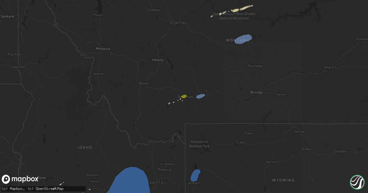
Hail Map on July 25, 2024
Get this storm
July 25 map
$229
one time, instant access
Download today. No call, no setup
Keep the $229
Bought the map and want the full workflow? Apply the entire $229 to a subscription within 7 days. None of it is wasted.
Every map, not just this one
This buys you this map. Subscription and you get every map we run, in the markets you choose from a few cities to whole states to nationwide. Plus real-time alerts the moment a storm fires.
Contact data
Name, contact info, occupancy, even credit band for addresses in the footprint. You go from where it hit to who to call.
Become the source they trust
Unlimited branding weather history reports on demand. You already have the documented answer ready for the property owner, and you are the one who showed up with it.
Property data and RoofTrace estimates
Pull up any address you have got, its value and the exact code rules for that jurisdiction, straight from One Click Code. Then RoofTrace estimates the squares, pitch, and roof value, priced the way you price.
States Impacted by Hail Map on July 25, 2024
Storm reports
Kansas
| Date | Description |
|---|---|
| 07/25/20245:20 PM CDT | Tree branches down. |
| 07/25/20245:05 PM CDT | Several 2-3 diameter tree branches down between mission and roe on 67th st. |
| 07/25/20244:57 PM CDT | Large tree downed. |
Georgia
| Date | Description |
|---|---|
| 07/25/20245:09 PM CDT | 911 call center reported 1 tree down and 1 power pole down at highway 17 and us highway 80 in bloomingdale... Ga. |
Arizona
| Date | Description |
|---|---|
| 07/25/20246:16 PM CDT | Several power lines and poles fallen across the roadway near sunrise dr. And pontatoc rd. |
| 07/25/20243:10 PM CDT | Power pole down on hwy 86 near assembly of god church. |
| 07/24/202410:11 PM CDT | Delayed report. Personal weather station reported gust to 58 mph at 8:11 pm. |
| 07/24/202410:00 PM CDT | Mesonet station fw4391 avondale. |
| 07/24/20249:39 PM CDT | Delayed report. Personal weather station measured gust to 60 mph at 7:39 pm. |
| 07/24/20249:15 PM CDT | Power poles down near van buren st and 295th ave. |
| 07/24/20249:12 PM CDT | Power poles down near buckeye rd and 339th ave. |
| 07/24/20248:53 PM CDT | Power lines down near meridian rd and pueblo ave. |
| 07/24/20248:19 PM CDT | Private weather station. |
| 07/24/20248:00 PM CDT | Tree down on grant and 1st blocking northbound road lanes. |
| 07/24/20247:14 PM CDT | Mesonet station aw681 ajo. |
Wyoming
| Date | Description |
|---|---|
| 07/24/202410:10 PM CDT | Mesonet station pc452 cottonwood merna. |
| 07/24/20249:45 PM CDT | Mesonet station tetwy teton saddle. |
Montana
| Date | Description |
|---|---|
| 07/25/20246:55 PM CDT | A local report indicates 60 MPH wind near 2.3 SSW Big Timber |
| 07/25/20246:31 PM CDT | A local report indicates 65 MPH wind near 6.1 ENE Livingston |
| 07/25/20245:53 PM CDT | Report from mping: quarter |
| 07/25/20245:52 PM CDT | Awos station k1nm 5 ne forestgrove. |
| 07/25/20245:49 PM CDT | Trained spotter reports a few 1 inch hail stones mixed in with primarily half to three quarter of an inch hailstones. |
| 07/25/20245:40 PM CDT | Mesonet station lbcm8 little bullwhacker creek raws. Time estimated via radar. |
| 07/25/202412:00 PM CDT | A few 6-8 inch trees and branches broken. |
| 07/24/20247:46 PM CDT | Mesonet station mtsco 1.9 e saco |
| 07/24/20247:35 PM CDT | Observed at the saco s montana mesonet site. |
Iowa
| Date | Description |
|---|---|
| 07/25/20246:42 PM CDT | Asos station klwd lamoni airport. Likely a microburst. |
Nevada
| Date | Description |
|---|---|
| 07/25/20246:29 PM CDT | Station: up994... Elevation: 4408 ft. |
| 07/24/20248:38 PM CDT | Station: coin2... Elevation: 6745 ft. |
Idaho
| Date | Description |
|---|---|
| 07/25/20246:44 PM CDT | Mesonet station roci1 5 n owinza. |
| 07/25/20245:45 PM CDT | Large tree branches down. Motor home flipped over. Power poles down. Outdoor structure damaged. |
| 07/24/20248:00 PM CDT | Mesonet station san sand dunes. (p |
| 07/24/20248:00 PM CDT | Mesonet station san sand dunes. |
| 07/24/20247:50 PM CDT | Mesonet station nrf inl naval reactors facility. |
| 07/24/20247:45 PM CDT | Mesonet station gri inl intec/grid 3. |
| 07/24/20247:15 PM CDT | Rwis itd32 sterling id-39. |
| 07/24/20247:10 PM CDT | Mesonet station abe 1 ne aberdeen. 1 ne aberdeen... Id. |
Virginia
| Date | Description |
|---|---|
| 07/25/202411:26 AM CDT | Tree down along the 800 block of sherman road |
Missouri
| Date | Description |
|---|---|
| 07/25/20245:03 PM CDT | A local report indicates 1.25 inch wind near 4 S Kansas City |
| 07/25/20245:01 PM CDT | A local report indicates 1.00 inch wind near 4 S Kansas City |
Utah
| Date | Description |
|---|---|
| 07/25/20242:50 AM CDT | Mesonet station pc338 horse haven. |
| 07/25/202412:20 AM CDT | Mesonet station pc349 nephi west. |
| 07/24/202411:30 PM CDT | Mesonet station pc104 grantsville south. |
| 07/24/202411:00 PM CDT | Mesonet station utdol dolomite. |
| 07/24/202411:00 PM CDT | Mesonet station ut31 i-80 at mp 78. |
| 07/24/202410:58 PM CDT | Mesonet station up068 marsh. |
| 07/24/202410:20 PM CDT | Mesonet station uttim i-80 at mp 79 timpie. |
| 07/24/20249:45 PM CDT | Mesonet station gni gunnison island. |
| 07/24/20249:40 PM CDT | Mesonet station freut fremont island - miller hill. |
| 07/24/20249:40 PM CDT | Mesonet station utgrs i-80 at grassey. |
| 07/24/20249:30 PM CDT | Mesonet station dpg21 simpson spring. |
| 07/24/20249:25 PM CDT | Mesonet station lmr lakeside mountain. |
| 07/24/20249:15 PM CDT | Mesonet station dpg06 camel back mtn. |
| 07/24/20249:10 PM CDT | Mesonet station dpg15 salt flats. |
| 07/24/20249:05 PM CDT | Mesonet station dpg12 juliet road. |
| 07/24/20248:55 PM CDT | Mesonet station dpg02 callao gate. |
| 07/24/20248:50 PM CDT | Mesonet station dpg31 west granite. |
| 07/24/20248:45 PM CDT | Mesonet station dpg18 causeway. |
| 07/24/20248:30 PM CDT | Mesonet station utkno i-80 at mp 40 knolls. |
| 07/24/20248:20 PM CDT | Mesonet station ut33 i-80 at mp 29. |
| 07/24/20248:15 PM CDT | Mesonet station dpg17 interstate 80. |
| 07/24/20248:10 PM CDT | Measured at the udot rwis site along i80 at mp 29. |
| 07/24/20248:10 PM CDT | Measured at the i80 dugway udot rwis site. |
| 07/24/20248:07 PM CDT | Mesonet station ur298 15.9 w knolls. |
| 07/24/20247:58 PM CDT | Measured at the arnosa upr site. |
| 07/24/20247:50 PM CDT | Mesonet station pc172 junction south. |
| 07/24/20247:40 PM CDT | Measured at the junction south pacificorp site. In addition 0.27 inches of rain was observed in 10 minutes. |
| 07/24/20247:30 PM CDT | Measured at the bonneville salt flats uunet site. |
Cities Impacted by Hail Map on July 25, 2024
- Patterson, CA
- Hampton, KY
- Lacassine, LA
- Lake Arthur, LA
- Welsh, LA
- Roanoke, LA
- Jennings, LA
- Pecos, NM
- Chinle, AZ
- Bluford, IL
- Las Vegas, NM
- Flagstaff, AZ
- Sells, AZ
- Kanab, UT
- Reserve, NM
- Bruneau, ID
- Young, AZ
- Cisne, IL
- Geraldine, MT
- Dewey, AZ
- Kirkland, AZ
- Spring Creek, NV
- Payson, AZ
- Kansas City, MO
- Big Sandy, MT
- Twin Falls, ID
- Filer, ID
- Prairie Village, KS
- Mission, KS
- Hansen, ID
- Kimberly, ID
- Harrisburg, IL
- Winifred, MT
- Leawood, KS
- Lloyd, MT
- Ray City, GA
- Lakeland, GA
- Carrier Mills, IL
- Hazelton, ID
- Murtaugh, ID
- King Hill, ID
- Morristown, AZ
- Eden, ID
- Cottonwood, AZ
- Concho, AZ
- Glenns Ferry, ID
- Ennis, MT
- Norris, MT
- Rupert, ID
- Bozeman, MT
- Osyka, MS
- Zortman, MT
- Wickenburg, AZ
- Lewistown, MT
- Grass Range, MT
- Winnett, MT
- Forest Grove, MT
- Mountain Home, ID
- Davis City, IA
- Lamoni, IA
- Richfield, ID
- Princeton, MO
- Roosevelt, AZ
- Gilman City, MO
- Trenton, MO
- Rio Rico, AZ
- Pocatello, ID
- Mccammon, ID
- Miami, AZ
- Tucson, AZ
- Benson, AZ
- Arbon, ID
- Livingston, MT
- American Falls, ID
- Aberdeen, ID
- Pingree, ID
- Springfield, ID
- Ajo, AZ
- West Wendover, NV
- Wendover, UT
- Malta, MT
- Fort Peck, MT
- Saco, MT
- Hinsdale, MT
- Glasgow, MT
- Vandalia, MT
- Bancroft, ID
- Apache Junction, AZ
- Fort Mcdowell, AZ
- Mesa, AZ
- Kingston, UT
- Vail, AZ
- Sahuarita, AZ
- Malad City, ID
- Paul, ID
- Arco, ID
- Moore, ID
- Carey, ID
- Howe, ID
- Blackfoot, ID
- Atomic City, ID
- Terreton, ID
- Idaho Falls, ID
- Shelley, ID
- Firth, ID
- Beaver, UT
- Circleville, UT
- Antimony, UT
- Panguitch, UT
- Green Valley, AZ
- Soda Springs, ID
- Grouse Creek, UT
- Marana, AZ
- Snowville, UT
- Eloy, AZ
- Hays, MT
- Moose, WY
- Jackson, WY
- Wilson, WY
- Moran, WY
- Kelly, WY
- Daniel, WY
- Pinedale, WY
- Bondurant, WY
- Big Piney, WY
- Cora, WY
- Laveen, AZ
- Avondale, AZ
- Goodyear, AZ
- Dugway, UT
- Grantsville, UT
- Tooele, UT
- Ogden, UT
- Corinne, UT
- Magna, UT
- Mount Lemmon, AZ
- Willcox, AZ
- Howell, UT
- Spickard, MO