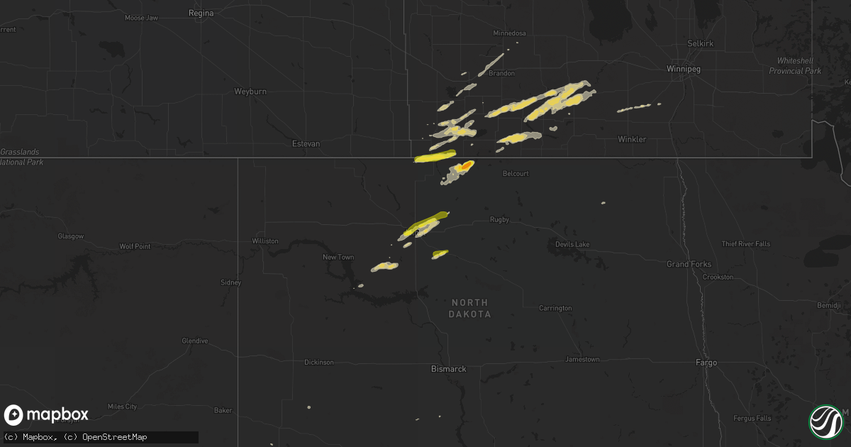
Hail Map on July 24, 2017
Get this storm
July 24 map
$229
one time, instant access
Download today. No call, no setup
Keep the $229
Bought the map and want the full workflow? Apply the entire $229 to a subscription within 7 days. None of it is wasted.
Every map, not just this one
This buys you this map. Subscription and you get every map we run, in the markets you choose from a few cities to whole states to nationwide. Plus real-time alerts the moment a storm fires.
Contact data
Name, contact info, occupancy, even credit band for addresses in the footprint. You go from where it hit to who to call.
Become the source they trust
Unlimited branding weather history reports on demand. You already have the documented answer ready for the property owner, and you are the one who showed up with it.
Property data and RoofTrace estimates
Pull up any address you have got, its value and the exact code rules for that jurisdiction, straight from One Click Code. Then RoofTrace estimates the squares, pitch, and roof value, priced the way you price.
States Impacted by Hail Map on July 24, 2017
Storm reports
Pennsylvania
| Date | Description |
|---|---|
| 07/24/20176:40 PM CDT | Trees and wires down |
| 07/24/20175:30 PM CDT | Trees down |
| 07/24/20175:30 PM CDT | A large maple tree was uprooted and dented the gutter on a home and crushed some bushes. |
| 07/24/20175:29 PM CDT | Severeal trees uprooted. |
| 07/24/20175:22 PM CDT | Several trees downed due to thunderstorm winds. |
| 07/24/20175:10 PM CDT | Trees downed in several locations along with damage to a baseball fence and nursing home. |
| 07/24/20174:03 PM CDT | Trees and wires down |
| 07/24/20173:40 PM CDT | Trees down. |
| 07/24/20173:30 PM CDT | Tree down across road |
| 07/24/20173:26 PM CDT | Trees and wires down on happy valley road |
| 07/24/20173:20 PM CDT | Trees and wires down. |
| 07/24/20173:20 PM CDT | Tree fell into house |
| 07/24/20173:15 PM CDT | At least 3 homes sustained damage from fallen trees in several municipalities including nicholson township and factoryville borough. Power lines are down. |
| 07/24/20173:15 PM CDT | Numerous trees down... Roads blocked. |
| 07/24/20173:14 PM CDT | Trees and wires down |
| 07/24/20173:14 PM CDT | Trees and wires down across rupert road at train street |
| 07/24/20173:13 PM CDT | Tree down across state st |
| 07/24/20173:10 PM CDT | Trees and wires down along route 11 |
| 07/24/20172:40 PM CDT | Widespread trees and wires down across montour county |
Texas
| Date | Description |
|---|---|
| 07/24/20176:15 PM CDT | The emergency manager also reported a snapped power pole at the local airport associated with this wind gust. |
| 07/24/20175:19 PM CDT | A local report indicates 68 MPH wind near 2 N BORGER |
| 07/24/20175:10 PM CDT | Tree down on highway 152 in borger and several traffic lights are out of service. |
| 07/24/20174:57 PM CDT | A local report indicates 61 MPH wind near 2 N BORGER |
| 07/24/20173:18 PM CDT | Large tree limb snapped off a tree. Picture sent in on social media. |
| 07/23/20178:25 PM CDT | Sheriffs office relayed a 60 mph wind gust reported from the ozona volunteer fire departent that was 17 miles west of ozona along i-10. |
North Dakota
| Date | Description |
|---|---|
| 07/23/201711:53 PM CDT | A local report indicates 1.50 inch wind near 2 NNW CARBURY |
| 07/23/201710:48 PM CDT | A local report indicates 1.00 inch wind near MINOT |
| 07/23/201710:36 PM CDT | A local report indicates 1.25 inch wind near 1 NNW MINOT |
| 07/23/20178:59 PM CDT | Hail lasted from 850 pm to around 859 pm. Hail is covering the yard but melting fast. Sizes ranged from dimes to quarters. |
South Carolina
| Date | Description |
|---|---|
| 07/24/20172:50 PM CDT | Partial damage to a roof of a business on brookwood dr. Time estimated. |
| 07/24/20172:50 PM CDT | Broadcast media relayed a photo via social media of a large tree down on a house on dover st in columbia. Time estimated. |
South Dakota
| Date | Description |
|---|---|
| 07/23/20178:11 PM CDT | A local report indicates 60 MPH wind near WEWELA |
| 07/23/20177:56 PM CDT | Nicked sized hail |
Nevada
| Date | Description |
|---|---|
| 07/23/20177:50 PM CDT | Unknown speed wind gust snapped utility poles and damaged many trees |
| 07/23/20177:39 PM CDT | Thunderstorm downdraft at red butte raws site. |
Montana
| Date | Description |
|---|---|
| 07/23/20178:15 PM CDT | A local report indicates 59 MPH wind near 2 WSW LIVINGSTON |
Georgia
| Date | Description |
|---|---|
| 07/24/20173:45 PM CDT | Tree reported down at the intersection of lester rd and buckingham dr. |
| 07/24/20173:40 PM CDT | Peachtree city police department reported via social media that multiple trees were down in the area of fishers luck road... Cove road and bayview road. |
| 07/24/20173:37 PM CDT | Three trees down in the braelinn village shopping center. |
| 07/24/20173:35 PM CDT | Two trees down along the golf cart path reported by the peachtree city police department via social media. |
| 07/24/20173:30 PM CDT | Several trees reported down at the mcdonough square. |
Nebraska
| Date | Description |
|---|---|
| 07/23/201711:35 PM CDT | Time estimated. Large tree limb broke and dropped onto a house in thedford... Ne. |
California
| Date | Description |
|---|---|
| 07/24/20175:24 PM CDT | Knxp reports gust to 55 knots out of the east-southeast at 2224z. |
| 07/23/20177:00 PM CDT | A power pole was blown down by thunderstorm winds along utah trail north of amboy rd. Reported via twitter with picture. |
Maryland
| Date | Description |
|---|---|
| 07/24/20176:58 PM CDT | Tree on power lines. Tree on fire. Glenwood road between balmoral drive and vermont road. |
| 07/24/20176:56 PM CDT | Tree down in roadway near the intersection of saint andrews way and east macphail road. |
| 07/24/20176:55 PM CDT | Tree in roadway in 1400 block of stafford road. |
| 07/24/20176:51 PM CDT | Tree and wires down in the 600 block of prospect mill road. |
| 07/24/20176:51 PM CDT | Tree down near the intersection of rock spring road and wagner way. |
| 07/24/20176:50 PM CDT | Wires down blocking roadway in the 1000 block of prospect mill road. |
| 07/24/20176:50 PM CDT | Tree on wires on persimmon place. |
| 07/24/20176:48 PM CDT | Tree down between fallston road and sweet air road. |
| 07/24/20176:48 PM CDT | Wires down in the 200 block of marshall drive. |
| 07/24/20176:48 PM CDT | Tree and wires down in the 1900 block of rock spring road. |
| 07/24/20176:42 PM CDT | Tree on power lines in the 2600 block of bailey road. |
| 07/23/20178:06 PM CDT | 1 foot in diameter tree down near the intersection of thunder hill road and white acre road. |
| 07/23/20177:40 PM CDT | 8-inch in diameter tree down in the 3000 block of north ridge road. |
| 07/23/20177:25 PM CDT | Wires down near the intersection of sykesville road and gamber road. |
| 07/23/20177:13 PM CDT | A local report indicates 63 MPH wind near NORTH EAST |
New York
| Date | Description |
|---|---|
| 07/24/20176:40 PM CDT | Trees down. |
| 07/24/20175:05 PM CDT | Trees downs and poles snapped. |
| 07/24/20174:55 PM CDT | Trees and poles down. |
| 07/24/20173:25 PM CDT | Multiple trees and power poles down along north midler ave |
| 07/24/20173:25 PM CDT | Roof torn off at syracuse diesel and electric |
Mississippi
| Date | Description |
|---|---|
| 07/24/201711:09 AM CDT | Tree on a power line on noah trail nw rd. |
| 07/24/201711:05 AM CDT | Tree down on damascus rd. |
| 07/24/201711:05 AM CDT | Tree down on i-55 near mile marker 57. |
| 07/24/201711:04 AM CDT | Tree down on county farm rd near i-55. |
Cities Impacted by Hail Map on July 24, 2017
- Burnet, TX
- Winner, SD
- Twin Brooks, SD
- Bassett, NE
- Groton, SD
- Andover, SD
- Velva, ND
- Marvin, SD
- Summit, SD
- South Shore, SD
- Kempton, PA
- New Ringgold, PA
- Mcdonough, GA
- Kennebec, SD
- Presho, SD
- Voltaire, ND
- Sawyer, ND
- Florence, AL
- Happy, TX
- Hanceville, AL
- Bremen, AL
- Valera, TX
- Talpa, TX
- Makoti, ND
- Plaza, ND
- Ryder, ND
- Milbank, SD
- Revillo, SD
- Stockholm, SD
- Labolt, SD
- Granville, ND
- Surrey, ND
- Minot, ND
- Norwich, ND
- Long Pine, NE
- Ainsworth, NE
- Mason, TX
- Stevensville, PA
- Wyalusing, PA
- Ozona, TX
- Murdo, SD
- Warwick, MD
- Claremont, SD
- Tunkhannock, PA
- Nicholson, PA
- Dalton, PA
- Factoryville, PA
- Fleetville, PA
- Antler, ND
- Westhope, ND
- Souris, ND
- Griffin, GA
- Milner, GA
- Oneonta, AL
- Cleveland, AL
- White River, SD
- Leander, TX
- Cedar Park, TX
- Crockett, TX
- Jean, NV
- Klamath Falls, OR
- Shiloh, GA
- Starkville, MS
- Wendel, CA
- Groesbeck, TX
- Amarillo, TX
- Borger, TX
- Lovelock, NV
- Irvine, KY
- Vega, TX
- New Prague, MN
- Springfield, KY
- Townsend, DE
- Northfield, MN
- Webster, MN
- Wilmot, SD
- Syracuse, NY
- East Syracuse, NY
- Ovid, CO
- Fayetteville, GA
- Michie, TN
- Locust Grove, GA
- Gaylord, MN
- Doyle, CA
- Herlong, CA
- Colome, SD
- Moulton, AL
- Fernley, NV
- Tamaqua, PA
- Middleport, PA
- New Tripoli, PA
- Fogelsville, PA
- Orwigsburg, PA
- New Philadelphia, PA
- Cumbola, PA
- Kutztown, PA
- Wadsworth, NV
- Silver Springs, NV
- Ganado, AZ
- Paducah, TX
- Bottineau, ND
- Liverpool, NY
- Sparta, GA
- Des Lacs, ND
- Burlington, ND
- Brighton, MO
- Willard, MO
- Lookout, CA
- Canby, CA
- Standish, CA
- Fayette, AL
- Harrington, DE
- Sparks, NV
- Brownton, MN
- Draper, SD
- Mission, SD
- Prairie City, SD
- Belle Plaine, MN
- Jonesboro, GA
- Hampton, GA
- Likely, CA
- Waubay, SD
- Lohn, TX
- Grant, NE
- Tuscumbia, AL
- Silverton, TX
- Newburg, ND
- Kramer, ND
- Bristol, SD
- Lodgepole, SD
- Menard, TX
- Hext, TX
- Parshall, ND
- Batesville, MS
- Federalsburg, MD
- Greenwood, DE
- Bridgeville, DE
- Roseglen, ND
- Cullman, AL
- Holly Pond, AL
- Hereford, TX
- Madeline, CA
- Worton, MD
- Paisley, OR
- Orefield, PA
- Garrison, MO
- Peachtree City, GA
- Arlington, MN
- Schnecksville, PA
- Saint Clair, PA
- Allentown, PA
- Pottsville, PA
- Lenhartsville, PA
- New England, ND
- Ortonville, MN
- Clinton, MN
- Woodland, GA
- Burfordville, MO
- Whitewater, MO
- Loris, SC
- Conway, SC
- Ortley, SD
- Webster, SD
- Jackson, MO
- Rhodesdale, MD
- Birmingham, AL
- Central City, KY
- Jordan, MN
- Seaford, DE
- Chappell, NE
- Wayside, TX
- Peever, SD
- Grenville, SD
- Strafford, MO
- Springfield, MO
- Warthen, GA
- Sandersville, GA
- Beech Creek, KY
- Beechmont, KY
- Wood, SD
- Henderson, MN
- Lonsdale, MN
- Odessa, MN
- Bellingham, MN
- Mertztown, PA
- Barto, PA
- Zionsville, PA
- Macungie, PA
- Springville, PA
- Vernon, AL
- Hector, MN
- Buffalo Lake, MN
- Waverly Hall, GA
- Madisonville, KY
- Jermyn, PA
- Rogersville, MO
- Oshkosh, NE
- Fallon, NV
- Carbondale, PA
- Fort Pierre, SD
- Okaton, SD
- Springview, NE
- Deering, ND
- Glenburn, ND
- Bantry, ND