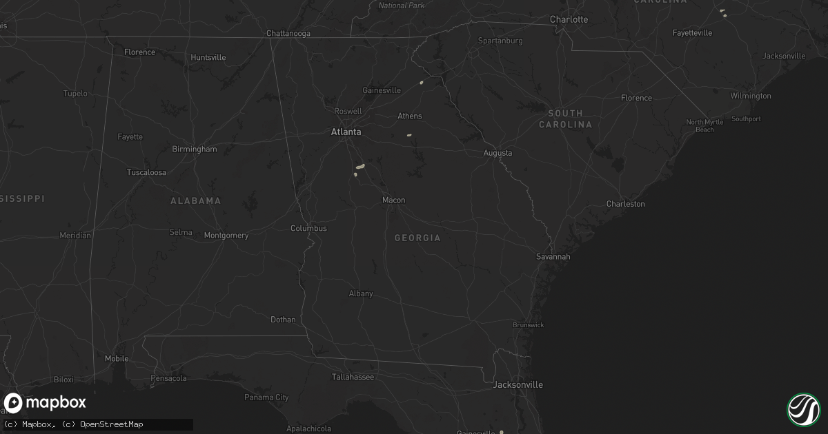
Hail Map in Georgia on July 23, 2024
Get this storm
July 23 map
$229
one time, instant access
Download today. No call, no setup
Keep the $229
Bought the map and want the full workflow? Apply the entire $229 to a subscription within 7 days. None of it is wasted.
Every map, not just this one
This buys you this map. Subscription and you get every map we run, in the markets you choose from a few cities to whole states to nationwide. Plus real-time alerts the moment a storm fires.
Contact data
Name, contact info, occupancy, even credit band for addresses in the footprint. You go from where it hit to who to call.
Become the source they trust
Unlimited branding weather history reports on demand. You already have the documented answer ready for the property owner, and you are the one who showed up with it.
Property data and RoofTrace estimates
Pull up any address you have got, its value and the exact code rules for that jurisdiction, straight from One Click Code. Then RoofTrace estimates the squares, pitch, and roof value, priced the way you price.
Storm reports in Georgia
Georgia
| Date | Description |
|---|---|
| 07/23/20243:30 PM CDT | Corrects previous tstm wnd dmg report from 3 sse homer. Tree reported down on a power line near the intersection of dogwood dr and historic homer hwy. Other isolated tr |
| 07/23/20243:08 PM CDT | Tree reported down on a power line near the intersection of dogwood dr and historic homer hwy. Other isolated trees reported down just north of commerce in the same are |
| 07/23/20242:50 PM CDT | Sub-severe report: small trees and limbs reported down near the intersection of bearden blvd and luanne way. |
| 07/22/20248:30 PM CDT | Significant structural damage near the intersection of logistics pkwy and hwy-16. Possible tornado damage. |
| 07/22/20248:15 PM CDT | Tree down on a house off of cradley circle. |
| 07/22/20247:47 PM CDT | Power line reported down the intersection of college drive and veterans pkwy. |
All States Impacted by Hail Map on July 23, 2024
Cities Impacted by Hail Map on July 23, 2024
- Dawson, MN
- Madison, MN
- Granada, MN
- Delavan, MN
- Blue Earth, MN
- Kiester, MN
- Easton, MN
- Frost, MN
- Bricelyn, MN
- Wells, MN
- Twin Lakes, MN
- Albert Lea, MN
- Emmons, MN
- Scarville, IA
- Alden, MN
- Thompson, IA
- Northwood, IA
- Kensett, IA
- Manly, IA
- Grafton, IA
- Harvard, IL
- Plymouth, IA
- Osage, IA
- Belmond, IA
- Clarion, IA
- Woodstock, IL
- Hebron, IL
- Waverly, IA
- Croton, OH
- Centerburg, OH
- Williamsburg, VA
- Blairsburg, IA
- Williams, IA
- Winterville, NC
- Greenville, NC
- Farmville, NC
- Reinbeck, IA
- Anamosa, IA
- Johnstown, OH
- Monticello, IA
- Manchester, IA
- Warsaw, OH
- Frazeysburg, OH
- Walhonding, OH
- Central City, IA
- Coggon, IA
- Zwingle, IA
- Madison Heights, MI
- Royal Oak, MI
- Ryan, IA
- Louisburg, NC
- Franklinton, NC
- Youngsville, NC
- Hopkinton, IA
- Maquoketa, IA
- Warren, MI
- Cascade, IA
- Martelle, IA
- Worthington, IA
- Bernard, IA
- Baldwin, IA
- Welton, IA
- Delmar, IA
- Radcliffe, IA
- Roland, IA
- Marion, AL
- Farley, IA
- Story City, IA
- Charlotte, IA
- Nevada, IA
- Cedar Rapids, IA
- Olin, IA
- Mechanicsville, IA
- Goose Lake, IA
- Grand Mound, IA
- De Witt, IA
- Garden Prairie, IL
- Lavonia, GA
- Carnesville, GA
- Canon, GA
- West Lafayette, OH
- Marengo, IL
- Ames, IA
- Gilbert, IA
- Calamus, IA
- Hanover, IL
- Mchenry, IL
- Coshocton, OH
- Barrington, IL
- Island Lake, IL
- Walworth, WI
- Newcomerstown, OH
- Kimbolton, OH
- Bennettsville, SC
- Lake Zurich, IL
- Windom, MN
- Rockford, IL
- Erie, IL
- Prophetstown, IL
- Geneseo, IL
- Wauconda, IL
- Belvidere, IL
- Heron Lake, MN
- Poplar Grove, IL
- Lakefield, MN
- Reno, NV
- Darlington, SC
- Society Hill, SC
- Capron, IL
- Kirkland, AZ
- Arlington Heights, IL
- Prospect Heights, IL
- Lincolnshire, IL
- Deerfield, IL
- Wheeling, IL
- Buffalo Grove, IL
- Ajo, AZ
- Mount Prospect, IL
- Des Plaines, IL
- Spirit Lake, IA
- Jackson, MN
- Evanston, IL
- Wilmette, IL
- Morton Grove, IL
- Glenview, IL
- Niles, IL
- Park Ridge, IL
- Slayton, MN
- Wilmont, MN
- Chandler, MN
- Iona, MN
- Sutherlin, VA
- Ringgold, VA
- Alton, VA
- Kenilworth, IL
- Cotulla, TX
- Winnetka, IL
- Howell, MI
- Pinckney, MI
- Wood Dale, IL
- Bensenville, IL
- Lismore, MN
- Brighton, MI
- Chicago, IL
- Harwood Heights, IL
- Silver Springs, NV
- Interlachen, FL
- Adrian, MN
- Franklin Park, IL
- Milford, IA
- Oak Brook, IL
- Elmhurst, IL
- Villa Park, IL
- Boulder, MT
- Hinsdale, IL
- La Grange, IL
- Berwyn, IL
- Riverside, IL
- Lyons, IL
- Willowbrook, IL
- Brookfield, IL
- Western Springs, IL
- Watkinsville, GA
- Madison, GA
- Pearsall, TX
- Skokie, IL
- Bridgeview, IL
- Burbank, IL
- Justice, IL
- Hickory Hills, IL
- Willow Springs, IL
- Summit Argo, IL
- Oak Lawn, IL
- Palos Hills, IL
- Milner, GA
- Griffin, GA
- Palos Park, IL
- Orland Park, IL
- Danville, VA
- Palos Heights, IL
- South Lyon, MI
- Locust Grove, GA
- Crestwood, IL
- Robbins, IL
- Oak Forest, IL
- Midlothian, IL
- Chicago Ridge, IL
- Cicero, IL
- Dunn, NC
- Newton Grove, NC
- Four Oaks, NC
- Clawson, MI
- Aguila, AZ
- Dade City, FL
- Brooksville, FL
- Wellton, AZ
- Chapel Hill, NC
- Hillsborough, NC
- Benson, NC
- Durham, NC
- Efland, NC
- Wickenburg, AZ
- Caledonia, IL
- Loves Park, IL
- Twentynine Palms, CA
- Armstrong, IA
- Swea City, IA
- Algona, IA
- Bode, IA
- Livermore, IA
- Lu Verne, IA
- Ackley, IA
- Steamboat Rock, IA
- Wellsburg, IA
- Eldora, IA
- Grundy Center, IA


