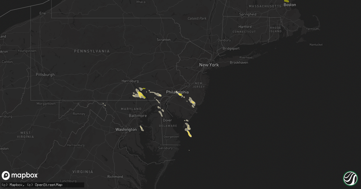
Hail Map on July 23, 2016
Get this storm
July 23 map
$229
one time, instant access
Download today. No call, no setup
Keep the $229
Bought the map and want the full workflow? Apply the entire $229 to a subscription within 7 days. None of it is wasted.
Every map, not just this one
This buys you this map. Subscription and you get every map we run, in the markets you choose from a few cities to whole states to nationwide. Plus real-time alerts the moment a storm fires.
Contact data
Name, contact info, occupancy, even credit band for addresses in the footprint. You go from where it hit to who to call.
Become the source they trust
Unlimited branding weather history reports on demand. You already have the documented answer ready for the property owner, and you are the one who showed up with it.
Property data and RoofTrace estimates
Pull up any address you have got, its value and the exact code rules for that jurisdiction, straight from One Click Code. Then RoofTrace estimates the squares, pitch, and roof value, priced the way you price.
States Impacted by Hail Map on July 23, 2016
Storm reports
North Carolina
| Date | Description |
|---|---|
| 07/23/20164:40 PM CDT | One tree down near the intersection of odell school road and shiloh church road. |
Tennessee
| Date | Description |
|---|---|
| 07/23/20165:47 PM CDT | Several reports of power outages from severe thunderstorm in shelbyville. |
Iowa
| Date | Description |
|---|---|
| 07/23/20166:18 PM CDT | Delayed report - branches downed by high wind. |
| 07/23/20165:30 PM CDT | Partial trees down - time estimated |
| 07/23/20164:48 PM CDT | Law enforcement reported a tornado going up and down near farley. |
| 07/23/20164:41 PM CDT | Spotter reported a tornado near worthington. |
| 07/23/20164:25 PM CDT | Several large trees and branches down. Via facebook. Report was delayed and time estimated using radar. |
| 07/23/20164:21 PM CDT | 3 limbs approximately 6 to 12 inches in diameter were down. |
| 07/23/20164:18 PM CDT | Video of narrow tornado crossing the southwest portion of lake delhi. |
| 07/23/20164:10 PM CDT | 2 estimated 8 inch diamater trees down. Report via twitter. Time estimated by radar. |
| 07/23/20164:03 PM CDT | Numerous branches and tree limbs down across town. |
| 07/23/20163:49 PM CDT | Wind estimated 70 to 80 mph downed trees at campground |
| 07/23/20163:49 PM CDT | Trees down at campground. |
| 07/23/20163:35 PM CDT | 4 inch diameter branch snapped off tree |
| 07/23/20163:35 PM CDT | Wind estimated 60 to 65 mph |
| 07/23/20163:30 PM CDT | Very heavy rain and winds to 65 mph. |
| 07/23/20162:40 PM CDT | Several tree branches down in the vicinity...up to 4 inches in diameter. Time estimated by radar. Delayed report from saturday. |
| 07/23/20168:35 AM CDT | Damage to docks... Including poles bent at a severe angle. Boats moved 4-8 feet upstream and 6 feet into shore. Trees and limbs down... Including at least one 12 inches |
New Hampshire
| Date | Description |
|---|---|
| 07/23/20165:55 PM CDT | A local report indicates 1.00 inch wind near SEABROOK |
| 07/23/20165:50 PM CDT | Trees and wires down |
| 07/23/20165:50 PM CDT | Trees across liberty hil rd |
| 07/23/20165:50 PM CDT | Trees and wires down |
| 07/23/20165:48 PM CDT | Trees down |
| 07/23/20165:47 PM CDT | Trees and wires down |
| 07/23/20165:44 PM CDT | Widespread trees and wires down |
| 07/23/20165:40 PM CDT | Trees and wires down |
| 07/23/20165:35 PM CDT | Trees and wires down. |
| 07/23/20165:35 PM CDT | Tree fell on a house on greenwood road. |
| 07/23/20165:35 PM CDT | Multiple trees and power lines down. |
| 07/23/20165:35 PM CDT | Trees down blocking the road |
| 07/23/20165:30 PM CDT | Widespread trees and wires down |
| 07/23/20165:25 PM CDT | Trees and power lines down |
| 07/23/20165:25 PM CDT | Trees and wires down |
| 07/23/20165:20 PM CDT | Trees and wires down |
| 07/23/20165:20 PM CDT | Trees and wires down |
| 07/23/20165:18 PM CDT | Trees blocking amtrak in newmarket |
| 07/23/20165:15 PM CDT | Trees and power lines down at nh-136 e and ferson road. |
| 07/23/20165:15 PM CDT | Nh-136 e at scobie road...trees and power lines down. |
| 07/23/20165:10 PM CDT | Trees and wires down |
| 07/23/20165:05 PM CDT | Trees down on power lines. Snapped power pole. |
| 07/23/20165:00 PM CDT | Trees and wires down |
| 07/23/20164:50 PM CDT | Trees down on birchwood terrace. |
| 07/23/20164:50 PM CDT | Tree on a house at the intersection of pleasant and high streets. |
| 07/23/20164:45 PM CDT | Trees on wires and pea sized hail |
| 07/23/20164:45 PM CDT | Wires down. |
| 07/23/20164:40 PM CDT | Trees down rt. 28 |
| 07/23/20164:40 PM CDT | Trees blocking rt 127 |
| 07/23/20164:40 PM CDT | Tree down on house on russell road. |
| 07/23/20164:40 PM CDT | Tress down on houses and wires. Multiple roads closed. Route 132 and 127 closed. |
| 07/23/20164:35 PM CDT | Wires down on hill road. |
| 07/23/20164:30 PM CDT | Wires down on brookdale road. |
| 07/23/20164:30 PM CDT | Trees down |
| 07/23/20164:30 PM CDT | Wires down at the intersection of plains road and currier road. |
| 07/23/20164:29 PM CDT | Numerous trees down. |
| 07/23/20164:25 PM CDT | Wires down on porter road. |
| 07/23/20164:24 PM CDT | Trees down west shore rd. |
| 07/23/20164:17 PM CDT | Trees and wires down on texas hill road. |
| 07/23/20164:15 PM CDT | Dozens of trees down. |
| 07/23/20164:15 PM CDT | Trees down. |
| 07/23/20164:15 PM CDT | Trees and wires down on beauty hill road |
| 07/23/20163:10 PM CDT | Large branches down |
Rhode Island
| Date | Description |
|---|---|
| 07/22/20167:15 PM CDT | Tree down across route 116. Wires down at station street and route 116. Trees down on wires on station street and knotty oak shores road. |
| 07/22/20167:06 PM CDT | Large tree down onto moving car on main street. People trapped in car but no injuries. |
Texas
| Date | Description |
|---|---|
| 07/23/20165:55 PM CDT | Power lines down along county road 4507. |
| 07/23/20165:45 PM CDT | Trees downed on power lines along hwy 259 |
| 07/23/20165:35 PM CDT | Power lines down along fm road 561. |
| 07/23/20165:25 PM CDT | Power lines down on county road 3010. |
New York
| Date | Description |
|---|---|
| 07/23/20166:10 PM CDT | A local report indicates 1.00 inch wind near CLINTON |
| 07/23/20166:00 PM CDT | Trees down with power outages around clark mills. |
| 07/23/20166:00 PM CDT | A tree down in road at krumkill rd and salem ct |
| 07/23/20165:55 PM CDT | Eureka road closed in westmoreland due to fallen trees. Many trees down from westmoreland to clinton with power outages. |
| 07/23/20165:45 PM CDT | Many trees down with power outages in rome. |
| 07/23/20163:30 PM CDT | Multiple trees and wires down on residence. |
| 07/23/20163:15 PM CDT | Spotter report |
| 07/23/20163:12 PM CDT | *** 1 inj *** trees on residence resulting in an injury |
| 07/23/20163:00 PM CDT | Power outages in jay township. Numerous trees on lines across essex county |
| 07/23/20162:40 PM CDT | Trees down |
| 07/23/20162:25 PM CDT | Trees down on course and dime sized hail |
| 07/23/20162:24 PM CDT | Trees down |
| 07/23/20162:24 PM CDT | Trees down |
| 07/23/20162:07 PM CDT | A local report indicates 1.00 inch wind near LYON MOUNTAIN |
| 07/23/20162:05 PM CDT | Trees down |
Arkansas
| Date | Description |
|---|---|
| 07/23/20166:06 PM CDT | Roof damage to a home was reported about 1 mile south of the van buren and faulkner county line on hwy. 65. |
| 07/23/20166:06 PM CDT | Many trees were reported down on hwy. 65 between damascus and twin groves. |
| 07/23/20166:01 PM CDT | A local report indicates 1.00 inch wind near GREENBRIER |
| 07/23/20165:05 PM CDT | Trees were reported down in furlow on hwy. 89. |
| 07/23/20164:55 PM CDT | Poweer poles were snapped and half of a mcdonalds sign was destroyed. |
| 07/23/20164:29 PM CDT | Siding was blown off of several homes in cabot from a thunderstorm wind gust. |
Florida
| Date | Description |
|---|---|
| 07/23/20168:00 AM CDT | Seco energy reports numerous trees downed by likely downburst in the marion oaks area. Significant damage to the tops of trees noted. Time of damage based on radar data |
| 07/23/20168:00 AM CDT | Dozens of trees downed in the marion oaks country club by likely downburst with significant damage noted to the tops of trees...as wells as branches stripped of bark. T |
| 07/22/20168:55 PM CDT | Alachua county 911/dispatch reports a large tree downed by strong thunderstorm winds near the intersection of northwest 190th avenue and northwest 184th terrace. |
| 07/22/20168:30 PM CDT | Alachua county 911/dispatch reports that a large tree was damaged and was hanging over the road across millhopper road. Time of damage based on radar data. |
| 07/22/20168:15 PM CDT | Alachua county 911/dispatch reports that a large tree branch of nearly 8 inches in diameter was snapped and impacted the intersection of northwest 34th street and north |
| 07/22/20168:00 PM CDT | Trees were blown down along sw 36th avenue road in the marion oaks area. The time of damage was based on radar. |
| 07/22/20168:00 PM CDT | Trees were blown down along marion oaks blvd. The time of damage was based on radar. |
| 07/22/20168:00 PM CDT | Trees were blown down along sw 36th avenue road in the marion oaks area. The time of damage was based on radar. A marion county emergency management storm survey and re |
Massachusetts
| Date | Description |
|---|---|
| 07/23/20166:44 PM CDT | Multiple trees...limbs...and wires down in multiple locations. |
| 07/23/20166:44 PM CDT | Tree down on wires on massachusetts avenue near harvard law school. |
| 07/23/20166:35 PM CDT | Large limb down on power lines on hancock street. |
| 07/23/20166:35 PM CDT | Branch down on a garage on charles street. |
| 07/23/20166:32 PM CDT | Tree down on willow street. |
| 07/23/20166:32 PM CDT | Large branch down. |
| 07/23/20166:31 PM CDT | Tree down. |
| 07/23/20166:31 PM CDT | Power lines down on burncoat street. |
| 07/23/20166:30 PM CDT | Tree down on boylston street. |
| 07/23/20166:30 PM CDT | Large branch down on meadow road. |
| 07/23/20166:30 PM CDT | Multiple trees and wires down...including on barstool street. A tree was downed onto a car on forrester and washington streets. Tree down on houston road. Portion of a |
| 07/23/20166:30 PM CDT | Tree down blocking willow street. |
| 07/23/20166:27 PM CDT | Numerous trees and wires down...including valley road and route 97. |
| 07/23/20166:25 PM CDT | Tree down on car on westford road. Tree down on wires on old stow road. Wires downed on lindsay pond road. |
| 07/23/20166:23 PM CDT | *** 1 inj *** awning fell onto a pedestrian at the lenox hotel on exeter street. Person was injured. |
| 07/23/20166:15 PM CDT | Multiple small boats in distress on the merrimack river. |
| 07/23/20166:15 PM CDT | Tree down on a car on fowler avenue. |
| 07/23/20166:15 PM CDT | Large tree and power lines down in wychwood heights. |
| 07/23/20166:12 PM CDT | Tree down onto the colonial inn. Tree down across shagbark road...everett street...and main street. |
| 07/23/20166:11 PM CDT | Trees and power lines down on lowell road. |
| 07/23/20166:09 PM CDT | Large branch down on concord street. |
| 07/23/20166:09 PM CDT | Big tree down. |
| 07/23/20166:08 PM CDT | Wires down and a tree uprooted. |
| 07/23/20166:07 PM CDT | Tree down on route 78. Tree and wires down on east road. Tree down on east river street. |
| 07/23/20166:06 PM CDT | Multiple trees and wires down in west peabody... Including on lowell street... Newbridge road... And pocahontas drive. |
| 07/23/20166:05 PM CDT | Tree down blocking high street. |
| 07/23/20166:03 PM CDT | Trees and wires down in various locations throughout town. |
| 07/23/20166:02 PM CDT | Trees down on ipswich road...barehill road...whitney road. Motorcyclist down on downed wires on georgetown road near hillside road. |
| 07/23/20166:00 PM CDT | Tree down on north street. |
| 07/23/20166:00 PM CDT | Tree down in chelmsford center damaging a car so it had to be towed. Tree down on wires on spaulding road. Tree down on warren avenue. Tree down on car on boston road. |
| 07/23/20165:59 PM CDT | Tree down on river street. Large branch down on wires on concord street. |
| 07/23/20165:56 PM CDT | Trees were downed on dock lane...true road...and cushing road. |
| 07/23/20165:55 PM CDT | Power lines down on cold spring at graniteville. |
| 07/23/20165:54 PM CDT | Several trees and wires down on main street and mechanic street. |
| 07/23/20165:54 PM CDT | Two large trees down. |
| 07/23/20165:52 PM CDT | Numerous trees down throughout town...including a tree down onto a car. Wires down on steven street and fairmont street. Large tree down on wires on greendale avenue. W |
| 07/23/20165:50 PM CDT | Tree down in the right lane of 213 westbound. |
| 07/23/20165:50 PM CDT | Tree down and transformer blew on liberty street. |
| 07/23/20165:10 PM CDT | Tent blown over on revere beach. Tree and power lines down on endicott avenue and on caruso street. Wires down on vinyl street. |
| 07/23/20165:05 PM CDT | Tree down on avon street. |
| 07/23/20165:01 PM CDT | Tree branch down. |
| 07/23/20165:00 PM CDT | Large limbs down on whitman...lionel...and middle streets. Tree and wires down on lionel and middle streets. |
| 07/23/20165:00 PM CDT | Large tree limb down. |
| 07/23/20165:00 PM CDT | Tree down on a car on howard street. Large branch down on wires on dudley street. |
| 07/23/20165:00 PM CDT | Wires down on hanover street. Trees and wires down in several locations. |
| 07/23/20165:00 PM CDT | Large tree down on bacon street. |
| 07/23/20164:52 PM CDT | Wires down on irving street. Tree down on house on sheffield road. Large tree branch down on madison avenue and cambridge street. Tree down on main street by the rec de |
| 07/22/20167:35 PM CDT | Tree down on car on coolidge street. |
| 07/22/20167:35 PM CDT | Large branch on car on howart at conduit street. Tree down in the buttonwood park area. Tree down on union and 6th street. Tree down on aquidneck at brock avenue. Tree |
| 07/22/20167:21 PM CDT | Tree down on wires on westerly road. |
Maine
| Date | Description |
|---|---|
| 07/23/20165:35 PM CDT | Trees and large branches down |
| 07/23/20163:25 PM CDT | Trees and power lines down |
| 07/23/20163:20 PM CDT | Trees and power lines down on brook street. Tree on building. |
| 07/23/20163:15 PM CDT | Power lines down on meridian |
| 07/23/20163:10 PM CDT | Trees on wires along rt 302 |
| 07/23/20163:10 PM CDT | Large branches on wires. |
| 07/23/20163:05 PM CDT | A local report indicates 1.00 inch wind near DURHAM |
| 07/23/20162:35 PM CDT | Trees and power lines down. Power outages. |
| 07/23/20162:25 PM CDT | Trees and wires down |
Wisconsin
| Date | Description |
|---|---|
| 07/23/20162:45 PM CDT | Tree branches down in pardeeville. |
| 07/23/20162:25 PM CDT | . |
| 07/23/20161:52 PM CDT | Tree damage in mount horeb area per dispatch. Time estimated from radar. |
| 07/23/201611:08 AM CDT | Multiple trees down..... |
| 07/23/201611:00 AM CDT | Multiple trees down. |
| 07/23/20163:35 AM CDT | Near the intersection of county highway n and barnes road there were multiple large pine trees uprooted or snapped. Spotter estimated that the largest trees were approx |
Delaware
| Date | Description |
|---|---|
| 07/23/20165:11 PM CDT | Trees and wires down on bunker hill road. Tree uprooted on bohemia mill road. |
| 07/23/20164:15 PM CDT | Trees and wires down on centerville road |
Illinois
| Date | Description |
|---|---|
| 07/23/20166:42 PM CDT | A few large limbs downed. Radar estimated time. |
| 07/23/20166:28 PM CDT | Wind estimated at 55-60 mph. Dempster street west of skokie blvd. |
| 07/23/20166:26 PM CDT | Branches down at route 25 and sunset park. |
| 07/23/20166:15 PM CDT | Several 6 inch diameter branches down. |
| 07/23/20165:32 PM CDT | Also 55 to 60 mph winds and very heavy rainfall with visibility around 200 feet. |
| 07/23/20165:28 PM CDT | Power line down |
| 07/23/20165:15 PM CDT | Large tree blown down. Time estimated by radar. |
| 07/23/20164:58 PM CDT | Numerous large branched downed in the city. Radar estimated time. |
| 07/22/201611:30 PM CDT | Multiple large tree branches down. Some branches fell on a house. Minor damage to the house. One tree uprooted. Time estimated. Late report. |
| 07/22/201610:39 PM CDT | Couple trees downed. Numerous large branches downed. Outbuilding damaged. Radar estimated time. |
| 07/22/20169:28 PM CDT | Numerous large trees down over fences on property...several trees down or uprooted in town of geneseo...time estimated from radar. |
| 07/22/20168:08 PM CDT | Multiple power lines down in the town of dixon. Time estimated from radar. |
| 07/22/20167:58 PM CDT | Old shed knocked down... Portion of an old barn damaged... And branches downed. Radar estimated time. |
| 07/22/20167:08 PM CDT | Branches down at route 25 and sunset park. Corrected for radar estimated time. |
Colorado
| Date | Description |
|---|---|
| 07/23/20166:12 PM CDT | Large living elm tree snapped half way up. Branch was approximately 12 inches in diameter. |
| 07/22/20169:14 PM CDT | . |
Pennsylvania
| Date | Description |
|---|---|
| 07/23/20165:11 PM CDT | A local report indicates 1.00 inch wind near LOGANVILLE |
| 07/23/20165:00 PM CDT | Trees and power poles down in sadsbury township... And the borough of christiana. |
| 07/23/20164:57 PM CDT | 12 trees down across morey road |
| 07/23/20164:35 PM CDT | Multiple trees down in manor township. |
| 07/23/20164:15 PM CDT | Quarter size hail in airville. |
| 07/23/20164:07 PM CDT | Tree fell into septa train wires. Two people rescued from train. |
| 07/23/20164:07 PM CDT | Utility pole and wires down... Trees down. |
| 07/23/20164:00 PM CDT | Trees and power poles down in sadsbury township... And the borough of christiana. |
| 07/23/20163:42 PM CDT | Trees and wires down on school lane and berkeley road. Damage to a roof. |
| 07/23/20163:36 PM CDT | Multiple trees down on st. Rt. 837 between elrama and new eagle |
| 07/23/20163:35 PM CDT | Multiple trees down in manor township. |
| 07/23/20163:30 PM CDT | Large tree limbs down. Time estimated from radar. |
| 07/23/20163:23 PM CDT | Nickel to quarter size hail in lancaster. |
| 07/23/20163:20 PM CDT | Roof blown off trailer in rapho township. |
Minnesota
| Date | Description |
|---|---|
| 07/23/20162:05 PM CDT | A few 3 inch diameter tree branches down. |
| 07/23/20161:25 PM CDT | Hail diameter 2.25 inches. Mostly one inch hail... Lasted approximately 5 minutes. Vehicles... House siding damaged. Also measured 3 inches of rain in 1.5 hours. |
| 07/23/201611:11 AM CDT | Multiple trees down. |
| 07/23/201610:50 AM CDT | Large branch snapped off. Social media image. |
| 07/23/201610:41 AM CDT | A few trees down. |
| 07/23/201610:40 AM CDT | Power lines down. |
| 07/23/201610:40 AM CDT | Multiple trees down . |
| 07/23/201610:20 AM CDT | Large tree down. . |
| 07/23/20169:32 AM CDT | Large tree branch down blocking traffic |
| 07/23/20162:15 AM CDT | 10 inch diameter birch tree brought down from strong winds. |
| 07/23/20162:06 AM CDT | Few trees reported down in the willow river campground area. Time estimated from radar. |
| 07/23/20161:07 AM CDT | Few trees reported down. Time estimated by radar. |
| 07/23/201612:41 AM CDT | Tree fell and took down a powerline on beach road. Time estimated by radar. |
Vermont
| Date | Description |
|---|---|
| 07/23/20165:15 PM CDT | Trees down. Time estimated by radar. |
| 07/23/20164:35 PM CDT | Trees down throughout down |
| 07/23/20164:27 PM CDT | Few trees down |
| 07/23/20164:20 PM CDT | Trees down on i-89 at mile marker 15.8 southbound. |
| 07/23/20164:20 PM CDT | Trees down |
| 07/23/20164:00 PM CDT | Trees down on post road |
| 07/23/20163:55 PM CDT | Trees down |
| 07/23/20163:52 PM CDT | Trees down on cricket hill road |
| 07/23/20163:40 PM CDT | Trees down...power lines down |
| 07/23/20163:30 PM CDT | *** 1 fatal *** trees down |
| 07/23/20163:27 PM CDT | Trees down on route 30 |
| 07/23/20163:27 PM CDT | Reports of numerous trees downed or snapped along interstate 89 bewteen mile markers 50 in barre to mile marker 25 near bethel |
| 07/23/20163:20 PM CDT | Reports of numerous trees downed or snapped along interstate 89 bewteen mile markers 50 in barre to mile marker 25 near bethel |
| 07/23/20163:19 PM CDT | Trees down on route 12 near wrightsville dam |
| 07/23/20163:18 PM CDT | Trees down on main road |
| 07/23/20163:12 PM CDT | Shingles blown off roof...power is out. |
| 07/23/20163:02 PM CDT | Tree down |
| 07/23/20163:00 PM CDT | Trees down on powerlines |
| 07/23/20163:00 PM CDT | Numerous trees down |
| 07/23/20162:47 PM CDT | Trees down...power lines down |
| 07/23/20162:40 PM CDT | A few trees down |
| 07/23/20162:36 PM CDT | Power lines down on road |
| 07/23/20162:35 PM CDT | Trees down |
| 07/23/20162:25 PM CDT | Trees down...power lines down on dorset street. |
| 07/23/20162:24 PM CDT | Trees down...rt 2a blocked. |
| 07/23/20162:24 PM CDT | Part of a tree in right lane of i-89n just before williston exit. |
| 07/23/20162:24 PM CDT | Tree down on south brownell road. |
| 07/23/20161:45 PM CDT | Trees down |
New Jersey
| Date | Description |
|---|---|
| 07/23/20166:10 PM CDT | Trees and power lines down. Power outages. Time estimated from radar. |
| 07/23/20165:22 PM CDT | Large tree limbs down. Time estimated from radar. |
| 07/23/20164:37 PM CDT | Downed wires on burnt mill road. |
| 07/23/20164:35 PM CDT | Power pole snapped in half. |
| 07/23/20164:35 PM CDT | Large tree limbs down on burbank drive. Time estimated from radar. |
| 07/23/20164:33 PM CDT | A local report indicates 1.00 inch wind near HADDONFIELD |
| 07/23/20164:33 PM CDT | Trees down on cars at intersection of barr drive and clements drive |
| 07/23/20164:32 PM CDT | Some trees down. Some large tree limbs fell onto a house. Time estimated from radar. |
| 07/23/20164:30 PM CDT | Several trees down in the glendora and runnemede areas. Time estimated from radar. |
| 07/23/20164:30 PM CDT | Trees down. Time estimated from radar. |
| 07/23/20164:30 PM CDT | Quarter size hail. Time estimated from radar. |
| 07/23/20164:30 PM CDT | A large tree completely toppled over onto two cars on the 400 block of lincoln avenue. A woman was trapped in one of the cars and had to be rescued. Time estimated from |
| 07/23/20164:29 PM CDT | A local report indicates 1.00 inch wind near AUDUBON |
Maryland
| Date | Description |
|---|---|
| 07/23/20165:58 PM CDT | Trees down at red pump rd and ennis way |
| 07/23/20165:54 PM CDT | Trees down near 1205 grafton shop rd |
| 07/23/20165:35 PM CDT | Trees down along n tollgate rd near ma and pa hertiage trail |
| 07/23/20165:25 PM CDT | Trees down near intersection of st ann dr and md-543 |
| 07/23/20165:15 PM CDT | Trees down near rt 136 between telegraph and onion rd |
| 07/23/20165:03 PM CDT | Trees down. Time estimated from radar. |
| 07/23/20164:58 PM CDT | A local report indicates 67 MPH wind near 2 S BRANTWOOD |
| 07/23/20164:55 PM CDT | Several trees snapped in half. Shingles off of some roofs. Time estimated from radar. |
North Dakota
| Date | Description |
|---|---|
| 07/23/20169:12 AM CDT | A local report indicates 1.00 inch wind near 5 SSW STEELE |
South Dakota
| Date | Description |
|---|---|
| 07/23/20167:00 AM CDT | . |
Cities Impacted by Hail Map on July 23, 2016
- Osceola, WI
- Amery, WI
- Star Prairie, WI
- Atwater, MN
- New Park, PA
- Red Lion, PA
- Brogue, PA
- Airville, PA
- York, PA
- Felton, PA
- Windsor, PA
- Wrightsville, PA
- Menoken, ND
- Bismarck, ND
- Medina, ND
- Driscoll, ND
- Mandan, ND
- Baxter, MN
- Brainerd, MN
- Hanley Falls, MN
- Watertown, MN
- Mound, MN
- Maple Plain, MN
- Excelsior, MN
- Saint Bonifacius, MN
- Poland, ME
- Oxford, ME
- Casco, ME
- Fairmont, NC
- Orrum, NC
- McGrath, MN
- Isle, MN
- Starbuck, MN
- Streeter, ND
- Hartland, MN
- Elysian, MN
- Madison Lake, MN
- Waseca, MN
- Waldorf, MN
- Alden, MN
- New Richland, MN
- Janesville, MN
- Pemberton, MN
- Wells, MN
- Eagle Lake, MN
- Winthrop, IA
- Danbury, WI
- Trego, WI
- Spooner, WI
- Albert Lea, MN
- Emmons, MN
- Twin Lakes, MN
- Lewiston, MN
- Webster, WI
- Sandstone, MN
- Hinckley, MN
- Clarkfield, MN
- Wing, ND
- Regan, ND
- Dekalb, IL
- Clare, IL
- Sycamore, IL
- Calmar, IA
- Eagle Bridge, NY
- Cambridge, NY
- Lake Lillian, MN
- Nisswa, MN
- Garrison, MN
- Pillager, MN
- Pequot Lakes, MN
- Deerwood, MN
- Madison, MN
- Lake Crystal, MN
- Nicollet, MN
- Mankato, MN
- Oregon, IL
- Dixon, IL
- La Crosse, WI
- Coon Valley, WI
- Viroqua, WI
- Westby, WI
- Cashton, WI
- Chaseburg, WI
- Stoddard, WI
- Ward, AR
- Austin, AR
- Rome, NY
- Mineral Point, WI
- Darlington, WI
- Platteville, WI
- Belmont, WI
- Dolgeville, NY
- Atkinson, IL
- Darwin, MN
- Dassel, MN
- Gackle, ND
- Wells, VT
- West Pawlet, VT
- Moira, NY
- Brasher Falls, NY
- Dickinson Center, NY
- Brushton, NY
- North Lawrence, NY
- Buda, IL
- Bradford, IL
- Calhoun, GA
- Adairsville, GA
- Benson, MN
- Danvers, MN
- Kerkhoven, MN
- Murdock, MN
- Barrington, NJ
- Gloucester City, NJ
- Magnolia, NJ
- Bellmawr, NJ
- Lawnside, NJ
- Oaklyn, NJ
- Audubon, NJ
- Mount Ephraim, NJ
- Haddonfield, NJ
- Haddon Heights, NJ
- Viola, WI
- De Witt, AR
- Crocketts Bluff, AR
- Springbrook, WI
- La Junta, CO
- Colesburg, IA
- Whitesburg, KY
- Whiteville, NC
- Blountsville, AL
- Hayden, AL
- Hanceville, AL
- Hoffmeister, NY
- Ogilvie, MN
- Litchfield, MN
- West Union, IA
- Castalia, IA
- Ossian, IA
- Clermont, IA
- Postville, IA
- Luana, IA
- Elgin, IA
- Hector, AR
- Prophetstown, IL
- Stratford, NY
- Caroga Lake, NY
- Mora, MN
- Wahkon, MN
- Milaca, MN
- Camden, AR
- Chidester, AR
- Delight, AR
- Fort Atkinson, IA
- Waucoma, IA
- Morris, MN
- Decorah, IA
- Ridgeway, IA
- Hokah, MN
- La Crescent, MN
- Grove City, MN
- Coldwater, MS
- Kellogg, MN
- Wabasha, MN
- Alma, WI
- Janesville, WI
- Avalon, WI
- Delavan, WI
- Darien, WI
- Cheraw, CO
- Pine City, MN
- Argyle, NY
- Salem, NY
- Robinson, ND
- Grasston, MN
- Henriette, MN
- Evansdale, IA
- Waterloo, IA
- Cedar Falls, IA
- Hudson, IA
- Farmersburg, IA
- Saint Olaf, IA
- Miami, FL
- Leaf River, IL
- Agar, SD
- Onida, SD
- Monticello, IA
- Milan, MN
- New Boston, TX
- Alachua, FL
- Charlotte, NC
- Huntersville, NC
- Woodworth, ND
- Kensal, ND
- Courtenay, ND
- Montpelier, ND
- Ionia, IA
- New Hampton, IA
- Alta Vista, IA
- Worthington, IA
- Hopkinton, IA
- Delhi, IA
- Earlville, IA
- Marston, NC
- Rockingham, NC
- Bradford, IA
- Hampton, IA
- Hot Springs National Park, AR
- Lamar, CO
- Nashville, AR
- Rowley, IA
- Independence, IA
- Steele, ND
- Wellsburg, IA
- Morris, IL
- Manchester, IA
- Lyon Mountain, NY
- Solen, ND
- Glencoe, IL
- Winnetka, IL
- Holland, IA
- Parkersburg, IA
- Aitkin, MN
- Finlayson, MN
- Brook Park, MN
- Exeland, WI
- Philadelphia, PA
- Collingswood, NJ
- Clementon, NJ
- Runnemede, NJ
- Glendora, NJ
- Voorhees, NJ
- Gibbsboro, NJ
- Camden, NJ
- Somerdale, NJ
- Blackwood, NJ
- Cherry Hill, NJ
- Beebe, AR
- McCrory, AR
- Hutchinson, MN
- Poplar Grove, IL
- Capron, IL
- Cambridge, IL
- Kewanee, IL
- Port Byron, IL
- Colona, IL
- Hillsdale, IL
- Annawan, IL
- Geneseo, IL
- Hampton, IL
- East Moline, IL
- Annapolis, MD
- Dierks, AR
- Northwood, IA
- Lake Mills, IA
- Bagley, WI
- Bloomington, WI
- Delmar, IA
- Charlotte, IA
- Parks, AR
- Warwick, MD
- Galena, MD
- Townsend, DE
- Clayton, DE
- Massey, MD
- Canby, MN
- Ivanhoe, MN
- Hendricks, MN
- Spillville, IA
- Buffalo Lake, MN
- Pingree, ND
- Grand Mound, IA
- Lost Nation, IA
- Saint Amant, LA
- Prairieville, LA
- Gonzales, LA
- Charlotte, VT
- Mount Prospect, IL
- Rolling Meadows, IL
- Elk Grove Village, IL
- Arlington Heights, IL
- Highland Park, IL
- Wilmette, IL
- Glenview, IL
- Little Rock, AR
- Hensley, AR
- Mabelvale, AR
- Bryant, AR
- Alexander, AR
- Bauxite, AR
- Buffalo Center, IA
- Conger, MN
- Forest City, IA
- Leland, IA
- Kiester, MN
- Scarville, IA
- Thompson, IA
- Oxford, PA
- Brevard, NC
- Caledonia, IL
- Cosmos, MN
- Cape May Court House, NJ
- Echo, MN
- Eolia, KY
- Shelbyville, TN
- Newport, MN
- Saint Paul Park, MN
- Saint Paul, MN
- Cottage Grove, MN
- Birchwood, WI
- Stone Lake, WI
- Beardsley, MN
- Mountain View, AR
- Edgemont, AR
- Shirley, AR
- Onslow, IA
- Anamosa, IA
- Center Junction, IA
- Wiley, CO
- Clinton, WI
- Genoa, WI
- Harvey, AR
- Wauzeka, WI
- Boscobel, WI
- Steuben, WI
- Gays Mills, WI
- Blomkest, MN
- Raymond, MN
- Kandiyohi, MN
- Willmar, MN
- Belvidere, IL
- Oakland, TN
- Somerville, TN
- Hope, AR
- Mayer, MN
- Fayette, IA
- Ferryville, WI
- Orient, ME
- Hermosa, SD
- Pine Ridge, SD
- Danube, MN
- Olivia, MN
- Bird Island, MN
- Columbia, PA
- Wheaton, MN
- Three Oaks, MI
- New Buffalo, MI
- Rolling Prairie, IN
- La Porte, IN
- Dumont, MN
- Lawler, IA
- Garden Prairie, IL
- Holly Grove, AR
- Garner, IA
- Britt, IA
- Hudson Falls, NY
- Fort Ann, NY
- Fort Edward, NY
- Norcross, MN
- Herman, MN
- Williamsport, MD
- Seven Valleys, PA
- Fredericksburg, IA
- Cossayuna, NY
- Middletown, DE
- North Little Rock, AR
- Corona, SD
- Sebeka, MN
- Verndale, MN
- Avondale, PA
- West Grove, PA
- Kennett Square, PA
- Mapleton, ME
- Maquoketa, IA
- Wyoming, IA
- Baldwin, IA
- Monmouth, IA
- De Kalb, TX
- Prairie Du Chien, WI
- Glen Haven, WI
- Fulton, AR
- Magnolia, AR
- Ladysmith, WI
- Bruce, WI
- Dallastown, PA
- Fawn Grove, PA
- Stewartstown, PA
- Spring Grove, PA
- Glen Rock, PA
- Delta, PA
- New Freedom, PA
- Houston, MN
- Freeport, ME
- Toughkenamon, PA
- Johnson City, TN
- Woodman, WI
- Garnavillo, IA
- Patch Grove, WI
- Guttenberg, IA
- Garber, IA
- Mount Hope, WI
- Cassville, WI
- Fennimore, WI
- Lancaster, WI
- Rattan, OK
- Egg Harbor City, NJ
- De Soto, WI
- Elkton, MD
- Elk Mills, MD
- Cochranville, PA
- Atglen, PA
- Coatesville, PA
- Christiana, PA
- Clear Lake, SD
- De Witt, IA
- Oxford Junction, IA
- Wheatland, IA
- Calamus, IA
- Browntown, WI
- South Wayne, WI
- Silver Lake, MN
- Lester Prairie, MN
- Glencoe, MN
- Onamia, MN
- Granite Falls, MN
- Winona, MN
- Wentworth, NH
- Tappen, ND
- Dawson, ND
- Moffit, ND
- Sterling, ND
- Polo, IL
- Milledgeville, IL
- Wadena, IA
- Vincentown, NJ
- Morrison, IL
- Fenton, IL
- Erie, IL
- Lyndon, IL
- Willow Street, PA
- Stuttgart, AR
- Pierre, SD
- Morton Grove, IL
- Skokie, IL
- Libertyville, IL
- Vernon Hills, IL
- Utica, MN
- Rushford, MN
- Peterson, MN
- Lanesboro, MN
- Amity, AR
- Baileyville, IL
- Forreston, IL
- Cyrus, MN
- Glenwood, MN
- Rockford, IL
- Chadwick, IL
- Smithville, OK
- Plattsburgh, NY
- German Valley, IL
- Brandt, SD
- Cannon Ball, ND
- Marietta, MN
- Winnsboro, LA
- Waukon, IA
- Niles, IL
- Lincolnwood, IL
- Chicago, IL
- Holloway, MN
- Braham, MN
- Cherry Valley, IL
- Marseilles, IL
- Seneca, IL
- Sheridan, IL
- Newark, IL
- Palatine, IL
- Plainville, GA
- Benton, AR
- Union Pier, MI
- Avoca, WI
- Dodgeville, WI
- Lone Rock, WI
- Spring Green, WI
- Highland, WI
- Glencoe, AR
- Buchanan, ND
- Wimbledon, ND
- Jamestown, ND
- Stewart, MN
- Brownton, MN
- Marlton, NJ
- Berlin, NJ
- West Berlin, NJ
- Texarkana, TX
- Texarkana, AR
- Ashdown, AR
- Center Ridge, AR
- Mangham, LA
- Baskin, LA
- Woosung, IL
- Sterling, IL
- Soldiers Grove, WI
- Readstown, WI
- Good Thunder, MN
- Mount Morris, IL
- Massena, NY
- Helena, NY
- Wildwood, NJ
- Stone Harbor, NJ
- Strasburg, PA
- Ronks, PA
- Lake Villa, IL
- Wadsworth, IL
- Lee Center, NY
- Granville, NY
- West Rupert, VT
- Brunswick, ME
- Durham, ME
- Pownal, ME
- Marietta, PA
- Mount Joy, PA
- Mountville, PA
- Washington Boro, PA
- Lancaster, PA
- Hoffman Estates, IL
- Franklin Grove, IL
- Amboy, IL
- Cleveland, ND
- Kirkland, IL
- Boles, AR
- Spicer, MN
- Latimer, IA
- Milo, ME
- Monroe, WI
- Jud, ND
- Argyle, WI
- Conway, SC
- Tuttle, ND
- Neponset, IL
- Paradise, PA
- Quarryville, PA
- Story, AR
- Arlington, TN
- Eads, TN
- Porter, MN
- Taunton, MN
- Rosholt, SD
- Barrington, IL
- Wauconda, IL
- Louisville, TN
- Deerfield, IL
- Lake Forest, IL
- Buffalo Grove, IL
- Lincolnshire, IL
- Mundelein, IL
- Wheeling, IL
- Lake Zurich, IL
- Jesup, IA
- Cicero, IL
- Racine, WI
- Redfield, AR
- Scott, AR
- Lonoke, AR
- Jacksonville, AR
- Cabot, AR
- North Yarmouth, ME
- New Gloucester, ME
- Chesapeake City, MD
- West Brooklyn, IL
- Compton, IL
- Clinton, NY
- Cresco, IA
- Hector, MN
- Aplington, IA
- Ackley, IA
- Golf, IL
- Highwood, IL
- Evanston, IL
- Park Ridge, IL
- Northbrook, IL
- Harwood Heights, IL
- Kenilworth, IL
- Schiller Park, IL
- Sheridan Lake, CO
- Appleton, MN
- Saint Anthony, ND
- Flasher, ND
- McGregor, IA
- Kingston, TN
- Marengo, IL
- Genoa, IL
- Kingston, IL
- Hampshire, IL
- Sheridan, AR
- Newton, NC
- Conover, NC
- Sanford, NC
- Ellenburg Center, NY
- Saranac, NY
- Westmoreland, NY
- Arlington, MA
- Stoneham, MA
- Lexington, MA
- Malden, MA
- Medford, MA
- Winchester, MA
- Burlington, MA
- Woburn, MA
- Salisbury, MA
- Hampton, NH
- Hampton Falls, NH
- Kingston, NH
- Seabrook, NH
- East Kingston, NH
- Amesbury, MA
- Exeter, NH
- Gray, ME