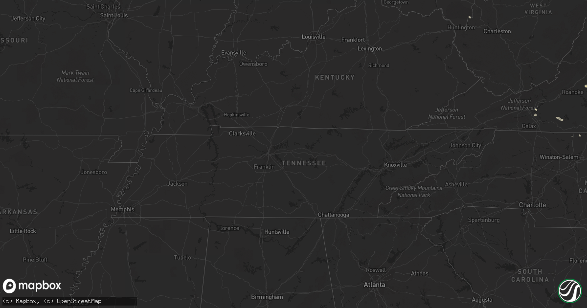
Hail Map in Virginia on July 23, 2011
Get this storm
July 23 map
$229
one time, instant access
Download today. No call, no setup
Keep the $229
Bought the map and want the full workflow? Apply the entire $229 to a subscription within 7 days. None of it is wasted.
Every map, not just this one
This buys you this map. Subscription and you get every map we run, in the markets you choose from a few cities to whole states to nationwide. Plus real-time alerts the moment a storm fires.
Contact data
Name, contact info, occupancy, even credit band for addresses in the footprint. You go from where it hit to who to call.
Become the source they trust
Unlimited branding weather history reports on demand. You already have the documented answer ready for the property owner, and you are the one who showed up with it.
Property data and RoofTrace estimates
Pull up any address you have got, its value and the exact code rules for that jurisdiction, straight from One Click Code. Then RoofTrace estimates the squares, pitch, and roof value, priced the way you price.
Storm reports in Virginia
Virginia
| Date | Description |
|---|---|
| 07/23/20115:35 PM CDT | Three 4 inch diameter limbs blown down. One was down on a power line. |
| 07/23/20115:10 PM CDT | 60 foot pine tree down and 2.5 inches of rain. |
| 07/23/20115:02 PM CDT | 8 inch tree limb downed on valley ridge rd. |
| 07/23/20115:00 PM CDT | Tree down at the 6000 block of stage road. |
| 07/23/20114:58 PM CDT | Tree down |
| 07/23/20114:55 PM CDT | Tree down blocking intersection of studley rd and shady grove rd |
| 07/23/20114:20 PM CDT | Tree down on kelso mill rd near the intersection with route 43. |
| 07/23/20114:15 PM CDT | Several trees and tree limbs were blown down on peaks road. |
| 07/23/20114:05 PM CDT | Tree down on five forks road |
| 07/23/20113:45 PM CDT | Tree down |
| 07/23/20113:44 PM CDT | Tree down |
| 07/23/20113:42 PM CDT | Tree down acrs road |
| 07/23/20113:41 PM CDT | Power lines down |
| 07/23/20113:40 PM CDT | Tree down on lynch road. |
| 07/23/20113:38 PM CDT | Trees down on road |
| 07/23/20112:58 PM CDT | 2 to 3 inch branches were blown down with thunderstorm wind gusts. |
| 07/23/20112:30 PM CDT | Trees blocking zachary taylor hwy |
| 07/23/20112:20 PM CDT | Tree down on us highway 29. |
| 07/23/20112:15 PM CDT | Tree down on holland road. |
| 07/23/20112:10 PM CDT | Several trees down in the pleasant gap drive and franklin turnpike area. |
| 07/23/20112:05 PM CDT | Tremendous wind snapped and dragged several medium-sized trees. Hail also accompanied the storm...but the size was unobserved. |
| 07/23/20112:00 PM CDT | Many 2 foot diameter trees uprooted. Large branches snapped off a mature tree and blown a few hundred feet away. |
| 07/23/20111:58 PM CDT | 2 inch limbs blown down with strong wind gusts. |
| 07/23/20111:50 PM CDT | Tree down on pinecrest drive |
| 07/23/201111:13 AM CDT | Trees down on delton road and boyd road. |
| 07/23/201111:08 AM CDT | Tree down |
All States Impacted by Hail Map on July 23, 2011
Cities Impacted by Hail Map on July 23, 2011
- Dekalb, IL
- Ellsworth, WI
- Hager City, WI
- McCausland, IA
- Long Grove, IA
- Arcadia, FL
- Cologne, MN
- Eaton, IN
- Janesville, MN
- Chesapeake, VA
- Vermilion, OH
- Lorain, OH
- New Auburn, WI
- Chetek, WI
- Bloomer, WI
- Zumbrota, MN
- Goodhue, MN
- Trenton, MO
- New Prague, MN
- Glencoe, MN
- Green Isle, MN
- Norwood Young America, MN
- Jordan, MN
- Belle Plaine, MN
- Carver, MN
- Plato, MN
- Henderson, MN
- Hamburg, MN
- Sidney, IA
- Fountain, NC
- Greenville, NC
- Sparta, WI
- Lynchburg, VA
- Bedford, VA
- Thaxton, VA
- Danville, VA
- Brooten, MN
- Rio, IL
- Belle Center, OH
- Rushsylvania, OH
- Tampa, FL
- Cornell, WI
- Jim Falls, WI
- Zebulon, NC
- Port Clinton, OH
- Ladysmith, WI
- Bruce, WI
- Exeland, WI
- Cave City, AR
- Jeddo, MI
- Eyota, MN
- Dover, MN
- Winona, MN
- Minnesota City, MN
- Corydon, IA
- Allerton, IA
- Iowa City, IA
- Tilleda, WI
- Tigerton, WI
- Caroline, WI
- Marion, WI
- Leopolis, WI
- Bellevue, IA
- Malvern, IA
- Cascade, VA
- Dry Fork, VA
- Chatham, VA
- Lakeland, FL
- Polk City, FL
- Hanover, IL
- Marion, OH
- Hartford City, IN
- Silver City, IA
- Henderson, IA
- Glenwood, MN
- Columbus, OH
- Galena, OH
- Blacklick, OH
- Lewis Center, OH
- Westerville, OH
- New Albany, OH
- Melrose, WI
- Gresham, WI
- Prior Lake, MN
- Webster, MN
- Elko New Market, MN
- North Fort Myers, FL
- Fort Gratiot, MI
- Croswell, MI
- La Crosse, KS
- Richmond, MN
- Cold Spring, MN
- Roscoe, MN
- Paynesville, MN
- Morris, MN
- Saint Paul, MN
- Minneapolis, MN
- Circle Pines, MN
- Jamesville, NC
- Stuarts Draft, VA
- Lyndhurst, VA
- Hope, MN
- Owatonna, MN
- Phillips, WI
- Winter, WI
- Louisa, VA
- Seven Valleys, PA
- York, PA
- Avoca, NE
- Polo, IL
- Merrill, WI
- Cuttyhunk, MA
- Willowbrook, IL
- Darien, IL
- Medford, MN
- Sturgis, MI
- Sheldon, IL
- Earl Park, IN
- Kentland, IN
- Starbuck, MN
- Stanley, WI
- Thorp, WI
- Nerstrand, MN
- Faribault, MN
- Northfield, MN
- Three Rivers, MI
- Jones, MI
- Boyd, WI
- Virginia Beach, VA
- Charlotte, IA
- Chariton, IA
- Mindoro, WI
- Fowler, IN
- Fulton, IL
- Morrison, IL
- Rice, MN
- Deadwood, SD
- Mankato, MN
- Belgrade, MN
- Wautoma, WI
- Ogema, WI
- Prentice, WI
- Powersville, MO
- Chardon, OH
- Newbury, OH
- Burton, OH
- Novelty, OH
- Hastings, MN
- Moncure, NC
- Sanford, NC
- Felton, PA
- Brogue, PA
- Culbertson, NE
- Comstock, WI
- Almena, WI
- Bristol, IN
- Sauk Rapids, MN
- Foley, MN
- Gatesville, NC
- Gates, NC
- Eure, NC
- Black River Falls, WI
- Fork Union, VA
- Palmyra, VA
- Bremo Bluff, VA
- Alton, MO
- Koshkonong, MO
- Hobbsville, NC
- Sunbury, NC
- Corapeake, NC
- Trenton, NC
- Pineville, LA
- Middlebury, IN
- Millersburg, OH
- Holmesville, OH
- Goshen, IN
- Elkhart, IN
- Constantine, MI
- Topeka, IN
- White Pigeon, MI
- Union, MI
- Shipshewana, IN
- Lagrange, IN
- Bison, KS
- Melrose, IA
- Russell, IA
- Charlottesville, VA
- Scottsville, VA
- Cadott, WI
- Concord, VA
- Follett, TX
- Dakota, MN
- La Crescent, MN
- Auburn, NE
- Brownville, NE
- Loyal, WI
- Pequea, PA
- Bowler, WI
- Shawano, WI
- Mulberry, FL
- Piedmont, OH
- Freeport, OH
- Labelle, FL
- Seymour, IA
- Promise City, IA
- Cabot, AR
- Austin, AR
- Naperville, IL
- Lisle, IL
- Homerville, GA
- Warren, IN
- Marion, IN
- Warsaw, OH
- Nehawka, NE
- Weeping Water, NE
- Pierceton, IN
- Larwill, IN
- Saint James, MN
- Mechanicsville, VA
- Hanover, VA
- Fontanelle, IA
- Saint Petersburg, FL
- Caulfield, MO
- Waseca, MN
- Glen Allen, VA
- Ashland, VA
- Willard, NC
- Chippewa Falls, WI
- Cameron, WI
- Weyerhaeuser, WI
- Shannon, IL
- Lanark, IL
- Milledgeville, IL
- Forreston, IL
- Sterling, IL
- Blairs, VA
- Belmont, OH
- Idalia, CO
- Plano, IA
- Ray, OH
- McArthur, OH
- Bremen, IN
- Mazeppa, MN
- Pine Island, MN
- Colby, WI
- Stratford, WI
- Edgar, WI
- Morocco, IN
- Forest, OH
- Farmville, VA
- Hancock, WI
- East Dubuque, IL
- Leipsic, OH
- Bluffton, IN
- Lonsdale, MN
- Montgomery, MN
- Shakopee, MN
- Lakeville, MN
- Farmington, MN
- Dundas, MN
- Richmond, VA
- Davenport, IA
- Walcott, IA
- Richlands, NC
- Plattsmouth, NE
- Murray, NE
- Nevada, OH
- River Falls, WI
- Sturgis, SD
- Bellevue, NE
- Estero, FL
- Fort Myers, FL
- Middleport, OH
- Pomeroy, OH
- Welch, MN
- Randolph, MN
- Cannon Falls, MN
- Hampton, MN
- Nebraska City, NE
- Vilonia, AR
- Conway, AR
- Lonoke, AR
- Ward, AR
- El Paso, AR
- Beebe, AR
- Burlington, IA
- West Burlington, IA
- Neillsville, WI
- Granton, WI
- Pittsville, WI
- Humbird, WI
- Burlington, CO
- Clarks Grove, MN
- Alden, MN
- Albert Lea, MN
- Hartland, MN
- Saint Joseph, MN
- Waite Park, MN
- Saint Cloud, MN
- Clinton, MI
- Fredericktown, OH
- Warrens, WI
- Syracuse, NE
- Kismet, KS
- Satanta, KS
- Tabor, IA
- Oxford, IA
- Kalona, IA
- Wellman, IA
- McConnell, IL
- Orangeville, IL
- Trenton, NE
- Watkins, IA
- Marcellus, MI
- Cassopolis, MI
- Vandalia, MI
- Rochester, MN
- Rib Lake, WI
- Tripoli, WI
- Zumbro Falls, MN
- Huntsville, OH
- Austinville, VA
- Hillsville, VA
- Max Meadows, VA
- Saint Peter, MN
- Calhan, CO
- Edgartown, MA
- Clearwater, MN
- Freeport, MN
- Kimball, MN
- Beaver Dam, WI
- Oak Harbor, OH
- Summerfield, OH
- Wray, CO
- Kenansville, FL
- Fremont, OH
- Harpster, OH
- Upper Sandusky, OH
- La Rue, OH
- Morral, OH
- Clayton, WI
- Amery, WI
- Aniwa, WI
- Spring Valley, WI
- Woodville, WI
- Wittenberg, WI
- Camden, IN
- Prescott, WI
- Hot Springs National Park, AR
- Wharton, OH
- Ridgeland, WI
- Wheeler, WI
- Rudolph, OH
- Cygnet, OH
- Jerry City, OH
- Nantucket, MA
- Woolwine, VA
- Stuart, VA
- Centerville, IA
- Plano, IL
- Big Rock, IL
- Wilmore, KS
- Cashton, WI
- Norwalk, WI
- Portsmouth, VA
- Spring Grove, PA
- Dallastown, PA
- Stockton, IA
- Eldridge, IA
- Blue Grass, IA
- Pearl City, IL
- Elk Mound, WI
- Felda, FL
- Fairchild, WI
- Augusta, WI
- Rice Lake, WI
- Arlington, MN
- Cyrus, MN
- Jacksonville, NC
- Dillwyn, VA
- Buckingham, VA
- New Albin, IA
- Barnesville, OH
- Quaker City, OH
- Holdingford, MN
- Avon, MN
- Palmyra, NE
- Adams, NE
- Bennet, NE
- Airville, PA
- Red Lion, PA
- Chokio, MN
- Cumberland, VA
- Onalaska, WI
- Holmen, WI
- West Salem, WI
- Isle Saint George, OH
- Cincinnati, IA
- Unionville, MO
- Williamson, IA
- Exline, IA
- Mystic, IA
- Bowling Green, OH
- Portage, OH
- Smithfield, VA
- Carrollton, VA
- Suffolk, VA
- Greenfield, IA
- Sabula, IA
- Preston, IA
- Miles, IA
- Plymouth, IN
- Argos, IN
- Blue River, WI
- Omro, WI
- Chadwick, IL
- Dixon, IL
- West Yarmouth, MA
- Salesville, OH
- Flushing, OH
- Rollingstone, MN
- Holly Springs, NC
- Altura, MN
- Kenyon, MN
- Millville, MN
- Wanamingo, MN
- Oronoco, MN
- Saint Charles, MN
- Plainview, MN
- Elgin, MN
- Dennison, MN
- Spragueville, IA
- Newell, SD
- Spencer, WI
- Ellendale, MN
- Thayer, MO
- Bucyrus, OH
- Madison Heights, VA
- Dawson, MN
- Boyd, MN
- Erie, IL
- Fowler, OH
- Liberty, WV
- Leon, WV
- Tipton, IA
- Clarence, IA
- Deep Run, NC
- Bryant, IA
- Clinton, IA
- Somerset, WI
- Hillsdale, IL
- Cordova, IL
- Port Byron, IL
- Marengo, IA
- Blairstown, IA
- Osceola, WI
- Tecumseh, MI
- Nekoosa, WI
- Tomahawk, WI
- Draper, VA
- Lonsdale, AR
- Benton, AR
- Java, VA
- Gretna, VA
- Trempealeau, WI
- Arkdale, WI
- Venus, FL
- Beldenville, WI
- Pembroke Township, IL
- Searcy, AR
- Higginson, AR
- Talmage, NE
- Julian, NE
- Peru, NE
- Wilson, NC
- Elm City, NC
- Schaller, IA
- Storm Lake, IA
- Nemaha, IA
- Early, IA
- Withee, WI
- Owen, WI
- South Haven, MN
- Troy, VA
- Bangor, WI
- Rockland, WI
- Big Springs, WV
- Big Bend, WV
- Crown City, OH
- Glenwood, WV
- Lesage, WV
- Colfax, WI
- Kingsport, TN
- Douglas, NE
- Burr, NE
- Albany, MN
- Hancock, MN
- Danville, IA
- Bristol, TN
- Bluff City, TN
- Findlay, OH
- McComb, OH
- Norway, IA
- Madelia, MN
- Atkins, IA
- Viola, WI
- Sterling, NE
- Unadilla, NE
- Piedmont, SD
- Nemo, SD
- Westboro, WI
- Scranton, NC
- Muscoda, WI
- Boscobel, WI
- Dade City, FL
- Olin, IA
- Huntington, IN
- Pollocksville, NC
- Lublin, WI
- Ottawa, OH
- Royalton, MN
- Colorado Springs, CO
- La Mesa, NM
- Bloomdale, OH
- Marshfield, WI
- Hickman, NE
- Dunkirk, OH
- Kenton, OH
- Momence, IL
- Keeling, VA
- Vienna, WV
- Parkersburg, WV
- Blooming Prairie, MN
- Killbuck, OH
- Cumberland, OH
- Caldwell, OH
- Menomonie, WI
- Belle Fourche, SD
- Okeechobee, FL
- New Canton, VA
- Amelia Court House, VA
- Rice, VA
- Arvonia, VA
- Willard, WI
- Pataskala, OH
- Plympton, MA
- Kingston, MA
- Clear Lake, WI
- Liberty Center, IN
- Newcomerstown, OH
- Ashland, KS
- Tomah, WI
- Bunnell, FL
- Van Buren, OH
- North Baltimore, OH
- Wayne, OH
- Markle, IN
- Benson, NC
- Waupun, WI
- Brandon, WI
- Wallace, NC
- Burgaw, NC
- Bonduel, WI
- Cecil, WI
- Madison Lake, MN
- Brooksville, FL
- Winslow, IL
- Caledonia, OH
- Wendell, NC
- Fort Meade, FL
- Tyronza, AR
- Brockton, MA
- North Easton, MA
- Glen Rock, PA
- Pierz, MN
- Birnamwood, WI
- Manchester, MI
- Fox Lake, WI
- Holtwood, PA
- Livonia, MO
- Readstown, WI
- Dunbar, NE
- Wolcott, IN
- Le Center, MN
- Le Sueur, MN
- Laurelville, OH
- Medford, WI
- Woodridge, IL
- Brohard, WV
- North Port, FL
- Bradford, IL
- Wyoming, IL
- Red Oak, IA
- Land O'Lakes, FL
- Lutz, FL
- Wesley Chapel, FL
- Bolingbrook, IL
- Romeoville, IL
- Plainfield, IL
- Silver Lake, IN
- Warsaw, IN
- Claypool, IN
- South Whitley, IN
- Eden, NC
- Hamburg, IA
- Lore City, OH
- Van Buren, IN
- Coshocton, OH
- Washington, IA
- Spring Hill, FL
- New London, IA
- West Point, IA
- Baltimore, OH
- Millersport, OH
- Dowagiac, MI
- Maquoketa, IA
- Quarryville, PA
- Conestoga, PA
- New Providence, PA
- Lester Prairie, MN
- Lena, IL
- Norfolk, VA
- Edwardsburg, MI
- Rapidan, VA
- Culpeper, VA
- Avoca, WI
- Spring Green, WI
- Saint Anne, IL
- Waynesfield, OH
- Winfield, WV
- Red House, WV
- Eleanor, WV
- Londonderry, OH
- Fonda, IA
- Barron, WI
- New Windsor, IL
- Alpha, IL
- Emerson, IA
- Mount Carroll, IL
- Cambridge, OH
- Johnson, NE
- Nappanee, IN
- Jeromesville, OH
- Oswego, IL
- Aurora, IL
- Montgomery, IL
- Joliet, IL
- Carey, OH
- McCutchenville, OH
- Pemberville, OH
- Percival, IA
- Berlin, WI
- Donovan, IL
- Hinckley, IL
- Medaryville, IN
- Wheatfield, IN
- Chagrin Falls, OH
- Rock Falls, IL
- Cook, NE
- Saint Clairsville, OH
- Rock Island, IL
- Milan, IL
- Stoneville, NC
- Savanna, IL
- Bowlus, MN
- Cheshire, OH
- Montpelier, IN
- Howard, OH
- Gambier, OH
- Mount Vernon, OH
- Bristol, IL
- Rockville, VA
- Marietta, MN
- Riverton, IA
- Britton, MI
- Milan, MI
- Howe, IN
- Lacarne, OH
- New Richland, MN
- Blounts Creek, NC
- Fraziers Bottom, WV
- Altoona, WI
- Eau Claire, WI
- Willow Springs, MO
- Rochelle, IL
- Etna Green, IN
- Bourbon, IN
- Luckey, OH
- Woodville, OH
- Prairie Farm, WI
- Byron, MN
- Fall Creek, WI
- Boyce, LA
- Alexandria, LA
- Buda, IL
- Rocky Mount, NC
- Wellston, OH
- Waynesboro, VA
- Kirkland, IL
- Steward, IL
- Lee, IL
- Marietta, OH
- Fleming, OH
- Belpre, OH
- Dodgeville, WI
- Spickard, MO
- Greenwood, WI
- Unity, WI
- Watseka, IL
- Hastings, IA
- Dunkirk, IN
- Genoa, WI
- Delphi, IN
- Oak Park, MN
- Granville, OH
- Fostoria, OH
- Marine On Saint Croix, MN
- Scandia, MN
- Lomax, IL
- Waterville, MN
- Cleveland, MN
- Kilkenny, MN
- Elysian, MN
- Doswell, VA
- Henrico, VA
- Babcock, WI
- Flagler, CO
- Amanda, OH
- Hawkins, WI
- Lindenwood, IL
- Monroe Center, IL
- Esmond, IL
- Holstein, IA
- Crewe, VA


