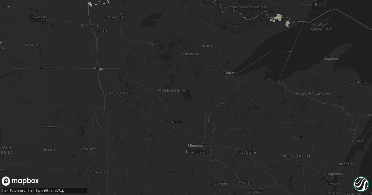
Hail Map in Minnesota on July 20, 2011
Get this storm
July 20 map
$229
one time, instant access
Download today. No call, no setup
Keep the $229
Bought the map and want the full workflow? Apply the entire $229 to a subscription within 7 days. None of it is wasted.
Every map, not just this one
This buys you this map. Subscription and you get every map we run, in the markets you choose from a few cities to whole states to nationwide. Plus real-time alerts the moment a storm fires.
Contact data
Name, contact info, occupancy, even credit band for addresses in the footprint. You go from where it hit to who to call.
Become the source they trust
Unlimited branding weather history reports on demand. You already have the documented answer ready for the property owner, and you are the one who showed up with it.
Property data and RoofTrace estimates
Pull up any address you have got, its value and the exact code rules for that jurisdiction, straight from One Click Code. Then RoofTrace estimates the squares, pitch, and roof value, priced the way you price.
Storm reports in Minnesota
Minnesota
| Date | Description |
|---|---|
| 07/20/201110:00 AM CDT | 2.5 to 3 foot diameter trees down in badger. Time approximated using radar imagery. |
| 07/20/20118:45 AM CDT | Dime size hail accompanied wind |
| 07/20/20118:40 AM CDT | Large trees...greater than a foot in diameter...blown down. |
| 07/20/20118:34 AM CDT | 4 to 6 inch diameter tree limbs broken off during storm. |
| 07/20/20118:25 AM CDT | 6 to 8 inch diameter trees down in town. Estimated wind gusts of 60 to 65 mph. |
| 07/20/20118:19 AM CDT | 4 inch diameter trees down |
| 07/20/20118:15 AM CDT | Numerous trees of 4 inch diameter down in town. |
| 07/20/20118:10 AM CDT | A local report indicates 70 MPH wind near 2 S ROSEAU |
| 07/20/20118:10 AM CDT | 2.5 to 3 foot diameter trees down in badger. Time approximated using radar imagery. |
| 07/20/20118:07 AM CDT | Extensive tree and house damage in greenbush. Time approximate. |
| 07/20/20118:00 AM CDT | Extensive tree and house damage in greenbush. Time approximate. |
| 07/20/20117:58 AM CDT | Measured wind gust at greenbush ndawn. |
| 07/20/20117:48 AM CDT | 6 to 8 inch diameter trees felled |
| 07/20/20117:40 AM CDT | Large trees...greater than a foot in diameter...blown down. |
| 07/20/20117:40 AM CDT | 6 inch diameter tree sections broken off 3 to 4 feet up on trunks. |
| 07/20/20117:38 AM CDT | A local report indicates 60 MPH wind near KARLSTAD |
| 07/20/20117:30 AM CDT | Large tree down |
| 07/20/20117:30 AM CDT | Grain bin tipped over. |
| 07/20/20117:30 AM CDT | Nws survey team concludes straight line winds estimated at 85 to 95 mph hit the town of karlstad. The kittson county garage and shed was damaged along with many trees. |
| 07/20/20117:27 AM CDT | Measured wind gust at the stephen ndawn. |
| 07/20/20117:22 AM CDT | A local report indicates 60 MPH wind near STEPHEN |
| 07/20/20117:00 AM CDT | 60 ft. Pine tree uprooted. Shingle damage. 1 ft diameter oak tree snapped at trunk. |
All States Impacted by Hail Map on July 20, 2011
Cities Impacted by Hail Map on July 20, 2011
- Union City, OH
- Douglasville, GA
- Liberty, IN
- Lyerly, GA
- Gaylesville, AL
- Bancroft, NE
- Oakland, NE
- Lyons, NE
- West Point, NE
- Albion, NE
- Primrose, NE
- Williams, IN
- Bedford, IN
- Rome, GA
- Brookville, IN
- Bath, IN
- West College Corner, IN
- Oxford, OH
- Norman, IN
- Oolitic, IN
- Heltonville, IN
- New Castle, IN
- Knightstown, IN
- Spiceland, IN
- Prestonsburg, KY
- Strathcona, MN
- Greenbush, MN
- Wannaska, MN
- York, ND
- Elba, NE
- Shady Dale, GA
- Newborn, GA
- Peebles, OH
- Hillsboro, GA
- Monticello, GA
- Richmond, IN
- New Paris, OH
- Hollansburg, OH
- Fountain City, IN
- Lumberton, NC
- Willow City, ND
- Wolbach, NE
- Saint Paul, NE
- Pisgah, IA
- Moorhead, IA
- Gulliver, MI
- Manistique, MI
- Saint Edward, NE
- Genoa, NE
- Aulander, NC
- Windsor, NC
- Waynesboro, GA
- California, KY
- New Richmond, OH
- Alexandria, KY
- Melbourne, KY
- Louisville, KY
- Esmond, ND
- Salyersville, KY
- Brownsville, IN
- Centerville, IN
- Van Lear, KY
- Maddock, ND
- Churchs Ferry, ND
- Leeds, ND
- Minnewaukan, ND
- Karlstad, MN
- Halma, MN
- Dallas, GA
- Tomahawk, KY
- Debord, KY
- Creswell, NC
- Farwell, NE
- Battle Creek, NE
- Churdan, IA
- Lohrville, IA
- Stanton, NE
- Madison, NE
- Leigh, NE
- Lake Bronson, MN
- Tribune, KS
- Humphrey, NE
- West Liberty, KY
- Economy, IN
- Hagerstown, IN
- Nancy, KY
- Loup City, NE
- Minford, OH
- Portsmouth, OH
- Lucasville, OH
- Elizabeth City, NC
- South Mills, NC
- Clarkson, NE
- Eaton, OH
- Lynn, IN
- New Madison, OH
- Greenville, OH
- Union City, IN
- Greenfield, IN
- Fairdale, KY
- Chesapeake, VA
- Stephen, MN
- Beemer, NE
- Decatur, NE
- Kim, CO
- Roseau, MN
- Roosevelt, MN
- Straughn, IN
- Wisner, NE
- Pender, NE
- Charter Oak, IA
- Dow City, IA
- Dodge, NE
- Bradfordsville, KY
- Liberty, KY
- Garrett, KY
- Hueysville, KY
- Spalding, NE
- Warroad, MN
- Deerton, MI
- Grand Marais, MN
- Strandquist, MN
- Goodridge, MN
- Bowdon, GA
- Scribner, NE
- Morehead, KY
- Jasper, GA
- Talking Rock, GA
- Losantville, IN
- Mooreland, IN
- Scotia, NE
- Newman Grove, NE
- Lindsay, NE
- Creston, NE
- Palmer, NE
- Greeley, NE
- Monroe, NE
- Belgrade, NE
- Cedar Rapids, NE
- Fullerton, NE
- Moyock, NC
- Otway, OH
- East Point, KY
- Science Hill, KY
- Bethelridge, KY
- Acworth, GA
- Cartersville, GA
- Greenwood, IN
- Indianapolis, IN
- Taylorsville, GA
- Kingston, GA
- Gray, GA
- Aurora, NE
- Eaton, CO
- Galeton, CO
- Dawsonville, GA
- Onawa, IA
- Needham, IN
- Fairland, IN
- Dunlap, IA
- Carrollton, GA
- Canal Winchester, OH
- Lithopolis, OH
- Groveport, OH
- Boggstown, IN
- Villa Rica, GA
- Winston, GA
- New Weston, OH
- Rossburg, OH
- Colby, KS
- Howells, NE
- Rockville, NE
- Blue River, KY
- Argyle, MN
- Edmore, ND
- Wallace, KS
- Winona, KS
- Leoti, KS
- Ellijay, GA
- Kennedy, MN
- Hagerhill, KY
- Auxier, KY
- Denison, IA
- Vail, IA
- Deloit, IA
- Royalton, KY
- Gunlock, KY
- Mableton, GA
- Lithia Springs, GA
- Austell, GA
- Wolford, ND
- Badger, MN
- Wilkinson, IN
- Shirley, IN
- Charlottesville, IN
- Kennard, IN
- Tate, GA
- Mason, OH
- Sandy Hook, KY
- Mapleton, IA
- Elkfork, KY
- Ashton, NE
- Lewisville, IN
- Norfolk, NE
- Ranburne, AL
- Amelia, OH
- Cincinnati, OH
- Winchester, IN
- Salamonia, IN
- Portland, IN
- Fort Recovery, OH
- Versailles, OH
- Yorkshire, OH
- Osgood, OH
- Tubac, AZ
- Tumacacori, AZ
- Chinquapin, NC
- Haswell, CO
- Milton, IN
- McCormick, SC
- Pilger, NE
- Little Sioux, IA
- Soldier, IA
- Blencoe, IA
- Mondamin, IA
- Morristown, IN
- Ravenna, NE
- Cando, ND
- Canton, GA
- Auburn, IA
- Carroll, IA
- Waco, GA
- Amado, AZ
- Briggsdale, CO
- Litchfield, NE
- Saraland, AL
- Brewton, AL
- Bay Minette, AL
- Daphne, AL
- Pensacola, FL
- Millry, AL
- Chatom, AL
- Jay, FL
- Okeechobee, FL
- Panama City, FL
- Freeport, FL
- Kissimmee, FL
- Fellsmere, FL
- Palm Bay, FL
- Milton, FL
- Cantonment, FL
- Davenport, FL
- Haines City, FL


