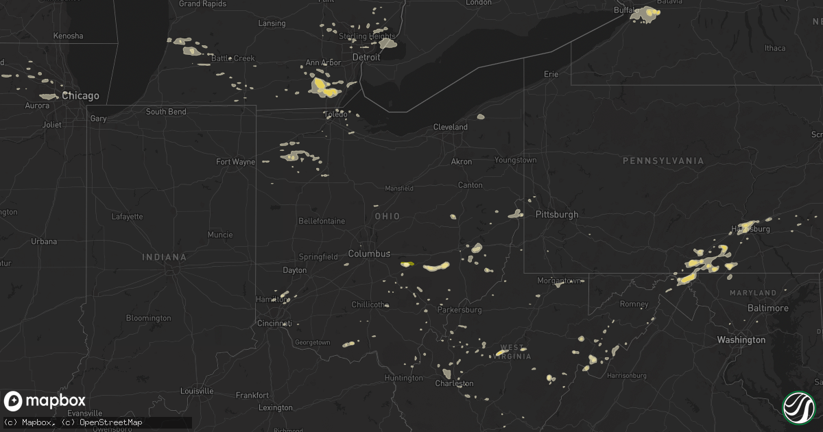
Hail Map in Ohio on July 19, 2013
Get this storm
July 19 map
$229
one time, instant access
Download today. No call, no setup
Keep the $229
Bought the map and want the full workflow? Apply the entire $229 to a subscription within 7 days. None of it is wasted.
Every map, not just this one
This buys you this map. Subscription and you get every map we run, in the markets you choose from a few cities to whole states to nationwide. Plus real-time alerts the moment a storm fires.
Contact data
Name, contact info, occupancy, even credit band for addresses in the footprint. You go from where it hit to who to call.
Become the source they trust
Unlimited branding weather history reports on demand. You already have the documented answer ready for the property owner, and you are the one who showed up with it.
Property data and RoofTrace estimates
Pull up any address you have got, its value and the exact code rules for that jurisdiction, straight from One Click Code. Then RoofTrace estimates the squares, pitch, and roof value, priced the way you price.
Storm reports in Ohio
Ohio
| Date | Description |
|---|---|
| 07/19/20135:33 PM CDT | A couple large branches down on sr348. |
| 07/19/20134:33 PM CDT | Trees down on us route 250 |
| 07/19/20134:30 PM CDT | Trees and power lines down in town |
| 07/19/20134:30 PM CDT | Trees down on chapel hill road |
| 07/19/20134:25 PM CDT | Trees down on chestnut level road |
| 07/19/20134:01 PM CDT | Numerous trees and power lines down for three miles down to the intersection of rt 164 and rt 524. Possible mile wide microburst. |
| 07/19/20133:50 PM CDT | Large branches down from strong thunderstorm wind |
| 07/19/20133:45 PM CDT | Trees down on cementary hill road |
| 07/19/20133:30 PM CDT | Multiple trees down in the town of somerset including one on rush creek road... East main street...and columbus street...time estimated from radar |
| 07/19/20133:05 PM CDT | Several trees blown down near the intersection of county route 32 and milner road...time estimated from radar |
| 07/19/20133:00 PM CDT | 3 to 4 large trees blown down on a property located on righteous run road...a door was also blown off of a barn...time estimated from radar |
| 07/19/20133:00 PM CDT | Several trees blown down in the area where route 339 intersects with county road 6...this is also in the same area of buchanan road and flint run road intersections...t |
| 07/19/20132:48 PM CDT | Torrential rain and hail |
| 07/19/20132:44 PM CDT | Numerous trees down across southeastern licking county...including the hanover area. |
| 07/19/20132:04 PM CDT | A couple 6 to 8 inch diameter branches down. |
| 07/19/20135:45 AM CDT | 15 trees of unknown size broke off in cemetary at intersection of road 10 and x |
| 07/19/20135:45 AM CDT | Portions of roofs blown off 5 turkey barns at 2500 road 10. One power pole broke in the area with a power line down along 9 pole spans. Time estimated from radar |
| 07/19/20133:30 AM CDT | A large tree down in fremont on state route 412. |
| 07/19/20132:35 AM CDT | Damage to gymnasium at ursuline college. Also had trees down. Time estimaed from radar. |
All States Impacted by Hail Map on July 19, 2013
Cities Impacted by Hail Map on July 19, 2013
- Moorcroft, WY
- Escanaba, MI
- Petersburg, MI
- Dundee, MI
- Ida, MI
- Medicine Bow, WY
- London, OH
- Mount Sterling, OH
- Surprise, AZ
- Belle Fourche, SD
- Findlay, OH
- McComb, OH
- Lebanon, OH
- Apple Grove, WV
- Gallipolis Ferry, WV
- Hill City, SD
- Zachary, LA
- Wray, CO
- Thomson, IL
- Morrison, IL
- Ozark, AR
- Bad Axe, MI
- Elkton, MI
- Filion, MI
- Britton, MI
- Milan, MI
- Tecumseh, MI
- Osakis, MN
- Las Vegas, NV
- North Las Vegas, NV
- Hugo, CO
- Chambersburg, PA
- Genoa, OH
- Pinon, AZ
- Hoffman Estates, IL
- Schaumburg, IL
- Elk Grove Village, IL
- Chana, IL
- Lombard, IL
- Warrenville, IL
- West Chicago, IL
- Glen Ellyn, IL
- Winfield, IL
- Villa Park, IL
- Oak Brook, IL
- Wheaton, IL
- Upton, WY
- Bowdon, ND
- Chaseley, ND
- Hurdsfield, ND
- Sundance, WY
- Middletown, OH
- Monroe, OH
- Tampico, IL
- Prophetstown, IL
- Maysville, WV
- Petersburg, WV
- Oregon, OH
- Walcott, IA
- South Haven, MI
- Fennville, MI
- Upper Tract, WV
- Leola, AR
- Hugo, OK
- Ellis, KS
- Elizabeth, WV
- Rockport, WV
- Pettigrew, AR
- Atalissa, IA
- West Liberty, IA
- Mena, AR
- Sedona, AZ
- Waverly, OH
- Deer, AR
- Karval, CO
- Van Wert, OH
- Nutrioso, AZ
- Eagar, AZ
- Bloomfield Hills, MI
- Randall, KS
- Greencastle, PA
- Saint Thomas, PA
- Mercersburg, PA
- Laurelville, OH
- Gobles, MI
- Allegan, MI
- Kalamazoo, MI
- Hartland, MI
- Danforth, ME
- Valliant, OK
- Wright City, OK
- Garvin, OK
- Rozet, WY
- Wading River, NY
- Morgantown, WV
- Lignite, ND
- Portal, ND
- Big Pool, MD
- Poca, WV
- Charleston, WV
- Ireland, WV
- Napier, WV
- Wardensville, WV
- Quincy, MI
- Jenera, OH
- Rawson, OH
- Oakdale, LA
- Mittie, LA
- Pitkin, LA
- Jewell, KS
- McDermott, OH
- Otway, OH
- Union Center, SD
- Rueter, MO
- Woodsfield, OH
- Lewisville, OH
- Summerfield, OH
- Quaker City, OH
- Longville, LA
- Dry Creek, LA
- Newell, SD
- Cambridge, NY
- Cossayuna, NY
- Saratoga Springs, NY
- Shushan, NY
- Salem, NY
- Argyle, NY
- Greenwich, NY
- Schuylerville, NY
- Arlington, VT
- Bonham, TX
- Berkeley Springs, WV
- Franklin Grove, IL
- Reeves, LA
- Glady, WV
- Ypsilanti, MI
- Wolfe City, TX
- West Branch, MI
- Mud Butte, SD
- Faith, SD
- East Aurora, NY
- Bruceton Mills, WV
- Ottawa, OH
- Leipsic, OH
- Bronson, MI
- Natoma, KS
- Glen Elder, KS
- Ladonia, TX
- Commerce, TX
- Hudson, ME
- Old Town, ME
- Hulett, WY
- Columbia City, IN
- Pierceton, IN
- Larwill, IN
- Macomb, MI
- Harrison Township, MI
- New Baltimore, MI
- Mount Clemens, MI
- Clinton Township, MI
- Warm Springs, VA
- McDowell, VA
- Monterey, VA
- Clay Center, KS
- Palmer, KS
- Continental, OH
- Whittemore, MI
- Prescott, MI
- Lupton, MI
- Iowa City, IA
- Creston, WV
- Wharton, TX
- Columbus, ND
- Rufe, OK
- Fort Towson, OK
- Ringold, OK
- Norway, KS
- Sauk Centre, MN
- Waddell, AZ
- Union City, MI
- Marilla, NY
- Alden, NY
- Darien Center, NY
- Cowlesville, NY
- Attica, NY
- Arnoldsburg, WV
- Milford, NJ
- Kintnersville, PA
- White Lake, MI
- Commerce Township, MI
- Scandia, KS
- Whitewood, SD
- Clear Spring, MD
- Hagerstown, MD
- Williamsport, MD
- Mechanicsburg, PA
- Lemoyne, PA
- Enola, PA
- Camp Hill, PA
- Summerdale, PA
- Marysville, PA
- Harrisburg, PA
- Slatyfork, WV
- Valley Head, WV
- Grottoes, VA
- Lancaster, OH
- Bremen, OH
- Grenora, ND
- Portage, MI
- Weirton, WV
- Le Roy, WV
- Debary, FL
- Athens, OH
- Rockville, MD
- Londonderry, OH
- Waldron, AR
- Boles, AR
- Salesville, OH
- Barnesville, OH
- Augusta, WV
- Holgate, OH
- Deshler, OH
- New Bavaria, OH
- Oakwood, OH
- Hamler, OH
- Gettysburg, PA
- Tipton, KS
- Robesonia, PA
- Bernville, PA
- Robinson, ND
- Harsens Island, MI
- Arriba, CO
- Genoa, CO
- Arthur City, TX
- Lore City, OH
- Niagara, ND
- Bosler, WY
- Rock River, WY
- Webster Springs, WV
- Milford, ME
- Greenbush, ME
- Henderson, NV
- Bay Port, MI
- Addison, MI
- Manitou Beach, MI
- Carlisle, PA
- Newville, PA
- Biglerville, PA
- Aspers, PA
- Gardners, PA
- Albia, IA
- Mount Gilead, OH
- Edison, OH
- Cardington, OH
- Weston, WY
- Fort Wayne, IN
- New Haven, IN
- Pryor, OK
- Blue Grass, VA
- Circleville, WV
- Franklin, WV
- Ilion, NY
- Falling Waters, WV
- Evart, MI
- Barryton, MI
- Farwell, MI
- Weidman, MI
- Fairfield, PA
- Waynesboro, PA
- Blue Ridge Summit, PA
- Amboy, IL
- Dixon, IL
- Woodville, MS
- Garrett, WY
- Blue Rock, OH
- Roseville, OH
- Crooksville, OH
- Mcconnelsville, OH
- Palmyra, MI
- Adrian, MI
- Blissfield, MI
- Monroe, MI
- Maybee, MI
- Saline, MI
- Deerfield, MI
- Clinton, MI
- Streamwood, IL
- Elgin, IL
- Red Cloud, NE
- Dillsburg, PA
- Lewisberry, PA
- West Liberty, KY
- Woodstock, IL
- Looneyville, WV
- Whitetail, MT
- Garden, MI
- Lakota, ND
- Souris, ND
- Bottineau, ND
- Paulding, OH
- Payne, OH
- Sterling, IL
- Needville, TX
- Boling, TX
- Somerset, OH
- Rushville, OH
- Thornville, OH
- Plainville, KS
- Johnson, KS
- Syracuse, KS
- Zahl, ND
- Sugar Grove, WV
- Brandywine, WV
- Whitmer, WV
- Wittmann, AZ
- Victor, WV
- Ansted, WV
- Maidsville, WV
- Coldwater, MI
- Wytheville, VA
- Fairfield, TX
- Mankato, KS
- Redford, MI
- Detroit, MI
- Southfield, MI
- Silver Spring, MD
- Spencerville, MD
- Green, KS
- Hersey, MI
- Dewey, AZ
- Ajo, AZ
- Sells, AZ
- Chase Mills, NY
- Norfolk, NY
- Richland, MI
- Hedgesville, WV
- Mason, OH
- Newcastle, WY
- Selden, KS
- Columbus Grove, OH
- Sugar Grove, OH
- New Cumberland, WV
- Toronto, OH
- Steubenville, OH
- Richmond, OH
- Spearfish, SD
- Port Byron, IL
- Cordova, IL
- Le Claire, IA
- Princeton, IA
- Flaxton, ND
- Roanoke, IN
- Cabins, WV
- Gassaway, WV
- Frametown, WV
- Erie, IL
- Hillsdale, IL
- Hindsville, AR
- Huntsville, AR
- Wesley, AR
- Prescott, AZ
- Mayer, AZ
- Rapids City, IL
- Winchester, VA
- Lucasville, OH
- Sumner, TX
- Morris, NY
- Laurens, NY
- Osage, WY
- Haigler, NE
- Winslow, AZ
- Rock Falls, IL
- Harmon, IL
- Waterville, NY
- Cassville, NY
- Sauquoit, NY
- Chloe, WV
- Orma, WV
- Oviedo, FL
- Winter Park, FL
- Littlestown, PA
- New Oxford, PA
- Fulton, IL
- Clinton, IA
- Eagle Bay, NY
- Monaca, PA
- Aliquippa, PA
- Happy Jack, AZ
- Arlington, OH
- Vanceboro, ME
- Lambert Lake, ME
- Brookton, ME
- Durbin, WV
- Monterey, IN
- Painesville, OH
- Chardon, OH
- Sturgis, SD
- Piedmont, SD
- Willow Wood, OH
- Scottown, OH
- Hancock, MD
- Chandlersville, OH
- Glencoe, KY
- Jonesville, KY
- Prestonsburg, KY
- Pleasant Hall, PA
- Bennington, KS
- Athens, MI
- Nelsonville, OH
- Logan, OH
- Shippensburg, PA
- Trenton, OH
- Sharon, ND
- Blue Creek, OH
- Frankfort, NY
- Goodrich, ND
- Sherwood, MI
- Parks, AR
- Paynesville, WV
- Hatton, ND
- Barrington, IL
- Carpentersville, IL
- Algonquin, IL
- Macungie, PA
- Alburtis, PA
- Hilliard, OH
- Columbus, OH
- Cincinnati, OH
- Otsego, MI
- Elkview, WV
- Bettendorf, IA
- Sandyville, WV
- Ravenswood, WV
- Stratton, NE
- Riverton, WV
- Ruth, MI
- Ubly, MI
- Quincy, PA
- Sears, MI
- Lake, MI
- Crawley, WV
- Williamsburg, WV
- Hampshire, IL
- Genoa, IL
- Eckley, CO
- Ann Arbor, MI
- Mize, KY
- Wayland, KY
- Bay City, MI
- Chippewa Lake, MI
- Pomeroy, OH
- South Wales, NY
- Depew, NY
- Elma, NY
- Lancaster, NY
- Buffalo, NY
- Strykersville, NY
- Orchard Park, NY
- Marion, PA
- Fayetteville, PA
- Maugansville, MD
- Mont Alto, PA
- Orrtanna, PA
- Rouzerville, PA
- Cambridge, OH
- Pittsford, MI
- Mount Solon, VA
- Johnstown, NY
- Fort Johnson, NY
- Greenleaf, KS
- Draper, SD
- Wood, SD
- Defiance, OH
- Exchange, WV
- Grantville, PA
- Annville, PA
- Palmyra, PA
- Memphis, MI
- Huntley, IL
- High View, WV
- Avilla, IN
- Corunna, IN
- Auburn, IN
- Acme, PA
- Mount Pleasant, PA
- Villard, MN
- Yuma, CO
- Toledo, OH
- Battle Creek, MI
- Caseville, MI
- Kinde, MI
- Clarksburg, WV
- Lumberport, WV
- Gilbertsville, PA
- Perkiomenville, PA
- Frederick, PA
- Barto, PA
- Kenna, WV
- Gallipolis, OH
- Crown City, OH
- Lesage, WV
- Vicksburg, MI
- Fulton, MI
- Hermosa, SD
- Rapid City, SD
- Del Rio, TN
- Laurel Springs, NC
- Clyde, NC
- Highland Park, MI
- Warren, MI
- Pullman, MI
- Kalona, IA
- Donahue, IA
- Eldridge, IA
- Long Grove, IA
- Pigeon, MI
- Cutler, OH
- Sugarcreek, OH
- Baltic, OH
- Stone Creek, OH
- Galax, VA
- Cando, ND
- Mount Jackson, VA
- Auburn Hills, MI
- Pontiac, MI
- Lindenwood, IL
- Rochester, MI
- Osborne, KS
- Alton, KS
- Carleton, MI
- Leo, IN
- Spencerville, IN
- Huntertown, IN
- Bowling Green, OH
- Cave Creek, AZ
- Davisburg, MI
- Pleasant City, OH
- White River, SD
- Sparta, NC
- Mount Zion, WV
- Bergton, VA
- Moorefield, WV
- Milam, WV
- Criders, VA
- West Union, OH
- Peebles, OH
- Sparta, KY
- Twining, MI
- Turner, MI
- Hamilton, OH
- Wytopitlock, ME
- Friendly, WV
- Middlebourne, WV
- Dublin, VA
- Croghan, NY
- Glouster, OH
- New Straitsville, OH
- Murray City, OH
- Hale, MI
- Tawas City, MI
- Au Gres, MI
- Seneca Rocks, WV
- Waynesburg, PA
- Marianna, PA
- Napoleon, OH
- Highland, MI
- Milford, MI
- Midland, MI
- Irons, MI
- Scottsdale, AZ
- Wellston, MI
- Washington, IA
- Keota, IA
- Abbeville, LA
- Wilton, IA
- Jewett, OH
- Cadiz, OH
- Snowflake, AZ
- Culver, IN
- Curtice, OH
- Maple Park, IL
- South Rockwood, MI
- Newport, MI
- Catharine, KS
- Victoria, KS
- Fenton, MI
- Sycamore, IL
- Buchanan, VA
- Little Falls, NY
- Mount Morris, IL
- Amanda, OH
- Grass Lake, MI
- Manchester, MI
- Richlandtown, PA
- Quakertown, PA
- Martin, OH
- Red House, WV
- Buffalo, WV
- Bloomingdale, MI
- Worthington, WV
- Enterprise, WV
- Fairmont, WV
- Bowden, WV
- Harman, WV
- Howe, IN
- Orland, IN
- Philo, OH
- Cumberland, OH
- Lincoln, ME
- Orient, ME
- Plainwell, MI
- Williamsville, VA
- Millboro, VA
- Stevens, PA
- Ephrata, PA
- Gillette, WY
- Bangor, ME
- Orono, ME
- Gaithersburg, MD
- Chicago, IL
- Oak Park, IL
- Grand Junction, MI
- Hansford, WV
- Gallagher, WV
- East Bank, WV
- Drybranch, WV
- Kirkland, IL
- Kingston, IL
- Weyers Cave, VA
- Mount Crawford, VA
- Cottageville, WV
- Millwood, WV
- Conesville, IA
- Pearl River, LA
- Washington, MI
- Utica, MI
- Sandy Hook, KY
- West Branch, IA
- Mount Airy, NC
- New Martinsville, WV
- Stanley, ND
- Davenport, IA
- Bel Air, MD
- Armada, MI
- Allenton, MI
- Latty, OH
- New Haven, MI
- Casco, MI
- Lamar, AR
- Fleetwood, PA
- Mousie, KY
- Garner, KY
- Amsterdam, OH
- Rosebush, MI
- Lake Helen, FL
- Deltona, FL
- Deland, FL
- Orange City, FL
- Waterford, OH
- New Marshfield, OH
- Ray, MI
- Marlinton, WV
- Maywood, IL
- Bellwood, IL
- Stone Park, IL
- Melrose Park, IL
- River Forest, IL
- Meadow Bridge, WV
- Green Sulphur Springs, WV
- Pataskala, OH
- Durant, IA
- Nellis Afb, NV
- Dixon, IA
- Saint James, NY
- East Setauket, NY
- Stony Brook, NY
- Devils Lake, ND
- Spencer, WV
- Reinholds, PA
- Reading, PA
- Wernersville, PA
- Beloit, KS
- Oregon, IL
- Levant, ME
- Corinth, ME
- Kissee Mills, MO
- Laurel, MD
- Annapolis Junction, MD
- Fort George G Meade, MD
- Gloversville, NY
- Kendall, KS
- Gibsonburg, OH
- Lindsey, OH
- Dunmore, WV
- Murdo, SD
- Lebanon, PA
- Franklin, MI
- Royal Oak, MI
- Birmingham, MI
- Senecaville, OH
- Luray, VA
- Camanche, IA
- Coram, NY
- Miller Place, NY
- Port Jefferson Station, NY
- Mount Sinai, NY
- Dallas, WV
- Smithers, WV
- East Greenville, PA
- Pennsburg, PA
- Brighton, MI
- Harbor Beach, MI
- Phoenix, AZ
- Roseville, MI
- Saint Clair Shores, MI
- Akron, CO
- Albion, MI
- Franklin, OH
- Crary, ND
- Ararat, VA
- Prattsville, AR
- Danese, WV
- Ripley, WV
- Concho, AZ
- Mathias, WV
- Taneytown, MD
- Keymar, MD
- Ozone, AR
- Gilberts, IL
- Hookstown, PA
- Otis, CO
- Gandeeville, WV
- Shipshewana, IN
- Clayton, MI
- Batavia, OH
- Paw Paw, MI
- Reed City, MI
- Paris, MI
- Big Rapids, MI
- Fraser, MI
- Middleport, OH
- Rutland, OH
- Advent, WV
- Carencro, LA
- Reedy, WV
- West Chester, OH
- Macy, IN
- Nisland, SD
- Auburn, MI
- Freeland, MI
- Pleasantville, OH
- Houlton, ME
- Albuquerque, NM
- Glenford, OH


