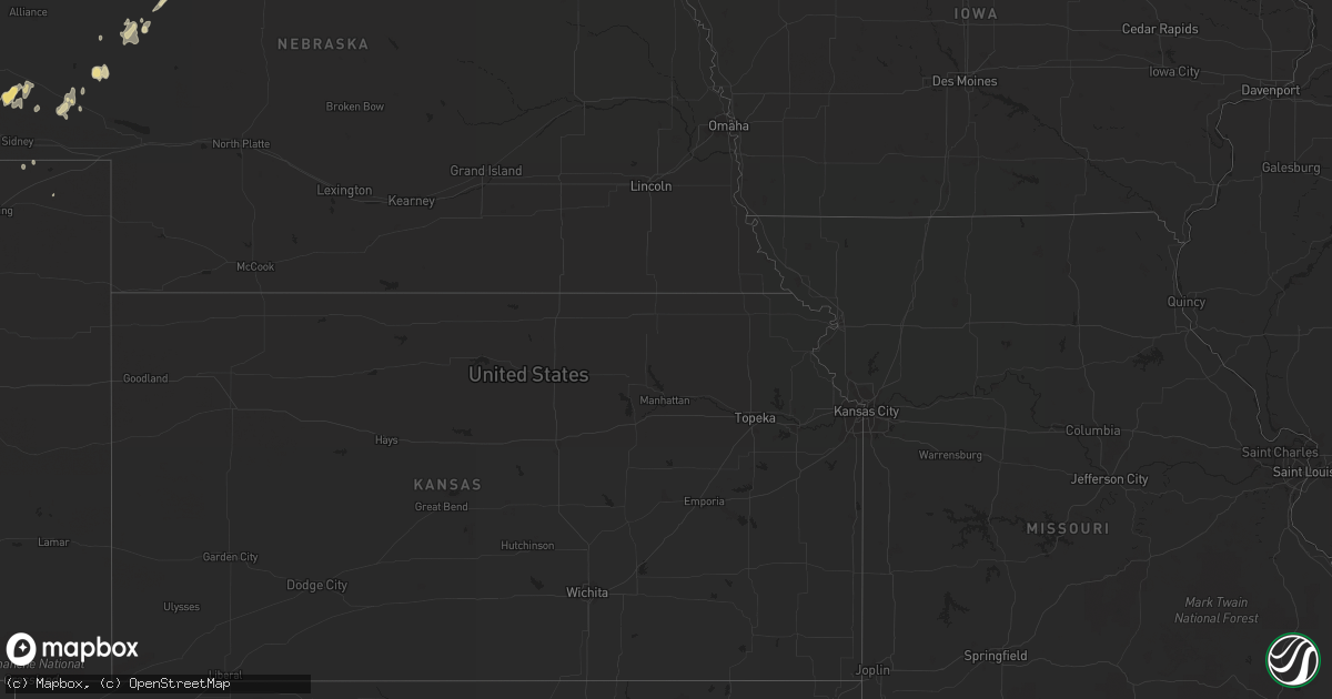
Hail Map in North Dakota on July 14, 2011
Get this storm
July 14 map
$229
one time, instant access
Download today. No call, no setup
Keep the $229
Bought the map and want the full workflow? Apply the entire $229 to a subscription within 7 days. None of it is wasted.
Every map, not just this one
This buys you this map. Subscription and you get every map we run, in the markets you choose from a few cities to whole states to nationwide. Plus real-time alerts the moment a storm fires.
Contact data
Name, contact info, occupancy, even credit band for addresses in the footprint. You go from where it hit to who to call.
Become the source they trust
Unlimited branding weather history reports on demand. You already have the documented answer ready for the property owner, and you are the one who showed up with it.
Property data and RoofTrace estimates
Pull up any address you have got, its value and the exact code rules for that jurisdiction, straight from One Click Code. Then RoofTrace estimates the squares, pitch, and roof value, priced the way you price.
Storm reports in North Dakota
North Dakota
| Date | Description |
|---|---|
| 07/14/20115:20 AM CDT | Numerous large tree branches and limbs were broken down by winds. Sporadic power outages were also observed. |
| 07/14/20115:00 AM CDT | Several 3 to 5 inch tree branches were broken down in a a shelter belt. |
| 07/14/20114:40 AM CDT | A local report indicates 1.25 inch wind near 5 WNW GALCHUTT |
| 07/14/20114:05 AM CDT | Nickel to quarter sized hail was reported by multiple sources and occurred mainly between 405 and 410 am cdt. |
| 07/14/20113:45 AM CDT | Numerous reports of tree branches and powerlines down around town. |
| 07/14/20113:15 AM CDT | Numerous tree branches 3 to 4 inches in diameter on ground around town. |
| 07/14/20111:45 AM CDT | Along highway 200. Zero visibility from heavy rain as well. |
| 07/14/20111:05 AM CDT | A local report indicates 60 MPH wind near 1 W CARRINGTON |
All States Impacted by Hail Map on July 14, 2011
Cities Impacted by Hail Map on July 14, 2011
- Alexandria, MN
- Diboll, TX
- Corrigan, TX
- Lufkin, TX
- Saratoga, TX
- Sour Lake, TX
- Hull, TX
- Kountze, TX
- Batson, TX
- Bowdon, ND
- Sulphur, LA
- Bighorn, MT
- Forsyth, MT
- Colstrip, MT
- Hardin, MT
- Crow Agency, MT
- Ludlow, SD
- Ralph, SD
- Roseglen, ND
- Parshall, ND
- Ryder, ND
- Savannah, GA
- Sanborn, ND
- Adrian, GA
- Franktown, CO
- Clanton, AL
- Hyannis, NE
- Joliet, MT
- Laurel, MT
- Akron, AL
- Maud, TX
- New Boston, TX
- Jasper, AL
- Brusett, MT
- Sand Springs, MT
- Osakis, MN
- Gering, NE
- Bayard, NE
- Harrisburg, NE
- Jordan, MT
- Cohagen, MT
- Montgomery, AL
- Walsenburg, CO
- Ashby, NE
- Campbell, MN
- Fort Davis, TX
- Omaha, GA
- Milnor, ND
- Lisbon, ND
- Frazer, MT
- Malta, MT
- Littleton, CO
- Burns, WY
- Cheyenne, WY
- Daufuskie Island, SC
- Bluffton, SC
- Buchanan, ND
- Wahpeton, ND
- Mooreton, ND
- Waynesville, GA
- Brunswick, GA
- Worden, MT
- Custer, MT
- Volborg, MT
- Perry, GA
- Spicer, MN
- Willmar, MN
- New London, MN
- Dupree, SD
- Meadow, SD
- Casselton, ND
- Sauk Centre, MN
- West Union, MN
- Beaufort, SC
- Byromville, GA
- Vienna, GA
- Oshkosh, NE
- Covington, TN
- Wyndmere, ND
- Barney, ND
- Milan, GA
- Lisco, NE
- Litchville, ND
- Albin, WY
- Pine Bluffs, WY
- Nahunta, GA
- Hortense, GA
- Hazlehurst, GA
- Crook, CO
- Buffalo, SD
- Fort Peck, MT
- Amenia, ND
- Mcleod, ND
- Denver, CO
- Jennings, FL
- Brandon, MN
- Elbow Lake, MN
- Evansville, MN
- Ashby, MN
- Rogers, ND
- Defuniak Springs, FL
- Bridger, MT
- Dazey, ND
- Wimbledon, ND
- Valley City, ND
- Oriska, ND
- Swainsboro, GA
- Garfield, MN
- Evergreen, CO
- Glenfield, ND
- Park City, MT
- Billings, MT
- Carpenter, WY
- Statesboro, GA
- Two Dot, MT
- Driscoll, ND
- Baxley, GA
- Prairie City, SD
- Dalton, NE
- Bridgeport, NE
- Broadwater, NE
- Americus, GA
- Andersonville, GA
- Ellaville, GA
- Mcgrew, NE
- Colfax, ND
- Kensington, MN
- Rainsville, AL
- Fort Payne, AL
- Fyffe, AL
- Charleston, SC
- Johns Island, SC
- Lafayette, AL
- Talladega, AL
- Ayr, ND
- Buffalo, ND
- Stanford, MT
- Hobson, MT
- Alpine, AL
- Lumpkin, GA
- Alexander, ND
- Watford City, ND
- Grassy Butte, ND
- Arnegard, ND
- Cartwright, ND
- Glendive, MT
- Huntley, MT
- Shepherd, MT
- Nashua, MN
- Fergus Falls, MN
- Isabel, SD
- Carrington, ND
- Fitzgerald, GA
- Brooten, MN
- Glenwood, MN
- Cleveland, TX
- Minter, AL
- Tyler, AL
- Conifer, CO
- Bison, SD
- Sterling, ND
- Owens Cross Roads, AL
- Hoffman, MN
- Herman, MN
- Ashburn, GA
- Rebecca, GA
- Blackshear, GA
- Patterson, GA
- Hoboken, GA
- Meridian, MS
- Ballantine, MT
- Pompeys Pillar, MT
- Musselshell, MT
- Ingomar, MT
- Nashua, MT
- Blakely, GA
- Saint Xavier, MT
- Colquitt, GA
- Donalsonville, GA
- Rockford, AL
- Kandiyohi, MN
- Beatrice, AL
- Raymond, MN
- Grady, AL
- Goshen, AL
- Cobb, GA
- De Soto, GA
- Cordele, GA
- Lewellen, NE
- Bivins, TX
- Liberty, TX
- Steele, ND
- Tuttle, ND
- Grace City, ND
- Wendell, MN
- Dalton, MN
- Jackson, MT
- Dillon, MT
- Wise River, MT
- Villard, MN
- Commerce City, CO
- Ray City, GA
- Nashville, GA
- Bushnell, NE
- Lavina, MT
- Ambrose, GA
- Douglas, GA
- Hardeeville, SC
- Rosebud, MT
- Jacksons Gap, AL
- Trinidad, CO
- Wheatland, ND
- Stockton, GA
- Lakeland, GA
- Wolf Point, MT
- Butte, MT
- Conroe, TX
- Timber Lake, SD
- Pollock, SD
- Herreid, SD
- Wakpala, SD
- Mound City, SD
- Sykeston, ND
- Alma, GA
- Nicholls, GA
- Sierra Blanca, TX
- Reva, SD
- Leslie, GA
- Norton, KS
- Hysham, MT
- Englewood, CO
- North Charleston, SC
- Edison, GA
- Bluffton, GA
- Dutton, AL
- Section, AL
- Wing, ND
- Robinson, ND
- Woodworth, ND
- Dadeville, AL
- Menoken, ND
- Hannaford, ND
- Cooperstown, ND
- Fairfield, ND
- Letohatchee, AL
- Du Pont, GA
- Valdosta, GA
- Naylor, GA
- Sterling, CO
- Mapleton, ND
- Breckenridge, MN
- Foxhome, MN
- Makoti, ND
- Simms, TX
- Molt, MT
- Port Royal, SC
- Clarksville, TX
- Hanceville, AL
- Saint Helena Island, SC
- Stockton, AL
- Killdeer, ND
- Redstone, MT
- Outlook, MT
- Absaraka, ND
- Twin City, GA
- Portal, GA
- Metter, GA
- Coleharbor, ND
- Garfield, GA
- Whitman, NE
- Troy, AL
- Cottondale, AL
- Lewistown, MT
- Baldwin, ND
- Bismarck, ND
- Glenham, SD
- Fort Valley, GA
- Fort Stewart, GA
- Live Oak, FL
- Pocahontas, TN
- Mcalester, OK
- Hartshorne, OK
- Keene, ND
- New Town, ND
- Mandaree, ND
- Farwell, MN
- Turtle Lake, ND
- Harlowton, MT
- Shawmut, MT
- Folkston, GA
- Lapine, AL
- Lodge Grass, MT
- Jakin, GA
- Gordon, AL
- Boulder, MT
- East Palatka, FL
- Pooler, GA
- Guyton, GA
- Bloomingdale, GA
- McLaughlin, SD
- Bullard, TX
- Sycamore, GA
- Arabi, GA
- Ocilla, GA
- Houston, AL
- Sutton, ND
- Pingree, ND
- Kensal, ND
- Courtenay, ND
- Jamestown, ND
- Orange, TX
- Center, TX
- Valentine, NE
- Hilton Head Island, SC
- Fargo, GA
- Warner Robins, GA
- Santee, SC
- Wrens, GA
- Louisville, GA
- Bonaire, GA
- Kathleen, GA
- Kent, MN
- Rothsay, MN
- Cuthbert, GA
- Ramer, AL
- Michigan City, MS
- Mosby, MT
- Fort Benning, GA
- Box Springs, GA
- Forest Grove, MT
- Whitetail, MT
- Dry Branch, GA
- Keysville, GA
- Matthews, GA
- Phenix City, AL
- Seabrook, SC
- Melrose, MN
- Riceboro, GA
- Allenhurst, GA
- Hinesville, GA
- Spiritwood, ND
- Clara City, MN
- Alford, FL
- Marianna, FL
- Buffalo Creek, CO
- Winifred, MT
- Melstone, MT
- Lidgerwood, ND
- Wilton, ND
- West Blocton, AL
- McCalla, AL
- Ryegate, MT
- Crane Hill, AL
- Bonifay, FL
- Graceville, FL
- Barrett, MN
- Tybee Island, GA
- Milledgeville, GA
- Sparta, GA
- Aurora, CO
- West Green, GA
- Tower City, ND
- Binford, ND
- Waverly, AL
- Winnett, MT
- Mount Pleasant, TX
- Pittsview, AL
- Reeder, ND
- Crary, ND
- Somerville, AL
- Lineville, AL
- Childersburg, AL
- Underwood, MN
- Battle Lake, MN
- Peetz, CO
- Larkspur, CO
- Pine, CO
- Daviston, AL
- Wadley, AL
- Wray, GA
- Penokee, KS
- Hill City, KS
- Dawson, ND
- Glennville, GA
- White Oak, GA
- East Dublin, GA
- Smithville, GA
- Clyo, GA
- Bennett, CO
- Midville, GA
- Midway, AL
- Huntsville, AL
- Fromberg, MT
- Ridgeland, SC
- New Hope, AL
- Walcott, ND
- Nelson, MN
- Carlos, MN
- Lowry, MN
- Moscow, TN
- Cusseta, GA
- Richland, GA
- Tallassee, AL
- Cullman, AL
- Aneta, ND
- Brookwood, AL
- Rochelle, GA
- Adel, GA
- Moundville, AL
- Rhine, GA
- Pike Road, AL
- Jemison, AL
- Summerville, GA
- La Fayette, GA
- Menlo, GA
- Lumber City, GA
- Bremen, AL
- Divide, MT
- Wetumpka, AL
- Ashland, MS
- Sawyerville, AL
- Underwood, ND
- Luverne, AL
- Pettibone, ND
- Lodgepole, SD
- Padroni, CO
- Kimball, NE
- Preston, GA
- Dix, NE
- Stapleton, GA
- Pineview, GA
- Hawkinsville, GA
- Bolivar, TN
- Page, ND
- Abbeville, GA
- Forkland, AL
- Duncanville, AL
- Minatare, NE
- Haxtun, CO
- Merriman, NE


