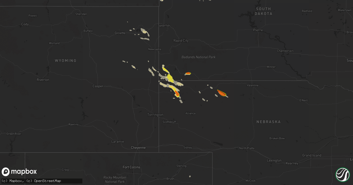
Hail Map on July 12, 2024
Get this storm
July 12 map
$229
one time, instant access
Download today. No call, no setup
Keep the $229
Bought the map and want the full workflow? Apply the entire $229 to a subscription within 7 days. None of it is wasted.
Every map, not just this one
This buys you this map. Subscription and you get every map we run, in the markets you choose from a few cities to whole states to nationwide. Plus real-time alerts the moment a storm fires.
Contact data
Name, contact info, occupancy, even credit band for addresses in the footprint. You go from where it hit to who to call.
Become the source they trust
Unlimited branding weather history reports on demand. You already have the documented answer ready for the property owner, and you are the one who showed up with it.
Property data and RoofTrace estimates
Pull up any address you have got, its value and the exact code rules for that jurisdiction, straight from One Click Code. Then RoofTrace estimates the squares, pitch, and roof value, priced the way you price.
States Impacted by Hail Map on July 12, 2024
Storm reports
Arizona
| Date | Description |
|---|---|
| 07/12/20243:30 PM CDT | Numerous social media posts of hail covering the ground in pea to nickel size hail. One public report of quarter size hail. |
| 07/12/20242:07 AM CDT | The winslow airport measured a peak wind gust of 73 mph at 1207 am as a result of convective activity in the area. Wind gusts were above 58 mph between 1130 pm to 1210 |
| 07/11/20247:14 PM CDT | A thunderstorm produced wind gust of at least 63 mph... Heavy rain |
| 07/11/20247:00 PM CDT | A local report indicates 68 MPH wind near 1 NW Meadview |
Wyoming
| Date | Description |
|---|---|
| 07/11/20247:36 PM CDT | A local report indicates 58 MPH wind near 10 ESE Pine Haven |
Nebraska
| Date | Description |
|---|---|
| 07/11/20247:12 PM CDT | A local report indicates 1.00 inch wind near 6 N Gordon |
New Hampshire
| Date | Description |
|---|---|
| 07/12/20241:00 AM CDT | Delayed report. Two trees and several branches down on breed rd near chesham pond. |
California
| Date | Description |
|---|---|
| 07/12/20245:15 PM CDT | Thunderstorm dry microburst. Sce pack trail reported gust 41 mph and 92f and 16 percent humidity at 310 pm and cwop hesperia reported gust 35 mph at 315 pm. Roof damage |
| 07/11/20247:45 PM CDT | Data courtesy of earth networks. |
Colorado
| Date | Description |
|---|---|
| 07/12/20245:09 PM CDT | Awos station kpub pueblo airport. Strong outflow winds from collapsing rain showers. |
| 07/12/20245:02 PM CDT | [landspout] lasted a few minutes. |
Illinois
| Date | Description |
|---|---|
| 07/12/20244:47 PM CDT | Metal roof removed and structural damage on lucretia street. |
| 07/12/20244:47 PM CDT | Tree and power line damage in sesser. |
Montana
| Date | Description |
|---|---|
| 07/11/202411:00 PM CDT | Public reported... Via facebook... A thunderstorm wind gust of 60 mph. |
| 07/11/202410:00 PM CDT | Public reported via facebook with photo... Hail up to the size of golf balls. |
| 07/11/20248:35 PM CDT | Relayed via fb concurrent with the report of a tornado. |
| 07/11/20248:30 PM CDT | Public reported via facebook a tornado touching down and remaining on the ground for ten minutes. A circular hay bale also caught fire from a lightning strike. |
| 07/11/20248:25 PM CDT | Concurrent with this hail report the person also reported viewing a funnel cloud to the nw of their location but no tornado. |
| 07/11/20248:25 PM CDT | Significant and widespread crop damage including thousands of acres of corn... Peas... Canola... Wheat... Barley and alfalfa. Photos submitted confirmed large hail most |
| 07/11/20248:20 PM CDT | Report via fb. Video and photos of a tornado with debris at the surface visible. Visual evidence of a nearby power pole snapped and strange damage to a wind break made |
| 07/11/20248:15 PM CDT | Randy edwards reported hail the size of ping pong balls... As well as some broken windows. |
| 07/11/20248:15 PM CDT | Damage to multiple farm buildings including a roof completely blown off a barn and some walls knocked down. Wood debris scattered in multiple directions. A circular hay |
| 07/11/20248:15 PM CDT | Corrects previous hail report from 5 ssw opheim. Spotter reported hail the size of ping pong balls... As well as some broken windows. |
| 07/11/20248:11 PM CDT | Report of hail made alongside reports of a visual of a funnel cloud. |
South Dakota
| Date | Description |
|---|---|
| 07/11/202410:55 PM CDT | Also received nickle size hail and 1 inch of rain |
| 07/11/202410:25 PM CDT | A local report indicates 65 MPH wind near 7 SSE Meadow |
| 07/11/202410:25 PM CDT | A local report indicates 1.00 inch wind near 1 N Edgemont |
| 07/11/202410:08 PM CDT | A local report indicates 1.00 inch wind near 7 SSE Bison |
| 07/11/202410:08 PM CDT | Estimated 60 to 70 mph. |
Missouri
| Date | Description |
|---|---|
| 07/12/20246:24 AM CDT | Measured 60 mph winds with small branches down. Time estimated from radar. |
Utah
| Date | Description |
|---|---|
| 07/12/20246:50 PM CDT | Mesonet station utcir i-15 at mp 169. |
| 07/11/20248:50 PM CDT | Mesonet station utnbc i-15 north brigham city. |
| 07/11/20248:35 PM CDT | Awos station kbmc brigham city rgnl airport. |
North Dakota
| Date | Description |
|---|---|
| 07/12/20246:20 PM CDT | Delayed report from friday july 12th on social media with video. Estimated 7 inch alive tree branches down. |
| 07/12/20246:09 PM CDT | A local report indicates 1.75 inch wind near 8 NW Plaza |
| 07/12/20245:55 PM CDT | A local report indicates 1.75 inch wind near 7 S Palermo |
| 07/12/20245:41 PM CDT | 40 mph winds with the hail. |
| 07/12/20245:37 PM CDT | A local report indicates 1.00 inch wind near 1 SSW Stanley |
| 07/12/20245:17 PM CDT | A local report indicates 1.50 inch wind near 2 SW Ross |
| 07/12/20245:15 PM CDT | A local report indicates 1.00 inch wind near 4 W Ross |
| 07/12/20245:00 PM CDT | A local report indicates 1.00 inch wind near White Earth |
| 07/12/20244:15 PM CDT | Hailed for about 10 minutes. 0.52 inch of rain. |
| 07/12/20243:10 PM CDT | Funnel touched the ground and kicked up dust. Multiple photos of the tornado were shared with the national weather service. |
| 07/12/20246:09 AM CDT | Rugby ndawn station. |
| 07/12/20242:23 AM CDT | A local report indicates 68 MPH wind near Minot Air Force Base |
| 07/12/202412:03 AM CDT | 10 meter gust recorded from ndawn station 9 miles south of noonan. Appeared to be associated with outflow. |
| 07/11/202411:13 PM CDT | A local report indicates 1.00 inch wind near 1 N Mandan |
| 07/11/20249:48 PM CDT | Report relayed via broadcast media with radar estimated time. |
| 07/11/20248:56 PM CDT | Report relayed via social media with radar estimated time. |
| 07/11/20248:51 PM CDT | Mostly nickel and dime size hail but a few q |
| 07/11/20248:51 PM CDT | Mostly nickel and dime size hail but a few quarters. |
| 07/11/20248:50 PM CDT | A local report indicates 1.00 inch wind near 5 N Mercer |
| 07/11/20247:41 PM CDT | Report relayed via broadcast media. Radar estimated time. |
| 07/11/20247:30 PM CDT | Report relayed via broadcast media with radar estimated time. |
| 07/11/20247:24 PM CDT | Report relayed via social media. Radar estimated time. |
| 07/11/20247:20 PM CDT | Hail ongoing at the time of the call. |
Idaho
| Date | Description |
|---|---|
| 07/12/20246:40 PM CDT | Mesonet station ham 1 wnw camas. |
Cities Impacted by Hail Map on July 12, 2024
- Bourbon, MO
- Leasburg, MO
- Greenfield, MO
- Everton, MO
- Dadeville, MO
- Walnut Grove, MO
- Aldrich, MO
- Williamsville, MO
- Morrisville, MO
- Glennie, MI
- Brighton, MO
- Willard, MO
- Mikado, MI
- Enfield, IL
- Houston, TX
- Broughton, IL
- Ozark, IL
- Stonefort, IL
- Norris City, IL
- Simpson, IL
- Naylor, MO
- Carmi, IL
- Green Forest, AR
- Alpena, AR
- Harviell, MO
- Poplar Bluff, MO
- Omaha, IL
- Success, AR
- Golconda, IL
- Grantsburg, IL
- Junction, IL
- Ridgway, IL
- Harrison, AR
- Shawneetown, IL
- Williams, AZ
- Goreville, IL
- Marion, IL
- Pocahontas, AR
- Creal Springs, IL
- Carsonville, MI
- Deckerville, MI
- Du Bois, IL
- Sharon, OK
- Ravenden Springs, AR
- Alamo, ND
- Gatewood, MO
- Scheller, IL
- Ray, ND
- Tamaroa, IL
- Wildrose, ND
- Sesser, IL
- Waltonville, IL
- Seligman, AZ
- Fargo, OK
- Arnett, OK
- Tioga, ND
- Otis, CO
- White Earth, ND
- Los Alamos, NM
- Stanley, ND
- Ross, ND
- Gage, OK
- Ponderosa, NM
- Edwardsville, IL
- Paulden, AZ
- Palermo, ND
- Plaza, ND
- Peach Springs, AZ
- Medora, ND
- Belfield, ND
- Makoti, ND
- Watford City, ND
- Edgewood, NM
- Payson, AZ
- Tijeras, NM
- Ryder, ND
- Killdeer, ND
- Kingman, AZ
- Minot, ND
- Glenburn, ND
- Douglas, ND
- Moorcroft, WY
- Surrey, ND
- Rozet, WY
- Deering, ND
- Norwich, ND
- Upton, WY
- Velva, ND
- Granville, ND
- Bantry, ND
- Upham, ND
- Sundance, WY
- Gordon, NE
- Dunn Center, ND
- Merriman, NE
- Voltaire, ND
- Opheim, MT
- Hinsdale, MT
- Richland, MT
- Larslan, MT
- Belle Fourche, SD
- Glentana, MT
- Gillette, WY
- Turtle Lake, ND
- Osage, WY
- Ruso, ND
- Regent, ND
- Hazen, ND
- Mercer, ND
- Mott, ND
- Peerless, MT
- Coleharbor, ND
- Stanton, ND
- Mcclusky, ND
- Flaxville, MT
- Lance Creek, WY
- Rugby, ND
- Pine Ridge, SD
- Douglas, WY
- New Leipzig, ND
- Oelrichs, SD
- Wolf Point, MT
- Hettinger, ND
- Center, ND
- Bison, SD
- Edgemont, SD
- Meadow, SD
- Selfridge, ND
- Prescott Valley, AZ
- Dupree, SD
- Mandan, ND
- Parshall, ND
- Dagmar, MT
- Harrison, NE
- Lusk, WY
- Grenora, ND
- Fortuna, ND
- Zahl, ND
- Ambrose, ND
- Crosby, ND
- Whitney, NE
- Noonan, ND
- Mcgregor, ND
- Columbus, ND
- Powers Lake, ND
- Crawford, NE
- Chadron, NE
- McIntosh, SD
- Osborne, KS
- Alton, KS
- Carson, ND
- Fullerton, ND
- Marsland, NE
- Natoma, KS
- Waldo, KS
- Isabel, SD
- Timber Lake, SD
- Paradise, KS
- Hemingford, NE
- Hay Springs, NE
- Rushville, NE
- New Town, ND
- Halliday, ND
- Berthold, ND
- Strasburg, ND
- Hague, ND
- Burlington, ND
- Minot Afb, ND
- Maxbass, ND
- Newburg, ND
- Towner, ND
- Fergus Falls, MN
- Elbow Lake, MN
- Otterville, MO
- Bunceton, MO
- Syracuse, MO
- Florence, MO
- Norcross, MN
- Herman, MN
- Barrett, MN
- Carbondale, IL
- Pomona, IL
- Hancock, MN
- Evansville, MN
- Urich, MO
- Butler, MO
- Morris, MN
- Revillo, SD
- Danvers, MN
- Creighton, MO
- Clinton, MO
- Starbuck, MN
- Cyrus, MN
- Gary, SD
- Blairstown, MO
- Glenwood, MN
- Calhoun, MO
- Vergennes, IL
- Montrose, MO
- Welda, KS
- Alexandria, MN
- Fortuna, MO
- Chilhowee, MO
- Lowry City, MO
- Kincaid, KS
- Windsor, MO
- Lincoln, MO
- New Franklin, MO
- Leeton, MO
- Garnett, KS
- Osceola, MO
- Clarkfield, MN
- Boyd, MN
- Appleton City, MO
- Fayette, MO
- Rocheport, MO
- Elkville, IL
- Blue Mound, KS
- Centerville, KS
- Columbia, MO
- Harrisburg, MO
- Deepwater, MO
- El Dorado Springs, MO
- Eldon, MO
- Eugene, MO
- Green Ridge, MO
- Rockville, MO
- Tuscumbia, MO
- Schell City, MO
- Marshall, MO
- Houstonia, MO
- Hughesville, MO
- Iberia, MO
- Ulman, MO
- Blackwater, MO
- Nelson, MO
- Brumley, MO