Hail Map in Illinois on July 10, 2021
Get this storm
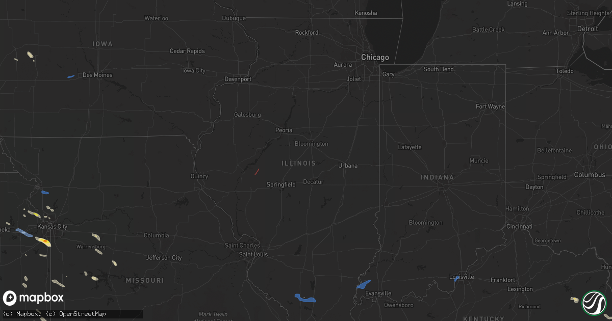
July 10 map
$229
one time, instant access
Download today. No call, no setup
Keep the $229
Bought the map and want the full workflow? Apply the entire $229 to a subscription within 7 days. None of it is wasted.
Every map, not just this one
This buys you this map. Subscription and you get every map we run, in the markets you choose from a few cities to whole states to nationwide. Plus real-time alerts the moment a storm fires.
Contact data
Name, contact info, occupancy, even credit band for addresses in the footprint. You go from where it hit to who to call.
Become the source they trust
Unlimited branding weather history reports on demand. You already have the documented answer ready for the property owner, and you are the one who showed up with it.
Property data and RoofTrace estimates
Pull up any address you have got, its value and the exact code rules for that jurisdiction, straight from One Click Code. Then RoofTrace estimates the squares, pitch, and roof value, priced the way you price.
Storm reports in Illinois
Illinois
| Date | Description |
|---|---|
| 07/10/20216:10 PM CDT | Telephone lines down. Weighted tables at a mexican restaurant blown over. Time estimated from radar. |
| 07/10/20216:05 PM CDT | One to two inch tree limbs down. Estimated winds at 50 mph. Spotter was still estimating winds at 30 to 40 mph winds at time of report. |
| 07/10/20215:42 PM CDT | Tree covering both lanes on highway 149 north of hurst in the community of bush. |
| 07/10/20215:06 PM CDT | Large partially rotter tree snapped at the base of the trunk. Image shared via social media. Time estimated from radar. |
| 07/10/20214:48 PM CDT | Multiple large trees down. Images shared via social media. Time based on radar. |
| 07/10/20214:40 PM CDT | A few trees and limbs down in coulterville. |
| 07/10/20213:33 PM CDT | Report from mping: 1-inch tree limbs broken. |
| 07/10/20213:16 PM CDT | Brief touchdown. |
| 07/10/20212:50 PM CDT | Delayed report. Tree blown down across road. |
| 07/10/20212:40 PM CDT | Brief touchdown. |
| 07/10/20212:31 PM CDT | Brief touchdown in open area. |
| 07/10/20212:10 PM CDT | Delayed report. Homeowner witnessed tornado which damaged a pole barn and carried debris into a tree line. Broken tree tops also reported. |
| 07/10/20212:00 PM CDT | Delayed report. Crops damaged... Power poles snapped... And tree limbs broken near intersection of arenzville rd. And church rd. Time estimated from radar. |
| 07/10/20211:22 AM CDT | At 621 PM CDT, a severe thunderstorm was located near Schnell, or 13 miles southwest of Olney, moving east at 30 mph. HAZARD...60 mph wind gusts. SOURCE...Radar indicated. IMPACT...Expect damage to roofs, siding, and trees. Locations impacted include... Parkersburg, Calhoun and Claremont. |
| 07/10/20211:00 AM CDT | At 559 PM CDT, severe thunderstorms were located along a line extending from near West Frankfort to near Marion, moving east at 40 mph. HAZARD...60 mph wind gusts and penny size hail. SOURCE...Trained weather spotters. Trees were reported down near Bush and Hurst in northwest Williamson County. IMPACT...Expect damage to roofs, siding, and trees. Severe thunderstorms will be near... Pittsburg around 605 PM CDT. Thompsonville around 610 PM CDT.Other locations in the path of these severe thunderstorms includeGalatia, Carrier Mills, Harrisburg and Eldorado. |
| 07/10/202112:09 AM CDT | At 509 PM CDT, a severe thunderstorm was located over Tamaroa, or 8 miles north of Du Quoin, moving east at 55 mph. HAZARD...60 mph wind gusts and nickel size hail. SOURCE...Radar indicated. IMPACT...Expect damage to roofs, siding, and trees. This severe thunderstorm will be near... Sesser around 515 PM CDT. Rend Lake Area around 520 PM CDT. |
| 07/09/202111:36 PM CDT | At 435 PM CDT, severe thunderstorms were located along a line extending from near Irvington to near Sparta, moving east at 20 mph. HAZARD...60 mph wind gusts and penny size hail. SOURCE...Radar indicated. IMPACT...Expect damage to roofs, siding, and trees. Locations impacted include... Woodlawn, Mount Vernon and Pinckneyville. |
| 07/09/202111:31 PM CDT | At 431 PM CDT, severe thunderstorms were located along a line extending from near Patoka to near Evansville, moving east at 25 mph. HAZARD...60 mph wind gusts and penny size hail. SOURCE...Radar indicated. IMPACT...Expect damage to roofs, siding, and trees. Severe thunderstorms will be near... Sandoval, Patoka and Fairman around 435 PM CDT. Odin around 445 PM CDT.Other locations in the path of these severe thunderstorms includeSalem, Steeleville, Percy, Kinmundy, Omega and Stephen ForbesStation.This includes the following highways... Interstate 57 in Illinois between exits 109 and 127. Interstate 64 in Illinois between exits 50 and 61. |
| 07/09/202110:57 PM CDT | At 356 PM CDT, a severe thunderstorm was located over New Harmony, or 11 miles north of Mount Vernon, moving northeast at 45 mph. HAZARD...60 mph wind gusts and penny size hail. SOURCE...Radar indicated. IMPACT...Expect damage to roofs, siding, and trees. Locations impacted include... Princeton, Fort Branch, Oakland City, Haubstadt, Owensville, Poseyville, New Harmony, Patoka. |
| 07/09/202110:05 PM CDT | At 305 PM CDT, a severe thunderstorm was located over St. Jacob, moving east at 30 mph. HAZARD...60 mph wind gusts. SOURCE...Radar indicated. IMPACT...Expect damage to roofs, siding, and trees. This severe thunderstorm will be near... Trenton around 315 PM CDT. Aviston around 325 PM CDT.Other locations in the path of this severe thunderstorm includeBreese, St. Rose, Jamestown, Beckemeyer, Carlyle and Beaver Creek. |
| 07/09/20218:50 PM CDT | At 150 AM CDT, severe thunderstorms were located along a line extending from near Red Bud to near Ste. Genevieve to near Farmington, moving southeast at 55 mph. HAZARD...60 mph wind gusts and quarter size hail. SOURCE...Radar indicated. IMPACT...Hail damage to vehicles is expected. Expect wind damage to roofs, siding, and trees. Severe thunderstorms will be near... Ste. Genevieve and Evansville around 155 AM CDT. Chester, Baldwin and St. Mary around 200 AM CDT. Fredericktown and Junction City around 205 AM CDT. Bremen and Womac around 210 AM CDT.Other locations in the path of these severe thunderstorms includeSteeleville and Percy.This includes Interstate 55 in Missouri between exits 141 and 154. This also includes St. Joe State Park, Hawn State Park, Fort DavidsonHistoric Site, Felix Valle House State Park, Elephant Rocks StatePark, and Missouri Mines Historic Site. |
| 07/09/20218:36 PM CDT | At 135 AM CDT, severe thunderstorms were located along a line extending from near Highland to near New Memphis to near Baldwin, moving east at 55 mph. HAZARD...70 mph wind gusts. SOURCE...Trained weather spotters. IMPACT...Expect considerable tree damage. Damage is likely to mobile homes, roofs, and outbuildings. Severe thunderstorms will be near... St. Rose, Albers and Jamestown around 140 AM CDT. Breese and Okawville around 145 AM CDT. Carlyle, Beckemeyer and Tilden around 150 AM CDT.Other locations in the path of these severe thunderstorms includeNashville, Boulder, Sandoval, Central City, Fairman, Shattuc,Centralia, Odin, Irvington, Ashley, Salem and Helm.This includes the following highways... Interstate 57 in Illinois between exits 109 and 116. Interstate 64 in Illinois between exits 34 and 61.This also includes Carlyle Lake Recreational Area. |
| 07/09/20218:08 PM CDT | At 108 AM CDT, severe thunderstorms were located along a line extending from near Cedar Hill Lakes to 7 miles west of De Soto to 6 miles southwest of Richwoods, moving east at 50 mph. HAZARD...60 mph wind gusts and half dollar size hail. SOURCE...Radar indicated. IMPACT...Hail damage to vehicles is expected. Expect wind damage to roofs, siding, and trees. Severe thunderstorms will be near... De Soto and Hillsboro around 115 AM CDT. Pevely, Olympian Village and Horine around 120 AM CDT. Festus, Crystal City, Herculaneum and Mineral Point around 125 AM CDT.Other locations in the path of these severe thunderstorms includeBonne Terre, Bloomsdale, Ste. Genevieve, Red Bud, Evansville, RockyRidge, Weingarten, Baldwin and St. Mary.This includes Interstate 55 in Missouri between exits 141 and 178. This also includes Washington State Park, St. Joe State Park, St.Francois State Park, Hawn State Park, Felix Valle House State Park,Sandy Creek Covered Bridge Historic Site, and Missouri Mines HistoricSite. |
All States Impacted by Hail Map on July 10, 2021
Cities Impacted by Hail Map on July 10, 2021
- Roff, OK
- Happy Jack, AZ
- Sedona, AZ
- Rio Rico, AZ
- Nogales, AZ
- Marlow, OK
- Foster, OK
- Duncan, OK
- Winslow, AZ
- Patagonia, AZ
- Benson, AZ
- Wellston, OK
- Prescott Valley, AZ
- Yale, OK
- Henryetta, OK
- Perryville, AR
- Ada, OK
- Stratford, OK
- Chandler, OK
- Stroud, OK
- Anadarko, OK
- Gracemont, OK
- Binger, OK
- Edmond, OK
- Girard, KS
- Pittsburg, KS
- Blanchard, OK
- Newcastle, OK
- Washington, OK
- Gotebo, OK
- Watonga, OK
- Geary, OK
- Woodson, TX
- Leavenworth, KS
- Dexter, KS
- Maple City, KS
- O'Brien, TX
- Knox City, TX
- Rochester, TX
- Seymour, TX
- Luther, OK
- Deepwater, MO
- Hydro, OK
- Fort Cobb, OK
- Carnegie, OK
- Cordell, OK
- Apache, OK
- Elgin, OK
- Fletcher, OK
- Cyril, OK
- Willcox, AZ
- Oronogo, MO
- Ganado, AZ
- Tubac, AZ
- Pine, AZ
- Piedmont, KS
- Leon, KS
- Latham, KS
- Gilbert, AZ
- Eureka, KS
- Young, AZ
- Globe, AZ
- Cleveland, OK
- Pawnee, OK
- Hominy, OK
- Socorro, NM
- Sabetha, KS
- Pawhuska, OK
- Bartlesville, OK
- Barnsdall, OK
- El Reno, OK
- Mustang, OK
- Tuttle, OK
- Union City, OK
- Meridian, OK
- Guthrie, OK
- Coyle, OK
- Frederick, OK
- Florence, AZ
- Gold Canyon, AZ
- San Tan Valley, AZ
- Crowell, TX
- Pocasset, OK
- Indiahoma, OK
- Chattanooga, OK
- Loveland, OK
- Lavaca, AR
- Punta Gorda, FL
- Mountain View, OK
- Hobart, OK
- Weir, KS
- Scammon, KS
- Columbus, KS
- Grandfield, OK
- Walters, OK
- Snyder, OK
- Faxon, OK
- Cache, OK
- Fairfax, OK
- Ralston, OK
- Overland Park, KS
- Olathe, KS
- Bucyrus, KS
- Stilwell, KS
- Henrietta, TX
- Bellevue, TX
- Unadilla, NE
- Burr, NE
- Tucson, AZ
- Wilber, NE
- Goree, TX
- Bristow, OK
- Cushing, OK
- Drumright, OK
- Ninnekah, OK
- Nowata, OK
- Fort Smith, AR
- Van Buren, AR
- Roland, OK
- Taos, NM
- Angel Fire, NM
- Defiance, IA
- Alvo, NE
- Elmwood, NE
- Franklin, KS
- Arma, KS
- Delaware, OK
- Comanche, OK
- Davidson, OK
- Wharncliffe, WV
- Gilbert, WV
- Jacksboro, TX
- Windthorst, TX
- Cashion, OK
- Yukon, OK
- Elkville, IL
- Royalton, IL
- Washington, KS
- Greenleaf, KS
- Barnes, KS
- Waterville, KS
- Hanover, KS
- Fort Huachuca, AZ
- Huachuca City, AZ
- Elgin, AZ
- San Ysidro, NM
- Parsons, KS
- Galesburg, KS
- Queen Creek, AZ
- Magdalena, NM
- Laguna, NM
- Jarales, NM
- Bosque, NM
- Johnson, NE
- Sierra Vista, AZ
- Winchester, KS
- McLouth, KS
- Butler, MO
- Cole Camp, MO
- Audubon, IA
- Bowie, TX
- Harrah, OK
- Depew, OK
- Maramec, OK
- Piedmont, OK
- Jones, OK
- Mulhall, OK
- Marshall, OK
- Agra, OK
- Glencoe, OK
- Tryon, OK
- Arcadia, OK
- Osage, OK
- Perkins, OK
- Stillwater, OK
- Perry, OK
- Oklahoma City, OK
- Carney, OK
- Morrison, OK
- Ripley, OK
- Fort Sumner, NM
- Gretna, NE
- Ashland, NE
- Elkhorn, NE
- Yutan, NE
- Waterloo, NE
- Glasgow, KY
- Austin, KY
- Lucas, KY
- Konawa, OK
- Albuquerque, NM
- Kingman, AZ
- Alex, OK
- Mora, MO
- Sumner, TX
- Oakland, KY
- Smiths Grove, KY
- Howard, KS
- Burnside, KY
- Dewey, OK
- Asher, OK
- Safford, AZ
- Vernon, TX
- Mora, NM
- Chacon, NM
- Hodgen, OK
- Muse, OK
- Manning, IA
- Blue Rapids, KS
- Peridot, AZ
- Grimesland, NC
- Colony, OK
- Wynnewood, OK
- Sulphur, OK
- Sonoita, AZ
- Hollister, OK
- Morris, OK
- Beggs, OK
- Okmulgee, OK
- Council Hill, OK
- Vail, AZ
- Easton, KS
- Atchison, KS
- Cherokee, KS
- Cedar Vale, KS
- Sedan, KS
- Syracuse, NE
- Hennepin, OK
- Barling, AR
- Alma, AR
- Kansas City, MO
- Minco, OK
- Hinton, OK
- Amber, OK
- Chickasha, OK
- Lookeba, OK
- Springer, NM
- Bonita Springs, FL
- Naples, FL
- Waurika, OK
- Meriden, KS
- Mesa, AZ
- Concordia, MO
- Hepler, KS
- Fort Scott, KS
- Knob Noster, MO
- Green Ridge, MO
- Windsor, MO
- Warrensburg, MO
- El Dorado, KS
- Green Valley, AZ
- Amado, AZ
- Paducah, TX
- Ona, FL
- West Liberty, KY
- Lindsay, OK
- Hawley, TX
- Higginsville, MO
- Jemez Springs, NM
- Lawton, OK
- Rule, TX
- Wellington, TX
- Saint David, AZ
- Pearce, AZ
- Purcell, OK
- Forest Lakes, AZ
- Rosiclare, IL
- Carson, NM
- Penasco, NM
- Mena, AR
- Coalgate, OK
- Show Low, AZ
- Raccoon, KY
- Scottsville, KY
- Abilene, TX
- Tye, TX
- Tecumseh, NE
- Cocoa, FL
- Farlington, KS
- Ava, MO
- Iowa Park, TX
- Rush Springs, OK
- Bradley, OK
- Pickrell, NE
- Belen, NM
- Mansfield, AR
- Muldrow, OK
- Charleston, AR
- Huntington, AR
- Greenwood, AR
- Miami, NM
- Tipton, OK
- Elk Creek, NE
- Payson, AZ
- Nehawka, NE
- Murray, NE
- Merkel, TX
- Anson, TX
- Tram, KY
- Pikeville, KY
- Betsy Layne, KY
- Stanville, KY
- Banner, KY
- Harold, KY
- Ivel, KY
- Stonewall, OK
- Willow Springs, MO
- Loco, OK
- Headrick, OK
- Elmer, OK
- Altus, OK
- Du Bois, NE
- Baisden, WV
- Omar, WV
- Delbarton, WV
- Clinton, MO
- Ryan, OK
- Floydada, TX
- Kincaid, KS
- Cimarron, NM
- Belton, MO
- Kellyville, OK
- Platte City, MO
- Lansing, KS
- Forgan, OK
- Lawrence, KS
- Cedarville, AR
- Black Canyon City, AZ
- Scottsdale, AZ
- Chillicothe, TX
- Hull, IA
- Shidler, OK
- Bern, KS
- Omaha, NE
- Dexter, MO
- Wynona, OK
- Ezel, KY
- Noble, OK
- Norman, OK
- Wanette, OK
- Macomb, OK
- Tecumseh, OK
- Adair, OK
- Tupelo, OK
- Centrahoma, OK
- Cochise, AZ
- Tombstone, AZ
- McCune, KS
- Roosevelt, OK
- Christmas, FL
- Geronimo, OK
- Nebraska City, NE
- Chelsea, OK
- Talala, OK
- Bloomfield, MO
- Dudley, MO
- Thomas, OK
- Weatherford, OK
- Cannel City, KY
- Mize, KY
- Hazel Green, KY
- Rich Hill, MO
- Throckmorton, TX
- Maysville, OK
- Cherryvale, KS
- Duke, OK
- Gould, OK
- Edgerton, MO
- Smithville, MO
- Chamisal, NM
- Rocky, OK
- Spring Hill, KS
- Orlando, OK
- Ottawa, KS
- Rantoul, KS
- Wellsville, KS
- Peru, KS
- Chautauqua, KS
- Fort Mcdowell, AZ
- Clarkson, NE
- Dodge, NE
- Howells, NE
- Paola, KS
- Louisburg, KS
- Dennis, KS
- Corn, OK
- Paulden, AZ
- Tussy, OK
- Elmore City, OK
- Arthur City, TX
- Honey Grove, TX
- Electra, TX
- Harrold, TX
- Tumacacori, AZ
- Weleetka, OK
- Garnett, KS
- Quanah, TX
- Childress, TX
- Louisville, NE
- Weeping Water, NE
- Seligman, AZ
- Springfield, NE
- Boynton, OK
- Foster, MO
- Turpin, OK
- Rio Verde, AZ
- Palmyra, NE
- Cook, NE
- Hollis, OK
- Beaver, OK
- Verner, WV
- Grundy, VA
- Oakwood, VA
- Vansant, VA
- Stanfield, AZ
- Chandler, AZ
- Maricopa, AZ
- Coolidge, AZ
- Bapchule, AZ
- Casa Grande, AZ
- Houston, MO
- Cabool, MO
- Mountain Grove, MO
- Seymour, MO
- Mansfield, MO
- Graff, MO
- Bucyrus, MO
- Norwood, MO
- Niangua, MO
- Huggins, MO
- Hartville, MO
- Marshfield, MO
- Solo, MO
- Agency, MO
- Gower, MO
- Saint Joseph, MO
- Essex, MO
- Wagon Mound, NM
- Maxwell, NM
- Chandlerville, IL
- Virginia, IL
- Poseyville, IN
- New Harmony, IN
- Carmi, IL
- Cynthiana, IN
- Wadesville, IN
- Herrin, IL
- Freeman Spur, IL
- De Soto, IL
- West Frankfort, IL
- Du Quoin, IL
- Johnston City, IL
- Hurst, IL
- Vergennes, IL
- Carterville, IL
- Louisville, KY
- Elizabeth, IN
- New Albany, IN
- Frankfort, KS
- De Soto, KS
- Linwood, KS
- Lecompton, KS
- Perry, KS
- Eudora, KS
- Beaumont, KS
- Logan, IA
- Neola, IA
- Missouri Valley, IA
- Grand Island, NE
- Saint Libory, NE
- Redfield, IA
- Earlham, IA
- Dexter, IA
- Adel, IA
- Inola, OK
- Ramona, OK
- Copan, OK
- Oologah, OK
- Pryor, OK
- Claremore, OK
- Wann, OK
- Big Cabin, OK
- Owasso, OK
- Collinsville, OK
- Ochelata, OK
- Vera, OK
- Skiatook, OK
- Fort Gibson, OK
- Gore, OK
- Braggs, OK
- Porter, OK
- Muskogee, OK
- Calumet, OK
- Byars, OK
- Fitzhugh, OK
- Atoka, OK
- Allen, OK
- Mountain Park, OK
- Saint Jo, TX
- Healdton, OK
- Wilson, OK
- Ringling, OK
- Leon, OK
- Burneyville, OK
- Muenster, TX
- Lebanon, OK
- Kingston, OK
- Madill, OK
- Whitesboro, TX
- Springer, OK
- Ardmore, OK
- Marietta, OK
- Olney, TX
- Archer City, TX
- Holliday, TX
- Wichita Falls, TX
- Weinert, TX
- Albany, TX
- Haskell, TX


