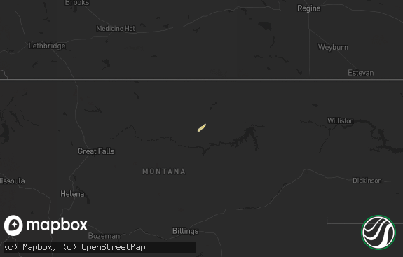
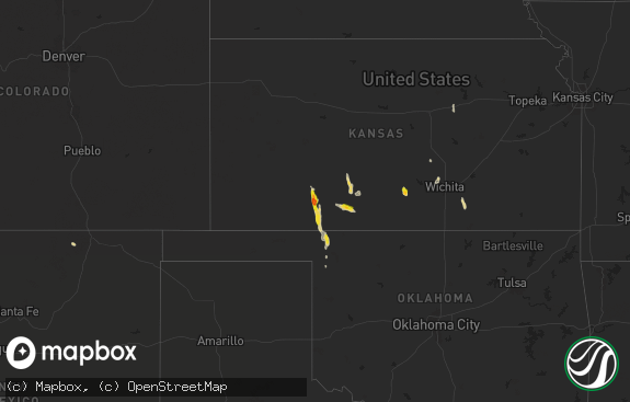
Hail Map in North Dakota on July 10, 2018
The weather event in North Dakota on July 10, 2018 includes Hail map. 20 states and 200 cities were impacted and suffered possible damage. The total estimated number of properties impacted is 0.

Hail
0
Estimated number of impacted properties by a 1.00" hail or larger0
Estimated number of impacted properties by a 1.75" hail or larger0
Estimated number of impacted properties by a 2.50" hail or largerStorm reports in North Dakota
North Dakota
| Date | Description |
|---|---|
| 07/10/20186:07 AM CDT | At 1106 PM CDT, severe thunderstorms were located along a line extending from 13 miles west of Sherwood to near Donnybrook, moving east at 55 mph. HAZARD...70 mph wind gusts. SOURCE...Trained weather spotters. IMPACT...Expect considerable tree damage. Damage is likely to mobile homes, roofs, and outbuildings. Severe thunderstorms will be near... Sherwood around 1120 PM CDT. Lansford around 1135 PM CDT. Glenburn and Antler around 1140 PM CDT. Westhope around 1150 PM CDT. Upham around 1200 AM CDT.Other locations impacted by these severe thunderstorms includeRussell, Coulee, Roth, Loraine, Landa, Tolley, Grano, Norma, Niobeand Eckman. |
| 07/09/201810:58 PM CDT | A local report indicates 70 MPH wind near 5 N LOSTWOOD |
| 07/09/20189:56 PM CDT | Mesonet station csbn8... 30 w crosby. |
| 07/09/20189:46 PM CDT | At 246 AM CDT, severe thunderstorms were located along a line extending from 6 miles northeast of Garrison to 6 miles northeast of Hazen, moving east at 50 mph. HAZARD...60 mph wind gusts and penny size hail. SOURCE...Radar indicated. IMPACT...Expect damage to roofs, siding, and trees. Severe thunderstorms will be near... Stanton around 255 AM CDT. Washburn, Turtle Lake and Cross Ranch State Park around 315 AM CDT. Mercer around 325 AM CDT. Wilton around 330 AM CDT.Other locations impacted by these severe thunderstorms includeHensler, Fort Clark, Strawberry Lake and Falkirk. |
| 07/09/20189:45 PM CDT | Fortuna grain elevator had its roof torn off. Also some of the tin structure is damaged. Time estimated from radar. Report relayed by emergency manager. |
| 07/09/20189:18 PM CDT | At 217 AM CDT/117 AM MDT/, a severe thunderstorm was located 6 miles south of Indian Hills Recreation Area, or 24 miles northwest of Beulah, moving east at 45 mph. HAZARD...60 mph wind gusts and penny size hail. SOURCE...Radar indicated. IMPACT...Expect damage to roofs, siding, and trees. This severe thunderstorm will be near... Beulah Bay Recreation Area around 240 AM CDT. Hazen Bay Recreation Area around 250 AM CDT. Hazen around 255 AM CDT.Other locations impacted by this severe thunderstorm include DakotaWaters Recreation Area, Emmet, White Shield and Twin Buttes. |
| 07/09/20188:37 PM CDT | At 137 AM CDT/1237 AM MDT/, severe thunderstorms were located along a line extending from 8 miles southwest of 4 Bears Lodge to 4 miles south of Little Missouri State Park to 8 miles southwest of Theodore Roosevelt National Park North Unit, moving southeast at 30 mph. HAZARD...Golf ball size hail and 70 mph wind gusts. SOURCE...Public. Extensive wind damage was reported in Watford City IMPACT...People and animals outdoors will be injured. Expect hail damage to roofs, siding, windows, and vehicles. Expect considerable tree damage. Wind damage is also likely to mobile homes, roofs, and outbuildings. Severe thunderstorms will be near... Little Missouri State Park around 1240 AM MDT. Killdeer around 1250 AM MDT. Dunn Center around 100 AM MDT. Halliday around 120 AM MDT.Other locations impacted by these severe thunderstorms include DeepWater Creek Recreation Area, Oakdale, Skunk Creek Bay RecreationArea, Twin Buttes and Pouch Point Recreation Area. |
All States Impacted by Hail Map on July 10, 2018
Cities Impacted by Hail Map on July 10, 2018
- Wilsall, MT
- Reed Point, MT
- Pomeroy, IA
- Palmer, IA
- Pocahontas, IA
- Livingston, MT
- Salisbury, NH
- Concord, NH
- Tilton, NH
- Canterbury, NH
- Franklin, NH
- Chichester, NH
- Pittsfield, NH
- Loudon, NH
- Epsom, NH
- Geyser, MT
- Molt, MT
- Big Timber, MT
- Terral, OK
- Ryan, OK
- Topsfield, ME
- Curlew, IA
- Ruthven, IA
- Webb, IA
- Spencer, IA
- Milford, IA
- Arnolds Park, IA
- Dickens, IA
- Laurens, IA
- Spirit Lake, IA
- Ayrshire, IA
- Okoboji, IA
- Cape Vincent, NY
- Meddybemps, ME
- Pembroke, ME
- Baileyville, ME
- Lancaster, MN
- Arlington, OH
- White Sulphur Springs, MT
- Ringling, MT
- Turner, MT
- Harlem, MT
- Hogeland, MT
- Monson, ME
- Sebec, ME
- Guilford, ME
- Abbot, ME
- Shirley Mills, ME
- Dover Foxcroft, ME
- Decatur, IN
- Greycliff, MT
- McLeod, MT
- Chinook, MT
- Bigfork, MN
- Effie, MN
- Jeffrey City, WY
- Equality, IL
- Delanson, NY
- Peerless, MT
- Dallas, TX
- Malta, MT
- Saco, MT
- Wolf Point, MT
- Balaton, MN
- Frazer, MT
- Broadview, MT
- Taunton, MN
- Wewahitchka, FL
- Madison, MN
- Panama City Beach, FL
- Panama City, FL
- Alamo, ND
- Melville, MT
- Zortman, MT
- Hays, MT
- Brockton, MT
- Two Dot, MT
- Pinedale, WY
- Poplar, MT
- Minneota, MN
- Dawson, MN
- Canby, MN
- Boyd, MN
- Havelock, IA
- Shawmut, MT
- Belt, MT
- Raynesford, MT
- Geraldine, MT
- Denton, MT
- Haworth, OK
- Culbertson, MT
- Froid, MT
- Ryegate, MT
- Porter, MN
- Strandburg, SD
- Labolt, SD
- Revillo, SD
- Milbank, SD
- Three Mile Bay, NY
- Ghent, MN
- Lynd, MN
- Marshall, MN
- Fort Kent, ME
- Scobey, MT
- Clearmont, WY
- Hammond, IL
- Garvin, MN
- Roy, MT
- Sloansville, NY
- Central Bridge, NY
- Esperance, NY
- Zurich, MT
- Larslan, MT
- Zahl, ND
- Greenbush, ME
- Lloyd, MT
- Bozeman, MT
- Winifred, MT
- Harlowton, MT
- Redstone, MT
- Whitehall, MT
- Robbinston, ME
- Kingman, AZ
- Salome, AZ
- Lewistown, MT
- Townsend, MT
- Richland, MT
- Marietta, MN
- Miami, FL
- Opa Locka, FL
- Corinna, ME
- Urbana, IL
- Tracy, MN
- Currie, MN
- Slayton, MN
- Loring, MT
- Norwood, CO
- Venedocia, OH
- Fort Myers, FL
- Estero, FL
- Bancroft, ID
- Lovington, IL
- Cerro Gordo, IL
- La Place, IL
- Springfield, MO
- Whitetail, MT
- Fort Peck, MT
- Stockholm, ME
- Hilger, MT
- Dewey, IL
- Rantoul, IL
- Immokalee, FL
- Havre, MT
- Lavina, MT
- Cape Coral, FL
- Old Town, ME
- Milmine, IL
- Ringgold, TX
- Nocona, TX
- Punta Gorda, FL
- Pembroke Pines, FL
- Hollywood, FL
- Fort Lauderdale, FL
- Roosevelt, MN
- Ely, NV
- Milford, ME
- Winston, MT
- Howland, ME
- Tucson, AZ
- Stanley, ND
- Powers Lake, ND
- White Earth, ND
- Andover, NH
- Gilford, NH
- Center Barnstead, NH
- Alton, NH
- Gilmanton Iron Works, NH
- Danbury, NH
- Contoocook, NH
- Bow, NH
- Strafford, NH
- Warner, NH
- Deerfield, NH
- Laconia, NH
- Suncook, NH
- Belmont, NH
- Bristol, NH
- Alton Bay, NH
- Northwood, NH
- Sanbornton, NH
- Barnstead, NH
- New Hampton, NH
- Hill, NH
- Gilmanton, NH
- Greenville Junction, ME
- Greenville, ME
- Brownville, ME
- Frenchville, ME
- Saint Agatha, ME
- Hinsdale, MT


