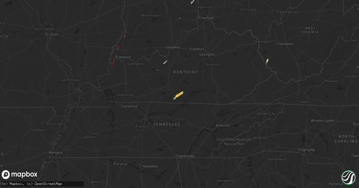
Hail Map on July 9, 2024
Get this storm
July 9 map
$229
one time, instant access
Download today. No call, no setup
Keep the $229
Bought the map and want the full workflow? Apply the entire $229 to a subscription within 7 days. None of it is wasted.
Every map, not just this one
This buys you this map. Subscription and you get every map we run, in the markets you choose from a few cities to whole states to nationwide. Plus real-time alerts the moment a storm fires.
Contact data
Name, contact info, occupancy, even credit band for addresses in the footprint. You go from where it hit to who to call.
Become the source they trust
Unlimited branding weather history reports on demand. You already have the documented answer ready for the property owner, and you are the one who showed up with it.
Property data and RoofTrace estimates
Pull up any address you have got, its value and the exact code rules for that jurisdiction, straight from One Click Code. Then RoofTrace estimates the squares, pitch, and roof value, priced the way you price.
States Impacted by Hail Map on July 9, 2024
Storm reports
New Jersey
| Date | Description |
|---|---|
| 07/09/20244:08 PM CDT | Pole and wires down. Time estimated from radar. |
| 07/09/20244:05 PM CDT | Trees down on us highway 22 in clinton township. Time and location approximated from radar. |
| 07/09/20243:59 PM CDT | Tree down at mile marker 36 on new jersey route 31 in lebanon township. Time estimated from radar. |
Nebraska
| Date | Description |
|---|---|
| 07/09/20246:24 PM CDT | A local report indicates 1.50 inch wind near 6 SSW Phillips |
Maine
| Date | Description |
|---|---|
| 07/09/20245:45 PM CDT | 5 inch diameter tree snapped at base. |
| 07/09/20245:45 PM CDT | 3 large healthy trees uprooted and blocking road. |
| 07/09/20245:45 PM CDT | 8 inch diameter tree down on power lines. |
| 07/09/20245:45 PM CDT | 3 large trees down on power lines; large tree down on road. |
| 07/09/20244:23 PM CDT | A local report indicates 1.00 inch wind near 3 ENE Lee |
| 07/09/20244:19 PM CDT | Delayed report. Numerous branches down. One power pole also snapped with another one broken due to trees coming down. Time estimated by radar. |
| 07/09/20244:18 PM CDT | Large branches with lines down. |
| 07/09/20244:15 PM CDT | A local report indicates 1.00 inch wind near Lee |
| 07/09/20244:15 PM CDT | Time estimated based on radar. |
| 07/09/20243:43 PM CDT | Tree down into the powerlines on forth street. |
| 07/09/20243:30 PM CDT | Tree down on kelley road on the glenburn/hermon town line. Time estimated based on radar. |
| 07/09/20243:30 PM CDT | Tree down into the wires on clark road in levant. |
| 07/09/20243:28 PM CDT | Photos received via nws chat. Large tree down on a pickup truck on the phillips road. Penobscot ema/glenburn fire reports multiple trees down in town. |
| 07/09/20243:28 PM CDT | Tree down into the powerlines on dunston drive. |
| 07/09/20243:20 PM CDT | Corrects previous tstm wnd dmg report from 4 ene hermon. 3 inch diameter tree down on union street in hermon taking up about one-third of the road. Time estimated based |
| 07/09/20243:20 PM CDT | 3 inch tree down on union street in hermon taking up about one-third of the road. Time estimated based on radar. |
| 07/09/20243:19 PM CDT | Multiple trees down in the area of union st and kelley road in levant on the hermon townline. Wires down with one of the trees. |
| 07/09/20243:18 PM CDT | Large tree down into the powerlines blocking overlock road. |
| 07/09/20243:11 PM CDT | Tree down into the powerlines on the five road in carmel. |
| 07/09/20243:11 PM CDT | Large tree down at a residence on us route 2. Via social media. |
| 07/09/20243:11 PM CDT | Tree down into the powerlines at the intersection of dover road and school road. |
| 07/09/20243:00 PM CDT | Tree down into the powerlines blocking martin stream road. |
| 07/09/20243:00 PM CDT | Tree down into the powerlines on golf course road. |
| 07/09/20242:58 PM CDT | Large tree limb into the powerlines on ridge road. Power is out. |
| 07/09/20242:50 PM CDT | Delayed report. Tree reported down on spring road. |
| 07/09/20242:10 PM CDT | Trees down along smithield rd. |
| 07/09/202412:50 PM CDT | Trees down blocking traffic. |
| 07/09/202412:48 PM CDT | Power lines down. |
| 07/09/202412:48 PM CDT | Tree on wires. |
Massachusetts
| Date | Description |
|---|---|
| 07/09/20245:47 PM CDT | A local report indicates 70 MPH wind near Orange AP |
North Dakota
| Date | Description |
|---|---|
| 07/09/20245:35 PM CDT | Report via social media with photos of thunderstorm wind damage including a flipped dumpster... Stripped awning off a motorhome... A metal shed displaced by at least 50 |
Kentucky
| Date | Description |
|---|---|
| 07/09/20246:00 PM CDT | An nws louisville damage survey determined that a brief ef-0 tornado touched down in northern cumberland county between ferris fork road and cedar ridge. The tornado re |
| 07/09/20243:40 PM CDT | An ef-1 tornado touched down 3.1 miles west of morganfield and lifted 0.5 miles west of uniontown. The estimated peak wind was 100 mph. The path length was 6.34 miles a |
| 07/09/20243:32 PM CDT | Warned tornado confirmed on the ground. |
| 07/09/20243:31 PM CDT | Corrects previous tornado report from 6 n sturgis. Warned tornado confirmed on the ground. |
| 07/09/20243:31 PM CDT | Tornado damage reported... Power lines down... Damage to house. |
| 07/09/20243:28 PM CDT | An ef-1 tornado touched down 2.5 miles south of grove center and lifted 1 mile northeast of grove center. The estimated peak wind was 105 mph. The path length was 3.22 |
| 07/09/20242:00 PM CDT | Corrects previous tornado report from 1 nne dubre. An nws louisville damage survey determined that a brief ef-0 tornado touched down in northern cumberland county betwe |
| 07/09/20242:00 PM CDT | Powerlines and trees down on fierce fork road. |
| 07/09/20241:55 PM CDT | Residents had pictures of quarter size hail that they showed the damage survey crew. |
| 07/09/202410:09 AM CDT | A few uprooted trees on club drive and street light down. |
Ohio
| Date | Description |
|---|---|
| 07/08/202411:57 PM CDT | Large tree limbs broken. |
| 07/08/20249:23 PM CDT | Large tree down... Along with smaller limbs/branches broken off. |
New Mexico
| Date | Description |
|---|---|
| 07/09/20244:45 PM CDT | Also saw a quarter inch of rain. |
| 07/09/20244:11 PM CDT | Hail completely covered the ground. |
| 07/09/20244:01 PM CDT | Report from mping: quarter |
| 07/09/20242:06 PM CDT | [landspout] the ruidoso emergency manager forwarded a video of a landspout in the upper canyon area. Tome estimated based on radar derived products. |
| 07/09/20242:06 PM CDT | [landspout] the ruidoso emergency manager forwarded a video of a landspout in the upper canyon area. Time of landspout estimated based on derived radar products. |
| 07/08/20248:02 PM CDT | Asos station kdmn deming asos. |
| 07/08/20247:15 PM CDT | Off-duty nws employee estimated 60-70 mph wind gusts along with dust storm. |
Illinois
| Date | Description |
|---|---|
| 07/09/20242:50 PM CDT | Mobile home slid off the foundation and had areas of roofing damage. Multiple tree limbs blown down. |
Florida
| Date | Description |
|---|---|
| 07/09/20242:15 PM CDT | Public reports a tree down near the intersection of hopkins ave and court st. |
| 07/09/20242:10 PM CDT | Public reports portions of vinyl fence damaged. |
| 07/09/20241:30 PM CDT | Broadcast media reported a tree down on florida avenue. Time estimated via radar. |
South Dakota
| Date | Description |
|---|---|
| 07/08/20248:10 PM CDT | Several 10-12 inch diameter tree branches down as well as several 3 to 4 inch branches. |
| 07/08/20248:10 PM CDT | A local report indicates 1.25 inch wind near 2 E Frederick |
Arizona
| Date | Description |
|---|---|
| 07/09/20246:03 PM CDT | Mesonet station qgta3 guthrie. |
| 07/09/20246:00 PM CDT | Asos station ksad safford regional airport. |
| 07/08/20247:25 PM CDT | Mesonet station srp44 1.7 w roosevelt |
New Hampshire
| Date | Description |
|---|---|
| 07/09/20244:15 PM CDT | Trees and wires down. Cross country road. |
| 07/09/20244:08 PM CDT | Three trees down... Estimated 6 inches in diameter. |
| 07/09/20243:56 PM CDT | Delayed report. 3 to 4 trees reported down on us 202 west of concord between hedgerose ln and shenadoah dr. Time estimated. |
| 07/09/20243:55 PM CDT | Delayed report. Photo of large tree down near whittier pond... Partially blocking us hwy 202. Time estimated by radar. |
| 07/09/20243:50 PM CDT | Delayed report. Reports of at least 6 trees down on poverty plains rd st in warner. Reported by amateur radio. Time estimated by radar. |
| 07/09/20243:50 PM CDT | Delayed report. Reported by amateur radio. Trees down on wires on briar hill rd. Time estimated by radar. |
| 07/09/20243:48 PM CDT | Trees and wires down. |
| 07/09/20243:48 PM CDT | Trees and w |
| 07/09/20243:40 PM CDT | Delayed report. Time estimated by radar. |
Indiana
| Date | Description |
|---|---|
| 07/09/20246:21 PM CDT | Brief... Weak ef-0 tornado. Small trees and larger tree limbs down were the only damage reported. |
| 07/09/20245:50 PM CDT | An ef-1 touched down 0.8 miles west southwest of patoka and lifted 1.1 miles northwest of patoka. The estimated peak wind was 100 mph. The path length was 1.06 miles an |
| 07/09/20245:15 PM CDT | Report from mping: trees uprooted or snapped; roof blown off. |
| 07/09/20244:51 PM CDT | An ef-2 tornado touched down 0.7 miles north of poseyville and lifted 1.3 miles north of johnson in gibson county. The estimated peak wind was 120 mph. The path length |
| 07/09/20244:40 PM CDT | Confirmed tornado on the ground. |
| 07/09/20244:32 PM CDT | An ef-1 tornado touched down 0.4 miles east of springfield and lifted 4.6 miles west southwest of wadesville in posey county. The estimated peak wind was 105 mph. The p |
| 07/09/20244:25 PM CDT | Pole barn knocked completely down. |
| 07/09/20244:21 PM CDT | Power outage reported. |
| 07/09/20244:18 PM CDT | An ef-3 tornado touched down 2 miles east of mt vernon and lifted 2.4 miles east southeast of solitude in posey county. The estimated peak wind was 140 mph. The path le |
| 07/09/20246:10 AM CDT | Time estimated via radar. Tree down at cr 450 e and cr 200 n. |
| 07/09/20245:54 AM CDT | Tree down on us 24. Time estimated via radar. |
| 07/09/20245:49 AM CDT | Report of a tree down at us 35 and cr 100 n. Time estimated via radar. |
| 07/08/20247:00 PM CDT | Trees reported down on townsend road. |
New York
| Date | Description |
|---|---|
| 07/09/20246:35 AM CDT | Trees down near carton and ridge roads. Time estimated from radar. |
| 07/09/20245:09 AM CDT | Trees down in the road off of bloomingdale road. |
| 07/09/202412:56 AM CDT | Social media picture of a large branch of a willow tree broken off of tree. Time estimated from radar. |
Texas
| Date | Description |
|---|---|
| 07/09/20242:45 PM CDT | Large uprooted tree due to outflow boundary from thunderstorm to the north. Tree landed on and damaged at least 3 vehicles at mission villas apartment complex. Time est |
| 07/09/20242:43 PM CDT | Downed tree on tarpon drive in fair oaks ranch. |
| 07/08/20249:13 PM CDT | A local report indicates 65 MPH wind near 11 SSW Romero |
Cities Impacted by Hail Map on July 9, 2024
- Barksdale, TX
- Rocksprings, TX
- Brackettville, TX
- Sonora, TX
- Sand Lake, NY
- Averill Park, NY
- Uvalde, TX
- Tompkinsville, KY
- Burkesville, KY
- Summer Shade, KY
- Edmonton, KY
- Breeding, KY
- Belgrade, ME
- Oakland, ME
- Cimarron, NM
- Morganfield, KY
- Sonoita, AZ
- Springer, NM
- Uniontown, KY
- Mount Vernon, IN
- Elgin, AZ
- Ute Park, NM
- Burlington, ME
- Glen Gardner, NJ
- Clinton, NJ
- Augusta, ME
- Manchester, ME
- Gardiner, ME
- Readfield, ME
- Winthrop, ME
- Hampton, NJ
- Hereford, AZ
- Patagonia, AZ
- Leitchfield, KY
- Lee, ME
- Dryden, TX
- Hallowell, ME
- Farmingdale, ME
- Monmouth, ME
- Randolph, ME
- New Braunfels, TX
- Seguin, TX
- New Harmony, IN
- Wadesville, IN
- Raton, NM
- Magdalena, NM
- Whitefield, ME
- Hudson, KY
- Springfield, ME
- San Acacia, NM
- Polvadera, NM
- Lemitar, NM
- Milaca, MN
- Poseyville, IN
- Owensville, IN
- Foreston, MN
- Wagon Mound, NM
- Socorro, NM
- Mimbres, NM
- Hanover, NM
- Colebrook, CT
- Vaughn, NM
- Barkhamsted, CT
- Riverton, CT
- Winsted, CT
- Truth Or Consequences, NM
- Erving, MA
- Orange, MA
- Wendell Depot, MA
- Wendell, MA
- Bisbee, AZ
- Millers Falls, MA
- Gill, MA
- Turners Falls, MA
- Northfield, MA
- Roy, NM
- New Salem, MA
- Montague, MA
- Warwick, MA
- Athol, MA
- Petersham, MA
- Templeton, MA
- Barre, MA
- Vine Grove, KY
- Rineyville, KY
- Orient, ME
- Ocate, NM
- Ellendale, ND
- Vincennes, IN
- Hubbardston, MA
- Saint Libory, NE
- Radcliff, KY
- Frederick, SD
- Williamsburg, NM
- Grand Island, NE
- Jud, ND
- Doniphan, NE
- Phillips, NE
- Trementina, NM
- Giltner, NE
- Gackle, ND
- Butlerville, IN
- Lenore, WV
- Williamson, WV
- Kermit, WV
- Lovely, KY
- Las Cruces, NM
- Conchas Dam, NM
- Breeden, WV
- Dingess, WV
- Connersville, IN
- Brookville, IN
- Columbia, SD
- Laurel, IN
- Liberty, IN
- West Hartland, CT
- Hecla, SD
- Eaton, OH
- San Ygnacio, TX
- Litchville, ND
- Marion, ND
- Kathryn, ND
- Fort Ransom, ND
- Houghton, SD
- Zapata, TX
- Warner, SD
- Mellette, SD
- Mansfield, SD
- Aberdeen, SD
- Claremont, SD
- Langford, SD
- Andover, SD
- Pierpont, SD
- Summit, SD
- Ortley, SD
- Hamlin, NY