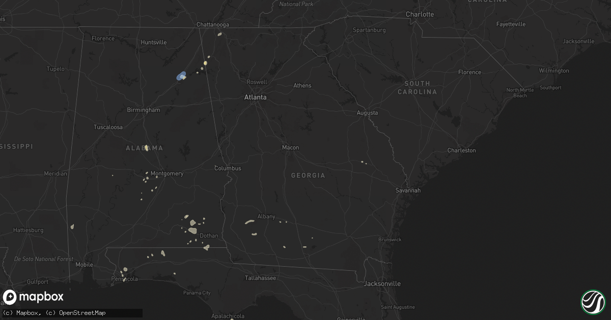
Hail Map in Georgia on July 9, 2019
Get this storm
July 9 map
$229
one time, instant access
Download today. No call, no setup
Keep the $229
Bought the map and want the full workflow? Apply the entire $229 to a subscription within 7 days. None of it is wasted.
Every map, not just this one
This buys you this map. Subscription and you get every map we run, in the markets you choose from a few cities to whole states to nationwide. Plus real-time alerts the moment a storm fires.
Contact data
Name, contact info, occupancy, even credit band for addresses in the footprint. You go from where it hit to who to call.
Become the source they trust
Unlimited branding weather history reports on demand. You already have the documented answer ready for the property owner, and you are the one who showed up with it.
Property data and RoofTrace estimates
Pull up any address you have got, its value and the exact code rules for that jurisdiction, straight from One Click Code. Then RoofTrace estimates the squares, pitch, and roof value, priced the way you price.
Storm reports in Georgia
Georgia
| Date | Description |
|---|---|
| 07/09/20195:34 AM CDT | At 1034 PM EDT, a severe thunderstorm was located over Chattoogaville, or 10 miles east of Little River Canyon National Preserve, and is nearly stationary. HAZARD...60 mph wind gusts. SOURCE...Radar indicated. IMPACT...Expect damage to roofs, siding, and trees. Locations impacted include... Lyerly, Menlo, Chattoogaville, Berryton and Holland. |
| 07/09/20194:01 AM CDT | At 901 PM EDT, severe thunderstorms were located along a line extending from near Linwood to near Ringgold, moving south at 10 mph. HAZARD...60 mph wind gusts. SOURCE...Radar indicated. IMPACT...Expect damage to roofs, siding, and trees. Locations impacted include... Lafayette, Ringgold, Tunnel Hill, Linwood, Beaumont, Noble, Wood Station, Blue Spring, Rock Spring and Center Post. |
| 07/09/20193:43 AM CDT | At 843 PM CDT, a severe thunderstorm was located over Centre, moving southwest at 10 mph. HAZARD...60 mph wind gusts. SOURCE...Radar indicated. IMPACT...Expect damage to roofs, siding, and trees. Locations impacted include... Hokes Bluff, Centre, Cedar Bluff, Centre Municipal Airport, Leesburg, Reece City, Sand Rock, Gaylesville, Tennala, Tabor Road, Cherokee Rock Village, Cornwall Furnace Park, Eastern Weiss Lake, Ballplay, Slackland, Western Weiss Lake, Moshat, Ball Flat, Coloma and Weiss Dam. |
| 07/08/20199:36 PM CDT | Tree down near the intersection of hwy 114 and ragland rd sw of the town of lyerly in chattooga county. |
All States Impacted by Hail Map on July 9, 2019
Cities Impacted by Hail Map on July 9, 2019
- Brule, NE
- Dryden, TX
- Comstock, TX
- Port Sulphur, LA
- Cambridge, NE
- Indianola, NE
- Pampa, TX
- Winner, SD
- Colome, SD
- Eldorado, TX
- Sonora, TX
- Gothenburg, NE
- Oconto, NE
- Callaway, NE
- Eddyville, NE
- Leary, GA
- Morgan, GA
- Albany, GA
- Rozet, WY
- Gillette, WY
- Cuba, KS
- Belleville, KS
- Munden, KS
- Chester, NE
- Republic, KS
- Byron, NE
- Lance Creek, WY
- Wanblee, SD
- Kyle, SD
- Mission, SD
- Dickens, NE
- Hartford, AL
- Mills, NE
- Bartley, NE
- Waterville, KS
- Blue Rapids, KS
- Ozona, TX
- Gaylesville, AL
- Lyerly, GA
- Valentine, NE
- Edison, NE
- Arapahoe, NE
- Alma, NE
- Moorefield, NE
- Orleans, NE
- Republican City, NE
- Eustis, NE
- Holbrook, NE
- Oxford, NE
- Riley, KS
- Cottonwood, AL
- Slocomb, AL
- Graceville, FL
- Campbellton, FL
- Lowndesboro, AL
- Morrowville, KS
- Fairbury, NE
- Hubbell, NE
- Hebron, NE
- Mahaska, KS
- Reynolds, NE
- Clanton, AL
- Thorsby, AL
- Hardy, NE
- Moorhead, MN
- Horace, ND
- Buras, LA
- Martin, SD
- McCook, NE
- Culbertson, NE
- Hershey, NE
- Hay Springs, NE
- Pensacola, FL
- Cantonment, FL
- Baker, FL
- Wellfleet, NE
- Axtell, NE
- Funk, NE
- Ringgold, GA
- Wallace, NE
- Kadoka, SD
- Belvidere, SD
- Frankfort, KS
- Stockville, NE
- Tuthill, SD
- Blue Hill, NE
- Guide Rock, NE
- Ruskin, NE
- Nelson, NE
- Midland City, AL
- Ozark, AL
- Twin City, GA
- Portal, GA
- Concordia, KS
- Crookston, NE
- Saint Francis, SD
- Whitney, NE
- Harrison, NE
- Gordon, NE
- Chadron, NE
- Edgemont, SD
- Rushville, NE
- Allen, SD
- Groom, TX
- Scandia, KS
- Kaycee, WY
- Kiln, MS
- Naponee, NE
- Salem, AL
- Elba, AL
- Red Cloud, NE
- Bladen, NE
- Superior, NE
- Wadena, MN
- Buffalo, WY
- Autaugaville, AL
- Laurel Hill, FL
- Clifton, KS
- Palmer, KS
- Agenda, KS
- Haddam, KS
- Linn, KS
- White River, SD
- Murdo, SD
- Beaver City, NE
- Hendley, NE
- Franklin, NE
- Elwood, NE
- Riverton, NE
- Wilcox, NE
- Hildreth, NE
- Curtis, NE
- Bloomington, NE
- Wilsonville, NE
- Powers Lake, ND
- Almena, KS
- Centre, AL
- Webber, KS
- Courtland, KS
- Chappell, NE
- Big Springs, NE
- Julesburg, CO
- Hahira, GA
- Wasta, SD
- Wood, SD
- Gregory, SD
- Dallas, SD
- Clay Center, KS
- Green, KS
- Elsie, NE
- Madrid, NE
- Clyde, KS
- Vermillion, KS
- Minter, AL
- Paxton, NE
- Palisade, NE
- Lexington, NE
- Grant, NE
- Mertzon, TX
- Stratton, NE
- Gadsden, AL
- Daleville, AL
- Ogallala, NE
- Roseland, NE
- New Underwood, SD
- Okaton, SD
- Eastpoint, FL
- Deshler, NE
- Hayes Center, NE
- Barnes, KS
- Norway, KS
- Hanover, KS
- Home, KS
- Onaga, KS
- Inavale, NE
- Greenleaf, KS
- Marysville, KS
- Narka, KS
- Washington, KS
- Lawrence, NE
- Mankato, KS
- Picayune, MS
- Bay Saint Louis, MS
- Brundidge, AL
- Jack, AL
- Campbell, NE
- Pavo, GA
- Holdrege, NE
- Maywood, NE
- Attalla, AL
- Hayneville, AL
- Fort Rucker, AL
- Letohatchee, AL
- Uniontown, AL
- Kindred, ND
- Sparks, NE
- Skipperville, AL
- Camilla, GA
- Newton, GA
- Westmoreland, KS
- Lovell, WY
- Farnam, NE
- Norton, KS
- Bertrand, NE
- Lebanon, NE
- Maxwell, NE
- Edgar, NE
- Oak, NE
- Holstein, NE
- New Brockton, AL
- Chisholm, MN
- Sumner, NE
- Cozad, NE
- Chatom, AL
- Deer Park, AL
- Fruitdale, AL
- Gibson, LA
- Beloit, KS
- Milton, FL
- Summerville, GA
- Tyler, AL
- Enterprise, AL
- Forest Home, AL
- North Platte, NE
- Wright, WY
- Newton, AL
- Sabin, MN
- Lebanon, KS
- Sylvester, GA
- Nashville, GA
- Freeport, FL
- Ty Ty, GA
- Collinsville, AL
- Upland, NE
- Morganville, KS
- Saint George, KS
- Jamestown, KS
- Leonardville, KS
- Wamego, KS
- Randolph, KS
- Manhattan, KS
- Olsburg, KS
- Aurora, KS
- Wall, SD
- Milesville, SD
- Philip, SD
- Owanka, SD
- Springview, NE


