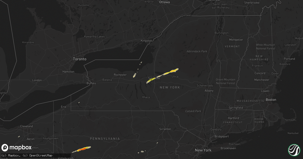
Hail Map on July 8, 2014
Get this storm
July 8 map
$229
one time, instant access
Download today. No call, no setup
Keep the $229
Bought the map and want the full workflow? Apply the entire $229 to a subscription within 7 days. None of it is wasted.
Every map, not just this one
This buys you this map. Subscription and you get every map we run, in the markets you choose from a few cities to whole states to nationwide. Plus real-time alerts the moment a storm fires.
Contact data
Name, contact info, occupancy, even credit band for addresses in the footprint. You go from where it hit to who to call.
Become the source they trust
Unlimited branding weather history reports on demand. You already have the documented answer ready for the property owner, and you are the one who showed up with it.
Property data and RoofTrace estimates
Pull up any address you have got, its value and the exact code rules for that jurisdiction, straight from One Click Code. Then RoofTrace estimates the squares, pitch, and roof value, priced the way you price.
States Impacted by Hail Map on July 8, 2014
Storm reports
Massachusetts
| Date | Description |
|---|---|
| 07/07/20149:50 PM CDT | Large tree fell on house on cole ave. |
Arkansas
| Date | Description |
|---|---|
| 07/08/20146:45 PM CDT | A local report indicates 1.00 inch wind near ATKINS |
| 07/08/20146:38 PM CDT | A local report indicates 1.00 inch wind near POTTSVILLE |
| 07/08/20145:25 PM CDT | A local report indicates 1.75 inch wind near 3 SW PARTHENON |
| 07/07/20148:45 PM CDT | A tree fell and was blocking highway 5. |
| 07/07/20148:35 PM CDT | Tree limb reported down. |
| 07/07/20147:30 PM CDT | Chicken house sustained roof damage in ola. |
| 07/07/20147:25 PM CDT | Large tree limbs reported down near lower ridge road. |
| 07/07/20147:05 PM CDT | Tree reported to be uprooted in dardanelle. |
| 07/07/20147:00 PM CDT | Numerous powerlines reported to be knocked down. |
North Carolina
| Date | Description |
|---|---|
| 07/08/20146:30 PM CDT | Public reports trees down near pilot mountain. Time is estimated by radar. |
| 07/08/20146:30 PM CDT | Trees down around the town. Time is estimated. |
| 07/08/20146:12 PM CDT | Tree down near the intersection of chandler dr and jenkinstown rd. |
| 07/08/20146:08 PM CDT | Tree down on cooper street |
| 07/08/20145:57 PM CDT | Tree down on mountain park road near us21 |
| 07/08/20145:49 PM CDT | Trees down near the city of hayesville... Nc. |
| 07/08/20145:37 PM CDT | Tree down on flint hill rd |
| 07/08/20145:30 PM CDT | Tree down on buckner branch rd |
| 07/08/20145:29 PM CDT | Tree down on west nc268 |
| 07/08/20145:29 PM CDT | Tree down on mountain meadow lane. |
| 07/08/20145:26 PM CDT | A few trees down across murphy... North carolina. |
| 07/08/20145:25 PM CDT | Tree down on n holiness church rd |
| 07/08/20145:14 PM CDT | Trees down across the northwest parts of cherokee county. |
| 07/08/20144:45 PM CDT | Tree down on king street in boone |
| 07/08/20144:45 PM CDT | Tree down on georges gap rd |
| 07/07/20147:13 PM CDT | At the base of becky mountain...trees and a few power lines down. |
Indiana
| Date | Description |
|---|---|
| 07/08/20148:28 AM CDT | Nws survey revealed trees down facing ese...a heavy trailer moved 5 feet se and flag poles facing ne. This suggests divergent flow pattern typical of a microburst with |
| 07/08/20148:20 AM CDT | Several trees down... Flag torn from pole... And a trailer was tossed around in wind near 96th and hazel dell. Possible tornado. |
Mississippi
| Date | Description |
|---|---|
| 07/08/20141:50 AM CDT | Several large trees down...powerlines down |
| 07/08/20141:05 AM CDT | Damage to outbuilding |
| 07/08/201412:30 AM CDT | Several large trees down |
| 07/08/201412:15 AM CDT | Roof damage to a house and to a metal storage building along sullivan road. Trees reported down near hartselle and springfield roads to the north of highway 6. Wind dam |
Nebraska
| Date | Description |
|---|---|
| 07/08/20146:50 AM CDT | Golf ball to tennis ball sized hail at the north platte experimental farm. |
Ohio
| Date | Description |
|---|---|
| 07/08/20141:24 PM CDT | Large branches down. Power out. |
| 07/08/20141:15 PM CDT | A tornado touched down near the society of st paul on w akron-canfield road and skipped east-northeast through canfield township and the city of canfield and finally li |
| 07/08/20141:13 PM CDT | Trees down along state route 7 . |
| 07/08/20141:10 PM CDT | A tree down along mitchell rd. Time estimated from radar. |
| 07/08/20141:05 PM CDT | Large branches down. |
| 07/08/20141:05 PM CDT | Several trees down along rock springs rd. Time estimated from radar. |
| 07/08/201412:49 PM CDT | Beginning of storm survey...ef1 tornado confirmed near valleaire golf course at ridge rd and boston rd. Estimated max winds 94 mph. Track length unknown attm. Survey co |
| 07/08/201412:47 PM CDT | Ef1 tornado confirmed. Tornado touched down just south of the intersection of ridge road and boston road in hinckley causing minor damage to a home. It then moved acros |
| 07/08/201412:47 PM CDT | Ef1 tornado confirmed. Tornado touched down just south of the intersection of ridge road and boston road in hinckley causing minor damage to a home. It then moved acros |
| 07/08/201412:47 PM CDT | Trees and lines down along grafton road. Roof damage. Possible tornado. |
| 07/08/201412:34 PM CDT | Trees down. Roof damage on erhart rd. Possible tornado. |
| 07/08/201412:33 PM CDT | The tornado started as an ef0 in extreme east central lorain county near the intersection of island road and route 303 and then quickly became an ef1 in medina county a |
| 07/08/201412:33 PM CDT | Several large limbs down. |
| 07/08/201412:20 PM CDT | One large tree downed on careys run pond creek road. |
| 07/08/20149:59 AM CDT | Several tree limbs downed near ohio route 362. |
Kentucky
| Date | Description |
|---|---|
| 07/08/20141:36 PM CDT | A tree reported down. |
| 07/08/20141:25 PM CDT | Tree down on shannondoah lane. Time estimated from radar. |
| 07/08/20141:23 PM CDT | Trees down along straight creek rd. Time estimated from radar. |
| 07/08/20141:22 PM CDT | Tree down along daniels fork rd. Time estimated from radar. |
| 07/08/20141:22 PM CDT | Tree down along straight creek rd. Time estimated from radar. |
| 07/08/20141:10 PM CDT | Several trees down along state route 2 toward load. Time estimated from radar. |
Delaware
| Date | Description |
|---|---|
| 07/07/20147:10 PM CDT | A few trees down along polly drummond hill rd. Time estimated from radar |
| 07/07/20147:06 PM CDT | Tree branches reported down with a tree down on route 7 in hockessin. |
| 07/07/20147:00 PM CDT | Trees down along red mill rd. Time estimated from radar |
New Mexico
| Date | Description |
|---|---|
| 07/08/20142:10 PM CDT | A local report indicates 1.00 inch wind near 2 SE AGUA FRIA |
Pennsylvania
| Date | Description |
|---|---|
| 07/08/20146:57 PM CDT | Trees and wires down |
| 07/08/20146:50 PM CDT | Several large tree limbs down. |
| 07/08/20146:42 PM CDT | Tree reported down in wernersville. |
| 07/08/20146:37 PM CDT | Tree on wires... Leaning on house. Other trees and wires down in area. |
| 07/08/20146:35 PM CDT | Peak gust from wnep-tv studio. Radar estimated time. |
| 07/08/20146:34 PM CDT | Estimated wind from dutch wonderland |
| 07/08/20146:30 PM CDT | Dozens of trees down in and near new milford. Crews working on clearing roads. |
| 07/08/20146:30 PM CDT | Downburst winds affected approximately a 2 mile long...and 1 mile wide path over portions of exeter and franklin townships. Scattered tree damage occurred at several re |
| 07/08/20146:29 PM CDT | A local report indicates 58 MPH wind near LANCASTER AIRPORT |
| 07/08/20146:23 PM CDT | Numerous reports of trees and wires down. |
| 07/08/20146:18 PM CDT | Many trees down... Some on houses and cars. Possible entrapments. Several roads blocked. Also in lehman township. |
| 07/08/20146:15 PM CDT | Many trees down blocking roads. |
| 07/08/20146:08 PM CDT | Trees and wires down. Tree on a house. |
| 07/08/20146:05 PM CDT | Trees down |
| 07/08/20146:05 PM CDT | Ef1 tornado with estimated maximum wind speeds of 90 mph...path width of 150 and path length of 1.4 miles touched down just south of the borough of kingsley. Numerous l |
| 07/08/20146:05 PM CDT | Many large branches down |
| 07/08/20146:05 PM CDT | Trees and wires down in londonderry twp. |
| 07/08/20146:00 PM CDT | An ef-0 tornado with maximum wind speeds of 70 mph was confirmed near this location. The tornado touched down in a rural area along state route 4041 in fairmount townsh |
| 07/08/20146:00 PM CDT | Many trees down... Power out. Radar estimated time. Via wnep-tv facebook. |
| 07/08/20145:57 PM CDT | Trees and large braches down. |
| 07/08/20145:57 PM CDT | Trees down on wires. |
| 07/08/20145:57 PM CDT | Numerous trees down and a shed destroyed. |
| 07/08/20145:56 PM CDT | Trees down across roads. |
| 07/08/20145:54 PM CDT | A local report indicates 60 MPH wind near SPRING GROVE |
| 07/08/20145:52 PM CDT | Trees and wires down and at least one home with structural damage. |
| 07/08/20145:50 PM CDT | Barn and garage destroyed... Many downed trees and power lines. Time estimated from radar. |
| 07/08/20145:50 PM CDT | Trees down in silver spring twp. |
| 07/08/20145:50 PM CDT | Trees and wires down |
| 07/08/20145:49 PM CDT | Hampden twp. |
| 07/08/20145:47 PM CDT | Trees and wires down. |
| 07/08/20145:47 PM CDT | A local report indicates 60 MPH wind near DILLSBURG |
| 07/08/20145:45 PM CDT | Many trees and wires down. Roads blocked. |
| 07/08/20145:40 PM CDT | Small airplane flipped over at carlisle airport |
| 07/08/20145:31 PM CDT | A local report indicates 70 MPH wind near GETTYSBURG |
| 07/08/20145:26 PM CDT | Trees down. |
| 07/08/20145:21 PM CDT | Trees and wires down. Route 16 closed at valley trail. |
| 07/08/20145:20 PM CDT | Ef1 tornado with maximum wind speeds of 100 mph...a path width of 500 yards and a path length of 4.5 miles. Numerous trees knocked down with a barn collapse and a trail |
| 07/08/20145:19 PM CDT | Silo blown down on a barn and a house. Trees and wires down. |
| 07/08/20145:19 PM CDT | Trees down and structures damaged. |
| 07/08/20145:15 PM CDT | Ef2 tornado with max winds 120 mph...path width 400 yds and path length of just over 2 miles before entering bradford county. Numerous trees knocked down with barn roof |
| 07/08/20145:15 PM CDT | Trees and wires down. |
| 07/08/20145:05 PM CDT | Trees down across roads. |
| 07/08/20145:04 PM CDT | Numerous trees reported down in and around williamsport. |
| 07/08/20145:02 PM CDT | Trees and wires down. A portion of route 87 is closed. |
| 07/08/20145:02 PM CDT | Numerous large limbs down. |
| 07/08/20145:00 PM CDT | Trees down and blocking roads in fox and elkland twps. |
| 07/08/20144:52 PM CDT | Trees down across route 75. |
| 07/08/20144:15 PM CDT | Trees and wires down countywide. Six mile run area especially hard hit. |
| 07/08/20143:49 PM CDT | Wires down. |
| 07/08/20143:41 PM CDT | Trees reported down near meyersdale. |
| 07/08/20143:28 PM CDT | A local report indicates 1.00 inch wind near 3 ENE ATWOOD |
| 07/08/20143:10 PM CDT | Trees and wires down on market street |
| 07/08/20143:08 PM CDT | Trees and wires down blocking jackson run road at creamary road |
| 07/08/20143:06 PM CDT | Trees down |
| 07/08/20143:05 PM CDT | A local report indicates 1.00 inch wind near 2 S PLUMVILLE |
| 07/08/20143:00 PM CDT | A local report indicates 1.00 inch wind near 3 NW MARION CENTER |
| 07/08/20143:00 PM CDT | A local report indicates 1.00 inch wind near 3 ESE PLUMVILLE |
| 07/08/20143:00 PM CDT | Trees and wires down at corey walmart |
| 07/08/20142:55 PM CDT | A local report indicates 1.00 inch wind near 4 WNW MARION CENTER |
| 07/08/20142:55 PM CDT | Trees down along route 286 |
| 07/08/20142:50 PM CDT | A local report indicates 1.50 inch wind near 4 WNW ELDERTON |
| 07/08/20142:50 PM CDT | Reports of trees down countywide. |
| 07/08/20142:50 PM CDT | A local report indicates 1.25 inch wind near 3 SE PLUMVILLE |
| 07/08/20142:45 PM CDT | A local report indicates 1.00 inch wind near 2 WNW MARION CENTER |
| 07/08/20142:45 PM CDT | A local report indicates 1.00 inch wind near 4 S PLUMVILLE |
| 07/08/20142:41 PM CDT | Relayed by nssl shave |
| 07/08/20142:41 PM CDT | Trees down along route 119 |
| 07/08/20142:40 PM CDT | A local report indicates 1.00 inch wind near 2 WNW MARION CENTER |
| 07/08/20142:40 PM CDT | A local report indicates 1.00 inch wind near 4 WNW MARION CENTER |
| 07/08/20142:40 PM CDT | A local report indicates 1.00 inch wind near 3 NW MARION CENTER |
| 07/08/20142:39 PM CDT | A local report indicates 1.25 inch wind near 3 W MARION CENTER |
| 07/08/20142:37 PM CDT | A local report indicates 1.00 inch wind near 3 ESE PLUMVILLE |
| 07/08/20142:37 PM CDT | Trees down along route 85 |
| 07/08/20142:36 PM CDT | A local report indicates 1.25 inch wind near 3 SE PLUMVILLE |
| 07/08/20142:36 PM CDT | Trees down |
| 07/08/20142:33 PM CDT | A local report indicates 1.00 inch wind near 2 S PLUMVILLE |
| 07/08/20142:33 PM CDT | A local report indicates 1.25 inch wind near 3 W MARION CENTER |
| 07/08/20142:33 PM CDT | A local report indicates 1.00 inch wind near 4 S PLUMVILLE |
| 07/08/20142:30 PM CDT | A few trees down. |
| 07/08/20142:30 PM CDT | Tree down on route 85 |
| 07/08/20142:30 PM CDT | A local report indicates 1.75 inch wind near SAGAMORE |
| 07/08/20142:28 PM CDT | A local report indicates 1.00 inch wind near 3 ENE ATWOOD |
| 07/08/20142:27 PM CDT | A local report indicates 1.00 inch wind near 4 WNW ELDERTON |
| 07/08/20142:21 PM CDT | A local report indicates 1.50 inch wind near 4 NNW ELDERTON |
| 07/08/20142:20 PM CDT | Tree down on rt 422 |
| 07/08/20142:19 PM CDT | Picture posted on social media |
| 07/08/20142:18 PM CDT | A local report indicates 1.00 inch wind near 4 WNW ELDERTON |
| 07/08/20142:10 PM CDT | Tree down on brick church road at gibson road |
| 07/08/20142:05 PM CDT | Trees down moraine state park |
| 07/08/20142:05 PM CDT | Roofs torn off houses |
| 07/08/20142:01 PM CDT | Tree down on house in millcreek township and tree down across wires in city of erie. |
| 07/08/20142:00 PM CDT | Tree down |
| 07/08/20141:59 PM CDT | Straight line wind damage was noted in and around the town of jackson center. Damage consisted of trees snapped and uprooted while minor roof damage was observed to sin |
| 07/08/20141:52 PM CDT | Trees down on house |
| 07/08/20141:50 PM CDT | Small tree down |
| 07/08/20141:49 PM CDT | Damage from a maximum ef-1 tornado with maximum winds of approximately 90 mph was noted extending down state route 318 from near orchard road to near stone base road. |
| 07/08/20141:48 PM CDT | Tree down on house |
| 07/08/20141:48 PM CDT | Damage from an ef-1 tornado with maximum winds of approximately 90mph was noted along the damage path. Numerous trees were snapped and uprooted. Roof damage to barns an |
| 07/08/20141:45 PM CDT | Trees and power lines down on millerstown road |
| 07/07/20148:20 PM CDT | Tree fell into house |
| 07/07/20148:20 PM CDT | Tree fell into house |
| 07/07/20148:20 PM CDT | Tree fell into house |
| 07/07/20148:20 PM CDT | Tree fell into house |
| 07/07/20148:15 PM CDT | Many trees down blocking roads. |
| 07/07/20147:54 PM CDT | Trees down and some transformers blowing. |
| 07/07/20147:45 PM CDT | Trees down across roadways. |
| 07/07/20147:45 PM CDT | Many trees and wires down. Roads blocked. |
| 07/07/20147:42 PM CDT | Large oak tree down in residents yard. |
| 07/07/20147:42 PM CDT | Trees and wires down on morvale road and delaware drive. |
| 07/07/20147:42 PM CDT | Multiple trees and wires down. |
| 07/07/20147:42 PM CDT | Large tree limbs down. |
| 07/07/20147:36 PM CDT | Trees reported down near danielsville. |
| 07/07/20147:36 PM CDT | A local report indicates 59 MPH wind near PHILADELPHIA INTL AIRPO |
| 07/07/20147:35 PM CDT | Large tree snapped and fell onto a car. |
| 07/07/20147:35 PM CDT | Numerous trees and wires down countywide. |
| 07/07/20147:30 PM CDT | Trees down in portions of the township. |
| 07/07/20147:30 PM CDT | A local report indicates 60 MPH wind near NORWOOD |
| 07/07/20147:20 PM CDT | Trees and wires down. |
| 07/07/20147:15 PM CDT | A couple trees down. Radar estimated time. |
| 07/07/20147:15 PM CDT | Couple trees down in palmyra township. |
| 07/07/20147:15 PM CDT | Couple trees down in greene township. |
| 07/07/20147:13 PM CDT | Large tree limbs reported down in exton |
| 07/07/20147:12 PM CDT | Numerous large tree limbs down. |
| 07/07/20147:05 PM CDT | Trees down. |
| 07/07/20147:05 PM CDT | Multiple trees and wires down throughout the county. Approximately 50000 customers without power. |
Maryland
| Date | Description |
|---|---|
| 07/08/20146:31 PM CDT | 6 inch branches snapped |
| 07/08/20146:30 PM CDT | A local report indicates 61 MPH wind near 1 N BALTIMORE MARTIN ST |
| 07/08/20146:21 PM CDT | Many large branches down. |
| 07/08/20146:15 PM CDT | Large tree limbs down |
| 07/08/20146:05 PM CDT | Five trees down... One large |
| 07/08/20146:00 PM CDT | Large tree down on house on lorain ave |
| 07/08/20145:58 PM CDT | A local report indicates 63 MPH wind near 4 NE MILLERS |
| 07/08/20145:55 PM CDT | *** 1 fatal... 8 inj *** branches from several trees knocked down |
| 07/08/20145:55 PM CDT | *** 1 fatal... 8 inj *** 1 fatality and 8 injuries from falling tree branches at youth campsite while trying to seek shelter. |
| 07/08/20145:39 PM CDT | 6 inch branches snapped. Intersection kings valley dr and kings valley rd. |
| 07/08/20145:35 PM CDT | Oakdale high school mesonet. |
| 07/08/20145:28 PM CDT | Multiple trees downed. Home siding damage along kelly road. |
| 07/08/20145:23 PM CDT | Several trees uprooted - up to two feet in diameter in size - on winston drive |
| 07/08/20145:03 PM CDT | Four trees down on interval road. |
| 07/08/20145:00 PM CDT | Multiple trees snapped and down on cars in the 700 and 800 blocks of interval rd |
| 07/08/20145:00 PM CDT | Roof of barn blown off. |
| 07/08/20144:47 PM CDT | Multiple trees down in clear spring. |
| 07/08/20144:29 PM CDT | Tree down at louisiana avenue in cumberland md. |
| 07/08/20143:54 PM CDT | Frostburg state university mesonet |
| 07/08/20143:41 PM CDT | Numerous trees and utility poles down... Power is out across the area. |
| 07/08/20143:23 PM CDT | Large trees and utility poles reported down... With power outages |
| 07/08/20143:13 PM CDT | Sang run road is closed due to a lager fallen tree. |
| 07/08/20143:11 PM CDT | Large trees reported down |
New York
| Date | Description |
|---|---|
| 07/08/20146:57 PM CDT | Large tree limbs down |
| 07/08/20146:55 PM CDT | Trees down |
| 07/08/20146:49 PM CDT | Trees and wires down |
| 07/08/20146:45 PM CDT | State rte 11... County rtes 58... 24 impassable due to downed trees wires potsdam vicinity. Time estimated. Relayed from county by state oem. |
| 07/08/20146:45 PM CDT | Tree down on a house. |
| 07/08/20146:45 PM CDT | Trees and wires down |
| 07/08/20146:40 PM CDT | Tree down on trailer. No injuries |
| 07/08/20146:40 PM CDT | Multiple trees down throughout town |
| 07/08/20146:36 PM CDT | Multiple trees and wires down countywide...tree and wires on house and wires on road in poland-norway |
| 07/08/20146:36 PM CDT | Tree down and on fire |
| 07/08/20146:32 PM CDT | Tree blocking road |
| 07/08/20146:30 PM CDT | Tree branches down... Power outages. |
| 07/08/20146:25 PM CDT | Trees down. From ny state oem. Time estimated from radar. |
| 07/08/20146:25 PM CDT | A small tornado tracked for approximately 1.3 miles through a residential area near utica ny. The tornado was rated as ef-1 with maximum estimated wind speeds of 90 mph |
| 07/08/20146:25 PM CDT | Trees also uprooted |
| 07/08/20146:20 PM CDT | Multiple trees down on county route 7. Pole with wires down on county route 10. |
| 07/08/20146:12 PM CDT | Tree on wire on fire in the vicinity of 400 wheelertown road |
| 07/08/20146:10 PM CDT | Downburst winds impacted a 10 mile long area... By about 1 mile wide. Most of the damage was sporadic until near route 365 and fairchild road. Just south of the stop an |
| 07/08/20146:08 PM CDT | Trees and powerlines down |
| 07/08/20146:02 PM CDT | *** 4 fatal *** tornado in smithfield northeast of peterboro. An ef2 tornado produced 4 fatalities in smithfield. Path width was 235 yards. Length was 2.5 miles. 3 home |
| 07/08/20146:00 PM CDT | *** 4 fatal *** possible tornado. 4 confirmed fatalities from 3 collapsed homes. 2 other destroyed homes as well. Nws survey to be conducted wed. |
| 07/08/20145:58 PM CDT | Trees and powerlines down |
| 07/08/20145:58 PM CDT | Trees and powerlines down |
| 07/08/20145:57 PM CDT | Barn blown apart...trees and powerlines down |
| 07/08/20145:57 PM CDT | Trees and powerlines down |
| 07/08/20145:55 PM CDT | Roof off residence on rt. 26 |
| 07/08/20145:55 PM CDT | A local report indicates 66 MPH wind near FORT DRUM |
| 07/08/20145:51 PM CDT | A local report indicates 1.25 inch wind near ROME |
| 07/08/20145:51 PM CDT | A local report indicates 58 MPH wind near ONEIDA CO REG ARPT |
| 07/08/20145:50 PM CDT | Confirmed 60-70 mph microburst through the city of rome. Some branches down and a few uprooted trees. |
| 07/08/20145:48 PM CDT | Ef1 tornado confirmed. The initial touchdown of the tornado was near the corner of gardner and eagle factory road near west lowville. Although the path length was 10 mi |
| 07/08/20145:48 PM CDT | Barn blown down and roof damage to homes. Possible tornado. |
| 07/08/20145:46 PM CDT | Trees and powerlines down |
| 07/08/20145:44 PM CDT | Damage to home. Possible tornado. |
| 07/08/20145:43 PM CDT | Trees and powerlines down |
| 07/08/20145:40 PM CDT | Many trees and powerlines down |
| 07/08/20145:39 PM CDT | Trees and wires on house. Possible structural collapse. |
| 07/08/20145:33 PM CDT | Ef1 tornado. 80-90 mph winds. Path length 1 mile. Max path width 600 yards. Numerous uprooted trees. Heavily damaged pavilion. Lightly damaged home. |
| 07/08/20145:31 PM CDT | Trees and powerlines down |
| 07/08/20145:27 PM CDT | Trees and wires down |
| 07/08/20145:25 PM CDT | Trees and powerlines down |
| 07/08/20145:25 PM CDT | Line of trees broken off 30 feet up from ground |
| 07/08/20145:23 PM CDT | Trees down on wires and houses |
| 07/08/20145:16 PM CDT | 11 inch and 30 inch diameter maple trees down. |
| 07/08/20145:07 PM CDT | Trees down |
| 07/08/20145:05 PM CDT | Trees and power lines down on fremont road and kirkville road |
| 07/08/20145:05 PM CDT | 5 trees down including one on a car |
| 07/08/20145:04 PM CDT | Confirmed 65-75 mph microburst in east syracuse. Widespread tree damage and a few snapped power poles. |
| 07/08/20145:00 PM CDT | Heavy damage to a national grid sub-station. Large swaths of trees down. |
| 07/08/20145:00 PM CDT | Few large trees knocked down |
| 07/08/20145:00 PM CDT | Trees down across town. |
| 07/08/20144:59 PM CDT | Trailer roof damage |
| 07/08/20144:58 PM CDT | Also 50-55 mph winds |
| 07/08/20144:50 PM CDT | Much of roof peeled off of west end bar and grille at nys fairgrounds. Radar estimated time. |
| 07/08/20144:49 PM CDT | Confirmed 65-75 mph microburst. Large downed branches. Some snapped evergreen trees and uprooted trees. |
| 07/08/20144:41 PM CDT | Trees and wires down |
| 07/08/20144:37 PM CDT | Trees and wires down |
| 07/08/20144:36 PM CDT | Trees down. |
| 07/08/20144:34 PM CDT | Trees down |
| 07/08/20144:30 PM CDT | Trees and wires down |
| 07/08/20144:30 PM CDT | Numerous uprooted trees |
| 07/08/20144:29 PM CDT | Trees down |
| 07/08/20144:26 PM CDT | Barn blown onto state route 88 |
| 07/08/20144:25 PM CDT | Trees and wires down |
| 07/08/20144:22 PM CDT | Tree on house on skinner road |
| 07/08/20144:22 PM CDT | Tree on a house |
| 07/08/20144:22 PM CDT | Trees down |
| 07/08/20144:21 PM CDT | Trees and wires down |
| 07/08/20144:20 PM CDT | Tree down on locust street |
| 07/08/20144:18 PM CDT | Trees and wires down |
| 07/08/20144:17 PM CDT | Series of power poles blown down. Photo submitted to buffalo facebook page |
| 07/08/20144:17 PM CDT | Trees and wires down |
| 07/08/20144:15 PM CDT | Trees and powerlines down |
| 07/08/20144:08 PM CDT | Trees and wires down across city. |
| 07/08/20144:06 PM CDT | Trees and wires down |
| 07/08/20144:05 PM CDT | Many trees down across town |
| 07/08/20144:05 PM CDT | Trees and wires down |
| 07/08/20144:01 PM CDT | Trees down in town |
| 07/08/20144:01 PM CDT | Trees and wires down |
| 07/08/20143:59 PM CDT | Tree on suv |
| 07/08/20143:58 PM CDT | Tree down on car |
| 07/08/20143:57 PM CDT | Trees and wires down |
| 07/08/20143:57 PM CDT | Trees and wires down across the city |
| 07/08/20143:50 PM CDT | Trees and wires down in town |
| 07/08/20143:50 PM CDT | Trees and wires down |
| 07/08/20143:47 PM CDT | A couple of trees down in town |
| 07/08/20143:47 PM CDT | One tree down... One leaning. Wires down. |
| 07/08/20143:45 PM CDT | Tree limbs down |
| 07/08/20143:42 PM CDT | Tree and wires down just off route 20. |
| 07/08/20143:22 PM CDT | Trees down |
| 07/08/20143:11 PM CDT | Trees and powerlines down |
| 07/08/20143:05 PM CDT | Large tree down on boston-colden road blocking most of the roadway |
| 07/08/20142:56 PM CDT | Tree down on rockspring road |
| 07/08/20142:50 PM CDT | Trees and wires down |
| 07/08/20142:49 PM CDT | Trees and wires down |
| 07/08/20142:48 PM CDT | Tree on house on allen street |
| 07/08/20142:48 PM CDT | Trees down |
| 07/08/20142:48 PM CDT | Trees down |
| 07/08/20142:45 PM CDT | Trees and powerlines down |
| 07/08/20142:42 PM CDT | Trees down on wires on old chatauqua road |
| 07/08/20142:38 PM CDT | Trees and powerlines down |
| 07/08/20142:36 PM CDT | Trees and powerlines down |
| 07/08/20142:30 PM CDT | Trees and powerlines down |
| 07/08/20142:25 PM CDT | Tree down |
| 07/08/201412:37 PM CDT | Tree down |
| 07/07/20149:45 PM CDT | Several large trees and wires down. |
| 07/07/20149:40 PM CDT | Multiple trees down with some minor damage reported by local police. |
| 07/07/20149:34 PM CDT | Tree down on crest road. |
| 07/07/20149:25 PM CDT | State rte 11... County rtes 58... 24 impassable due to downed trees wires potsdam vicinity. Time estimated. Relayed from county by state oem. |
| 07/07/20149:15 PM CDT | Trees down on hylan blvd from page avenue to midland avenue. |
| 07/07/20149:05 PM CDT | Tree down across twin bridges road |
| 07/07/20149:00 PM CDT | Wires down |
| 07/07/20149:00 PM CDT | Two trees down. Debris from construction site also fell at the same location. |
| 07/07/20148:58 PM CDT | Tree down on power lines on snydertown rd |
| 07/07/20148:47 PM CDT | Trees down |
| 07/07/20148:46 PM CDT | Trees down |
| 07/07/20148:40 PM CDT | Trees down |
| 07/07/20148:40 PM CDT | Several downed trees in tottenville. |
| 07/07/20148:30 PM CDT | Tree down on house and cars |
| 07/07/20148:30 PM CDT | Large maple tree down |
| 07/07/20148:30 PM CDT | Trees down and road closed...northwoods road off route 9n |
| 07/07/20148:30 PM CDT | Trees down. Time estimated by radar. |
| 07/07/20148:25 PM CDT | Tree down on route 74 |
| 07/07/20148:23 PM CDT | A local report indicates 68 MPH wind near WHITEHALL |
| 07/07/20148:16 PM CDT | Trees down |
| 07/07/20148:15 PM CDT | Part of tree down...12 inch diameter at harrison ave and crandall st |
| 07/07/20148:06 PM CDT | 2 trees down on spire falls road |
| 07/07/20148:06 PM CDT | Trees down |
| 07/07/20148:05 PM CDT | Route 52 closed in both directions with downed trees. |
| 07/07/20148:00 PM CDT | Trees down |
| 07/07/20148:00 PM CDT | Tree down on wires on jones road |
| 07/07/20147:57 PM CDT | Tree down partially on residence |
| 07/07/20147:48 PM CDT | Tree on wires at 20 east main street |
| 07/07/20147:45 PM CDT | Limbs down on wires just off mohawk road |
| 07/07/20147:45 PM CDT | Tree down on route 5s by argersinger road |
| 07/07/20147:42 PM CDT | Multiple trees down |
| 07/07/20147:40 PM CDT | A local report indicates a tornado near NORTH CREEK |
| 07/07/20147:36 PM CDT | Tree down and on fire |
| 07/07/20147:35 PM CDT | Several areas of trees and powerlines down. Also... Large tree down near exit 29 on interstate 87. |
| 07/07/20147:32 PM CDT | Tree blocking road |
| 07/07/20147:20 PM CDT | 3 trees down |
| 07/07/20147:20 PM CDT | Few trees down in town of delaware. |
| 07/07/20147:18 PM CDT | A local report indicates 60 MPH wind near SARANAC LAKE |
| 07/07/20147:18 PM CDT | Wires down on a house |
| 07/07/20147:10 PM CDT | Trees and wires down |
| 07/07/20147:00 PM CDT | Trees down. |
| 07/07/20147:00 PM CDT | A local report indicates 65 MPH wind near POTSDAM |
New Jersey
| Date | Description |
|---|---|
| 07/07/20149:15 PM CDT | Large tree limb down on ramapo valley road. |
| 07/07/20149:15 PM CDT | Tree down on ida street. |
| 07/07/20149:10 PM CDT | Trees down in fairfield. |
| 07/07/20149:10 PM CDT | Several large trees down. |
| 07/07/20149:10 PM CDT | Trees down on westfield road and on north pleasant avenue. |
| 07/07/20149:10 PM CDT | Tree down on greenway road. Tree limb down blocking rodney road near maple avenue. |
| 07/07/20149:05 PM CDT | Trees down across town of lyndhurst. |
| 07/07/20149:00 PM CDT | Large tree limb down blocking kenilworth avenue. |
| 07/07/20149:00 PM CDT | Large tree down on north 6th street. |
| 07/07/20148:35 PM CDT | Large limbs reported down. |
| 07/07/20148:35 PM CDT | Trees reported down in sayreville and old bridge. |
| 07/07/20148:30 PM CDT | Some trees down and transformers blown. Power out for over an hour. |
| 07/07/20148:22 PM CDT | Several trees and tree limbs down. One tree hit a car with no injuries. |
| 07/07/20148:20 PM CDT | Large tree down onto a parked car causing significant damage. No injuries. |
| 07/07/20148:20 PM CDT | A local report indicates 63 MPH wind near EAST BRUNSWICK |
| 07/07/20148:20 PM CDT | Tree reported down across garden road and ne blvd. |
| 07/07/20148:15 PM CDT | Small to medium tree branches reported down in blairstown. |
| 07/07/20148:05 PM CDT | Tree split in half in lumberton. |
| 07/07/20148:05 PM CDT | A local report indicates 60 MPH wind near SOUTHAMPTON TWP |
| 07/07/20148:02 PM CDT | Several trees down some blocking roadways. |
| 07/07/20148:02 PM CDT | Trees down. |
| 07/07/20148:00 PM CDT | Blew tree down with a base of 1.5 feet diameter. |
| 07/07/20147:58 PM CDT | A local report indicates 58 MPH wind near BURLINGTON |
| 07/07/20147:52 PM CDT | Tree down on creek road partially blocking the roadway. |
| 07/07/20147:51 PM CDT | Trees down and power is out. |
| 07/07/20147:50 PM CDT | Tree down. Poles and wires down in the area. |
| 07/07/20147:50 PM CDT | Many trees and wires down. |
| 07/07/20147:48 PM CDT | A local report indicates 62 MPH wind near RUNNEMEDE |
| 07/07/20147:48 PM CDT | Several trees and large tree limbs reported down. Powerlines also down |
| 07/07/20147:46 PM CDT | A local report indicates 58 MPH wind near MAPLE SHADE |
| 07/07/20147:42 PM CDT | Trees reported down in woodbury... Mullica hill... Washington township and deptford township. |
| 07/07/20147:40 PM CDT | Trees and power lines down in portions of the township. |
Nevada
| Date | Description |
|---|---|
| 07/08/20145:40 PM CDT | Thunderstorm winds gusting over 55 mph triggered swells up to 8 feet on lake mead that sunk at one vessel. 11 people had to be rescued including one woman who tread wat |
| 07/08/20145:39 PM CDT | Peak wind gust of 58 mph recorded near exit 57 on i-215. |
| 07/08/20145:10 PM CDT | An automated sensor near jean measured a thunderstorm wind gust of 66 mph at 310pm. |
Arizona
| Date | Description |
|---|---|
| 07/08/20146:25 PM CDT | East flagstaff. Quarter size hail with 2 inches of rain. |
| 07/08/20141:30 AM CDT | Delayed report. Time estimated. Uprooted 35 ft tree fell on house |
| 07/08/20141:30 AM CDT | Corrected report...delayed report. Time estimated. Uprooted 35 ft tree fell on house |
| 07/07/201410:30 PM CDT | The roof of the rutherford family resturant was damaged with a portion blown off. The event time is an estimate. |
| 07/07/20149:55 PM CDT | 30 year old mesquite tree uprooted. No estimated wind speed. |
| 07/07/20149:45 PM CDT | Power poles snapped |
| 07/07/20148:10 PM CDT | Delayed report. 4 mobile homes flipped over. Power poles down. Roof damage. Time estimated. |
| 07/07/20147:30 PM CDT | Quarter sized hail |
| 07/07/20147:15 PM CDT | A local report indicates 61 MPH wind near QUARTZSITE |
| 07/07/20147:10 PM CDT | Reports from quartzsite fire and print media of damaged and overturned rv properties in la paz valley and south of quartzsite. Washes also flooding area roadways. |
Oklahoma
| Date | Description |
|---|---|
| 07/08/20146:34 PM CDT | Hail fell for 10 minutes. |
| 07/08/20146:28 PM CDT | A local report indicates 1.50 inch wind near 3 W WAYNE |
| 07/08/20146:25 PM CDT | A local report indicates 60 MPH wind near 3 W WAYNE |
| 07/08/20146:04 PM CDT | Reported in and just west of wayne. |
Vermont
| Date | Description |
|---|---|
| 07/07/201410:30 PM CDT | 2 trees down... Road signs bent over... And minor property damage. |
| 07/07/20149:50 PM CDT | Trees down on bunker hill road |
| 07/07/20149:50 PM CDT | Trees and wires down on maple hill road |
| 07/07/20149:50 PM CDT | Trees down and no power |
| 07/07/20149:15 PM CDT | Trees uprooted and snapped off... With no power. |
| 07/07/20148:55 PM CDT | Trees and power lines down throughout rutland county |
| 07/07/20148:48 PM CDT | Large tree limb down |
| 07/07/20148:45 PM CDT | 1.5 ft diameter pine tree snapped half way up |
| 07/07/20148:42 PM CDT | Trees and wires down |
| 07/07/20148:40 PM CDT | Tree down on howard street |
| 07/07/20148:40 PM CDT | Tree down on weed road |
| 07/07/20148:35 PM CDT | Tree down... Damaged car. |
| 07/07/20148:30 PM CDT | Large tree down on lake road in milton |
California
| Date | Description |
|---|---|
| 07/07/20149:05 PM CDT | Report of 2 well established trees at least 12 feet tall were knocked down. |
Tennessee
| Date | Description |
|---|---|
| 07/08/20145:50 PM CDT | Hail for 10 minutes on jefferson street in bemis. |
| 07/08/20145:20 PM CDT | 2 trees down in manchester near the intersection of spring street and hwy 41 |
| 07/08/20145:15 PM CDT | Trees down. |
| 07/08/20144:20 PM CDT | Trees down near highway 64 and 2 miles west of 411. |
| 07/08/20144:20 PM CDT | A few trees down near wears valley rd just south of pigeon forge tennessee. |
| 07/08/20144:15 PM CDT | 5 trees down in unicoi tennessee off of unicoi drive. |
| 07/08/20144:15 PM CDT | A few trees down near mountain city. |
| 07/08/20144:05 PM CDT | Reports of trees down and power outages in watauga near elizabethton tennessee. |
| 07/08/20144:00 PM CDT | Trees down county-wide. |
| 07/08/20143:58 PM CDT | Metal roof blown off building in johnson city tennessee. |
| 07/08/20143:53 PM CDT | Trees down near the boones creek area. |
| 07/08/20143:40 PM CDT | A few trees down just east of seymour. |
| 07/08/20142:20 PM CDT | Tree down in halls. |
| 07/08/20142:15 PM CDT | Several trees down on western end of the county. |
| 07/07/20148:15 PM CDT | Tree down on state line road |
| 07/07/20148:10 PM CDT | Wlx radio reports tree limbs down on busby road between loretto and westpoint |
| 07/07/20148:00 PM CDT | Tree down on long branch road |
West Virginia
| Date | Description |
|---|---|
| 07/08/20146:33 PM CDT | Tree down in lashmeet wv |
| 07/08/20145:12 PM CDT | Tree down near hinton bypass and temple st bridge. |
| 07/08/20145:12 PM CDT | Multiple trees down in pipestem |
| 07/08/20144:58 PM CDT | Tree down on leetown rd near rt 9. |
| 07/08/20144:42 PM CDT | Mobile home flipped by wind gust on cannon hill rd |
| 07/08/20144:39 PM CDT | Tree on mason road. |
| 07/08/20144:39 PM CDT | Tree on road. Wild rose ln and river road. |
| 07/08/20144:35 PM CDT | Warm springs intermediate school mesonet. |
| 07/08/20144:33 PM CDT | Tree across both lanes. |
| 07/08/20144:33 PM CDT | Trees downed on power lines. |
| 07/08/20144:29 PM CDT | 2 trees downed near intersection of martinsburg and sphors roads. |
| 07/08/20144:29 PM CDT | Trees and power lines downed |
| 07/08/20144:29 PM CDT | Tree on down fence and against home on wiggins run road. |
| 07/08/20144:19 PM CDT | Tree down. 29124 wv-55 |
| 07/08/20144:18 PM CDT | Tree down on 800 block of pinnacle drive |
| 07/08/20144:18 PM CDT | Tree down at upper and middle cover roads. |
| 07/08/20144:14 PM CDT | Tree down at old baker road and old 55. |
| 07/08/20144:14 PM CDT | Tree down on leisure acres road |
| 07/08/20144:14 PM CDT | Tree down across road at 300 block sperrys run rd |
| 07/08/20144:07 PM CDT | A local report indicates 63 MPH wind near 3 NW NEW CREEK |
| 07/08/20143:54 PM CDT | Trees down throughout county at multiple locations. |
| 07/08/20143:50 PM CDT | Multiple trees down on rt 42 in maysville |
| 07/08/20143:50 PM CDT | A local report indicates 63 MPH wind near 3 NW NEW CREEK |
| 07/08/20143:42 PM CDT | Tree down near seneca rocks. |
| 07/08/20143:30 PM CDT | Trees and large branches down on route 219 from thomas to maryland state line |
| 07/08/20143:25 PM CDT | Several trees down on central street. Time estimated from radar. |
| 07/08/20143:24 PM CDT | 16 trees reported down... Structural damage to 2 homes and a garage |
| 07/08/20143:23 PM CDT | Several trees down in leading creek community. Time estimated from radar. |
| 07/08/20143:20 PM CDT | Numerous trees and powerlines down |
| 07/08/20143:20 PM CDT | A field of 20 to 30 trees reported down |
| 07/08/20143:18 PM CDT | A local report indicates 63 MPH wind near 2 S ELKINS |
| 07/08/20143:18 PM CDT | Several trees down on central street. Time estimated from radar. |
| 07/08/20143:17 PM CDT | Several trees down in leading creek community. Time estimated from radar. |
| 07/08/20143:15 PM CDT | *** 1 inj *** tree down onto car. Trapped driver. 1 injury. |
| 07/08/20143:15 PM CDT | *** 1 inj *** multiple trees down and tent collapse |
| 07/08/20143:14 PM CDT | Numerous trees and powerlines down |
| 07/08/20143:14 PM CDT | Weatherbug station at mountaineer challenge academy |
| 07/08/20143:10 PM CDT | 9 trees down blazer road |
| 07/08/20143:05 PM CDT | Numerous trees and powerlines down |
| 07/08/20143:00 PM CDT | Damage to a chicken coop. Power out |
| 07/08/20143:00 PM CDT | Trees down. |
| 07/08/20143:00 PM CDT | Multiple trees down around town. Tree down on callers house. |
| 07/08/20142:59 PM CDT | Branches and trees down. Power outages. |
| 07/08/20142:53 PM CDT | Several trees down in town. Time estimated from radar. |
| 07/08/20142:45 PM CDT | Trees down on william smith rd and morgan ridge rd |
| 07/08/20142:45 PM CDT | Trees down in bridgeport |
| 07/08/20142:42 PM CDT | Trees down |
| 07/08/20142:41 PM CDT | Trees and powerlines down. |
| 07/08/20142:41 PM CDT | Several trees and powerlines down in town. Time estimated from radar. Corrected time. |
| 07/08/20142:39 PM CDT | Trees down |
| 07/08/20142:37 PM CDT | Trees down on brookhaven road |
| 07/08/20142:37 PM CDT | Trees and powerlines down in jacksons mills. |
| 07/08/20142:36 PM CDT | Four trees down just off summer school road |
| 07/08/20142:36 PM CDT | Trees down on helens run rd |
| 07/08/20142:35 PM CDT | Trees down along wilsonburg rd. Time estimated from radar. Corrected time. |
| 07/08/20142:34 PM CDT | Trees down on smithtown road |
| 07/08/20142:30 PM CDT | Trees down |
| 07/08/20142:28 PM CDT | Trees down |
| 07/08/20142:27 PM CDT | Numerous trees down |
| 07/08/20142:26 PM CDT | Trees down |
| 07/08/20142:25 PM CDT | Trees down in the city |
| 07/08/20142:25 PM CDT | A narrow corridor of tornado damage extended from just west of county road 73 near smithtown for approximately 2 miles to near the town of little falls. A maximum damag |
| 07/08/20142:23 PM CDT | Trees down |
| 07/08/20142:20 PM CDT | Trees down. |
| 07/08/20142:20 PM CDT | Several trees down in and around glenville. |
| 07/08/20142:20 PM CDT | Shingles torn off a roof on the east side of fairmont |
| 07/08/20142:18 PM CDT | Trees down |
| 07/08/20142:15 PM CDT | Town of auburn wv. No power. At least a half a dozen homes with roof damage...of which two homes the roofs are completely missing and the homes have been declared unliv |
| 07/08/20141:57 PM CDT | Numerous trees down in town. |
| 07/08/20141:51 PM CDT | Trees down. Time estimated from radar. |
| 07/08/20141:38 PM CDT | Several trees down in town. Time estimated from radar. |
| 07/08/20141:36 PM CDT | Several trees and powerlines down in town. Time estimated from radar. |
| 07/08/20141:36 PM CDT | Several trees down in town. Time estimated from radar. |
| 07/08/20141:35 PM CDT | Trees down along wilsonburg rd. Time estimated from radar. Corrected time. |
| 07/08/20141:30 PM CDT | Trees down along wilsonburg rd. Time estimated from radar. |
| 07/08/20141:30 PM CDT | *** 1 inj *** tree limb fell on an individual in the city park. Injury reported to be minor. |
| 07/08/20141:30 PM CDT | Multiple large trees down along smithernan road in the town of washington |
| 07/08/20141:29 PM CDT | Several trees down in town. Time estimated from radar. |
| 07/08/20141:25 PM CDT | Trees down in community of millwood. Time estimated from radar. |
| 07/08/20141:25 PM CDT | Numerous trees and powerlines down in county. 10-15 homes estimated damaged by trees in county. Widespread power outages. Time 225 to 235 pm |
| 07/08/20141:15 PM CDT | Tree down along county route 15 and 16. Time estimated from radar. |
| 07/08/20141:15 PM CDT | Tree down on state route 62. Time estimated from radar. |
Virginia
| Date | Description |
|---|---|
| 07/08/20146:45 PM CDT | Two trees down within the city and a power lines down on lee avenue. |
| 07/08/20146:45 PM CDT | Four to five trees down in the rocky mount area...including one on ball park road at doe run road...one on level valley road...one on franklin turnpike... And another on (rnk |
| 07/08/20146:40 PM CDT | A couple of trees down west of lexington on u.s. Route 60. |
| 07/08/20146:18 PM CDT | Large tree limbs down |
| 07/08/20146:08 PM CDT | 3-5 inch tree branches down |
| 07/08/20145:45 PM CDT | Two trees down within the city and a power lines down on lee avenue. |
| 07/08/20145:40 PM CDT | A couple of trees down west of lexington on u.s. Route 60. |
| 07/08/20145:39 PM CDT | Large tree down near herndon pkwy and monroe st |
| 07/08/20145:25 PM CDT | One tree down. |
| 07/08/20145:22 PM CDT | Two large trees down near w-od trail west of rt. 7 in leesburg. |
| 07/08/20145:13 PM CDT | Two large trees down near hirst road in purcellville. |
| 07/08/20145:10 PM CDT | Trees down near intersection of possum hollow drive and delaplane grade road. |
| 07/08/20145:09 PM CDT | Tree down blocking woodgrove road near allder school road. |
| 07/08/20145:04 PM CDT | Tree down on route 42 |
| 07/08/20144:54 PM CDT | Tree down across stonewall jackson highway |
| 07/08/20144:53 PM CDT | Tree down across strasburg rd |
| 07/08/20144:53 PM CDT | Tree down across strasburg rd |
| 07/08/20144:50 PM CDT | Tree down on us220 |
| 07/08/20144:45 PM CDT | Tree down along with multiple large branches. |
| 07/08/20144:45 PM CDT | Large tree branch down on house on e hart st. |
| 07/08/20144:30 PM CDT | Tree down across rd near the intersection of mill gap rd and lower back creek rd |
| 07/07/20148:44 PM CDT | Tree down on stonewall rd |
| 07/07/20148:35 PM CDT | Tree down on holliday lake rd |
| 07/07/20148:32 PM CDT | Tree down on paradise rd |
| 07/07/20148:25 PM CDT | Power line down. |
| 07/07/20148:25 PM CDT | Several trees down. |
| 07/07/20148:15 PM CDT | Tree down on reedy spring rd. Time is estimated. |
| 07/07/20148:14 PM CDT | Tree down on vehicle on police tower rd |
| 07/07/20148:00 PM CDT | Tree down across lambs creek ch rd near intersection with kings hwy |
District of Columbia
| Date | Description |
|---|---|
| 07/08/20146:31 PM CDT | Tree down near intersection of 1st street and u street northeast. |
Cities Impacted by Hail Map on July 8, 2014
- Patagonia, AZ
- Wetmore, CO
- Rye, CO
- Beulah, CO
- Princeton, AL
- Hollytree, AL
- Flagstaff, AZ
- Mount Judea, AR
- Witts Springs, AR
- Sagamore, PA
- Home, PA
- Marion Center, PA
- Shelocta, PA
- Creekside, PA
- Rural Valley, PA
- Maysville, OK
- Wayne, OK
- Holdenville, OK
- Wewoka, OK
- Sasakwa, OK
- Wellton, AZ
- Salida, CO
- Warrington, PA
- Montgomeryville, PA
- Lansdale, PA
- North Wales, PA
- Doylestown, PA
- Chalfont, PA
- Heavener, OK
- Plainview, AR
- Brownsville, TN
- Glenwood, AR
- Olivehill, TN
- Lynnville, TN
- Culleoka, TN
- Cornersville, TN
- Lewisburg, TN
- Ponca, AR
- Lyons, NY
- Skull Valley, AZ
- Whiteville, TN
- Waynesboro, TN
- Bath Springs, TN
- Clifton, TN
- Savannah, TN
- Dundee, MS
- Sledge, MS
- Bismarck, AR
- Buckeye, AZ
- Belleville, AR
- Danville, AR
- Ola, AR
- Parthenon, AR
- Jasper, AR
- Deer, AR
- Harrison, AR
- Marble Falls, AR
- Compton, AR
- Kingston, AR
- Cove, AR
- Oklahoma City, OK
- Pottsville, AR
- Hattieville, AR
- Hector, AR
- Atkins, AR
- Jerusalem, AR
- Scotland, AR
- Russellville, AR
- Cleveland, AR
- Mena, AR
- Harvey, AR
- Yucca, AZ
- Wister, OK
- Oark, AR
- Saint Paul, AR
- Ozark, AR
- Pettigrew, AR
- Cherokee, AL
- Ford City, PA
- Kittanning, PA
- Hazleton, PA
- Briceville, TN
- Oliver Springs, TN
- Clinton, TN
- San Ygnacio, TX
- Ada, OK
- Nogales, AZ
- Cypress Inn, TN
- Ripley, TN
- Clarksville, AR
- Needles, CA
- Crown King, AZ
- Congress, AZ
- Green Valley, AZ
- Lafayette, LA
- Kingman, AZ
- Pitman, PA
- Klingerstown, PA
- San Ysidro, NM
- Holland Patent, NY
- Rome, NY
- Remsen, NY
- Jackson, TN
- Denmark, TN
- Medon, TN
- Somerville, TN
- Topock, AZ
- Henderson, TN
- Bethel Springs, TN
- Finger, TN
- Drummonds, TN
- Monticello, NM
- Young, AZ
- Socorro, NM
- Maud, OK
- Germantown, TN
- Sells, AZ
- Oak Hall, VA
- New Church, VA
- Quartzsite, AZ
- Vendor, AR
- Greenup, KY
- Flatwoods, KY
- Ashland, KY
- Russell, KY
- Ironton, OH
- South Point, OH
- Selmer, TN
- Ramer, TN
- Pueblo, CO
- Woodland Park, CO
- Seligman, AZ
- Shady Point, OK
- Lutts, TN
- Collinwood, TN
- Questa, NM
- Prescott, AZ
- Deming, NM
- Westcliffe, CO
- Marietta, OH
- London, AR
- Pelsor, AR
- Lindrith, NM
- Vidal, CA
- Iron City, TN
- Grand Junction, TN
- Hickory Valley, TN
- Saulsbury, TN
- Kirkland, AZ
- Nipton, CA
- Searchlight, NV
- Zachary, LA
- Linden, TN
- Mohave Valley, AZ
- Konawa, OK
- Krotz Springs, LA
- Jemez Pueblo, NM
- Las Cruces, NM
- Conchas Dam, NM
- Saint Martinville, LA
- Jefferson, CO
- Como, CO
- Mansfield, AR
- Waldron, AR
- Mule Creek, NM
- Ajo, AZ
- Witter, AR
- Jean, NV
- Crowley, LA
- Baton Rouge, LA
- Western Grove, AR
- Combs, AR
- Green Forest, AR
- Hasty, AR
- Winslow, AR
- Huntsville, AR
- Elkins, AR
- Ona, WV
- Huntington, WV
- Chesapeake, OH
- Proctorville, OH
- Barboursville, WV
- Lesage, WV
- Murphy, NC
- Bolivar, TN
- Lexington, TN
- Bagdad, AZ
- Lake Havasu City, AZ
- Syracuse, NY
- Skaneateles, NY
- Marietta, NY
- Auburn, NY
- Marcellus, NY
- West Helena, AR
- Helena, AR
- Lexa, AR
- Smithville, OK
- Jennings, LA
- Glenwood, NM
- Buckhorn, NM
- McCrory, AR
- Santa Fe, NM
- Durhamville, NY
- Verona, NY
- Mountainburg, AR
- Hohenwald, TN
- Dardanelle, AR
- Arlington, OH
- Williamstown, OH
- Forest, OH
- Dunkirk, OH
- Tucson, AZ
- Roma, TX
- Parker, AZ
- Earp, CA
- Briggsville, AR
- Gravelly, AR
- Bluffton, AR
- Marks, MS
- Sonoita, AZ
- Oden, AR
- Lindsay, OK
- Courtland, AL
- Dateland, AZ
- Indiantown, FL
- Booneville, AR
- Mercer, TN
- Houston, TX
- Hornsby, TN
- Toone, TN
- Mount Vernon, AR
- Romance, AR
- Barneveld, NY
- Prospect, NY
- Stittville, NY
- Killen, AL
- Westpoint, TN
- Hartman, AR
- Yarnell, AZ
- Burlison, TN
- Blossvale, NY
- Stratford, OK
- Newark, NY
- Herndon, PA
- Dornsife, PA
- Sacramento, PA
- Hegins, PA
- Payson, AZ
- Sedona, AZ
- Centerville, TN
- Ada, OH
- Dola, OH
- Abbeville, LA
- Iota, LA
- Basile, LA
- Atoka, TN
- Brighton, TN
- Kirkville, NY
- Chittenango, NY
- Hooker, OK
- Howard, CO
- Oak Ridge, TN
- Boles, AR
- Parks, AR
- Kentwood, LA
- Mason, TN
- Salome, AZ
- Bouse, AZ
- Zapata, TX
- Hampshire, TN
- Williamsport, TN
- Mount Pleasant, TN
- Knoxville, AR
- Lamar, AR
- Addis, LA
- Litchfield, OH
- Dalmatia, PA
- Elizabethville, PA
- Lykens, PA
- Pillow, PA
- Arlington, TN
- Florence, AL
- Howe, OK
- Hodgen, OK
- Woodbury, TN
- Michigan City, MS
- Walnut, MS
- Jemez Springs, NM
- Tucumcari, NM
- Divide, CO
- Woodward, OK
- Quinton, OK
- Breaux Bridge, LA
- Red Oak, OK
- Roll, AZ
- Tellico Plains, TN
- Medina, TN
- Reno, OH
- Vandergrift, PA
- Glen Campbell, PA
- Rochester Mills, PA
- Dayton, PA
- New Kensington, PA
- Freeport, PA
- Elderton, PA
- Natrona Heights, PA
- Gipsy, PA
- Leechburg, PA
- Williston, TN
- Oakland, TN
- Leslie, AR
- Jamesville, NY
- East Syracuse, NY
- Clyde, NY
- Sodus, NY
- North Rose, NY
- Dover, AR
- Peridot, AZ
- Beebe, AR
- Moscow, TN
- Courtland, MS
- Batesville, MS
- Greensburg, LA
- Marcy, NY
- Oriskany, NY
- Darden, TN
- Arlington, AZ
- Pinson, TN
- Erath, LA
- Verona Beach, NY
- Cold Brook, NY
- Canastota, NY
- Hot Springs National Park, AR
- Springfield, AR
- Cotton Plant, AR
- Coahoma, MS
- Decaturville, TN
- Saltillo, MS
- Eloy, AZ
- Loysville, PA
- Blain, PA
- Minoa, NY
- Broussard, LA
- Youngsville, LA
- Casa Grande, AZ
- Waynesfield, OH
- Harrod, OH
- Lobelville, TN
- Damascus, AR
- Grannis, AR
- Starks, LA
- Turrell, AR
- Silver City, NM
- Rogersville, AL
- Wolcott, NY
- Plaquemine, LA
- Stockton, NY
- Dewittville, NY
- Golden Valley, AZ
- Middleton, TN
- Huron, TN
- Rossville, TN
- Sims, AR
- Story, AR
- Mount Ida, AR
- Bonnerdale, AR
- Munford, TN
- Gilmore, AR
- Earle, AR
- Beech Bluff, TN
- Coal Hill, AR
- Readyville, TN
- Columbia, TN
- Arkadelphia, AR
- Spring Hill, TN
- Town Creek, AL
- Riceville, TN
- Allen, OK
- Atwood, OK
- Muldrow, OK
- Lepanto, AR
- Waterloo, AL
- Joiner, AR
- Frenchmans Bayou, AR
- Arnaudville, LA
- Greenbrier, AR
- Houston, AR
- Palm Bay, FL
- Melbourne, FL
- Gila Bend, AZ
- Camillus, NY