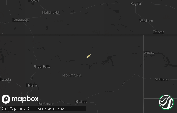
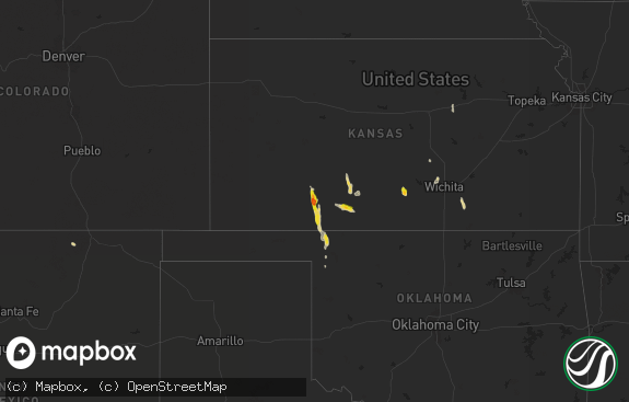
Hail Map in North Dakota on July 7, 2018
The weather event in North Dakota on July 7, 2018 includes Hail map. 16 states and 161 cities were impacted and suffered possible damage. The total estimated number of properties impacted is 0.

Hail
0
Estimated number of impacted properties by a 1.00" hail or larger0
Estimated number of impacted properties by a 1.75" hail or larger0
Estimated number of impacted properties by a 2.50" hail or largerStorm reports in North Dakota
North Dakota
| Date | Description |
|---|---|
| 07/07/20185:35 AM CDT | Report of four to five inch branches down in riverside park with time estimated by radar |
| 07/07/20185:30 AM CDT | Street light pole bent down to the ground. Numerous large tree branches and limbs broken down acros sthe area. Some smaller trees snapped. |
| 07/07/20185:27 AM CDT | Tree down blocking traffic on washington st near gateway dr |
| 07/07/20184:56 AM CDT | Tree branches broken done. Shingles off roof. |
| 07/07/20184:36 AM CDT | Widespread tree damage noted in farmsteads and shelter belts along hwy 32 through western rugh township. Time estimated based on radar. |
| 07/07/20184:18 AM CDT | Widespread tree damage noted along hwy 15 trough central osago township. Time estimated based on radar. |
| 07/07/20184:04 AM CDT | Peak winds measured at ndawn station located along hwy 20... 10 n of mchenry. Widespead tree damage noted throughout central colvin township. |
| 07/07/20184:04 AM CDT | Measured at ndawn 10 n of mchenry |
| 07/07/20183:43 AM CDT | Several trees of 12 to 18 inches uprooted in town. Time approximate based on radar |
| 07/07/20183:38 AM CDT | Multiple trees down and significant damage to a machine shed |
| 07/07/20183:35 AM CDT | Multiple trees down and significant damage to a machine shed |
| 07/07/20183:35 AM CDT | Airport hanger blown down and planes scattered. |
| 07/07/20183:34 AM CDT | Airport hangar sustained significant damage with half of the roof removed and outside walls on north end of the building collapsed. Heavier debris scattered approx 50 t |
| 07/07/20183:33 AM CDT | Numerous trees uprooted within the city limits. Tree size varied from 12 to 24 inches. Power lines taken down by tree limbs all around town and the area leading to wids |
| 07/07/20183:30 AM CDT | Several trees of 12 to 18 inches uprooted in town. Time approximate based on radar |
| 07/07/20183:30 AM CDT | Numerous trees uprooted within the city limits. Tree size varied from 12 to 24 inches. Time approximate based on radar. |
| 07/07/20183:30 AM CDT | Airport hangar sustained significant damage with half of the roof removed and outside walls on north end of the building collapsed. Heavier debris scattered approx 50 t |
| 07/07/20183:30 AM CDT | Significant tree damage begins south and west of town. |
| 07/07/20183:25 AM CDT | Delayed report from early sunday morning... July 8th... 2018. Measured by a personal weather station. Time estimated based on radar. |
| 07/07/20183:23 AM CDT | A local report indicates 64 MPH wind near CATHAY |
| 07/07/20182:50 AM CDT | Measured by an ndawn station. |
| 07/07/20182:43 AM CDT | Ndawn station. |
| 07/07/20182:18 AM CDT | Measured by the sterling dot site. |
| 07/07/20182:00 AM CDT | Deputy in moffit reported extensive wind damage about 5 miles west of moffit. Many large trees uprooted... Power-lines down... And buildings heavily damaged. Time is es |
| 07/07/20181:35 AM CDT | Measured by the linton ndawn station. Associated with outflow from distant thunderstorms. |
| 07/07/20181:32 AM CDT | Morton county em reported extensive t-storm wind damage at fort rice and south of fort rice. Several garages were ripped from foundations... An unoccupied mobile home w |
| 07/07/20181:31 AM CDT | Emmons co. Sheriffs office reported extensive wind damage from badger bay to just north of the hazelton recreational area. At badger bay a 5th wheel camper was tipped o |
| 07/07/20181:00 AM CDT | Tatanka prairie raws site. Time estimated based on radar data. |
All States Impacted by Hail Map on July 7, 2018
Cities Impacted by Hail Map on July 7, 2018
- Moorcroft, WY
- Broadus, MT
- Alzada, MT
- Goodridge, MN
- Thief River Falls, MN
- Big Falls, MN
- Euclid, MN
- Red Lake Falls, MN
- South Heart, ND
- Belfield, ND
- Lakota, ND
- Pekin, ND
- Michigan, ND
- Mcville, ND
- Larimore, ND
- Gonzales, LA
- Prairieville, LA
- Woodville, MS
- Ariton, AL
- Emerado, ND
- Grand Forks, ND
- Tuttle, ND
- Saint Hilaire, MN
- Hettinger, ND
- New Leipzig, ND
- New Rockford, ND
- Sheyenne, ND
- Cathay, ND
- Comstock, TX
- Del Rio, TX
- Mandan, ND
- Ralph, SD
- Lodgepole, SD
- Saint Anthony, ND
- Sulphur, LA
- Elmer, OK
- Glorieta, NM
- Columbus, TX
- Garwood, TX
- Upton, WY
- Hondo, TX
- Littlefork, MN
- Warren, MN
- Olustee, OK
- Eldorado, OK
- Wallis, TX
- Sealy, TX
- East Grand Forks, MN
- Grygla, MN
- Arvilla, ND
- Grand Forks Afb, ND
- Elgin, ND
- Hebron, ND
- Beulah, ND
- Hazen, ND
- Estancia, NM
- Mountainair, NM
- Orlando, FL
- Hamburg, AR
- Richardton, ND
- Glen Ullin, ND
- Carson, ND
- Geneva, AL
- Chancellor, AL
- Wing, ND
- Driscoll, ND
- Sterling, ND
- Roswell, NM
- Solen, ND
- Steele, ND
- Robinson, ND
- Gillette, WY
- Harvey, ND
- Carrington, ND
- Sykeston, ND
- Lemmon, SD
- Dolores, CO
- Awendaw, SC
- Daleville, AL
- Coffee Springs, AL
- Stuart, FL
- Indiantown, FL
- Linden, AL
- Tolna, ND
- Elba, AL
- Plummer, MN
- Northwood, ND
- Georgetown, TX
- Gilbertown, AL
- Toxey, AL
- Maddock, ND
- Monroeville, AL
- Repton, AL
- Petersburg, ND
- Gladstone, ND
- Cimarron, NM
- Florala, AL
- Fessenden, ND
- Bovey, MN
- Ekalaka, MT
- Sweet Water, AL
- Dequincy, LA
- Jackson, AL
- Ozark, AL
- East Bernard, TX
- Fort Myers, FL
- Raleigh, ND
- Goodrich, ND
- Bowdon, ND
- Crookston, MN
- Shorter, AL
- Orange, TX
- Midway, AL
- Taylor, ND
- New Salem, ND
- Prairie City, SD
- Dickinson, ND
- New England, ND
- Charleston, SC
- Bison, SD
- Bigfork, MN
- Menoken, ND
- Hazelton, ND
- Flasher, ND
- Bismarck, ND
- Amidon, ND
- Vernon, TX
- Chillicothe, TX
- Odell, TX
- Samson, AL
- Kinston, AL
- Rocksprings, TX
- Niagara, ND
- Reynolds, ND
- Thompson, ND
- Fulshear, TX
- Brookshire, TX
- Burton, TX
- Lenox, AL
- Range, AL
- Brewton, AL
- Denhoff, ND
- Mcclusky, ND
- Shields, ND
- Ludlow, SD
- Sardis, AL
- Reva, SD
- Frisco City, AL
- Sonora, TX
- Huntsville, AL
- Odessa, TX
- Clio, AL
- Coffeeville, AL
- Minter, AL
- Blakely, GA
- Warwick, ND
- Geismar, LA
- Seguin, TX
- Ragley, LA
- Lake Charles, LA
- Kinder, LA


