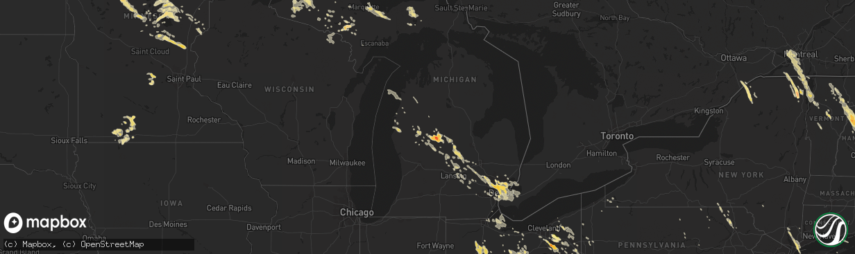
Hail Map in Minnesota on July 4, 2012
The weather event in Minnesota on July 4, 2012 includes Hail map. 34 states and 1,331 cities were impacted and suffered possible damage. The total estimated number of properties impacted is 0.
Want more than just the map?
Turn this storm into a full workflow.
- Owner + property data so you know who to knock
- OnDemand branded weather history reports to win the "did we even have hail?" argument
- RoofTrace estimate so reps stop guessing numbers at the door
Bought this map? Upgrade within 7 days and we'll credit the $230. (10-15 min setup call)
Hail
0
Estimated number of impacted properties by a 1.00" hail or larger0
Estimated number of impacted properties by a 1.75" hail or larger0
Estimated number of impacted properties by a 2.50" hail or largerStorm reports in Minnesota
Minnesota
| Date | Description |
|---|---|
| 07/04/20123:35 PM CDT | Several 1.5 foot diameter trees down |
| 07/04/20123:20 PM CDT | 8 inch diameter branches down. |
| 07/04/20122:12 PM CDT | Numerous trees down along passi road |
| 07/04/20122:03 PM CDT | 3-4 inch diameter trees down |
| 07/04/20121:25 PM CDT | Reports of trees down on north side of lake bemidji. |
| 07/04/20121:15 PM CDT | A local report indicates 60 MPH wind near 3 E BEMIDJI |
| 07/04/201212:25 PM CDT | 10 inch diameter trees knocked down. |
| 07/04/20127:25 AM CDT | 4 to 5 inch diameter branches snapped off trees |
| 07/04/20124:15 AM CDT | A shed was lifted and twisted on foundation |
| 07/04/20123:45 AM CDT | 4 inch tree branch down. |
| 07/04/20122:30 AM CDT | Part of a house roof blown off 370th st. |
| 07/04/20122:30 AM CDT | Large tree down. Several branches down with damage to vehicles in town. |
| 07/03/201210:38 PM CDT | Also received pea size hail |
| 07/03/201210:12 PM CDT | A local report indicates 1.00 inch wind near 13 S AITKIN |
| 07/03/201210:12 PM CDT | A local report indicates 1.00 inch wind near 2 N PILLAGER |
| 07/03/20128:55 PM CDT | Power lines down...at least one tree and multiple branches blown down. |
| 07/03/20128:48 PM CDT | Fell between 838 and 848 pm cdt |
| 07/03/20128:15 PM CDT | Also numerous reports of 2 foot diameter trees down on the north side of lake mille lacs |
| 07/03/20127:48 PM CDT | A local report indicates 1.00 inch wind near KIMBERLY |
All States Impacted by Hail Map on July 4, 2012
- Alabama
- Louisiana
- Minnesota
- Michigan
- Wisconsin
- Georgia
- New Hampshire
- Nebraska
- North Dakota
- Texas
- Pennsylvania
- South Carolina
- West Virginia
- Maryland
- Virginia
- New York
- Indiana
- Kentucky
- Mississippi
- South Dakota
- Vermont
- Ohio
- North Carolina
- Florida
- Iowa
- Illinois
- Tennessee
- Wyoming
- Maine
- Connecticut
- New Mexico
- New Jersey
- Colorado
- Arkansas
Cities Impacted by Hail Map on July 4, 2012
- Grand Bay, AL
- Theodore, AL
- Irvington, AL
- Winnsboro, LA
- Big Falls, MN
- Fence, WI
- Florence, WI
- Long Lake, WI
- Crystal Falls, MI
- White, GA
- Cartersville, GA
- Rumney, NH
- Champion, NE
- Parks, NE
- Middle River, MN
- Crystal, ND
- Hensel, ND
- Midland, TX
- Linesville, PA
- Jamestown, PA
- Gaffney, SC
- Friendsville, MD
- Accident, MD
- Swanton, MD
- Bruceton Mills, WV
- McHenry, MD
- Aitkin, MN
- Mckeesport, PA
- Trafford, PA
- East McKeesport, PA
- Braddock, PA
- Wilmerding, PA
- North Versailles, PA
- Turtle Creek, PA
- Irwin, PA
- East Pittsburgh, PA
- Markham, VA
- Alpha, MN
- Lisbon, NY
- Hermon, NY
- De Kalb Junction, NY
- Rensselaer Falls, NY
- Ogdensburg, NY
- Canton, NY
- Deerwood, MN
- Mullen, NE
- Puposky, MN
- Bemidji, MN
- Iron Mountain, MI
- Foster City, MI
- Sagola, MI
- Evansville, IN
- Hayes Center, NE
- Wallace, NE
- Greenbush, MN
- Strandquist, MN
- Strathcona, MN
- Hart, MI
- Ludington, MI
- Pentwater, MI
- Potsdam, NY
- Detroit, MI
- Nicholson, PA
- Lumberton, MS
- Poplarville, MS
- Beaver Falls, PA
- Zelienople, PA
- Cranberry Township, PA
- Freedom, PA
- Rochester, PA
- New Brighton, PA
- Viborg, SD
- Irene, SD
- Hurley, SD
- Eden Mills, VT
- Craftsbury, VT
- Craftsbury Common, VT
- Randolph, VT
- Saint Clairsville, OH
- Flushing, OH
- Belmont, OH
- Andrews, TX
- Foxworth, MS
- Uniontown, OH
- Hinckley, OH
- Kent, OH
- Alliance, OH
- Akron, OH
- Mogadore, OH
- Hartville, OH
- Tallmadge, OH
- Richfield, OH
- Peninsula, OH
- Atwater, OH
- Louisville, OH
- Canton, OH
- Cuyahoga Falls, OH
- Union Church, MS
- New Washington, OH
- Shelby, OH
- Tiro, OH
- Glenford, OH
- Junction City, OH
- Somerset, OH
- Mount Perry, OH
- Thornville, OH
- New Lexington, OH
- Channing, MI
- Garrison, MN
- McGrath, MN
- Brainerd, MN
- Finlayson, MN
- Isle, MN
- Rumely, MI
- Munising, MI
- Deerton, MI
- Au Train, MI
- Wetmore, MI
- Wheeling, WV
- Columbus, OH
- Walhalla, ND
- Langdon, ND
- Bannister, MI
- Owosso, MI
- Brant, MI
- Oakley, MI
- Elsie, MI
- Henderson, MI
- Wheeler, MI
- Breckenridge, MI
- Ithaca, MI
- Ashley, MI
- Saint Louis, MI
- Alma, MI
- West Danville, VT
- Hardwick, VT
- Henderson, NC
- Warrenton, NC
- Coopersburg, PA
- Center Valley, PA
- Bethlehem, PA
- Pillager, MN
- Motley, MN
- Trout, LA
- Olla, LA
- Havana, FL
- Tallahassee, FL
- Midway, FL
- Mims, FL
- Valley Grove, WV
- Triadelphia, WV
- Dunnell, MN
- Sherburn, MN
- Littlefork, MN
- Warren, NH
- Wentworth, NH
- North Haverhill, NH
- Campton, NH
- Newbury, VT
- Groton, VT
- Barnet, VT
- East Ryegate, VT
- South Ryegate, VT
- Pike, NH
- Monroe, NH
- Woodsville, NH
- McIndoe Falls, VT
- Lisbon, NH
- Bath, NH
- Piermont, NH
- Wells River, VT
- Spring Hope, NC
- Kabetogama, MN
- Slidell, LA
- Purvis, MS
- Grygla, MN
- Saint James, MN
- Comfrey, MN
- Butterfield, MN
- Darfur, MN
- Odin, MN
- Garrettsville, OH
- Spirit Lake, IA
- Jackson, MN
- Haubstadt, IN
- Cedartown, GA
- Union Mills, NC
- Marion, NC
- Old Fort, NC
- Lake Lure, NC
- Gothenburg, NE
- Louisburg, NC
- Harrison City, PA
- Latrobe, PA
- Pleasant Unity, PA
- Jeannette, PA
- Grapeville, PA
- Greensburg, PA
- Claridge, PA
- Penn, PA
- Mount Pleasant, PA
- Hunker, PA
- Adamsburg, PA
- Bovard, PA
- Rawson, OH
- Jenera, OH
- Findlay, OH
- Cecil, WI
- Gillett, WI
- Ely, MN
- Winton, MN
- Middlesex, NC
- Bailey, NC
- Ridgeway, OH
- Mount Victory, OH
- West Mansfield, OH
- Mcgregor, MN
- Trout Run, PA
- Coshocton, OH
- Conesville, OH
- Dresden, OH
- Crozet, VA
- Greenwood, VA
- Afton, VA
- Colton, NY
- Bloomdale, OH
- Youngstown, OH
- Remer, MN
- Saint Thomas, ND
- Hamilton, ND
- Glasston, ND
- Brady, NE
- Utica, OH
- Jeromesville, OH
- Loudonville, OH
- Loudon, NH
- Gilmanton, NH
- Tilton, NH
- Pittsfield, NH
- Chichester, NH
- Canterbury, NH
- Belmont, NH
- Lawrenceville, IL
- Germfask, MI
- Dunning, NE
- Purdum, NE
- Stahlstown, PA
- Arlington, OH
- Mount Blanchard, OH
- Vanlue, OH
- Glencoe, MN
- Lester Prairie, MN
- Silver Lake, MN
- Berlin, PA
- Meyersdale, PA
- Wharton, OH
- Holden, LA
- Albany, LA
- Boones Mill, VA
- Hardy, VA
- Adams, TN
- Guthrie, KY
- Allensville, KY
- Hines, MN
- Blackduck, MN
- Hollsopple, PA
- Jennerstown, PA
- Ligonier, PA
- Boswell, PA
- Stoystown, PA
- Barryton, MI
- Remus, MI
- Troy, MI
- Grandfalls, TX
- Dillonvale, OH
- Warsaw, OH
- Eddyville, IL
- Stonefort, IL
- Chazy, NY
- Champlain, NY
- Mooers, NY
- Fairdale, ND
- Marenisco, MI
- Bergland, MI
- Duffield, VA
- Fort Blackmore, VA
- Minto, ND
- Gilbert, LA
- Drayton, ND
- Pine Apple, AL
- Circleville, OH
- Oakland, MD
- Adams, ND
- Edinburg, ND
- Forest River, ND
- Grafton, ND
- Park River, ND
- Hoople, ND
- Pisek, ND
- Marquette, MI
- Mount Vernon, OH
- Kelliher, MN
- Waddington, NY
- De Pere, WI
- Homestead, PA
- Pittsburgh, PA
- Herminie, PA
- Pitcairn, PA
- Rillton, PA
- West Mifflin, PA
- Verona, PA
- Ardara, PA
- Larimer, PA
- Oakmont, PA
- Monroeville, PA
- Duquesne, PA
- Laramie, WY
- Menahga, MN
- Sebeka, MN
- Staples, MN
- Verndale, MN
- Park Rapids, MN
- Bethel, ME
- Hampden, ND
- Hallock, MN
- Milton, ND
- Edmore, ND
- Starkweather, ND
- Cavalier, ND
- Alsen, ND
- Mountain, ND
- Osnabrock, ND
- Bathgate, ND
- Nekoma, ND
- Pembina, ND
- Munich, ND
- Milaca, MN
- The Plains, VA
- Williston, VT
- Shelburne, VT
- Hinesburg, VT
- South Burlington, VT
- Montverde, FL
- Clermont, FL
- Winter Garden, FL
- Huntington Woods, MI
- Oak Park, MI
- Highland Park, MI
- Ferndale, MI
- Royal Oak, MI
- Berkley, MI
- Pleasant Ridge, MI
- Stafford, VA
- Quantico, VA
- Mansfield, OH
- Greenwich, OH
- Perrysville, OH
- Ashland, OH
- Shiloh, OH
- Huron, OH
- Arnold, NE
- Halsey, NE
- Stapleton, NE
- Ogilvie, MN
- Summit Hill, PA
- Lansford, PA
- Lehighton, PA
- Chauncey, OH
- Millfield, OH
- Athens, OH
- The Plains, OH
- Jacksonville, FL
- Kenton, OH
- Selma, AL
- Danville, OH
- Dewitt, MI
- Rushsylvania, OH
- Bellefontaine, OH
- Huntsville, OH
- Michigamme, MI
- Big Rapids, MI
- White Cloud, MI
- Bitely, MI
- Paris, MI
- Hattiesburg, MS
- Wayne, MI
- Westland, MI
- Canton, MI
- Romulus, MI
- Mohegan Lake, NY
- Crompond, NY
- Lake Peekskill, NY
- Garrison, NY
- Putnam Valley, NY
- Cortlandt Manor, NY
- Vancleave, MS
- Morrice, MI
- Bancroft, MI
- Gulliver, MI
- Mekinock, ND
- Grand Forks, ND
- Manvel, ND
- Hinckley, MN
- Golconda, IL
- Herod, IL
- Simpson, IL
- Zanesfield, OH
- West Liberty, OH
- Greenwich, CT
- Port Chester, NY
- Ossining, NY
- West Harrison, NY
- Millwood, NY
- Purchase, NY
- Armonk, NY
- Yorktown Heights, NY
- Mount Kisco, NY
- Chappaqua, NY
- Jackson, AL
- Clarksville, TN
- Cass Lake, MN
- New Baltimore, MI
- Six Lakes, MI
- Stanton, MI
- Lakeview, MI
- Ecorse, MI
- Cadiz, OH
- Hopedale, OH
- Jewett, OH
- Palisade, MN
- Redlake, MN
- Redby, MN
- Tenstrike, MN
- Pennington, MN
- Marshall, VA
- Clearville, PA
- Bedford, PA
- Buffalo Mills, PA
- Fairhope, PA
- Hyndman, PA
- Mizpah, MN
- Clovis, NM
- Nickelsville, VA
- Gate City, VA
- Southampton, NY
- Thornton, WV
- Tunnelton, WV
- Moatsville, WV
- Friedens, PA
- Shanksville, PA
- Southfield, MI
- Walled Lake, MI
- Farmington, MI
- Madison Heights, MI
- Saint Clair Shores, MI
- Eastpointe, MI
- Bloomfield Hills, MI
- Hazel Park, MI
- Clawson, MI
- Grosse Pointe, MI
- Franklin, MI
- West Bloomfield, MI
- Davisburg, MI
- Birmingham, MI
- Waterford, MI
- Commerce Township, MI
- Holly, MI
- Highland, MI
- White Lake, MI
- Hamtramck, MI
- Harper Woods, MI
- Warren, MI
- Center Line, MI
- Rayland, OH
- Ellisville, MS
- La Rue, OH
- Patterson, NY
- Pauline, SC
- Durand, MI
- Trout Creek, MI
- Cameron, WV
- Colmar, PA
- Line Lexington, PA
- Hatfield, PA
- Lansdale, PA
- Montgomeryville, PA
- Howard Lake, MN
- Columbia, MS
- Lovingston, VA
- Maxwell, NE
- Sandusky, OH
- Bena, MN
- Mount Holly, NJ
- Blanchard, MI
- Wakeman, OH
- New London, OH
- Collins, OH
- Thomasville, AL
- Dickens, NE
- Harpster, OH
- Upper Sandusky, OH
- Wauneta, NE
- Scio, OH
- Cardington, OH
- Mount Gilead, OH
- Marengo, OH
- Fredericktown, OH
- Watertown, TN
- Auburntown, TN
- Champion, MI
- Bellville, OH
- Butler, OH
- Swatara, MN
- Orr, MN
- Crane Lake, MN
- Little Meadows, PA
- Hooversville, PA
- Davidsville, PA
- Mecosta, MI
- Seminole, TX
- Lake, MI
- Weidman, MI
- Mount Pleasant, MI
- Salem, IN
- Leroy, MI
- Tustin, MI
- Concord, NH
- New Hampton, NH
- Dryden, TX
- Imperial, NE
- Enders, NE
- Wannaska, MN
- Federal Dam, MN
- Ada, OH
- Alger, OH
- McGuffey, OH
- Saint Louisville, OH
- Lakefield, MN
- Windom, MN
- Heron Lake, MN
- Stephens City, VA
- Front Royal, VA
- White Post, VA
- Newaygo, MI
- Newfolden, MN
- Carrier Mills, IL
- Saxonburg, PA
- Tarentum, PA
- Gibsonia, PA
- Sarver, PA
- Pattison, MS
- Schuyler Falls, NY
- Ellenburg Depot, NY
- Saranac, NY
- Cadyville, NY
- Peru, NY
- Bayfield, WI
- Friendsville, PA
- Lancaster, MN
- Middleburg, VA
- Meredith, NH
- Bristol, NH
- Plymouth, NH
- Leakey, TX
- Ravenna, OH
- Stanwood, MI
- Rodney, MI
- Iron River, MI
- Bruce Crossing, MI
- Mass City, MI
- New Vineyard, ME
- Anson, ME
- North Anson, ME
- North Benton, OH
- Southside, TN
- Rutherfordton, NC
- Perronville, MI
- State Line, MS
- Richton, MS
- Waynesboro, MS
- Starksboro, VT
- Huntington, VT
- North Jackson, OH
- Diamond, OH
- Lake Milton, OH
- Newton Falls, OH
- Moss Point, MS
- Magnolia Springs, AL
- Foley, AL
- Valencia, PA
- Mars, PA
- Monaca, PA
- Butler, PA
- Darlington, PA
- Callery, PA
- Evans City, PA
- Renfrew, PA
- Beaver, PA
- Errol, NH
- Saucier, MS
- Berlin Center, OH
- Mount Carmel, IL
- McMillan, MI
- Morrisonville, NY
- Ellenburg Center, NY
- Churubusco, NY
- Reed City, MI
- Portales, NM
- Pep, NM
- Gallipolis, OH
- Patriot, OH
- Oak Harbor, OH
- White Lake, WI
- Braham, MN
- Harris, MN
- Stanchfield, MN
- Rush City, MN
- Lanse, MI
- Shelbyville, IN
- South Portland, ME
- Cape Elizabeth, ME
- Saint James, LA
- West Farmington, OH
- Huntsburg, OH
- Bristolville, OH
- Chardon, OH
- Windsor, OH
- Orwell, OH
- North Bloomfield, OH
- Burton, OH
- Middlefield, OH
- Cortland, OH
- Roseau, MN
- Monticello, FL
- Atlantic Mine, MI
- Paw Paw, WV
- Thompsonville, MI
- Mesick, MI
- Pequot Lakes, MN
- Haymarket, VA
- Frankville, AL
- Brownfield, TX
- Meadow, TX
- Ropesville, TX
- Ontonagon, MI
- Mccomb, MS
- Emily, MN
- Clinton, LA
- Thief River Falls, MN
- Dola, OH
- Northfield, VT
- Williamstown, VT
- Brookfield, VT
- Roxbury, VT
- Warren, MN
- East Grand Forks, MN
- Alvarado, MN
- Viking, MN
- White, PA
- Acme, PA
- Normalville, PA
- Sandstone, MN
- Trimont, MN
- Baudette, MN
- Davis, SD
- Holland, IN
- Dale, IN
- Argyle, MN
- Stephen, MN
- Shepherd, MI
- Cold Spring, NY
- Riverside, CT
- Mill Neck, NY
- Pleasantville, NY
- Bedford, NY
- Croton On Hudson, NY
- Old Greenwich, CT
- Cos Cob, CT
- Bayville, NY
- West Point, NY
- Stamford, CT
- Locust Valley, NY
- Ainsworth, NE
- Belle Center, OH
- Mount Cory, OH
- Forest, OH
- Dunkirk, OH
- McComb, OH
- Deshler, OH
- Benton Ridge, OH
- Howard, OH
- Okabena, MN
- Pierz, MN
- Northome, MN
- Texico, NM
- Parsons, WV
- Martins Ferry, OH
- Ormsby, MN
- Dallas, WV
- Moundsville, WV
- Richwood, OH
- New Bloomington, OH
- Morral, OH
- Cable, OH
- East Liberty, OH
- Williamstown, OH
- Carey, OH
- Bluffton, OH
- Leipsic, OH
- Harrod, OH
- Willow River, MN
- Askov, MN
- Delaplane, VA
- Seney, MI
- Newark, OH
- Heath, OH
- Whitakers, NC
- Johnstown, PA
- Windber, PA
- Cleveland, OH
- Vass, NC
- Fort Bragg, NC
- Cameron, NC
- Mobile, AL
- Resaca, GA
- Goodridge, MN
- Bock, MN
- Dalton, GA
- Hudson, OH
- Fort Ripley, MN
- Cushing, MN
- Baxter, MN
- Osage, MN
- Mountain Lake, MN
- Walhonding, OH
- Hope, IN
- Flat Rock, IN
- Ruffs Dale, PA
- Frazeysburg, OH
- Fairmont, WV
- Morgantown, WV
- Grafton, WV
- Waitsfield, VT
- Glen Easton, WV
- Aleppo, PA
- Independence, LA
- Centreville, MS
- Saint Francisville, LA
- Woodville, MS
- Danbury, WI
- Halma, MN
- Karlstad, MN
- Bethany, WV
- Haxtun, CO
- Kennedy, MN
- Pembine, WI
- Auburn Hills, MI
- Oldtown, MD
- Hyde Park, VT
- Sumrall, MS
- Onamia, MN
- New Concord, OH
- Perry, FL
- Milton, FL
- Henderson, KY
- River Rouge, MI
- Sherman, NY
- Belton, KY
- Dunmor, KY
- Galena, OH
- Johnstown, OH
- Westerville, OH
- New Albany, OH
- Littleton, WV
- Burton, WV
- Mannington, WV
- Metz, WV
- Keyser, WV
- Curtice, OH
- Tatum, NM
- West Liberty, WV
- Crosby, MN
- Palisade, NE
- Pataskala, OH
- Blacklick, OH
- Sunbury, OH
- Boutte, LA
- Luling, LA
- New Kensington, PA
- Murrysville, PA
- Bellevue, OH
- Hop Bottom, PA
- Springville, PA
- Sears, MI
- Manistee, MI
- Welcome, MD
- Liberty, MS
- Smithdale, MS
- Clinton Township, MI
- Fraser, MI
- Roseville, MI
- Kentwood, LA
- Skandia, MI
- Chatham, MI
- Eben Junction, MI
- Roanoke, VA
- Sebring, OH
- Beloit, OH
- Salem, OH
- Milton, TN
- Painesville, OH
- Sanbornton, NH
- Ashland, NH
- Monroe, MI
- West Chazy, NY
- Plattsburgh, NY
- Somerset, PA
- Shevlin, MN
- Scottville, MI
- Mayville, NY
- Hillman, MN
- Morley, MI
- Howard City, MI
- Laughlintown, PA
- Hidden Valley, PA
- Rector, PA
- Jenners, PA
- Reynoldsburg, OH
- Warrenton, VA
- Broad Run, VA
- Gainesville, VA
- Russell, NY
- Fort Branch, IN
- Montrose, PA
- Hallstead, PA
- New Cumberland, WV
- Warren, OH
- Southington, OH
- Leavittsburg, OH
- Watsontown, PA
- Turbotville, PA
- Monahans, TX
- Ovid, MI
- Saint Johns, MI
- Laingsburg, MI
- Fort Stockton, TX
- Zanesville, OH
- Conchas Dam, NM
- Rolla, ND
- Shawnee, OH
- Vale, NC
- North Platte, NE
- Flat Rock, IL
- Santa Claus, IN
- Lamar, IN
- Elsie, NE
- Bordentown, NJ
- Morrisville, PA
- Fairless Hills, PA
- Columbus, NJ
- Wardensville, WV
- Lima, OH
- New Ringgold, PA
- Kempton, PA
- Grove Hill, AL
- Oxford, FL
- Wildwood, FL
- The Villages, FL
- Lady Lake, FL
- Minter, AL
- Covington, MI
- Watton, MI
- Groveport, OH
- Winchester, VA
- Bruno, MN
- Joint Base Mdl, NJ
- New Wilmington, PA
- Mercer, PA
- Volant, PA
- Ann Arbor, MI
- Wellsburg, WV
- Jersey Shore, PA
- Bluemont, VA
- Brackettville, TX
- Antigo, WI
- Franklinton, LA
- Romney, WV
- Shanks, WV
- Rio, WV
- Twinsburg, OH
- Aurora, OH
- Streetsboro, OH
- Mantua, OH
- Alburgh, VT
- Rouses Point, NY
- Palmerton, PA
- Siren, WI
- Barnum, MN
- Greenleaf, WI
- Smithland, KY
- Tiline, KY
- Burna, KY
- Catharpin, VA
- Chantilly, VA
- Aldie, VA
- Grand Marais, MI
- Sterling Heights, MI
- Rocky Mount, NC
- Livonia, MI
- Garden City, MI
- Monticello, AR
- New Portland, ME
- Chase, MI
- Isle La Motte, VT
- Milton, VT
- Burlington, VT
- Grand Isle, VT
- Colchester, VT
- South Hero, VT
- Denver City, TX
- Cokato, MN
- Winsted, MN
- Waverly, MN
- Woodbury, VT
- Gorham, ME
- Scarborough, ME
- Westbrook, ME
- Farnam, NE
- Belvidere Center, VT
- Eden, VT
- Johnson, VT
- Montgomery Center, VT
- McDavid, FL
- Century, FL
- Bridgeport, OH
- Charlottesville, VA
- Neche, ND
- Ewen, MI
- Gilby, ND
- Marion, OH
- Richlandtown, PA
- Quakertown, PA
- Canfield, OH
- North Lima, OH
- Dungannon, VA
- Vincentown, NJ
- Burlington, NJ
- Hainesport, NJ
- Centennial, WY
- Harrison Township, MI
- Rochester, VT
- Venango, NE
- Independence, WV
- Madison, ME
- Solon, ME
- Strong, ME
- East Palestine, OH
- New Waterford, OH
- Ponsford, MN
- Rootstown, OH
- Gore, VA
- Foreston, MN
- Foley, MN
- Mora, MN
- Okeechobee, FL
- Thedford, NE
- Mayer, MN
- Lakeville, OH
- Sturgeon Lake, MN
- Brewster, NE
- Derby, IN
- Tell City, IN
- Nova, OH
- Sullivan, OH
- Milford, OH
- Bowler, WI
- Elton, WI
- Smithton, PA
- Connellsville, PA
- Scottdale, PA
- Dawson, PA
- Olyphant, PA
- Great Cacapon, WV
- Little Orleans, MD
- Scottown, OH
- Perry, MI
- Galion, OH
- Eagle Rock, VA
- Buchanan, VA
- Grand Marais, MN
- Sturgeon Bay, WI
- Yorkville, OH
- Fowler, MI
- Mineral Ridge, OH
- McDonald, OH
- Girard, OH
- Wilson, MI
- Roundhill, KY
- Campbellsburg, IN
- West Forks, ME
- Corunna, MI
- Lennon, MI
- Flushing, MI
- Wixom, MI
- Gaines, MI
- Hartland, MI
- Wyandotte, MI
- Riverview, MI
- Milford, MI
- Rochester, MI
- Byron, MI
- Fenton, MI
- Southgate, MI
- Grosse Ile, MI
- Harsens Island, MI
- Trenton, MI
- Linden, MI
- Taylor, MI
- Babbitt, MN
- Nanjemoy, MD
- Howell, MI
- Fowlerville, MI
- Gregory, MI
- Abingdon, VA
- Arcadia, MI
- Newburgh, IN
- Titusville, NJ
- Richmond, OH
- Steubenville, OH
- Pipersville, PA
- Doylestown, PA
- New Springfield, OH
- Columbiana, OH
- Negley, OH
- Mingo Junction, OH
- Brilliant, OH
- Lawton, ND
- Owego, NY
- Apalachin, NY
- Edmore, MI
- Marion Junction, AL
- Amasa, MI
- Talmoon, MN
- Deer River, MN
- Indianola, PA
- Cheswick, PA
- Walker, MN
- Battleboro, NC
- Tarboro, NC
- Uvalde, TX
- Boonville, IN
- Lynnville, IN
- Waldron, IN
- Montpelier, VT
- Moretown, VT
- New Egypt, NJ
- Allentown, NJ
- Cream Ridge, NJ
- Sunshine, LA
- Plaquemine, LA
- Addis, LA
- Nisswa, MN
- Hume, VA
- Gentryville, IN
- Tennyson, IN
- Louisville, KY
- Pennsburg, PA
- Green Lane, PA
- Sellersville, PA
- Telford, PA
- Gould City, MI
- Clyde, OH
- Niagara, WI
- Middleton, MI
- Perrinton, MI
- Nevis, MN
- Weirton, WV
- Clewiston, FL
- Gatzke, MN
- Tamarack, MN
- Windham, ME
- Chapmansboro, TN
- Fremont, OH
- Green Springs, OH
- Kenly, NC
- Lucama, NC
- Stow, OH
- Bryant, WI
- Madrid, NE
- Greensboro Bend, VT
- Greensboro, VT
- Orient, NY
- Alburtis, PA
- Macungie, PA
- New Stanton, PA
- Peacham, VT
- Haverhill, NH
- Summerdale, AL
- Covington, LA
- Lincoln Park, MI
- Melvindale, MI
- Allen Park, MI
- Dearborn, MI
- Dearborn Heights, MI
- Aliquippa, PA
- Upperville, VA
- Boyce, VA
- Linden, VA
- Lincolnton, NC
- Magnolia, MS
- Goodman, WI
- Ashville, NY
- Sugar Grove, PA
- Jamestown, NY
- Chesterland, OH
- Robesonia, PA
- Bernville, PA
- Saint Johnsbury, VT
- Danville, VT
- Brimson, MN
- Goldvein, VA
- Triangle, VA
- Midland, VA
- Fredericksburg, VA
- Brunswick, OH
- Strongsville, OH
- North Royalton, OH
- Emerado, ND
- Grand Forks Afb, ND
- Lisbon, OH
- Leetonia, OH
- East Hardwick, VT
- Cabot, VT
- Bridgton, ME
- Dansville, MI
- Mason, MI
- Webberville, MI
- Williamston, MI
- North Woodstock, NH
- Hebron, NH
- Glouster, OH
- Duluth, MN
- Hubbardston, MI
- Carson City, MI
- Pittsburg, NH
- Elkton, KY
- Wellsville, OH
- Gillett, PA
- Columbia Cross Roads, PA
- Bealeton, VA
- Van Buren, OH
- Ocate, NM
- Volin, SD
- Wray, CO
- Pensacola, FL
- Floyd, NM
- Amherst, CO
- Stowe, VT
- Lake Bronson, MN
- Wilson, NC
- Ray, MI
- Colebrook, NH
- Olmstead, KY
- Two Harbors, MN
- Northampton, PA
- Cherryville, PA
- Laurys Station, PA
- Walnutport, PA
- Grosse Tete, LA
- Unionville, TN
- Rockvale, TN
- Birnamwood, WI
- Hookstown, PA
- Fleming, CO
- Wellsboro, PA
- Tamaqua, PA
- Faber, VA
- Gulf Shores, AL
- Amanda, OH
- Lancaster, OH
- Dassel, MN
- Rock Spring, GA
- Haslett, MI
- Egeland, ND
- Toledo, OH
- Greensburg, IN
- Croydon, PA
- Jobstown, NJ
- Willingboro, NJ
- Pemberton, NJ
- Lumberton, NJ
- Bristol, PA
- Bensalem, PA
- Beverly, NJ
- Mooers Forks, NY
- North Hero, VT
- Winooski, VT
- Des Allemands, LA
- Okemos, MI
- East Lansing, MI
- Bath, MI
- Roseville, OH
- Crestline, OH
- Polk, OH
- Martinsburg, OH
- Gambier, OH
- Glenmont, OH
- Nashport, OH
- Plymouth, OH
- Safford, AL
- Kokomo, MS
- Madrid, NY
- Brackney, PA
- Bingham Lake, MN
- Berkeley Springs, WV
- Tiltonsville, OH
- Beech Bottom, WV
- Windsor Heights, WV
- Stockbridge, MI
- Pinckney, MI
- Rockland, MI
- Holyoke, CO
- Port Allen, LA
- Panama, NY
- Naples, ME
- Towanda, PA
- Wolcott, VT
- Perkasie, PA
- Cleveland, TN
- Plymouth, MI
- Bell Buckle, TN
- Crystal, MI
- Sheridan, MI
- Lonaconing, MD
- Frostburg, MD
- Midlothian, MD
- Rocky Ridge, OH
- Port Clinton, OH
- Graytown, OH
- Brussels, WI
- Philo, OH
- Rowlesburg, WV
- Newberry, MI
- Engadine, MI
- Norris City, IL
- Sims, NC
- Richmond, VT
- Oslo, MN
- Berlin Heights, OH
- Vermilion, OH
- Everly, IA
- Baldwin, MI
- Greenland, MI
- Dushore, PA
- Amite, LA
- Bloomery, WV
- Cross Junction, VA
- Centerburg, OH
- Buckatunna, MS
- Little Falls, MN
- Sharpsville, PA
- Harbor View, OH
- Oregon, OH
- Beacon, NY
- Tickfaw, LA
- Tallapoosa, GA
- Jonesborough, TN
- Unicoi, TN
- Erwin, TN
- Waskish, MN
- New Freeport, PA
- Livingston Manor, NY
- Andes, NY
- Merrifield, MN
- Lowell, VT
- Newbury, OH
- Chagrin Falls, OH
- Novelty, OH
- Camp Wood, TX
- Cannon Afb, NM
- Belle Vernon, PA
- Perkinston, MS
- Clarks Summit, PA
- Dalton, PA
- Leesburg, VA
- Fogelsville, PA
- Breinigsville, PA
- New Tripoli, PA
- Redford, NY
- Kings Mountain, NC
- Cherryville, NC
- Bessemer City, NC
- Factoryville, PA
- Tower, MN
- Keeseville, NY
- Au Sable Forks, NY
- Whitelaw, WI
- Reedsville, WI
- Maribel, WI
- Mill Spring, NC
- Bloomville, OH
- Burnt Prairie, IL
- Chatfield, OH
- Bellaire, OH
- Tyrone, GA
- Andover, NH
- Danbury, NH
- Hill City, MN
- Benkelman, NE
- Groveland, FL
- Brandon, VT
- Union City, PA
- Felch, MI
- Frederic, WI
- Shell Lake, WI
- Barronett, WI
- Folsom, LA
- Loranger, LA
- Hendricks, WV
- Hambleton, WV
- Flint, MI
- Swartz Creek, MI
- Trenton, NJ
- Lawrence Township, NJ
- Grove City, PA
- Gadsden, AL
- Republic, MI
- Chatom, AL
- Flintstone, MD
- Peralta, NM
- Los Lunas, NM


