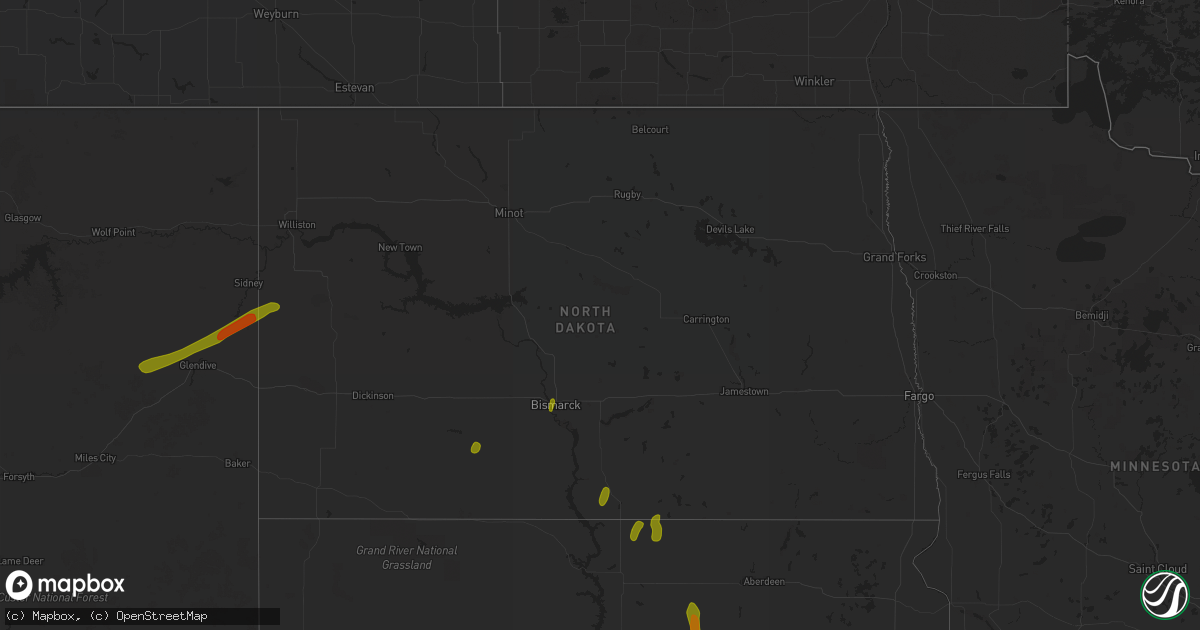
Hail Map in North Dakota on July 3, 2018
Get this storm
July 3 map
$229
one time, instant access
Download today. No call, no setup
Keep the $229
Bought the map and want the full workflow? Apply the entire $229 to a subscription within 7 days. None of it is wasted.
Every map, not just this one
This buys you this map. Subscription and you get every map we run, in the markets you choose from a few cities to whole states to nationwide. Plus real-time alerts the moment a storm fires.
Contact data
Name, contact info, occupancy, even credit band for addresses in the footprint. You go from where it hit to who to call.
Become the source they trust
Unlimited branding weather history reports on demand. You already have the documented answer ready for the property owner, and you are the one who showed up with it.
Property data and RoofTrace estimates
Pull up any address you have got, its value and the exact code rules for that jurisdiction, straight from One Click Code. Then RoofTrace estimates the squares, pitch, and roof value, priced the way you price.
Storm reports in North Dakota
North Dakota
| Date | Description |
|---|---|
| 07/03/20187:46 AM CDT | At 1246 AM MDT, severe thunderstorms were located along a line extending from 12 miles south of Carlyle to 11 miles southwest of Marmarth to 12 miles east of Ekalaka, moving east at 55 mph. These are very dangerous storms. HAZARD...80 mph wind gusts and ping pong ball size hail. SOURCE...Trained weather spotters. IMPACT...Flying debris will be dangerous to those caught without shelter. Mobile homes will be heavily damaged. Expect considerable damage to roofs, windows, and vehicles. Extensive tree damage and power outages are likely. Locations impacted include... Webster and Mill Iron. This replaces the warning previously in effect for this area. |
| 07/03/20187:10 AM CDT | At 1209 AM MDT, a severe thunderstorm was located 8 miles west of Golva, or 12 miles southwest of Beach, moving east at 45 mph. HAZARD...60 mph wind gusts and quarter size hail. SOURCE...Radar indicated. IMPACT...Hail damage to vehicles is expected. Expect wind damage to roofs, siding, and trees. This severe thunderstorm will be near... Golva around 1220 AM MDT. Medora around 1250 AM MDT.Other locations impacted by this severe thunderstorm include Alphaand Fryburg. |
| 07/03/20187:02 AM CDT | At 1202 AM MDT, severe thunderstorms were located along a line extending from 30 miles south of Fallon to 17 miles northwest of Ekalaka to 27 miles northwest of Ridgeway, moving east at 40 mph. HAZARD...Ping pong ball size hail and 60 mph wind gusts. SOURCE...Radar indicated. IMPACT...People and animals outdoors will be injured. Expect hail damage to roofs, siding, windows, and vehicles. Expect wind damage to roofs, siding, and trees. Locations impacted include... Ekalaka, Ismay, Webster, Medicine Rocks State Park, Willard and Mill Iron. |
| 07/03/20186:49 AM CDT | At 1149 PM CDT/1049 PM MDT/, severe thunderstorms were located along a line extending from 7 miles north of Shields to 6 miles northwest of Walker, moving east at 30 mph. HAZARD...60 mph wind gusts and quarter size hail. SOURCE...Radar indicated. IMPACT...Hail damage to vehicles is expected. Expect wind damage to roofs, siding, and trees. Severe thunderstorms will be near... Selfridge around 1215 AM CDT. Solen around 1220 AM CDT. Prairie Knights Resort around 1235 AM CDT. Cannon Ball around 1240 AM CDT.Other locations impacted by these severe thunderstorms include St.Gertrude and Porcupine. |
| 07/03/20186:43 AM CDT | At 1143 PM CDT, a severe thunderstorm was located 7 miles northwest of Lake Harmon, or 16 miles northwest of Mandan, moving northeast at 30 mph. HAZARD...60 mph wind gusts and nickel size hail. SOURCE...Trained weather spotters. A 60 mph wind gust was reported 5 miles west of Center. IMPACT...Expect damage to roofs, siding, and trees. This severe thunderstorm will be near... Wilton around 1215 AM CDT. Regan around 1235 AM CDT.Other locations impacted by this severe thunderstorm include Sanger,Hensler, Price, New Johns Lake, Baldwin and Nelson Lake. |
| 07/03/20186:35 AM CDT | At 1134 PM CDT, severe thunderstorms were located along a line extending from near Lake Harmon to 8 miles northwest of St. Anthony to 11 miles west of Shields, moving northeast at 40 mph. HAZARD...60 mph wind gusts and quarter size hail. SOURCE...Radar indicated. IMPACT...Hail damage to vehicles is expected. Expect wind damage to roofs, siding, and trees. Severe thunderstorms will be near... Mandan, Lake Harmon and St. Anthony around 1140 PM CDT. Flasher around 1150 PM CDT. Bismarck and Lincoln around 1200 AM CDT. Menoken around 1210 AM CDT. Wing around 1225 AM CDT.Other locations impacted by these severe thunderstorms include DoubleDitch Indian Village, Fort Rice, Baldwin, Crown Butte Lake, Breien,Fort Abraham Lincoln State Park, University Of Mary and Huff. |
| 07/03/20186:30 AM CDT | At 1130 PM CDT/1030 PM MDT/, a severe thunderstorm was located 12 miles west of Theodore Roosevelt National Park North Unit, or 17 miles southwest of Watford City, moving northeast at 25 mph. HAZARD...60 mph wind gusts and quarter size hail. SOURCE...Radar indicated. IMPACT...Hail damage to vehicles is expected. Expect wind damage to roofs, siding, and trees. This severe thunderstorm will be near... Theodore Roosevelt National Park North Unit around 1155 PM CDT. Watford City around 1210 AM CDT.Other locations impacted by this severe thunderstorm include JohnsonsCorner and Keene. |
| 07/03/20185:55 AM CDT | At 1055 PM CDT/955 PM MDT/, severe thunderstorms were located along a line extending from 9 miles south of Center to Keldron, moving northeast at 30 mph. HAZARD...60 mph wind gusts and quarter size hail. SOURCE...Radar indicated. IMPACT...Hail damage to vehicles is expected. Expect wind damage to roofs, siding, and trees. These severe thunderstorms will remain over mainly rural areas of southwestern Sioux...western Morton and Grant Counties, including the following locations... Heil, St. Gertrude, Raleigh, Sweet Briar Lake, Crown Butte Lake, Leith, Lark and Judson. |
| 07/03/20185:51 AM CDT | At 1051 PM MDT, a severe thunderstorm was located 7 miles northeast of Black Horse, or 21 miles west of Mclaughlin, moving northeast at 30 mph. HAZARD...60 mph wind gusts and quarter size hail. SOURCE...Radar indicated. IMPACT...Hail damage to vehicles is expected. Expect wind damage to roofs, siding, and trees. Locations impacted include... Mcintosh, Black Horse, Walker and Bullhead. |
| 07/03/20185:24 AM CDT | At 1023 PM CDT/923 PM MDT/, a severe thunderstorm was located 7 miles southeast of Savage, or 21 miles south of Sidney, moving northeast at 35 mph. HAZARD...Golf ball size hail and 60 mph wind gusts. SOURCE...Radar indicated. IMPACT...People and animals outdoors will be injured. Expect hail damage to roofs, siding, windows, and vehicles. Expect wind damage to roofs, siding, and trees. This severe thunderstorm will remain over mainly rural areas of southwestern McKenzie County, including the following locations... Sather Dam. |
| 07/03/20184:45 AM CDT | 3... 4... 7... And 8 inch diameter trees down. Wind threw porch glider across deck and knocked the deck railing off. |
| 07/03/20184:23 AM CDT | At 922 PM MDT, a severe thunderstorm was located near Savage, or 24 miles south of Sidney, moving northeast at 40 mph. HAZARD...60 mph wind gusts and quarter size hail. SOURCE...Radar indicated. IMPACT...Hail damage to vehicles is expected. Expect wind damage to roofs, siding, and trees. Locations impacted include... Savage and Burns. |
| 07/03/20184:23 AM CDT | Report of a tree blown down in north fargo. |
| 07/03/20184:21 AM CDT | At 921 PM MDT, a severe thunderstorm was located 5 miles southwest of New England, or 17 miles east of Amidon, moving northeast at 35 mph. HAZARD...60 mph wind gusts and quarter size hail. SOURCE...Radar indicated. IMPACT...Hail damage to vehicles is expected. Expect wind damage to roofs, siding, and trees. This severe thunderstorm will be near... New England around 930 PM MDT.Other locations impacted by this severe thunderstorm includeSchefield, Havelock, Lefor and Dickinson Regional Airport. |
| 07/03/20184:20 AM CDT | Large trees broken down and grandstand roof blown off at the ballfield in south pembina. |
| 07/03/20184:09 AM CDT | Large tree branches broken down. Winds measured at a nearby personal weather station of sustained at 43 mph and peak gusts to 53 mph. |
| 07/03/20184:06 AM CDT | Several trees broken down along highway 13 between gwinner and milton. |
| 07/03/20184:05 AM CDT | Report of trees uprooted and power outages. |
| 07/03/20184:02 AM CDT | Branches and tree down within the city limits. Some damage to shingles as well. |
| 07/03/20184:00 AM CDT | A few large evergreens snapped along the bike path. Reported via social media. |
| 07/03/20183:58 AM CDT | Public reported tree down. Time estimated based on radar. |
| 07/03/20183:54 AM CDT | 2 power poles down along nd highway 17. Time estimated based on radar. |
| 07/03/20183:52 AM CDT | Ash tree snapped 12 feet up... 2 1/2 blocks north of the nws office. |
| 07/03/20183:52 AM CDT | Ash tree snapped 12 feet up... 1 1/2 blocks north of the office. |
| 07/03/20183:50 AM CDT | At 849 PM MDT, a severe thunderstorm was located near North Cave Hills, or 20 miles north of Buffalo, moving northeast at 40 mph. HAZARD...60 mph wind gusts and quarter size hail. SOURCE...Radar indicated. IMPACT...Hail damage to vehicles is expected. Expect wind damage to roofs, siding, and trees. Locations impacted include... Ludlow, Ralph, North Cave Hills and South Cave Hills. |
| 07/03/20183:48 AM CDT | Within the town of grafton... Two 2 foot diameter poplar trees snapped at the base... An 18 inch diameter trunk snapped at 15 feet... 6 to 8 inch diameter branches snap |
| 07/03/20183:46 AM CDT | A couple of large trees blown down. A fireworks tent blown down and a boat/trailer combination blown over. Time estimated based on radar. |
| 07/03/20183:44 AM CDT | Tree uprooted near interstate 29 mile marker 149 in shelter belt. Time based on radar estimate. |
| 07/03/20183:44 AM CDT | Tree uprooted near interstate 29 mile marker 149 in shelter belt. Time based on radar estimate. |
| 07/03/20183:44 AM CDT | Peak wind at personal weather station. |
| 07/03/20183:37 AM CDT | At 837 PM MDT, a severe thunderstorm was located 7 miles north of West Glendive, or 8 miles north of Glendive, moving northeast at 45 mph. HAZARD...60 mph wind gusts and quarter size hail. SOURCE...Radar indicated. IMPACT...Hail damage to vehicles is expected. Expect wind damage to roofs, siding, and trees. Locations impacted include... Glendive, Savage, Intake, West Glendive, Forest Park, Stipek, Midway, Burns and Crane. |
| 07/03/20183:28 AM CDT | 3 trees uprooted... Including one at the elementary... And some larger branches broken off of trees. One brick housing entry sign completely knocked over. Reported via |
| 07/03/20183:25 AM CDT | Peak winds measured at an ndawn station. |
| 07/03/20183:23 AM CDT | Report of a tree blown down in north fargo. |
| 07/03/20183:20 AM CDT | No hail. The wind was very strong. A few small to medium sized tree branches down. A good rain... Too. |
| 07/03/20183:20 AM CDT | This tornado tracked about a mile to around 5 nw of lawton by 321 am cdt. An old barn was peeled opened... With sections of walls and roof flung to the north. Timbers p |
| 07/03/20183:20 AM CDT | Barn blown down 3 miles ne of arb observer location. Observer is located 8w and 0.5n of lawton thus the location of barn is approximately 6.3 miles wnw of lawton nd. Ob |
| 07/03/20183:15 AM CDT | Trees blown down and front of trailer home damaged. |
| 07/03/20183:14 AM CDT | Large tree branches and several trees knocked over along shelter belt near rest area along highway 2 via photos from social media. Time estimated based on radar. |
| 07/03/20182:48 AM CDT | Shed tumbled... Fencing and roofing torn up... Hoop building demolished at devils lake speedway. Time estimated based on radar. |
| 07/03/20182:46 AM CDT | A few large branches and limbs broken down at the lake astabula campground. |
| 07/03/20182:45 AM CDT | A few large 4-6 inch diameter tree branches and limbs broken down around town. |
| 07/03/20182:44 AM CDT | Large tree branches and limbs droken down around stump lake park and campground. Time estimated based on radar. |
| 07/03/20182:42 AM CDT | Nd agricultural weather network obs. |
| 07/03/20182:35 AM CDT | Downburst winds hits homesteads across eastern coulee and western dry lake townships. At one homestead... Wind of 70 to 80 mph... Blew in the overhead door of a south f |
| 07/03/20182:31 AM CDT | Reports within or near warwick of a tree on a house... Roof off trailer... Trees down in the city park... And power poles down along highway 20 south of warwick. Time e |
| 07/03/20182:29 AM CDT | A tornado likely initiated in a bowing section of a squall line as in moved northeastward through central eddy township into warwick township. The tornado tracked for a |
| 07/03/20182:07 AM CDT | Half mile or more of power poles snapped off on 69...000 volt transmission line. Time estimated based on radar. |
| 07/03/20182:05 AM CDT | Half mile or more of power poles snapped off on 69...000 volt transmission line. Time estimated based on radar. |
| 07/03/20181:40 AM CDT | A local report indicates 1.00 inch wind near 4 NW VENTURIA |
| 07/03/20181:35 AM CDT | Trees blown down... A couple out buildings destroyed. Grain auger was toppled. Time estimated by radar. |
| 07/03/201812:25 AM CDT | Mesonet station ttkn8... 8 n selfridge. |
| 07/03/201812:17 AM CDT | Relayed through broadcast meteorologist to nws. |
| 07/03/201812:15 AM CDT | Large trees uprooted in wilton. Report relayed through broadcast meteorologist. |
| 07/03/201812:10 AM CDT | Sporadic nickel to quarter size hail near the capitol building in bismarck. Heavy rain resulting in ponding in the street. |
| 07/03/201812:00 AM CDT | Measured from weather station at hefty seed... A mile south of wilton. Relayed via social media with picture... Time stamped at midnight cdt of july... 4. This time is |
| 07/02/201811:50 PM CDT | Ham radio operator. Also had just smaller than dime size hail. |
| 07/02/201811:12 PM CDT | At 412 AM CDT/312 AM MDT/, severe thunderstorms were located along a line extending from 8 miles north of New Salem to 7 miles north of Carson to 4 miles west of Keldron, moving east at 55 mph. HAZARD...70 mph wind gusts and quarter size hail. SOURCE...Radar indicated. IMPACT...Hail damage to vehicles is expected. Expect considerable tree damage. Wind damage is also likely to mobile homes, roofs, and outbuildings. Severe thunderstorms will be near... New Salem around 315 AM MDT. Flasher around 430 AM CDT. Lake Harmon around 435 AM CDT. Mandan around 440 AM CDT. Bismarck and Solen around 450 AM CDT. Mcdowell Dam Recreation Area around 455 AM CDT. Menoken and Cannon Ball around 500 AM CDT.Other locations impacted by these severe thunderstorms include DoubleDitch Indian Village, Heil, Raleigh, Breien, Lark, HazeltonRecreation Area, University Of Mary, Huff, St. Gertrude and SweetBriar Lake. |
| 07/02/201811:04 PM CDT | Hail lasted two minutes. Very heavy rain lasted 45 minutes. |
| 07/02/201811:00 PM CDT | Report relayed through nws glasgow... Montana. |
| 07/02/201810:00 PM CDT | No hail... Very heavy rain... And frequent lightning with the wind. |
| 07/02/20189:56 PM CDT | At 256 AM MDT, a severe thunderstorm was located 7 miles southwest of White Butte, or 16 miles west of Lemmon, moving east at 45 mph. HAZARD...Golf ball size hail and 70 mph wind gusts. SOURCE...Radar indicated. IMPACT...People and animals outdoors will be injured. Expect hail damage to roofs, siding, windows, and vehicles. Expect considerable tree damage. Wind damage is also likely to mobile homes, roofs, and outbuildings. Locations impacted include... Lemmon and White Butte. |
| 07/02/20188:02 PM CDT | At 102 AM MDT, severe thunderstorms were located along a line extending from 11 miles northwest of Ladner to 12 miles northwest of Camp Crook, moving east at 20 mph. These are very dangerous storms. HAZARD...90 mph wind gusts and quarter size hail. SOURCE...Radar indicated. IMPACT...You are in a life-threatening situation. Flying debris may be deadly to those caught without shelter. Mobile homes will be heavily damaged or destroyed. Homes and businesses will have substantial roof and window damage. Expect extensive tree damage and power outages. Locations impacted include... Buffalo, Ludlow, Ladner, Table Mountain, South Cave Hills, North Cave Hills and Lake Gardner. |
All States Impacted by Hail Map on July 3, 2018
Cities Impacted by Hail Map on July 3, 2018
- Arkadelphia, AR
- Midwest, WY
- Edgerton, WY
- Manville, WY
- Shawnee, WY
- Brewster, MN
- Reading, MN
- Worthington, MN
- Fulda, MN
- Redwood Falls, MN
- Wabasso, MN
- Franklin, MN
- Morton, MN
- Morgan, MN
- Elgin, ND
- Carson, ND
- Mandan, ND
- Bismarck, ND
- Strasburg, ND
- Spearfish, SD
- Belle Fourche, SD
- Miller, SD
- Roscoe, SD
- Faulkton, SD
- Orient, SD
- Custer, SD
- Buffalo Gap, SD
- Howes, SD
- New Underwood, SD
- Wall, SD
- Wasta, SD
- Herreid, SD
- Eureka, SD
- Zeeland, ND
- Ashley, ND
- Wibaux, MT
- Glendive, MT
- Cartwright, ND
- Savage, MT
- Lindsay, MT
- Willingboro, NJ
- Riverside, NJ
- Beverly, NJ
- Downingtown, PA
- Coatesville, PA
- Ranier, MN
- Littlefork, MN
- International Falls, MN
- Kabetogama, MN
- Badger, MN
- Watford City, ND
- New Town, ND
- Linton, ND
- Wakpala, SD
- Glencross, SD
- Pollock, SD
- Hague, ND
- McLaughlin, SD
- Trail City, SD
- Timber Lake, SD
- Forbes, ND
- Ludlow, SD
- Bowman, ND
- Kaycee, WY
- Eagle Butte, SD
- Lantry, SD
- Heron Lake, MN
- Regan, ND
- Dardanelle, AR
- Danville, AR
- Edgemont, SD
- Roselle Park, NJ
- Roselle, NJ
- Clark, NJ
- Cranford, NJ
- Linden, NJ
- Kenilworth, NJ
- Grygla, MN
- Fullerton, ND
- Hemphill, TX
- Pine Bluffs, WY
- Lakeland, FL
- Mulberry, FL
- Tallmansville, WV
- Mabie, WV
- Almont, ND
- Owanka, SD
- Magnolia, MN
- Kenneth, MN
- Newcastle, WY
- Cherry Creek, SD
- Dupree, SD
- New Salem, ND
- Baldwin, ND
- Mcclusky, ND
- Wishek, ND
- Shepherd, MT
- Worden, MT
- Lamberton, MN
- Sanborn, MN
- Clements, MN
- Springfield, MN
- Dumont, MN
- Chokio, MN
- Morris, MN
- Luverne, MN
- Bowdle, SD
- Hosmer, SD
- Rogers, AR
- Eureka Springs, AR
- Thomson, GA
- New Leipzig, ND
- Driscoll, ND
- Steele, ND
- Isabel, SD
- New Raymer, CO
- Alpine, AL
- Vincent, AL
- Cropwell, AL
- Talladega, AL
- Pell City, AL
- Edgerton, MN
- Hodges, SC
- Arnegard, ND
- Alexander, ND
- Damascus, GA
- Arlington, GA
- Selfridge, ND
- Polk City, FL
- Adrian, MN
- Center, ND
- Langley, AR
- Glenwood, AR
- Davisboro, GA
- Harrison, GA
- Sandersville, GA
- Tennille, GA
- Big Falls, MN
- Sundance, WY
- Beulah, WY
- Como, TX
- Sulphur Springs, TX
- Lance Creek, WY
- Wauneta, NE
- Kirby, AR
- Ainsworth, NE
- Greenwood, SC
- Climax, GA
- Whigham, GA
- Lithia, FL
- Parrish, FL
- Perry, FL
- Roseau, MN
- Ortonville, MN
- White Owl, SD
- Twin City, GA
- Garfield, GA
- Woodworth, ND
- Pingree, ND
- Orr, MN
- Molt, MT
- Dunning, NE
- Dierks, AR
- Mineral Springs, AR
- Nashville, AR
- Hill City, SD
- Tuttle, ND
- Philip, SD
- Detroit, TX
- Johnstown, NE
- Glen Ullin, ND
- Stapleton, GA
- Wrens, GA
- Queen City, TX
- Winnie, TX
- Roundup, MT
- Chiefland, FL
- Old Town, FL
- Lismore, MN
- Wilmont, MN
- Waynesboro, GA
- Purdum, NE
- Foreman, AR
- Terry, MT
- Brewster, NE
- Longview, TX
- White Oak, TX
- Blakely, GA
- Acton, MT
- Broadview, MT
- McCormick, SC
- Plum Branch, SC
- Crane Lake, MN
- Sedgwick, CO
- Haxtun, CO
- Meadow, SD
- Flasher, ND
- Hardwick, MN
- Arnold, NE
- Mena, AR
- Bradley, SC
- Troy, SC
- Louisville, GA
- Keysville, GA
- Midville, GA
- Hardaway, AL
- Tuskegee, AL
- Shorter, AL
- Omaha, GA
- Lumpkin, GA
- Cusseta, GA
- Richland, GA
- Salol, MN
- Morristown, SD
- Watauga, SD
- Keldron, SD
- Washington, GA
- Little Eagle, SD
- Enning, SD
- Grassy Butte, ND
- Graceville, MN
- Clinton, MN
- Menoken, ND
- Ellendale, ND
- Yellville, AR
- Greenbush, MN
- Bartow, GA
- Mulberry, AR
- Dover, AR
- Saint Anthony, ND
- Solen, ND
- Musselshell, MT
- Hettinger, ND
- Rushmore, MN
- Casper, WY
- Faith, SD
- Fairburn, SD
- Auburndale, FL
- Sylvania, GA
- Texarkana, TX
- Cooperstown, ND
- Huntington, TX
- Wimauma, FL
- Carrington, ND
- Fort Yates, ND
- Alma, AR
- Dyer, AR
- Buffalo, SD
- Raleigh, ND
- Davenport, FL
- Kissimmee, FL
- Mohall, ND
- Alzada, MT
- Calhoun, KY
- Livermore, KY
- Ninety Six, SC
- Texarkana, AR
- Palmetto, FL
- Drayton, ND
- Grafton, ND
- Saint Thomas, ND
- Starkweather, ND
- Strandquist, MN
- Munich, ND
- Courtenay, ND
- Kensal, ND
- Red Lake Falls, MN
- Fredonia, ND
- Kulm, ND
- New Rockford, ND
- Mentor, MN
- Denhoff, ND
- Goodrich, ND
- Brocket, ND
- Lakota, ND
- Sheyenne, ND
- Aneta, ND
- Mcville, ND
- Whitehorse, SD
- Sisseton, SD
- Lemmon, SD
- Capitol, MT
- Java, SD
- Saint Lawrence, SD
- Wessington, SD
- Douglas, WY
- Venango, NE
- Lexington, SC
- Gilbert, SC
- Dickens, NE
- Fort Morgan, CO
- Central, SC
- Toomsboro, GA
- Edgefield, SC
- Lincolnton, GA
- Appling, GA
- Norwood, GA
- Beech Island, SC
- Claxton, GA
- Rocky Ford, GA
- Statesboro, GA
- Donalsonville, GA
- Fort Benning, GA
- Colmesneil, TX
- Sarasota, FL
- Devers, TX
- Lehigh Acres, FL
- Williston, FL
- Hoople, ND
- Devils Lake, ND
- Oberon, ND
- Harvey, ND
- Hurdsfield, ND
- Robinson, ND
- Bowdon, ND
- Wing, ND
- Dawson, ND
- Long Lake, SD
- Bison, SD
- Newell, SD
- Leota, MN
- Chandler, MN
- Peach Bottom, PA
- Conowingo, MD
- Walden, NY
- Montgomery, NY
- Pine Bush, NY
- Hayes Center, NE
- Cleveland, OH
- Chagrin Falls, OH
- Ovid, CO
- Montrose, WV
- Mount Kisco, NY
- Collinsville, IL
- O'Fallon, IL
- Dunmor, KY
- Belton, KY
- Ozark, AR
- Troy, IL
- Saint Jacob, IL
- Bowden, WV
- Glady, WV
- Huntsville, AR
- Buckhannon, WV
- French Creek, WV
- Calhoun, GA
- Adairsville, GA
- Plainville, GA
- Norman, AR
- Brookston, TX
- Paris, TX
- Rosston, AR
- Leesville, SC
- Newington, GA
- Guyton, GA
- Newton, GA
- Tampa, FL
- Bogata, TX
- Pembroke, GA
- Chireno, TX
- San Augustine, TX
- Nacogdoches, TX
- Naples, FL
- Newfolden, MN
- Goodridge, MN
- Cathay, ND
- Viking, MN
- Shields, ND
- Wilton, ND
- Sterling, ND
- Raymond, SD
- Mud Butte, SD
- Pipestone, MN
- North Platte, NE
- Wellfleet, NE
- Edwardsville, IL
- Granite City, IL
- Bel Air, MD
- Abingdon, MD
- Mount Orab, OH
- Vulcan, MO
- Van Buren, AR
- Street, MD
- Jarrettsville, MD
- Pylesville, MD
- White Hall, MD
- Abbeville, SC
- Watson, OK
- Bruceton Mills, WV
- Albright, WV
- Millen, GA
- Bronson, TX
- Deport, TX
- Coushatta, LA
- Sibley, LA
- Minden, LA
- Sale City, GA
- Lamont, FL
- Port Charlotte, FL
- North Port, FL
- Fort Myers, FL
- Langdon, ND
- Alsen, ND
- Warroad, MN
- Leeds, ND
- Maddock, ND
- Minnewaukan, ND
- Thief River Falls, MN
- Fertile, MN
- Beltrami, MN
- Washburn, ND
- Lisbon, ND
- McIntosh, SD
- Corona, SD
- Donnelly, MN
- Big Stone City, SD
- Lucan, MN
- Walnut Grove, MN
- Wanda, MN
- Union Center, SD
- Jeffers, MN
- Harrold, SD
- Westbrook, MN
- Ree Heights, SD
- Kimball, NE
- Middletown, OH
- Franklin, OH
- Stapleton, NE
- Maryville, IL
- Glen Carbon, IL
- Avinger, TX
- Hughes Springs, TX
- Matthews, GA
- Brooklet, GA
- Chapin, SC
- Havana, AR
- Pendleton, SC
- Vernon, FL
- Malvern, AR
- Tignall, GA
- Dublin, GA
- Hamshire, TX
- Ocala, FL
- Lake Placid, FL
- Sebring, FL
- Churchs Ferry, ND
- Fairdale, ND
- Lawton, ND
- Esmond, ND
- New England, ND
- Edgeley, ND
- Tulare, SD
- Redfield, SD
- Rockham, SD
- Hulett, WY
- Ipswich, SD
- Conde, SD
- De Smet, SD
- Moorcroft, WY
- Onida, SD
- Milesville, SD
- Jasper, MN
- Slayton, MN
- Avoca, MN
- East Hartford, CT
- Rapid City, SD
- Aurora, MO
- Tennyson, IN
- Rockville, MD
- Gaithersburg, MD
- Potomac, MD
- Holyoke, CO
- Paris, AR
- Anderson, SC
- Belton, SC
- Vendor, AR
- Jasper, AR
- Mount Ida, AR
- Prosperity, SC
- Lexington, GA
- Crawford, GA
- Nashoba, OK
- Gaylesville, AL
- Jackson, SC
- West Columbia, SC
- Bagwell, TX
- Hephzibah, GA
- Blythe, GA
- Haynesville, LA
- Arcadia, FL
- Wales, ND
- Karlstad, MN
- Fessenden, ND
- Amidon, ND
- Scranton, ND
- Wolsey, SD
- Hermosa, SD
- Revere, MN
- Maxwell, NE
- Westfield, NJ
- Garwood, NJ
- Grant, NE
- Nabb, IN
- Fair Play, MO
- Uniontown, KY
- Russellville, AR
- Newhope, AR
- Wadley, GA
- Columbus, GA
- Gladewater, TX
- Kilgore, TX
- Waldo, AR
- Sulphur Bluff, TX
- Dike, TX
- Wewahitchka, FL
- Pelham, GA
- Crawfordville, FL
- Leesville, LA
- Anacoco, LA
- Ponce De Leon, FL
- Windermere, FL
- Bradenton, FL
- Thonotosassa, FL
- Wesley Chapel, FL
- Zephyrhills, FL
- Martin, ND
- Roosevelt, MN
- Saint Michael, ND
- Winter Garden, FL
- Orlando, FL
- Haworth, OK
- Lavaca, AR
- Etoile, TX
- Glenmora, LA
- Iroquois, SD
- Blunt, SD
- Camden, OH
- Atlanta, TX
- Ogallala, NE
- Colquitt, GA
- Augusta, GA
- Ashland, IL
- Adairville, KY
- Weirsdale, FL
- Pyatt, AR
- Calhoun Falls, SC
- Troy, AL
- Tallahassee, FL
- Waldron, AR
- Cando, ND
- Crary, ND
- Pettibone, ND
- Petersburg, ND
- Hazelton, ND
- Lead, SD
- Long Pine, NE
- Bushnell, NE
- Gibbon Glade, PA
- Chardon, OH
- Churchville, MD
- Darlington, MD
- Paramus, NJ
- Oradell, NJ
- River Edge, NJ
- Emerson, NJ
- Fayetteville, OH
- Blanchester, OH
- Oxford, OH
- Uniontown, PA
- Dayton, OH
- Chapmansboro, TN
- Springfield, TN
- Orlinda, TN
- Parthenon, AR
- Armuchee, GA
- Bismarck, AR
- Talco, TX
- Gurdon, AR
- Cedartown, GA
- East Dublin, GA
- Carlton, GA
- Luverne, AL
- Honoraville, AL
- Ellenton, FL
- Sun City Center, FL
- Ruskin, FL
- Reddick, FL
- Baudette, MN
- Park River, ND
- Finley, ND
- Hannaford, ND
- Sharon, ND
- West Chester, PA
- Ellsworth, MN
- Devils Tower, WY
- Whiteford, MD
- Carpenter, WY
- Burns, WY
- Iona, MN
- Julesburg, CO
- Masontown, WV
- Russellville, KY
- Aiken, SC
- Utica, KY
- Saluda, SC
- Huntingburg, IN
- Dale, IN
- Lineville, AL
- Wadley, AL
- Cragford, AL
- Flemington, MO
- Ashland, AL
- Clayton, AL
- Cairo, GA
- Havana, FL
- Thomasville, GA
- Portal, GA
- Preston, GA
- Metter, GA
- Chester, TX
- Summerfield, FL
- Sykeston, ND
- Frederick, SD
- Correll, MN
- Holland, MN
- Woodstock, MN
- Lusk, WY
- Gillette, WY
- Chesterland, OH
- Novelty, OH
- Waterloo, SC
- Morgantown, WV
- Newberry, SC
- Kinards, SC
- Rockmart, GA
- Aragon, GA
- Berryville, AR
- Springfield, GA
- Natchitoches, LA
- Pitkin, LA
- Clio, AL
- Louisville, AL
- Lawtey, FL
- Punta Gorda, FL


