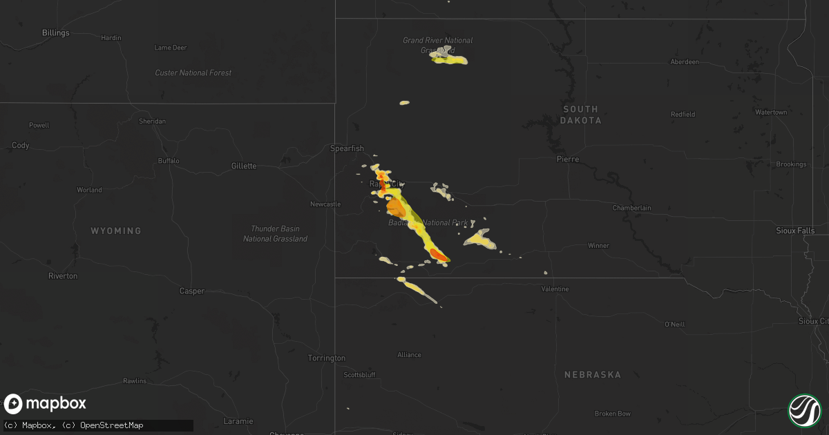
Hail Map on July 3, 2016
Get this storm
July 3 map
$229
one time, instant access
Download today. No call, no setup
Keep the $229
Bought the map and want the full workflow? Apply the entire $229 to a subscription within 7 days. None of it is wasted.
Every map, not just this one
This buys you this map. Subscription and you get every map we run, in the markets you choose from a few cities to whole states to nationwide. Plus real-time alerts the moment a storm fires.
Contact data
Name, contact info, occupancy, even credit band for addresses in the footprint. You go from where it hit to who to call.
Become the source they trust
Unlimited branding weather history reports on demand. You already have the documented answer ready for the property owner, and you are the one who showed up with it.
Property data and RoofTrace estimates
Pull up any address you have got, its value and the exact code rules for that jurisdiction, straight from One Click Code. Then RoofTrace estimates the squares, pitch, and roof value, priced the way you price.
States Impacted by Hail Map on July 3, 2016
Storm reports
South Dakota
| Date | Description |
|---|---|
| 07/03/20166:42 PM CDT | A local report indicates 1.00 inch wind near 5 ESE MEADOW |
| 07/03/20166:42 PM CDT | A local report indicates 60 MPH wind near 5 ESE MEADOW |
| 07/03/20166:40 PM CDT | A local report indicates 1.00 inch wind near 8 ESE MEADOW |
| 07/03/20166:20 PM CDT | 60 to 70 mph wind gusts |
| 07/03/20165:43 PM CDT | A local report indicates 1.00 inch wind near 5 N CHANCE |
| 07/03/20165:25 PM CDT | A local report indicates 1.50 inch wind near HERMOSA |
| 07/03/20165:15 PM CDT | A local report indicates 1.00 inch wind near 1 E HERMOSA |
| 07/03/20164:15 PM CDT | A few the size of golf balls to start. Otherwise less than penny size. |
| 07/03/20163:40 PM CDT | A local report indicates 1.00 inch wind near 1 ESE DOWNTOWN RAPID CI |
| 07/03/20162:04 PM CDT | A local report indicates 1.75 inch wind near 4 S DOWNTOWN RAPID CITY |
| 07/03/20162:03 PM CDT | A local report indicates 1.25 inch wind near 5 SW DOWNTOWN RAPID CIT |
| 07/03/20162:01 PM CDT | A local report indicates 1.75 inch wind near 5 SW DOWNTOWN RAPID CIT |
| 07/03/20161:17 PM CDT | A local report indicates 1.75 inch wind near 4 W DOWNTOWN RAPID CITY |
| 07/03/20161:23 AM CDT | A local report indicates 61 MPH wind near 4 E CACTUS FLAT |
| 07/02/20168:30 PM CDT | Time estimated by radar. |
North Dakota
| Date | Description |
|---|---|
| 07/03/20166:50 PM CDT | Numerous reports of tree branches down in hazen. Observation near hazen reported a 72 mph thunderstorm wind gust. |
| 07/03/20166:38 PM CDT | Hazen ndawn observation. |
| 07/03/20166:35 PM CDT | Camper trailer turned over on its side...house siding torn off...and road signs flattened. Time estimated based on radar. |
| 07/03/20166:35 PM CDT | Hail lasted 15 minutes. Largest was golf ball size. Corrected for location. |
| 07/03/20166:35 PM CDT | Hail lasted 15 minutes. Largest was golf ball size. |
| 07/03/20166:15 PM CDT | Nd dot sensor near golden valley... Nd mercer county. Peak gust as of 615 pm cdt. |
| 07/03/20165:45 PM CDT | Hail started about 545 pm cdt and lasted 10 min. |
| 07/03/20165:15 PM CDT | Hail from 515 pm cdt to 525 pm cdt. Damage to siding. |
| 07/03/20165:05 PM CDT | A local report indicates 1.00 inch wind near 9 SW HALLIDAY |
| 07/02/20168:16 PM CDT | Dime to quarter size hail reported on north side of kenmare. |
| 07/02/20168:14 PM CDT | Dime to quarter size hail reported on north side of kenmare. |
Montana
| Date | Description |
|---|---|
| 07/03/20164:17 PM CDT | A local report indicates 64 MPH wind near 6 ENE LIVINGSTON |
Oklahoma
| Date | Description |
|---|---|
| 07/03/20166:54 PM CDT | A local report indicates 1.00 inch wind near 4 ENE NOBLE |
| 07/03/20166:20 PM CDT | A local report indicates 1.00 inch wind near 3 E HARRAH |
| 07/02/20168:27 PM CDT | Pea size hail and very heavy rainfall. |
| 07/02/20168:25 PM CDT | A local report indicates 60 MPH wind near 7 W TECUMSEH |
| 07/02/20167:27 PM CDT | A local report indicates 64 MPH wind near 2 SW JOHNSON |
| 07/02/20167:21 PM CDT | A local report indicates 70 MPH wind near 2 NE NORMAN |
| 07/02/20167:15 PM CDT | A local report indicates 61 MPH wind near 3 SSE BOISE CITY |
| 07/02/20167:10 PM CDT | A local report indicates 58 MPH wind near 3 SSE BOISE CITY |
| 07/02/20167:05 PM CDT | A local report indicates 70 MPH wind near 3 SSE BOISE CITY |
| 07/02/20167:00 PM CDT | A local report indicates 60 MPH wind near 7 S CHANDLER |
New Mexico
| Date | Description |
|---|---|
| 07/03/20166:50 PM CDT | Trained spotter reported heavy hail at 1 with strong pre-storm gust front knocking limbs off trees. |
| 07/03/20166:50 PM CDT | Heavy damage at house due to combo wind and hail. Windows busted. Power pole broke off at the base. Limbs 12 inch diameter broke off tree. Hail piled up between 3 to 4 |
| 07/02/20168:01 PM CDT | Gusty thunderstorm winds flipped over a pop-up camper at ute lake state park. |
| 07/02/20168:00 PM CDT | Heavy hail by logan in quay cty. |
Indiana
| Date | Description |
|---|---|
| 07/03/20163:53 PM CDT | Several trees down and damage to fences in town. |
Texas
| Date | Description |
|---|---|
| 07/03/20165:47 AM CDT | At addison airport /kads/ |
| 07/02/20169:45 PM CDT | Damage to metal silo and barn |
| 07/02/20169:45 PM CDT | A local report indicates 77 MPH wind near 2 NE FRIONA |
| 07/02/20167:10 PM CDT | A local report indicates 1.00 inch wind near 4 N LAKE ARROWHEAD |
South Carolina
| Date | Description |
|---|---|
| 07/03/20164:13 PM CDT | Power lines and trees reported down in the new zion area. |
| 07/03/20163:02 PM CDT | Report of tree down at the intersection of s charleston rd and dargan farms rd. Time estimated by radar. |
| 07/03/20162:48 PM CDT | Trees and powerlines down at gunn mill rd near patrick society hill rd. |
| 07/03/20162:30 PM CDT | 1/2 mile by 6 mile swath of straightline wind damage to trees... Ending approximately 1.5 miles west of lamar. The majority of trees were snapped 15 to 30 feet above gr |
| 07/03/20162:23 PM CDT | Report of tree down at the intersection of una rd and lee state park rd. Time estimated by radar. |
| 07/03/20162:23 PM CDT | Report of tree down at the intersection of newman swamp rd and windham town rd. Time estimated by radar. |
| 07/03/20162:23 PM CDT | Report of tree down on mill branch road. Time estimated by radar. |
Alabama
| Date | Description |
|---|---|
| 07/03/20162:41 PM CDT | A large tree was blown down on wilbanks ave. Winds estimated at 50 to 55 mph. |
North Carolina
| Date | Description |
|---|---|
| 07/03/20166:52 PM CDT | Multiple trees down on stroud rd. Over 200 people reported to be without power. |
Kentucky
| Date | Description |
|---|---|
| 07/03/20166:50 PM CDT | Ef-0 tornado with 80 mph winds touched down on norsworthy rd southwest of kirksey. A couple dozen trees or tree limbs were blown down. Shingles were blown off a couple |
| 07/03/20166:50 PM CDT | Ef-0 tornado with 80 mph winds touched down 2.5 miles southwest of kirksey on norsworthy road. A couple dozen trees or tree limbs were blown down. Shingles were blown o |
| 07/03/20166:50 PM CDT | Ef-0 tornado with 80 mph winds touched down 2.5 miles southwest of kirksey on norsworthy road. A couple dozen trees or tree limbs were blown down. Shingles were blown o |
| 07/03/20166:30 PM CDT | 20-25 trees blown down. Minor shingle damage and a cover blown off a well house. Damage is in the 1300-1500 block of norsworthy rd 1 to 2 miles south of kirksey ky. |
| 07/03/20166:15 PM CDT | . |
| 07/03/20166:15 PM CDT | Ohio county dispatch reported several trees down across the northern part of the county. . |
| 07/03/20166:03 PM CDT | Downed trees blocking the road near the intersection of sr 764 and sr 1738. |
| 07/03/20163:12 PM CDT | A number of tree limbs on the roads across the southern portions of the county. |
| 07/03/20163:05 PM CDT | Two trees down across ky80 at mile marker 3 closing the road. Time estimated from radar. |
| 07/02/20167:25 PM CDT | Several large tree limbs down near the town of hudson. Time estimated from radar. |
| 07/02/20167:21 PM CDT | Trees and power lines down along sr 1740. |
| 07/02/20167:21 PM CDT | Tree across airport road and into nearby power lines at tucker road. |
Wyoming
| Date | Description |
|---|---|
| 07/03/20161:10 AM CDT | A local report indicates 68 MPH wind near 2 SSW SHERIDAN |
Illinois
| Date | Description |
|---|---|
| 07/03/20163:15 PM CDT | Late report. 20ft tall tree with 2ft diameter uprooted. Larger pine tree snapped. |
| 07/03/20163:15 PM CDT | Late report. 20ft tall tree with 2ft diameter uprooted. Larger pine tree snapped. |
Tennessee
| Date | Description |
|---|---|
| 07/03/20164:40 PM CDT | Several reports of trees down throughout the city. In addition unverified reports of structural damage to an appartment complex possible roof collapse and a store with |
| 07/03/20163:15 PM CDT | Trees down in three seperate places across the county. One on allen drive... Two on webbs camp road... And another two 70 south. |
Cities Impacted by Hail Map on July 3, 2016
- Stanton, ND
- Zap, ND
- Dodge, ND
- Halliday, ND
- Beulah, ND
- Golden Valley, ND
- Piedmont, SD
- Rapid City, SD
- Black Hawk, SD
- Fordsville, KY
- Boise City, OK
- Alvarado, TX
- Cleburne, TX
- Falls Of Rough, KY
- Leitchfield, KY
- Hartford, KY
- Westview, KY
- Whitesville, KY
- Hardinsburg, KY
- McDaniels, KY
- Utica, KY
- Alvord, TX
- Lexington, OK
- Springfield, CO
- Throckmorton, TX
- Ochelata, OK
- Barnsdall, OK
- Mud Butte, SD
- Newell, SD
- Decatur, TX
- Bridgeport, TX
- Wall, SD
- Bismarck, ND
- Baldwin, ND
- Hazen, ND
- Newcastle, TX
- Roy, NM
- Roseglen, ND
- Woodson, TX
- Norman, OK
- Duncan, OK
- Marlow, OK
- Jacksboro, TX
- Gladstone, ND
- Center, ND
- Taylor, ND
- Wilton, ND
- Washburn, ND
- Hebron, ND
- Glen Ullin, ND
- Dunn Center, ND
- Mingus, TX
- Crossville, TN
- Killdeer, ND
- New Salem, ND
- Watford City, ND
- Ryder, ND
- Keene, ND
- Sterling, ND
- Mandan, ND
- Mandaree, ND
- New Town, ND
- Parshall, ND
- Menoken, ND
- Cresson, TX
- Fort Worth, TX
- Godley, TX
- Weatherford, TX
- Ponder, TX
- Justin, TX
- Portageville, MO
- Bard, NM
- Mosquero, NM
- Friona, TX
- Conchas Dam, NM
- Hereford, TX
- Logan, NM
- Solano, NM
- San Jon, NM
- Dimmitt, TX
- Talala, OK
- Steele, ND
- Driscoll, ND
- New Leipzig, ND
- Nocona, TX
- Henrietta, TX
- Bellevue, TX
- Bowie, TX
- Sunset, TX
- Mounds, OK
- Lead, SD
- Santa Claus, IN
- Bristow, IN
- Saint Meinrad, IN
- Ferdinand, IN
- Aledo, TX
- Joshua, TX
- Crowley, TX
- Keene, TX
- Grandview, TX
- Burleson, TX
- Kenmare, ND
- Bowbells, ND
- Donnybrook, ND
- Pine Ridge, SD
- Wellston, OK
- Luther, OK
- Lindsay, OK
- Rush Springs, OK
- Metropolis, IL
- New Zion, SC
- Gable, SC
- Hardyville, KY
- Center, KY
- Columbia, KY
- Edmonton, KY
- Cave City, KY
- Greensburg, KY
- Horse Cave, KY
- Perrin, TX
- Chelsea, OK
- Bison, SD
- Maxton, NC
- Sturgis, SD
- Tecumseh, OK
- Shawnee, OK
- Oklahoma City, OK
- Choctaw, OK
- Macomb, OK
- Noble, OK
- Newalla, OK
- Meeker, OK
- Mcloud, OK
- Harrah, OK
- Tell City, IN
- Leopold, IN
- Krum, TX
- Denton, TX
- Golconda, IL
- Grantsburg, IL
- Caputa, SD
- Stamford, TX
- Manning, SC
- Kenton, OK
- Felt, OK
- Dalhart, TX
- Grenville, NM
- Kim, CO
- Roanoke, TX
- Argyle, TX
- Byers, TX
- Wichita Falls, TX
- Randlett, OK
- Temple, OK
- Petrolia, TX
- Braddock, ND
- Happy, TX
- Poseyville, IN
- Owanka, SD
- Wasta, SD
- Pauls Valley, OK
- Wounded Knee, SD
- Manderson, SD
- Porcupine, SD
- Hermosa, SD
- Kyle, SD
- Wanblee, SD
- Wing, ND
- Meadow, SD
- Naples, FL
- Seminole, OK
- Wewoka, OK
- Wetumka, OK
- Albany, TX
- Springer, NM
- Ringgold, TX
- Loving, TX
- Bryson, TX
- Graham, TX
- Olney, TX
- Waurika, OK
- Hastings, OK
- Stroud, OK
- Paden, OK
- Martin, SD
- Beaver Dam, KY
- Carson, ND
- Elgin, ND
- Lake Dallas, TX
- Collinsville, TX
- Whitney, TX
- Blum, TX
- Haltom City, TX
- Windthorst, TX
- Purcell, OK
- Adrian, TX
- Vega, TX
- Muenster, TX
- Gainesville, TX
- Oakland, KY
- Smiths Grove, KY
- Chico, TX
- Holliday, TX
- Scotland, TX
- Hay Springs, NE
- Chadron, NE
- Hartsville, SC
- Tulia, TX
- Canyon, TX
- Okemah, OK
- Egnar, CO
- Mayfield, KY
- Fancy Farm, KY
- Garrison, ND
- Mineral Wells, TX
- Crossville, IL
- Griffin, IN
- Carbondale, CO
- Konawa, OK
- Maud, OK
- Marion, KY
- Providence, KY
- Princeton, KY
- Bedford, TX
- Hurst, TX
- Colleyville, TX
- North Richland Hills, TX
- Keller, TX
- Little Elm, TX
- Rhome, TX
- Forestburg, TX
- Paradise, TX
- Jermyn, TX
- Cynthiana, IN
- Wadesville, IN
- Carmi, IL
- Haubstadt, IN
- New Harmony, IN
- Owensville, IN
- Newcastle, OK
- Blanchard, OK
- Valley View, TX
- Sanger, TX
- Pawnee, OK
- Glencoe, OK
- Maramec, OK
- Hawley, TX
- Anson, TX
- Lemmon, SD
- Carney, OK
- Clayton, NM
- Azle, TX
- Rocky Point, NC
- Whitt, TX
- Poolville, TX
- Oelrichs, SD
- Hot Springs, SD
- Hampstead, NC
- Comanche, OK
- Smithwick, SD
- Broken Arrow, OK
- Keystone, SD
- Springtown, TX
- Evanston, IN
- Dale, IN
- Horse Branch, KY
- Olaton, KY
- Wallace, NC
- Asher, OK
- Richardton, ND
- Almont, ND
- Guthrie, OK
- Bessemer City, NC
- Kings Mountain, NC
- Shelby, NC
- Porum, OK
- Stigler, OK
- Whitefield, OK
- Millsap, TX
- Ellenboro, NC
- Vienna, IL
- Silverton, TX
- Box Elder, SD
- Arcadia, FL
- Punta Gorda, FL
- Kellyville, OK
- Sapulpa, OK
- Palo Pinto, TX
- Fort Gibson, OK
- Bristow, OK
- Waxahachie, TX
- Maypearl, TX
- Arlington, TX
- Teachey, NC
- Rose Hill, NC
- The Colony, TX
- Carrollton, TX
- Avoca, TX
- Maysville, OK
- Lipan, TX
- Campo, CO
- Abilene, TX
- Washington, OK
- Glasgow, KY
- Patrick, SC
- Santo, TX
- Clinton, KY
- Clifton, TX
- Holly Ridge, NC
- Tucumcari, NM
- Boyd, TX
- Vinita, OK
- Society Hill, SC
- Darlington, SC
- Evansville, IN
- Graford, TX
- Lake Placid, FL
- Cushing, OK
- Hawesville, KY
- Lewisport, KY
- Pritchett, CO
- Hudson, KY
- Deadwood, SD
- Haskell, TX
- Rushville, NE
- Flower Mound, TX
- Lewisville, TX
- Haslet, TX
- Newark, TX
- Gideon, MO
- Hamlin, TX
- Overbrook, OK
- Lueders, TX
- Bardstown, KY
- Reynolds Station, KY
- Gordon, TX
- Lawndale, NC
- Ramona, OK
- Drumright, OK
- Meridian, OK
- Chandler, OK
- Mission, SD
- Mcalester, OK
- Stillwater, OK
- Yale, OK
- Knob Lick, KY
- Gradyville, KY
- Nemo, TX
- Ada, OK
- Sumter, SC
- Alcolu, SC
- Depew, OK
- Morrison, OK
- Enfield, IL
- Mott, ND
- Napoleon, ND
- Kintyre, ND
- Aubrey, TX
- Pilot Point, TX
- Zolfo Springs, FL
- Arlington, KY
- Elliott, SC
- Bishopville, SC
- Lincoln City, IN
- Huntingburg, IN
- Lamar, IN
- Tennyson, IN
- Holland, IN
- Clay, KY
- Fredonia, KY
- Allen, SD
- Weleetka, OK
- Scenic, SD
- Batesland, SD
- Manning, ND
- Tolley, ND
- Summerfield, TX