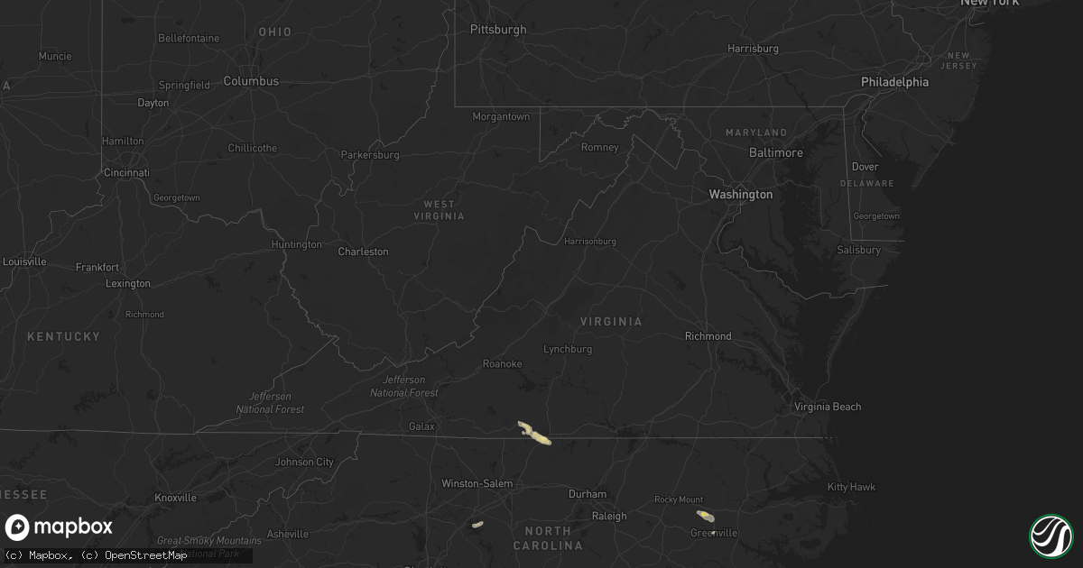
Hail Map in Virginia on July 2, 2016
Get this storm
July 2 map
$229
one time, instant access
Download today. No call, no setup
Keep the $229
Bought the map and want the full workflow? Apply the entire $229 to a subscription within 7 days. None of it is wasted.
Every map, not just this one
This buys you this map. Subscription and you get every map we run, in the markets you choose from a few cities to whole states to nationwide. Plus real-time alerts the moment a storm fires.
Contact data
Name, contact info, occupancy, even credit band for addresses in the footprint. You go from where it hit to who to call.
Become the source they trust
Unlimited branding weather history reports on demand. You already have the documented answer ready for the property owner, and you are the one who showed up with it.
Property data and RoofTrace estimates
Pull up any address you have got, its value and the exact code rules for that jurisdiction, straight from One Click Code. Then RoofTrace estimates the squares, pitch, and roof value, priced the way you price.
Storm reports in Virginia
Virginia
| Date | Description |
|---|---|
| 07/01/201611:30 PM CDT | Henry county 911 center reports that a tree was down on a power line in the 4850 block of mitchell road. |
| 07/01/201610:53 PM CDT | Henry county 911 reports that a tree was down on a power line at 463 holland court road off mountain-valley road. The power line was arcing. |
| 07/01/201610:49 PM CDT | Henry county 911 center reports a tree down on a vehicle in the 2350 block of sandy river road. Time estimated from radar. |
| 07/01/201610:29 PM CDT | Henry county 911 center reports back that from 15 to 20 large trees were down across dyers creek road. The road was completely blocked and it will take some time to cle |
| 07/01/20169:36 PM CDT | Tree down on hitesburg road. |
| 07/01/20169:14 PM CDT | Two trees were blown down near the intersection of routes 683 and 680. |
| 07/01/20169:04 PM CDT | Tree down on east hyco road. |
All States Impacted by Hail Map on July 2, 2016
Cities Impacted by Hail Map on July 2, 2016
- Olmitz, KS
- Hoisington, KS
- Claflin, KS
- Rush Center, KS
- Pawnee Rock, KS
- Bison, KS
- Otis, KS
- Great Bend, KS
- Albert, KS
- Nekoma, KS
- La Crosse, KS
- Keyes, OK
- Goodwell, OK
- Winifred, MT
- Upton, WY
- Moorcroft, WY
- Sundance, WY
- Aspermont, TX
- Ellis, KS
- Lexington, NC
- Syracuse, KS
- Holly, CO
- Jetmore, KS
- Lumberton, NC
- Pembroke, NC
- Forgan, OK
- Hardesty, OK
- Hooker, OK
- Beaver, OK
- Turpin, OK
- Balko, OK
- Roundup, MT
- Ness City, KS
- Mountain Home, AR
- Spivey, KS
- Hays, KS
- Lockney, TX
- Dighton, KS
- El Dorado, KS
- Leon, KS
- Glendive, MT
- Dodge City, KS
- Kingman, KS
- Tarboro, NC
- Bethel, NC
- Macclesfield, NC
- Greenville, NC
- Mcpherson, KS
- Beeler, KS
- Garden City, KS
- Cimarron, KS
- Ingalls, KS
- Cohagen, MT
- Lindsborg, KS
- Chanute, KS
- Humboldt, KS
- Elsmore, KS
- La Harpe, KS
- Iola, KS
- Rosebud, MT
- Forsyth, MT
- Quitaque, TX
- Turkey, TX
- Silverton, TX
- Hays, MT
- Rose Hill, KS
- Douglass, KS
- Fall River, KS
- Severy, KS
- Lyons, KS
- Hysham, MT
- Ransom, KS
- Smyrna Mills, ME
- Toronto, KS
- Clearwater, KS
- Eureka, KS
- Winnett, MT
- Terry, MT
- Boise City, OK
- Plains, KS
- Woodward, OK
- Fowler, KS
- Brownell, KS
- Mooreland, OK
- Fort Supply, OK
- Larned, KS
- Neosho Falls, KS
- Yates Center, KS
- Piqua, KS
- Garland, NC
- Wichita, KS
- Geneseo, KS
- Bushton, KS
- Holyrood, KS
- Ellinwood, KS
- Chase, KS
- Little River, KS
- Harlem, MT
- Childress, TX
- Satanta, KS
- Sublette, KS
- Ensign, KS
- Turner, MT
- McCracken, KS
- Okeechobee, FL
- Viola, KS
- Conway Springs, KS
- Mcconnell Afb, KS
- Kechi, KS
- Mulvane, KS
- Greenwich, KS
- Andover, KS
- Benton, KS
- Goddard, KS
- Augusta, KS
- Peck, KS
- Valley Center, KS
- Colwich, KS
- Derby, KS
- Maize, KS
- Haysville, KS
- Towanda, KS
- Volborg, MT
- Ismay, MT
- Minneola, KS
- Atlanta, KS
- Fredonia, KS
- Hugoton, KS
- Ulysses, KS
- Hogeland, MT
- Musselshell, MT
- Nipton, CA
- Meade, KS
- Uniontown, KS
- Moran, KS
- Piedmont, KS
- Buffalo, KS
- Savonburg, KS
- Benedict, KS
- Williams, AZ
- Ash Fork, AZ
- Moundridge, KS
- Canton, KS
- Sheridan Lake, CO
- Kinsey, MT
- Pelham, NC
- Providence, NC
- Danville, VA
- Cascade, VA
- Cunningham, KS
- Arlington, KS
- Turon, KS
- Worden, MT
- Marion, KS
- Olsburg, KS
- Hudson, KS
- Zenda, KS
- Saint Pauls, NC
- Florence, KS
- Windom, KS
- Garden Plain, KS
- Cheney, KS
- Andale, KS
- Ruffin, NC
- Blanch, NC
- Axton, VA
- Yanceyville, NC
- Malta, MT
- Huntington, UT
- Booker, TX
- Labelle, FL
- Justiceburg, TX
- Kendall, KS
- Martinsville, VA
- Liberal, KS
- Englewood, KS
- Kismet, KS
- Virgil, KS
- Newton Grove, NC
- Lakin, KS
- Cedar Point, KS
- Sebastian, FL
- Rozel, KS
- Lorraine, KS
- Red Springs, NC
- Shannon, NC
- Dryden, TX
- Rosalia, KS
- Port Orange, FL
- Galva, KS
- Seiling, OK
- Newton, KS
- Hesston, KS
- Goessel, KS
- Sand Springs, MT
- Paducah, TX
- Inman, KS
- Peabody, KS
- Burns, KS
- Houlton, ME


