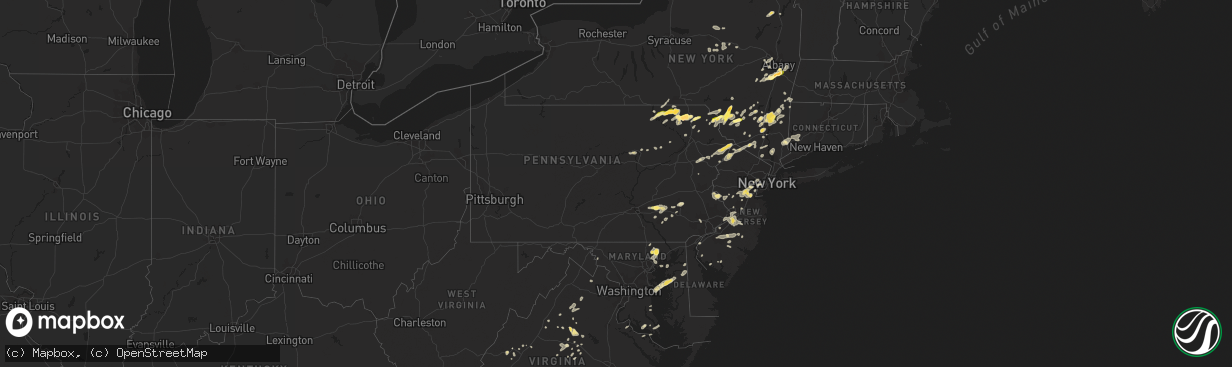
Hail Map in Pennsylvania on July 2, 2014
The weather event in Pennsylvania on July 2, 2014 includes Hail map. 24 states and 788 cities were impacted and suffered possible damage. The total estimated number of properties impacted is 7,420.
Want more than just the map?
Turn this storm into a full workflow.
- Owner + property data so you know who to knock
- OnDemand branded weather history reports to win the "did we even have hail?" argument
- RoofTrace estimate so reps stop guessing numbers at the door
Bought this map? Upgrade within 7 days and we'll credit the $230. (10-15 min setup call)
Hail
7,420
Estimated number of impacted properties by a 1.00" hail or larger597
Estimated number of impacted properties by a 1.75" hail or larger0
Estimated number of impacted properties by a 2.50" hail or largerStorm reports in Pennsylvania
Pennsylvania
| Date | Description |
|---|---|
| 07/02/20146:25 PM CDT | Trees and wires down along potters pond drive in phoenixville. |
| 07/02/20143:48 PM CDT | Trees down |
| 07/02/20143:07 PM CDT | Trees down along ace lane. |
| 07/02/20142:48 PM CDT | A local report indicates 1.25 inch wind near MILFORD |
| 07/02/20142:27 PM CDT | Trees blown down wind gusts estimated 50-60 mph. |
| 07/02/20142:27 PM CDT | Trees blown down wind gusts estimated 50-60 mph. |
| 07/02/20141:02 PM CDT | Tree down on car along rte 322 |
| 07/02/201412:55 PM CDT | Trees down between cornwall and kleinfeltersville |
| 07/02/201412:50 PM CDT | Tree uprooted along rte 419 |
| 07/02/201412:45 PM CDT | Damage to corn and wheat fields |
| 07/02/201412:37 PM CDT | Trees down on evergreen road |
| 07/02/201412:30 PM CDT | Trees down on camp levine road |
| 07/02/201411:57 AM CDT | Trees and wires down |
| 07/02/201411:50 AM CDT | Trees and wires down |
| 07/02/201411:30 AM CDT | Trees and wires down |
| 07/02/201411:20 AM CDT | A local report indicates 2.00 inch wind near BROOKLYN |
| 07/02/201410:36 AM CDT | Widespread hail damage. Relayed by wbng tv. |
| 07/02/201410:35 AM CDT | A local report indicates 1.75 inch wind near FRIENDSVILLE |
| 07/02/201410:34 AM CDT | A local report indicates 1.00 inch wind near WARREN CENTER |
| 07/02/20149:47 AM CDT | Tree down on vehicle |
| 07/01/20147:20 PM CDT | Damage to sail boats reported as the storm moved over the delaware river. |
| 07/01/20147:00 PM CDT | Trees and wires down at several locations across northeast philadelphia. |
All States Impacted by Hail Map on July 2, 2014
Cities Impacted by Hail Map on July 2, 2014
- Jemez Springs, NM
- Charleston, MS
- Ravena, NY
- Jena, LA
- Jeffersonville, NY
- Youngsville, NY
- Swan Lake, NY
- Livingston Manor, NY
- White Sulphur Springs, NY
- Woodbourne, NY
- Woodridge, NY
- Fallsburg, NY
- Hurleyville, NY
- South Fallsburg, NY
- Monticello, NY
- Bingham, ME
- Abbot, ME
- Dalton, PA
- Clarks Summit, PA
- Billingsley, AL
- Long Pond, PA
- Pocono Pines, PA
- Reading, PA
- Vienna, ME
- New Sharon, ME
- Linden, AL
- Jaffrey, NH
- Isola, MS
- Tishomingo, OK
- Milburn, OK
- Winnfield, LA
- Palmyra, VA
- Scottsville, VA
- Vaiden, MS
- Clanton, AL
- Greenville, NY
- Westerlo, NY
- Bronson, TX
- Maplesville, AL
- Randolph, AL
- Vidalia, LA
- Natchez, MS
- Columbia, VA
- Bremo Bluff, VA
- Seymour, TX
- Oakdale, LA
- Graham, TX
- Kiln, MS
- Mayersville, MS
- East Brunswick, NJ
- Cranford, NJ
- Dunellen, NJ
- Somerset, NJ
- New Brunswick, NJ
- Edison, NJ
- Sayreville, NJ
- Clark, NJ
- Middlesex, NJ
- South Plainfield, NJ
- Piscataway, NJ
- Plainfield, NJ
- Westfield, NJ
- Garwood, NJ
- Highland Park, NJ
- Keasbey, NJ
- Scotch Plains, NJ
- Linden, NJ
- Schodack Landing, NY
- Coeymans, NY
- Selkirk, NY
- Castleton On Hudson, NY
- West Coxsackie, NY
- Spring Valley, NY
- Pomona, NY
- Sloatsburg, NY
- Monsey, NY
- Suffern, NY
- Ville Platte, LA
- Converse, LA
- Pelican, LA
- Mansfield, LA
- Penn Laird, VA
- McGaheysville, VA
- Stevensville, MD
- Farmington, ME
- Ulster, PA
- Fallston, MD
- Bel Air, MD
- Hydes, MD
- Forest Hill, MD
- Hollandale, MS
- Newton, NJ
- Demopolis, AL
- Springfield, LA
- Holliday, TX
- Ruston, LA
- Eastland, TX
- Tillatoba, MS
- Cascilla, MS
- Scobey, MS
- Towanda, PA
- Florida, NY
- Goshen, NY
- Warwick, NY
- Chester, NY
- Eastpoint, FL
- New Castle, VA
- Montrose, PA
- Hyde Park, NY
- Rhinebeck, NY
- Ulster Park, NY
- Pleasant Valley, NY
- Poughkeepsie, NY
- New Paltz, NY
- Highland, NY
- Salt Point, NY
- Staatsburg, NY
- Jay, ME
- Burlington, NJ
- Fairless Hills, PA
- Jobstown, NJ
- Bordentown, NJ
- Columbus, NJ
- Roebling, NJ
- Mount Holly, NJ
- Florence, NJ
- Morrisville, PA
- West Forks, ME
- Shirley Mills, ME
- Monson, ME
- Santo, TX
- Gordon, TX
- Elm Grove, LA
- Ringgold, LA
- Terre Hill, PA
- New Holland, PA
- Ephrata, PA
- East Earl, PA
- Tchula, MS
- Radiant, VA
- Madison, VA
- Carbondale, PA
- Phil Campbell, AL
- Pineville, LA
- Alexandria, LA
- Lake Como, PA
- Equinunk, PA
- Long Eddy, NY
- Hankins, NY
- Roscoe, NY
- Hancock, NY
- Slingerlands, NY
- Voorheesville, NY
- Delmar, NY
- Glenmora, LA
- Louisa, VA
- Walden, NY
- Wallkill, NY
- Marlboro, NY
- Newburgh, NY
- Gordonsville, VA
- Weaverville, NC
- Asheville, NC
- Sturgis, MS
- Louisville, MS
- Chester, MD
- Candia, NH
- Ellenville, NY
- Lebanon, PA
- Barboursville, VA
- Somerset, VA
- Croton On Hudson, NY
- Cortlandt Manor, NY
- Poland, NY
- Remsen, NY
- Utica, NY
- Newport, NY
- Barneveld, NY
- Cold Brook, NY
- Muncy, PA
- Montgomery, PA
- Williamsport, PA
- Merkel, TX
- Newmanstown, PA
- Stevens, PA
- Lititz, PA
- Westfield, ME
- Bridgewater, ME
- Blaine, ME
- Erwinna, PA
- Ottsville, PA
- Stockton, NJ
- Upper Black Eddy, PA
- Pipersville, PA
- Frenchtown, NJ
- Raleigh, MS
- North Branch, NY
- Hortonville, NY
- Damascus, PA
- Callicoon, NY
- Kearny, NJ
- Irvington, NJ
- Newark, NJ
- Harrison, NJ
- East Orange, NJ
- Muncy Valley, PA
- Benton, PA
- Woodville, VA
- Sperryville, VA
- Parksville, NY
- Liberty, NY
- Silver City, NM
- Union, NJ
- Vauxhall, NJ
- Maplewood, NJ
- Pocono Summit, PA
- Berwick, LA
- Warren Center, PA
- Little Meadows, PA
- Wyalusing, PA
- Friendsville, PA
- Le Raysville, PA
- Rome, PA
- Mount Hermon, LA
- West Jefferson, NC
- Jefferson, NC
- King George, VA
- Stephenville, TX
- Mingus, TX
- Cochecton, NY
- Lake Huntington, NY
- Honesdale, PA
- Bethel, NY
- Loch Sheldrake, NY
- Ferndale, NY
- Beach Lake, PA
- Milanville, PA
- Tyler Hill, PA
- Kenoza Lake, NY
- South River, NJ
- Colonia, NJ
- North Brunswick, NJ
- Parlin, NJ
- Fanwood, NJ
- Milltown, NJ
- South Bound Brook, NJ
- Manville, NJ
- Bound Brook, NJ
- Hillsborough, NJ
- Fords, NJ
- Bridgewater, NJ
- Windthorst, TX
- Colfax, LA
- Dry Prong, LA
- Woodville, TX
- Center, TX
- Kingsley, PA
- New Milford, PA
- Clyde, TX
- Huntsville, TX
- Charlottesville, VA
- Troy, VA
- Knott, TX
- Yankeetown, FL
- Inglis, FL
- Suncook, NH
- Deerfield, NH
- Houston, MS
- Woodland, MS
- Baldwin, MD
- Weed, CA
- Chiloquin, OR
- Beaumont, MS
- Wardensville, WV
- Thompson, PA
- Herrick Center, PA
- Union Dale, PA
- Starkville, MS
- Ackerman, MS
- Villa Grove, CO
- Santa Fe, NM
- White Rock, NM
- Los Alamos, NM
- Cubero, NM
- Surprise, NY
- Earlton, NY
- Alcove, NY
- Coeymans Hollow, NY
- Hannacroix, NY
- Nassau, NY
- Rose Hill, MS
- Kunkletown, PA
- Clifton Forge, VA
- Zavalla, TX
- Huntington, TX
- Lawley, AL
- Harrington, DE
- Millville, NJ
- Pleasant Mount, PA
- Lucedale, MS
- Lexington, VA
- Prairie, MS
- Ancramdale, NY
- Stanfordville, NY
- Pine Plains, NY
- Ancram, NY
- Berlin, NJ
- West Berlin, NJ
- Carthage, TX
- Dulac, LA
- Flemington, NJ
- Ringoes, NJ
- Three Rivers, TX
- Yreka, CA
- Gazelle, CA
- New Windsor, NY
- Bridgewater, CT
- Southbury, CT
- Marksville, LA
- Hessmer, LA
- Mansura, LA
- Lecompte, LA
- Waterford Works, NJ
- Clinton Corners, NY
- Dingmans Ferry, PA
- Bushkill, PA
- Montague, NJ
- Canadensis, PA
- Milford, PA
- Monticello, FL
- Mohnton, PA
- Ossining, NY
- Yorktown Heights, NY
- Crawfordville, FL
- Richfield Springs, NY
- Jordanville, NY
- Mohawk, NY
- Little Falls, NY
- Shreveport, LA
- Narvon, PA
- Susquehanna, PA
- Harford, PA
- Springville, PA
- Center Ossipee, NH
- Freedom, NH
- Belzoni, MS
- Sussex, NJ
- Macon, MS
- Holden, LA
- Amite, LA
- West Winfield, NY
- Bridgewater, NY
- Waterville, NY
- Cassville, NY
- Moran, TX
- Cruger, MS
- Lexington, MS
- Centreville, MD
- Marshall, TX
- De Berry, TX
- Clintondale, NY
- Modena, NY
- Gardiner, NY
- Nottingham, MD
- Glen Arm, MD
- White Marsh, MD
- Kingsville, MD
- Fork, MD
- Middle River, MD
- Perry Hall, MD
- Rosedale, MD
- Jarrettsville, MD
- Phoenix, MD
- Monkton, MD
- Kearneysville, WV
- Prattville, AL
- Cisco, TX
- Huntingtown, MD
- Panacea, FL
- Etlan, VA
- Boston, VA
- Castleton, VA
- Breckenridge, TX
- Harmony, ME
- Guilford, ME
- Jermyn, PA
- Forest City, PA
- Noxen, PA
- Kerhonkson, NY
- Accord, NY
- Greensburg, LA
- Bethel, ME
- Tarzan, TX
- Lexington Park, MD
- Patuxent River, MD
- Throckmorton, TX
- Houma, LA
- Schriever, LA
- Smyrna, DE
- Clayton, DE
- Jefferson, TX
- Piney Point, MD
- Tallahassee, FL
- Plains, TX
- Transylvania, LA
- Lake Providence, LA
- South Bend, TX
- Upperville, VA
- Bluemont, VA
- Round Hill, VA
- Kentwood, LA
- Sopchoppy, FL
- Stone Ridge, NY
- Olivebridge, NY
- Daleville, MS
- Raphine, VA
- Bayonne, NJ
- Elizabeth, NJ
- Elizabethport, NJ
- Old Town, FL
- Haskell, TX
- Brewster, NY
- Cresco, PA
- Morton, MS
- Tutwiler, MS
- Pine Island, NY
- Westtown, NY
- Monroe, NY
- Marlton, NJ
- Medford, NJ
- Denver, PA
- Robesonia, PA
- Annville, PA
- Myerstown, PA
- Schaefferstown, PA
- Palmyra, PA
- Kilmichael, MS
- Temple, PA
- Oley, PA
- Jonesboro, LA
- Stamford, TX
- Baskin, LA
- Winnsboro, LA
- Livingston, LA
- Walker, LA
- Wetumpka, AL
- Hughesville, PA
- Unityville, PA
- Worton, MD
- Chestertown, MD
- Lamesa, TX
- Townsend, DE
- North Salem, NY
- Ridgefield, CT
- Danbury, CT
- Carrabelle, FL
- Grasonville, MD
- Rock Hall, MD
- Queenstown, MD
- Deridder, LA
- Pocono Lake, PA
- Swiftwater, PA
- Blakeslee, PA
- Mount Pocono, PA
- Scotrun, PA
- Layton, NJ
- Branchville, NJ
- Columbia, NJ
- Craryville, NY
- Hillsdale, NY
- Freehold, NY
- New Baltimore, NY
- Annapolis, MD
- Centreville, MS
- Shepherdstown, WV
- Shenandoah Junction, WV
- Averill Park, NY
- Sand Lake, NY
- Abilene, TX
- Sandy Level, VA
- Chatham, VA
- Pittsville, VA
- Millbrook, NY
- Wassaic, NY
- Brierfield, AL
- Centreville, AL
- Berne, NY
- East Berne, NY
- Aberdeen, MS
- West Point, MS
- Huddleston, VA
- Moneta, VA
- Glen Allan, MS
- Chatham, MS
- Gary, TX
- Tenaha, TX
- Rockbridge Baths, VA
- Points, WV
- Henryville, PA
- Wysox, PA
- Houston, TX
- Hickory, MS
- Chunky, MS
- Johnsburg, NY
- Athol, NY
- Joaquin, TX
- Coushatta, LA
- Leonardtown, MD
- Zwolle, LA
- Akron, AL
- York, AL
- Bow, NH
- Glen Wild, NY
- Rock Hill, NY
- Penhook, VA
- Montague, CA
- Drew, MS
- Lagrangeville, NY
- Verbank, NY
- Dover Plains, NY
- Rumford, ME
- Fitzwilliam, NH
- Troy, NH
- Marion Junction, AL
- Uniontown, AL
- Keswick, VA
- Kents Store, VA
- Keedysville, MD
- Sharpsburg, MD
- Penns Grove, NJ
- East Greenbush, NY
- White Hall, MD
- Kintnersville, PA
- Baker, WV
- Lost City, WV
- Richton, MS
- Zephyrhills, FL
- Newtown, CT
- Brookfield, CT
- Roxbury, CT
- New Fairfield, CT
- Sandy Hook, CT
- Jonesville, LA
- Karnack, TX
- Middletown, NY
- Winchester, NH
- Bearsville, NY
- Clinton, LA
- Stanardsville, VA
- Ruckersville, VA
- Rolling Fork, MS
- Cranbury, NJ
- Hightstown, NJ
- Brackney, PA
- Pitkin, LA
- High Falls, NY
- Pine Grove, LA
- Denham Springs, LA
- Franklinton, LA
- Wolfeboro, NH
- Mirror Lake, NH
- Moultonborough, NH
- Center Tuftonboro, NH
- Hop Bottom, PA
- Meshoppen, PA
- Laceyville, PA
- Enterprise, MS
- Kiamesha Lake, NY
- Greenfield Park, NY
- Smallwood, NY
- Mongaup Valley, NY
- Harris, NY
- White Lake, NY
- Moffat, CO
- Chatsworth, NJ
- Marion, AL
- Slaughter, LA
- Margaretville, NY
- Andes, NY
- Stony Creek, NY
- Galena, MD
- Massey, MD
- Holcomb, MS
- Martinsville, VA
- Lancaster, PA
- Leola, PA
- Bird In Hand, PA
- Peru, ME
- Dixfield, ME
- Wrightsville, GA
- Middletown, DE
- Belmont, LA
- Macdoel, CA
- Carteret, NJ
- Port Reading, NJ
- Sewaren, NJ
- Avenel, NJ
- Immokalee, FL
- Clewiston, FL
- Altamont, NY
- Marydel, MD
- Barclay, MD
- Sudlersville, MD
- Church Hill, MD
- Warrensburg, NY
- South Gibson, PA
- Trout, LA
- Choudrant, LA
- Bostic, NC
- Washington, VA
- Flint Hill, VA
- Amissville, VA
- Grahamsville, NY
- Napanoch, NY
- Vardaman, MS
- Mars Hill, ME
- Bryant Pond, ME
- Apalachin, NY
- Endicott, NY
- Esmont, VA
- Howardsville, VA
- Anson, TX
- Hawley, TX
- Newbern, AL
- Cheneyville, LA
- Brooksville, MS
- Hammonton, NJ
- Beacon, NY
- Goree, TX
- Woodville, MS
- Monmouth Junction, NJ
- Kendall Park, NJ
- Lettsworth, LA
- Moreauville, LA
- Simmesport, LA
- Miami, FL
- Albany, TX
- Rio, WV
- Shanks, WV
- Romney, WV
- Wurtsboro, NY
- Bloomingburg, NY
- East Durham, NY
- South Bethlehem, NY
- Cornwallville, NY
- Paw Paw, WV
- Lake George, NY
- French Camp, MS
- East Nassau, NY
- Lawrence Township, NJ
- Gunpowder, MD
- De Kalb, MS
- Cairo, GA
- Greensboro, AL
- Neversink, NY
- Peterborough, NH
- Elkton, VA
- Palo Pinto, TX
- Labelle, FL
- Free Union, VA
- Picayune, MS
- Fort Plain, NY
- Perry, FL
- Montross, VA
- Woodson, TX
- Waurika, OK
- Jemison, AL
- Cedarville, NJ
- Greenville, MS
- Tye, TX
- Owego, NY
- Island Falls, ME
- East Stroudsburg, PA
- Bernardston, MA
- Northfield, MA
- Vernon, VT
- Pollock, LA
- Mexico, ME
- Hanover, ME
- Livingston, AL
- Carmel, NY
- Croton Falls, NY
- Greenwood, DE
- Vincentown, NJ
- Gibson, LA
- Theriot, LA
- Jasper, TX
- Harrison, GA
- Tennille, GA
- Minter City, MS
- Boston, GA
- Sandy Hook, MS
- Prince Frederick, MD
- Wernersville, PA
- Reinholds, PA
- Delhi, LA
- Cookstown, NJ
- Langhorne, PA
- Wrightstown, NJ
- Bristol, PA
- Pemberton, NJ
- Bensalem, PA
- Chesterfield, NJ
- Trenton, NJ
- Croydon, PA
- Levittown, PA
- Joint Base Mdl, NJ
- Stevensville, PA
- Avenue, MD
- Abell, MD
- Manheim, PA
- Martinsburg, WV
- Shelburne Falls, MA
- Conway, MA
- Stanton, AL
- Arlington, AL
- Magnolia, AL
- Thomaston, AL
- Lakeville, CT
- Millerton, NY
- Hammond, LA
- Albany, LA
- Gibbsboro, NJ
- Stratford, NJ
- Atco, NJ
- Clementon, NJ
- Sewell, NJ
- Voorhees, NJ
- Blackwood, NJ
- Grenloch, NJ
- Sicklerville, NJ
- Tickfaw, LA
- Independence, LA
- Poplarville, MS
- Hamilton, AL
- Ilion, NY
- Hackleburg, AL
- Angola, LA
- Katy, TX
- Coffeeville, MS
- Saint Francisville, LA
- Plaucheville, LA
- Montgomery, AL
- California, MD
- Singer, LA
- Pride, LA
- Chesapeake Beach, MD
- Salem, NJ
- Norwood, LA
- Wilson, LA
- Copake, NY
- Copake Falls, NY
- South Egremont, MA
- Newellton, LA
- Fort Montgomery, NY
- Southfields, NY
- Garrison, NY
- Highland Falls, NY
- Bear Mountain, NY
- West Ossipee, NH
- Effingham, NH
- Kingston, NY
- Cottekill, NY
- Windham, NY
- Durham, NY
- Preston Hollow, NY
- Merchantville, NJ
- Maple Shade, NJ
- Cherry Hill, NJ
- Berwyn, PA
- Phoenixville, PA
- Malvern, PA
- Wayne, PA
- Devon, PA
- King Of Prussia, PA
- Sugar Land, TX
- Grottoes, VA
- Gallion, AL
- Electra, TX
- Fork Union, VA
- Augusta, WV
- Boiceville, NY
- West Shokan, NY
- Shokan, NY
- Albany, NY
- Guilderland, NY
- Schenectady, NY
- Alexander, NC


