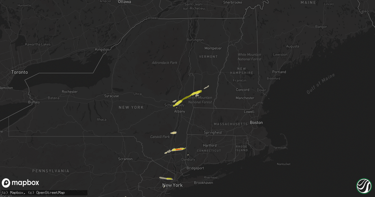
Hail Map on July 1, 2016
Get this storm
July 1 map
$229
one time, instant access
Download today. No call, no setup
Keep the $229
Bought the map and want the full workflow? Apply the entire $229 to a subscription within 7 days. None of it is wasted.
Every map, not just this one
This buys you this map. Subscription and you get every map we run, in the markets you choose from a few cities to whole states to nationwide. Plus real-time alerts the moment a storm fires.
Contact data
Name, contact info, occupancy, even credit band for addresses in the footprint. You go from where it hit to who to call.
Become the source they trust
Unlimited branding weather history reports on demand. You already have the documented answer ready for the property owner, and you are the one who showed up with it.
Property data and RoofTrace estimates
Pull up any address you have got, its value and the exact code rules for that jurisdiction, straight from One Click Code. Then RoofTrace estimates the squares, pitch, and roof value, priced the way you price.
States Impacted by Hail Map on July 1, 2016
Storm reports
California
| Date | Description |
|---|---|
| 07/01/20166:30 PM CDT | Local business reported hail dime to quarter sized on veterans parkway. Report relayed via social media. |
| 07/01/20166:25 PM CDT | Quarter to golf ball sized hail at intersection of rimrock rd and h st. Also reports of small branches down from thunderstorm wind gusts. |
| 07/01/20163:56 AM CDT | A local report indicates 59 MPH wind near 5 S NEEDLES |
| 07/01/201612:00 AM CDT | Report of at least one power pole down between death valley junction and furnace creek due to thunderstorm wind. Power was knocked out in the furnace creek area. |
New Hampshire
| Date | Description |
|---|---|
| 06/30/20168:00 PM CDT | Branches and powerlines down. Power outages. |
| 06/30/20167:30 PM CDT | Trees and wires down |
Arizona
| Date | Description |
|---|---|
| 07/01/20163:35 AM CDT | Severe winds occurred from 115 to 135 am. |
| 07/01/20163:30 AM CDT | Several trees down in mohave valley with minor structural damage also reported. Several photos posted to social media. Onset time based on social media posts. Duration |
| 07/01/20163:30 AM CDT | Nine power poles down in bullhead city and mohave valley with scattered power outages throughout the area. Timing and duration estimated based on radar. The duration of |
| 06/30/20169:14 PM CDT | Gila bend af |
New Jersey
| Date | Description |
|---|---|
| 07/01/20163:40 PM CDT | Tree uprooted |
| 07/01/20163:00 PM CDT | A local report indicates 1.25 inch wind near EASTAMPTON TWP |
| 07/01/20162:55 PM CDT | Large tree uprooted onto 3 cars and home. |
| 07/01/20162:53 PM CDT | A local report indicates 1.00 inch wind near LUMBERTON |
| 07/01/20162:50 PM CDT | Multiple reports of trees and power lines down |
| 07/01/20162:50 PM CDT | Multiple reports of trees and powerlines down |
| 07/01/20162:48 PM CDT | A local report indicates 1.00 inch wind near HAINESPORT |
| 07/01/20162:45 PM CDT | Tree down |
| 07/01/20162:40 PM CDT | Small trees down |
| 07/01/20162:40 PM CDT | Power lines down |
| 07/01/20162:15 PM CDT | Trees down and telephone poles snapped in freehold borough |
| 07/01/20162:00 PM CDT | Tree limbs down. |
| 07/01/20161:55 PM CDT | Trees down. |
| 06/30/20168:12 PM CDT | Tree down on house on andover drive |
| 06/30/20168:09 PM CDT | 1 inch hail reported |
Maryland
| Date | Description |
|---|---|
| 07/01/20165:24 PM CDT | A local report indicates 1.00 inch wind near 1 SSE BOWIE |
| 07/01/20164:54 PM CDT | Trees down at intersection of garland and mountain road |
| 07/01/20164:51 PM CDT | Trees down at the intersection of woods road and 11th street |
| 07/01/20164:46 PM CDT | Trees down at intersection of truck house road and swaying oak court |
| 07/01/20164:43 PM CDT | Trees down at the intersection of catherine ave and harlem ave |
| 07/01/20163:35 PM CDT | Numerous trees down. Power lines downed also. |
| 07/01/201610:01 AM CDT | Numerous trees and power lines down around crisfield. |
| 07/01/20169:59 AM CDT | Crisfield coast guard station |
| 06/30/20169:42 PM CDT | Tree down on power lines at walnut ave and birch ave |
Colorado
| Date | Description |
|---|---|
| 07/01/20164:05 PM CDT | Trees stripped of leaves. Standing water in fields. Cedarwood road flooded to several inches. |
| 07/01/20163:25 PM CDT | A local report indicates 1.50 inch wind near 1 E CASTLE ROCK |
| 07/01/20163:18 PM CDT | A local report indicates 2.00 inch wind near 2 E CASTLE ROCK |
| 07/01/20163:16 PM CDT | A local report indicates 1.00 inch wind near 3 NNE CASTLE ROCK |
| 06/30/201610:14 PM CDT | A local report indicates 60 MPH wind near WALSH |
Wyoming
| Date | Description |
|---|---|
| 06/30/20167:45 PM CDT | Stucco siding on north side of house was blown off. Window screens were blown off. Minor tree damage |
New York
| Date | Description |
|---|---|
| 07/01/20166:14 PM CDT | Reports of trees down |
| 07/01/20166:05 PM CDT | Multiple reports of trees and power lines down |
| 07/01/20165:37 PM CDT | Tree down that caught the corner of a house and several large limbs down. Time estimated from radar |
| 07/01/20165:28 PM CDT | Tree onto a house meredith street rochester |
| 07/01/20164:19 PM CDT | Tree down on house at 93 bay st... Wires also down. |
| 07/01/20164:07 PM CDT | Tree and wires down at intersection of south cambridge rd and beadle hill rd. |
| 07/01/20164:00 PM CDT | Multiple trees and wires down |
| 07/01/20163:45 PM CDT | Trees and wires down. |
| 07/01/20163:42 PM CDT | Quarter size hail. |
| 07/01/20163:39 PM CDT | Quarter size hail. |
| 07/01/20163:25 PM CDT | Multiple trees down on union st. |
| 07/01/20163:20 PM CDT | Downtown schenectady |
| 07/01/20163:20 PM CDT | Downtown schenectady |
| 07/01/20163:17 PM CDT | Large tree limbs down on union st. |
| 07/01/20163:17 PM CDT | Observed damage indicates a microburst. Estimated winds 80-90 mph. |
| 07/01/20163:10 PM CDT | Multiple trees and wires down |
| 07/01/20162:47 PM CDT | Trees were downed and across the southbound taconic state parkway between stringham road and arthursburg road |
| 07/01/20162:45 PM CDT | Quarter size hail |
| 07/01/20162:45 PM CDT | Multiple trees down. |
| 07/01/20162:45 PM CDT | Trees down |
| 07/01/20162:45 PM CDT | Tree limbs down across cramer road with debris across lauer road |
| 07/01/20162:33 PM CDT | Trees and wires down |
| 07/01/20162:33 PM CDT | Trees and wires down |
| 07/01/20162:30 PM CDT | Trees down |
| 07/01/20162:25 PM CDT | Trees down |
| 07/01/20162:13 PM CDT | Trees and wires down. |
| 07/01/20162:04 PM CDT | Trees and wires down |
| 07/01/20161:42 PM CDT | Trees and wires down |
| 06/30/201610:46 PM CDT | Trees down... Some on homes |
| 06/30/201610:45 PM CDT | Mobile home roof blown off by wind. Trees and wires down and across road. |
| 06/30/201610:44 PM CDT | Trees down... Some on homes |
| 06/30/201610:39 PM CDT | Trees and power lines down |
| 06/30/20167:20 PM CDT | Trees down. |
Massachusetts
| Date | Description |
|---|---|
| 06/30/201610:27 PM CDT | Wires down on canal road. |
| 06/30/20168:54 PM CDT | Tree down on a house on rockingham street |
Arkansas
| Date | Description |
|---|---|
| 07/01/20162:40 PM CDT | Damage to a large tree. Power out across a large portion of town. Time estimated via radar. |
Pennsylvania
| Date | Description |
|---|---|
| 07/01/20161:41 PM CDT | Trees down across greenfield road in east lampeter twp. |
| 07/01/20161:40 PM CDT | Trees down. Time estimated from radar. |
| 07/01/20161:30 PM CDT | Trees down. Time estimated by radar. |
Virginia
| Date | Description |
|---|---|
| 07/01/20166:50 PM CDT | Numerous trees down west of 360. |
| 07/01/20166:35 PM CDT | Numerous trees down in king william county from mangohick to aylett. |
| 07/01/20166:10 PM CDT | Multiple reports of trees down. |
| 07/01/20166:05 PM CDT | Strong wind caused huge branches to break off trees and fly into house |
| 07/01/20165:52 PM CDT | Numerous trees down in western caroline county. |
| 07/01/20165:38 PM CDT | Large tree down across the road at intersection of sassafras lane and blanton road |
| 07/01/20165:37 PM CDT | Large tree down across road and power lines at intersection of mt olive road and partlow road |
| 07/01/20165:30 PM CDT | Several trees down throughout the city. |
| 07/01/20165:15 PM CDT | One tree down on trailer along kentuck road. |
| 07/01/20165:07 PM CDT | Power line down. |
| 07/01/20164:01 PM CDT | Tree down near route 20 and 675 |
| 07/01/20164:00 PM CDT | Portion of tree fell on power lines |
Nevada
| Date | Description |
|---|---|
| 07/01/20161:45 AM CDT | Time estimated from radar. |
| 07/01/201612:30 AM CDT | Blowing dust also reported. |
| 07/01/201612:25 AM CDT | Several reports of downed trees and power lines from crystal road through the central portions of pahrump. Awnings were pulled from residences and structures into power |
| 06/30/201611:06 PM CDT | Asos station desert rock airport /dra/. |
| 06/30/201610:30 PM CDT | Mesonet station nnss - a06 /a06ae/. |
| 06/30/20168:49 PM CDT | A local report indicates 59 MPH wind near TONOPAH AIRPORT |
Vermont
| Date | Description |
|---|---|
| 07/01/20165:40 PM CDT | Trees and wires down. |
| 07/01/20164:57 PM CDT | Several trees and wires down. On river road |
| 07/01/20164:50 PM CDT | Numerous large limbs down. |
| 07/01/20164:50 PM CDT | A local report indicates 1.00 inch wind near MANCHESTER |
Connecticut
| Date | Description |
|---|---|
| 07/01/20164:00 PM CDT | Trees down on a house. |
Cities Impacted by Hail Map on July 1, 2016
- Haswell, CO
- Shawnee, WY
- Arlington, VT
- Shushan, NY
- Clifton, NJ
- Passaic, NJ
- Wayne, NJ
- Totowa, NJ
- Little Falls, NJ
- Friendship, MD
- North Beach, MD
- Tracys Landing, MD
- Las Animas, CO
- La Junta, CO
- Georgetown, DE
- Seaford, DE
- Perryton, TX
- Rexford, NY
- Mechanicville, NY
- Clifton Park, NY
- Round Lake, NY
- Schenectady, NY
- Heathsville, VA
- Reedville, VA
- New River, AZ
- Richfield, KS
- Chesapeake, VA
- New Church, VA
- Pocomoke City, MD
- Hinkley, CA
- White Plains, VA
- Yucca, AZ
- Bullhead City, AZ
- Oxford, PA
- Owings, MD
- Dunkirk, MD
- Larned, KS
- Kinsley, KS
- Garfield, KS
- Elkton, MD
- Lincoln University, PA
- Landenberg, PA
- Rising Sun, MD
- Nottingham, PA
- Sedalia, CO
- Franktown, CO
- Castle Rock, CO
- Hainesport, NJ
- Lumberton, NJ
- Mount Holly, NJ
- Medford, NJ
- Manter, KS
- Peyton, CO
- Barstow, CA
- Two Buttes, CO
- Springfield, CO
- Poughkeepsie, NY
- Wappingers Falls, NY
- Chesapeake Beach, MD
- Wellton, AZ
- Stockton, MD
- Marion Station, MD
- Overton, NV
- Saugerties, NY
- Malden On Hudson, NY
- Crawford, NE
- Oviedo, FL
- Rock Hall, MD
- Manchester Center, VT
- Merritt Island, FL
- Colorado Springs, CO
- Phoenix, AZ
- Clermont, FL
- Accomac, VA
- Lambert, MT
- Wingdale, NY
- Dover Plains, NY
- Christmas, FL
- Orlando, FL
- Carter, OK
- Walsh, CO
- Buckeye, AZ
- Walden, NY
- Montgomery, NY
- Upper Marlboro, MD
- Lothian, MD
- Harrison, NE
- Pemberton, NJ
- Browns Mills, NJ
- Burgess, VA
- Bowie, MD
- Elizabeth, CO
- Bechtelsville, PA
- Boyertown, PA
- Pasadena, MD
- Glen Burnie, MD
- Millersville, MD
- Severn, MD
- Severna Park, MD
- Suffolk, VA
- Gates, NC
- Franklin, VA
- Como, NC
- Cambridge, NY
- Manchester, VT
- Texhoma, OK
- Schaghticoke, NY
- Ballston Lake, NY
- Waterford, NY
- Melrose, NY
- Lost Springs, WY
- Burnt Hills, NY
- Milton, NY
- Pleasant Valley, NY
- Marlboro, NY
- Lagrangeville, NY
- Vilas, CO
- Rye, CO
- Pueblo, CO
- Avondale, CO
- Lewis, KS
- Trenton, NJ
- Allentown, NJ
- Chesterfield, NJ
- Spotsylvania, VA
- Johnson, KS
- Clarksville, AR
- Gillette, WY
- Riverside, NJ
- Willingboro, NJ
- Beverly, NJ
- Burlington, NJ
- Campo, CO
- Lamar, CO
- Verbank, NY
- Poughquag, NY
- Gardiner, NY
- Highland, NY
- Hopewell Junction, NY
- Modena, NY
- Wallkill, NY
- Beaverdam, VA
- Ruther Glen, VA
- Harwood, MD
- Crisfield, MD
- Willow, OK
- Granite, OK
- Burdett, KS
- Newark, DE
- Otis, CO
- Akron, CO
- Lucerne Valley, CA
- Montville, NJ
- Boonton, NJ
- Millstone Township, NJ
- Brockton, MT
- Partlow, VA
- Aylett, VA
- Woodford, VA
- Williamsburg, VA
- Newsoms, VA
- Courtland, VA
- Rockledge, FL
- Melbourne, FL
- Marlton, NJ
- Suitland, MD
- Temple Hills, MD
- Andrews Air Force Base, MD
- Gibson Island, MD
- Arnold, MD
- Annapolis, MD
- Edgewater, MD
- Elkhart, KS
- Young, AZ
- Bumpass, VA
- Doswell, VA
- Milford, VA
- Canute, OK
- Elk City, OK
- Butler, OK
- Columbus, NJ
- Vincentown, NJ
- Bordentown, NJ
- Jobstown, NJ
- Mount Laurel, NJ
- Onley, VA
- Windsor, NJ
- Hightstown, NJ
- Robbinsville, NJ
- Helendale, CA
- Adelanto, CA
- Oro Grande, CA
- Chestertown, MD
- Cave Creek, AZ
- Ash Fork, AZ
- Granada, CO
- Roosevelt, NJ
- Arlington, CO
- Oark, AR
- Ozone, AR
- Kiowa, CO
- Ewell, MD
- Kenilworth, NJ
- Union, NJ
- Cranford, NJ
- Bethel, DE
- Hialeah, FL
- Lancaster, VA
- Germantown, NY
- Tivoli, NY
- Colorado City, CO
- Horntown, VA
- Oak Hall, VA
- Greenbackville, VA
- Virginia Beach, VA
- Ivor, VA
- Wakefield, VA
- Cape Canaveral, FL
- Patrick Afb, FL
- Westfield, NJ
- Bunnell, FL
- Big Bear City, CA
- Ordway, CO
- Albany, NY
- Catskill, NY
- Fayetteville, AR
- Paterson, NJ
- Caldwell, NJ
- Teterboro, NJ
- Wood Ridge, NJ
- Elmwood Park, NJ
- Lodi, NJ
- Mountain Lakes, NJ
- South Hackensack, NJ
- Hasbrouck Heights, NJ
- Cedar Grove, NJ
- Garfield, NJ
- Teaneck, NJ
- Saddle Brook, NJ
- Wallington, NJ
- Denville, NJ
- Lake Hiawatha, NJ
- Montclair, NJ
- Pine Brook, NJ
- Bogota, NJ
- Hackensack, NJ
- Fairfield, NJ
- Lincoln Park, NJ
- Towaco, NJ
- Leonia, NJ
- Ridgefield Park, NJ
- Goodyear, AZ
- East Arlington, VT
- Chester, VT
- Weston, VT
- Londonderry, VT
- Peru, VT
- Woodstock, NY
- Newberry Springs, CA
- Millville, NJ
- New Milford, CT
- New Fairfield, CT
- Garysburg, NC
- Heber, AZ
- Bondville, VT
- Johnsonville, NY
- Stillwater, NY
- Greenwich, NY
- Valley Falls, NY
- Rochelle Park, NJ
- Maywood, NJ