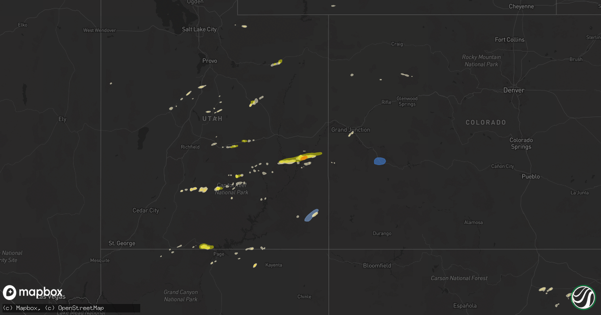
Hail Map on June 27, 2024
Get this storm
June 27 map
$229
one time, instant access
Download today. No call, no setup
Keep the $229
Bought the map and want the full workflow? Apply the entire $229 to a subscription within 7 days. None of it is wasted.
Every map, not just this one
This buys you this map. Subscription and you get every map we run, in the markets you choose from a few cities to whole states to nationwide. Plus real-time alerts the moment a storm fires.
Contact data
Name, contact info, occupancy, even credit band for addresses in the footprint. You go from where it hit to who to call.
Become the source they trust
Unlimited branding weather history reports on demand. You already have the documented answer ready for the property owner, and you are the one who showed up with it.
Property data and RoofTrace estimates
Pull up any address you have got, its value and the exact code rules for that jurisdiction, straight from One Click Code. Then RoofTrace estimates the squares, pitch, and roof value, priced the way you price.
States Impacted by Hail Map on June 27, 2024
Storm reports
Kansas
| Date | Description |
|---|---|
| 06/26/20248:50 PM CDT | Mesonet station ur350 kismws. |
| 06/26/20248:11 PM CDT | Liberal awos reported a 61 mph wind gust. |
North Carolina
| Date | Description |
|---|---|
| 06/27/20243:45 PM CDT | Downed tree reported along forest drive sw in sunset beach. Event time estimated by radar. |
| 06/27/20242:55 PM CDT | Delayed report. Public reported trees uprooted and fence blown over in stella. Time estimated from radar. |
| 06/27/20242:15 PM CDT | Personal weather station in waves observed a 58 mph / 50 knot marine thunderstorm wind gust. |
| 06/27/20242:00 PM CDT | Em reports two trees downed in white oak... Nc. Time estimated via radar. |
| 06/27/202412:31 PM CDT | Lenoir county 911 relayed report of an aluminum carport blow across a property along vernon avenue in kinston. Time based on radar. |
South Carolina
| Date | Description |
|---|---|
| 06/27/20245:25 PM CDT | Tri-county electric reported multiple trees down on power lines from gadsden to eastover causing several dozen power outages. Time estimated by radar. |
| 06/27/20244:45 PM CDT | Several large tree limbs down at carteret st and craven st. |
| 06/27/20244:27 PM CDT | Tree down on young circle. |
| 06/27/20244:24 PM CDT | Tree down on road. |
| 06/27/20244:24 PM CDT | Tree down blocking both lanes. |
| 06/27/20244:24 PM CDT | Tree down at agnes major rd and cuthbert farm rd. |
| 06/27/20244:23 PM CDT | Tree down on robert smalls parkway and parris island gateway. |
| 06/27/20244:18 PM CDT | Tree down at joe frazier rd and laurel bay rd. |
| 06/27/20244:09 PM CDT | Tree down on road. |
| 06/27/20244:09 PM CDT | Tree down on churchill rd. |
| 06/27/20244:09 PM CDT | Tree down on cottageville highway. |
| 06/27/20244:03 PM CDT | Tree down blocking both lanes on hendersonville highway. |
| 06/27/20244:02 PM CDT | Tree down blocking both lanes. |
Louisiana
| Date | Description |
|---|---|
| 06/27/20246:26 PM CDT | [landspout] national weather service in lake charles... La... Specifically the equipment building and adjacent outside equipment on the north side of the property... W |
New Mexico
| Date | Description |
|---|---|
| 06/27/20241:56 PM CDT | Asos station kgup gallup airport. |
Oklahoma
| Date | Description |
|---|---|
| 06/27/20241:25 AM CDT | A local report indicates 62 MPH wind near 2 WSW Woodward |
| 06/27/20241:20 AM CDT | A local report indicates 63 MPH wind near 2 WSW Woodward |
| 06/27/20241:20 AM CDT | A local report indicates 60 MPH wind near 3 SSW Freedom |
| 06/26/20248:10 PM CDT | Strong winds as well as the storm approached. |
Montana
| Date | Description |
|---|---|
| 06/27/20246:45 PM CDT | Measured a 61 mph gust at the savage mt dot site. |
| 06/27/20246:30 PM CDT | Report submitted via fb. Image indicates that a tree snapped and fell onto a vehicle. Same issue with a power pole falling onto the same vehicle. |
| 06/27/20246:30 PM CDT | Measured at the beaver hill mt dot site. |
| 06/27/20246:30 PM CDT | Submitted via fb. Image shows a 5 ft tree trunk that fell onto a vehicle. |
| 06/27/20246:30 PM CDT | Dawson county des sent in an image of a warehouse like building with walls made of a sheet metal material. Portions of the wall were ripped off the building. |
| 06/27/20246:30 PM CDT | Submitted via fb. Image also indicates that a tree of at least 2 ft uprooted onto a yard. Unclear if damage was received on the adjacent home. |
| 06/27/20246:30 PM CDT | Swing set and playground on property were blown away and crumpled. |
| 06/27/20246:30 PM CDT | Roof and tree damage. |
| 06/27/20246:25 PM CDT | Issued a new local storm report now that the observation came into the database. Awos station kgdv glendive airport. |
| 06/27/20246:22 PM CDT | Corrects previous tstm wnd gst report from 1 se baker. Asos station kbhk baker. |
| 06/27/20246:22 PM CDT | Asos station kbhk baker. |
| 06/27/20246:20 PM CDT | Report via fb of a portion of the roof torn off the town pump gas station damaging some vehicles and a gas pump. |
| 06/27/20246:15 PM CDT | Video of storm passing through. 4 to 6 inch branches were snapped off tree. Estimated a minimum of 60 mph gusts. Pea-sized hail was also observed. |
| 06/27/20246:15 PM CDT | Image sent through fb of a neighbors tree leaning onto home. Trunk diameter estimated at 1 to 2 ft. |
| 06/27/20246:10 PM CDT | Measured at the glendive airport asos. |
| 06/27/20245:45 PM CDT | Measured at the blm glendive mesonet site. |
| 06/27/20245:45 PM CDT | Measured at the terry agrimet site. |
| 06/27/20245:30 PM CDT | Measured at the blm terry mesonet site. |
| 06/27/20245:24 PM CDT | Submitted via fb. An image was sent showing a sheet metal coming off a structure at the mccone county fairgrounds. |
| 06/27/20245:14 PM CDT | Report from mping: 1-inch tree limbs broken; shingles blown off. |
| 06/27/20245:11 PM CDT | Report from mping: 3-inch tree limbs broken; power poles broken. |
| 06/27/20245:10 PM CDT | Prairie county des estimated gusts of 60 mph initially. Behind the initial rain... Heavy rain and 30-40 mph wind gusts. |
| 06/27/20245:10 PM CDT | Report |
| 06/27/20245:10 PM CDT | Report via facebook. Estimated a minimum of 60 mph gusts. |
| 06/27/20245:08 PM CDT | Report from mping: 1-inch tree limbs broken; shingles blown off. |
| 06/27/20245:00 PM CDT | Mesonet station mtm40 16.4 s murn |
| 06/27/20244:49 PM CDT | Asos station kmls miles city. |
| 06/27/20244:45 PM CDT | Tree damage and power out. |
| 06/27/20244:35 PM CDT | A local report indicates 1.50 inch wind near 8 SSE Angela |
| 06/27/20244:15 PM CDT | Mesonet station mtm89 angela w. |
| 06/27/20244:15 PM CDT | Corrects previous tstm wnd gst report from 9 ene bascom. Mesonet station mtm89 angela w. |
| 06/27/20244:15 PM CDT | Mesonet station mtm91 busby n. |
| 06/27/20244:15 PM CDT | Mesonet station mtabr 2.5 se aberdeen |
| 06/27/20244:00 PM CDT | A local report indicates 1.00 inch wind near Colstrip |
| 06/27/20243:44 PM CDT | A local report indicates 62 MPH wind near 10 NW Busby |
| 06/27/20243:30 PM CDT | Mesonet station mting 1.6 w ingomar |
| 06/27/20243:15 PM CDT | Awos station k00u 2 wnw hardin. |
| 06/27/20243:15 PM CDT | A local report indicates 1.75 inch wind near Custer |
| 06/27/20243:14 PM CDT | A local report indicates 64 MPH wind near 3 ESE Billings |
| 06/27/20243:00 PM CDT | Mesonet station lmmm 4.9 ne musselshell |
| 06/27/20242:59 PM CDT | A local report indicates 64 MPH wind near 8 NE Worden |
| 06/27/20242:56 PM CDT | Awos station kbil billings. |
| 06/27/20242:53 PM CDT | Awos station kbil billings. |
| 06/27/20242:49 PM CDT | A local report indicates 60 MPH wind near 7 S Billings |
| 06/27/20242:43 PM CDT | Awos station kbil billings. |
| 06/27/20242:43 PM CDT | Asos station kbil billings. |
| 06/27/20242:43 PM CDT | Awos station kbil billings. |
| 06/27/20242:30 PM CDT | A local report indicates 1.00 inch wind near 12 E Roundup |
| 06/27/20242:30 PM CDT | . |
| 06/27/20242:29 PM CDT | Report from mping: 1-inch tree limbs broken. |
| 06/26/20249:02 PM CDT | A local report indicates 61 MPH wind near 18 S Baker |
Pennsylvania
| Date | Description |
|---|---|
| 06/27/20247:19 AM CDT | Report from mping: trees uprooted or snapped; roof blown off. Likely a tornado; time estimated from radar. |
Texas
| Date | Description |
|---|---|
| 06/26/202411:52 PM CDT | Gust of 59 at 1152pm...followed by a gust of 65 at 1153pm. |
Nebraska
| Date | Description |
|---|---|
| 06/27/20246:29 PM CDT | Via spotternetwork. |
Utah
| Date | Description |
|---|---|
| 06/27/20245:45 PM CDT | Two social media reports of hail up to the size of quarters in myton around 4:45 pm... Including a photo. |
| 06/27/20245:45 PM CDT | Two social media reports of hail up to the size of quarters in myton around 4:45 pm... Including a photo. |
| 06/27/20245:35 PM CDT | Awos station kbdg blanding. |
| 06/27/20245:29 PM CDT | Social media post of up to quarter size hail in bridgeland. Time estimated from radar. |
| 06/27/20245:00 PM CDT | Also 1 inch of rain reported. |
| 06/27/20244:30 PM CDT | A local report indicates 1.00 inch wind near 1 W Moab |
| 06/27/20244:18 PM CDT | A local report indicates 1.50 inch wind near Moab |
| 06/27/20244:14 PM CDT | Report from mping: quarter |
| 06/27/20244:05 PM CDT | Half-dollar size hail reported in wellington... Ut. |
| 06/27/20243:30 PM CDT | Photo on social media of up to half dollar size hail reported on miller creek at 2:30pm. |
| 06/27/20243:27 PM CDT | Corrects previous hail report from wellington. Half-dollar size hail reported in wellington... Ut. Corrected time from previous lsr based on radar estimate. |
| 06/27/20242:10 PM CDT | Photo of up to quarter sized hail 5 miles west of exit 131 on i-70. |
Arizona
| Date | Description |
|---|---|
| 06/27/202410:23 AM CDT | Asos station kinw winslow airport. |
| 06/27/202410:23 AM CDT | Thunderstorm wind gust at winslow airport |
| 06/27/20249:43 AM CDT | Mesonet station azt09 i-40 @ two guns mm 230. |
| 06/26/20249:25 PM CDT | Large palo verde tree uprooted on pantano rd near seneca street. Time estimate based on radar. |
North Dakota
| Date | Description |
|---|---|
| 06/27/20246:52 PM CDT | Ndawn station at davis dam 2nw. 10 meter wind gust report. |
| 06/27/20246:50 PM CDT | Hail fell from 6:50 pm to 7:00 pm. |
| 06/27/20246:50 PM CDT | Report from mping: quarter |
| 06/27/20246:45 PM CDT | Ndawn station located at marmarth 2n. |
| 06/27/20246:41 PM CDT | Awos station k20u beach. Time estimated from radar. |
| 06/27/20245:38 PM CDT | Drone video from storm chaser confirms brief ground circulation under funnel cloud. Time came from video time stamp and exact location estimated from radar and spotter |
| 06/27/20245:00 PM CDT | Heavy rain. No measurement yet. |
| 06/26/20248:10 PM CDT | Asos station khei hettinger airport. |
| 06/26/20248:10 PM CDT | Nddot site near gladstone reported a 65 mph wind gust at 8 pm |
| 06/26/20247:48 PM CDT | Healthy tree fallen over... Snapped at base. Public report relayed via media partner... With photo. Time estimated from radar. |
| 06/26/20247:48 PM CDT | Healthy tree fallen over onto house. Public report relayed via media partner... With photos. Time estimated from radar. |
| 06/26/20247:48 PM CDT | Asos station kdik dickinson airport. |
| 06/26/20247:40 PM CDT | Delayed report. Photos sent through social media of a large tree that split and partially fell onto a house. Time estimated from radar. |
| 06/26/20247:38 PM CDT | Delayed report from 6/27. Photos relayed from broadcast media shows a trailer flipped upside down. Talked to property owner and they said that this was the only damage |
| 06/26/20247:32 PM CDT | 10 meter measured wind gust at ndawn station new england 5w. |
| 06/26/20247:27 PM CDT | 10 meter measured wind gust at ndawn station 2w fairfield. |
| 06/26/20247:20 PM CDT | Fryburg nddot station. Time estimated from radar. |
| 06/26/20247:10 PM CDT | Awos station kbww bowman airport. Time estimated from radar. |
| 06/26/20247:02 PM CDT | Delayed report from 6/27. Report and photo relayed through social media. Report also noted that tin building roofs were dented and window screens were shredded. Crop da |
Wyoming
| Date | Description |
|---|---|
| 06/27/20246:20 PM CDT | Time estimated based on radar |
| 06/27/20246:18 PM CDT | A local report indicates 59 MPH wind near 5 NNW Dwtn Gillette |
| 06/27/20246:12 PM CDT | Mesonet station wy3 ucross 28 se |
| 06/27/20246:02 PM CDT | Mesonet station wy3 ucross 28 se |
| 06/27/20245:53 PM CDT | Asos station kbyg buffalo airport. |
| 06/27/20244:56 PM CDT | Downed power lines and tree limbs. |
| 06/27/20244:56 PM CDT | Mesonet station wy55 2.9 n banner |
| 06/27/20244:49 PM CDT | A local report indicates 60 MPH wind near Big Horn |
| 06/27/20244:47 PM CDT | Asos station kshr sheridan. |
South Dakota
| Date | Description |
|---|---|
| 06/27/20245:28 PM CDT | A local report indicates 70 MPH wind near 1 N Hereford |
| 06/27/20244:31 PM CDT | Mping report |
| 06/27/202411:51 AM CDT | Time estimated. Power outages and broken tree branches reported. |
| 06/27/202411:42 AM CDT | Relayed via facebook. |
| 06/27/202412:40 AM CDT | Mesonet station 201 gann valley |
| 06/27/202412:20 AM CDT | A local report indicates 1.00 inch wind near Spring Creek Rec Area |
| 06/27/202412:05 AM CDT | Pole barn roof ripped off. 2 to 3 inch tree limbs down. |
| 06/26/202411:51 PM CDT | Corrects time from am to pm from previous tstm wnd dmg report. Time estimated. Power outages and broken tree branches reported. |
| 06/26/202411:45 PM CDT | Mesonet station hihs2 highmore |
| 06/26/202411:42 PM CDT | Report via social media... Estimated 60 mph wind. |
| 06/26/202411:37 PM CDT | Mesonet station 325 seneca |
| 06/26/202411:35 PM CDT | A local report indicates 60 MPH wind near 1 S Holabird |
| 06/26/202411:31 PM CDT | Mesonet station 19 harrold |
| 06/26/202411:29 PM CDT | Mesonet station 56 tolstoy |
| 06/26/202411:25 PM CDT | Mesonet station 185 blunt |
| 06/26/202411:10 PM CDT | Lowry 2s sdsu mesonet. |
| 06/26/202411:07 PM CDT | Asos station kpir pierre muni ap. |
| 06/26/202411:01 PM CDT | A local report indicates 73 MPH wind near 1 NNW Whitlocks Bay Rec |
| 06/26/202411:00 PM CDT | Mesonet station onms2 onida 13wsw |
| 06/26/202410:55 PM CDT | Mesonet station onms2 onida 13wsw |
| 06/26/202410:55 PM CDT | A local report indicates 73 MPH wind near 1 NNW Whitlocks Bay Rec |
| 06/26/202410:52 PM CDT | Time estimated from radar. |
| 06/26/202410:50 PM CDT | Mesonet station 202 hayes |
| 06/26/202410:47 PM CDT | Estimated 60-70 mph winds. |
| 06/26/202410:19 PM CDT | Mesonet station 168 foster bay |
| 06/26/202410:19 PM CDT | A local report indicates 58 MPH wind near 10 NNW Ottumwa |
| 06/26/202410:09 PM CDT | A local report indicates 70 MPH wind near 10 NNW Ottumwa |
| 06/26/202410:00 PM CDT | Mesonet station tims2 timber lake |
| 06/26/20249:45 PM CDT | A local report indicates 67 MPH wind near 2 SW Bridger |
| 06/26/20249:44 PM CDT | A local report indicates 60 MPH wind near Howes |
| 06/26/20249:38 PM CDT | A local report indicates 58 MPH wind near 4 NW Lantry |
| 06/26/20249:35 PM CDT | A local report indicates 82 MPH wind near 11 W Milesville |
| 06/26/20249:05 PM CDT | A local report indicates 64 MPH wind near 1 NNE Faith |
| 06/26/20248:24 PM CDT | A local report indicates 60 MPH wind near 13 NW Belle Fourche |
| 06/26/20247:43 PM CDT | A local report indicates 72 MPH wind near 7 NNE Ralph |
| 06/26/20247:43 PM CDT | A local report indicates 66 MPH wind near 13 SSW Reva |
| 06/26/20247:35 PM CDT | A local report indicates 70 MPH wind near 10 W Reva |
| 06/26/20247:29 PM CDT | A local report indicates 60 MPH wind near 12 WSW Castle Rock |
| 06/26/20247:18 PM CDT | A local report indicates 60 MPH wind near 8 N Redig |
| 06/26/20247:16 PM CDT | A local report indicates 91 MPH wind near 1 N Buffalo |
| 06/26/20247:12 PM CDT | A local report indicates 67 MPH wind near 1 N Buffalo |
Colorado
| Date | Description |
|---|---|
| 06/27/20246:42 PM CDT | Site up723 reported 61 mph wind gust. |
| 06/27/20246:40 PM CDT | Asos station kmtj montrose rgnl |
| 06/27/20246:40 PM CDT | Asos station kmtj montrose rgnl airport. |
| 06/27/20246:30 PM CDT | Site co068 reports 65 mph wind gust near firstview. |
| 06/27/20244:43 PM CDT | A local report indicates 60 MPH wind near 7 SE Julesburg |
| 06/27/20242:51 PM CDT | A local report indicates 65 MPH wind near 9 S Springfield |
Cities Impacted by Hail Map on June 27, 2024
- Flagstaff, AZ
- Sedona, AZ
- Winslow, AZ
- Belgrade, MT
- Manhattan, MT
- Manteo, NC
- Nags Head, NC
- Plymouth, NC
- Roper, NC
- Pantego, NC
- Pinetown, NC
- Creswell, NC
- Hartsville, SC
- Belhaven, NC
- Antimony, UT
- Big Timber, MT
- Ganado, AZ
- Concho, AZ
- Darlington, SC
- Fairfield, NC
- Melville, MT
- Scranton, NC
- Fredonia, AZ
- Merritt, NC
- White Oak, NC
- Colorado City, AZ
- Roundup, MT
- Bayboro, NC
- Grantsboro, NC
- New Bern, NC
- Elizabethtown, NC
- Ferron, UT
- Lavina, MT
- Maysville, NC
- Hanksville, UT
- Tohatchi, NM
- Musselshell, MT
- Crownpoint, NM
- Arapahoe, NC
- Wilmington, NC
- Boulder, UT
- Melstone, MT
- Ingomar, MT
- Shepherd, MT
- Hardin, MT
- Castle Hayne, NC
- Worden, MT
- Custer, MT
- Leupp, AZ
- Leland, NC
- Crow Agency, MT
- Kanab, UT
- Bighorn, MT
- Forsyth, MT
- Hysham, MT
- Grants, NM
- Holly Ridge, NC
- Price, UT
- Wellington, UT
- Myrtle Beach, SC
- Green River, UT
- Thompson, UT
- Monticello, UT
- Springer, NM
- Longs, SC
- Little River, SC
- Holly Hill, SC
- Otter, MT
- Ravenel, SC
- North Myrtle Beach, SC
- Huger, SC
- Hardeeville, SC
- Sneads Ferry, NC
- Moab, UT
- Cross, SC
- Okatie, SC
- Adams Run, SC
- Colstrip, MT
- Rosebud, MT
- Angela, MT
- Round O, SC
- Shonto, AZ
- Sturgis, SD
- Whitewood, SD
- Cordesville, SC
- Fort Meade, SD
- Lame Deer, MT
- Julesburg, CO
- Beach, ND
- Wibaux, MT
- Kinsey, MT
- Volborg, MT
- Georgetown, SC
- Moncks Corner, SC
- Page, AZ
- Richfield, UT
- Kenton, OK
- Buffalo, SD
- Meeker, CO
- Hathaway, MT
- Boise City, OK
- Saint Matthews, SC
- Venango, NE
- Miles City, MT
- Ismay, MT
- Rifle, CO
- Bedrock, CO
- Gateway, CO
- Hopkins, SC
- Gadsden, SC
- Monument Valley, UT
- New Underwood, SD
- Terry, MT
- Cartwright, ND
- Circle, MT
- Duchesne, UT
- Eastover, SC
- Enning, SD
- Medora, ND
- Whitewater, CO
- Grand Junction, CO
- Myton, UT
- Lambert, MT
- Wasta, SD
- Fairfield, ND
- Howes, SD
- Scenic, SD
- Hemingford, NE
- Caputa, SD
- Pine Ridge, SD
- Chadron, NE
- Owanka, SD
- Gordon, NE
- Porcupine, SD
- Kyle, SD
- Wall, SD
- Hermosa, SD
- Rapid City, SD
- Custer, SD
- Douglas, WY
- Newcastle, WY
- Lost Springs, WY
- Box Elder, SD
- Glendo, WY
- Manville, WY
- Edgemont, SD
- Keystone, SD
- Ellsworth Afb, SD
- Hill City, SD
- Shawnee, WY
- Lance Creek, WY
- Lusk, WY
- Savage, MT
- Richey, MT
- Gladstone, NM
- Glendive, MT
- Blanding, UT
- Roy, NM
- Wagon Mound, NM
- Solano, NM
- Patagonia, AZ
- Belfield, ND
- Elsie, NE
- Bloomfield, MT
- Clayton, NM
- Fallon, MT
- Sheridan, WY
- Ranchester, WY
- Banner, WY
- Clearmont, WY
- Big Horn, WY
- Wyarno, WY
- Story, WY
- Buffalo, WY
- Gillette, WY
- Arvada, WY
- Weston, WY
- Moorcroft, WY
- Rozet, WY
- Huntington, UT
- Montrose, CO
- Olathe, CO
- Kit Carson, CO
- Cheyenne Wells, CO
- Roosevelt, UT
- Hulett, WY
- Bowman, ND
- Camp Crook, SD
- Sentinel Butte, ND
- Rhame, ND
- Golva, ND
- Marmarth, ND
- Baker, MT
- Amidon, ND
- Plevna, MT
- South Heart, ND
- Scranton, ND
- Aladdin, WY
- Belle Fourche, SD
- Ludlow, SD
- Ephraim, UT
- Dickinson, ND
- New England, ND
- Fayette, UT
- Wales, UT
- Alzada, MT
- Whitman, NE
- Reva, SD
- Ralph, SD
- Grassy Butte, ND
- Arnegard, ND
- Manning, ND
- Killdeer, ND
- Reeder, ND
- Regent, ND
- Mott, ND
- Lefor, ND
- Hettinger, ND
- Newell, SD
- Prairie City, SD
- Lodgepole, SD
- Ekalaka, MT
- Gladstone, ND
- Taylor, ND
- Hooker, OK
- Hugoton, KS
- Liberal, KS
- Saint Onge, SD
- Tyrone, OK
- Turpin, OK
- Mud Butte, SD
- Lemmon, SD
- Meadow, SD
- Richardton, ND
- Mandaree, ND
- Dunn Center, ND
- Halliday, ND
- Dodge, ND
- Elgin, ND
- Beulah, ND
- Almont, ND
- Hebron, ND
- New Leipzig, ND
- Glen Ullin, ND
- Faith, SD
- Vale, SD
- Union Center, SD
- Wendover, UT
- Mona, UT
- White Owl, SD
- Nephi, UT
- Dupree, SD
- Forgan, OK
- Philip, SD
- Milesville, SD
- Cherry Creek, SD
- Lantry, SD
- Eagle Butte, SD
- Midland, SD
- Plains, KS
- Timber Lake, SD
- Isabel, SD
- McLaughlin, SD
- Morristown, SD
- Watauga, SD
- McIntosh, SD
- Keldron, SD
- Walker, SD
- Bullhead, SD
- Selfridge, ND
- Carson, ND
- Zap, ND
- Hazen, ND
- New Salem, ND
- Golden Valley, ND
- Center, ND
- Coldwater, KS
- Wilmore, KS
- Trail City, SD
- Glencross, SD
- Perryton, TX
- Fairview, UT
- Fort Pierre, SD
- Hayes, SD
- Balko, OK
- Mount Pleasant, UT
- Haviland, KS
- Lake City, KS
- Pierre, SD
- Sun City, KS
- Medicine Lodge, KS
- Agar, SD
- Gettysburg, SD
- Blunt, SD
- Onida, SD
- Hoven, SD
- Selby, SD
- Java, SD
- Bowdle, SD
- Tolstoy, SD
- Whitehorse, SD
- Ridgeview, SD
- Glenham, SD
- Akaska, SD
- Roscoe, SD
- Hosmer, SD
- Lebanon, SD
- Draper, SD
- Murdo, SD
- Okaton, SD
- Harrold, SD
- Kathryn, ND
- Leola, SD
- Onaka, SD
- Westport, SD
- Ipswich, SD
- Faulkton, SD
- Seneca, SD
- Highmore, SD
- Cresbard, SD
- Presho, SD
- Fort Thompson, SD
- Lower Brule, SD
- Stephan, SD
- Orient, SD
- Ree Heights, SD
- Vivian, SD
- Holabird, SD
- Miller, SD
- Shattuck, OK
- Gann Valley, SD
- Fargo, OK
- Gage, OK
- Reliance, SD
- Kennebec, SD
- Aberdeen, SD
- Rockham, SD
- Mansfield, SD
- Northville, SD
- Warner, SD
- Ashton, SD
- Andover, SD
- Mellette, SD
- Redfield, SD
- Saint Lawrence, SD
- Stratford, SD
- Groton, SD
- Tulare, SD
- Brentford, SD
- Ferney, SD
- Conde, SD
- Turton, SD
- Bath, SD
- Frankfort, SD
- Bristol, SD
- Doland, SD
- Webster, SD
- Huron, SD
- Hitchcock, SD
- Raymond, SD
- Wessington, SD
- Clark, SD
- Wolsey, SD
- Virgil, SD
- Wessington Springs, SD
- Canadian, TX
- Lipscomb, TX
- Follett, TX
- Booker, TX
- Higgins, TX
- Woodward, OK
- Sharon, OK
- Arnett, OK
- Mooreland, OK
- Washington, KS
- Hollenberg, KS
- Morrowville, KS
- Steele City, NE
- Endicott, NE
- Diller, NE
- Bradley, SD
- Waubay, SD
- Ortley, SD
- Bryant, SD
- Iroquois, SD
- De Smet, SD
- Alpena, SD
- Cavour, SD
- Garden City, SD
- Florence, SD
- Watertown, SD
- Carpenter, SD
- Henry, SD
- Willow Lake, SD
- Vienna, SD
- Wallace, SD
- Yale, SD
- Hazel, SD
- Woonsocket, SD
- Hardtner, KS
- Bremen, KS
- Odell, NE
- Wymore, NE
- Marysville, KS
- Hanover, KS
- Blue Springs, NE
- Oketo, KS