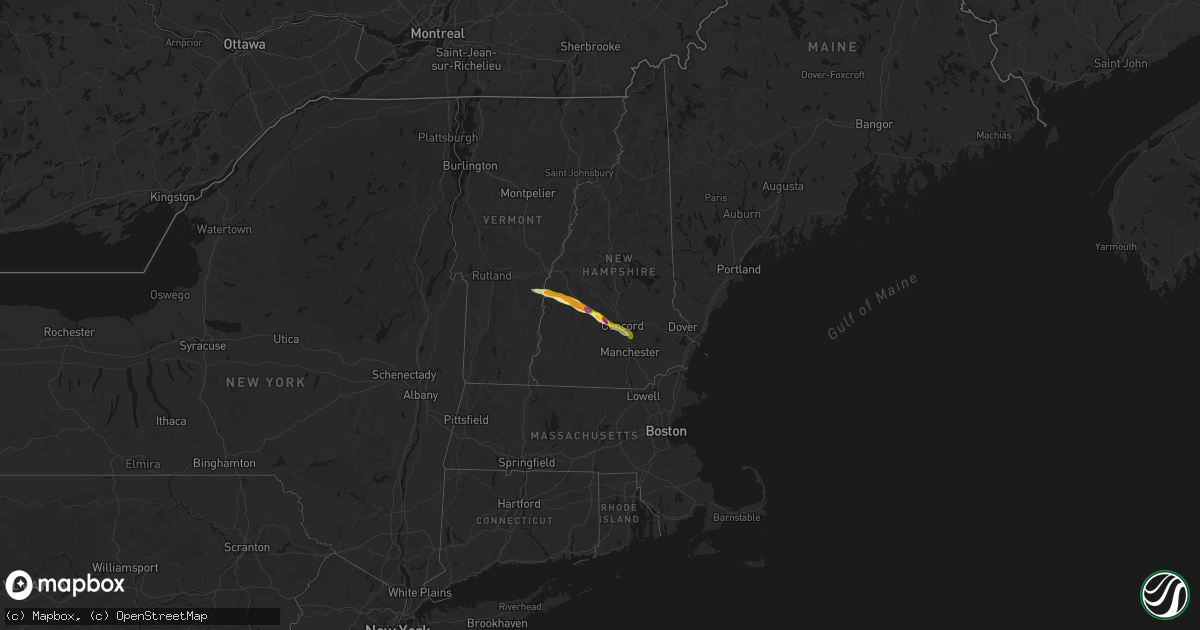
Hail Map in New Hampshire on June 26, 2026
Get this storm
June 26 map
$229
one time, instant access
Download today. No call, no setup
Keep the $229
Bought the map and want the full workflow? Apply the entire $229 to a subscription within 7 days. None of it is wasted.
Every map, not just this one
This buys you this map. Subscription and you get every map we run, in the markets you choose from a few cities to whole states to nationwide. Plus real-time alerts the moment a storm fires.
Contact data
Name, contact info, occupancy, even credit band for addresses in the footprint. You go from where it hit to who to call.
Become the source they trust
Unlimited branding weather history reports on demand. You already have the documented answer ready for the property owner, and you are the one who showed up with it.
Property data and RoofTrace estimates
Pull up any address you have got, its value and the exact code rules for that jurisdiction, straight from One Click Code. Then RoofTrace estimates the squares, pitch, and roof value, priced the way you price.
Storm reports in New Hampshire
New Hampshire
| Date | Description |
|---|---|
| 06/26/20265:48 PM CDT | Reported by weather spotter... Delayed report. Trees down on whitehall road... No wires down. Time estimated by radar. |
| 06/26/20265:45 PM CDT | Social media photos of hail up to 1.25in in auburn. |
| 06/26/20265:23 PM CDT | Delayed report. Time est. By radar. |
| 06/26/20265:10 PM CDT | Delayed report. Time est. By radar. |
| 06/26/20265:07 PM CDT | Spotter reported 2 trees and large branches down in this area. Time est by radar. |
| 06/26/20264:54 PM CDT | Hail between 1.75 to 2 in fell for 5 to 6 mins. Cracked windshield and dented car hood. Time estimated by radar. |
| 06/26/20264:45 PM CDT | Delayed report. |
| 06/26/20264:40 PM CDT | Ne511 reported a tree down on southington rd. One lane closed during time of report... Time estimated by radar. |
| 06/26/20264:37 PM CDT | Social media photo of 12 to 18 in diameter trees down and partially blocking kearsage mountain rd in warner. Time estimated by radar. |
| 06/26/20264:31 PM CDT | Trees on wires on birch hill rd. Time estimated by radar. |
| 06/26/20264:20 PM CDT | Off duty ems reports downed trees blocking baker hill rd. |
| 06/26/20264:10 PM CDT | Trees on wires on nh 11 near grandliden rd. Time estimated by radar. |
| 06/26/20264:10 PM CDT | Golf ball size hail for 6-7 minutes. Time estimated by radar. |
| 06/26/20264:04 PM CDT | Ping pong size hail on nh 103 in east newport. |
| 06/26/20264:00 PM CDT | Time estimated by radar. |
| 06/26/20263:53 PM CDT | Trees down on wires on hwy 120 near town house rd. Hail accumulated on grassy surfaces. |
| 06/26/20263:44 PM CDT | Facebook photo of hail in garden from a pembroke resident. Time estimated by radar. |
| 06/26/20263:40 PM CDT | Some stones larger than half dollars left dents in a few cars. |
All States Impacted by Hail Map on June 26, 2026
Cities Impacted by Hail Map on June 26, 2026
- Putnam Station, NY
- Orwell, VT
- Fair Haven, VT
- Brandon, VT
- Bomoseen, VT
- Castleton, VT
- Florence, VT
- West Rutland, VT
- Ganado, AZ
- Proctor, VT
- Campton, KY
- Farmington, NM
- Ezel, KY
- Hazel Green, KY
- Arvada, CO
- Broomfield, CO
- Los Lunas, NM
- Elizabeth, CO
- Gallup, NM
- Golden, CO
- Kiowa, CO
- Denver, CO
- Westminster, CO
- Elbert, CO
- Grants, NM
- Bluewater, NM
- Franktown, CO
- Chaffee, MO
- Belen, NM
- Gamerco, NM
- Palm Coast, FL
- Scott City, MO
- Charleston, MO
- Benton, MO
- Fountain, CO
- Fort Myers, FL
- Tohatchi, NM
- Cairo, IL
- Miller City, IL
- Pueblo, CO
- Ashton, ID
- Cornish, NH
- Windsor, VT
- Thebes, IL
- Chugwater, WY
- Bertrand, MO
- Sikeston, MO
- Lehigh Acres, FL
- Bunnell, FL
- Newport, NH
- Cubero, NM
- Wesley Chapel, FL
- Sunapee, NH
- New London, NH
- Newbury, NH
- Bradford, NH
- Lindrith, NM
- Jemez Springs, NM
- Lutz, FL
- Brownsville, VT
- Hawk Springs, WY
- Yoder, WY
- Reading, VT
- Bayfield, CO
- Agate, CO
- South Sutton, NH
- North Sutton, NH
- Warner, NH
- Peyton, CO
- Calhan, CO
- Kingstree, SC
- Thoreau, NM
- Ponderosa, NM
- Land O'Lakes, FL
- Bradley, FL
- Bowling Green, FL
- Mulberry, FL
- Waycross, GA
- Aztec, NM
- Bloomfield, NM
- Ramah, CO
- Fort Davis, TX
- Andrews, SC
- Bartow, FL
- Arcadia, FL
- Durango, CO
- Flora Vista, NM
- Bosque, NM
- Magdalena, NM
- San Acacia, NM
- La Joya, NM
- Cuba, NM
- La Jara, NM
- Counselor, NM
- Miami, TX
- Varney, KY
- Sidney, KY
- Pikeville, KY
- Carl Junction, MO
- Mooreland, OK
- Chester, OK
- Gillette, WY
- Myakka City, FL
- Pena Blanca, NM
- Los Alamos, NM
- Bow, NH
- Contoocook, NH
- Concord, NH
- Ringwood, OK
- Canada, KY
- Enid, OK
- Lusk, WY
- Folsom, NM
- Grenville, NM
- Lyman, NE
- Ona, FL
- Manville, WY
- Avondale, CO
- Gering, NE
- Canadian, TX
- Fairmont, OK
- Kremlin, OK
- Conway, MO
- Wann, OK
- Shawnee, WY
- Billings, OK
- Boone, CO
- Ava, MO
- Limon, CO
- Genoa, CO
- Garber, OK
- Woodward, OK
- Scottsbluff, NE
- Mitchell, NE
- Coffeyville, KS
- S Coffeyville, OK
- Greeley, CO
- Eaton, CO
- Lucerne, CO
- Buffalo, OK
- Fort Supply, OK
- Denton, MT
- Hilger, MT
- Waynoka, OK
- Perry, OK
- Hunter, OK
- Pond Creek, OK
- Kit Carson, CO
- Hugo, CO
- Seibert, CO
- Flagler, CO
- Fowler, CO
- Winifred, MT
- Lucien, OK
- Covington, OK
- Douglas, OK
- Watonga, OK
- Harrison, NE
- Alva, OK
- Karval, CO
- Lamont, OK
- Kenton, OK
- Candia, NH
- Raymond, NH
- Clayton, NM
- Suncook, NH
- Tonkawa, OK
- Gill, CO
- Londonderry, NH
- Seiling, OK
- Hitchcock, OK
- Okeene, OK
- Mobeetie, TX
- Wheeler, TX
- Briscoe, TX
- Vona, CO
- Stratton, CO
- Galeton, CO
- Briggsdale, CO
- Newcastle, WY
- Upton, WY
- Minatare, NE
- Ponca City, OK
- Lenapah, OK
- Pritchett, CO
- Douglas, WY
- Columbus, KS
- Bayard, NE
- Blackwell, OK
- Branchville, SC
- Hennessey, OK
- Loyal, OK
- Kingfisher, OK
- Rocky Ford, CO
- Boise City, OK
- Sheridan, WY
- La Junta, CO
- Bridgeport, NE
- Decker, MT
- Branson, CO
- Angora, NE
- Cheraw, CO
- Nardin, OK
- Haswell, CO
- Felt, OK
- Burlington, CO
- Bethune, CO
- Grover, CO
- Braman, OK
- Hot Springs, SD
- Sundance, WY
- Waukomis, OK
- Statesboro, GA
- Las Animas, CO
- Hooksett, NH
- Morrison, OK
- Stillwater, OK
- Oral, SD
- Newkirk, OK
- Drummond, OK
- Buffalo Gap, SD
- Otter, MT
- Eads, CO
- Beulah, WY
- Carrier, OK
- Ames, OK
- Tucumcari, NM
- San Jon, NM
- Bard, NM
- Bushnell, NE
- Dover, OK
- Lagrange, WY
- Spearfish, SD
- Caney, KS
- Cheyenne Wells, CO
- Fairburn, SD
- Glencoe, OK
- Pine Ridge, SD
- Marshall, OK
- Hill City, SD
- McClave, CO
- Hasty, CO
- Orlando, OK
- Copan, OK
- Nyssa, OR
- Delaware, OK
- Arkansas City, KS
- Hay Springs, NE
- Maple City, KS
- Lamar, CO
- Wiley, CO
- Hermosa, SD
- Harrisburg, NE
- Custer, SD
- Dexter, KS
- Caputa, SD
- Dalhart, TX
- Channing, TX
- Nara Visa, NM
- Hereford, TX
- Adrian, TX
- Logan, NM
- Holly, CO
- Vinita, OK
- Niotaze, KS
- New Underwood, SD
- Crescent, OK
- Mulhall, OK
- Whitewood, SD
- Ripley, OK
- Perkins, OK
- Vega, TX
- Hartley, TX
- Owanka, SD
- Granada, CO
- Arapahoe, CO
- Wasta, SD
- Volborg, MT
- Piedmont, SD
- Nemo, SD
- Baxter Springs, KS
- Tyro, KS
- Box Elder, SD
- Rapid City, SD
- Lead, SD
- Deadwood, SD
- Sturgis, SD
- Black Hawk, SD
- Ellsworth Afb, SD
- Wall, SD
- Coyle, OK
- Putnam, OK
- Taloga, OK
- Custer City, OK
- Butler, OK
- Havana, KS
- Bluejacket, OK
- Caldwell, ID
- Guthrie, OK
- Oakwood, OK
- Syracuse, KS
- Enning, SD
- Texline, TX
- Sedan, NM
- Nampa, ID
- Sedan, KS
- Cedar Vale, KS
- Leedey, OK
- Fay, OK
- Coolidge, KS
- Johnson, KS
- Kendall, KS
- Howes, SD
- Quinn, SD
- White Owl, SD
- Dumas, TX
- Stratford, TX
- Meridian, ID
- Canton, OK
- Moline, KS
- Meno, OK
- Eagle, ID
- Boise, ID
- Garden City, ID
- Meridian, OK
- Mud Butte, SD
- Union Center, SD
- Sunray, TX
- Masterson, TX
- Cactus, TX
- Texhoma, OK
- Keyes, OK
- Omega, OK
- Longdale, OK
- Wellston, OK
- Luther, OK
- Southard, OK
- Thomas, OK
- Welch, OK
- Goltry, OK
- Lahoma, OK
- Helena, OK
- Faith, SD
- Walsh, CO
- Peru, KS
- Kuna, ID
- Kadoka, SD
- Philip, SD
- Cherry Creek, SD
- Milesville, SD
- Gruver, TX
- Goodwell, OK
- Texhoma, TX
- Guymon, OK
- Morse, TX
- Stinnett, TX
- Cashion, OK
- Midland, SD
- Meadow, SD
- Bison, SD
- Dupree, SD
- Borger, TX
- Spearman, TX
- Chandler, OK
- Bison, OK
- Fairview, OK
- Aline, OK
- Earth, TX
- Muleshoe, TX
- Sudan, TX
- Amherst, TX
- Fieldton, TX
- Springlake, TX
- Olton, TX
- Littlefield, TX
- Plainview, TX
- Hale Center, TX
- Okarche, OK
- Calumet, OK
- Greenfield, OK
- Geary, OK
- Davenport, OK
- Perryton, TX
- Pampa, TX
- Hardesty, OK
- Abernathy, TX
- Petersburg, TX
- Anton, TX
- Shallowater, TX
- Stroud, OK
- Lodgepole, SD
- Balko, OK
- El Reno, OK
- Piedmont, OK
- Yukon, OK
- Cherokee, OK
- Carmen, OK
- Union City, OK
- Beaver, OK
- Booker, TX
- Hooker, OK
- Turpin, OK
- Higgins, TX
- Hayes, SD
- Fort Pierre, SD
- Cleo Springs, OK
- Isabella, OK
- Oklahoma City, OK
- Mustang, OK
- Wheatland, OK
- Edmond, OK
- Bethany, OK
- Watauga, SD
- Dacoma, OK
- McLaughlin, SD
- Spencer, OK
- Jones, OK
- Follett, TX
- Lipscomb, TX
- Rosston, OK
- Gate, OK
- Laverne, OK
- Darrouzett, TX
- Forgan, OK
- Shattuck, OK
- Choctaw, OK
- Arcadia, OK
- McIntosh, SD
- Gage, OK
- Arnett, OK
- Fargo, OK
- May, OK
- Ashland, KS
- Englewood, KS
- Holcomb, KS
- Garden City, KS
- Pierceville, KS
- Ingalls, KS
- Sublette, KS
- Copeland, KS
- Cimarron, KS
- Montezuma, KS
- Dodge City, KS
- Harrah, OK
- Burlington, OK
- Shields, ND
- Selfridge, ND
- Fort Yates, ND
- Meade, KS
- Plains, KS
- Ensign, KS
- Newalla, OK
- Meeker, OK
- Mcloud, OK
- Freedom, OK
- Fowler, KS
- Minneola, KS
- Solen, ND
- Sparks, OK
- Ford, KS
- Chickasha, OK
- Haviland, KS
- Harper, KS
- Bucklin, KS
- Coats, KS
- Sawyer, KS
- Sun City, KS
- Medicine Lodge, KS
- Pratt, KS
- Medford, OK
- Whitney, NE
- Prague, OK
- Kingman, KS
- Chadron, NE
- Amber, OK
- Blanchard, OK
- Lewistown, MT
- Hardin, MT
- Dodson, MT
- Malta, MT
- Agra, OK
- Shawnee, OK
- Silverthorne, CO
- Estes Park, CO
- Kremmling, CO
- Granby, CO
- Grand Lake, CO
- Hot Sulphur Springs, CO
- Parshall, CO
- Wallace, KS
- Tribune, KS
- Winona, KS
- Sharon Springs, KS
- Leoti, KS
- Floydada, TX
- Kress, TX
- Silverton, TX
- Lockney, TX
- Dimmitt, TX
- Hart, TX
- Post, TX
- Levelland, TX
- Pep, TX
- Justiceburg, TX
- Smyer, TX
- Lorenzo, TX
- Ralls, TX
- Odonnell, TX
- Mcadoo, TX
- Tahoka, TX
- Whiteface, TX
- Lubbock, TX
- Tokio, TX
- Dickens, TX
- New Deal, TX
- Maple, TX
- Meadow, TX
- Slaton, TX
- Ransom Canyon, TX
- Idalou, TX
- Morton, TX
- Brownfield, TX
- Spur, TX
- Enochs, TX
- Gail, TX
- Plains, TX
- Crosbyton, TX
- Sundown, TX
- Snyder, TX
- Ropesville, TX
- Lamesa, TX
- Wilson, TX
- Wolfforth, TX
- Turkey, TX
- Milnesand, NM
- Flomot, TX
- Rogers, NM
- Matador, TX
- Causey, NM
- Quitaque, TX
- Tatum, NM
- Floyd, NM
- Pep, NM
- Portales, NM
- Elida, NM
- Melrose, NM
- Texico, NM
- Friona, TX
- Cannon Afb, NM
- Crossroads, NM
- House, NM
- Taiban, NM
- Clovis, NM
- Farwell, TX
- Childress, TX
- Wellington, TX
- Clarendon, TX
- Lelia Lake, TX
- Hedley, TX
- Memphis, TX
- Epping, NH
- Fremont, NH
- Salisbury, MA
- Exeter, NH
- East Kingston, NH
- Seabrook, NH
- Hampton Falls, NH
- Quaker City, OH


