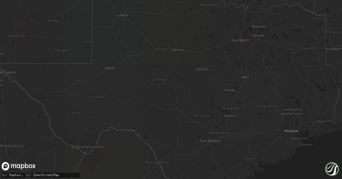
Hail Map in Texas on June 25, 2022
Get this storm
June 25 map
$229
one time, instant access
Download today. No call, no setup
Keep the $229
Bought the map and want the full workflow? Apply the entire $229 to a subscription within 7 days. None of it is wasted.
Every map, not just this one
This buys you this map. Subscription and you get every map we run, in the markets you choose from a few cities to whole states to nationwide. Plus real-time alerts the moment a storm fires.
Contact data
Name, contact info, occupancy, even credit band for addresses in the footprint. You go from where it hit to who to call.
Become the source they trust
Unlimited branding weather history reports on demand. You already have the documented answer ready for the property owner, and you are the one who showed up with it.
Property data and RoofTrace estimates
Pull up any address you have got, its value and the exact code rules for that jurisdiction, straight from One Click Code. Then RoofTrace estimates the squares, pitch, and roof value, priced the way you price.
Storm reports in Texas
Texas
| Date | Description |
|---|---|
| 06/25/20226:46 PM CDT | A local report indicates 1.00 inch wind near 1 NE HOWARDWICK |
| 06/25/20226:45 PM CDT | Tree limbs down around town... Of which were at least 3 inches in diameter. |
| 06/25/20223:03 AM CDT | At 803 PM CDT, a severe thunderstorm was located 6 miles southwest of Memphis, moving south at 10 mph. HAZARD...60 mph wind gusts and quarter size hail. SOURCE...Radar indicated. IMPACT...Hail damage to vehicles is expected. Expect wind damage to roofs, siding, and trees. Locations impacted include... Memphis, Lakeview and Plaska Community. |
| 06/25/20221:48 AM CDT | At 648 PM CDT, a severe thunderstorm was located near Howardwick, or 8 miles north of Clarendon, moving east at 10 mph. HAZARD...60 mph wind gusts and half dollar size hail. SOURCE...Radar indicated. IMPACT...Minor damage to roofs, siding, and trees is possible. Hail damage to vehicles is expected. Locations impacted include... Howardwick, Hedley, Lelia Lake and Greenbelt Lake. |
| 06/25/20221:33 AM CDT | At 633 PM CDT, a severe thunderstorm was located near Howardwick, or 9 miles north of Clarendon, moving north at 10 mph. HAZARD...60 mph wind gusts and half dollar size hail. SOURCE...Radar indicated. IMPACT...Minor damage to roofs, siding, and trees is possible. Hail damage to vehicles is expected. Locations impacted include... Howardwick, Lake Mcclellan and Greenbelt Lake. |
All States Impacted by Hail Map on June 25, 2022
Cities Impacted by Hail Map on June 25, 2022
- Runnells, IA
- Grafton, IL
- Jerseyville, IL
- Winfield, MO
- Old Monroe, MO
- Stanford, IL
- Minier, IL
- Shirley, IL
- Bloomington, IL
- Saint Charles, MO
- Portage Des Sioux, MO
- Princeville, IL
- Dunlap, IL
- Edwards, IL
- New Berlin, IL
- Springfield, IL
- Delavan, IL
- New Florence, MO
- Wentzville, MO
- Maroa, IL
- Argenta, IL
- Weldon, IL
- Nebo, IL
- Clarksville, MO
- Danville, KY
- Mayer, AZ
- Breese, IL
- Aviston, IL
- Galesburg, KS
- Parsons, KS
- Strasburg, IL
- Windsor, IL
- Burden, KS
- Atlanta, IL
- Moscow Mills, MO
- Montgomery City, MO
- Brimfield, IL
- Norwalk, IA
- Tobias, NE
- Winterset, IA
- Earlham, IA
- Clinton, IL
- Easton, IL
- Hopedale, IL
- Heyworth, IL
- Middletown, MO
- Bowling Green, MO
- Dewitt, IL
- Farmer City, IL
- Alhambra, IL
- Marine, IL
- Roodhouse, IL
- Muscatine, IA
- Yates City, IL
- Maquon, IL
- Sawyerville, IL
- Benld, IL
- Staunton, IL
- Gillespie, IL
- Mount Olive, IL
- Lincoln, IL
- Elkhart, IL
- Chestnut, IL
- New Holland, IL
- McLean, IL
- Mason City, IL
- Greenview, IL
- Armington, IL
- Latham, IL
- Cantrall, IL
- Dawson, IL
- Emden, IL
- Mount Pulaski, IL
- Warrensburg, IL
- Williamsville, IL
- San Jose, IL
- Sherman, IL
- Illiopolis, IL
- Athens, IL
- Hartsburg, IL
- Riverton, IL
- Buffalo, IL
- Middletown, IL
- Lawndale, IL
- Murrayville, IL
- Petersburg, IL
- Havana, IL
- Topeka, IL
- Florissant, MO
- Hermann, MO
- Portland, MO
- Steedman, MO
- Rhineland, MO
- Pleasantville, IA
- Virden, IL
- Modesto, IL
- Girard, IL
- New Boston, IL
- Illinois City, IL
- Dunnegan, MO
- Stockton, MO
- Fair Play, MO
- Raymond, IL
- Harvel, IL
- Waggoner, IL
- Paris, IL
- Indianola, IA
- Carlinville, IL
- Hillview, IL
- White Hall, IL
- Toronto, KS
- Warrenton, MO
- Moran, KS
- Tunas, MO
- Urbana, MO
- Hermitage, MO
- Lebanon, MO
- Canadian, TX
- Briscoe, TX
- Columbus, NE
- Van Meter, IA
- Martensdale, IA
- Patterson, IA
- Cumming, IA
- Swan, IA
- Carlisle, IA
- Bevington, IA
- Prole, IA
- Saint Charles, IA
- Ackworth, IA
- Neoga, IL
- Stewardson, IL
- Sigel, IL
- Buffalo, KS
- Benedict, KS
- Chanute, KS
- Godfrey, IL
- Dow, IL
- West Alton, MO
- Arnett, OK
- West Frankfort, IL
- Logan, IL
- Benton, IL
- Thompsonville, IL
- Erie, KS
- Douglass, KS
- Caldwell, KS
- Crawford, OK
- Hilham, TN
- Cookeville, TN
- Livingston, TN
- Beaver, KY
- Shamrock, TX
- Amite, LA
- Roseland, LA
- Coldwater, KS
- Howard, KS
- Piedmont, KS
- Severy, KS
- Black Canyon City, AZ
- Edwardsville, IL
- Laurel Hill, FL
- Canyon, TX
- Summerdale, AL
- Elberta, AL
- Robertsdale, AL
- Mulkeytown, IL
- Du Quoin, IL
- Newbern, AL
- Mascoutah, IL
- Belleville, IL
- New Baden, IL
- Lebanon, IL
- O'Fallon, IL
- Lenzburg, IL
- Saint Libory, IL
- Marissa, IL
- Oakdale, IL
- Trenton, IL
- Freeburg, IL
- Addieville, IL
- Scott Air Force Base, IL
- Peck, KS
- Mobile, AL
- Pikeville, KY
- Claude, TX
- Daphne, AL
- Picayune, MS
- Pearl River, LA
- Eight Mile, AL
- Pride, LA
- Cheyenne, OK
- Peoria Heights, IL
- Carriere, MS
- Piasa, IL
- Shipman, IL
- Sharon, OK
- Saint Jacob, IL
- Highland, IL
- Lakeview, TX
- Memphis, TX
- Laquey, MO
- Brainard, NE
- Prague, NE
- Bellwood, NE
- Shelby, NE
- Rising City, NE
- Bruno, NE
- Weston, NE
- Osceola, NE
- David City, NE
- Okawville, IL
- Argonia, KS
- New Athens, IL
- Kampsville, IL
- Fall River, KS
- Monroe, TN
- Protection, KS
- Follett, TX
- Grethel, KY
- Teaberry, KY
- Harold, KY
- Waverly, IL
- Franklin, IL
- Kentwood, LA
- Fluker, LA
- Waltonville, IL
- Eureka, IL
- Washington, IL
- Metamora, IL
- East Peoria, IL
- Peoria, IL
- Atmore, AL
- Century, FL
- Mclean, TX
- Sweetwater, OK
- Red Bud, IL
- La Center, KY
- Kevil, KY
- Barlow, KY
- Burkesville, KY
- Leedey, OK
- Hammon, OK
- Clarendon, TX
- McDavid, FL
- Mobeetie, TX
- Wheeler, TX
- Grenola, KS
- Cambridge, KS
- Atlanta, KS
- Latham, KS
- Grove Hill, AL
- Catherine, AL
- Camden, AL
- Covington, LA
- Loranger, LA
- Ponchatoula, LA
- Folsom, LA
- Bessemer, AL
- West Blocton, AL
- Helena, AL
- McCalla, AL
- Udall, KS
- Belle Plaine, KS
- Farmersville, IL
- Auburn, IL
- Divernon, IL
- Neodesha, KS
- Independence, KS
- Brighton, IL
- Medora, IL
- Fidelity, IL
- Chesterfield, IL
- Foristell, MO
- Woodlawn, IL
- Kell, IL
- Texico, IL
- Walnut Hill, IL
- Iuka, IL
- Dix, IL
- Mount Vernon, IL
- Sesser, IL
- Millstadt, IL
- Tamaroa, IL
- Alton, IL
- Bunker Hill, IL
- Stennis Space Center, MS
- Bethalto, IL
- Sayre, OK
- Reydon, OK
- Freeport, KS
- Bluff City, KS
- Collinsville, IL
- East Alton, IL
- Moro, IL
- Wood River, IL
- Maryville, IL
- Worden, IL
- Hamel, IL
- Hartford, IL
- Troy, IL
- South Roxana, IL
- Glen Carbon, IL
- Granite City, IL
- Cottage Hills, IL
- Dorsey, IL
- Roxana, IL
- El Dorado Springs, MO
- Jerico Springs, MO
- Thayer, KS
- Cherryvale, KS
- Jay, FL
- Durham, OK
- Linden, AL
- Scheller, IL
- Milton, FL
- Wellington, KS
- Vancleve, KY
- Jackson, KY
- Thayer, IL
- Hillsboro, IL
- Glenarm, IL
- Loami, IL
- Rochester, IL
- Pawnee, IL
- Morrisonville, IL
- Nokomis, IL
- Litchfield, IL
- Butler, IL
- Irving, IL
- Palmyra, IL
- Witt, IL
- Mechanicsburg, IL
- Edinburg, IL
- Chatham, IL
- Milan, KS
- Longton, KS
- Fredonia, KS
- Elk City, KS
- Roll, AZ
- Wellton, AZ
- Slaughter, LA
- Pine Hill, AL
- Alberta, AL
- Rock, KS
- Winfield, KS
- Oxford, KS
- Mulvane, KS
- Wright City, MO
- Du Bois, IL
- Pinckneyville, IL
- Ashley, IL
- Bonnie, IL
- Bridgeton, MO
- Waldron, KS
- Saint Paul, KS
- Plantersville, AL
- Mooreland, OK
- Bay Minette, AL
- Wellsville, MO
- Broughton, IL
- Opa Locka, FL
- Miami Gardens, FL
- Cambria, IL
- Carterville, IL
- Hereford, TX
- Zachary, LA
- Salome, AZ
- Johnsonville, IL
- Cisne, IL
- Williamsburg, MO
- Bolivar, MO
- Morrisville, MO
- Half Way, MO
- Aldrich, MO
- Brighton, MO
- Caseyville, IL
- Elkville, IL
- Woodward, OK
- Uniontown, KS
- Fort Scott, KS
- Humboldt, KS
- Stark, KS
- Savonburg, KS
- Hepler, KS
- La Harpe, KS
- Walnut, KS
- Elsmore, KS
- Sikeston, MO
- Charleston, MO
- Carbondale, IL
- Makanda, IL
- Cobden, IL
- Pocahontas, IL
- Goreville, IL
- Buncombe, IL
- Hollywood, FL
- Stockton, AL
- Pine Apple, AL
- Evergreen, AL
- Repton, AL
- O'Fallon, MO
- Mayfield, KS
- Irvine, KY
- Ravenna, KY
- Salyersville, KY
- Rousseau, KY
- Franklin, AL
- Adger, AL
- Saraland, AL
- Uniontown, AL
- Jackson, LA
- Norwood, LA
- Gulfport, MS
- Hammond, LA
- Rinard, IL
- Moline, KS
- Dennis, KS
- Kiln, MS
- Foley, AL
- Marion, AL
- Selma, AL
- Loxley, AL
- Montgomery, AL
- Hudson, IL
- Knoxville, IL
- Galesburg, IL
- Gilson, IL
- Secor, IL
- El Paso, IL
- Congerville, IL
- Trivoli, IL
- Dahinda, IL
- Morton, IL
- Williamsfield, IL
- Elmwood, IL
- Creve Coeur, IL
- Hanna City, IL
- Oneida, IL
- Carlock, IL
- Farlington, KS
- Wahoo, NE


