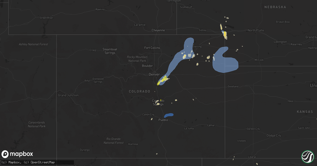
Hail Map on June 24, 2025
Get this storm
June 24 map
$229
one time, instant access
Download today. No call, no setup
Keep the $229
Bought the map and want the full workflow? Apply the entire $229 to a subscription within 7 days. None of it is wasted.
Every map, not just this one
This buys you this map. Subscription and you get every map we run, in the markets you choose from a few cities to whole states to nationwide. Plus real-time alerts the moment a storm fires.
Contact data
Name, contact info, occupancy, even credit band for addresses in the footprint. You go from where it hit to who to call.
Become the source they trust
Unlimited branding weather history reports on demand. You already have the documented answer ready for the property owner, and you are the one who showed up with it.
Property data and RoofTrace estimates
Pull up any address you have got, its value and the exact code rules for that jurisdiction, straight from One Click Code. Then RoofTrace estimates the squares, pitch, and roof value, priced the way you price.
States Impacted by Hail Map on June 24, 2025
Storm reports
Nebraska
| Date | Description |
|---|---|
| 06/24/20256:42 PM CDT | Pws-knebigsp22. |
| 06/23/20258:38 PM CDT | Site brunswig shop on weatherlink reported 67 mph wind gust. |
Indiana
| Date | Description |
|---|---|
| 06/24/20254:50 PM CDT | Broadcast media reported a few trees/limbs down on country road 3 on the northside of wakarusa... In in elkhart county. Adjusted report based on radar data. |
| 06/24/20254:13 PM CDT | Delayed report. Photo on x of a very large tree with rot snapped near is trunk. |
Louisiana
| Date | Description |
|---|---|
| 06/24/20256:27 PM CDT | Tree down on home off youree drive near stoner avenue in shreveport. |
| 06/24/20255:55 PM CDT | Tree down on kisatchie falls road. |
Maine
| Date | Description |
|---|---|
| 06/24/20256:10 PM CDT | Tree down on car. |
| 06/24/20256:05 PM CDT | Multiple large branches and some trees down in south portland. |
| 06/24/20256:02 PM CDT | Multiple poles down. |
| 06/24/20256:02 PM CDT | A tv meteorologist posted a picture of a powerline down on an suv in scarborough. Powerline and wires all over the road for at least about 100 yards. Time estimated by |
| 06/24/20255:50 PM CDT | Tree down across the road. |
North Carolina
| Date | Description |
|---|---|
| 06/24/20255:35 PM CDT | Trees down on roadway. |
| 06/24/20255:34 PM CDT | Trees down on roadway. |
| 06/24/20255:34 PM CDT | Trees down on roadway. |
| 06/24/20254:30 PM CDT | Trees down. |
| 06/24/20254:30 PM CDT | Tree down on fontana rd. |
| 06/24/20254:30 PM CDT | Several trees down around bryson city. |
| 06/24/20253:51 PM CDT | Tree down along big cove rd. |
| 06/24/20253:46 PM CDT | Multiple trees down on hwy 19 near harrahs casino. |
| 06/24/20253:46 PM CDT | Tree down across parking lot. |
| 06/24/20253:15 PM CDT | Several trees downed in the barnardsville area. |
Texas
| Date | Description |
|---|---|
| 06/24/20255:28 PM CDT | Tree down on hwy 21 near fm road 3121. |
| 06/24/20255:26 PM CDT | Tree down on hwy 21 near cedar grove road. |
| 06/24/20255:21 PM CDT | Tree down on fm road 1592. |
| 06/24/20255:15 PM CDT | Several trees down on dorsey road. |
| 06/24/20255:03 PM CDT | Tree down on hwy 96 just south of charlie force road. |
New Hampshire
| Date | Description |
|---|---|
| 06/24/20255:34 PM CDT | Tree down on east side drive. Time es |
| 06/24/20255:34 PM CDT | Tree down on east side drive. Time estimated by radar. |
| 06/24/20255:20 PM CDT | Trees down on stage rd and fatima rd near camp fatima. Time estimated by radar. |
| 06/24/20255:17 PM CDT | Tree down in the road. |
| 06/24/20255:09 PM CDT | Tree down. |
| 06/24/20255:08 PM CDT | Observed 2 downed trees on wentworth rd |
| 06/24/20255:04 PM CDT | Tree and wires down. |
| 06/24/20254:59 PM CDT | Tree and wires down. |
| 06/24/20254:56 PM CDT | Tree and wires down. |
| 06/24/20254:53 PM CDT | Tree down in road. |
Florida
| Date | Description |
|---|---|
| 06/23/20257:33 PM CDT | Trees reported down along i-10 and along highway 81 in walton county. Time estimated by radar. |
Kansas
| Date | Description |
|---|---|
| 06/24/20255:45 PM CDT | Time estimate based off radar...reports of 6 powerlines down in south rolla along county road j... 3 powerlines down along highway 56... And tree damage to 8-12 inch di |
| 06/23/20257:57 PM CDT | Trained spotter reports 13 inch tree limb down. Time estimated from radar. |
Colorado
| Date | Description |
|---|---|
| 06/24/20255:53 PM CDT | A local report indicates 63 MPH wind near 6 NW Pawnee Pass |
| 06/24/20255:45 PM CDT | A local report indicates 64 MPH wind near 8 NNE Pueblo Depot |
| 06/24/20254:46 PM CDT | Corrects previous tstm wnd gst report from 2 ne wiggins. |
| 06/24/20254:36 PM CDT | A local report indicates 58 MPH wind near 2 NE Wiggins |
| 06/24/20254:12 PM CDT | A local report indicates 63 MPH wind near 8 WNW Hoyt |
| 06/24/20253:35 PM CDT | Corrects previous tstm wnd gst report from 1 ssw bennett. |
| 06/24/20253:25 PM CDT | A local report indicates 60 MPH wind near 1 SSW Bennett |
| 06/24/20253:20 PM CDT | A local report indicates 59 MPH wind near 10 E Arapahoe Park |
| 06/24/20253:15 PM CDT | A local report indicates 59 MPH wind near 10 E Arapahoe Park |
| 06/24/20253:10 PM CDT | A local report indicates 60 MPH wind near 3 SSW Arapahoe Park |
| 06/24/20252:58 PM CDT | Report from mping: quarter |
| 06/24/20252:35 PM CDT | A local report indicates 1.00 inch wind near 3 WNW The Pinery |
| 06/23/20257:06 PM CDT | Site brophy on awn reports 57.7 mph wind gust. |
Missouri
| Date | Description |
|---|---|
| 06/24/202510:45 AM CDT | Numerous roads closed in the albany area and throughout gentry county from flooding. |
Ohio
| Date | Description |
|---|---|
| 06/24/20256:37 PM CDT | Trees reported down at clear creek and starner. Time estimated from radar. |
| 06/24/20255:55 PM CDT | One large tree and numerous smaller branches downed at a property on state route 73. |
| 06/23/202510:42 PM CDT | Tree down on state route 800. |
| 06/23/202510:16 PM CDT | Tree fell into a building in port washington... Oh. (pbz |
| 06/23/202510:16 PM CDT | Tree fell into a building |
| 06/23/202510:16 PM CDT | Tree fell into a building in po |
| 06/23/202510:16 PM CDT | Tree fell into a building in port washington... Oh. |
| 06/23/202510:10 PM CDT | Tree fell on fry valley road. |
| 06/23/20259:43 PM CDT | Large tree down blocking roadway near bainbridge and geauga lake road. Time was estimated by radar. |
| 06/23/20259:43 PM CDT | Large tree down blocking roadway nea |
| 06/23/20259:21 PM CDT | Tree fell on a home. |
| 06/23/20259:08 PM CDT | Delayed report. Three-inch diameter tree branches broken. Time estimated via radar. |
| 06/23/20259:05 PM CDT | Delayed report. Trees damaged in west salem. Time estimated via radar. |
| 06/23/20258:28 PM CDT | A local report indicates 63 MPH wind near 5 N Wakeman |
| 06/23/20258:00 PM CDT | Emergency management relayed a report of several trees and power lines blown down south of collins. Time was estimated by radar. |
| 06/23/20257:03 PM CDT | Trees reported down at voris and bauer. Time estimated from radar. |
| 06/23/20257:00 PM CDT | Several large tree limbs blown down in the area of jackson township. |
Vermont
| Date | Description |
|---|---|
| 06/24/20255:52 PM CDT | Trees down on glover rd. |
| 06/24/20255:50 PM CDT | Trees down on minard hill rd. |
| 06/24/20254:56 PM CDT | Tree down into powerlines on lincoln street in waterbury. |
| 06/24/20254:46 PM CDT | Tree down into powerlines on us 2 in bolton |
New York
| Date | Description |
|---|---|
| 06/24/20254:55 PM CDT | Trees and power lines down on mason road. |
| 06/24/20254:19 PM CDT | Tree down onto hallock hill road near au sable ny |
| 06/24/20254:15 PM CDT | Tree down onto reservoir road near peru ny. |
| 06/24/20254:12 PM CDT | Tree down onto mud pond road in peasleeville ny |
| 06/24/20252:55 PM CDT | Tree down into baghdad road at around 569 near eben/west potsdam. |
| 06/24/20252:21 PM CDT | Tree down into power lines on county road 28 near heuvelton road west of lisbon. |
| 06/23/20257:24 PM CDT | Tree down across road in pierrepont. |
Tennessee
| Date | Description |
|---|---|
| 06/24/20256:35 PM CDT | Dispatch reports around 20 to 30 trees down throughout cocke county. |
| 06/24/20255:10 PM CDT | Few trees down as well. |
| 06/23/20257:22 PM CDT | Dispatch reports around 20 to 30 trees down throughout cocke county. |
Michigan
| Date | Description |
|---|---|
| 06/24/20255:51 PM CDT | Numerous trees and power lines down around mayville... Millington... And fostoria. |
| 06/24/20254:48 PM CDT | Tree reported down across railroad tracks near potter rd crossing. |
| 06/24/20254:34 PM CDT | Delayed report. Time estimated via radar. Social media report of tree blocking e ave near 12th st. |
| 06/24/20254:27 PM CDT | Delayed report. Time estimated via radar. Large branch blocking sidewalk. |
| 06/24/20254:23 PM CDT | Social media photo of large uprooted tree on house 1 mile sse of henderson. |
| 06/24/20252:45 PM CDT | Large uprooted tree approximately 1 to 1.5 feet in diameter. |
| 06/24/20252:43 PM CDT | 3 to 4 inch limb on power line at intersection of woodward and long lake rd. |
| 06/24/20252:39 PM CDT | Roof torn off mobile home near clinton river rd and hayes rd. |
| 06/24/20252:34 PM CDT | Tree reported down at mark sawyers family park in sterling heights. |
| 06/24/20252:30 PM CDT | Broadcast media reports numerous trees down along 7 mile between middlebelt and beech in livonia/redford. |
| 06/24/20252:24 PM CDT | Broadcast media reports multiple tree limbs down in ferndale. |
| 06/24/20252:24 PM CDT | Large uprooted tree approximately 1 to 1.5 feet in diameter...corrected time. |
| 06/24/20252:22 PM CDT | 3 to 4 inch limb on power line at intersection of woodward and long lake rd...corrected time. |
| 06/24/20252:09 PM CDT | Quarter sized hail reported via mping. |
| 06/24/20252:00 PM CDT | Two large spruce trees uprooted. Photos sent via social media. |
| 06/24/20251:09 PM CDT | A few 3 inch branches down and dot sign rolled. Time estimated via radar. |
Cities Impacted by Hail Map on June 24, 2025
- Red Oak, IA
- Clarinda, IA
- Essex, IA
- Stanton, IA
- Villisca, IA
- Union Star, MO
- Rea, MO
- Savannah, MO
- Helena, MO
- King City, MO
- Amity, MO
- Maysville, MO
- Agency, MO
- Moorcroft, WY
- Upton, WY
- Weston, CO
- Plymouth, IN
- Milford, MI
- Brighton, MI
- New Hudson, MI
- Wixom, MI
- Commerce Township, MI
- South Lyon, MI
- Novi, MI
- Walled Lake, MI
- Castle Rock, CO
- Manitou Springs, CO
- Colorado Springs, CO
- Holly, MI
- Grand Blanc, MI
- Belknap, IL
- Parker, CO
- Mattawan, MI
- Kalamazoo, MI
- Creole, LA
- Elizabeth, CO
- Aurora, CO
- Datil, NM
- Captiva, FL
- Little River, KS
- Lyons, KS
- Vale, SD
- Franktown, CO
- Watkins, CO
- Bennett, CO
- Strasburg, CO
- Farmington, MI
- Southfield, MI
- Franklin, MI
- Clay Center, KS
- Magdalena, NM
- Newell, SD
- Royal Oak, MI
- Berkley, MI
- Huntington Woods, MI
- Oak Park, MI
- Clawson, MI
- Madison Heights, MI
- Troy, MI
- Sterling Heights, MI
- Warren, MI
- Cameron, LA
- Brooklyn, MI
- Cement City, MI
- Glenrock, WY
- Douglas, WY
- Whittier, NC
- Laguna, NM
- Florence, CO
- Wetmore, CO
- Kewanee, IL
- Loxley, AL
- Daphne, AL
- Fairhope, AL
- Cherokee, NC
- Leonardville, KS
- Elsie, MI
- Ovid, MI
- Owosso, MI
- Henderson, MI
- Roggen, CO
- Wiggins, CO
- Byers, CO
- Cambridge, IL
- Tomball, TX
- Cypress, TX
- Bryson City, NC
- Beaver, OK
- Florien, LA
- Atkinson, IL
- Hayesville, NC
- Wiergate, TX
- Paw Paw, MI
- Wakarusa, IN
- Weldona, CO
- Orchard, CO
- Fort Morgan, CO
- Log Lane Village, CO
- Snyder, CO
- Nappanee, IN
- Goshen, IN
- Mountain City, TN
- Frankfort, KS
- Robeline, LA
- Brush, CO
- Hillrose, CO
- Akron, CO
- New Paris, IN
- Bloomingdale, IN
- Warne, NC
- Stoneham, CO
- Merino, CO
- Butler, TN
- Gatlinburg, TN
- Sterling, CO
- Columbia, MS
- New Raymer, CO
- Broaddus, TX
- Sabetha, KS
- Casper, WY
- Big Springs, NE
- Yoder, CO
- Trenton, MO
- Forest, MS
- Horton, KS
- Summit, MS
- Sevierville, TN
- Ramah, CO
- Pigeon Forge, TN
- Salem, NE
- Dawson, NE
- Brule, NE
- Rush, CO
- Hiawatha, KS
- Cosby, TN
- Yazoo City, MS
- Trout, LA
- Benton, MS
- Kingston, MI
- White Cloud, KS
- Robinson, KS
- Venango, NE
- Julesburg, CO
- Canton, KS
- Marlette, MI
- Canton, MS
- Camden, MS
- Carthage, MS
- Wray, CO
- Eckley, CO
- Yuma, CO
- Milan, MO
- Decker, MI
- Enders, NE
- Imperial, NE
- Many, LA
- Haxtun, CO
- Blountstown, FL
- Oregon, MO
- Rolling Fork, MS
- Mayersville, MS
- Neely, MS
- McLain, MS
- Chipley, FL
- McDavid, FL
- Molino, FL
- Panama City, FL
- Lysite, WY
- Hemphill, TX
- Anguilla, MS
- Lewellen, NE
- Chappell, NE
- Newport, TN
- Roxbury, KS
- Maitland, MO
- Green Castle, MO
- Arthur, NE
- Oshkosh, NE
- Del Rio, TN
- Mosheim, TN
- Greeneville, TN
- Parrottsville, TN
- Queen City, MO
- Greentop, MO
- Hayes Center, NE
- Avon, OH
- Westlake, OH
- Olmsted Falls, OH
- North Olmsted, OH
- Leesville, LA
- Johnson City, TN
- Lancaster, OH
- Rockbridge, OH
- New London, OH
- Norwalk, OH
- Collins, OH
- Wakeman, OH
- Wellington, OH
- Magnolia, AR
- Taylor, AR
- Milam, TX
- Vernon, FL
- Otis, CO
- Novinger, MO
- Karnack, TX
- Frazeysburg, OH
- Dresden, OH
- Conesville, OH
- Coshocton, OH
- Marshall, TX
- Albany, MO
- Tonica, IL
- Lostant, IL
- Newtown, MO
- Harris, MO
- Pollock, MO
- Stone Creek, OH
- Newcomerstown, OH
- Uhrichsville, OH
- Pattonsburg, MO
- Tippecanoe, OH
- Port Washington, OH
- Graham, MO
- Browning, MO
- Gnadenhutten, OH
- Midwest, WY
- Otter, MT
- Birney, MT
- Zanesville, OH
- Newcastle, WY
- Hill City, SD
- Lead, SD
- Shields, ND
- Vermilion, OH
- Huron, OH
- Oberlin, OH
- Amherst, OH
- Kipton, OH
- Berlin Heights, OH
- Milan, OH
- Sandusky, OH
- Monroeville, OH
- Padroni, CO
- Boone, CO
- Holyoke, CO
- Champion, NE
- Parks, NE
- Haigler, NE
- Benkelman, NE
- Saint Francis, KS
- Bird City, KS
- Vernon, CO
- Idalia, CO