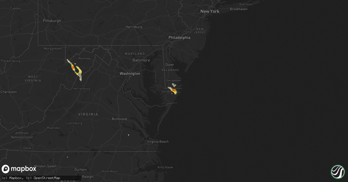
Hail Map on June 24, 2016
Get this storm
June 24 map
$229
one time, instant access
Download today. No call, no setup
Keep the $229
Bought the map and want the full workflow? Apply the entire $229 to a subscription within 7 days. None of it is wasted.
Every map, not just this one
This buys you this map. Subscription and you get every map we run, in the markets you choose from a few cities to whole states to nationwide. Plus real-time alerts the moment a storm fires.
Contact data
Name, contact info, occupancy, even credit band for addresses in the footprint. You go from where it hit to who to call.
Become the source they trust
Unlimited branding weather history reports on demand. You already have the documented answer ready for the property owner, and you are the one who showed up with it.
Property data and RoofTrace estimates
Pull up any address you have got, its value and the exact code rules for that jurisdiction, straight from One Click Code. Then RoofTrace estimates the squares, pitch, and roof value, priced the way you price.
States Impacted by Hail Map on June 24, 2016
Storm reports
West Virginia
| Date | Description |
|---|---|
| 06/24/20164:36 PM CDT | Several tree limbs snapped on snyder road. |
| 06/24/20164:36 PM CDT | Several trees down along howards lick rd |
| 06/24/20164:36 PM CDT | Several trees down along crab run road |
| 06/24/20164:18 PM CDT | A local report indicates 1.00 inch wind near 4 W LOST CITY |
| 06/24/20164:06 PM CDT | Trees down on knob rd and durgon rd. Both near south mill creek rd |
| 06/24/20164:05 PM CDT | Tree down on route 220 2 |
| 06/24/20164:01 PM CDT | Tree down on car on south grove st |
| 06/24/20164:01 PM CDT | A local report indicates 1.00 inch wind near PETERSBURG |
| 06/24/20164:01 PM CDT | Several trees down in the 5000 to 7000 block of south fork road. |
| 06/24/20164:01 PM CDT | Tree down on car on south grove st |
| 06/24/20163:57 PM CDT | Tree down on lunice creek hwy north of petersburg |
| 06/24/20163:49 PM CDT | Very large tree branches blocking s fork road |
| 06/24/20163:45 PM CDT | 3 inch diameter tree branches blocked road to house set on fire by lightning |
| 06/24/20163:35 PM CDT | 3 inch diameter tree branches blocked road to house set on fire by lightning |
Maryland
| Date | Description |
|---|---|
| 06/24/20162:28 PM CDT | . |
South Carolina
| Date | Description |
|---|---|
| 06/24/20165:37 PM CDT | Tree down on hwy 521. |
| 06/24/20165:15 PM CDT | Law enforcement and public reports of several trees down in the vicinity of george harvin rd... Loss brook rd... And racoon rd. |
| 06/24/20164:56 PM CDT | Clarendon co 911 reports multiple trees down just outside summerton. . |
| 06/24/20164:49 PM CDT | Tree down on 62 ave in north myrtle beach. |
| 06/24/20164:43 PM CDT | Tree uprooted on sc 90. Relayed by media. |
| 06/24/20164:39 PM CDT | Tree on old mullins hwy. |
| 06/24/20164:39 PM CDT | Trees down at crossing of old mullins hwy and sc9 |
| 06/24/20164:37 PM CDT | Trees down at intersection of sc66 and holly hill rd |
| 06/24/20164:37 PM CDT | Tree down on alford rd. |
| 06/24/20164:31 PM CDT | Tree on hwy 301 and iris rd. |
| 06/24/20164:30 PM CDT | Tree down at the intersection of mckenzie and scurry rd. |
| 06/24/20164:29 PM CDT | Tree down on sc 19. |
| 06/24/20164:27 PM CDT | Schp reports trees down on interstate 95 southbound near mile markers 137-138. |
| 06/24/20164:27 PM CDT | Power lines on short cut rd. |
| 06/24/20164:14 PM CDT | Schp reports trees down at kolb rd and starks ferry rd. Time estimated based on radar. |
| 06/24/20164:10 PM CDT | Quarter size hail in olanta |
| 06/24/20164:10 PM CDT | Quarter size hail in olanta |
| 06/24/20164:07 PM CDT | Tree in roadway on hwy 403. |
| 06/24/20163:34 PM CDT | Tree down on pocket rd. |
| 06/24/20163:24 PM CDT | Tree down on pocket rd. |
| 06/24/20163:13 PM CDT | Tree on old mullins hwy. |
| 06/24/20163:11 PM CDT | Trees down at crossing of old mullins hwy and sc9 |
| 06/24/20163:08 PM CDT | Power lines down in lake view. |
Wyoming
| Date | Description |
|---|---|
| 06/24/20166:30 PM CDT | A local report indicates 65 MPH wind near HORSE CREEK |
| 06/24/20165:55 PM CDT | A local report indicates 59 MPH wind near 2 SE HULETT |
| 06/24/20165:36 PM CDT | Sustained wind 30 mph. |
Alabama
| Date | Description |
|---|---|
| 06/24/20166:08 AM CDT | A tree was reported down on oak park drive near bankhead parkway ne. |
Minnesota
| Date | Description |
|---|---|
| 06/24/20165:15 AM CDT | Trees down across town. Time estimated by radar and asos gust. Crews dispatched to clear trees after 6 am. |
| 06/24/20164:22 AM CDT | Large hail and very heavy rain along the southeast shore of upper red lake. Time estimated based on radar. |
| 06/24/20164:06 AM CDT | Heavy rain and hail along the upper red lake shore line. Some stones were a bit bigger than a quarter. Time estimated based on radar. |
| 06/24/20164:00 AM CDT | A local report indicates 1.50 inch wind near 4 ENE PONEMAH |
| 06/24/20162:05 AM CDT | Brief heavy rains and occasional dime to quarter sized hail fell across far northern rollis and southeastern moose river townships. |
Nebraska
| Date | Description |
|---|---|
| 06/24/20165:18 PM CDT | Sustained 39 mph. |
North Dakota
| Date | Description |
|---|---|
| 06/23/201611:57 PM CDT | Mesonet station lostwood /lwdn8/. |
| 06/23/201611:39 PM CDT | A local report indicates 67 MPH wind near 2 ESE BLAISDELL |
| 06/23/201611:05 PM CDT | A local report indicates 62 MPH wind near 1 SSW STANLEY |
| 06/23/201611:00 PM CDT | Winds stayed high for some time |
| 06/23/201610:49 PM CDT | Watford city raws station. |
| 06/23/201610:20 PM CDT | A local report indicates 60 MPH wind near 7 NE WATFORD CITY |
| 06/23/201610:20 PM CDT | A local report indicates 1.00 inch wind near BONETRAIL |
| 06/23/201610:20 PM CDT | High winds have continued through the time of the call 1050. |
| 06/23/201610:13 PM CDT | A local report indicates 60 MPH wind near 15 E GRENORA |
| 06/23/201610:05 PM CDT | Some branches were broken and torrential rain reported |
| 06/23/201610:05 PM CDT | Considerable thunderstorm wind damage at the williams county fairgrounds between 1005 and 1100 pm cdt. Many if not all tents blown over. No injuries. |
South Dakota
| Date | Description |
|---|---|
| 06/23/20168:18 PM CDT | A local report indicates 1.00 inch wind near 11 S HARRINGTON |
Virginia
| Date | Description |
|---|---|
| 06/24/20166:45 PM CDT | Reports of multiple trees down in the area. |
| 06/24/20165:09 PM CDT | Trees across road at hopkins gap rd and genoa rd intersection |
| 06/24/20164:45 PM CDT | Couple trees down along rt 259 about a mile south of rt 820 |
| 06/23/201610:15 PM CDT | Two barns and several trees blown down. |
| 06/23/201610:00 PM CDT | Trailer turned over... Numerous trees uprooted/topped... Carport blown against tree. . |
| 06/23/20168:57 PM CDT | Danville city 911 center reports that a tree was down on water street at the railroad tracks. |
Kentucky
| Date | Description |
|---|---|
| 06/24/20166:23 PM CDT | Trees were blown down. |
Montana
| Date | Description |
|---|---|
| 06/24/20166:45 PM CDT | A local report indicates 1.00 inch wind near 9 SE EDWARDS |
| 06/24/20166:10 PM CDT | Lufborough hill dot |
| 06/24/20165:40 PM CDT | Hail covered the ground |
| 06/24/20165:33 PM CDT | A local report indicates 1.00 inch wind near 1 W FLATWILLOW |
| 06/24/20165:10 PM CDT | A local report indicates 59 MPH wind near 13 SSE FORESTGROVE |
| 06/23/201610:35 PM CDT | State line dot station. |
| 06/23/201610:35 PM CDT | Raws station. Time estimated. |
| 06/23/201610:10 PM CDT | Sious pass dot |
| 06/23/201610:00 PM CDT | Power outage. Time estimated. |
| 06/23/20169:46 PM CDT | A local report indicates 69 MPH wind near N FROID |
| 06/23/20169:30 PM CDT | Camper was overturned and 2 tipis collapsed during badlands pow wow. Report via facebook. |
| 06/23/20169:20 PM CDT | Poplar airport recorded wind gust. Time approximate. |
| 06/23/20169:20 PM CDT | Numerous trees uprooted and roofs blown off |
| 06/23/20169:20 PM CDT | A local report indicates 60 MPH wind near 14 SSE CULBERTSON |
| 06/23/20169:18 PM CDT | Measured by the poplar raws sensor |
| 06/23/20169:15 PM CDT | Highway 13 closed by mile marker 17 for approximately 20 power poles broken |
| 06/23/20169:15 PM CDT | Followup from friday night. Doe/wapa had 14 h-structure power poles snapped or blown over along highway 13. These were less than a year old. The rural utility had 50 si |
| 06/23/20168:59 PM CDT | A local report indicates 62 MPH wind near 12 SSE SPROLE |
| 06/23/20168:55 PM CDT | Trees ripped up on property... Windows broken... And doors knocked out of jams. |
| 06/23/20168:54 PM CDT | A local report indicates 75 MPH wind near 8 S RICHEY |
| 06/23/20168:32 PM CDT | A local report indicates 66 MPH wind near WOLF POINT |
| 06/23/20168:24 PM CDT | A local report indicates 60 MPH wind near CIRCLE |
| 06/23/20168:09 PM CDT | A local report indicates 62 MPH wind near 20 NW TERRY |
| 06/23/20168:00 PM CDT | A local report indicates 61 MPH wind near 27 N TERRY |
| 06/23/20167:44 PM CDT | Reported by off duty nws employee |
| 06/23/20167:36 PM CDT | A local report indicates 66 MPH wind near 2 E FORT PECK |
| 06/23/20167:15 PM CDT | A local report indicates 70 MPH wind near COHAGEN |
| 06/23/20167:15 PM CDT | A local report indicates 1.00 inch wind near COHAGEN |
| 06/23/20167:11 PM CDT | A local report indicates 68 MPH wind near JORDAN |
| 06/23/20167:10 PM CDT | A local report indicates 1.00 inch wind near 5 WNW COHAGEN |
| 06/23/20167:07 PM CDT | King coulee raws |
| 06/23/20167:05 PM CDT | Branches broken off trees |
| 06/23/20167:05 PM CDT | A local report indicates 1.00 inch wind near 12 S JORDAN |
Colorado
| Date | Description |
|---|---|
| 06/23/20168:16 PM CDT | Tree damage was also experienced. |
North Carolina
| Date | Description |
|---|---|
| 06/24/20165:10 PM CDT | Tree down on a mobile home; 200 block of misty drive. Time estimated by radar. |
| 06/24/20163:30 PM CDT | Trees down in fair bluff on hwy 904. Vehicle in ditch. |
| 06/23/20168:43 PM CDT | Tree down in the 800 block of lawsonville avenue on the east side of reidsville. |
| 06/23/20168:43 PM CDT | Rockingham county 911 center reported that one tree was down on north carolina highway 770 in stoneville. |
| 06/23/20168:00 PM CDT | 911 center reported trees down in the southern pines/vass area |
| 06/23/20167:44 PM CDT | A tree down... Taking power lines down with it. |
| 06/23/20167:03 PM CDT | Rockingham county 911 center reported that one tree was down in the 8200 block of brann road blocking the road. The tree was also down on a power line. |
Cities Impacted by Hail Map on June 24, 2016
- Big Falls, MN
- Littlefork, MN
- Crosby, ND
- Wildrose, ND
- Alamo, ND
- Watford City, ND
- Mandaree, ND
- New Town, ND
- Parshall, ND
- Arnegard, ND
- Keene, ND
- Roseglen, ND
- Killdeer, ND
- Berlin, MD
- Pittsville, MD
- Newark, MD
- Parsonsburg, MD
- Delmar, DE
- Delmar, MD
- Willards, MD
- Pamplico, SC
- Peerless, MT
- Wheatland, WY
- Grenora, ND
- Zahl, ND
- San Patricio, NM
- Lake View, SC
- Nichols, SC
- Centralia, MO
- Vida, MT
- Culbertson, MT
- Williston, ND
- Fort Morgan, CO
- Brush, CO
- Snyder, CO
- Frazer, MT
- Winnett, MT
- Roundup, MT
- Parmelee, SD
- Fisher, WV
- Moorefield, WV
- Merriman, NE
- Bottineau, ND
- Dunseith, ND
- Taylor, ND
- Gladstone, ND
- Beulah, ND
- Alexander, ND
- Washburn, ND
- Underwood, ND
- Turtle Lake, ND
- Mercer, ND
- Lynchburg, SC
- Olanta, SC
- Hamilton, ND
- Kenmare, ND
- Wedgefield, SC
- Sumter, SC
- Pinewood, SC
- Kelliher, MN
- Goodridge, MN
- Antler, ND
- Mohall, ND
- Westhope, ND
- Maxbass, ND
- Warroad, MN
- Cohagen, MT
- Sand Springs, MT
- Jordan, MT
- Chadbourn, NC
- Clarendon, NC
- Cascade, MT
- Petersburg, WV
- Maysville, WV
- Cody, NE
- Terry, MT
- Palermo, ND
- Stanley, ND
- Poplar, MT
- Tioga, ND
- Huger, SC
- Baker, WV
- Mathias, WV
- Waverly, VA
- Lavina, MT
- Lewistown, MT
- Weskan, KS
- Grygla, MN
- Roseau, MN
- Wannaska, MN
- Petersburg, TN
- Bennettsville, SC
- Orr, MN
- Whitman, NE
- Tuthill, SD
- Ashby, NE
- Ripley, TN
- Dickinson, ND
- Green Sea, SC
- Fair Bluff, NC
- Epping, ND
- Kabetogama, MN
- Souris, ND
- Port Charlotte, FL
- Wolf Point, MT
- Darlington, SC
- Society Hill, SC
- Blenheim, SC
- Latta, SC
- Waskish, MN
- Ponemah, MN
- Columbus, ND
- Noonan, ND
- Redlake, MN
- Redby, MN
- Mosby, MT
- Grass Range, MT
- Brusett, MT
- Circle, MT
- Gormania, WV
- Mount Storm, WV
- Nashua, MT
- Berthold, ND
- Dagmar, MT
- International Falls, MN
- Hazen, ND
- Zap, ND
- Cheraw, SC
- Florence, SC
- Pembina, ND
- Froid, MT
- Middle River, MN
- Gatzke, MN
- Clearbrook, MN
- Mizpah, MN
- Brockway, MT
- Forest Grove, MT
- Ray, ND
- Lancaster, MN
- Loris, SC
- Tabor City, NC
- Ryegate, MT
- Eads, CO
- Arcadia, FL
- Southern Pines, NC
- Vass, NC
- Carthage, NC
- Pinehurst, NC
- Judith Gap, MT
- Larslan, MT
- Fork, SC
- Fairmont, NC
- Lynchburg, TN
- Anamoose, ND
- Jackson, TN
- Medina, TN
- Belfield, ND
- Georgetown, DE
- Millsboro, DE
- Saint John, ND
- McColl, SC
- Esmond, ND
- York, ND
- Longs, SC
- Conway, SC
- Dunn Center, ND
- Langdon, ND
- Minden, NE
- Humboldt, TN
- Gadsden, TN
- Yanceyville, NC
- Cabins, WV
- Blackduck, MN
- Northome, MN
- Crane Lake, MN
- Bathgate, ND
- Cavalier, ND
- Myrtle Beach, SC
- Medicine Lake, MT
- Bowling Green, FL
- Drummond, MT
- Wolf Creek, MT
- Helena, MT
- Heartwell, NE
- Fulks Run, VA
- Broadway, VA
- Bergton, VA
- Dagsboro, DE
- Laurel, DE
- Frankford, DE
- Keyser, WV
- Oakland, MD
- Mcclusky, ND
- Whitetail, MT
- Scobey, MT
- Saint Matthews, SC
- Brownsville, TN
- Fallon, MT
- Lindsay, MT
- Miles City, MT
- Effingham, SC
- Timmonsville, SC
- Mount Vernon, AR
- Leeds, ND
- Carpenter, WY
- Cartwright, ND
- Belvidere, TN
- Plaza, ND
- Makoti, ND
- Vail, AZ
- Charleston, SC
- Dillon, SC
- Orrum, NC
- Galivants Ferry, SC
- Winston, MT
- Fortuna, ND
- Ambrose, ND
- Hebron, ND
- Turbeville, SC
- Glendive, MT
- Romance, AR
- Bloomfield, MT
- Richey, MT
- Calhan, CO
- Goodland, KS
- Myakka City, FL
- Parrish, FL
- Richardton, ND
- East Helena, MT
- Rose Bud, AR
- Sheridan Lake, CO
- Red Cloud, NE
- Stanton, ND
- New Salem, ND
- Willow City, ND
- Bowbells, ND
- Belfast, TN
- Kelso, TN
- Mulberry, TN
- Fayetteville, TN
- Rugby, ND
- Savage, MT
- Sidney, MT
- Crane, MT
- Winchester, TN
- Whiteville, NC
- Mayesville, SC
- Scranton, SC
- Lake City, SC
- Ingomar, MT
- Whaleyville, MD