Hail Map in Virginia on June 24, 2011
Get this storm
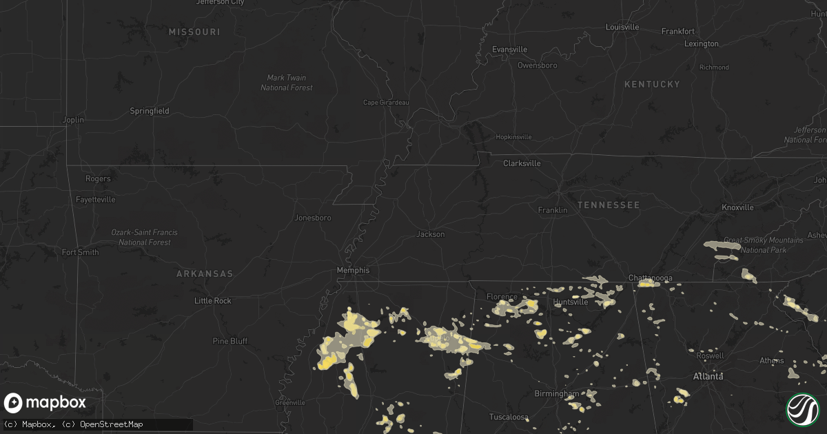
June 24 map
$229
one time, instant access
Download today. No call, no setup
Keep the $229
Bought the map and want the full workflow? Apply the entire $229 to a subscription within 7 days. None of it is wasted.
Every map, not just this one
This buys you this map. Subscription and you get every map we run, in the markets you choose from a few cities to whole states to nationwide. Plus real-time alerts the moment a storm fires.
Contact data
Name, contact info, occupancy, even credit band for addresses in the footprint. You go from where it hit to who to call.
Become the source they trust
Unlimited branding weather history reports on demand. You already have the documented answer ready for the property owner, and you are the one who showed up with it.
Property data and RoofTrace estimates
Pull up any address you have got, its value and the exact code rules for that jurisdiction, straight from One Click Code. Then RoofTrace estimates the squares, pitch, and roof value, priced the way you price.
Storm reports in Virginia
Virginia
| Date | Description |
|---|---|
| 06/24/20113:00 PM CDT | Large limbs down in the road near patrick henry mall blocking 3 lanes of traffic. |
| 06/24/20112:58 PM CDT | A local report indicates 61 MPH wind near PATRICK HENRY FIELD |
| 06/24/20112:52 PM CDT | 2 large trees down blocking portions of wolf trap rd. |
| 06/24/20112:52 PM CDT | A local report indicates 1.00 inch wind near 2 NNW NEWPORT NEWS |
All States Impacted by Hail Map on June 24, 2011
Cities Impacted by Hail Map on June 24, 2011
- Abbeville, MS
- Aurora, NE
- Newell, SD
- Hermosa, SD
- Caputa, SD
- Bronson, FL
- Inglis, FL
- Guernsey, WY
- Fort Eustis, VA
- Watford City, ND
- Spearfish, SD
- East Prairie, MO
- Oshkosh, NE
- Saint Augustine, FL
- Ooltewah, TN
- Ringgold, GA
- Apison, TN
- Omaha, NE
- Aberdeen, MS
- Hamilton, MS
- Caledonia, MS
- Greenwood Springs, MS
- Weston, NE
- Brainard, NE
- Stone Mountain, GA
- Box Elder, SD
- Ellsworth Afb, SD
- Rapid City, SD
- Henrico, NC
- Littleton, NC
- Hulett, WY
- Harrisburg, NE
- Addison, AL
- Falkville, AL
- Hartselle, AL
- Danville, AL
- Cullman, AL
- Vinemont, AL
- Merriman, NE
- Bingham, NE
- Ashby, NE
- Hyannis, NE
- Sturgis, SD
- Vale, SD
- Shelbyville, TN
- Fayetteville, TN
- Madisonville, TN
- Saluda, SC
- Nemo, SD
- Piedmont, SD
- Summerville, GA
- Armuchee, GA
- Calhoun, GA
- Columbus, MT
- Oviedo, FL
- Tullahoma, TN
- Estill Springs, TN
- Huntsville, AL
- Clearmont, WY
- Winter Park, FL
- Casselberry, FL
- Winter Springs, FL
- Charlotte, NC
- Guntersville, AL
- Tremont, MS
- Smithville, MS
- Fulton, MS
- Nettleton, MS
- Tutwiler, MS
- Drew, MS
- Parchman, MS
- Sundance, WY
- Casper, WY
- Arab, AL
- Hastings, FL
- Griswold, IA
- Elliott, IA
- Corning, IA
- Cumberland, IA
- Cascilla, MS
- Philipp, MS
- Charleston, MS
- Holcomb, MS
- Newnan, GA
- Doniphan, NE
- Juniata, NE
- Hastings, NE
- Wood River, NE
- Kenesaw, NE
- Palmetto, GA
- Potter, NE
- Hollywood, AL
- Scottsboro, AL
- Harleyville, SC
- Saint George, SC
- Harrison, NE
- Dermott, AR
- Batesville, MS
- Sardis, MS
- Englishtown, NJ
- Cranbury, NJ
- Monroe Township, NJ
- Crawford, NE
- Wheatland, WY
- Marble Hill, MO
- Lead, SD
- Silver Springs, FL
- Benton, MO
- Oran, MO
- Sidney, NE
- Floral City, FL
- Florahome, FL
- Lewellen, NE
- Elberon, VA
- Matthews, MO
- Bertrand, MO
- Yoder, WY
- Torrington, WY
- Lyman, NE
- Alda, NE
- Tuscumbia, AL
- Russellville, AL
- Chelsea, AL
- Harpersville, AL
- Sterrett, AL
- York, AL
- Harvard, NE
- Beulah, WY
- Whitesburg, GA
- Fairmont, NC
- Lumberton, NC
- Orrum, NC
- Saronville, NE
- Carthage, NY
- Carlton, GA
- Lexington, GA
- Dexter, MO
- Dudley, MO
- Tellico Plains, TN
- Robbinsville, NC
- Vonore, TN
- Bryson City, NC
- Chaffee, MO
- Rainbow City, AL
- Steele, AL
- Lake Wales, FL
- Kenansville, FL
- Brent, AL
- Labelle, FL
- Margarettsville, NC
- Seaboard, NC
- Walhalla, SC
- Trumbull, NE
- Giltner, NE
- Pickrell, NE
- Cortland, NE
- Clatonia, NE
- Bowman, SC
- Reevesville, SC
- Branchville, SC
- Jefferson, SC
- Plantersville, MS
- Inverness, FL
- Vance, AL
- Belvidere, TN
- Atlanta, GA
- Chickamauga, GA
- Rossville, GA
- Fort Oglethorpe, GA
- Sarah, MS
- Senatobia, MS
- Snow Hill, MD
- Kimball, NE
- Lincolnton, GA
- Tignall, GA
- Kilmichael, MS
- Oxford, MS
- Bushnell, NE
- Birney, MT
- Ava, MO
- Sumner, MS
- Palmer, TN
- Gruetli Laager, TN
- Seneca, SC
- Dix, NE
- Council Bluffs, IA
- Treynor, IA
- Sheridan, WY
- Deadwood, SD
- Belle Fourche, SD
- Hay Springs, NE
- Chadron, NE
- Bunn, NC
- Louisburg, NC
- Clarksdale, MS
- Marks, MS
- Lyon, MS
- Lambert, MS
- Ecru, MS
- Pontotoc, MS
- Birmingham, AL
- Leeds, AL
- Gastonia, NC
- Belmont, NC
- Longwood, FL
- Orlando, FL
- Altamonte Springs, FL
- Millry, AL
- Silas, AL
- Greenwood, MS
- Carrollton, MS
- Franktown, VA
- Exmore, VA
- Arthur, NE
- Douglas, WY
- Spring Hill, FL
- Coalmont, TN
- Tracy City, TN
- Glendo, WY
- Hartville, WY
- Hickory Flat, MS
- Anniston, AL
- Brooklyn, MS
- Black Hawk, SD
- Maywood, NE
- Alva, WY
- Hemingford, NE
- Hosford, FL
- Sopchoppy, FL
- Ninety Six, SC
- Detroit, AL
- Hamilton, AL
- Greybull, WY
- Gasburg, VA
- Wewahitchka, FL
- Worden, MT
- Amherst, NE
- Kearney, NE
- Odessa, NE
- Elm Creek, NE
- Overton, NE
- Riverdale, NE
- Monroe, NC
- Wingate, NC
- Kosciusko, MS
- Pell City, AL
- Cropwell, AL
- Heflin, AL
- Girdletree, MD
- Newark, MD
- Starke, FL
- Lawtey, FL
- Noxapater, MS
- Louisville, MS
- Belton, SC
- Clermont, GA
- Gainesville, GA
- Aladdin, WY
- Myrtle, MS
- Waterford, MS
- Potts Camp, MS
- Lebanon, MO
- Calhoun, TN
- Riceville, TN
- Mooreville, MS
- Tupelo, MS
- Saltillo, MS
- Fort Morgan, CO
- Lusk, WY
- Trinity, AL
- Courtland, AL
- Hillsboro, AL
- Moulton, AL
- Elwood, NE
- Dozier, AL
- Estillfork, AL
- Brick, NJ
- Mantoloking, NJ
- Decker, MT
- Melville, MT
- Athens, AL
- Mountain Grove, MO
- Cabool, MO
- Bernie, MO
- Greenwood, SC
- Abbeville, SC
- Decatur, IA
- Leon, IA
- Belden, MS
- Tioga, ND
- Westminster, SC
- Falcon, MO
- Richland, MO
- Laquey, MO
- Dunlap, TN
- Scottsbluff, NE
- Mitchell, NE
- Gallant, AL
- Attalla, AL
- Collinsville, MS
- Charleston, TN
- Ithaca, NE
- Wahoo, NE
- Quinn, SD
- Demopolis, AL
- Valentine, NE
- Leesville, SC
- Batesburg, SC
- Cape Girardeau, MO
- New Site, MS
- Marietta, MS
- Murdo, SD
- Hartsville, SC
- McBee, SC
- Patrick, SC
- Society Hill, SC
- Marquette, NE
- Central City, NE
- Hordville, NE
- Town Creek, AL
- Bayard, NE
- Franklin, GA
- Hightstown, NJ
- Windsor, NJ
- Robbinsville, NJ
- Bertrand, NE
- Stanley, ND
- Ragland, AL
- Manahawkin, NJ
- Barnegat, NJ
- Waretown, NJ
- Beach Haven, NJ
- Billings, MT
- New Port Richey, FL
- Hudson, FL
- Sulligent, AL
- Ocala, FL
- Buchanan, GA
- Waco, GA
- Bremen, GA
- Tallapoosa, GA
- Hillsboro, TN
- Manchester, TN
- Trenton, NJ
- Silver City, IA
- Carson, IA
- Henderson, IA
- Grant, IA
- Emerson, IA
- Prescott, IA
- Red Oak, IA
- Macedonia, IA
- Villisca, IA
- Killdeer, ND
- Norlina, NC
- Henderson, NC
- Anderson, SC
- Montreal, MO
- Camdenton, MO
- Linn Creek, MO
- Lecanto, FL
- Beverly Hills, FL
- Hernando, FL
- Roby, MO
- Tillar, AR
- Creston, IA
- Joppa, AL
- Blountsville, AL
- Baileyton, AL
- Holly Pond, AL
- Newport News, VA
- Safford, AL
- Oakland, MS
- Taylor, MS
- Water Valley, MS
- Courtland, MS
- Pope, MS
- Advance, MO
- Whitewater, MO
- Leopold, MO
- Brandon, FL
- Glenrock, WY
- Carnesville, GA
- Toccoa, GA
- Bridgeport, NE
- Fort Payne, AL
- Collinsville, AL
- Cedar Bluff, AL
- New Underwood, SD
- New Smyrna Beach, FL
- Parma, MO
- Catron, MO
- New Madrid, MO
- Canalou, MO
- Sikeston, MO
- Shannon, MS
- Henderson, NE
- Alliance, NE
- Lookout Mountain, GA
- Wildwood, GA
- Guild, TN
- Lookout Mountain, TN
- Flintstone, GA
- Chattanooga, TN
- Trenton, GA
- Pompeys Pillar, MT
- Geneva, NE
- Smithfield, VA
- Surry, VA
- Ethel, MS
- Shelton, NE
- Patton, MO
- Rushville, NE
- Wilson, NC
- Metter, GA
- Osceola, IA
- Murray, IA
- Wauchula, FL
- Centreville, AL
- Jeffrey City, WY
- Ackerman, MS
- Weir, MS
- Winchester, TN
- Essex, MO
- Fort McCoy, FL
- Gering, NE
- Vero Beach, FL
- Okeechobee, FL
- Silverstreet, SC
- Rising City, NE
- David City, NE
- Ulysses, NE
- Minatare, NE
- Melbeta, NE
- Deltona, FL
- Osteen, FL
- Gaston, NC
- Roanoke Rapids, NC
- Elkton, FL
- Verona, MS
- Point Pleasant Beach, NJ
- Lakewood, NJ
- Tallassee, TN
- Englewood, TN
- Spring Hope, NC
- Plato, MO
- Lenox, IA
- Reddick, FL
- Dahlonega, GA
- Laceys Spring, AL
- Lawrence Township, NJ
- Sparta, IL
- McCormick, SC
- Farnam, NE
- Eustis, NE
- Townville, SC
- Hershey, NE
- Scott City, MO
- Petersburg, TN
- Springville, AL
- Pendleton, NC
- Boykins, VA
- Branchville, VA
- Shelby, AL
- Christmas, FL
- Dade City, FL
- Childersburg, AL
- Glenallen, MO
- Ormond Beach, FL
- Swansea, SC
- Toney, AL
- Vina, AL
- Red Bay, AL
- Saylorsburg, PA
- Effort, PA
- Stroudsburg, PA
- Marietta, GA
- Wellington, FL
- West Palm Beach, FL
- Harvest, AL
- Elkmont, AL
- Carthage, MS
- Walnut Grove, MS
- Chatsworth, GA
- Devils Tower, WY
- Brooksville, FL
- Dunnellon, FL
- Holder, FL
- Pleasant Hill, NC
- Emporia, VA
- Mills, WY
- Laurel, MT
- Plainsboro, NJ
- Princeton, NJ
- Athens, TN
- Winter Garden, FL
- Windermere, FL
- Gilbert, SC
- Rogersville, AL
- Anderson, AL
- Athens, GA
- Ogallala, NE
- Lemoyne, NE
- Virginia Beach, VA
- Yorktown, VA
- McCool, MS
- Chatsworth, NJ
- Linden, AL
- Gallion, AL
- Hickman, KY
- Anthony, FL
- Muscle Shoals, AL
- Coila, MS
- Hayesville, NC
- Como, MS
- Crenshaw, MS
- Leighton, AL
- Cozad, NE
- Lexington, NE
- Elora, TN
- Stevenson, AL
- Huntland, TN
- Wyola, MT
- Holdrege, NE
- Funk, NE
- Covington, GA
- Springfield, NE
- Opp, AL
- Warrenton, NC
- Millstone Township, NJ
- Princeton Junction, NJ
- Seaford, VA
- Poquoson, VA
- Eldridge, MO
- Brielle, NJ
- Manasquan, NJ
- Spruce Pine, AL
- Quinton, AL
- Lander, WY
- Hill City, SD
- Neptune, NJ
- Eatontown, NJ
- Chappells, SC
- Polk, NE
- Cedartown, GA
- Keystone, NE
- Daytona Beach, FL
- Port Orange, FL
- Vaiden, MS
- Scooba, MS
- Lawley, AL
- Minden, NE
- Exeter, NE
- Fairmont, NE
- Jay Em, WY
- Madison, FL
- Haleyville, AL
- Bear Creek, AL
- Talladega, AL
- Tingley, IA
- Wilsonville, AL
- Vincent, AL
- Valparaiso, NE
- Leesburg, AL
- Midland City, AL
- Calhoun Falls, SC
- Troy, SC
- Bradley, SC
- Quakertown, PA
- Shickley, NE
- Thaxton, MS
- Sylacauga, AL
- Macon, NC
- Columbus, MS
- Pleasanton, NE
- Double Springs, AL
- Lynn, AL
- Toms River, NJ
- Nashville, NC
- Zebulon, NC
- Andalusia, AL
- Martin, SD
- Mims, FL
- Titusville, FL
- Altamont, TN
- Pelham, TN
- Gordon, NE
- Yulee, FL
- Brantley, AL
- Shepherd, MT
- Midland, SD
- Washington, GA
- Taft, TN
- Arcadia, FL
- Ashville, AL
- Okaton, SD
- Troy, AL
- Whitney, NE
- Marsland, NE
- Hillsborough, NC
- Madison, AL
- Nisland, SD
- Dendron, VA
- Mountain Rest, SC
- Long Creek, SC
- Lingle, WY
- Windsor, VA
- Freehold, NJ
- Stoutland, MO
- Alto, GA
- Baldwin, GA
- Manchester Township, NJ
- Rayle, GA
- Stephens, GA
- Afton, IA
- Acworth, GA
- Browning, MO
- Fellsmere, FL
- Monticello, FL
- Lamont, FL
- Clarks, NE
- Pierre, SD
- Fort Pierre, SD
- Goshen, AL
- Ellsworth, NE
- Roswell, GA
- Alpharetta, GA
- Lynchburg, TN
- Clayton, GA
- Vandiver, AL
- Coldwater, MS
- Holly Springs, MS
- Ellston, IA
- Micanopy, FL
- Cody, NE
- Mantachie, MS
- Peetz, CO
- Barnegat Light, NJ
- Eva, AL
- Edgewater, FL
- Greenville, AL
- Forest Home, AL
- West, MS
- Tuthill, SD
- Lodge Grass, MT
- Union City, TN
- Altoona, AL
- Miller, NE
- Sumner, NE
- Pinson, AL
- Weogufka, AL
- Suffolk, VA
- Osage Beach, MO
- Sunrise Beach, MO
- Parrish, FL
- Wimauma, FL
- Gadsden, AL
- Hazel Green, AL
- Meridianville, AL
- New Market, AL
- Garrett, WY
- Lake Worth, FL
- Loxahatchee, FL
- Absarokee, MT
- Reed Point, MT
- Shuqualak, MS
- Mableton, GA
- Saint Onge, SD
- Boaz, AL
- Normandy, TN
- Busby, MT
- South Pittsburg, TN
- Monteagle, TN
- Fulton, KY
- Newcastle, WY
- Cody, WY
- Rocky Mount, NC
- Blue Springs, MS
- Guntown, MS
- Big Timber, MT
- Alpine, AL
- Crawfordville, GA
- Burlington, WY
- Gresham, NE
- Ariton, AL
- Immokalee, FL
- Rome, GA
- Mount Berry, GA
- Muscadine, AL
- Fruithurst, AL
- Whitewood, SD
- Ashland, NE
- Gretna, NE
- Howell, NJ
- Colts Neck, NJ
- Oakhurst, NJ
- Roosevelt, NJ
- Farmingdale, NJ
- Asbury Park, NJ
- Golden, MS
- Sheffield, AL
- Mount Hope, AL
- Belmar, NJ
- Jemison, AL
- Thorsby, AL
- Buffalo, SD
- Woodstock, GA
- La Fayette, GA
- Menlo, GA
- Winner, SD
- Buffalo, MO
- Tunas, MO
- Windyville, MO
- Loomis, NE
- Pisgah, AL
- Woodville, AL
- Fackler, AL
- Calera, AL
- Phil Campbell, AL
- Newberry, SC
- Iliff, CO
- Winterville, GA
- Piedmont, AL
- Hampton, NE
- Matthews, NC
- Indian Trail, NC
- Youngsville, NC
- Castalia, NC
- Annapolis, MO
- Okolona, MS
- Lancaster, SC
- Blue Ridge, GA
- Ellijay, GA
- Saint Francis, SD
- Ceresco, NE
- Cohutta, GA
- Dalton, GA
- Crandall, GA
- Ardmore, TN
- Colbert, GA
- Oxford, AL
- Ward, SC
- Cross Hill, SC
- Prosperity, SC
- Macks Creek, MO
- Lakeland, FL
- Mount Carmel, SC
- Michie, TN
- Gibbon, NE
- Amory, MS
- Decatur, AL
- Halifax, NC
- Jackson, NC
- Garysburg, NC
- Weldon, NC
- Ong, NE
- Lynchburg, MO
- Edgefield, SC
- Kinston, AL
- Edgemont, SD
- Newton, AL
- Camden, MS
- Belmont, MS
- Shelby, NE
- Percy, IL
- Trion, GA
- Smithfield, NE
- Moorefield, NE
- Summerfield, FL
- Graysville, TN
- Elba, AL
- Thomaston, GA
- Sallis, MS
- Belvidere, SD
- Davis City, IA
- West Point, MS
- Norfolk, VA
- Chesapeake, VA
- West Union, SC
- Canon, GA
- Nauvoo, AL
- Yutan, NE
- Belle Glade, FL
- Sutherland, NE
- Bee, NE
- Seward, NE
- Merigold, MS
- Walsh, IL
- Evansville, IL
- Ruby, SC
- Mount Croghan, SC
- Tampa, FL
- Dover, FL
- Seffner, FL
- Valrico, FL
- Enfield, NC
- Thomaston, AL
- Henagar, AL
- Sylvania, AL
- Bridgeport, AL
- Decatur, GA
- Enid, MS
- Marquand, MO
- Fredericktown, MO
- Sims, NC
- Bailey, NC
- Elm City, NC
- Graff, MO
- Huggins, MO
- Dennis, MS
- Union Grove, AL
- Somerville, AL
- Sledge, MS
- Vance, MS
- Dundee, MS
- Andrews, NC
- Logan, AL
- Mulberry, TN
- Colome, SD
- Shellman, GA
- Douglasville, GA
- Winston, GA
- Etta, MS
- Schlater, MS
- East Palatka, FL
- Meeteetse, WY
- Due West, SC
- Water Valley, KY
- Ballantine, MT
- Gurley, AL
- Princeton, AL
- Hollytree, AL
- Whitwell, TN
- Sutton, NE
- West Blocton, AL
- Guin, AL
- New Boston, MO
- Jacksonville, AL
- Lisco, NE
- Clanton, AL
- French Camp, MS
- Stewart, MS
- Lauderdale, MS
- Tunnel Hill, GA
- Mead, NE
- Middlesex, NC
- Scobey, MS
- Tillatoba, MS
- Oneonta, AL
- Bowdon, GA
- Cleveland, TN
- Utica, NE
- Staplehurst, NE


