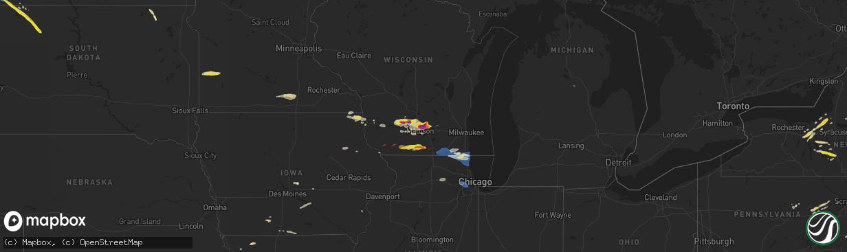
Hail Map on June 22, 2024
The weather event on June 22, 2024 includes Wind, Hail, and Tornado maps. 19 states and 494 cities were impacted and suffered possible damage. The total estimated number of properties impacted is 93,813.
Want more than just the map?
Turn this storm into a full workflow.
- Owner + property data so you know who to knock
- OnDemand branded weather history reports to win the "did we even have hail?" argument
- RoofTrace estimate so reps stop guessing numbers at the door
Bought this map? Upgrade within 7 days and we'll credit the $230. (10-15 min setup call)
Wind
Hail
Tornado
93,813
Estimated number of impacted properties by a 1.00" hail or larger48,098
Estimated number of impacted properties by a 1.75" hail or larger2,992
Estimated number of impacted properties by a 2.50" hail or largerStates Impacted by Hail Map on June 22, 2024
Storm reports
Missouri
| Date | Description |
|---|---|
| 06/21/202411:11 PM CDT | A local report indicates 65 MPH wind near 2 ENE Unity Village |
| 06/21/202411:08 PM CDT | A local report indicates 61 MPH wind near 2 ENE Unity Village |
New York
| Date | Description |
|---|---|
| 06/22/20246:50 PM CDT | Tree down blocking the road near the intersection of outlet road and curran road. |
| 06/22/20246:44 PM CDT | Trees down. Poles down. |
| 06/22/20246:42 PM CDT | Time estimated based on radar. Tree down in the southbound lane on state rt 14 at gifford road. |
| 06/22/20246:42 PM CDT | Tree down blocking the road on thompson station rd. |
| 06/22/20246:40 PM CDT | Trees down. |
| 06/22/20246:40 PM CDT | Trees down. |
| 06/22/20246:39 PM CDT | Two trees down completely blocking toll road between griffith road and case road. |
| 06/22/20246:38 PM CDT | Tree down blocking road. |
| 06/22/20246:35 PM CDT | Trees down. |
| 06/22/20246:33 PM CDT | *** 1 inj *** multiple trees down on route 392. Road impassable in spots. 1 reported injured from fallen tree. |
| 06/22/20246:33 PM CDT | *** 1 inj *** |
| 06/22/20246:28 PM CDT | Trees down and pole snapped. |
| 06/22/20246:25 PM CDT | Trees and wires down. Time estimated by radar. |
| 06/22/20246:23 PM CDT | Relayed via social media. |
| 06/22/20246:20 PM CDT | Numerous trees down. Tree down on house. |
| 06/22/20246:18 PM CDT | Trees down. |
| 06/22/20246:15 PM CDT | Trees down. |
| 06/22/20246:15 PM CDT | Trees down. |
| 06/22/20246:15 PM CDT | Trees down. |
| 06/22/20246:12 PM CDT | Multiple trees down. |
| 06/22/20245:25 PM CDT | Trees and wires down. |
| 06/22/20245:14 PM CDT | Trees and wires down... Snapped power pole. Time estimated by radar. |
| 06/22/20245:10 PM CDT | Time estimated based on radar. Power lines down with a large tree limb on the lines. |
| 06/22/20245:10 PM CDT | Time estimated based on radar. Tree down... Partially blocking white springs road in geneva. |
| 06/22/20245:10 PM CDT | Time estimated based on radar. Tree down completely blocking the intersection at saint clair street and south main street. |
| 06/22/20244:08 PM CDT | Tree down at hwy 306 & pearl dr. |
| 06/22/20242:00 PM CDT | Trees down on sharon station road. |
| 06/22/202412:52 PM CDT | 2 trees and wires down on highland road. One of the downed trees is at the intersection of highland road and rock city road. |
| 06/22/202411:35 AM CDT | Trees down. |
| 06/22/20241:55 AM CDT | A local report indicates 1.25 inch wind near 1 SE Point Rock |
| 06/21/202410:15 PM CDT | Tree and wires down on road. |
| 06/21/202410:04 PM CDT | Corrects previous tstm wnd dmg report from highland lake. Trees and wires down in area. |
| 06/21/20249:04 PM CDT | Corrects previous tstm wnd dmg report from highland lake. Corrects previous tstm wnd dmg report from highland lake. Trees and wires down in area. |
| 06/21/20248:20 PM CDT | Corrects previous tstm wnd dmg report from highland lake. Trees and wires down in area. |
| 06/21/20248:06 PM CDT | Trees and wires down in the town of oswego. |
| 06/21/20247:53 PM CDT | Half dollar sized hail reported in fulton. |
| 06/21/20247:53 PM CDT | Picture of ping pong ball sized hail in fulton sent via social media. |
| 06/21/20247:50 PM CDT | Multiple trees and wires down in fulton. |
| 06/21/20247:47 PM CDT | Multiple trees and wires down in granby. |
| 06/21/20247:44 PM CDT | Picture shows hail stone in hand that looks between 1 and 1.5 inches. |
| 06/21/20247:31 PM CDT | Trees and wires down. |
| 06/21/20247:30 PM CDT | Trees and wires down. |
| 06/21/20247:29 PM CDT | Report from mping: 1-inch tree limbs broken; shingles blown off. |
| 06/21/20247:28 PM CDT | Trees and wires down. |
| 06/21/20247:27 PM CDT | Multiple trees and wires down in the town of cato. |
| 06/21/20247:26 PM CDT | Tree and wires down on road. |
| 06/21/20247:25 PM CDT | Multiple trees and wires down in the town of victory. |
| 06/21/20247:22 PM CDT | Multiple trees down in the town of conquest. |
| 06/21/20247:12 PM CDT | Trees and wires reported down in auburn. |
| 06/21/20247:11 PM CDT | Trees down in the town of lyons. |
| 06/21/20247:07 PM CDT | Trees down in the town of savannah. |
| 06/21/20247:04 PM CDT | Two trees down in the town of newark. |
| 06/21/20247:04 PM CDT | Numerous trees and lines down in the town of clyde. |
| 06/21/20247:04 PM CDT | Trees down. |
| 06/21/20247:02 PM CDT | Trees down. |
Connecticut
| Date | Description |
|---|---|
| 06/22/20246:20 PM CDT | Large downed tree limb partially blocked residential street in trumbull. |
| 06/22/20245:41 PM CDT | Law enforcement reports trees down across the town of brookfield with numerous instances of damage. |
| 06/22/20245:41 PM CDT | Corrects previous tstm wnd dmg report from 3 e new fairfield. Law enforcement reports trees down across the town of brookfield with numerous instances of damage. Some o |
| 06/22/20245:39 PM CDT | Trees down across road at shore rd and hawthorne cove rd. Time estimated from radar. |
| 06/22/20245:14 PM CDT | Tree down with wires on middletown ave in north haven. |
| 06/22/20244:52 PM CDT | Several downed trees reported by woodbridge pd. Some of the roads include racebrook and bunkerhill. |
| 06/22/20244:25 PM CDT | Route 188 closed between hogsback road & captain wooster road because of wires and poles down. |
| 06/22/20244:18 PM CDT | Downed tree on sachem rd. |
| 06/22/20244:14 PM CDT | Corrects previous tstm wnd dmg report from 2 sse north haven. Tree down with wires on middletown ave in north haven. |
| 06/22/20243:50 PM CDT | Large tree across road near hwy 70 & waterbury rd. |
| 06/22/20243:45 PM CDT | Photo of ping pong ball sized hail. |
| 06/22/20243:32 PM CDT | Near crosby high school. |
| 06/22/20243:26 PM CDT | Downed tree on willow st. |
| 06/22/20243:26 PM CDT | **3 inj** first responders identified a tree struck by lightning and 3 patients near the strike. Ems crew treated two patients who were transported to area hospitals fo |
| 06/22/20243:17 PM CDT | Video of half dollar size hail on social media. |
| 06/22/20243:17 PM CDT | Corrects previous hail report from 1 nw east hampton. Video of half dollar size hail on social media and photo of golf ball size hail. |
| 06/22/20243:15 PM CDT | Tree/wires down on hampton rd. Relayed by amateur radio. Time estimated from radar. |
| 06/22/20243:15 PM CDT | Tree/wires down on hampton rd. Relayed by amateur radio. Tim |
| 06/22/20243:10 PM CDT | Photos and video of numerous trees and wires down at a campground will trees causing damage to several rvs. |
| 06/22/20243:08 PM CDT | Photos showing numerous trees down with wires. |
| 06/22/20243:06 PM CDT | Several trees down in morris |
| 06/22/20243:05 PM CDT | Tree/wires down along rt 171 and rt 198. Relayed by amateur radio. Time estimated from radar. |
| 06/22/20242:58 PM CDT | Report from mping - quarter size hail. |
| 06/22/20242:55 PM CDT | Video of ping pong size hail on social media. |
| 06/22/20242:55 PM CDT | Multiple trees down along rte 190. Time estimated from radar. |
| 06/22/20242:50 PM CDT | Half of a large tree fell onto a house on south rd. |
| 06/22/20242:50 PM CDT | Photo of large limbs downed along with a broken power pole. Time estimated from radar. |
Indiana
| Date | Description |
|---|---|
| 06/22/20242:59 AM CDT | Delayed report on facebook of a medium sized |
| 06/22/20242:00 AM CDT | Delayed report. Public report of tree damage at 3 am edt at the intersection of us 20 and cr 23 near elkhart. Photo on facebook shows a large limb |
| 06/22/20242:00 AM CDT | Delayed report of several boat lifts flipped on barbee lake. Time estimated via radar. |
| 06/22/20242:00 AM CDT | Delayed report. Photo on facebook shows a large tree branch |
| 06/22/20241:54 AM CDT | Corrects time of previous tstm wnd dmg report from leesburg. Delayed report. Photos on facebook show a large tree branch |
| 06/22/20241:54 AM CDT | Delayed report. Large branches |
| 06/22/20241:24 AM CDT | Delayed report. Several reports on facebook of branches down |
| 06/22/20241:24 AM CDT | Delayed report. Public report on facebook of quite a few branches down on us 33 heading from mishawaka to goshen. Time estimated via radar. |
| 06/22/20241:23 AM CDT | Delayed report. Public report on facebook of quite a few branches down on mishawaka rd near the intersection with cr 111. Time estimated via radar. |
| 06/22/20241:12 AM CDT | Tree down |
| 06/22/20241:05 AM CDT | Delayed report. Medium size tree |
| 06/22/20241:05 AM CDT | Tree down |
| 06/22/20241:04 AM CDT | Power line down on a tree on grape road. Time estimated from radar. |
| 06/22/20241:03 AM CDT | Delayed report. Several trees |
| 06/22/202412:31 AM CDT | Delayed report. Photo on facebook shows a large tree limb |
| 06/22/202412:30 AM CDT | Delayed report. Photo on facebook shows damage on the west side of south pine lake. Several limbs down |
Iowa
| Date | Description |
|---|---|
| 06/22/20245:01 PM CDT | Tree blown down. |
Michigan
| Date | Description |
|---|---|
| 06/22/20243:43 PM CDT | Arenac county emergency manager reports damage in and around the community surrounding forest lake. Possible tornado. Time estimated by radar. |
| 06/22/20243:36 PM CDT | Arenac county em reports damage in and around the town of alger. Possible tornado. Time estimated by radar. |
| 06/22/20243:24 PM CDT | Report of trees down over wildwood road in northeastern gladwin county. Possible tornado. Time estimated by radar. |
| 06/22/20243:24 PM CDT | Trees and wires down on bench road. Possible tornado. Time estimated by radar. |
| 06/22/20243:24 PM CDT | Report of wires down relayed by gladwin county em. Tornado possible |
| 06/22/20243:24 PM CDT | Large tree branches downed onto wires one mile north of the bourret township fire hall. Possible tornado. Time estimated by radar. |
| 06/22/20243:24 PM CDT | Report of wires down relayed by gladwin county em. Tornado possible. Time estimated by radar. |
| 06/22/20243:17 PM CDT | Report of trees and wires down on cedar lake road. Possible tornado. Time estimated by radar. |
| 06/22/20242:18 PM CDT | Several downed trees with power outages. |
| 06/21/202410:55 PM CDT | Delayed report. Numerous small branches |
| 06/21/202410:53 PM CDT | Delayed report. Powerlines down onto hoover avenue in benton harbor. Time estimated via radar. |
North Dakota
| Date | Description |
|---|---|
| 06/22/20246:07 PM CDT | Ndawn site. |
| 06/22/20245:45 PM CDT | Hail from 5:45 to 5:50. Swing set blown over. |
| 06/21/20248:06 PM CDT | Picture of a handful of hailstones up to the size of quarters. Relayed via broadcast media. Time estimated by radar. |
| 06/21/20247:05 PM CDT | Small hail. |
New Hampshire
| Date | Description |
|---|---|
| 06/22/20243:45 AM CDT | Delayed report...tree down blocking nh-10 in the area of oak dr in gilsum. Time estimated via radar. |
Wisconsin
| Date | Description |
|---|---|
| 06/22/20246:58 PM CDT | A local report indicates 1.75 inch wind near 1 W Sun Prairie |
| 06/22/20246:56 PM CDT | A local report indicates 1.00 inch wind near 1 SW Sun Prairie |
| 06/22/20246:55 PM CDT | Structure damage to large shed/barn. Picture via social media. |
| 06/22/20246:54 PM CDT | A local report indicates 1.75 inch wind near 1 N Sun Prairie |
| 06/22/20246:53 PM CDT | A local report indicates 1.25 inch wind near 2 W Sun Prairie |
| 06/22/20246:51 PM CDT | A local report indicates 1.50 inch wind near 3 W Sun Prairie |
| 06/22/20246:49 PM CDT | Picture of measured hail via social media. |
| 06/22/20246:47 PM CDT | A local report indicates 1.25 inch wind near 2 NW Maple Bluff |
| 06/22/20245:39 PM CDT | Trees down over road |
| 06/22/20245:39 PM CDT | Trees down over road and debris blocking roads around cornelia. Possible tornado damage. |
| 06/22/20245:37 PM CDT | Brief ef-0 tornado with tree damage near the intersection of highway o and north lane. Touchdown was observed. |
| 06/21/20248:23 PM CDT | Videos of house and tree damage in janesville on social media. |
| 06/21/20248:22 PM CDT | Nws damage survey confirmed tornado. An ef-1 tornado developed south of geneva lake and moved northeast across the lake before lifting just south of lake como. Multiple |
| 06/21/20248:22 PM CDT | Nws damage survey confirmed tornado. Rated ef-1 with peak wind of 105 mph. |
| 06/21/20248:14 PM CDT | Report from mping: 1-inch tree limbs broken; shingles blown off. |
| 06/21/20248:13 PM CDT | Report from mping: 3-inch tree limbs broken; power poles broken. |
| 06/21/20248:12 PM CDT | Report from mping: 3-inch tree limbs broken; power poles broken. |
| 06/21/20248:11 PM CDT | Report from mping: 3-inch tree limbs broken; power poles broken. |
| 06/21/20248:11 PM CDT | Report from mping: 3-inch tree limbs broken; power poles |
| 06/21/20248:04 PM CDT | Report from mping: 3-inch tree limbs broken; power poles broken. |
| 06/21/20248:03 PM CDT | Report from mping: 3-inch tree limbs broken; power poles broken. |
| 06/21/20248:00 PM CDT | Report from mping: 3-inch tree limbs broken; power poles broken. |
| 06/21/20247:42 PM CDT | Nws storm survey: ef-2 tornado with estimated peak wind speeds of 115mph. Estimated to be on the ground from 7:42pm-7:53pm. Most of the damage was at ef-1 level but a f |
| 06/21/20247:30 PM CDT | An ef-1 rated tornado developed west of watertown... Near the intersection of county roads q and t. The tornado progressed northeastward... Causing substantial damage t |
| 06/21/20247:10 PM CDT | Picture of measured hail via social media. |
| 06/21/20247:10 PM CDT | An ef-1 rated tornado developed south of marshall... Progressing northeastward. Multiple farm and outbuildings... A few homes... And numerous trees were damaged. Peak w |
| 06/21/20247:07 PM CDT | A local report indicates 1.75 inch wind near 2 N Maple Bluff |
Minnesota
| Date | Description |
|---|---|
| 06/22/20242:25 PM CDT | Chaser reported several uprooted trees in new richland. Noted that the winds were likely below severe criteria but the recent excessive rainfall caused the trees to upr |
| 06/22/20242:24 PM CDT | Photos of large tree branches down across town and several trees snapped near their base. Noted branches down on homes and power lines down. Time estimated via radar. |
| 06/22/202411:59 AM CDT | Quarter sized hail stripped a lot of leaves. |
| 06/22/202411:59 AM CDT | Multiple trees blown down by winds estimated at 60 to 70 mph. Some downed trees had trunk diameters as large as 4 feet. |
| 06/22/202411:20 AM CDT | Reports of several trees down and power lines near the intersection of county road 15 and 1. Damage extended slightly further east with minor property damage near the i |
Pennsylvania
| Date | Description |
|---|---|
| 06/22/20246:50 PM CDT | Tree down blocking route 11/15. |
| 06/22/20246:48 PM CDT | Tree down on susquehanna trail. |
| 06/22/20245:50 PM CDT | Heavy rain - 0.95 inches in 20 minutes. Quarter sized hail |
| 06/22/20245:23 PM CDT | Report of a tree down on a car parked near the corner of boak ave and south branch st in hughesville... Pa boro. |
| 06/22/20245:19 PM CDT | Trees down across the roadway along clarkstown rd west of clarkstown... Pa. |
| 06/22/20245:00 PM CDT | Trees on the roadway northern end of pleasant hills rd. |
| 06/22/20245:00 PM CDT | Power outages reported by multiple home owners along armstrong rd due to poles down along armstrong rd and rt 15. |
| 06/22/20245:00 PM CDT | Trees down on the roadway 2 miles north of rt 220 on highland lake rd. |
| 06/22/20244:57 PM CDT | Quarter sized hail. |
| 06/22/20244:55 PM CDT | Report of a tree on a house at the corner of south railroad st and west academy st. No reports of any injuries. |
| 06/22/20244:55 PM CDT | Trees on the roadway. |
| 06/22/20244:55 PM CDT | Measured .7 inches of rain... Heavy winds |
| 06/22/20244:55 PM CDT | Numerous trees down across the town of hughesville especially between main st and cardinal dr. |
| 06/22/20244:50 PM CDT | Market street in muncy - multiple trees down. Multiple wires down. |
| 06/22/20244:50 PM CDT | Reports of trees and poles down near the 200 block of state home rd. |
| 06/22/20244:50 PM CDT | Trees down on power lines along wolf run rd in wolf township. |
| 06/22/20244:50 PM CDT | Tree across the roadway on john bradley dr. ! mile north of the rt 405 intersection. |
| 06/22/20244:45 PM CDT | Reported power outages... Wire down on road and multiple trees down. |
| 06/22/20244:42 PM CDT | Trees down on the train tracks along rt 405 in muncy township. |
| 06/22/20244:31 PM CDT | Tree down on 2200 block s front st partially blocking roadway. |
| 06/22/20244:07 PM CDT | Tree down on property along 16th st. |
| 06/22/20244:05 PM CDT | Tree down on wires on rathton rd. |
| 06/22/20244:00 PM CDT | Trees down between pine hill rd and wertzville rd. |
| 06/22/20244:00 PM CDT | Tree down on 500 block good hope rd. |
| 06/22/20243:48 PM CDT | Trees snapped and uprooted between 1200 and 1600 block moose run rd. Powerlines down. |
| 06/22/20241:56 PM CDT | Trees/wires down. |
| 06/22/20241:56 PM CDT | Trees and wires down. |
| 06/21/20249:40 PM CDT | Corrects previous tstm wnd dmg report from 1 wsw beach lake. Tree down on a house... With damage. |
| 06/21/20249:07 PM CDT | Wires down. Time estimated by radar. |
| 06/21/20248:50 PM CDT | Trees and wires down. Time estimated by radar. |
| 06/21/20248:40 PM CDT | Tree down on a house. |
| 06/21/20248:40 PM CDT | Tree down on a house... With damage. |
| 06/21/20248:09 PM CDT | Multiple trees snapped or uprooted around harveys lake. |
| 06/21/20247:30 PM CDT | Multiples trees |
| 06/21/20247:30 PM CDT | *** 1 inj *** tree down. 1 person injured grassmere park campground. |
| 06/21/20247:28 PM CDT | Tree down and pole down - vehicle has hit the downed pole. |
| 06/21/20247:20 PM CDT | Tree down onto a mobile home on fawn grove lane. Time estimated from rad |
| 06/21/20247:20 PM CDT | Large tree down on adams road blocking the roadway. Time estimated from radar. |
| 06/21/20247:20 PM CDT | Tree down onto a mobile home on fawn grove lane. Time estimated from radar. |
| 06/21/20247:17 PM CDT | Tree across the roadway on a blind curve near the moreland bapist church. |
| 06/21/20247:13 PM CDT | Report from mping: 1-inch tree limbs broken; shingles blown off. |
| 06/21/20247:12 PM CDT | Tree down on sr 42. |
| 06/21/20247:10 PM CDT | Tree down on fernheim road. Time estimated by radar. |
| 06/21/20247:07 PM CDT | Tree reported down blocking road on hawk rd. |
Illinois
| Date | Description |
|---|---|
| 06/22/202412:32 AM CDT | Tree branches down. |
| 06/21/202411:45 PM CDT | Report of a bigger limb that came down and stuck in lower branches of the tree. Time approximated by radar. |
| 06/21/202411:24 PM CDT | Report of a tree down blocking the road at briarcliff and fernwood roads in boulder hill. Time estimated by radar. |
| 06/21/202411:24 PM CDT | 20 foot long... 6 inch diameter tree branch blocking west bound royce road. Time approximated by radar. |
| 06/21/202411:16 PM CDT | Large branches down... Approximated 12tree snapped diameter tree snapped at the base in katherine legge memorial park. |
| 06/21/202411:14 PM CDT | Davis personal weather station. |
| 06/21/202411:13 PM CDT | Large tree uprooted. |
| 06/21/202411:09 PM CDT | Several large branches downed and also 2 large old willow trees uprooted. |
| 06/21/202411:05 PM CDT | Numerous trees and large branches down across south part of wheaton... Including one large tree uprooted onto a car. |
| 06/21/202411:05 PM CDT | Report passed along of several trees and large limbs down... Along with some sign damage on butterfield rd between wheaton and glen ellyn. Time estimated by radar. |
| 06/21/202411:00 PM CDT | Large willow tree down on fence. |
| 06/21/202410:51 PM CDT | Tree down across randall rd. Near fabyan parkway. |
| 06/21/202410:50 PM CDT | Reported via social media that on the northeast side of batavia had a lot of tree branches down including one full grown tree. Time approximated by radar. |
| 06/21/202410:50 PM CDT | Tree reported down on a house on maple lane near center street. |
| 06/21/202410:50 PM CDT | Large branches down on fabyan rd. |
| 06/21/202410:49 PM CDT | Numerous downed trees and large branches in the randall square area and near fabyan pkwy. |
| 06/21/202410:48 PM CDT | Numerous large branches and trees downed... Including one large oak tree uprooted. Tree down into powerlines. |
| 06/21/20249:09 PM CDT | Corrects previous non-tstm wnd gst report from 1 sw beach park. Asos station kugn waukegan airport. |
| 06/21/20248:59 PM CDT | Ambient personal weather station. |
| 06/21/20248:50 PM CDT | Large trees down near lagoona lake. |
| 06/21/20248:49 PM CDT | Personal weather station. |
| 06/21/20248:46 PM CDT | Reported via social media of a 9 inch tree branch down just southeast of antioch... Il. Time approximated by radar. |
| 06/21/20248:37 PM CDT | Photographs of several large tree limbs down across richmond shared via social media. Some appear to be as large as 12 inches in diameter. Time estimated from radar. |
| 06/21/20248:30 PM CDT | Numerous trees and large branches down. |
| 06/21/20248:30 PM CDT | Large branches downed. |
Florida
| Date | Description |
|---|---|
| 06/22/20244:10 PM CDT | Pictures were received showing a large tree down in lutz. Time was estimated from radar. |
South Dakota
| Date | Description |
|---|---|
| 06/21/20248:35 PM CDT | Mping report |
| 06/21/20248:31 PM CDT | Mping report |
Ohio
| Date | Description |
|---|---|
| 06/22/20244:30 AM CDT | Delayed report. Photo on x/twitter shows a few large trees |
| 06/22/20243:36 AM CDT | Delayed report. Pictures on facebook show a large tree branch with some rot snapped along county road fg in delta |
New Jersey
| Date | Description |
|---|---|
| 06/22/20244:25 PM CDT | Downed trees reported by wayne pd. |
| 06/22/20243:25 PM CDT | Numerous trees blown down across ne monmouth county from port monmouth to the highlands. Time estimated from radar. |
| 06/22/20243:16 PM CDT | Report from mping: trees uprooted or snapped. |
| 06/22/20243:12 PM CDT | A 62 mph thunderstorm wind gust measured at the sandy hook nos weather station. |
| 06/22/20243:08 PM CDT | Report from mping: 1-inch tree limbs broken. |
| 06/22/20242:39 PM CDT | Late report. Caller reported numerous trees down in carteret. Radar indicated microburst. Time estimated from radar. |
| 06/22/20242:23 PM CDT | Multiple downed trees reported to media. |
| 06/22/20242:20 PM CDT | Multiple reports of trees down in middlesex borough on the somerset county side. Time estimated from radar. |
| 06/22/20242:20 PM CDT | Report of trees and wires down in middlesex borough. Time estimated from radar. |
| 06/22/20242:10 PM CDT | Multiple reports of trees and wires down in the somerville... Manville... And bridgewater areas. Time estimated from radar. |
| 06/22/20242:09 PM CDT | Report of several trees and wires down in bridgewater... Nj. Time estimated from radar. |
| 06/22/202412:52 PM CDT | Large tree across jackson ave. |
| 06/22/202411:42 AM CDT | Tree down on wires along branchville-lawson road. Time estimated from radar. |
| 06/21/20248:05 PM CDT | Report of roofs blown off of sheds in stewartsville. Time estimated from radar. |
| 06/21/20247:55 PM CDT | Several trees and wires down near greenwich township... Nj. Time estimated from radar. |
| 06/21/20247:54 PM CDT | Downed tree on us 22 westbound east of cr 519/saint james st/uniontown rd in pohatcong twp. All lanes closed. Time estimated from radar. |
| 06/21/20247:50 PM CDT | Hail estimated up to the size of quarters in the valley view neighborhood of phillipsburg. Time estimated from radar. |
| 06/21/20247:25 PM CDT | Trees and wires down around clinton. Time estimated from radar. |
| 06/21/20247:05 PM CDT | Trees and wires down near lebanon and mcpherson township. Time estimated from radar. |
| 06/21/20247:05 PM CDT | Report and photos relayed via social media of a large tree fallen onto a house on tamarack trail. Additional trees were down in the neighborhood as well. Time estimated |
| 06/21/20247:03 PM CDT | Tree down into a house. Time estimated from radar. |
Massachusetts
| Date | Description |
|---|---|
| 06/22/20242:35 PM CDT | Trees down on dozens of roads throughout town. Time estimated from radar. |
| 06/22/20242:35 PM CDT | Updated information - south portion of town more impacted. Several homes along monson rd with trees onto their roof. 1 with significant damage with tree going through t |
| 06/22/20242:35 PM CDT | Trees down along monson rd. One tree onto a house with minor damage. Relayed by amateur radio. Time estimated by radar. |
| 06/22/20241:53 PM CDT | Report of power lines and a tree down in russel near carrington road. |
| 06/22/20241:30 PM CDT | One tree and wires down on butler road in stockbridge... Ma. |
| 06/22/20241:25 PM CDT | Tree down on house. |
| 06/22/20241:15 PM CDT | Report of a tree down on west carter road in west stockbridge... Ma. |
| 06/22/20241:15 PM CDT | Multiple trees down on west alford road at the west stockbridge town line. |
| 06/22/20241:15 PM CDT | Report of a tree down on interstate 90 in the westbound lane. |
Cities Impacted by Hail Map on June 22, 2024
- Rawlins, WY
- Encampment, WY
- Saratoga, WY
- Craig, CO
- Hayden, CO
- Hamilton, CO
- Steamboat Springs, CO
- North Platte, NE
- Maxwell, NE
- Callaway, NE
- Gothenburg, NE
- Esperance, NY
- Sprakers, NY
- Sloansville, NY
- Schoharie, NY
- Central Bridge, NY
- Delanson, NY
- Lake Benton, MN
- Tyler, MN
- Arco, MN
- Ivanhoe, MN
- Branchville, NJ
- Russell, MN
- Lynd, MN
- Marshall, MN
- Valatie, NY
- Niverville, NY
- Old Chatham, NY
- East Chatham, NY
- Chatham, NY
- Canaan, NY
- Austerlitz, NY
- West Stockbridge, MA
- Richmond, MA
- Stockbridge, MA
- South Lee, MA
- Great Barrington, MA
- Pine Plains, NY
- Housatonic, MA
- Monterey, MA
- Stanfordville, NY
- Tyringham, MA
- Millerton, NY
- Amenia, NY
- Delavan, MN
- Minnesota Lake, MN
- Sandisfield, MA
- Norfolk, CT
- Mapleton, MN
- Southfield, MA
- Wells, MN
- New Richland, MN
- Waldorf, MN
- Colebrook, CT
- Winsted, CT
- West Hartford, CT
- Hartford, CT
- East Hartford, CT
- Glastonbury, CT
- Wethersfield, CT
- South Glastonbury, CT
- Rocky Hill, CT
- Wilbraham, MA
- Millbrook, NY
- Meeker, CO
- Hartland, MN
- Ellendale, MN
- Portland, CT
- East Hampton, CT
- Marlborough, CT
- Vernal, UT
- Bantam, CT
- Lakeside, CT
- Morris, CT
- Litchfield, CT
- Staten Island, NY
- Watertown, CT
- Bethlehem, CT
- Sewaren, NJ
- Thomaston, CT
- Northfield, CT
- Plymouth, CT
- Bristol, CT
- Terryville, CT
- Burlington, CT
- Harwinton, CT
- Cobalt, CT
- Colchester, CT
- Waterbury, CT
- Newington, CT
- Oakville, CT
- Wolcott, CT
- Rangely, CO
- Cheshire, CT
- Lavallette, NJ
- Mantoloking, NJ
- Southington, CT
- Farmington, CT
- Thompson, UT
- Highlands, NJ
- Rumson, NJ
- Marion, CT
- Plantsville, CT
- Moodus, CT
- Cromwell, CT
- Prospect, CT
- Trenton, FL
- Teasdale, UT
- Hanksville, UT
- Plainville, CT
- Beacon Falls, CT
- Naugatuck, CT
- Bethany, CT
- Naturita, CO
- Seaside Heights, NJ
- Seaside Park, NJ
- Brick, NJ
- Bayville, NJ
- Hamden, CT
- Skillman, NJ
- Princeton, NJ
- Meriden, CT
- West Milford, NJ
- Andover, CT
- New Britain, CT
- Southbury, CT
- Oxford, CT
- Lock Haven, PA
- Bridgewater, CT
- Brookfield, CT
- South Windsor, CT
- Windsor, CT
- Glendive, MT
- East Haddam, CT
- Avon, CT
- Higganum, CT
- Watsontown, PA
- Muncy, PA
- Montgomery, PA
- Columbia, CT
- Wallingford, CT
- Middlebury, CT
- Jersey Shore, PA
- Middle Haddam, CT
- Hughesville, PA
- Seymour, CT
- Decorah, IA
- Dorchester, IA
- Sandy Hook, CT
- Waterville, PA
- Spring Grove, MN
- Waukon, IA
- Lansing, IA
- New Albin, IA
- Unityville, PA
- Oelwein, IA
- Stanley, IA
- Waterloo, NY
- Geneva, NY
- Muncy Valley, PA
- Glen Gardner, NJ
- Waterville, IA
- Harpers Ferry, IA
- Hackettstown, NJ
- Flanders, NJ
- Wibaux, MT
- Golva, ND
- Bloomingdale, NJ
- Plain, WI
- Loganville, WI
- Hillpoint, WI
- Aurora, IA
- Lamont, IA
- Succasunna, NJ
- Ledgewood, NJ
- Randolph, NJ
- Kenvil, NJ
- Lone Rock, WI
- Seneca Falls, NY
- Budd Lake, NJ
- Long Valley, NJ
- Chester, NJ
- Mine Hill, NJ
- Holmes, NY
- Carmel, NY
- Platteville, WI
- Lansing, NY
- Groton, NY
- Gays Mills, WI
- Afton, IA
- Flemington, NJ
- Pittstown, NJ
- Annandale, NJ
- North Freedom, WI
- Spring Green, WI
- Prairie Du Sac, WI
- Sauk City, WI
- Wharton, NJ
- Rockaway, NJ
- Dover, NJ
- Eastman, WI
- Port Murray, NJ
- Lopez, PA
- Danbury, CT
- Shannon City, IA
- New Fairfield, CT
- New Milford, CT
- Amidon, ND
- Rhame, ND
- Muscoda, WI
- Butler, NJ
- Hecla, SD
- Claremont, SD
- Britton, SD
- Easton, CT
- Newtown, CT
- Monroe, CT
- Denville, NJ
- Freeville, NY
- Bethel, CT
- Boscobel, WI
- Blue River, WI
- Lebanon, NJ
- Boonton, NJ
- Mazomanie, WI
- Arena, WI
- Savannah, NY
- Lodi, WI
- Belle Mead, NJ
- Hillsborough, NJ
- Cortland, NY
- Dryden, NY
- Trumbull, CT
- Dane, WI
- Cross Plains, WI
- Shullsburg, WI
- Amherst, SD
- Black Earth, WI
- Maitland, MO
- Shelton, CT
- Tingley, IA
- Sentinel Butte, ND
- Bowman, ND
- Slaterville Springs, NY
- Marathon, NY
- Walton, NY
- Sidney Center, NY
- Unadilla, NY
- Masonville, NY
- Madison, WI
- Waunakee, WI
- Middleton, WI
- Deforest, WI
- Phelps, NY
- Clifton Springs, NY
- Arlington, WI
- Windsor, WI
- Argyle, WI
- Darlington, WI
- Turbotville, PA
- Maryville, MO
- Lyons, NY
- Clyde, NY
- Monticello, WI
- Monroe, WI
- Langford, SD
- Sun Prairie, WI
- Collins, IA
- Maxwell, IA
- Mingo, IA
- Ravenwood, MO
- Milford, NJ
- Bloomsbury, NJ
- Easton, PA
- Phillipsburg, NJ
- South Wayne, WI
- Woodford, WI
- Gratiot, WI
- Califon, NJ
- Ridgeway, WI
- Barneveld, WI
- Langdon, ND
- Clinton, NJ
- Asbury, NJ
- Hampton, NJ
- Marshall, WI
- Columbus, WI
- Cottage Grove, WI
- Alsen, ND
- Parnell, MO
- Blue Mounds, WI
- Mount Horeb, WI
- Union Springs, NY
- Verona, WI
- Scranton, ND
- Franklin, NY
- Albany, WI
- Newark, NY
- Wales, ND
- Brodhead, WI
- Washington, NJ
- Kutztown, PA
- Deerfield, WI
- Evansville, WI
- Janesville, WI
- Footville, WI
- Orfordville, WI
- Scipio Center, NY
- Aurora, NY
- Manchester, IA
- Greeley, IA
- Edgewood, IA
- Knoxville, IA
- Brooktondale, NY
- Waterloo, WI
- Port Byron, NY
- Delhi, NY
- Millville, PA
- Morrisonville, WI
- Fillmore, MO
- New England, ND
- Hettinger, ND
- Reeder, ND
- Cato, NY
- Hannibal, NY
- Martville, NY
- Belmont, WI
- Mineral Point, WI
- Locke, NY
- Weedsport, NY
- Red Creek, NY
- Fulton, NY
- Benton, PA
- Moravia, NY
- Auburn, NY
- Juda, WI
- Decatur, IA
- Stewartsville, NJ
- Harvey, IA
- Pella, IA
- Rosendale, MO
- Savannah, MO
- Trumansburg, NY
- Interlaken, NY
- Lodi, NY
- Richford, NY
- Leon, IA
- Mcfarland, WI
- Watertown, WI
- Lemmon, SD
- Hamden, NY
- Baldwinsville, NY
- Rea, MO
- Lineville, IA
- Bethlehem, PA
- Hellertown, PA
- King Ferry, NY
- Grinnell, IA
- Genoa, NY
- Dubuque, IA
- Riegelsville, PA
- Delancey, NY
- Clio, IA
- Allerton, IA
- Clinton, WI
- Darien, WI
- Delavan, WI
- Walworth, WI
- Williams Bay, WI
- Sharon, WI
- Elkhorn, WI
- Lake Geneva, WI
- Fontana, WI
- Andes, NY
- Ithaca, NY
- Harveys Lake, PA
- Genoa City, WI
- Burlington, WI
- Spring Grove, IL
- Hebron, IL
- Mchenry, IL
- Richmond, IL
- Twin Lakes, WI
- Ringwood, IL
- Salem, WI
- Silver Lake, WI
- Margaretville, NY
- Harvard, IL
- Lankin, ND
- Wilmot, WI
- Trevor, WI
- Antioch, IL
- Bristol, WI
- Fox Lake, IL
- Keldron, SD
- Kenosha, WI
- Pleasant Prairie, WI
- Wadsworth, IL
- Grayslake, IL
- Gurnee, IL
- Ingleside, IL
- Libertyville, IL
- Zion, IL
- Round Lake, IL
- Waukegan, IL
- Lake Villa, IL
- Great Lakes, IL
- Winthrop Harbor, IL
- North Chicago, IL
- Meadow, SD
- McIntosh, SD
- Fordville, ND
- Lake Forest, IL
- Lake Bluff, IL
- Mundelein, IL
- Dupree, SD
- Wolcott, NY
- Oswego, NY
- Sterling, NY
- Jordan, NY
- Ringoes, NJ
- Howes Cave, NY
- Central Square, NY
- Leonardo, NJ
- Port Monmouth, NJ
- Keansburg, NJ
- Middletown, NJ
- Belford, NJ
- Atlantic Highlands, NJ
- Tatamy, PA
- Whitehouse Station, NJ
- Hebron, CT
- Wapello, IA
- Morning Sun, IA
- Winfield, IA
- Homer, NY
- Unionville, CT
- Phoenix, NY
- Bloomfield, CT
- Sharon, CT
- Haddam, CT
- Maple Park, IL
- Cortland, IL
- Dekalb, IL
- Sycamore, IL
- Glen Ellyn, IL
- Naperville, IL
- Wheaton, IL
- Lisle, IL
- Western Springs, IL
- Villa Park, IL
- Downers Grove, IL
- Lombard, IL
- Westmont, IL
- Oak Brook, IL
- Hinsdale, IL
- Willowbrook, IL
- Darien, IL
- Woodridge, IL
- Clarendon Hills, IL
- La Grange, IL
- Summit Argo, IL
- Justice, IL
- Willow Springs, IL
- Kansas City, MO
- Independence, MO
- Lees Summit, MO
- Grain Valley, MO
- Blue Springs, MO
- Greenwood, MO
- Woodbury, CT
- Torrington, CT
- Gouldsboro, PA
- Moscow, PA
- Scranton, PA
- Pennellville, NY
- Brewerton, NY
- Clay, NY
- Lebanon, CT
- Taberg, NY
- Camden, NY
- Lee Center, NY
- Ava, NY
- Boonville, NY
- Bolton, CT
- Manchester, CT
- Vernon Rockville, CT
- Middlefield, CT
- Gladwin, MI
- Alger, MI
- Elburn, IL
- Warrenville, IL
- West Chicago, IL
- Winfield, IL