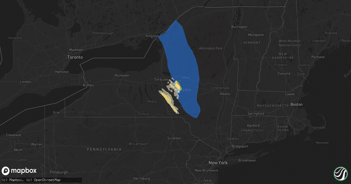
Hail Map in New York on June 21, 2025
Get this storm
June 21 map
$229
one time, instant access
Download today. No call, no setup
Keep the $229
Bought the map and want the full workflow? Apply the entire $229 to a subscription within 7 days. None of it is wasted.
Every map, not just this one
This buys you this map. Subscription and you get every map we run, in the markets you choose from a few cities to whole states to nationwide. Plus real-time alerts the moment a storm fires.
Contact data
Name, contact info, occupancy, even credit band for addresses in the footprint. You go from where it hit to who to call.
Become the source they trust
Unlimited branding weather history reports on demand. You already have the documented answer ready for the property owner, and you are the one who showed up with it.
Property data and RoofTrace estimates
Pull up any address you have got, its value and the exact code rules for that jurisdiction, straight from One Click Code. Then RoofTrace estimates the squares, pitch, and roof value, priced the way you price.
Storm reports in New York
New York
| Date | Description |
|---|---|
| 06/21/20254:22 AM CDT | Multiple trees and wires down on ny 357... Closed all lanes. Info from ny 511. |
| 06/21/20254:22 AM CDT | Multiple trees and wires down |
| 06/21/20254:22 AM CDT | Multiple trees and wires down on ny 357. |
| 06/21/20253:28 AM CDT | Report from mping: ping pong ball |
| 06/21/20253:10 AM CDT | Large tree down on 2 sheds and fence on folts st in herkimer. |
| 06/21/20253:10 AM CDT | Elizbethtown rd in ilion multiple trees down with some blocking the road. |
| 06/21/20253:07 AM CDT | Elizabethtown rd and north columbia rd large tree blocking entire road in town of columbia. |
| 06/21/20252:56 AM CDT | Tree down on trailer home on country rd in town of schuyler. No injuries reported. |
| 06/21/20252:56 AM CDT | Tree down blocking one lane on nys route 5 and elmwood drive. |
| 06/21/20252:56 AM CDT | Tree down on mobile home. No injuries reported. |
| 06/21/20252:56 AM CDT | Trees down on carder lane and nys route 5. |
| 06/21/20252:56 AM CDT | Wires down on patio circle. |
| 06/21/20252:56 AM CDT | Wires down on |
| 06/21/20252:56 AM CDT | Tree down on trailer home on country rd in town of schuyler. No injuries reported. (a |
| 06/21/20252:55 AM CDT | Tree down on a trailer on sycamore lane in town of schuyler. No injuries. |
| 06/21/20252:55 AM CDT | Cosby manor rd. Town of schuyler. Trees & wires down blocking the road. |
| 06/21/20252:55 AM CDT | Multiple trees down in the area. At least two separate structures were struck by trees which resulted in 3 fatalities. |
| 06/21/20252:55 AM CDT | Tree blocking road on millers grove rd in town of schuyler. |
| 06/21/20252:54 AM CDT | Numerous trees down throughout the hamilton college campus. Time estimated from radar. |
| 06/21/20252:50 AM CDT | At least 17 trees down in a yard. Time estimated from radar. |
| 06/21/20252:50 AM CDT | Numerous reports of trees and wires down... Tree on house. |
| 06/21/20252:39 AM CDT | Numerous trees down across roads... Homes... And wires down... Across rome ny. |
| 06/21/20252:37 AM CDT | Tree down across roadway. |
| 06/21/20252:37 AM CDT | Trees and wires down blocking dover road. |
| 06/21/20252:34 AM CDT | Multiple trees uprooted. Time estimated from radar. |
| 06/21/20252:34 AM CDT | Trees and wires down over wescott hill road. |
| 06/21/20252:34 AM CDT | Wires down on john street. |
| 06/21/20252:32 AM CDT | Tree and wires down. |
| 06/21/20252:30 AM CDT | Many trees down along sulphur springs road. Road completely blocked. Time estimated from radar. |
| 06/21/20252:30 AM CDT | Tree and wires down on water street. |
| 06/21/20252:30 AM CDT | Tree and wires down across sleepy hollow road and maple lane drive. |
| 06/21/20252:28 AM CDT | Tree on house. |
| 06/21/20252:25 AM CDT | Wires down on route 26. |
| 06/21/20252:25 AM CDT | Tree and wires down over harris road. |
| 06/21/20252:10 AM CDT | Tree blocking roadway. |
| 06/21/20252:07 AM CDT | Tree down in west leyden. |
| 06/21/20252:07 AM CDT | Delayed report... Over a dozen uprooted trees in the west leyden area. |
| 06/21/20252:05 AM CDT | Several trees down in osceola. |
| 06/21/20252:04 AM CDT | Tree blocking road way. |
| 06/21/20252:00 AM CDT | Tree down and blocking half the road on county road 91. |
| 06/21/20251:58 AM CDT | Tree down blocking roadway. |
| 06/21/20251:58 AM CDT | Tree down across driveway on us-11. |
| 06/21/20251:56 AM CDT | Tree down along mixer road. |
| 06/21/20251:53 AM CDT | Tree and wires down. |
| 06/21/20251:41 AM CDT | Tree down across military road. |
| 06/21/20251:40 AM CDT | Tree down across county road 189. |
| 06/21/20251:37 AM CDT | Tree down across county road 97. |
| 06/21/20251:36 AM CDT | Tree and wires down across fuller road. |
| 06/21/20251:36 AM CDT | Tree down across texas road near lumbley road. |
| 06/21/20251:35 AM CDT | Tree down across county road 160. |
| 06/21/20251:35 AM CDT | Pole and primary power line down on west church street. |
| 06/21/20251:33 AM CDT | Large tree down on keyes ave and clay street. |
| 06/21/20251:32 AM CDT | Power lines and pole down on sherman street. |
| 06/21/20251:31 AM CDT | Tree and wires down at franklin and hamilton st. |
| 06/21/20251:30 AM CDT | Tree down on north harbor road. |
| 06/21/20251:30 AM CDT | Several trees down across route 11. |
| 06/21/20251:30 AM CDT | Tree down into house on academy street. |
| 06/21/20251:30 AM CDT | Tree down at main and mill street. |
| 06/21/20251:30 AM CDT | Tree down across rail road tracks and county rd 85. |
| 06/21/20251:30 AM CDT | Several trees down in adams center. |
| 06/21/20251:25 AM CDT | Couple of trees down across glass road. |
| 06/21/20251:20 AM CDT | 2 poles snapped on county road 138. |
| 06/21/20251:20 AM CDT | At least three trees down on route 3 in great bend. |
| 06/21/20251:20 AM CDT | Pole snapped with wires down on old state route 3. |
| 06/21/20251:14 AM CDT | Personal weather station. |
| 06/21/202512:54 AM CDT | Tree down across county route 1. |
All States Impacted by Hail Map on June 21, 2025
Cities Impacted by Hail Map on June 21, 2025
- Hill City, MN
- Grand Rapids, MN
- Jacobson, MN
- Remer, MN
- Deer River, MN
- Cohasset, MN
- Traverse City, MI
- Elk Rapids, MI
- Kewadin, MI
- Bellaire, MI
- Rapid City, MI
- Alden, MI
- Mancelona, MI
- Grayling, MI
- Kalkaska, MI
- Fife Lake, MI
- Rapid River, MI
- Holcombe, WI
- Roscommon, MI
- Metamora, MI
- Oxford, MI
- North Branch, MI
- Fostoria, MI
- Manistique, MI
- Leonard, MI
- Lake Orion, MI
- Oakland, MI
- Luzerne, MI
- Dryden, MI
- Saint Helen, MI
- West Branch, MI
- Romeo, MI
- Petoskey, MI
- Charlevoix, MI
- Gladstone, MI
- Cornell, MI
- Harbor Springs, MI
- Carney, MI
- Wilson, MI
- Washington, MI
- Levering, MI
- Pellston, MI
- Cheboygan, MI
- Brutus, MI
- Imlay City, MI
- Alanson, MI
- Bark River, MI
- Capac, MI
- Yale, MI
- Decker, MI
- Snover, MI
- Cass City, MI
- Carp Lake, MI
- Saint Ignace, MI
- Mackinaw City, MI
- Onaway, MI
- Afton, MI
- Garden, MI
- Brown City, MI
- Emmett, MI
- Millersburg, MI
- Ubly, MI
- Beaver Island, MI
- Indian River, MI
- Melvin, MI
- Mackinac Island, MI
- Pointe Aux Pins, MI
- Northport, MI
- Wolverine, MI
- Boyne Falls, MI
- East Jordan, MI
- Boyne City, MI
- Rogers City, MI
- Presque Isle, MI
- Alpena, MI
- Ossineke, MI
- Box Springs, GA
- Paradise, MI
- Pine Hill, AL
- Fort Benning, GA
- Buena Vista, GA
- Lumpkin, GA
- Omaha, GA
- Tarpon Springs, FL
- Gilbertown, AL
- Cusseta, GA
- Melvin, AL
- Dixons Mills, AL
- Sweet Water, AL
- Gainestown, AL
- Jackson, AL
- Pine Apple, AL
- Abita Springs, LA
- New Port Richey, FL
- Interlachen, FL
- Monroeville, AL
- Frisco City, AL
- Opelika, AL
- Panama City, FL
- Little River, AL
- Atmore, AL
- Jay, FL
- Letohatchee, AL
- Milton, FL
- Lumberton, MS
- Wiggins, MS
- Citronelle, AL
- Hope Hull, AL
- Ramer, AL
- Ocala, FL
- McDavid, FL
- Marion, AL
- Englewood, FL
- Hattiesburg, MS
- Birmingham, AL
- Newton, MS
- Lucedale, MS
- Leakesville, MS
- Centreville, AL
- Brent, AL
- Carlsbad, NM
- Pearl River, LA
- Uriah, AL
- Poplarville, MS
- Loving, NM
- Clanton, AL
- Union Springs, AL
- Defuniak Springs, FL
- Eight Mile, AL
- Semmes, AL
- Chiefland, FL
- Otter Creek, FL
- Bronson, FL
- Inglis, FL
- Freeport, FL
- Tampa, FL
- Vancleave, MS
- Brierfield, AL
- Shelby, AL
- Columbiana, AL
- Longboat Key, FL
- Bradenton Beach, FL
- Jemison, AL
- Jayess, MS
- Bogue Chitto, MS
- Ruth, MS
- Alexander City, AL
- Ohatchee, AL
- Salt Flat, TX
- Lapine, AL
- Colome, SD
- Winner, SD
- Gregory, SD
- Greybull, WY
- Lovell, WY
- Eagle Butte, SD
- Mobridge, SD
- Black River, NY
- Felts Mills, NY
- Thousand Island Park, NY
- Sackets Harbor, NY
- Adams Center, NY
- Cape Vincent, NY
- Brownville, NY
- Chaumont, NY
- Depauville, NY
- Evans Mills, NY
- Calcium, NY
- Carthage, NY
- Clayton, NY
- Dexter, NY
- Fort Drum, NY
- Theresa, NY
- Rodman, NY
- Watertown, NY
- Adams, NY
- La Fargeville, NY
- Alexandria Bay, NY
- Wellesley Island, NY
- Lorraine, NY
- Mannsville, NY
- Copenhagen, NY
- Lowville, NY
- Oriskany Falls, NY
- Wampsville, NY
- Madison, NY
- Oneida, NY
- Vernon, NY
- Westdale, NY
- Constableville, NY
- Cleveland, NY
- Durhamville, NY
- Camden, NY
- Sherrill, NY
- Lee Center, NY
- Hamilton, NY
- Taberg, NY
- Ava, NY
- Verona Beach, NY
- Williamstown, NY
- Canastota, NY
- Richland, NY
- Vernon Center, NY
- Lacona, NY
- North Bay, NY
- West Leyden, NY
- Munnsville, NY
- Blossvale, NY
- Bouckville, NY
- Altmar, NY
- Sylvan Beach, NY
- Rome, NY
- Verona, NY
- Redfield, NY
- Morrisville, NY
- Burlington Flats, NY
- Cassville, NY
- Sauquoit, NY
- Westernville, NY
- West Edmeston, NY
- Hubbardsville, NY
- Jordanville, NY
- Westmoreland, NY
- New Hartford, NY
- Bridgewater, NY
- Stittville, NY
- Mohawk, NY
- Fly Creek, NY
- Richfield Springs, NY
- North Brookfield, NY
- Cooperstown, NY
- Barneveld, NY
- Yorkville, NY
- Waterville, NY
- New York Mills, NY
- Whitesboro, NY
- Ilion, NY
- Clinton, NY
- Clayville, NY
- Deansboro, NY
- Frankfort, NY
- Marcy, NY
- Oriskany, NY
- Holland Patent, NY
- Leonardsville, NY
- Remsen, NY
- Brookfield, NY
- Clark Mills, NY
- West Winfield, NY
- Turin, NY
- Chadwicks, NY
- Boonville, NY
- Utica, NY
- Castorland, NY
- Gouverneur, NY
- Glenfield, NY
- Prospect, NY
- Plessis, NY
- Herkimer, NY
- Poland, NY
- Forestport, NY
- Alder Creek, NY
- Port Leyden, NY
- Brantingham, NY
- Hammond, NY
- Greig, NY
- Natural Bridge, NY
- Philadelphia, NY
- Redwood, NY
- Antwerp, NY
- Croghan, NY
- Lyons Falls, NY
- Newport, NY
- Brier Hill, NY
- De Kalb Junction, NY
- Edwards, NY
- Lisbon, NY
- Wanakena, NY
- Middleville, NY
- Little Falls, NY
- Hermon, NY
- Thendara, NY
- Canton, NY
- Harrisville, NY
- Ogdensburg, NY
- De Peyster, NY
- Cold Brook, NY
- Rensselaer Falls, NY
- Richville, NY
- Heuvelton, NY
- Woodgate, NY
- Eagle Bay, NY
- Russell, NY
- Dolgeville, NY
- Oswegatchie, NY
- Fine, NY
- Fort Plain, NY
- Johnstown, NY
- Long Lake, NY
- Hoffmeister, NY
- Gloversville, NY
- Piseco, NY
- Stratford, NY
- Old Forge, NY
- Caroga Lake, NY
- Saint Johnsville, NY
- Salisbury Center, NY
- Inlet, NY
- Star Lake, NY
- Newton Falls, NY
- Lake Pleasant, NY
- Wells, NY
- Nelliston, NY
- Fonda, NY
- Blue Mountain Lake, NY
- Speculator, NY
- Palatine Bridge, NY
- Colton, NY
- Madrid, NY
- Northville, NY
- Potsdam, NY
- Cranberry Lake, NY
- Raquette Lake, NY
- Van Hornesville, NY
- Sprakers, NY
- Fultonville, NY
- Cherry Valley, NY
- East Springfield, NY
- Amsterdam, NY
- Springfield Center, NY
- Canajoharie, NY
- Eaton, NY
- Earlville, NY
- Fort Johnson, NY
- Tribes Hill, NY
- Mayfield, NY
- Fort Hunter, NY
- Edmeston, NY
- Roseboom, NY
- Sharon Springs, NY
- Hartwick, NY
- Pukwana, SD
- Mound City, SD
- Chamberlain, SD
- Cazenovia, NY
- Erieville, NY
- Chittenango, NY
- Gann Valley, SD
- Kimball, SD
- Sherburne, NY
- West Burlington, NY
- New Berlin, NY
- Smyrna, NY
- Norwich, NY
- Garrattsville, NY
- Schenevus, NY
- Mount Vision, NY
- Milford, NY
- South New Berlin, NY
- New Lisbon, NY
- Westford, NY
- Cobleskill, NY
- Plymouth, NY
- Georgetown, NY
- South Plymouth, NY
- New Woodstock, NY
- De Ruyter, NY
- Morris, NY
- Guilford, NY
- Mount Upton, NY
- Laurens, NY
- Gilbertsville, NY
- West Oneonta, NY
- Oneonta, NY
- Otego, NY
- Unadilla, NY
- East Meredith, NY
- Sidney Center, NY
- Portlandville, NY
- Worcester, NY
- Treadwell, NY
- Franklin, NY
- West Davenport, NY
- Maryland, NY
- Wells Bridge, NY
- Davenport, NY
- Davenport Center, NY
- Truxton, NY
- Tully, NY
- Manlius, NY
- Fabius, NY
- Virgil, SD
- Alpena, SD
- McDonough, NY
- South Otselic, NY
- Cincinnatus, NY
- Pitcher, NY
- North Pitcher, NY
- Oxford, NY
- McGraw, NY
- Mellette, SD
- Streeter, ND
- Wolsey, SD
- Alexandria, SD
- Little York, NY
- Preble, NY
- Cortland, NY
- Willet, NY
- Homer, NY
- Howard, SD
- Conde, SD
- Stratford, SD
- Brentford, SD
- Harpursville, NY
- Chenango Forks, NY
- Greene, NY
- Gackle, ND
- Medina, ND
- Huron, SD
- Afton, NY
- Smithville Flats, NY
- Delhi, NY
- Meridale, NY
- Margaretville, NY
- Bovina Center, NY
- Downsville, NY
- Livingston Manor, NY
- Bloomville, NY
- Delancey, NY
- Hamden, NY
- Roscoe, NY
- Andes, NY
- Walton, NY
- South Kortright, NY
- New Kingston, NY
- Hobart, NY
- Nineveh, NY
- Port Crane, NY
- Marathon, NY
- East Branch, NY
- Groton, SD
- Deposit, NY
- Whitney Point, NY
- Windsor, NY
- Claremont, SD
- Houghton, SD
- Columbia, SD
- Hecla, SD
- Britton, SD
- Amherst, SD
- Dawson, ND
- Tappen, ND
- Cogswell, ND
- Pettibone, ND
- Veblen, SD
- Stirum, ND
- Courtenay, ND
- Kensal, ND
- Hannaford, ND
- Sutton, ND
- Cooperstown, ND
- Maple City, MI
- Empire, MI
- Lake Ann, MI
- Cedar, MI
- Williamsburg, MI
- Glenham, SD
- Wakpala, SD


