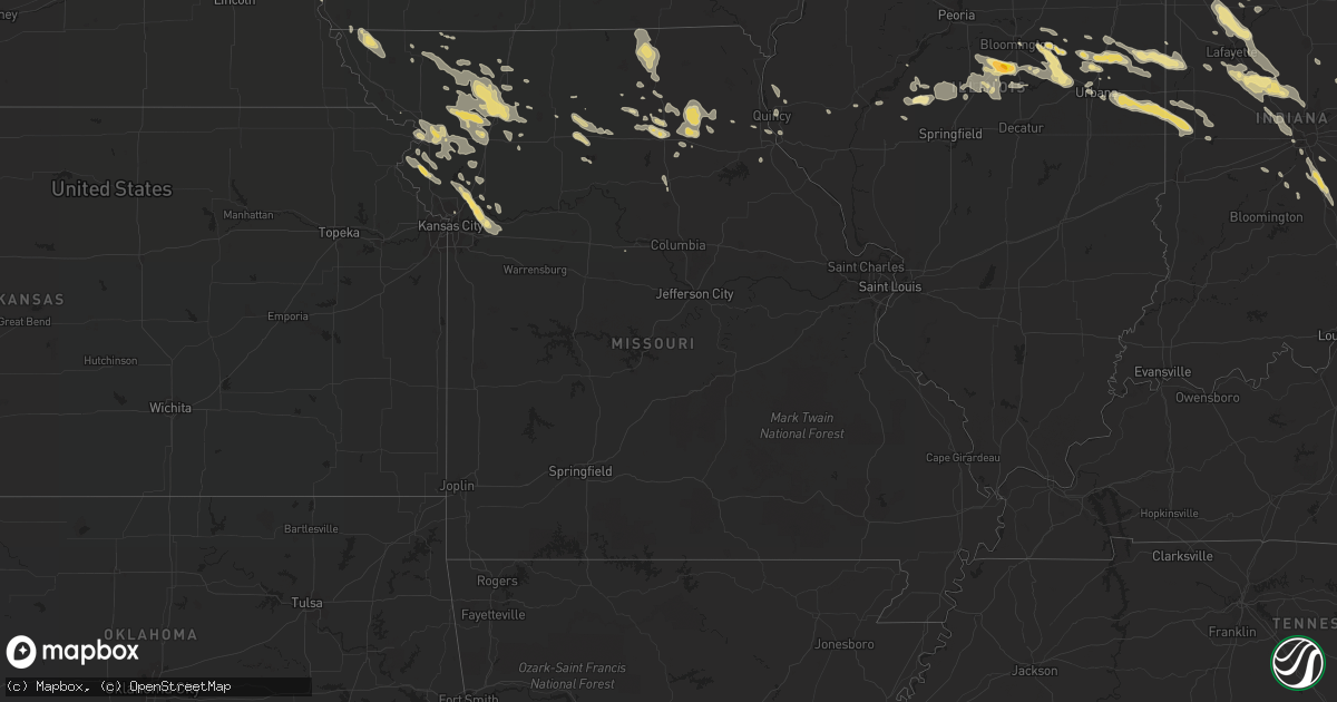
Hail Map in Missouri on June 20, 2016
Get this storm
June 20 map
$229
one time, instant access
Download today. No call, no setup
Keep the $229
Bought the map and want the full workflow? Apply the entire $229 to a subscription within 7 days. None of it is wasted.
Every map, not just this one
This buys you this map. Subscription and you get every map we run, in the markets you choose from a few cities to whole states to nationwide. Plus real-time alerts the moment a storm fires.
Contact data
Name, contact info, occupancy, even credit band for addresses in the footprint. You go from where it hit to who to call.
Become the source they trust
Unlimited branding weather history reports on demand. You already have the documented answer ready for the property owner, and you are the one who showed up with it.
Property data and RoofTrace estimates
Pull up any address you have got, its value and the exact code rules for that jurisdiction, straight from One Click Code. Then RoofTrace estimates the squares, pitch, and roof value, priced the way you price.
Storm reports in Missouri
Missouri
| Date | Description |
|---|---|
| 06/20/20166:54 PM CDT | Delayed report. Large healthy tree branch down near lake arrowhead. Report from social media. |
| 06/20/20166:40 PM CDT | 3 to 6 inch branches down |
| 06/20/20166:20 PM CDT | Delayed report. Large tree down on vehicle parked at residence. Report from social media. |
| 06/20/20165:44 PM CDT | 8 inch healthy tree reported down. |
| 06/20/201612:55 AM CDT | A local report indicates 1.00 inch wind near BUCKNER |
| 06/20/201612:44 AM CDT | Social media reported trees uprooted and down... Also dime sized hail. |
| 06/20/201612:25 AM CDT | A local report indicates 1.50 inch wind near MISSOURI CITY |
| 06/20/201612:01 AM CDT | Large tree down near intersection of nebo hills rd and road 112th |
| 06/19/201611:53 PM CDT | Via social media |
| 06/19/201611:49 PM CDT | Several branches 3-4 inch diameter snapped in the area...delayed report |
| 06/19/20168:32 PM CDT | Tree blocking road on cr823 west of route jj. Time estimated from radar. |
| 06/19/20168:30 PM CDT | Tree fell on house and power lines...time est from radar |
| 06/19/20168:25 PM CDT | Tree blocking road on cr306 west of route nn. Time estimated from radar. |
| 06/19/20168:10 PM CDT | Town is without power due to multiple tree limbs down onto power lines...report from fire dept relayed via cou eoc...time est from radar |
| 06/19/20168:00 PM CDT | Tree blown down across hwy y one half mile north of hwy 22...time est from radar |
| 06/19/20167:45 PM CDT | Partial roof loss to fire station 2 and one tree down blocking county road 2630 |
| 06/19/20167:15 PM CDT | 2-3inch limbs down and power went out briefly. |
All States Impacted by Hail Map on June 20, 2016
Cities Impacted by Hail Map on June 20, 2016
- Hornell, NY
- Bath, NY
- Canisteo, NY
- Howells, NE
- Wisner, NE
- Dodge, NE
- West Point, NE
- Hooper, NE
- Conklin, MI
- Kent City, MI
- Sparta, MI
- Clayton, NY
- Rochester, NY
- Gower, MO
- Arkport, NY
- Almond, NY
- Yorkville, IL
- Minooka, IL
- Channahon, IL
- Shorewood, IL
- Monee, IL
- Manhattan, IL
- Peotone, IL
- Elwood, IL
- Joliet, IL
- Plainfield, IL
- Lafayette, IN
- Clarks Hill, IN
- Arlington, NE
- Blair, NE
- Farmersville Station, NY
- Houghton, NY
- Freedom, NY
- Fillmore, NY
- Waynesville, IL
- Atlanta, IL
- Wapella, IL
- Shirley, IL
- McLean, IL
- Heyworth, IL
- Kingsville, OH
- Ashtabula, OH
- Jefferson, OH
- Urbana, IL
- Saint Joseph, IL
- Parnell, MO
- Three Mile Bay, NY
- Cape Vincent, NY
- Brookston, IN
- Chalmers, IN
- Schuyler, NE
- Linwood, NE
- David City, NE
- Stanton, NE
- Pierce, NE
- Norfolk, NE
- Pine, CO
- Bailey, CO
- Wawaka, IN
- Rome City, IN
- Kendallville, IN
- Buchanan, MI
- South Bend, IN
- Niles, MI
- Granger, IN
- Laurel, IN
- Rushville, IN
- Colorado Springs, CO
- Usaf Academy, CO
- Howard, CO
- Coaldale, CO
- Gloversville, NY
- Northville, NY
- Millersburg, IN
- Goshen, IN
- Wolcottville, IN
- Ligonier, IN
- Frankfort, IN
- Thorntown, IN
- Kirklin, IN
- Lebanon, IN
- Sheridan, IN
- Darlington, IN
- Whitestown, IN
- Colfax, IN
- Romney, IN
- Bronson, MI
- Boonville, MO
- Glenwood, NY
- Chaffee, NY
- Buffalo, NY
- Arcade, NY
- North Java, NY
- Springville, NY
- Orchard Park, NY
- Elma, NY
- Varysburg, NY
- Java Center, NY
- East Concord, NY
- Colden, NY
- East Aurora, NY
- South Wales, NY
- Strykersville, NY
- Eden, NY
- West Falls, NY
- Holland, NY
- Hamburg, NY
- Java Village, NY
- Gainesville, NY
- Bliss, NY
- Boston, NY
- Cowlesville, NY
- Bloomingdale, IN
- Marshall, IN
- Waveland, IN
- Kingman, IN
- Penn Yan, NY
- Middlesex, NY
- Branchport, NY
- Naples, NY
- Honeoye, NY
- Springwater, NY
- Canandaigua, NY
- Shawnee, CO
- Sedalia, CO
- Buffalo Creek, CO
- Palmyra, MO
- Gilman City, MO
- Morgantown, IN
- Martinsville, IN
- Comstock Park, MI
- Belmont, MI
- Rockford, MI
- Spencerport, NY
- Dewitt, IL
- Le Roy, IL
- Farmer City, IL
- Clinton, MI
- Jasper, NY
- Woodhull, NY
- Greenwood, NY
- Paxton, IL
- Dewey, IL
- Foosland, IL
- Gibson City, IL
- Fisher, IL
- Ethel, MO
- Downers Grove, IL
- Oak Brook, IL
- Westmont, IL
- Newark, NY
- Marion, NY
- Palmyra, NY
- Sibley, IL
- Melvin, IL
- Arrowsmith, IL
- Ellsworth, IL
- Excelsior Springs, MO
- Oakland, NE
- Lewiston, MI
- Hamilton, MO
- Rantoul, IL
- Clarence, MO
- Bergen, NY
- Churchville, NY
- Plainview, NE
- Osmond, NE
- West Greenwich, RI
- East Greenwich, RI
- Bevier, MO
- Macon, MO
- Fremont, IN
- Coldwater, MI
- Weatherby, MO
- Maryville, MO
- Winston, MO
- Ravenwood, MO
- New Hampton, MO
- Clyde, MO
- Gallatin, MO
- Stanberry, MO
- Jamesport, MO
- Amity, MO
- Darlington, MO
- Osborn, MO
- Jameson, MO
- King City, MO
- Pattonsburg, MO
- Conception Junction, MO
- Maysville, MO
- Altamont, MO
- Cameron, MO
- Bethany, MO
- McFall, MO
- Albany, MO
- Union Star, MO
- Edinburgh, IN
- Franklin, IN
- Philadelphia, MO
- Warwick, RI
- Leonard, MO
- Novelty, MO
- Monon, IN
- Monticello, IN
- Lowville, NY
- Divide, CO
- Woodland Park, CO
- Georgetown, IL
- Norwalk, CT
- Fairfield, CT
- Southport, CT
- Westport, CT
- Shelbyville, IN
- Morristown, IN
- Lake George, CO
- Amsterdam, NY
- Fort Johnson, NY
- Westboro, MO
- Tarkio, MO
- Elkhart, IN
- Moberly, MO
- Ceresco, NE
- Memphis, NE
- Weston, NE
- Ashland, NE
- Yutan, NE
- Wahoo, NE
- Ithaca, NE
- Petersburg, IL
- Oakford, IL
- Crescent, IA
- Mentone, IN
- Etna Green, IN
- Warsaw, IN
- Columbia City, IN
- Roanoke, IN
- Springfield, NE
- Malmo, NE
- Cedar Creek, NE
- Weeping Water, NE
- Nehawka, NE
- Columbus, NE
- Rogers, NE
- Waterloo, NE
- Cedar Bluffs, NE
- Bruno, NE
- Prague, NE
- South Bend, NE
- Thurman, IA
- Mead, NE
- Murray, NE
- Abie, NE
- Gretna, NE
- Bellwood, NE
- Colon, NE
- Monroe, NE
- Louisville, NE
- Platte Center, NE
- Fremont, NE
- Lindsay, NE
- Plattsmouth, NE
- Humphrey, NE
- Valley, NE
- Mill Creek, IN
- Cayuga, IN
- Ridge Farm, IL
- Omaha, NE
- Gladwin, MI
- Ellston, IA
- Andover, NY
- Canaseraga, NY
- Dansville, NY
- Hamburg, IA
- Sidney, IA
- Riverton, IA
- Percival, IA
- Le Roy, NY
- Williamsport, IN
- West Lebanon, IN
- Rossville, IL
- Hoopeston, IL
- Belding, MI
- Ada, MI
- Lowell, MI
- Cedar Springs, MI
- Grand Rapids, MI
- Casnovia, MI
- Ravenna, MI
- Georgetown, CO
- Scottsburg, NY
- Mount Morris, NY
- Groveland, NY
- Conesus, NY
- Hartford, MI
- Lawrence, MI
- Rock Port, MO
- Fairfax, MO
- Mishawaka, IN
- Curran, MI
- Comins, MI
- Paul Smiths, NY
- Trenton, NJ
- Indianapolis, IN
- Stanton, MI
- Harrietta, MI
- Brethren, MI
- Wellston, MI
- Buckner, MO
- Trafalgar, IN
- Elmer, MO
- New Boston, MO
- Fort Calhoun, NE
- Saint Joseph, MO
- Agency, MO
- Wathena, KS
- Easton, MO
- Clarksdale, MO
- Cosby, MO
- Savannah, MO
- Plattsburg, MO
- Amazonia, MO
- Stewartsville, MO
- Pilger, NE
- Downs, IL
- Mansfield, IL
- Bellflower, IL
- Mahomet, IL
- Greenwood, IN
- Whiteland, IN
- Sheridan, MO
- Laclede, MO
- Meadville, MO
- Morris, PA
- Wellsboro, PA
- Timewell, IL
- Pittsford, NY
- Altmar, NY
- Williamstown, NY
- Jonesville, MI
- Tobyhanna, PA
- Loda, IL
- Gifford, IL
- Potomac, IL
- Ludlow, IL
- Rankin, IL
- Penfield, IL
- Thomasboro, IL
- Monrovia, IN
- Hoosick Falls, NY
- North Bennington, VT
- Gouldsboro, PA
- Saybrook, IL
- Sumner, MO
- Guffey, CO
- Hartsel, CO
- Fairplay, CO
- Anchor, IL
- Dexter, NY
- Little Sioux, IA
- Indianola, IL
- Fairmount, IL
- Montezuma, IN
- Ogden, IL
- Hillsdale, IN
- Sidney, IL
- Catlin, IL
- Dana, IN
- Homer, IL
- Fithian, IL
- Westville, IL
- Clifford, IN
- Columbus, IN
- Milroy, IN
- Greensburg, IN
- Oldenburg, IN
- Carthage, IN
- Batesville, IN
- Glenwood, IN
- Dearborn, MO
- Weston, MO
- Holt, MO
- Shelbyville, MO
- Idaville, IN
- Logansport, IN
- Burnettsville, IN
- Frankton, IN
- Elwood, IN
- Brewerton, NY
- Central Square, NY
- Fulton, NY
- Baldwinsville, NY
- Phoenix, NY
- Clay, NY
- Pennellville, NY
- Castle Rock, CO
- Orrick, MO
- Michigan City, IN
- Clarinda, IA
- Medina, NY
- Corunna, IN
- Topeka, IN
- Oswego, NY
- Mexico, NY
- Hannibal, NY
- Minetto, NY
- Sterling, NY
- Lockridge, IA
- Valparaiso, NE
- Stillwater, PA
- Benton, PA
- Jerome, MI
- Beason, IL
- Lincoln, IL
- Creston, IA
- East Berlin, PA
- Dillsburg, PA
- Boiling Springs, PA
- Carlisle, PA
- Gardners, PA
- Mount Holly Springs, PA
- Newville, PA
- York Springs, PA
- Bremen, IN
- Nappanee, IN
- Bourbon, IN
- Queen City, MO
- Bates City, MO
- Smithville, MO
- Liberty, MO
- Independence, MO
- Kearney, MO
- Missouri City, MO
- Napoleon, MO
- Grain Valley, MO
- Sibley, MO
- Oak Grove, MO
- Bloomsburg, PA
- Millville, PA
- Osceola, IN
- Baroda, MI
- North Rose, NY
- Sandwich, IL
- Wheeling, MO
- Linneus, MO
- Brookfield, MO
- Chula, MO
- Callao, MO
- New Cambria, MO
- Morrisville, PA
- Robbinsville, NJ
- Allentown, NJ
- Bordentown, NJ
- Fairless Hills, PA
- Chesterfield, NJ
- Markleville, IN
- Shirley, IN
- Pendleton, IN
- Diagonal, IA
- Shannon City, IA
- Bucklin, MO
- Coffey, MO
- Reynolds, IN
- Battle Ground, IN
- Wolcott, IN
- Delphi, IN
- Brunswick, NE
- Royal, NE
- Hoskins, NE
- Scribner, NE
- Herman, NE
- Kennard, NE
- Nickerson, NE
- Madison, NE
- Snyder, NE
- Neligh, NE
- Clarkson, NE
- Missouri Valley, IA
- Winslow, NE
- Bennington, NE
- Oregon, MO
- Chandlerville, IL
- Cohocton, NY
- Avoca, NY
- Milford, IN
- Saint Regis Falls, NY
- Somonauk, IL
- Waterman, IL
- Blossburg, PA
- Liberty, PA
- Lake View, NY
- Avon, NY
- Montoursville, PA
- Williamsport, PA
- Griswold, IA
- Lewis, IA
- Cumberland, IA
- Ava, NY
- Campbell, NY
- Addison, NY
- Beardstown, IL
- Greenfield Center, NY
- Porter Corners, NY
- Middle Grove, NY
- Sharpsville, IN
- Tipton, IN
- Windfall, IN
- Syracuse, IN
- New Paris, IN
- Piffard, NY
- Lindrith, NM
- Leesburg, IN
- Bloomingdale, NY
- Vermontville, NY
- Kirksville, MO
- Middletown, IL
- Elkhart, IL
- Tingley, IA
- Mount Ayr, IA
- La Plata, MO
- Little Falls, NY
- Saint Johnsville, NY
- Dolgeville, NY
- Afton, IA
- Watertown, NY
- Fort Drum, NY
- Evans Mills, NY
- Calcium, NY
- Theresa, NY
- Butler, IN
- Hamilton, IN
- Greentop, MO
- Coatsville, MO
- Unionville, MO
- Glenwood, MO
- Novinger, MO
- Livonia, MO
- Worthington, MO
- Schoolcraft, MI
- Three Rivers, MI
- Marcellus, MI
- Camden, NY
- Taberg, NY
- Lee Center, NY
- Addison, MI
- Brooklyn, MI
- Holton, IN
- Osgood, IN
- Versailles, IN
- Fairfield, IA
- Mount Pleasant, IA
- Hartsburg, IL
- Seymour, IL
- New Holland, IL
- Delavan, IL
- Kenney, IL
- Hopedale, IL
- Chestnut, IL
- De Land, IL
- Armington, IL
- Clinton, IL
- Stanford, IL
- Lawndale, IL
- White Heath, IL
- Exline, IA
- Cincinnati, IA
- Atlanta, MO
- Rushville, IL
- Moravia, IA
- Muncy, PA
- Lyons, NE
- Chaumont, NY
- Linwood, NY
- Pavilion, NY
- Galeton, PA
- Cogan Station, PA
- Trout Run, PA
- Lenox, IA
- Orient, IA
- Camden Point, MO
- Platte City, MO
- Edgerton, MO
- Rushville, MO
- De Kalb, MO
- Schenevus, NY
- Jefferson, NY
- Davenport, NY
- Hancock, IA
- Oakland, IA
- Atlantic, IA
- Essex, IA
- Colon, MI
- Burr Oak, MI
- Centreville, MI
- Hughesville, PA
- Perrysville, IN
- Covington, IN
- Veedersburg, IN
- Guilford, MO
- Craig, NE
- Atchison, KS
- Bendena, KS
- Pittsboro, IN
- Brownsburg, IN
- Troy, KS
- Greenville, NY
- Conneautville, PA
- Linesville, PA
- Worcester, NY
- Alden, NY
- Glenfield, NY
- Bridgman, MI
- Berrien Springs, MI
- Atwood, IN
- Pierceton, IN
- Edgerton, OH
- Argos, IN
- Huntington, IN
- Wakarusa, IN
- Winona Lake, IN
- Kimmell, IN
- Silver Lake, IN
- Akron, IN
- Notre Dame, IN
- Cromwell, IN
- New Carlisle, IN
- Galien, MI
- Claypool, IN
- Waterloo, IN
- Plymouth, IN
- Burket, IN
- Larwill, IN
- North Webster, IN
- Ashley, IN
- Sawyer, MI
- South Whitley, IN
- North Manchester, IN
- Tippecanoe, IN
- Unityville, PA
- Pender, NE
- Bancroft, NE
- Havana, IL
- Champaign, IL
- Turbotville, PA
- Danville, PA
- Florissant, CO
- Mio, MI
- Armstrong, IL
- Danville, IL
- Collison, IL
- Kansas City, MO
- McVeytown, PA
- Mount Union, PA
- Decatur, NE
- Dover, PA
- Plano, IL
- Beemer, NE
- Johnstown, NY
- Cato, NY
- Lima, NY
- Liverpool, NY
- Villisca, IA
- Trimble, MO
- Rush, NY
- West Henrietta, NY
- Henrietta, NY
- Honeoye Falls, NY
- Mondamin, IA
- New Buffalo, MI
- La Porte, IN
- Panama, NY
- Columbus, PA
- Sugar Grove, PA
- Bear Lake, PA
- Massena, IA
- Boggstown, IN
- Needham, IN
- Anabel, MO
- Decatur, IA
- Leon, IA
- Breckenridge, MO
- Westhampton Beach, NY
- Bennington, IN
- Vevay, IN
- Quogue, NY
- East Quogue, NY
- Purdin, MO
- Alcove, NY
- Hannacroix, NY
- Thayer, IA
- Rockville, IN
- La Fargeville, NY
- Greenview, IL
- Manilla, IN
- South Plymouth, NY
- Norwich, NY
- Belfast, NY
- Angelica, NY
- Bethel, MO
- Edina, MO
- Newark, MO
- Clarendon Hills, IL
- Hinsdale, IL
- Western Springs, IL
- Ambia, IN
- Lagrange, IN
- Perry, NY
- Castile, NY
- Leicester, NY
- Silver Lake, NY
- Portageville, NY
- Warsaw, NY
- Geneseo, NY
- Livonia, NY
- Hemlock, NY
- Silver Springs, NY
- Pierpont, OH
- Fairview, MI
- Westerlo, NY
- Coeymans Hollow, NY
- Burlington Junction, MO
- Friendship, NY
- Belmont, NY
- Scio, NY
- Alfred Station, NY
- Cameron, NY
- Paw Paw, MI
- Coloma, MI
- Watervliet, MI
- Covert, MI
- Decatur, MI
- Lawton, MI
- Kirkville, NY
- Bridgeport, NY
- Saint Paul, IN
- Randolph, NE
- Clyde, NY
- Bitely, MI
- Hesperia, MI
- Frankfort, IL
- Oswego, IL
- Crest Hill, IL
- Beecher, IL
- New Lenox, IL
- Westpoint, IN
- Attica, IN
- Rhodes, MI
- Papillion, NE
- Oneida, NY
- Durhamville, NY
- Canastota, NY
- New Berlin, NY
- Mason City, IL
- Tecumseh, MI
- Britton, MI
- Three Oaks, MI
- Lyons, NY
- Savannah, NY
- Wolcott, NY
- Red Creek, NY
- Kilbourne, IL
- Easton, IL
- New London, MO
- Whitehall, MI
- Charlestown, RI
- Green Castle, MO
- Ursa, IL
- Mendon, IL
- Camden, MO
- Richmond, MO
- Shenandoah, IA
- Virginia, IL
- Ashland, IL
- Attica, NY
- Lakeside, MI
- Union Pier, MI
- West Lafayette, IN
- Black Creek, NY
- Saranac, MI
- Onsted, MI
- Cement City, MI
- Manitou Beach, MI
- Tipton, MI
- Caneadea, NY
- Walkerville, MI
- Lathrop, MO
- Verona, NY
- Tekamah, NE
- Blencoe, IA
- Lexington, IL
- Colfax, IL
- Harrison, MI
- Lakeville, IN
- Union, NE
- Smithfield, NE
- Rensselaer, IN
- Coin, IA
- Logan, IA
- Woodbine, IA
- Paloma, IL
- Fowler, IL
- Mulberry, IN
- Westfield, IN
- Rossville, IN
- Remington, IN
- Carmel, IN
- Linden, IN
- Chittenango, NY
- Modale, IA
- Pella, IA
- Muskegon, MI
- Madison, IN
- Troupsburg, NY
- Gaines, PA
- Humphreys, MO
- Como, CO
- Knoxville, PA
- Rexville, NY
- Westfield, PA
- Macedon, NY
- Fairport, NY
- Boonville, NY
- Westernville, NY
- Quincy, IL
- Payson, IL
- Bridgewater, IA
- Fontanelle, IA
- Hastings, IA
- Bernhards Bay, NY
- Portsmouth, IA
- Valparaiso, IN
- Derby, NY
- Delevan, NY
- Sardinia, NY
- Depew, NY
- Angola, NY
- Marilla, NY
- Lancaster, NY
- Faucett, MO
- Corning, IA
- Portland, MI
- Ionia, MI
- Elkhorn, NE
- Maybee, MI
- Carleton, MI
- Remsen, NY
- Martville, NY
- Excello, MO
- Jacksonville, MO
- Centerville, IA
- Lawson, MO
- Bloomington, IL
- Alvin, IL
- Milan, MI
- Dalton, NY
- Swain, NY
- Middlebury Center, PA
- Gentry, MO
- Conifer, CO
- Cascade, CO
- Monument, CO
- South Dartmouth, MA
- North Dartmouth, MA


