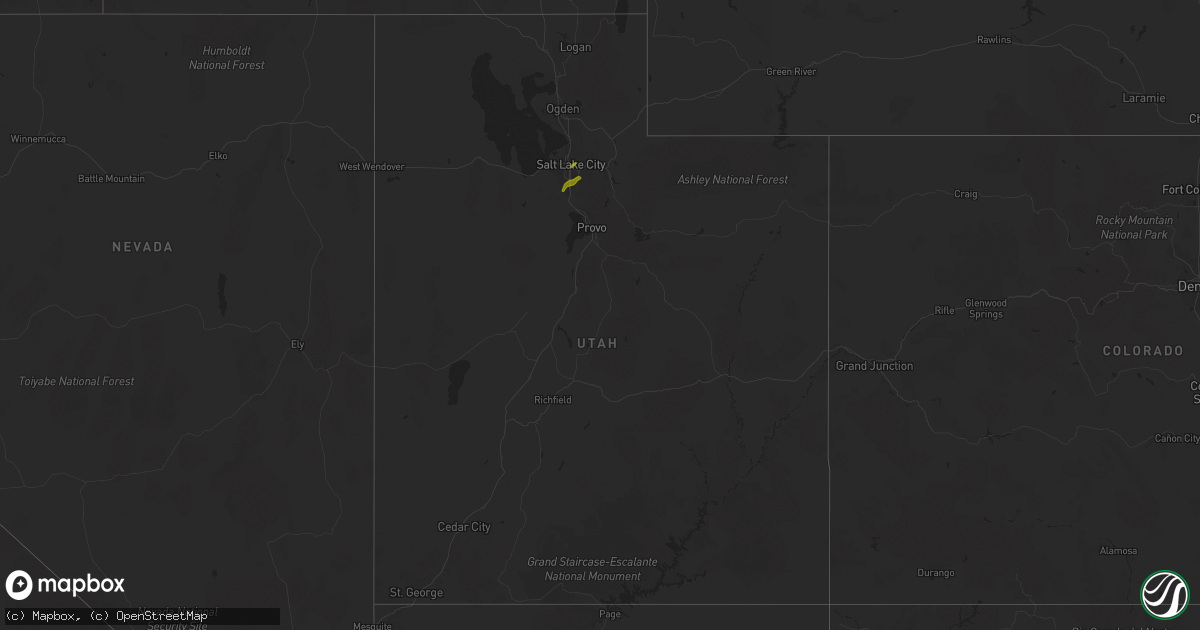
Hail Map in Utah on June 18, 2018
Get this storm
June 18 map
$229
one time, instant access
Download today. No call, no setup
Keep the $229
Bought the map and want the full workflow? Apply the entire $229 to a subscription within 7 days. None of it is wasted.
Every map, not just this one
This buys you this map. Subscription and you get every map we run, in the markets you choose from a few cities to whole states to nationwide. Plus real-time alerts the moment a storm fires.
Contact data
Name, contact info, occupancy, even credit band for addresses in the footprint. You go from where it hit to who to call.
Become the source they trust
Unlimited branding weather history reports on demand. You already have the documented answer ready for the property owner, and you are the one who showed up with it.
Property data and RoofTrace estimates
Pull up any address you have got, its value and the exact code rules for that jurisdiction, straight from One Click Code. Then RoofTrace estimates the squares, pitch, and roof value, priced the way you price.
Storm reports in Utah
Utah
| Date | Description |
|---|---|
| 06/18/20181:11 PM CDT | A local report indicates 1.00 inch wind near UNIV OF UTAH |
| 06/18/201812:52 PM CDT | Time is estimated. |
| 06/18/201812:15 PM CDT | A local report indicates 1.00 inch wind near COTTONWOOD HEIGHTS |
| 06/18/201811:55 AM CDT | A local report indicates 1.25 inch wind near SOUTH JORDAN |
| 06/18/201811:54 AM CDT | A local report indicates 1.00 inch wind near 2 N SANDY |
| 06/18/201811:51 AM CDT | A local report indicates 1.00 inch wind near SANDY |
| 06/18/201811:47 AM CDT | A local report indicates 1.00 inch wind near SOUTH JORDAN |
| 06/18/20187:12 AM CDT | At 1211 PM MDT, a severe thunderstorm was located 7 miles northwest of Summit Park, or 8 miles east of Salt Lake City, moving northeast at 25 mph. HAZARD...60 mph wind gusts and quarter size hail. SOURCE...Trained weather spotters. IMPACT...Hail damage to vehicles is expected. Expect wind damage to roofs, siding, and trees. Locations impacted include... Salt Lake City, Coalville, Summit Park, North Snyderville Basin, Henefer, Hoytsville, Echo and Echo Reservoir. |
| 06/18/20186:11 AM CDT | At 1110 AM MDT, a severe thunderstorm was located near Mount Olympus, or 9 miles west of Park City, moving northeast at 30 mph. HAZARD...60 mph wind gusts and half dollar size hail. SOURCE...Public. IMPACT...Hail damage to vehicles is expected. Expect wind damage to roofs, siding, and trees. Locations impacted include... Park City, Coalville, Summit Park, Kamas, Oakley, Wanship, Mount Olympus, South Snyderville Basin, North Snyderville Basin, Alta, Peoa, Hoytsville, Brighton, Parleys Summit, Snyderville, Kimball Junction, Marion and Rockport Reservoir. |
| 06/18/20185:41 AM CDT | At 1040 AM MDT, a severe thunderstorm was located over Midvale, or near Sandy, moving northeast at 20 mph. HAZARD...60 mph wind gusts and quarter size hail. SOURCE...Radar indicated. IMPACT...Hail damage to vehicles is expected. Expect wind damage to roofs, siding, and trees. Locations impacted include... Salt Lake City, Sandy, Murray, West Jordan, Taylorsville, South Jordan, Draper, Riverton, Cottonwood Heights, Midvale, Holladay, South Salt Lake, Millcreek, Mount Olympus, Little Cottonwood Creek Valley, Granite, White City, East Millcreek, Cottonwood West and Canyon Rim. |
All States Impacted by Hail Map on June 18, 2018
Cities Impacted by Hail Map on June 18, 2018
- Manson, IA
- Clare, IA
- Haydenville, MA
- Plainfield, MA
- Conway, MA
- Ashfield, MA
- Shelburne Falls, MA
- Williamsburg, MA
- Hatfield, MA
- West Hatfield, MA
- Amherst, MA
- Hadley, MA
- Northampton, MA
- Granby, MA
- Lyons, CO
- Boulder, CO
- Longmont, CO
- Ward, CO
- Orchard, CO
- Nederland, CO
- Lafayette, CO
- La Salle, CO
- Frederick, CO
- Dacono, CO
- Roggen, CO
- Erie, CO
- Fort Lupton, CO
- Wiggins, CO
- Kersey, CO
- Hudson, CO
- Weldona, CO
- Firestone, CO
- Fort Collins, CO
- Loveland, CO
- Milliken, CO
- Platteville, CO
- Greeley, CO
- Mead, CO
- Gilcrest, CO
- Berthoud, CO
- Johnstown, CO
- Niwot, CO
- Eldorado Springs, CO
- Broomfield, CO
- Louisville, CO
- Golden, CO
- Arvada, CO
- Henderson, CO
- Westminster, CO
- Brighton, CO
- Keenesburg, CO
- Commerce City, CO
- Denver, CO
- Fort Morgan, CO
- Thornton, CO
- Snyder, CO
- Sterling, CO
- Haxtun, CO
- Merino, CO
- Fleming, CO
- Yuma, CO
- Otis, CO
- Hillrose, CO
- Brush, CO
- Akron, CO
- Salt Lake City, UT
- South Jordan, UT
- West Jordan, UT
- Riverton, UT
- Midvale, UT
- Sandy, UT
- Walthill, NE
- Rosalie, NE
- Pender, NE
- Bancroft, NE
- Lagrange, WY
- Hawk Springs, WY
- Hooper, NE
- Assaria, KS
- Randolph, KS
- Leonardville, KS
- Sweetwater, TX
- Bennington, NE
- Fonda, IA
- Pomeroy, IA
- Sweetwater, OK
- Roaring Springs, TX
- Mcadoo, TX
- Matador, TX
- Afton, TX
- Beemer, NE
- Holstein, NE
- Roseland, NE
- Fullerton, NE
- Oakland, NE
- West Point, NE
- Avalon, WI
- Paducah, TX
- Midkiff, TX
- Snyder, TX
- Ewing, NE
- Gaylord, KS
- Portis, KS
- Darien, WI
- Wisner, NE
- Palmer, IA
- Turkey, TX
- Wheatland, WY
- Oketo, KS
- Kennard, NE
- Washington, NE
- Elkhorn, NE
- Mankato, KS
- Toledo, OH
- Buxton, ME
- Esbon, KS
- Madison, NE
- Woodston, KS
- Stockton, KS
- Wolbach, NE
- Belgrade, NE
- Rising City, NE
- Salem, WI
- Bloomington, NE
- Franklin, NE
- Hutchinson, KS
- Blairsburg, IA
- Webster City, IA
- Woolstock, IA
- Shickley, NE
- Albion, NE
- Sac City, IA
- Fort Dodge, IA
- Norfolk, NE
- Alton, KS
- Florence, MA
- Strang, NE
- Bladen, NE
- Burr Oak, KS
- Wheeler, TX
- Marysville, KS
- Wilber, NE
- Downs, KS
- Carr, CO
- Wellington, CO
- Council Bluffs, IA
- Pacific Junction, IA
- Bellevue, NE
- Hollis Center, ME
- Douglas, WY
- Blair, NE
- Valley, NE
- Arlington, NE
- Bladenboro, NC
- Saint Edward, NE
- Bartlett, NE
- Cawker City, KS
- Chambers, NE
- Aplington, IA
- Ackley, IA
- Waterloo, IA
- Dunkerton, IA
- Carroll, IA
- Tilden, NE
- Pilger, NE
- Arcadia, NE
- Weston, NE
- Brainard, NE
- Valparaiso, NE
- Cedar Rapids, NE
- Malvern, IA
- David City, NE
- Bremen, KS
- Green, KS
- Rotan, TX
- Delavan, WI
- Clinton, WI
- Janesville, WI
- Newman Grove, NE
- Silver Lake, WI
- Burlington, WI
- Plattsmouth, NE
- Offutt Afb, NE
- Prague, NE
- Carson, IA
- Mead, NE
- Fremont, NE
- Yutan, NE
- Fort Calhoun, NE
- Omaha, NE
- Waterloo, NE
- Hellertown, PA
- Riegelsville, PA
- Coopersburg, PA
- Kintnersville, PA
- Lindsborg, KS
- Falun, KS
- Ozona, TX
- Jaffrey, NH
- Verdigre, NE
- Beloit, WI
- Worthington, IA
- Dyersville, IA
- Odebolt, IA
- Malmo, NE
- Rippey, IA
- New Raymer, CO
- Maxton, NC
- Salina, KS
- Formoso, KS
- Sharon, KS
- Hazelton, KS
- Attica, KS
- Limerick, ME
- East Waterboro, ME
- Limington, ME
- Cornish, ME
- Parsonsfield, ME
- Saco, ME
- Biddeford, ME
- Standish, ME
- North Waterboro, ME
- Pleasant Dale, NE
- Milford, NE
- Ansley, NE
- Jolley, IA
- Pocahontas, IA
- Newell, IA
- Barnum, IA
- Clarkson, NE
- Wahoo, NE
- Colon, NE
- Brady, NE
- Byers, CO
- Jamestown, CO
- Geneva, NE
- Lumberton, NC
- Franksville, WI
- Caledonia, WI
- Palmyra, WI
- Alden, IA
- Battle Creek, IA
- Danbury, IA
- Manilla, IA
- Leeds, MA
- South Hadley, MA
- Logan, IA
- Woodbine, IA
- Hubbard, NE
- Stanton, NE
- Washington, KS
- Briggsdale, CO
- Stoneham, CO
- Solomon, KS
- McConnell, IL
- Orangeville, IL
- Nemaha, IA
- Mukwonago, WI
- Eagle, WI
- Thurston, NE
- Lyons, NE
- Winnebago, NE
- Emerson, NE
- Scribner, NE
- Uehling, NE
- Ord, NE
- Farragut, IA
- Hancock, IA
- Oakland, IA
- La Vista, NE
- Wellfleet, NE
- Barnes, KS
- Waterville, KS
- Big Spring, TX
- Midland, TX
- Cassville, WI
- Potosi, WI
- Sharon, WI
- Clarion, IA
- Hastings, NE
- Oto, IA
- Smithland, IA
- Papillion, NE
- Malcolm, NE
- Superior, NE
- Louisville, NE
- Wadesboro, NC
- Lebanon, KS
- Guide Rock, NE
- Home, KS
- Beattie, KS
- Smith Center, KS
- Dunnellon, FL
- Childress, TX
- Durand, IL
- Early, IA
- Heath, MA
- Charlemont, MA
- Colrain, MA
- North Platte, NE
- Ashland, NE
- Randolph, IA
- Tabor, IA
- Sidney, IA
- Enterprise, KS
- Abilene, KS
- De Witt, NE
- Blue Rapids, KS
- Charlottesville, VA
- Genoa City, WI
- Dakota, IL
- Springfield, WI
- Lake Geneva, WI
- Elkhorn, WI
- Manchester, IA
- Earlville, IA
- Brimfield, MA
- Southbridge, MA
- Sturbridge, MA
- Fiskdale, MA
- Hanover, KS
- Oregon, OH
- Harbor View, OH
- Lincoln, NE
- Denton, NE
- Spalding, NE
- Ericson, NE
- South Hutchinson, KS
- Beloit, KS
- Orrum, NC
- East Baldwin, ME
- West Baldwin, ME
- Dows, IA
- Geneva, IA
- Monroe, WI
- East Troy, WI
- Whitewater, WI
- Rockton, IL
- North Loup, NE
- Andrews, IN
- Huntington, IN
- Jewell, KS
- Ulysses, NE
- Surprise, NE
- Shamrock, TX
- Erick, OK
- Del Rio, TX


