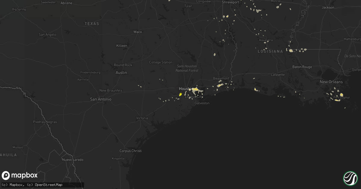
Hail Map on June 18, 2016
Get this storm
June 18 map
$229
one time, instant access
Download today. No call, no setup
Keep the $229
Bought the map and want the full workflow? Apply the entire $229 to a subscription within 7 days. None of it is wasted.
Every map, not just this one
This buys you this map. Subscription and you get every map we run, in the markets you choose from a few cities to whole states to nationwide. Plus real-time alerts the moment a storm fires.
Contact data
Name, contact info, occupancy, even credit band for addresses in the footprint. You go from where it hit to who to call.
Become the source they trust
Unlimited branding weather history reports on demand. You already have the documented answer ready for the property owner, and you are the one who showed up with it.
Property data and RoofTrace estimates
Pull up any address you have got, its value and the exact code rules for that jurisdiction, straight from One Click Code. Then RoofTrace estimates the squares, pitch, and roof value, priced the way you price.
States Impacted by Hail Map on June 18, 2016
Storm reports
Alabama
| Date | Description |
|---|---|
| 06/18/201612:57 PM CDT | An oak tree was downed across both lanes of the highway. |
Minnesota
| Date | Description |
|---|---|
| 06/18/20166:47 AM CDT | A local report indicates 1.00 inch wind near 3 E GATZKE |
| 06/18/20166:30 AM CDT | Very heavy rain with dime to quarter sized hail. |
| 06/18/20165:55 AM CDT | Dime to quarter sized hail. |
North Dakota
| Date | Description |
|---|---|
| 06/18/20165:10 AM CDT | Very heavy rain and numerous nickle to half dollar sized hail. |
| 06/18/20164:49 AM CDT | 1.50 inches of rain and a lot of quarter size hails |
| 06/18/20164:40 AM CDT | Mostly pea sized hail with a few quarter sized hail |
| 06/18/20164:30 AM CDT | Mostly pea sized hail with a few quarter sized hail. Time estimated based on radar. |
| 06/18/20164:22 AM CDT | Report posted via social media. Time estimated based on radar. |
| 06/18/20164:15 AM CDT | Hail just smaller than golfball reported. |
| 06/18/20163:50 AM CDT | Quarter to ping poing ball sized hail fell for a couple minutes. Report and photo via social media. Time estimated based on radar. |
| 06/18/20162:55 AM CDT | Relayed by broadcast media. Time estimated from radar. |
| 06/18/20162:23 AM CDT | Quarter sized hail in south minot. |
| 06/18/201612:05 AM CDT | Crosby raws site. Time estimated from radar. |
Montana
| Date | Description |
|---|---|
| 06/18/20166:49 PM CDT | 62 mph wind gust when the storms moved through. |
| 06/17/201611:20 PM CDT | Shingles blown off of roof. Time estimated from radar. Report via social media. |
| 06/17/201611:05 PM CDT | Also 40 to 50 mph winds |
| 06/17/201610:31 PM CDT | Measured by mcdonalds dot sensor |
| 06/17/201610:25 PM CDT | A local report indicates 1.50 inch wind near WOLF POINT |
| 06/17/201610:25 PM CDT | A local report indicates 2.00 inch wind near 2 E WOLF POINT |
| 06/17/201610:23 PM CDT | A local report indicates 68 MPH wind near WOLF POINT |
| 06/17/201610:20 PM CDT | A local report indicates 4.00 inch wind near WOLF POINT |
| 06/17/201610:15 PM CDT | A local report indicates 1.75 inch wind near WOLF POINT |
| 06/17/201610:00 PM CDT | A local report indicates 1.50 inch wind near FRAZER |
| 06/17/20169:50 PM CDT | Estimated by off duty nws employee |
| 06/17/20169:40 PM CDT | A local report indicates 67 MPH wind near 10 NW LARSLAN |
| 06/17/20169:40 PM CDT | Shingles off of roof and part of a chimney broken |
| 06/17/20169:40 PM CDT | A local report indicates 1.25 inch wind near NASHUA |
| 06/17/20169:36 PM CDT | 10 broken windows on buildings. Time estimated from radar. |
| 06/17/20169:30 PM CDT | A local report indicates 1.75 inch wind near 6 WNW NASHUA |
| 06/17/20169:30 PM CDT | A local report indicates 60 MPH wind near 2 N FORT PECK |
| 06/17/20169:25 PM CDT | 10 power poles blown down on east side of highway 24. |
| 06/17/20169:25 PM CDT | A local report indicates 1.25 inch wind near GLASGOW |
| 06/17/20169:25 PM CDT | A local report indicates 2.00 inch wind near 2 NW GLASGOW |
| 06/17/20169:22 PM CDT | A local report indicates 61 MPH wind near GLASGOW |
| 06/17/20169:17 PM CDT | A local report indicates 1.25 inch wind near 2 NW GLASGOW |
| 06/17/20169:17 PM CDT | A local report indicates 60 MPH wind near 2 NW GLASGOW |
| 06/17/20169:15 PM CDT | 2 inch hail reported |
| 06/17/20169:00 PM CDT | Measured by department of transportation sensor mtsco |
| 06/17/20168:45 PM CDT | A local report indicates 1.75 inch wind near SSW SACO |
| 06/17/20168:45 PM CDT | A local report indicates 60 MPH wind near 8 NE SACO |
| 06/17/20168:45 PM CDT | Very strong winds along with large hail. Some of the siding of his house was blown off. |
| 06/17/20168:40 PM CDT | A local report indicates 80 MPH wind near 1 NW SACO |
| 06/17/20168:40 PM CDT | Large branches broken off of trees from thunderstorm winds. A few branches estimated to be 10 inches in diameter. |
| 06/17/20168:38 PM CDT | A local report indicates 2.00 inch wind near SLEEPING BUFFALO |
| 06/17/20168:30 PM CDT | Freight train derailed. Freight containers were flipped over... Some seperating from holding cars. |
| 06/17/20168:20 PM CDT | Wind gust toppled semi-trailer. |
| 06/17/20168:17 PM CDT | Trained spotter reported 3 to 5 inch diameter tree branches down. |
| 06/17/20168:10 PM CDT | A local report indicates 2.00 inch wind near 6 NNE PHILLIPS |
| 06/17/20168:09 PM CDT | Also 70 mph wind and zero visibility. Time estimated by radar. |
| 06/17/20168:06 PM CDT | A local report indicates 1.50 inch wind near 1 NNE PHILLIPS |
| 06/17/20168:06 PM CDT | A local report indicates 70 MPH wind near 1 NNE PHILLIPS |
| 06/17/20168:00 PM CDT | Estimated wind gusts of 50 to 60 mph. |
| 06/17/20167:50 PM CDT | 4 to 6 inch diameter tree limbs down |
| 06/17/20167:31 PM CDT | Facebook report and video from storm chaser. Time and location estimated based on report and radar. |
| 06/17/20167:31 PM CDT | Facebook report and video from storm chaser. Time and location estimated based on report and radar. |
| 06/17/20167:10 PM CDT | Quarter to golf ball size hail. Window screens broken from hail. Time estimated based on radar. |
Texas
| Date | Description |
|---|---|
| 06/18/20165:25 PM CDT | Dime to quarter size hail in missouri city. |
| 06/18/20164:16 AM CDT | 62 mph wind gust at kvct. |
| 06/18/20164:08 AM CDT | 62 mph wind gust at kvct. |
| 06/18/20163:55 AM CDT | Trees down... Power lines down... Building damaged. |
| 06/18/20162:18 AM CDT | A local report indicates 1.00 inch wind near 3 SSW CHILDRESS |
| 06/17/20167:09 PM CDT | A local report indicates 58 MPH wind near TAYLOR LAKE VILLAGE |
| 06/17/20167:09 PM CDT | 50 knot wind recorded near taylor lake village. |
Florida
| Date | Description |
|---|---|
| 06/18/20165:12 PM CDT | Fence blown down... Near intersection of sw 43rd st and sw 82nd st |
| 06/18/20165:11 PM CDT | A thunderstorm produced a wind gust of 66 mph at marlins park. This was measured at 100 feet above the surface. |
| 06/18/20165:06 PM CDT | Power lines have been knocked down at sw 84th ave and bird rd. |
Louisiana
| Date | Description |
|---|---|
| 06/18/20162:01 PM CDT | Trees and power lines reported down in multiple areas in and near the logansport area |
| 06/18/20161:52 PM CDT | Sheriffs dept reports tree down on chaffee rd. |
| 06/18/20161:52 PM CDT | Sheriffs dept reports tree down on hwy 10. |
| 06/18/20161:51 PM CDT | Tree fell on home on greywood drive in keithville |
| 06/18/20161:30 PM CDT | Rapides 911 reports tree down at woodworth. |
| 06/18/20161:30 PM CDT | Rapides 911 reports tree down at forest hill. |
| 06/18/201612:55 PM CDT | Trees down on 371 with power lines... Also franklin road... Webster... Art camp roads |
| 06/18/201612:45 PM CDT | Trees down on 371 with power lines... Also franklin road... Webster... Art camp roads |
| 06/18/201612:03 PM CDT | Trees reported down on i20 north of ada and taylor... Mile marker 56 |
| 06/18/201611:30 AM CDT | Trees reported down in winnfield and trees reported down northern part of parish. |
| 06/18/201611:12 AM CDT | Trees down nne of dodson on on 499 |
| 06/18/201611:12 AM CDT | Trees reported down east of calvin on 501 |
| 06/18/201611:12 AM CDT | Trees down on hwy 126 nw of dodson |
Oklahoma
| Date | Description |
|---|---|
| 06/18/20166:07 PM CDT | 4 inch tree limb down at 121st and south riverside drive. Relayed via social media. Time estimated via radar. |
| 06/17/20168:15 PM CDT | A local report indicates 70 MPH wind near ALLEN |
Cities Impacted by Hail Map on June 18, 2016
- Mangum, OK
- Gould, OK
- Blanco, OK
- Pittsburg, OK
- Mcalester, OK
- Hartshorne, OK
- Kiowa, OK
- Badger, MN
- Watford City, ND
- Wolf Point, MT
- Malta, MT
- Lankin, ND
- Havre, MT
- Peerless, MT
- Manvel, TX
- Houston, TX
- Pearland, TX
- Rosharon, TX
- Milton, ND
- Edinburg, ND
- Bienville, LA
- Saline, LA
- Vale, SD
- Newell, SD
- Pasadena, TX
- Galena Park, TX
- Turkey, TX
- Childress, TX
- Osage, OK
- Hominy, OK
- Prue, OK
- Larslan, MT
- Chinook, MT
- Lloyd, MT
- Vandalia, MT
- Glasgow, MT
- Hinsdale, MT
- Zahl, ND
- Williston, ND
- Winnie, TX
- Hays, MT
- Brockton, MT
- Saco, MT
- Grand Chenier, LA
- Plentywood, MT
- Woodville, MS
- Towner, ND
- Knox, ND
- Rugby, ND
- Lawton, ND
- Webster, ND
- Penn, ND
- Edmore, ND
- York, ND
- Churchs Ferry, ND
- Adams, ND
- Devils Lake, ND
- Leeds, ND
- Poplar, MT
- Woodworth, LA
- Alexandria, LA
- Allen, OK
- Dry Prong, LA
- Des Lacs, ND
- Burlington, ND
- Fort Peck, MT
- Matador, TX
- Big Sandy, MT
- Medicine Lake, MT
- Homestead, MT
- Newfolden, MN
- Grafton, ND
- New Town, ND
- Angola, LA
- Saint Francisville, LA
- Palm Bay, FL
- La Porte, TX
- Harlem, MT
- Dodson, MT
- Palermo, ND
- Stanley, ND
- Deer Park, TX
- Baytown, TX
- Channelview, TX
- Gatzke, MN
- Grygla, MN
- Middle River, MN
- Parshall, ND
- Park River, ND
- Pisek, ND
- Pauls Valley, OK
- Wynnewood, OK
- Antlers, OK
- Glenmora, LA
- Esmond, ND
- Starkweather, ND
- Granville, ND
- Wolford, ND
- Cando, ND
- Fordville, ND
- Bisbee, ND
- Karlsruhe, ND
- Savanna, OK
- Clayton, OK
- Aspermont, TX
- Sugar Land, TX
- Missouri City, TX
- Wharton, TX
- East Bernard, TX
- Clinton, OK
- Berthold, ND
- Moyers, OK
- Argyle, MN
- Stephen, MN
- Strandquist, MN
- Winfield, KS
- Tell, TX
- Okeechobee, FL
- Jenks, OK
- Nashua, MT
- Wetumka, OK
- Brenham, TX
- Bellville, TX
- Paris, TX
- Pattonville, TX
- Cordell, OK
- Gotebo, OK
- Dagmar, MT
- Grenora, ND
- Beaumont, TX
- Leola, SD
- Box Elder, MT
- Norwood, LA
- Centreville, MS
- Frazer, MT
- Depew, OK
- Port Sulphur, LA
- Eureka, SD
- Holdenville, OK
- Sasakwa, OK
- Cohagen, MT
- Lake Arthur, LA
- Lacassine, LA
- Grand Cane, LA
- Davis, OK
- Cameron, LA
- Willow City, ND
- Surrey, ND
- Minot, ND
- Norwich, ND
- Velva, ND
- Timber Lake, SD
- Rayville, LA
- Calvin, OK
- Granite, OK
- Clarendon, TX
- Castor, LA
- Culbertson, MT
- Froid, MT
- Bainville, MT
- Nisland, SD
- Vinson, OK
- Mims, FL
- Seabrook, TX
- Richmond, TX
- Stafford, TX
- Belle Fourche, SD
- Lake Placid, FL
- Hobart, OK
- Melbourne Beach, FL
- Brush Prairie, WA
- Dunnellon, FL
- Morriston, FL
- Alexander, ND
- Tulsa, OK
- Sand Springs, OK
- Pierson, FL
- Jamestown, LA
- Lettsworth, LA
- Arapaho, OK
- Weleetka, OK
- Pineland, TX
- Saint Cloud, FL
- Cartwright, ND
- Pelican, LA
- Dodson, LA
- Paducah, TX
- Scobey, MT
- Flaxville, MT
- Fort McCoy, FL
- Hollis, OK
- Golden Meadow, LA
- Princeton, LA
- Minden, LA
- Doyline, LA
- Brandon, FL
- Keene, ND
- Converse, LA
- Braithwaite, LA
- Timpson, TX
- Crystal, ND
- Heflin, LA
- Dubberly, LA
- Miami, FL
- Montgomery, LA
- Norman, OK
- Oklahoma City, OK
- Newcastle, OK
- Hanna, OK
- Dustin, OK
- Epping, ND
- Arnegard, ND
- Logansport, LA
- Wewoka, OK
- Quanah, TX
- Woodville, TX
- Needville, TX
- Rosenberg, TX
- Broaddus, TX
- Fort Pierce, FL
- Willow, OK
- Reserve, MT
- Centrahoma, OK
- Atwood, OK
- Coalgate, OK
- Port Arthur, TX
- Stratford, OK
- Spencer, OK
- Plain Dealing, LA
- Muldoon, TX
- Indianola, OK
- Stroud, OK
- Davenport, OK
- Chandler, OK
- Karlstad, MN
- Wilson, LA
- Clinton, LA
- Vero Beach, FL
- Sturgis, SD
- Delhi, LA
- Winnsboro, LA
- Daytona Beach, FL
- Port Orange, FL
- Richland, MT
- Center, TX
- Hampden, ND
- Mansfield, LA
- Palm Beach, FL
- Bronson, TX
- Old Town, FL
- San Augustine, TX
- Belle Chasse, LA
- Lafitte, LA
- Dickinson, TX
- Santa Fe, TX
- Alvin, TX
- Sebring, FL
- Deland, FL
- Hialeah, FL
- Sikes, LA
- Lambert, MT
- Fairview, MT
- Vida, MT
- Snyder, TX
- Lone Wolf, OK
- Sanford, FL
- Winter Park, FL
- Orlando, FL
- Friendswood, TX
- Drayton, ND
- Minto, ND
- Forest River, ND
- Fairdale, ND
- Corn, OK
- Sebastian, FL
- Melbourne, FL
- Malabar, FL
- Greenbush, MN
- Strathcona, MN
- Williston, FL
- Plaza, ND
- Lane, OK
- Anahuac, TX
- Pawnee, OK
- Joaquin, TX
- Mounds, OK
- Beggs, OK
- Kellyville, OK
- Sapulpa, OK
- Gary, TX
- Thief River Falls, MN
- Jonesboro, LA
- Okemah, OK
- Texas City, TX
- McLaughlin, SD
- Alamo, ND
- Canton, TX
- Talco, TX
- Gibsland, LA
- Lexington, OK
- Wanette, OK
- League City, TX
- Glen Flora, TX
- Sparks, OK
- Prague, OK
- Kemah, TX
- Monroe, LA
- Barataria, LA
- Byars, OK
- Mcpherson, KS
- Simsboro, LA
- Warren, MN
- Sibley, LA
- Interlachen, FL
- Quitman, LA
- Bristow, OK
- Lakeview, TX
- Trenton, FL
- Forest Hill, LA
- Memphis, TX
- Colfax, LA
- Jordan, MT