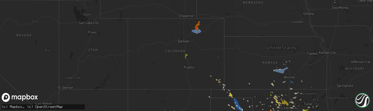
Hail Map on June 14, 2025
The weather event on June 14, 2025 includes Wind, Hail, and Tornado maps. 22 states and 569 cities were impacted and suffered possible damage. The total estimated number of properties impacted is 54,068.
Want more than just the map?
Turn this storm into a full workflow.
- Owner + property data so you know who to knock
- OnDemand branded weather history reports to win the "did we even have hail?" argument
- RoofTrace estimate so reps stop guessing numbers at the door
Bought this map? Upgrade within 7 days and we'll credit the $230. (10-15 min setup call)
Wind
Hail
Tornado
54,068
Estimated number of impacted properties by a 1.00" hail or larger3,731
Estimated number of impacted properties by a 1.75" hail or larger836
Estimated number of impacted properties by a 2.50" hail or largerStates Impacted by Hail Map on June 14, 2025
Storm reports
South Dakota
| Date | Description |
|---|---|
| 06/14/20256:35 PM CDT | A local report indicates 1.25 inch wind near 8 ENE Vermillion |
| 06/14/20254:15 AM CDT | A local report indicates 1.00 inch wind near Glencross |
| 06/13/202511:19 PM CDT | A local report indicates 60 MPH wind near 12 E Oelrichs |
Florida
| Date | Description |
|---|---|
| 06/14/20252:30 PM CDT | Fallen tree on sw 170th street lead to temporarily closure. Time based off radar and report. |
| 06/14/202511:45 AM CDT | Road closed at the intersection of w newberry rd and nw 120th terrace in gainesville due to a fallen tree and downed power lines. Time est. Based off radar. |
Oklahoma
| Date | Description |
|---|---|
| 06/14/20256:20 PM CDT | A local report indicates 1.75 inch wind near 3 ENE Thomas |
| 06/14/20251:05 PM CDT | Report from mping: quarter |
| 06/14/202512:40 PM CDT | Tree blown down at holdenville lake. Time estimated from radar. |
| 06/14/202512:02 AM CDT | Report from mping: half dollar |
| 06/14/202512:00 AM CDT | A few hail stones up to golf ball size. |
| 06/13/202511:54 PM CDT | Report from mping: quarter |
| 06/13/202511:53 PM CDT | Report from mping: half dollar |
| 06/13/202511:40 PM CDT | Tree blown down. Social media image. Time is estimated from radar. |
| 06/13/202511:27 PM CDT | Report from mping: half dollar |
| 06/13/20258:57 PM CDT | Relayed via social media. |
| 06/13/20258:06 PM CDT | Report from mping |
| 06/13/20258:06 PM CDT | Report from mping: hen egg |
| 06/13/20258:04 PM CDT | A local report indicates 1.25 inch wind near 2 ESE Hydro |
| 06/13/20258:00 PM CDT | Report from mping: ping pong ball |
| 06/13/20257:56 PM CDT | Intersection of highway 58 and interstate 40. |
| 06/13/20257:52 PM CDT | A local report indicates 2.50 inch wind near Hydro |
| 06/13/20257:50 PM CDT | A local report indicates 2.10 inch wind near 1 W Hydro |
Kansas
| Date | Description |
|---|---|
| 06/14/20259:15 AM CDT | A local report indicates 60 MPH wind near Udall |
| 06/14/20259:04 AM CDT | A local report indicates 70 MPH wind near 5 WNW Udall |
| 06/14/20258:05 AM CDT | A local report indicates 65 MPH wind near 5 WNW Moundridge |
| 06/14/20257:51 AM CDT | A local report indicates 63 MPH wind near 5 NNE Hutchinson |
| 06/14/20257:46 AM CDT | A local report indicates 62 MPH wind near KHUT |
| 06/14/20257:27 AM CDT | A local report indicates 60 MPH wind near 3 WSW Langdon |
Colorado
| Date | Description |
|---|---|
| 06/14/20256:41 PM CDT | Report from mping: quarter |
| 06/14/20256:39 PM CDT | Report from mping: half dollar |
| 06/14/20256:38 PM CDT | Report from mping: quarter |
| 06/14/20256:37 PM CDT | Report from mping: quarter |
| 06/14/20256:37 PM CDT | A local report indicates 1.00 inch wind near 6 SSE Air Force Academy |
| 06/14/20256:35 PM CDT | Report from mping: quarter |
| 06/14/20256:33 PM CDT | Report from mping: quarter |
| 06/14/20256:28 PM CDT | Report from mping: quarter |
| 06/14/20256:26 PM CDT | A local report indicates 1.00 inch wind near 5 NE Manitou Springs |
| 06/14/20256:26 PM CDT | Report from mping: quarter |
| 06/14/20256:24 PM CDT | Report from mping: quarter |
| 06/14/20256:22 PM CDT | Report from mping: half dollar |
| 06/14/202512:12 AM CDT | Ambient weather site struckmeyer reported the gust. (g |
| 06/14/202512:12 AM CDT | Ambient weather site struckmeyer reported the gust. |
| 06/13/20258:55 PM CDT | A local report indicates 66 MPH wind near Fort Morgan Airport |
| 06/13/20258:51 PM CDT | A local report indicates 58 MPH wind near 2 WSW Fort Morgan Airpo |
| 06/13/20258:40 PM CDT | A local report indicates 73 MPH wind near 8 WNW Hoyt Beet Dump |
| 06/13/20258:27 PM CDT | Mesonet station co222 dearfield. |
| 06/13/20257:42 PM CDT | Hailed ranged in size from peas to golfballs. |
| 06/13/20257:16 PM CDT | Report from mping: quarter |
| 06/13/20257:15 PM CDT | A local report indicates 1.00 inch wind near 1 WNW Colorado Springs |
| 06/13/20257:01 PM CDT | A local report indicates 1.00 inch wind near Manitou Springs |
| 06/13/20257:00 PM CDT | A local report indicates 1.00 inch wind near 1 SE Manitou Springs |
| 06/13/20257:00 PM CDT | A local report indicates 1.25 inch wind near 5 NW Peterson AFB |
Georgia
| Date | Description |
|---|---|
| 06/14/20254:40 PM CDT | Trees down along grady and hightower mountain rd. |
| 06/14/20253:50 PM CDT | Trees down along antioch rd. |
| 06/13/20258:35 PM CDT | Ga511 reports tree limbs on sr 42 in both directions. All lanes closed. |
| 06/13/20258:15 PM CDT | Ga511 reports tree limbs on sr 36 eastbound at lee maddox rd. All lanes closed. |
| 06/13/20257:20 PM CDT | Ga511 reported tree limbs on sr 362 in both directions at near james store rd. All lanes closed. |
Louisiana
| Date | Description |
|---|---|
| 06/14/202512:00 PM CDT | Tree down on moore ave in walker. |
| 06/13/20257:45 PM CDT | Trees downed around black lake hosston including near coatney road and nichols camp road. |
Mississippi
| Date | Description |
|---|---|
| 06/14/20255:20 PM CDT | A tree was downed on hwy-16e as well as numerous other trees across the county. |
| 06/14/20254:52 PM CDT | A tree was blown down onto powerlines on maple street in jackson. |
| 06/14/20254:43 PM CDT | Multiple trees downed. |
| 06/14/20254:05 PM CDT | There have been numerous reports of downed trees and a powerline across the county. |
| 06/14/20253:47 PM CDT | Trees were downed at multiple locations on ms hwy 18. |
| 06/14/20253:30 PM CDT | A tree was downed on y camp rd. |
| 06/14/20253:30 PM CDT | Trees downed on johnson ln and chicago plantation rd. |
| 06/14/20252:50 PM CDT | A utility pole was downed blocking traffic near the intersection of oak grove rd and griffith rd. |
| 06/14/20252:27 PM CDT | A tree was downed across blackjack rd blocking traffic. |
Nebraska
| Date | Description |
|---|---|
| 06/14/20256:55 PM CDT | Mesonet station reported wind gust of 61mph from nearby thunderstorm. |
Montana
| Date | Description |
|---|---|
| 06/14/20256:20 PM CDT | A local report indicates 1.25 inch wind near 12 WNW Rapelje |
| 06/14/202512:45 AM CDT | Post event report received via social media. Size estimated from photo of hail in the palm of a hand. |
| 06/13/20258:55 PM CDT | Corrects previous tstm wnd gst report from 8 wsw suffolk. |
| 06/13/20258:55 PM CDT | A local report indicates 65 MPH wind near 8 WSW Suffolk |
| 06/13/20258:32 PM CDT | Patrol car traveling along highway 81 received substantial hail damage. Location and time estimated based on radar. |
| 06/13/20258:22 PM CDT | Report from social media. Ground was almost completely covered with hailstones ranging from quarter to golf ball size. Time estimated based on radar. |
| 06/13/20257:58 PM CDT | Spotter reports golf ball size hail. |
| 06/13/20257:55 PM CDT | Golf ball to egg size hail reported. Additionally... Hail damage to vehicle and campers was reported. |
| 06/13/20257:55 PM CDT | Report from social media showed golf ball sized hail as well as significant damage to outdoor play equipment and shattered skylights and windows. Time estimated from ra |
| 06/13/20257:45 PM CDT | Spotter reports golf ball to egg size hail. Tree damage was also observed. |
Texas
| Date | Description |
|---|---|
| 06/14/20253:25 PM CDT | Mesonet station 156 marfa 13se. |
| 06/14/20254:05 AM CDT | A local report indicates 61 MPH wind near 2 N Spearman |
| 06/14/20253:52 AM CDT | Wind gusts over 60 mph continued until 3:54 am. |
| 06/14/20253:52 AM CDT | Wind gusts ov |
Wyoming
| Date | Description |
|---|---|
| 06/13/20259:30 PM CDT | A local report indicates 1.50 inch wind near 17 NNW Recluse |
| 06/13/20258:54 PM CDT | Reported by a rancher east of interstate 25 exit 280. |
| 06/13/20258:10 PM CDT | A local report indicates 1.00 inch wind near 7 SW Spotted Horse |
| 06/13/20257:32 PM CDT | A local report indicates 61 MPH wind near 5 NNW Dwtn Gillette |
Alabama
| Date | Description |
|---|---|
| 06/14/20256:25 PM CDT | Tree and a powerline fell on a house. |
| 06/14/20256:15 PM CDT | Video and photos on facebook of a woman who survived a large tree falling on her car and was able to escape without injury. Time and location approximate. |
| 06/14/20256:09 PM CDT | Trees down. |
| 06/14/20255:38 PM CDT | Multiple trees down across horseshoe bend road near wisel road. Aldot remains on scene clearing trees. |
| 06/14/20255:27 PM CDT | Report of a tree down near ridge marina way. |
| 06/14/20254:29 PM CDT | Tree reported down along old highway 25 near the intersection with cr 30. |
| 06/14/20253:18 PM CDT | Tree down at highway 9 and county road 121. |
| 06/14/20253:15 PM CDT | Tree and power lines down. |
| 06/14/20252:57 PM CDT | Tree and power line down in centre. |
| 06/13/20257:53 PM CDT | Pine tree down across the road. |
Iowa
| Date | Description |
|---|---|
| 06/14/20256:00 PM CDT | Hail was observed at the golf course. |
| 06/14/20255:56 PM CDT | Significant damage to campers at the willow creek campground from hail and wind driven hail. Hail lasted around 10 minutes. |
| 06/14/20255:55 PM CDT | Infrequent larger stones from quarter to half-dollar size. |
| 06/13/20259:22 PM CDT | Personal weather station. |
| 06/13/20258:58 PM CDT | Social media pictures of large trees down... Some on top on vehicles. |
| 06/13/20257:20 PM CDT | Heavy rain and some strong winds as well with small twigs down and some standing water in the backyard. |
West Virginia
| Date | Description |
|---|---|
| 06/14/20255:29 PM CDT | Trees blew down in the 2900 block of cr-14 capon river road. |
| 06/14/20255:08 PM CDT | Trees blew down near the intersection of cr-45/20 cold stream road and cr-4/2 north river mills road. |
| 06/14/20254:50 PM CDT | Trees blew down in the 1900 block of cr-24/1 sam mason road between i-81 and us-11 winchester avenue. |
Virginia
| Date | Description |
|---|---|
| 06/14/20255:08 PM CDT | Multiple trees knocked down along us-58 east. Time estimated from radar. |
| 06/14/20253:30 PM CDT | One tree down. |
| 06/14/20252:58 PM CDT | One tree down. |
| 06/14/20252:05 PM CDT | Henry county 911 call center reported a tree down blocking one lane on cameron road in martinsville... Va. |
| 06/13/20259:33 PM CDT | A tree blew down near the intersection of va-20 constitution highway and va-622 pine stake road. |
| 06/13/20259:30 PM CDT | Multiple trees blew down on va-621 old plank road between va-604 gold dale road and new hope church road. |
| 06/13/20259:25 PM CDT | A tree blew down near the intersection of va-621 mine run road/old plank road and va-608 dulin lane. |
| 06/13/20259:16 PM CDT | Corrects previous flash flood report from 1 sw flat run. At least 10 calls for trees down near lake of the woods. |
| 06/13/20259:12 PM CDT | Trees blew down near the intersection of westover parkway and chesterfield court. |
| 06/13/20259:12 PM CDT | Trees blew down on lake of the woods way. |
| 06/13/20259:11 PM CDT | Trees blew down near the intersection of sand trap lane and gold valley road. |
| 06/13/20259:11 PM CDT | Trees blew down near the intersection of va-601 flat run road and back gate lane. |
| 06/13/20258:59 PM CDT | Trees blew down near the intersection of va-611 zoar road and va-20 constitution highway. |
| 06/13/20258:40 PM CDT | Numerous roads were closed due to high water with some vehicles stranded. |
North Carolina
| Date | Description |
|---|---|
| 06/14/20256:25 PM CDT | Ham radio operator reported a tree blown down on power lines on stout farm rd. |
| 06/14/20255:08 PM CDT | Ham radio operator reported a tree blown down at hibriten dr and woodridge dr. |
| 06/14/20251:28 PM CDT | Tree down... Blocking one lane of country club road. |
| 06/14/20251:18 PM CDT | Delayed report: surry county 911 call center reported that two trees are down on hardy road in siloam... Nc. Time is estimated from radar. |
| 06/14/20251:00 PM CDT | Surry county 911 call center reported a tree down near the intersection of massey road and saint marie trail in mount airy... Nc. Time is estimated from radar. |
| 06/14/20251:00 PM CDT | Delayed report: surry county 911 call center reported a tree fell across rockford road near dobson... Blocking both lanes. Time is estimated from radar. |
Arkansas
| Date | Description |
|---|---|
| 06/14/20254:55 PM CDT | A few trees were blown down in this area. |
| 06/14/20253:35 PM CDT | A few trees and powerlines blown down just north of town on 270 n. |
Cities Impacted by Hail Map on June 14, 2025
- Nashville, KS
- Medicine Lodge, KS
- Sylvia, KS
- Hutchinson, KS
- Chester, OK
- Sand Springs, OK
- Sterling, KS
- Nickerson, KS
- Tulsa, OK
- Sharon, KS
- Sperry, OK
- Hazelton, KS
- Buhler, KS
- Owasso, OK
- Partridge, KS
- South Hutchinson, KS
- Plevna, KS
- Abbyville, KS
- Haven, KS
- Burrton, KS
- Grenola, KS
- Okarche, OK
- El Reno, OK
- Claremore, OK
- Calumet, OK
- Inman, KS
- Catoosa, OK
- Moundridge, KS
- New Cambria, KS
- Mcpherson, KS
- Rose Hill, KS
- Brinkley, AR
- Clarendon, AR
- Milton, KS
- Conway Springs, KS
- Howard, KS
- Gypsum, KS
- Douglass, KS
- Salina, KS
- Chelsea, OK
- Inola, OK
- Broken Arrow, OK
- Chouteau, OK
- Goddard, KS
- Piedmont, OK
- Yukon, OK
- Coweta, OK
- Mulvane, KS
- Udall, KS
- Pryor, OK
- South Haven, KS
- Belle Plaine, KS
- Butte, NE
- Oklahoma City, OK
- Hulbert, OK
- Hope, KS
- Tampa, KS
- Freeport, TX
- Tahlequah, OK
- Bristow, OK
- Locust Grove, OK
- Wagoner, OK
- El Campo, TX
- Castle, OK
- Mounds, OK
- Beggs, OK
- Okmulgee, OK
- Okemah, OK
- Bixby, OK
- Glenpool, OK
- Independence, KS
- Lake Charles, LA
- Paden, OK
- Kellyville, OK
- Wiggins, MS
- Porter, OK
- Seminole, OK
- Earlsboro, OK
- Baton Rouge, LA
- Haskell, OK
- Pitkin, LA
- Greenwell Springs, LA
- Denham Springs, LA
- Redbird, OK
- Vardaman, MS
- Wewoka, OK
- Maud, OK
- Konawa, OK
- Tecumseh, OK
- Wetumka, OK
- North Wilkesboro, NC
- Edna, TX
- Holden, LA
- Roaring River, NC
- Leesville, LA
- Ronda, NC
- Holdenville, OK
- Amite, LA
- Lena, LA
- Leakesville, MS
- Boyce, LA
- Greensburg, LA
- Atwood, OK
- Calvin, OK
- Jonesville, NC
- Hamptonville, NC
- Ada, OK
- Liberty, MS
- Tylertown, MS
- Pine Grove, LA
- Red Oak, OK
- Walker, LA
- Cuero, TX
- Jena, LA
- Poteau, OK
- Wister, OK
- Shady Point, OK
- Brookhaven, MS
- Marthaville, LA
- Yorktown, TX
- Nordheim, TX
- Pineville, LA
- Moravian Falls, NC
- Wilkesboro, NC
- Pleasant Hill, LA
- Bogue Chitto, MS
- Mansfield, LA
- Heavener, OK
- Silver Creek, MS
- Gainestown, AL
- Waldron, AR
- Prentiss, MS
- Yulee, FL
- Howe, OK
- Elgin, TX
- Thrall, TX
- Georgetown, SC
- Nesmith, SC
- Charles City, IA
- Coupland, TX
- Taylorsville, MS
- Purvis, MS
- Sumrall, MS
- Booneville, AR
- Bay Springs, MS
- Natchez, MS
- Gretna, VA
- Java, VA
- Winnsboro, LA
- Hattiesburg, MS
- Newellton, LA
- Mount Ida, AR
- Mena, AR
- Statesboro, GA
- Pachuta, MS
- Rose Hill, MS
- Brooklet, GA
- Monroe, GA
- Louin, MS
- Stockdale, TX
- Catherine, AL
- Cabot, AR
- Floresville, TX
- Utica, MS
- Princeton, LA
- Lonoke, AR
- Mountain Pine, AR
- Alberta, AL
- Safford, AL
- Sutherland Springs, TX
- Poth, TX
- Edwards, MS
- Mebane, NC
- Yanceyville, NC
- Ramer, AL
- Falls City, TX
- Camden, AL
- Big Timber, MT
- Pine Apple, AL
- Montgomery, AL
- Leasburg, NC
- Laurel, NE
- Lenoir, NC
- Minter, AL
- Bolton, MS
- Westwego, LA
- Canton, GA
- Thermopolis, WY
- Caledonia, MS
- Meeteetse, WY
- Ball Ground, GA
- Evergreen, AL
- Steens, MS
- Hamilton, MS
- Columbus, MS
- Taylorsville, NC
- Pleasanton, TX
- Woodstock, AL
- Remsen, IA
- West Blocton, AL
- Roswell, NM
- Waskom, TX
- De Berry, TX
- Saint George, GA
- Kingsley, IA
- Le Mars, IA
- Hinton, IA
- Lexington, MS
- Hartington, NE
- Camden, MS
- Midway, GA
- Fleming, GA
- Saint Marys, WV
- Healdton, OK
- Wilson, OK
- Thomas, OK
- Buffalo, MT
- Aplington, IA
- Millport, AL
- Springer, OK
- Ardmore, OK
- Watonga, OK
- Usaf Academy, CO
- Melville, MT
- Ireton, IA
- Colorado Springs, CO
- Elk Point, SD
- Burbank, SD
- Merrill, IA
- Marietta, TX
- Tichnor, AR
- Ryegate, MT
- Lewistown, MT
- Manson, IA
- Geary, OK
- Littleton, NC
- Rockwell City, IA
- Beresford, SD
- Maurice, IA
- Akron, IA
- Hawarden, IA
- Wausa, NE
- Little Plymouth, VA
- Mattaponi, VA
- Osmond, NE
- Hollister, NC
- Manitou Springs, CO
- Aurelia, IA
- Plainview, NE
- Alcester, SD
- New Raymer, CO
- Lake City, IA
- Douglas, WY
- Glenrock, WY
- Orange City, IA
- Hobson, MT
- Marcus, IA
- Grover, CO
- Peyton, CO
- Alton, IA
- Briggsdale, CO
- Hydro, OK
- Gillette, WY
- Lusk, WY
- Forest Grove, MT
- Roundup, MT
- Moccasin, MT
- Clayton, NM
- Cherokee, IA
- Weldona, CO
- Orchard, CO
- Colony, OK
- Clinton, OK
- Denton, MT
- Kaycee, WY
- Hinton, OK
- Humboldt, IA
- Badger, IA
- Fort Dodge, IA
- Powell, WY
- Newcastle, NE
- Butler, OK
- Odebolt, IA
- Canute, OK
- Foss, OK
- Enid, OK
- Greenville, IA
- Royal, IA
- Pierson, IA
- Hilger, MT
- Buffalo, WY
- Ogden, IA
- Everly, IA
- Wall Lake, IA
- Vincent, IA
- Winifred, MT
- Spencer, IA
- Wiggins, CO
- Perry, OK
- Fort Morgan, CO
- Mulhall, OK
- Orlando, OK
- Webster City, IA
- Cordell, OK
- Fairmont, OK
- Marshall, OK
- Douglas, OK
- Covington, OK
- Washta, IA
- Correctionville, IA
- Lake View, IA
- Woolstock, IA
- Eagle Grove, IA
- Locust Grove, VA
- Dill City, OK
- White Sulphur Springs, MT
- Stanhope, IA
- Kamrar, IA
- Braman, OK
- Edgemont, SD
- Broadus, MT
- Recluse, WY
- Roggen, CO
- Kersey, CO
- Log Lane Village, CO
- Bloomfield, NE
- Battle Creek, IA
- Lucien, OK
- Stillwater, OK
- Jewell, IA
- Geuda Springs, KS
- Newkirk, OK
- Pawnee, OK
- Morrison, OK
- Thor, IA
- Garber, OK
- Story City, IA
- Ellsworth, IA
- Danbury, IA
- Crofton, NE
- Arkansas City, KS
- Radcliffe, IA
- Ponca City, OK
- Lloyd, MT
- Glencoe, OK
- Charter Oak, IA
- Mapleton, IA
- Crescent, OK
- Kaw City, OK
- Red Rock, OK
- Ralston, OK
- Moore, MT
- Buffalo Gap, SD
- Woodward, IA
- Burbank, OK
- Hominy, OK
- Shidler, OK
- Perry, IA
- Woodford, VA
- Chadron, NE
- Bouton, IA
- Hays, MT
- Fairfax, OK
- Pawhuska, OK
- Whitney, NE
- Carrier, OK
- Martinsdale, MT
- Two Dot, MT
- Billings, OK
- Perkins, OK
- Coyle, OK
- Cushing, OK
- Ripley, OK
- Guthrie, OK
- Hennessey, OK
- Wellston, OK
- Edmond, OK
- Meridian, OK
- Tryon, OK
- Carney, OK
- Newell, SD
- Stanford, MT
- Drumright, OK
- Malta, MT
- Wounded Knee, SD
- Manderson, SD
- Mud Butte, SD
- Jones, OK
- Sapulpa, OK
- Mannford, OK
- Skiatook, OK
- Choctaw, OK
- Arcadia, OK
- Stroud, OK
- Agra, OK
- Luther, OK
- Bethany, OK
- Batesland, SD
- Martin, SD
- Ekalaka, MT
- Hammond, MT
- Porcupine, SD
- Kremlin, OK
- Allen, SD
- Pond Creek, OK
- Reva, SD
- Buffalo, SD
- Dacoma, OK
- Alva, OK
- Camp Crook, SD
- Waynoka, OK
- Two Buttes, CO
- Spencer, OK
- Walsh, CO
- Harrah, OK
- Winnett, MT
- Tuthill, SD
- Faith, SD
- Brusett, MT
- Waukomis, OK
- Enning, SD
- Shawnee, OK
- Mcloud, OK
- Cherokee, OK
- Carmen, OK
- White Owl, SD
- Meadow, SD
- Wilmont, MN
- Bison, OK
- Helena, OK
- Marland, OK
- Fulda, MN
- Reading, MN
- Elkhart, KS
- Aline, OK
- Parmelee, SD
- Saint Francis, SD
- Meno, OK
- Ringwood, OK
- Valentine, NE
- Lamont, OK
- Lahoma, OK
- Cleo Springs, OK
- Circle, MT
- Jordan, MT
- Drummond, OK
- Dupree, SD
- Fort Peck, MT
- Worthington, MN
- Rolla, KS
- Ames, OK
- Geyser, MT
- Burlington, OK
- Jet, OK
- McIntosh, SD
- Goltry, OK
- Nash, OK
- Guymon, OK
- Isabella, OK
- Goodwell, OK
- Thedford, NE
- Wolf Point, MT
- Round Lake, MN
- Brewster, MN
- Haswell, CO
- McLaughlin, SD
- Johnstown, NE
- Keldron, SD
- Springview, NE
- Gruver, TX
- Amorita, OK
- Spearman, TX
- Timber Lake, SD
- Coffee Creek, MT
- Vida, MT
- Glencross, SD
- Trail City, SD
- Miami, TX
- Perryton, TX
- Stinnett, TX
- Richey, MT
- Sioux Rapids, IA
- Kingfisher, OK
- Wakpala, SD
- Bloomfield, MT
- Omega, OK
- Sunray, TX
- Linn Grove, IA
- Pampa, TX
- Springfield, CO
- Morse, TX
- Booker, TX
- Keyes, OK
- Okeene, OK
- Alta, IA
- Follett, TX
- Fowler, KS
- Granville, IA
- Ninnekah, OK
- Glenham, SD
- Mound City, SD
- Pomeroy, IA
- Canadian, TX
- Chickasha, OK
- Laverne, OK
- Loyal, OK
- Mountain View, OK
- Fairview, OK
- Vici, OK
- Buffalo, OK
- Mobeetie, TX
- Wheeler, TX
- Savage, MT
- Vilas, CO
- Anadarko, OK
- Arnett, OK
- Freedom, OK
- Jolley, IA
- Marlow, OK
- Fargo, OK
- Roy, MT
- Reydon, OK
- Oakwood, OK
- Briscoe, TX
- Gotebo, OK
- Greenfield, OK
- Lawton, OK
- Seiling, OK
- Sharon, OK
- Terry, MT
- Larrabee, IA
- Brockway, MT
- Shamrock, TX
- Paullina, IA
- Walters, OK
- Sweetwater, OK
- Lytton, IA
- Erick, OK
- Bowdle, SD
- Weatherford, OK
- Wellington, TX
- Cohagen, MT
- Utica, SD
- Menno, SD
- Texola, OK
- Woodward, OK
- Fort Supply, OK
- Leedey, OK
- Hosmer, SD
- Sayre, OK
- Custer City, OK
- Saint Helena, NE
- Fordyce, NE
- Yankton, SD
- Tabor, SD
- Mooreland, OK
- Camargo, OK
- Taloga, OK
- Wynot, NE
- Carter, OK
- Sentinel, OK
- Roosevelt, OK
- Willow, OK
- Mclean, TX
- Granite, OK
- Lone Wolf, OK
- Gayville, SD
- Longdale, OK
- Duncan, OK