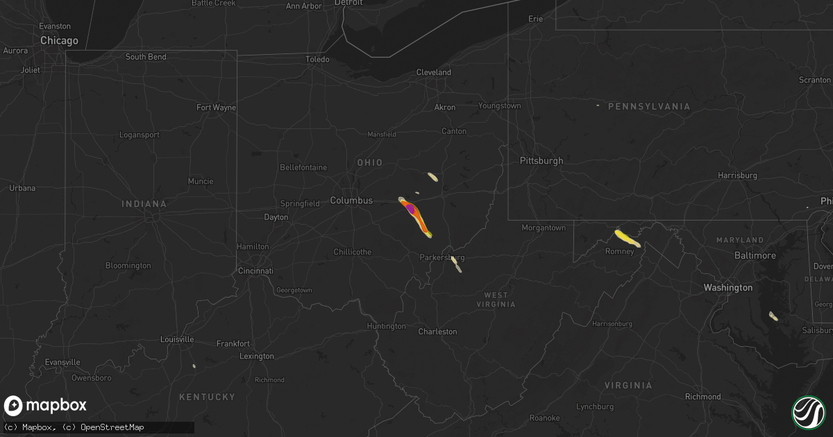
Hail Map on June 14, 2024
Get this storm
June 14 map
$229
one time, instant access
Download today. No call, no setup
Keep the $229
Bought the map and want the full workflow? Apply the entire $229 to a subscription within 7 days. None of it is wasted.
Every map, not just this one
This buys you this map. Subscription and you get every map we run, in the markets you choose from a few cities to whole states to nationwide. Plus real-time alerts the moment a storm fires.
Contact data
Name, contact info, occupancy, even credit band for addresses in the footprint. You go from where it hit to who to call.
Become the source they trust
Unlimited branding weather history reports on demand. You already have the documented answer ready for the property owner, and you are the one who showed up with it.
Property data and RoofTrace estimates
Pull up any address you have got, its value and the exact code rules for that jurisdiction, straight from One Click Code. Then RoofTrace estimates the squares, pitch, and roof value, priced the way you price.
States Impacted by Hail Map on June 14, 2024
Storm reports
Kentucky
| Date | Description |
|---|---|
| 06/14/20245:01 PM CDT | Trees down. |
Massachusetts
| Date | Description |
|---|---|
| 06/14/202412:36 PM CDT | Picture of trees down on plummer ave. Time estimated from radar. |
| 06/14/202412:35 PM CDT | Large tree limb down on whitmore rd. |
| 06/14/202412:35 PM CDT | Picture of tree and powerlines down on a vehicle. Time estimated from radar. |
| 06/14/202412:30 PM CDT | Several large limbs down... Blocking the sidewalk on main st. |
| 06/14/202412:25 PM CDT | Tree down on sidewalk in front of fire station. Time estimated from radar. |
Ohio
| Date | Description |
|---|---|
| 06/14/20246:06 PM CDT | Tree on powerline. |
| 06/14/20246:05 PM CDT | Downed trees and powerlines. |
| 06/14/20245:45 PM CDT | Tree down on power line. |
| 06/14/20245:34 PM CDT | A tree was downed over lake logan road. |
| 06/14/20245:31 PM CDT | A tree was downed and fell onto dupler road. |
| 06/14/20245:12 PM CDT | A tree was downed and knocked down powerlines. |
| 06/14/20245:10 PM CDT | Tree on powerline. |
| 06/14/20244:57 PM CDT | Trees down. |
| 06/14/20244:56 PM CDT | Trees and powerlines down in malta. |
| 06/14/20244:47 PM CDT | Trees down. |
| 06/14/20244:25 PM CDT | A local report indicates 1.00 inch wind near 1 ESE Avondale |
| 06/14/20244:24 PM CDT | Corrected location based on additional information from observer |
| 06/14/20244:24 PM CDT | A local report indicates 2.00 inch wind near South Zanesville |
| 06/14/20244:23 PM CDT | A local report indicates 1.00 inch wind near White Cottage |
| 06/14/20244:23 PM CDT | Report of tree down along huggins road. Time estimated based on radar. |
| 06/14/20244:22 PM CDT | Tree damage and snapped power poles near roseville road and butler road |
| 06/14/20244:22 PM CDT | *** 1 inj *** tree fell on camper at up the creek campground. |
| 06/14/20244:22 PM CDT | Em reporting damage to multiple homes southwest of zanesville and near the maysville middle school. |
| 06/14/20244:22 PM CDT | Report of power poles broken in the area. Time estimated based on radar. |
| 06/14/20244:22 PM CDT | Report of tree down on state route 93 blocking road in avondale. Time estimated based on radar. |
| 06/14/20244:21 PM CDT | Public reported between nickel to quarter size hail just off state route 22. Time estimated based on radar. |
| 06/14/20244:17 PM CDT | Report of trees uprooted or snapped in area. Time estimated based on radar. |
| 06/14/20244:17 PM CDT | Large healthy tree limbs down. Time estimated from radar. |
| 06/14/20244:09 PM CDT | Some siding pulled from home and a wooden fence was broken by lawn furniture that was displaced. |
| 06/14/20244:05 PM CDT | Multiple trees down in the yard. |
New Mexico
| Date | Description |
|---|---|
| 06/14/20246:27 PM CDT | Corrects previous non-tstm wnd gst report from 4 ne south valley. Asos station kabq albuquerque intl sunport. |
| 06/14/20244:50 PM CDT | Corrects previous non-tstm wnd gst report from amistad. |
| 06/14/20244:24 PM CDT | Asos station krtn raton crews airport. |
| 06/14/20244:21 PM CDT | Corrects previous non-tstm wnd gst report from 6 nne ute lake state park. Some weak or old tree limbs were also knocked down. Time is estimated based on radar. |
| 06/14/20242:50 PM CDT | [landspout] video footage from public showing a landspout... Relayed via media. |
| 06/14/20242:28 PM CDT | Corrects previous non-tstm wnd gst report from 3 w farmington. Asos station kfmn farmington airport. |
Colorado
| Date | Description |
|---|---|
| 06/14/20246:10 PM CDT | Spotter reported nickel to quarter size hail and an inch of rain. |
| 06/14/20245:53 PM CDT | Asos station klaa lamar airport. |
| 06/14/20245:45 PM CDT | A local report indicates 1.75 inch wind near 8 N Otis |
| 06/14/20245:00 PM CDT | 8 inch live tree limb blown off. Dead tree blown down and 3/4 inch hail. |
| 06/14/20244:47 PM CDT | Asos station klhx la junta airport. |
| 06/14/20244:20 PM CDT | Public report and photo via social media. Location estimated. |
| 06/14/20243:15 PM CDT | A local report indicates 1.00 inch wind near 2 SE Chatfield Reservoi |
| 06/14/20243:15 PM CDT | Report via social media. Location and time estimated. |
| 06/14/20242:09 PM CDT | Asos station kcez cortez municipal airport. |
Illinois
| Date | Description |
|---|---|
| 06/14/202411:00 AM CDT | 2 large trees down. |
Kansas
| Date | Description |
|---|---|
| 06/14/20248:00 AM CDT | Corrects time on previous hail report from 2 w syracuse. |
| 06/14/20247:53 AM CDT | A local report indicates 1.25 inch wind near 2 W Syracuse |
| 06/13/202410:00 PM CDT | Delayed report via social media. Damage to a pole barn... Garage... And chicken coop on property. Reportee also mentioned downed power lines in town... But no location |
| 06/13/202410:00 PM CDT | Delayed report via social media of a damaged garage. Extent is currently unknown. Time is radar estimated. |
| 06/13/20249:21 PM CDT | Trained spotter reports pea to quarter sized hail... Lasted approximately 3 minutes. |
| 06/13/20249:08 PM CDT | Ambient weather station - home station selden. |
| 06/13/20248:50 PM CDT | Delayed report via social media. Estimated 50-60 mph winds. Time estimate provided via report. |
| 06/13/20248:24 PM CDT | A local report indicates 58 MPH wind near 4 NE Hayne |
| 06/13/20247:40 PM CDT | Media storm chaser estimated 60 to 70 mph wind gusts. |
| 06/13/20247:23 PM CDT | Peak wind gust measured at the cimarron national grasslands automated weather station |
| 06/13/20247:21 PM CDT | Up840. |
Montana
| Date | Description |
|---|---|
| 06/13/20247:40 PM CDT | A local report indicates 1.00 inch wind near 15 W Biddle |
| 06/13/20247:07 PM CDT | Mesonet station wcrm8 wicked creek. |
New York
| Date | Description |
|---|---|
| 06/14/20245:42 PM CDT | Department of transportation reported a tree down causing a road closure on rt 9a between worthington road and sprain brook parkway drive in greenburgh with time estima |
Oklahoma
| Date | Description |
|---|---|
| 06/14/20246:30 PM CDT | Report of 25 train cars laid over from thunderstorm wind. No injuries reported. |
| 06/14/20246:30 PM CDT | A local report indicates 58 MPH wind near 3 SSE Boise City |
| 06/14/20246:30 PM CDT | Corrects previous tstm wnd dmg report from 9 se boise city. Report of 55 train cars laid over from thunderstorm wind. No injuries reported. |
| 06/13/20247:15 PM CDT | A local report indicates 58 MPH wind near 11 NE Eva |
Texas
| Date | Description |
|---|---|
| 06/14/20245:49 PM CDT | First wind gust at 549 pm was 60 mph. Max wind gust of 61 mph occurred at 551 pm. Wind gust persisted for 6 minutes from 549 through 555 pm. |
| 06/14/20245:47 PM CDT | Video on social media shows a grain silo destroyed and laying across the south bound lane of highway 87. |
Pennsylvania
| Date | Description |
|---|---|
| 06/14/20245:06 PM CDT | Emergency manager reports numerous trees and power lines down across bristol. Time estimated. |
| 06/14/20245:05 PM CDT | Several large tree limbs down near bristol. Time estimated from radar. |
| 06/14/20245:04 PM CDT | Tractor trailer flipped over... Numerous trees down... And hundreds of power outages near and south/west of bristol. Much of the damage is centered around the intersect |
| 06/14/20245:01 PM CDT | Trees reported down in croydon. Time estimated from radar. |
| 06/14/20245:01 PM CDT | Reports of numerous trees and power lines down across eastern bensalem. Numerous power outages as well. Time estimated. |
| 06/14/20244:58 PM CDT | Downed tree on i-95 southbound near the train station parking lot |
| 06/14/20244:50 PM CDT | Downed tree on i-76 eastbound between exit 342: us 13/30 west - girard ave/phila zoo and exit 343: spring garden st/haverford ave. There is a lane restriction. Time est |
| 06/14/20244:47 PM CDT | Picture of trees down in the somerton section of philadelphia. Time estimated from radar. |
| 06/14/20244:42 PM CDT | Trees down in lower merion township... Pa. Time estimated from radar. |
| 06/14/20244:25 PM CDT | A few downed large tree limbs |
| 06/14/20244:07 PM CDT | Local fd reported multiple trees and power lines down in the area between rollton and lowber. Time estimated based on radar. |
| 06/14/20244:05 PM CDT | Reports of trees and wires down around upper saucon twp. Time estimated. |
| 06/14/20244:02 PM CDT | Report of trees down on a house in hellertown. Widespread damage reported across the allentown/bethlehem area. Time estimated from radar. |
| 06/14/20243:59 PM CDT | Several trees down on wires in bethlehem. Time estimated from radar. |
| 06/14/20243:52 PM CDT | Reports of trees and wires down around allentown. Time estimated. |
| 06/14/20243:52 PM CDT | Large tree down on barclay street in mertztown... Pa in berks county. Photo relayed via social media. Time estimated from radar. |
| 06/14/20243:52 PM CDT | Several trees down on wires in upper mount bethel township... Pa. Time estimated from radar. |
| 06/14/20243:42 PM CDT | Several trees and wires down in marshalls creek... Pa. Time estimated from radar. |
| 06/14/20243:42 PM CDT | Reports of trees and wires down around north whitehall twp. Time estimated. |
| 06/14/20243:37 PM CDT | Several trees and wires down around hamilton township... Pa. Time estimated from radar. |
| 06/14/20243:21 PM CDT | Trees and wires down in mount pocono. Time estimated from radar. |
| 06/14/20243:11 PM CDT | Mpo measured 50 kt wind gust. |
| 06/14/202411:10 AM CDT | Trees down and power outages in and around reynoldsville. Pictures provided. |
West Virginia
| Date | Description |
|---|---|
| 06/14/20244:33 PM CDT | Multiple reports of trees down across northwestern hampshire county. |
| 06/14/20244:08 PM CDT | Two reports of trees down on the north side of short gap. |
| 06/14/20244:02 PM CDT | Report of a few trees down in star city and morgantown areas. Time estimated based on radar. |
New Jersey
| Date | Description |
|---|---|
| 06/14/20246:15 PM CDT | Bingham hill circle mesonet measured a 70 mph wind gust. |
| 06/14/20245:52 PM CDT | Spotter reports estimated 60 mph winds and tree limbs down. No hail. Time estimated from radar. |
| 06/14/20245:52 PM CDT | Several trees and wires down in monmouth county. Time estimated from radar. |
| 06/14/20245:41 PM CDT | Several trees and wires down around colts neck... Nj. Time estimated from radar. |
| 06/14/20245:41 PM CDT | Confirmed reports by fire department of trees down in lakewood twp as well. Time estimated from radar. |
| 06/14/20245:36 PM CDT | Several trees and wires down around freehold. Time estimated from radar. |
| 06/14/20245:28 PM CDT | Trees down in area of jackson. Time estimated from radar. |
| 06/14/20245:20 PM CDT | Njwxnet measured gust at columbus. |
| 06/14/20245:11 PM CDT | Tree fell on top of a vehicle at forest road and franklin near mahwah. |
| 06/14/20245:10 PM CDT | Trees and wires down with road closed and police on scene at woodside ave and pulis ave in franklin lakes. |
| 06/14/20245:04 PM CDT | Photo relayed of a tree fallen onto a house at wood street and w 8th street in burlington. Time estimated from radar. |
| 06/14/20245:01 PM CDT | Trees down in manville. Time estimated from radar. |
| 06/14/20245:01 PM CDT | Downed tree on us 1 southbound south of raymond rd |
| 06/14/20245:00 PM CDT | Trees down in montgomery township. Time estimated from radar. |
| 06/14/20245:00 PM CDT | The fortis institute building across the highway from where a landspout tornado occurred off of magnetic drive had 3 hvac units displaced on the roof as well as an arra |
| 06/14/20244:59 PM CDT | [landspout] an ef-0 strength landspout tornado occurred in lawrence township in mercer county. The landspout began near the marwa service center and conoco gas station |
| 06/14/20244:58 PM CDT | Multiple reports of trees and branches... Along with power lines down throughout ringwood. |
| 06/14/20244:56 PM CDT | Photos showing 2 flipped over portable toilets... Minor structural damage... And tree limbs down near a school. Time estimated from radar. |
| 06/14/20244:54 PM CDT | Trees down around bridgewater. Time estimated from radar. |
| 06/14/20244:52 PM CDT | Large tree reported down blocking the road at east shore road and greenwood lake turnpike. Time estimated by radar. |
| 06/14/20244:50 PM CDT | Trees down in far hills. Nj. Time estimated from radar. |
| 06/14/20244:48 PM CDT | Multiple trees reported down at clinton and coventry road in west milford. Time estimated by radar. |
| 06/14/20244:47 PM CDT | Downed tree on i-195 eastbound west of exit 3 - hamilton square-yardville rd |
| 06/14/20244:42 PM CDT | Report of numerous tree limbs down on us route 130 north of bordentown. There are road closures in the area. Time estimated from radar. |
| 06/14/20244:42 PM CDT | Utility pole down on us 130 northbound south of nj 156 |
| 06/14/20244:39 PM CDT | Report of trees and wires down around readington township... Nj. Time estimated from radar. |
| 06/14/20244:37 PM CDT | Several trees and wires down around tewksbury. Time estimated from radar. |
| 06/14/20244:36 PM CDT | Trees down around the roxbury area. Time estimated from radar. |
| 06/14/20244:29 PM CDT | Reports of trees down around the randolph area. Time estimated from radar. |
| 06/14/20244:20 PM CDT | State police reported trees down in wantage... Nj. Time estimated from radar. |
| 06/14/20244:10 PM CDT | State police reports trees down across hampton township. Time estimated from radar. |
| 06/14/20243:57 PM CDT | Trees down around frelinghuysen township. Time estimated from radar. |
| 06/14/20243:52 PM CDT | State police reports trees down in fredon... Nj. Time estimated from radar. |
Virginia
| Date | Description |
|---|---|
| 06/14/20245:50 PM CDT | Tree down on misty meadow drive. |
| 06/14/20245:44 PM CDT | Tree down on cattail road. |
| 06/14/20245:30 PM CDT | Tree down on glengary road. |
Maine
| Date | Description |
|---|---|
| 06/14/20246:55 PM CDT | Trees down on wires. Power outages. |
| 06/14/20242:49 PM CDT | Update to previous report from penobscot county sheriff of one tree down on south chester road in chester. They said that it was one tree down and not multiple trees. |
| 06/14/20242:49 PM CDT | Reports of trees down in chester. |
| 06/14/20242:46 PM CDT | Delayed report. Photos via social media show hail up to half dollar sized in lincoln. Time estimated via radar. |
Wyoming
| Date | Description |
|---|---|
| 06/14/20245:35 PM CDT | Asos station kgey greybull airport. |
| 06/14/20245:30 PM CDT | Multiple trees and branches downed in the area. Time estimated from radar and report. |
Nebraska
| Date | Description |
|---|---|
| 06/13/202411:43 PM CDT | A local report indicates 58 MPH wind near 4 NNW Berwyn |
| 06/13/202410:20 PM CDT | A local report indicates 59 MPH wind near 7 SSE Stamford |
| 06/13/20249:08 PM CDT | 60 mile per hour wind gusts and heavy rain. |
| 06/13/20248:58 PM CDT | Corrects previous tstm wnd gst report from wauneta. 60 mile per hour wind gusts and heavy rain. |
North Dakota
| Date | Description |
|---|---|
| 06/14/20245:40 PM CDT | Hail lasted for about 5 to 7 minutes. Report relayed via social media video. Largest estimated size was ping pong ball. |
Cities Impacted by Hail Map on June 14, 2024
- Goodland, KS
- Syracuse, KS
- Johnson, KS
- Edgemont, SD
- Oelrichs, SD
- Hot Springs, SD
- Oral, SD
- Manter, KS
- Corsica, PA
- Brookville, PA
- Ovid, CO
- Chappell, NE
- Revere, MA
- Malden, MA
- Everett, MA
- Medford, MA
- Chelsea, MA
- Winchester, MA
- Saugus, MA
- Melrose, MA
- Bushnell, NE
- Haigler, NE
- Kimball, NE
- Coshocton, OH
- West Lafayette, OH
- Fresno, OH
- Newcomerstown, OH
- Kimbolton, OH
- Farmington, ME
- Norridgewock, ME
- New Sharon, ME
- Oakland, ME
- Aguilar, CO
- Walsenburg, CO
- Fort Fairfield, ME
- Limestone, ME
- Smithfield, ME
- Gurley, NE
- Lima, MT
- Springer, NM
- Conifer, CO
- Littleton, CO
- Winn, ME
- Raton, NM
- Lincoln, ME
- South Hadley, MA
- Amherst, MA
- Granby, MA
- Rocky Ford, CO
- Pueblo, CO
- Belchertown, MA
- Model, CO
- Mosquero, NM
- Sugar City, CO
- Conchas Dam, NM
- Ogallala, NE
- Potter, NE
- Roy, NM
- Gladstone, NM
- Clayton, NM
- Kennett Square, PA
- Dalton, NE
- Trinidad, CO
- Trinchera, CO
- Torrington, WY
- Logan, NM
- Hopewell, OH
- Heath, OH
- Zanesville, OH
- Mount Perry, OH
- Bellingham, MA
- Wrentham, MA
- Franklin, MA
- Ridgeley, WV
- Branson, CO
- Grenora, ND
- Sidney, NE
- Roseville, OH
- White Cottage, OH
- Eckley, CO
- Springfield, WV
- Cumberland, MD
- Fort Ashby, WV
- Zahl, ND
- New Town, ND
- Ramah, CO
- Agate, CO
- Byers, CO
- Deer Trail, CO
- Tucumcari, NM
- San Jon, NM
- Grenville, NM
- Philo, OH
- Blue Rock, OH
- Mcconnelsville, OH
- Arriba, CO
- Nara Visa, NM
- Roseglen, ND
- Green Spring, WV
- Wray, CO
- Lyman, NE
- La Junta, CO
- Fairless Hills, PA
- Fort Morgan, CO
- Alamo, ND
- Crooksville, OH
- Foxboro, MA
- Yuma, CO
- Plainville, MA
- Swink, CO
- Cheraw, CO
- Malta, OH
- Stockholm, NJ
- Levels, WV
- Points, WV
- Paw Paw, WV
- Slanesville, WV
- Broadwater, NE
- Trenton, NJ
- Bordentown, NJ
- Coxs Creek, KY
- Las Animas, CO
- Oldtown, MD
- Stockport, OH
- Ray, ND
- Arlington, CO
- Tioga, ND
- Powers Lake, ND
- Anton, CO
- Otis, CO
- Cope, CO
- Bard, NM
- Kissimmee, FL
- Intercession City, FL
- Davenport, FL
- Harrison, NE
- Akron, CO
- Lindon, CO
- Capon Bridge, WV
- Haxtun, CO
- Lodgepole, NE
- Tappan, NY
- Palisades, NY
- Westwood, NJ
- Norwood, NJ
- Northvale, NJ
- Orangeburg, NY
- Matawan, NJ
- Old Bridge, NJ
- Piermont, NY
- Sparkill, NY
- Harrington Park, NJ
- Park Ridge, NJ
- Pearl River, NY
- Tarrytown, NY
- Montvale, NJ
- Nyack, NY
- Blauvelt, NY
- Cubero, NM
- Haines City, FL
- Waterford, OH
- Alpine, NJ
- Genoa, CO
- Stanley, ND
- Kenmare, ND
- Winter Haven, FL
- White Earth, ND
- Dobbs Ferry, NY
- Hastings On Hudson, NY
- Irvington, NY
- Hasty, CO
- Eads, CO
- Wiley, CO
- McClave, CO
- Lamar, CO
- Haswell, CO
- Florence, NJ
- Mount Holly, NJ
- Burlington, NJ
- Columbus, NJ
- Roebling, NJ
- New Egypt, NJ
- Jackson, NJ
- Mantoloking, NJ
- Brick, NJ
- Chesterfield, NJ
- Wrightstown, NJ
- Allentown, NJ
- Jobstown, NJ
- Cream Ridge, NJ
- Cookstown, NJ
- Lakewood, NJ
- Joint Base Mdl, NJ
- Manchester Township, NJ
- Toms River, NJ
- Ocean Grove, NJ
- Avon By The Sea, NJ
- West Long Branch, NJ
- Howell, NJ
- Sea Girt, NJ
- Oakhurst, NJ
- Colts Neck, NJ
- Asbury Park, NJ
- Allenwood, NJ
- Farmingdale, NJ
- Freehold, NJ
- Deal, NJ
- Millstone Township, NJ
- Allenhurst, NJ
- Englishtown, NJ
- Point Pleasant Beach, NJ
- Long Branch, NJ
- Belmar, NJ
- Bradley Beach, NJ
- Brielle, NJ
- Spring Lake, NJ
- Eatontown, NJ
- Manasquan, NJ
- Neptune, NJ
- Robbinsville, NJ
- Texline, TX
- Dalhart, TX
- Lakehurst, NJ
- Fairfield, CT
- Westport, CT
- Broadview, NM
- Grady, NM
- Woodcliff Lake, NJ
- Hillsdale, NJ
- Melrose, NM
- Holyoke, CO
- Pemberton, NJ
- Clovis, NM
- Walsh, CO
- Southport, CT
- Springfield, CO
- Sheridan Lake, CO
- Holly, CO
- Granada, CO
- Boise City, OK
- Felt, OK
- Red Bank, NJ
- Rumson, NJ
- Oceanport, NJ
- Monmouth Beach, NJ
- Little Silver, NJ
- Fort Monmouth, NJ
- Shrewsbury, NJ
- Fair Haven, NJ
- Lincroft, NJ
- Marlboro, NJ
- Kiowa, CO
- Two Buttes, CO
- Stratford, TX
- Fleming, CO
- Norwalk, CT
- Oshkosh, NE
- Arvada, WY
- Adrian, TX
- Vernon, CO
- Keyes, OK
- Goodwell, OK
- Elkhart, KS
- Texhoma, OK
- Walker, WV
- Stratton, NE
- Elida, NM
- Marienthal, KS
- Scott City, KS
- Sharon Springs, KS
- Windham, ME
- Gray, ME
- Cannon Afb, NM
- Otis, MA
- Tyringham, MA
- Waverly, WV
- Petroleum, WV
- Elizabeth, WV
- Rolla, KS
- Richfield, KS
- Hugoton, KS
- Ulysses, KS
- Oakley, KS
- Benkelman, NE
- Macfarlan, WV
- Portales, NM
- Floyd, NM
- Grinnell, KS
- Broadus, MT
- Farwell, TX
- Hoxie, KS
- Rexford, KS
- Selden, KS
- Lewellen, NE
- Paxton, NE
- Dresden, KS
- Oberlin, KS
- Colby, KS
- Palisade, NE
- Wauneta, NE
- Trenton, NE
- Jennings, KS
- Norcatur, KS
- Hayes Center, NE
- Lenora, KS
- Herndon, KS
- Max, NE
- Culbertson, NE
- Columbus, ND
- McCook, NE
- Texico, NM
- Mcgregor, ND
- Almena, KS
- Norton, KS
- Wildrose, ND
- Morland, KS
- Maywood, NE
- Danbury, NE
- Curtis, NE
- Bartley, NE
- Cambridge, NE
- Phillipsburg, KS
- Logan, KS
- Oxford, NE
- Prairie View, KS
- Long Island, KS
- Alma, NE
- Hendley, NE
- Stamford, NE
- Orleans, NE
- Beaver City, NE
- Naponee, NE
- Republican City, NE
- Bloomington, NE
- Funk, NE
- Wilcox, NE
- Atlanta, NE
- Holdrege, NE
- Taylors Island, MD
- Madison, MD
- Hildreth, NE
- Axtell, NE
- Franklin, NE
- Minden, NE
- Upland, NE
- Glade, KS
- Gothenburg, NE
- Brewster, NE
- Natoma, KS
- Kirwin, KS
- Gaylord, KS
- Kensington, KS
- Russell, KS
- Gorham, KS
- Douglas, ND
- Agra, KS
- Stockton, KS
- Woodston, KS
- Pep, NM
- Paradise, KS
- Cedar, KS
- Arnold, NE
- Stapleton, NE
- Anselmo, NE
- Merna, NE
- Callaway, NE
- Halsey, NE
- Broken Bow, NE
- Ansley, NE
- Comstock, NE
- Westerville, NE
- Dunning, NE
- Buffalo, SD
- Reva, SD
- Claflin, KS
- Bunker Hill, KS
- Ralph, SD
- Holyrood, KS
- Portis, KS
- Downs, KS
- Crook, CO
- Bushton, KS
- Dorrance, KS
- Wilson, KS
- Lorraine, KS
- Esbon, KS
- Lebanon, KS
- Ellsworth, KS
- Sylvan Grove, KS
- Geneseo, KS
- Mankato, KS
- Hunter, KS
- Hettinger, ND
- Beloit, KS
- Barnard, KS
- Lyons, KS
- Lincoln, KS
- Beverly, KS
- Minneapolis, KS
- Tescott, KS
- Salina, KS
- Fairbury, NE
- Western, NE
- Swanton, NE
- Bennington, KS
- Blue Springs, NE
- Beatrice, NE
- Crab Orchard, NE
- Filley, NE
- Lincoln, NE
- Home, KS
- Marysville, KS
- Pawnee City, NE
- Donnybrook, ND
- Steinauer, NE
- Table Rock, NE
- Frankfort, KS
- Killdeer, ND
- Johnson, NE
- Axtell, KS
- Humboldt, NE
- Brock, NE
- Auburn, NE
- Baileyville, KS
- Centralia, KS
- Du Bois, NE
- Seneca, KS
- Bern, KS
- Sabetha, KS
- Oneida, KS
- Goff, KS
- Soldier, KS
- Wetmore, KS
- Circleville, KS
- Lee, ME