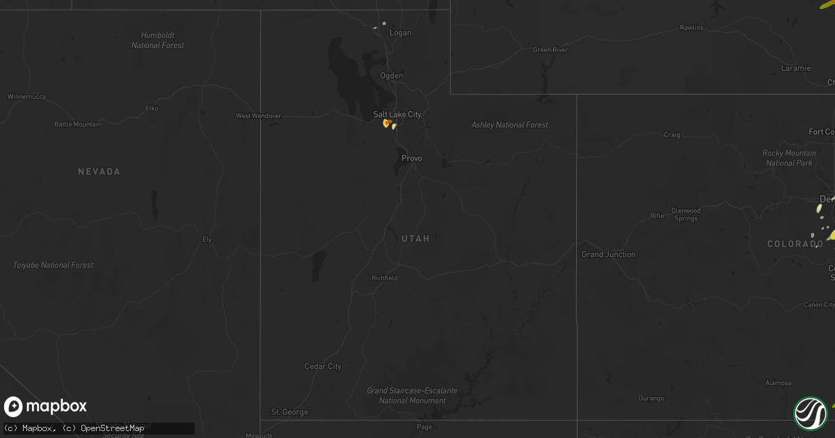
Hail Map in Utah on June 13, 2016
Get this storm
June 13 map
$229
one time, instant access
Download today. No call, no setup
Keep the $229
Bought the map and want the full workflow? Apply the entire $229 to a subscription within 7 days. None of it is wasted.
Every map, not just this one
This buys you this map. Subscription and you get every map we run, in the markets you choose from a few cities to whole states to nationwide. Plus real-time alerts the moment a storm fires.
Contact data
Name, contact info, occupancy, even credit band for addresses in the footprint. You go from where it hit to who to call.
Become the source they trust
Unlimited branding weather history reports on demand. You already have the documented answer ready for the property owner, and you are the one who showed up with it.
Property data and RoofTrace estimates
Pull up any address you have got, its value and the exact code rules for that jurisdiction, straight from One Click Code. Then RoofTrace estimates the squares, pitch, and roof value, priced the way you price.
Storm reports in Utah
Utah
| Date | Description |
|---|---|
| 06/13/20166:00 PM CDT | Lakeside mountain- lmr. |
| 06/13/20161:58 PM CDT | Reported via broadcast media |
| 06/13/20161:37 PM CDT | A local report indicates 1.75 inch wind near KEARNS |
| 06/13/20161:25 PM CDT | A local report indicates 1.00 inch wind near WEST VALLEY CITY |
| 06/13/20161:20 PM CDT | A local report indicates 1.00 inch wind near WEST JORDAN |
| 06/13/20161:15 PM CDT | Quarter sized hail photographed by a member of the public and reported on twitter. |
| 06/12/20167:00 PM CDT | Gunnison island- gni. |
All States Impacted by Hail Map on June 13, 2016
Cities Impacted by Hail Map on June 13, 2016
- Mountain View, OK
- Tucumcari, NM
- Merriman, NE
- Tuthill, SD
- Cody, NE
- Martin, SD
- Byers, CO
- Masterson, TX
- Amarillo, TX
- Vega, TX
- Panhandle, TX
- Sedalia, CO
- Gordon, NE
- Batesland, SD
- Mission, SD
- Valentine, NE
- Crookston, NE
- Saint Francis, SD
- Whitney, NE
- Canyon, TX
- Reed Point, MT
- Conchas Dam, NM
- Trementina, NM
- Harrison, NE
- Friona, TX
- Selma, AL
- Farwell, TX
- Bovina, TX
- Texico, NM
- Wagon Mound, NM
- Fort Stockton, TX
- Atkinson, NE
- Stuart, NE
- Claude, TX
- Marion Junction, AL
- Crane, TX
- Hulett, WY
- Sundance, WY
- Devils Tower, WY
- Deer Trail, CO
- Hugoton, KS
- Elbert, CO
- Colorado Springs, CO
- Channing, TX
- Bricelyn, MN
- Thompson, IA
- Scarville, IA
- Kiester, MN
- Yoder, CO
- Rapid City, SD
- Stinnett, TX
- Magna, UT
- West Jordan, UT
- Salt Lake City, UT
- West Valley City, UT
- Hardin, MT
- Bighorn, MT
- Solano, NM
- Dumas, TX
- Pueblo, CO
- Rye, CO
- Colorado City, CO
- Fairburn, SD
- Beach, ND
- Cartwright, ND
- Caputa, SD
- Hartley, TX
- Kyle, SD
- Watkins, CO
- Kaycee, WY
- Gillette, WY
- Billings, MT
- Worden, MT
- Ballantine, MT
- Huntley, MT
- Kiowa, CO
- Agate, CO
- Ramah, CO
- Peyton, CO
- Calhan, CO
- Newkirk, NM
- Cuervo, NM
- Linwood, NE
- Bennett, CO
- Alzada, MT
- Otis, CO
- Porcupine, SD
- Roy, NM
- Melrose, NM
- Clovis, NM
- Wibaux, MT
- Hope, AR
- Littleton, CO
- Morrison, CO
- Indian Hills, CO
- Adrian, TX
- Marion, AL
- Uniontown, AL
- Parmelee, SD
- Edgemont, SD
- Hot Springs, SD
- Trinidad, CO
- Flomaton, AL
- Rolla, KS
- Richfield, KS
- Crawford, NE
- Ekalaka, MT
- Hammond, MT
- Santa Rosa, NM
- Ismay, MT
- Kinsey, MT
- Aberdeen, MS
- Gruver, TX
- Canadian, TX
- Hazleton, IA
- Fairbank, IA
- Sidney, NE
- Potter, NE
- Gurley, NE
- Butler, OK
- Snyder, CO
- Larkspur, CO
- Parker, CO
- Castle Rock, CO
- Lakeside, NE
- Avondale, CO
- Roggen, CO
- Strasburg, CO
- Hereford, TX
- San Jon, NM
- Groom, TX
- Sunray, TX
- Franktown, CO
- Arlington, TX
- Grand Prairie, TX
- Cedar Hill, TX
- Clayton, NM
- Rushville, NE
- Leedey, OK
- Buffalo Center, IA
- Yuma, CO
- Allen, SD
- Oshkosh, NE
- Lewellen, NE
- Wiggins, CO
- Commerce City, CO
- Denver, CO
- Purdum, NE
- Forsyth, MT
- Colstrip, MT
- Aurora, CO
- Hermosa, SD
- Miami, TX
- Dalhart, TX
- Keystone, SD
- Custer, SD
- Buffalo Gap, SD
- Wagner, SD
- Dante, SD
- Akron, CO
- Fountain, CO
- Fort Morgan, CO
- Woodrow, CO
- Holyoke, CO
- Bascom, FL
- Terry, MT
- Ellsworth, NE
- Nenzel, NE
- Kilgore, NE
- Hammon, OK
- Mcalister, NM
- House, NM
- Roosevelt, OK
- Century, FL
- Bethpage, TN
- Jeffrey City, WY
- Bingham, NE
- Casper, WY
- Elizabeth, CO
- Keyes, OK
- Evansville, WY
- Taloga, OK
- Lawton, OK
- Buena Vista, NM
- Hill City, SD
- South Jordan, UT
- Midvale, UT
- Columbia, AL
- Bowling Green, KY
- Boncarbo, CO
- Caruthersville, MO
- Wildorado, TX
- Oral, SD
- Belle Fourche, SD
- Whitman, NE
- Ashby, NE
- Brewster, NE
- Lynch, NE
- Sidney, MT
- Clarendon, TX
- Hedley, TX
- Weston, CO
- Preston, ID
- Cordell, OK
- Mills, NM
- Amherst, CO
- Glenrock, WY
- Pine Ridge, SD
- Lytton, IA
- Rockwell City, IA
- Frisco City, AL
- Aladdin, WY
- Arnett, OK
- Manderson, SD
- Elba, AL
- Gallatin, TN
- Springfield, TN
- Decker, MT
- Busby, MT
- Lodge Grass, MT
- Spearman, TX
- Bronwood, GA
- Dawson, GA
- Weston, ID
- Chappell, NE
- Cache, OK
- Saint Onge, SD
- Spearfish, SD
- Mosquero, NM
- Jesup, IA
- Oelwein, IA
- Independence, IA
- Kinston, AL
- Dixons Mills, AL
- Briscoe, TX
- Walsenburg, CO
- Opp, AL
- Burwell, NE
- Bassett, NE
- Keenesburg, CO
- Hudson, CO
- Ocate, NM
- Elkhart, KS
- Guernsey, WY
- Wheatland, WY
- Clinton, OK
- Franklin, KY
- Wayside, TX
- Laurel, MT
- Follett, TX
- Broadwater, NE
- Desoto, TX
- Dallas, TX
- Lancaster, TX
- Haxtun, CO
- Cheyenne, OK
- Monument, CO
- Palmer Lake, CO
- Nashville, TN
- Park City, MT
- Alva, WY
- Newell, SD
- Duke, OK
- Custer, MT
- Thedford, NE
- Fairfield, TX
- Seagoville, TX
- Hooker, OK
- Spencer, NE
- Liberal, KS
- Fort Sumner, NM
- Pampa, TX
- Plains, KS
- Moorcroft, WY
- Crawford, OK
- Samson, AL
- Milligan, NE
- Lawtey, FL
- Box Elder, SD
- Rozet, WY
- Garland, UT
- Nisland, SD
- Kimball, NE
- Dix, NE
- Gotebo, OK
- Skellytown, TX
- Cairo, IL
- Brush, CO
- Covington, TX
- Springfield, CO
- Fleming, CO
- Whitney, TX
- Hillsboro, TX
- New Orleans, LA
- Lavina, MT
- Springer, NM
- Wounded Knee, SD
- Brighton, CO
- Golden, CO
- Daniel, WY
- Conifer, CO
- Guymon, OK
- Goodwell, OK
- Lambert, MT
- Waxahachie, TX
- Clanton, AL
- Adairville, KY
- Red Level, AL
- Tyrone, OK
- Collinston, UT
- Wilmer, TX
- Hutchins, TX
- Silverton, TX
- Quitaque, TX
- Cody, WY
- Faxon, OK
- White Deer, TX
- Fort Cobb, OK
- Walsh, CO
- Wanblee, SD
- Norris, SD
- Rosston, AR
- Emmet, AR
- Pritchett, CO
- Perryton, TX
- Custer City, OK
- Booker, TX
- Edgewood, IL
- Dimmitt, TX
- Sedan, NM
- Bard, NM


