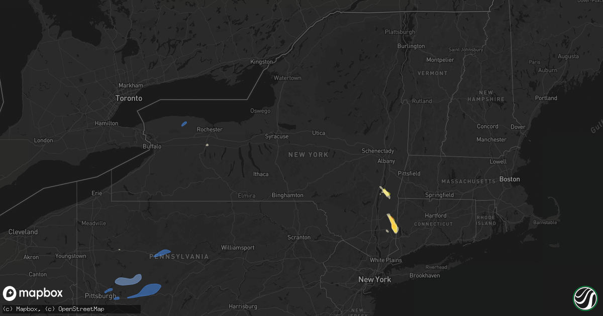
Hail Map in New York on June 11, 2026
Get this storm
June 11 map
$229
one time, instant access
Download today. No call, no setup
Keep the $229
Bought the map and want the full workflow? Apply the entire $229 to a subscription within 7 days. None of it is wasted.
Every map, not just this one
This buys you this map. Subscription and you get every map we run, in the markets you choose from a few cities to whole states to nationwide. Plus real-time alerts the moment a storm fires.
Contact data
Name, contact info, occupancy, even credit band for addresses in the footprint. You go from where it hit to who to call.
Become the source they trust
Unlimited branding weather history reports on demand. You already have the documented answer ready for the property owner, and you are the one who showed up with it.
Property data and RoofTrace estimates
Pull up any address you have got, its value and the exact code rules for that jurisdiction, straight from One Click Code. Then RoofTrace estimates the squares, pitch, and roof value, priced the way you price.
Storm reports in New York
New York
| Date | Description |
|---|---|
| 06/11/20266:07 PM CDT | Tree down over black river road. |
| 06/11/20266:07 PM CDT | Tree down over baltimore avenue. |
| 06/11/20266:03 PM CDT | Tree down over roadway on chestnut street. |
| 06/11/20266:03 PM CDT | Tree and wires down over riverside drive. |
| 06/11/20265:35 PM CDT | Tree down over river road in lisle. |
| 06/11/20265:16 PM CDT | Tree down over roadway on honeypot road. |
| 06/11/20265:08 PM CDT | Picture of large tree down on south country road in remsenburg. |
| 06/11/20265:08 PM CDT | Widespread trees and wires down across shirley... Mastic and mastic beach. |
| 06/11/20265:05 PM CDT | Branches... And fences are becoming damaged. |
| 06/11/20265:05 PM CDT | Large tree down on wading river road in manorville. Time estimated by radar. |
| 06/11/20265:02 PM CDT | Multiple trees and wires down. |
| 06/11/20265:00 PM CDT | Multiple trees and wires down across ridge. |
| 06/11/20264:55 PM CDT | Wires down on academy street. Radar-estimated time of impact. |
| 06/11/20264:55 PM CDT | Video of multiple trees down across wading river. |
| 06/11/20264:55 PM CDT | Video of wires down causing a fire on gully road in wading river. Time estimated by radar. |
| 06/11/20264:55 PM CDT | Multiple trees and wires down across rocky point. |
| 06/11/20264:55 PM CDT | 66 mph wind gusts recorded at mesonet station dvi03260 shoreham. |
| 06/11/20264:50 PM CDT | Tree down along clock road. Radar-estimated time of impact. |
| 06/11/20264:47 PM CDT | Powerline fell on house and resulted in a fire that was later put out. |
| 06/11/20264:47 PM CDT | Multiple reports of trees and wires down throughout corning. |
| 06/11/20264:40 PM CDT | Wires down at warren and north main. Radar-estimated time. |
| 06/11/20264:40 PM CDT | Tree down along taylor street. Radar-estimated time of impact. |
| 06/11/20264:38 PM CDT | Power pole down near middle rd and burch hill rd. |
| 06/11/20264:38 PM CDT | Tree down on route 115 north of lindley. |
| 06/11/20264:00 PM CDT | Tree and wires down on halsey st. |
| 06/11/20263:40 PM CDT | Power poles and trees down near nichols rd causing a traffic backup. |
| 06/11/20263:38 PM CDT | Tree... Power pole... And wires down across club seneca rd. |
| 06/11/20263:38 PM CDT | A local report indicates 1.75 inch wind near 1 S Pawling |
| 06/11/20263:38 PM CDT | Power line down... Causing arcing and a small grass fire. |
| 06/11/20263:35 PM CDT | A local report indicates 1.75 inch wind near Pawling |
| 06/11/20263:30 PM CDT | Trained spotter in the village of pawling sent pictures of hail with sizes ranging between 1 inch to 1.5 inches. |
| 06/11/20263:30 PM CDT | Social media report of hail up to 2 inches in diameter near route 22 and west mountain in pawling. |
| 06/11/20263:30 PM CDT | Multiple photos on social media of quarter to 1.25 inch hail in pawling. |
| 06/11/20263:26 PM CDT | Multiple reports of tree and wires down. |
| 06/11/20263:25 PM CDT | Hail in wingdale estimated between 1.25 and 1.50 inches based on pictures. |
| 06/11/20263:21 PM CDT | Multiple reports of trees and wires down across the town. |
| 06/11/20263:20 PM CDT | Tree down on ny 22 northbound near the intersection of chippawalla road in dover. |
| 06/11/20263:19 PM CDT | Tree down on roy rd. |
| 06/11/20263:11 PM CDT | Multiple reports of trees and wires down across the town and village. |
| 06/11/20263:11 PM CDT | Tree and wires down in roadway. |
| 06/11/20262:57 PM CDT | Tree down on route 54. |
| 06/11/20262:45 PM CDT | Multiple reports of trees and wires down across the town. |
| 06/11/20262:45 PM CDT | Multiple reports of trees and wires down across the town. |
| 06/11/20262:42 PM CDT | Tree down blocking roadway. |
| 06/11/20262:37 PM CDT | Tree down on trevett rd in the town of concord. |
| 06/11/20262:11 PM CDT | Tree down. |
| 06/11/20262:10 PM CDT | Tree fell on vehicle. |
| 06/11/20261:56 PM CDT | Tree on power line catching fire on route 82 near doodletown road. |
| 06/11/20261:56 PM CDT | Wires down in the road near the intersection of church road and willowbrook road in the town of livingston. |
| 06/11/20261:55 PM CDT | Trees and wires down between cr 10 and cr 15 along route 82 in the town of taghkanic. |
| 06/11/20261:45 PM CDT | Tree down along intersection of schneider road and cr10 in the town of livingston. |
| 06/11/20261:37 PM CDT | Corrects previous tstm wnd dmg report from 3 wsw springville for timing. Tree down on trevett rd in the town of concord. |
| 06/11/202612:37 PM CDT | Corrects previous tstm wnd dmg report from 3 wsw springville due to zulu conversion error. Tree down on trevett rd in the town of concord. |
| 06/10/202611:06 PM CDT | Multiple trees down and knocked over along and in the vicinity of brookside court between strong avenue and great neck road. Time estimated by radar. |
| 06/10/202610:45 PM CDT | Downed tree on the major deegan at exit 11. Exact time estimated by radar. |
| 06/10/202610:39 PM CDT | Asos station klga nyc/la guardia. |
| 06/10/202610:30 PM CDT | Large tree limb onto home. Exact time estimated by radar. |
| 06/10/20267:20 PM CDT | 2 trees down blocking the roadway. Time estimated by radar. |
All States Impacted by Hail Map on June 11, 2026
Cities Impacted by Hail Map on June 11, 2026
- Shannon City, IA
- Tingley, IA
- Greenfield, IA
- Mount Ayr, IA
- Afton, IA
- Guthrie Center, IA
- Diagonal, IA
- Panora, IA
- Menlo, IA
- Bagley, IA
- Creston, IA
- Stuart, IA
- Orient, IA
- Yale, IA
- Kellerton, IA
- Dexter, IA
- Macksburg, IA
- Ellston, IA
- Grand River, IA
- Thayer, IA
- Murray, IA
- Worth, MO
- Lenox, IA
- Redding, IA
- Denver, MO
- Blockton, IA
- Benton, IA
- Grant City, MO
- Hatfield, MO
- Casey, IA
- Martinsville, MO
- Winterset, IA
- Linden, IA
- Jamaica, IA
- Rippey, IA
- Perry, IA
- Earlham, IA
- Dawson, IA
- Jefferson, IA
- Adel, IA
- Grand Junction, IA
- Redfield, IA
- Lorimor, IA
- Dallas Center, IA
- Woodward, IA
- Minburn, IA
- Ogden, IA
- Bouton, IA
- Beaver, IA
- Gentry, MO
- Albany, MO
- Unionville, MO
- Green Castle, MO
- Parnell, MO
- Bedford, IA
- Sheridan, MO
- Clearfield, IA
- Osceola, IA
- Peru, IA
- Ravenwood, MO
- Granger, IA
- Van Meter, IA
- De Soto, IA
- Luther, IA
- Boone, IA
- Waukee, IA
- Madrid, IA
- Eagleville, MO
- Booneville, IA
- Ridgeway, MO
- Bethany, MO
- Van Wert, IA
- Weldon, IA
- New Virginia, IA
- Woodburn, IA
- Lucas, IA
- Humeston, IA
- Truro, IA
- Saint Charles, IA
- Livonia, MO
- Derby, IA
- Chariton, IA
- Lacona, IA
- Leon, IA
- Grimes, IA
- Davis City, IA
- Prole, IA
- Blythedale, MO
- Urbandale, IA
- Patterson, IA
- West Des Moines, IA
- Cainsville, MO
- Lamoni, IA
- Clive, IA
- Cumming, IA
- Decatur, IA
- Johnston, IA
- Ames, IA
- Bevington, IA
- Kelley, IA
- Norwalk, IA
- Polk City, IA
- Pleasantville, IA
- Sheldahl, IA
- Runnells, IA
- Knoxville, IA
- Saint Marys, IA
- Garden Grove, IA
- Slater, IA
- Berwick, IA
- Alleman, IA
- Martensdale, IA
- Bondurant, IA
- Ackworth, IA
- Indianola, IA
- Melcher Dallas, IA
- Des Moines, IA
- Altoona, IA
- Elkhart, IA
- Lineville, IA
- Windsor Heights, IA
- Allerton, IA
- Milo, IA
- Carlisle, IA
- Cambridge, IA
- Hartford, IA
- Swan, IA
- Williamson, IA
- Liberty Center, IA
- Corydon, IA
- Pleasant Hill, IA
- Huxley, IA
- Ankeny, IA
- Columbia, IA
- Princeton, MO
- Stanberry, MO
- Conception Junction, MO
- Clyde, MO
- Moulton, IA
- Coatsville, MO
- Wildorado, TX
- Vega, TX
- Russell, IA
- Hamilton, IA
- Lovilia, IA
- Story City, IA
- Gilbert, IA
- Nevada, IA
- Monroe, IA
- Maxwell, IA
- Colfax, IA
- Mitchellville, IA
- Prairie City, IA
- Collins, IA
- Mingo, IA
- Harvey, IA
- Tracy, IA
- Bussey, IA
- Melrose, IA
- Albia, IA
- Oskaloosa, IA
- Eddyville, IA
- Leighton, IA
- Pella, IA
- Beacon, IA
- Pulaski, IA
- Douds, IA
- Bloomfield, IA
- Milton, IA
- Mercer, MO
- Clio, IA
- New Hampton, MO
- Colo, IA
- Memphis, MO
- McFall, MO
- Friona, TX
- Darlington, MO
- Saint Anthony, IA
- Newton, IA
- Baxter, IA
- State Center, IA
- Ira, IA
- McCallsburg, IA
- Zearing, IA
- Roland, IA
- Rhodes, IA
- Blakesburg, IA
- Ottumwa, IA
- University Park, IA
- New Sharon, IA
- Millerton, IA
- Promise City, IA
- Clemons, IA
- Melbourne, IA
- Union, IA
- New Providence, IA
- Albion, IA
- Marshalltown, IA
- Haverhill, IA
- Conrad, IA
- Liscomb, IA
- Laurel, IA
- Beaman, IA
- Garwin, IA
- Ferguson, IA
- Gilman, IA
- Gladbrook, IA
- Montour, IA
- Malcom, IA
- Otley, IA
- Toledo, IA
- Grinnell, IA
- Killduff, IA
- Searsboro, IA
- Kellogg, IA
- Reasnor, IA
- Sully, IA
- Le Grand, IA
- Lynnville, IA
- Tama, IA
- Cedar, IA
- Fremont, IA
- Mystic, IA
- What Cheer, IA
- Montezuma, IA
- Unionville, IA
- Chillicothe, IA
- Lucerne, MO
- Centerville, IA
- Powersville, MO
- Barnes City, IA
- Plano, IA
- Kirkville, IA
- Rose Hill, IA
- Moravia, IA
- Seymour, IA
- Brooklyn, IA
- Cincinnati, IA
- Udell, IA
- Newtown, MO
- Keosauqua, IA
- Hedrick, IA
- Birmingham, IA
- Drakesville, IA
- Exline, IA
- Pollock, MO
- Batavia, IA
- Delta, IA
- Agency, IA
- Deep River, IA
- Gibson, IA
- Eldon, IA
- Floris, IA
- Grundy Center, IA
- Lincoln, IA
- Reinbeck, IA
- Whitten, IA
- Eldora, IA
- Elberon, IA
- Chelsea, IA
- Vining, IA
- Clutier, IA
- Dysart, IA
- Traer, IA
- Buckingham, IA
- Stockport, IA
- Sigourney, IA
- Gilman City, MO
- Cedar Falls, IA
- Morrison, IA
- Hudson, IA
- Dike, IA
- Hartwick, IA
- Guernsey, IA
- Marengo, IA
- Martinsburg, IA
- Belle Plaine, IA
- Hayesville, IA
- Keswick, IA
- Webster, IA
- Victor, IA
- Harper, IA
- South English, IA
- Spickard, MO
- Keota, IA
- Jameson, MO
- Harris, MO
- Fairfield, IA
- Packwood, IA
- Ollie, IA
- Millersburg, IA
- North English, IA
- Richland, IA
- Libertyville, IA
- Williamsburg, IA
- Ladora, IA
- Janesville, IA
- Waverly, IA
- Waterloo, IA
- Keystone, IA
- New Hartford, IA
- La Porte City, IA
- Shellsburg, IA
- Van Horne, IA
- Vinton, IA
- Garrison, IA
- Mount Auburn, IA
- Evansdale, IA
- Brighton, IA
- Fairfax, IA
- Palo, IA
- Parnell, IA
- Blairstown, IA
- Norway, IA
- Wellman, IA
- Luzerne, IA
- Atkins, IA
- Jesup, IA
- Homestead, IA
- South Amana, IA
- Conroy, IA
- Middle Amana, IA
- Amana, IA
- Newhall, IA
- Gilbertville, IA
- Watkins, IA
- Swisher, IA
- Iowa City, IA
- North Liberty, IA
- Kalona, IA
- West Chester, IA
- Walford, IA
- Tiffin, IA
- Cedar Rapids, IA
- Washington, IA
- Oxford, IA
- Coralville, IA
- Riverside, IA
- Mount Pleasant, IA
- Ainsworth, IA
- Wayland, IA
- Lockridge, IA
- Olds, IA
- Crawfordsville, IA
- Columbus City, IA
- Winfield, IA
- Wapello, IA
- Mount Union, IA
- Hills, IA
- Conesville, IA
- Lone Tree, IA
- Columbus Junction, IA
- Morning Sun, IA
- Walker, IA
- Center Point, IA
- Denver, IA
- Hazleton, IA
- Brandon, IA
- Oran, IA
- Dewar, IA
- Sumner, IA
- Dunkerton, IA
- Urbana, IA
- Fairbank, IA
- Readlyn, IA
- Oelwein, IA
- Tripoli, IA
- Westgate, IA
- Raymond, IA
- Independence, IA
- Rowley, IA
- Hawkeye, IA
- Milan, MO
- Humphreys, MO
- Galt, MO
- Marion, IA
- Robins, IA
- Solon, IA
- Hiawatha, IA
- Maynard, IA
- Toddville, IA
- Green City, MO
- Yarmouth, IA
- Letts, IA
- Nichols, IA
- Muscatine, IA
- Grandview, IA
- New Boston, IL
- Moscow, IA
- West Branch, IA
- Tipton, IA
- West Liberty, IA
- Lisbon, IA
- Alburnett, IA
- Fruitland, IA
- Illinois City, IL
- Atalissa, IA
- Mount Vernon, IA
- Ely, IA
- Wilton, IA
- Farmersburg, IA
- Masonville, IA
- Dundee, IA
- Winthrop, IA
- Lamont, IA
- Randalia, IA
- Stanley, IA
- West Union, IA
- Aurora, IA
- Monona, IA
- Volga, IA
- Quasqueton, IA
- Wadena, IA
- Coggon, IA
- Fayette, IA
- Elkader, IA
- Luana, IA
- Saint Olaf, IA
- Elgin, IA
- Strawberry Point, IA
- Postville, IA
- Arlington, IA
- Clermont, IA
- Anamosa, IA
- Ryan, IA
- Olin, IA
- Monticello, IA
- Clarence, IA
- Elkport, IA
- Center Junction, IA
- Wyoming, IA
- Prairieburg, IA
- Stanwood, IA
- Bennett, IA
- Earlville, IA
- Mechanicsville, IA
- Durant, IA
- Edgewood, IA
- Delhi, IA
- Manchester, IA
- Langworthy, IA
- Martelle, IA
- Morley, IA
- Central City, IA
- Hopkinton, IA
- Springville, IA
- Delaware, IA
- Greeley, IA
- Worthington, MO
- Novinger, MO
- Glenwood, MO
- Lancaster, MO
- Monmouth, IA
- Oxford Junction, IA
- Queen City, MO
- Kirksville, MO
- Greentop, MO
- Brashear, MO
- Downing, MO
- McGregor, IA
- Garber, IA
- Guttenberg, IA
- Garnavillo, IA
- Marquette, IA
- Maquoketa, IA
- Baldwin, IA
- Glen Haven, WI
- New Vienna, IA
- Lowden, IA
- Epworth, IA
- Wheatland, IA
- Bernard, IA
- Cascade, IA
- Bagley, WI
- Farley, IA
- North Buena Vista, IA
- Holy Cross, IA
- Luxemburg, IA
- Onslow, IA
- Dyersville, IA
- Cassville, WI
- Bloomington, WI
- Colesburg, IA
- Worthington, IA
- Prairie Du Chien, WI
- New Liberty, IA
- Blue Grass, IA
- Potosi, WI
- Dubuque, IA
- La Motte, IA
- Walcott, IA
- Grand Mound, IA
- Delmar, IA
- Sherrill, IA
- Bellevue, IA
- Durango, IA
- Stockton, IA
- Zwingle, IA
- Dixon, IA
- Peosta, IA
- Calamus, IA
- Lost Nation, IA
- Oakville, IA
- Patch Grove, WI
- Baring, MO
- Hurdland, MO
- De Witt, IA
- Fulton, IL
- Davenport, IA
- Low Moor, IA
- Clinton, IA
- Andrew, IA
- Charlotte, IA
- Goose Lake, IA
- Princeton, IA
- McCausland, IA
- Eldridge, IA
- Donahue, IA
- Welton, IA
- Spragueville, IA
- Miles, IA
- Teeds Grove, IA
- Preston, IA
- Long Grove, IA
- Bryant, IA
- Camanche, IA
- East Dubuque, IL
- Elizabeth, IL
- Scales Mound, IL
- Sabula, IA
- Hanover, IL
- Savanna, IL
- Galena, IL
- Chadwick, IL
- Mount Carroll, IL
- Thomson, IL
- Morrison, IL
- Stockton, IL
- Milledgeville, IL
- Lanark, IL
- Gratiot, WI
- Pearl City, IL
- Darlington, WI
- Warren, IL
- Apple River, IL
- Cuba City, WI
- Shullsburg, WI
- Kent, IL
- Benton, WI
- Hazel Green, WI
- Lena, IL
- Keithsburg, IL
- Seaton, IL
- Mediapolis, IA
- Joy, IL
- Polo, IL
- Forreston, IL
- Shannon, IL
- Winslow, IL
- Nora, IL
- Freeport, IL
- South Wayne, WI
- Baileyville, IL
- Argyle, WI
- McConnell, IL
- Browntown, WI
- Bonaparte, IA
- Mount Sterling, IA
- Aledo, IL
- Alexis, IL
- Edina, MO
- Little York, IL
- Monroe, WI
- Cedarville, IL
- Orangeville, IL
- Dakota, IL
- Woodford, WI
- Ridott, IL
- Davis, IL
- Rock City, IL
- Brodhead, WI
- Juda, WI
- German Valley, IL
- Oregon, IL
- Byron, IL
- Mount Morris, IL
- Pecatonica, IL
- Winnebago, IL
- Durand, IL
- Leaf River, IL
- Rockford, IL
- Stillman Valley, IL
- Gorin, MO
- Donnellson, IA
- West Point, IA
- Farmington, IA
- Hillsboro, IA
- Knox City, MO
- La Belle, MO
- Rutledge, MO
- Shirland, IL
- Rockton, IL
- Janesville, WI
- Orfordville, WI
- Beloit, WI
- Evansville, WI
- Saint Paul, IA
- Kahoka, MO
- Danville, IA
- Monticello, WI
- New Glarus, WI
- Williamstown, MO
- Wyaconda, MO
- Monmouth, IL
- Blanchardville, WI
- Ohio, IL
- Princeton, IL
- South Beloit, IL
- Machesney Park, IL
- Loves Park, IL
- Roscoe, IL
- Caledonia, IL
- Footville, WI
- La Moille, IL
- Gerlaw, IL
- Rio, IL
- Galesburg, IL
- North Henderson, IL
- Viola, IL
- Oquawka, IL
- Wever, IA
- West Burlington, IA
- Burlington, IA
- Saint Patrick, MO
- Afton, WI
- Clinton, WI
- Stronghurst, IL
- Lomax, IL
- Carman, IL
- Wataga, IL
- Mendota, IL
- West Brooklyn, IL
- Gladstone, IL
- Media, IL
- Smithshire, IL
- Raritan, IL
- Roseville, IL
- Biggsville, IL
- Earlville, IL
- Oneida, IL
- Henderson, IL
- Avon, IL
- Berwick, IL
- Kirkwood, IL
- Gilson, IL
- Maquon, IL
- Saint Augustine, IL
- London Mills, IL
- Abingdon, IL
- Cameron, IL
- Altona, IL
- Knoxville, IL
- Victoria, IL
- Yates City, IL
- Elmwood, IL
- Williamsfield, IL
- Sardis, OH
- Mazon, IL
- Farmington, IL
- Trivoli, IL
- Hudson, NY
- Germantown, NY
- Elizaville, NY
- Craryville, NY
- Catskill, NY
- Trenton, MO
- Ancram, NY
- New Martinsville, WV
- Paden City, WV
- Coal City, IL
- Brimfield, IL
- Lore City, OH
- Salesville, OH
- Freeport, PA
- Leechburg, PA
- Vandergrift, PA
- Ford City, PA
- Hyde Park, PA
- Pine Plains, NY
- Peotone, IL
- Manteno, IL
- Cedar Lake, IN
- Lima, NY
- Honeoye Falls, NY
- Avon, NY
- Cordova, IL
- Quaker City, OH
- Apollo, PA
- Kittanning, PA
- Spring Church, PA
- Shelocta, PA
- Trafford, PA
- Export, PA
- Irwin, PA
- Jeannette, PA
- Murrysville, PA
- Harrison City, PA
- Claridge, PA
- Grant Park, IL
- Crown Point, IN
- Albany, IL
- Bourbonnais, IL
- Momence, IL
- Millbrook, NY
- Salt Point, NY
- Clinton Corners, NY
- Delmont, PA
- Indiana, PA
- Avonmore, PA
- Elderton, PA
- Rural Valley, PA
- Creekside, PA
- Sagamore, PA
- Home, PA
- Knox, PA
- Roxbury, CT
- Verbank, NY
- Lagrangeville, NY
- Dover Plains, NY
- Lakeside, CT
- Bethlehem, CT
- Valparaiso, IN
- Wanatah, IN
- New Alexandria, PA
- Blairsville, PA
- Black Lick, PA
- Homer City, PA
- Josephine, PA
- New Florence, PA
- Armagh, PA
- Derry, PA
- Brush Valley, PA
- Seward, PA
- Union Mills, IN
- Hanna, IN
- Pawling, NY
- Poughquag, NY
- Wingdale, NY
- Alexandria, MO
- Pittsburgh, PA
- Oakmont, PA
- Verona, PA
- New Kensington, PA
- Harwick, PA
- Springdale, PA
- Cheswick, PA
- Tarentum, PA
- Creighton, PA
- Albion, NY
- Glenville, WV
- Morgantown, WV
- Fairmont, WV
- Norborne, MO
- Kouts, IN
- Linneus, MO
- Sherman, CT
- Carrollton, MO
- Wayland, MO
- Hamilton, IL
- Warsaw, IL
- Keokuk, IA
- La Crosse, IN
- Bucklin, MO
- New Boston, MO
- Ethel, MO
- Sand Fork, WV
- Marion Center, PA
- Vintondale, PA
- Dilltown, PA
- Nanty Glo, PA
- Johnstown, PA
- Penn Run, PA
- Northern Cambria, PA
- Twin Rocks, PA
- Clymer, PA
- Belsano, PA
- Ebensburg, PA
- Strongstown, PA
- Nicktown, PA
- Heilwood, PA
- Alverda, PA
- Marsteller, PA
- Saint Benedict, PA
- Patton, PA
- Colver, PA
- Carrolltown, PA
- Elmora, PA
- Spangler, PA
- Patterson, NY
- Sublette, IL
- Sutter, IL
- West Point, IL
- Monroe, CT
- Sandy Hook, CT
- Oxford, CT
- Adrian, WV
- Buckhannon, WV
- Horner, WV
- Elmer, MO
- Carthage, IL
- Basco, IL
- Elvaston, IL
- Dixon, IL
- Reynoldsville, PA
- Du Bois, PA
- Rockton, PA
- Penfield, PA
- Chana, IL
- Brewster, NY
- New Fairfield, CT
- Gibbs, MO
- La Plata, MO
- Atlanta, MO
- Bevier, MO
- Callao, MO
- Spring Hope, NC
- Rochelle, IL
- New Cambria, MO
- Bradley, IL
- Kankakee, IL
- Rocky Mount, NC
- Pinetops, NC
- Watertown, CT
- Woodbury, CT
- Saint Anne, IL
- Elk City, KS
- Schneider, IN
- Lowell, IN
- Lake Village, IN
- Pembroke Township, IL
- Hebron, IN
- Morocco, IN
- Shelby, IN
- Demotte, IN
- Thayer, IN
- Wheatfield, IN
- Stormville, NY
- Carmel, NY
- Novelty, MO
- Cornwall Bridge, CT
- New Preston Marble Dale, CT
- Nashville, NC
- Dallas City, IL
- Tennessee, IL
- Blandinsville, IL
- La Harpe, IL
- Colchester, IL
- Independence, KS
- Neodesha, KS
- Macon, MO
- Miami, MO
- Plymouth, IL
- Bowen, IL
- Mendon, IL
- Leonard, MO
- Ursa, IL
- Cherryvale, KS
- Kent, CT
- Sharon, CT
- Middlesex, NC
- Zebulon, NC
- Edenton, NC
- Holmes, NY
- Anabel, MO
- Clarence, MO
- Okarche, OK
- Calumet, OK
- Butler, MO
- Litchfield, CT
- Slater, MO
- Castalia, NC
- Peoria, IL
- Metamora, IL
- Chillicothe, IL
- East Peoria, IL
- Mossville, IL
- Bettendorf, IA
- Sciota, IL
- Macomb, IL
- Danbury, CT
- Port Byron, IL
- Perry, OK
- Morrison, OK
- Lowpoint, IL
- Lacon, IL
- Washburn, IL
- Varna, IL
- Terra Alta, WV
- Oakland, MD
- Kitzmiller, MD
- Elk Garden, WV
- Newark, MO
- Gilliam, MO
- Glasgow, MO
- Tyner, NC
- Balmorhea, TX
- Monticello, MO
- Shelbyville, MO
- Lewistown, MO
- Ewing, MO
- Bethel, MO
- Keyser, WV
- Rawlings, MD
- Westernport, MD
- Swanton, MD
- New Creek, WV
- Burlington, WV
- Romney, WV
- Toluca, IL
- La Rose, IL
- El Reno, OK
- Dennis, KS
- Parsons, KS
- Mound Valley, KS
- Montrose, MO
- Urich, MO
- Clinton, MO
- Rushville, IL
- Vermont, IL
- Canton, MO
- Lynn Center, IL
- Clayton, IL
- Glencoe, OK
- Wenona, IL
- Lentner, MO
- Woodhull, IL
- Cambridge, IL
- Durham, MO
- La Grange, MO
- Armstrong, MO
- Augusta, IL
- Walnut, KS
- Washington Depot, CT
- New Windsor, IL
- Magnolia, IL
- Streator, IL
- Lostant, IL
- Camden, IL
- Pawnee, OK
- Industry, IL
- Shelbina, MO
- Chenoa, IL
- Gridley, IL
- Flanagan, IL
- Coffeyville, KS
- Stantonsburg, NC
- Wilson, NC
- Lewistown, IL
- Ipava, IL
- Fairview, IL
- Rutland, IL
- Lockwood, NY
- Waverly, NY
- Liberty, KS
- Altamont, KS
- Dana, IL
- Minonk, IL
- Higbee, MO
- Fayette, MO
- Battleboro, NC
- Osco, IL
- Adair, IL
- Marietta, IL
- Cuba, IL
- Ellisville, IL
- Smithfield, IL
- Pontiac, IL
- Graymont, IL
- Odell, IL
- Cornell, IL
- Littleton, IL
- Table Grove, IL
- Mount Sterling, IL
- Huntsville, IL
- Timewell, IL
- Golden, IL
- La Prairie, IL
- Barton, NY
- Ancona, IL
- Long Point, IL
- Tonica, IL
- Vinton, VA
- Goodview, VA
- Hunnewell, MO
- Emden, MO
- Canton, IL
- Hannibal, MO
- Davis Junction, IL
- Bryant, IL
- Saint David, IL
- Madison, MO
- Edna, KS
- Glasford, IL
- Astoria, IL
- Frederick, IL
- Hanna City, IL
- Browning, IL
- Sound Beach, NY
- Mount Sinai, NY
- Miller Place, NY
- Yaphank, NY
- Middle Island, NY
- Coram, NY
- Shirley, NY
- Rocky Point, NY
- Ridge, NY
- Shoreham, NY
- Medford, NY
- Maramec, OK
- Oswego, KS
- Bath, IL
- Havana, IL
- Beardstown, IL
- Liverpool, IL
- Mapleton, IL
- Topeka, IL
- Chandlerville, IL
- Manito, IL
- Kingston Mines, IL
- Pekin, IL
- Yale, OK
- Liberty, IL
- Camp Point, IL
- Lindenwood, IL
- Monroe Center, IL
- Esmond, IL
- Cherry Valley, IL
- Kirkland, IL
- Pecos, TX
- Sparland, IL
- Henry, IL
- McNabb, IL
- Hull, IL
- Burlington, WI
- Moneta, VA
- Deepwater, MO
- Colony, OK
- Easton, IL
- Kilbourne, IL
- Oakford, IL
- Monroe City, MO
- Paris, MO
- Holcomb, IL
- Kingston, IL
- Belvidere, IL
- Versailles, IL
- Dwight, IL
- Raleigh, NC
- Center, MO
- Ransom, IL
- Sturgeon, MO
- Harrisburg, MO
- Clark, MO
- Rocheport, MO
- Chambersburg, IL
- Griggsville, IL
- Bedford, VA
- Forest City, IL
- South Pekin, IL
- Tremont, IL
- Green Valley, IL
- San Jose, IL
- Delavan, IL
- Mason City, IL
- Arenzville, IL
- Virginia, IL
- Kenosha, WI
- Union Grove, WI
- Union City, OK
- Columbia, MO
- Hallsville, MO
- Thompson, MO
- Centralia, MO
- Verona, IL
- Seneca, IL
- Bartlett, KS
- Garden Prairie, IL
- Lookeba, OK
- Matador, TX
- Meredosia, IL
- Stillwater, OK
- Marengo, IL
- Galesburg, KS
- Chetopa, KS
- Sims, NC
- Saint Paul, KS
- Edwards, IL
- Louisiana, MO
- Rome, PA
- Quincy, IL
- Payson, IL
- Palmyra, MO
- Chebanse, IL
- Welch, OK
- Hinton, OK
- New London, MO
- Lenapah, OK
- S Coffeyville, OK
- Racine, WI
- Pleasant Prairie, WI
- Twin Lakes, WI
- Spring Grove, IL
- Kansasville, WI
- Bristol, WI
- Salem, WI
- Genoa City, WI
- Hebron, IL
- Wonder Lake, IL
- Richmond, IL
- Silver Lake, WI
- Sturtevant, WI
- Lake Geneva, WI
- Springfield, WI
- Elkhorn, WI
- Mexico, MO
- Harvard, IL
- Capron, IL
- Woodstock, IL
- Poplar Grove, IL
- Creve Coeur, IL
- Groveland, IL
- Washington, IL
- Morton, IL
- Jacksonville, IL
- Petersburg, IL
- Ashland, IL
- Tallula, IL
- Genoa, IL
- Hampshire, IL
- Jennings, OK
- New Canton, IL
- Rockport, IL
- Warsaw, MO
- Childress, TX
- Tell, TX
- Kinderhook, IL
- Rock Falls, IL
- Gotebo, OK
- Cordell, OK
- Wilmington, IL
- Duke, OK
- Barstow, TX
- Benton City, MO
- Martinsburg, MO
- Laddonia, MO
- Rush Hill, MO
- Deer Creek, IL
- Eureka, IL
- Essex, IL
- Braidwood, IL
- Herscher, IL
- Bonfield, IL
- Gardner, IL
- Buckingham, IL
- Reddick, IL
- Minco, OK
- Hartsburg, IL
- Emden, IL
- New Holland, IL
- Pleasant Plains, IL
- Drumright, OK
- Osceola, MO
- Pittsfield, IL
- Barry, IL
- Ochelata, OK
- Bartlesville, OK
- Barnsdall, OK
- Binger, OK
- Auxvasse, MO
- Middletown, IL
- Chapin, IL
- Concord, IL
- Perry, IL
- Jamestown, MO
- Delaware, OK
- Vinita, OK
- Carlock, IL
- Goodfield, IL
- Danvers, IL
- Lexington, IL
- Greenview, IL
- Roanoke, IL
- Hudson, IL
- Minier, IL
- Mackinaw, IL
- Stanford, IL
- Armington, IL
- Congerville, IL
- Benson, IL
- El Paso, IL
- Hopedale, IL
- Secor, IL
- Bloomington, IL
- Wapella, IL
- McLean, IL
- Lawndale, IL
- Cantrall, IL
- Waynesville, IL
- Lincoln, IL
- Sherman, IL
- Atlanta, IL
- Mount Pulaski, IL
- Kenney, IL
- Williamsville, IL
- Towanda, IL
- Clinton, IL
- Normal, IL
- Shirley, IL
- Chestnut, IL
- Elkhart, IL
- Athens, IL
- Beason, IL
- Heyworth, IL
- Springfield, IL
- Granite, OK
- Fulton, MO
- Ashland, MO
- Hartsburg, MO
- Paducah, TX
- Cushing, OK
- Gould, OK
- Fort Cobb, OK
- Martinton, IL
- Beaverville, IL
- Papineau, IL
- Miami, OK
- New Salem, IL
- Levelland, TX
- Bluffs, IL
- Winchester, IL
- Mountain View, OK
- Saint John, IN
- Dyer, IN
- Schererville, IN
- Bluejacket, OK
- Cee Vee, TX
- Anadarko, OK
- Lone Wolf, OK
- Manhattan, IL
- Alexander, IL
- New Bloomfield, MO
- Monee, IL
- Beecher, IL
- Gracemont, OK
- Floydada, TX
- Edwards, MO
- North Miami, OK
- Buffalo, IL
- Illiopolis, IL
- Riverton, IL
- Maroa, IL
- Latham, IL
- Niantic, IL
- Downs, IL
- Warrensburg, IL
- Cooksville, IL
- Decatur, IL
- De Land, IL
- Cisco, IL
- Le Roy, IL
- Hammond, IL
- Forsyth, IL
- Bement, IL
- Monticello, IL
- Farmer City, IL
- Dewitt, IL
- Colfax, IL
- Oreana, IL
- Lane, IL
- Ellsworth, IL
- Argenta, IL
- Milmine, IL
- Weldon, IL
- Arrowsmith, IL
- Cerro Gordo, IL
- Saybrook, IL
- White Heath, IL
- Forrest, IL
- Chatsworth, IL
- Fairbury, IL
- Melvin, IL
- Mansfield, IL
- Fisher, IL
- Seymour, IL
- Piper City, IL
- Danforth, IL
- Kempton, IL
- Saunemin, IL
- Ashkum, IL
- Roberts, IL
- Sibley, IL
- Cullom, IL
- Anchor, IL
- Gibson City, IL
- Mahomet, IL
- Strawn, IL
- Clifton, IL
- Foosland, IL
- Bellflower, IL
- Cropsey, IL
- Merrillville, IN
- Modesto, IL
- Unionville, VA
- Rapidan, VA
- White Hall, IL
- Roodhouse, IL
- Mangum, OK
- New Berlin, IL
- Loami, IL
- Shannon, NC
- Raeford, NC
- Griffith, IN
- Thawville, IL
- Dewey, IL
- Onarga, IL
- Paxton, IL
- Loda, IL
- Elliott, IL
- Gilman, IL
- Tolono, IL
- Sadorus, IL
- Champaign, IL
- Ivesdale, IL
- Buckley, IL
- Atwood, IL
- Bondville, IL
- Rantoul, IL
- Ludlow, IL
- Hobart, IN
- Fairland, OK
- Afton, OK
- Niota, IL
- Commerce, OK
- Mokane, MO
- Steedman, MO
- Pocasset, OK
- Morris, IL
- Virden, IL
- Waverly, IL
- Crete, IL
- Dawson, IL
- Murrayville, IL
- Chatham, IL
- Fort Madison, IA
- Roaring Springs, TX
- Rockbridge, IL
- Carrollton, IL
- Franklin, IL
- La Place, IL
- Mt Zion, IL
- Dalton City, IL
- Mount Auburn, IL
- Blue Mound, IL
- Macon, IL
- Harristown, IL
- Boody, IL
- Mechanicsburg, IL
- Edinburg, IL
- Rochester, IL
- Lovington, IL
- Wyandotte, OK
- Macatawa, MI
- Holland, MI
- West Olive, MI
- Zeeland, MI
- Hudsonville, MI
- Donovan, IL
- Crescent City, IL
- Watseka, IL
- Milford, IL
- Thomasboro, IL
- Bethany, IL
- Cissna Park, IL
- Moweaqua, IL
- Amber, OK
- Baxter Springs, KS
- Hettick, IL
- Greenfield, IL
- Portland, MO
- Rhineland, MO
- Auburn, IL
- Palmyra, IL
- Rich Hill, MO
- Williamsburg, MO
- Quapaw, OK
- Galena, KS
- Grandville, MI
- Jenison, MI
- Joplin, MO
- Bartlett, IL
- Ralls, TX
- Rankin, IL
- Gifford, IL
- Kentland, IN
- Iroquois, IL
- Sheldon, IL
- Fair Oaks, IN
- Brook, IN
- Saint Joseph, IL
- Tuscola, IL
- Wellington, IL
- Potomac, IL
- Hoopeston, IL
- Savoy, IL
- Arthur, IL
- Penfield, IL
- Urbana, IL
- Philo, IL
- Findlay, IL
- Sullivan, IL
- Pesotum, IL
- Grand Rapids, MI
- Wyoming, MI
- Byron Center, MI
- Jerseyville, IL
- Rockville, MO
- Kane, IL
- Taylorville, IL
- Roosevelt, OK
- Treece, KS
- Crosbyton, TX
- Appleton City, MO
- Kaiser, MO
- Brumley, MO
- Linn Creek, MO
- Chesterton, IN
- Quanah, TX
- Boone Grove, IN
- Caledonia, MI
- Yorkville, IL
- Lorenzo, TX
- Oswego, IL
- Romeoville, IL
- Plainfield, IL
- Bolingbrook, IL
- Naperville, IL
- Aurora, IL
- Mcadoo, TX
- Montgomery, IL
- Woodridge, IL
- Lemont, IL
- Lockport, IL
- Willowbrook, IL
- Robbins, IL
- Orland Park, IL
- Palos Heights, IL
- Willow Springs, IL
- Downers Grove, IL
- Markham, IL
- Darien, IL
- Midlothian, IL
- Crestwood, IL
- Palos Park, IL
- Lisle, IL
- Homer Glen, IL
- Oak Forest, IL
- Harvey, IL
- Posen, IL
- Blue Island, IL
- South Holland, IL
- Worth, IL
- Dolton, IL
- Alsip, IL
- Calumet City, IL
- Palos Hills, IL
- Riverdale, IL
- Brighton, IL
- Pawnee, IL
- Kincaid, IL
- Seneca, MO
- Cement, OK
- Medora, IL
- Columbus, KS
- Picher, OK
- Morrison, MO
- Warrenton, MO
- Divernon, IL
- Glenarm, IL
- Chamois, MO
- Claremore, OK
- Bridgeview, IL
- Riverside, IL
- Evergreen Park, IL
- Clarendon Hills, IL
- Oak Lawn, IL
- Westmont, IL
- Western Springs, IL
- Westchester, IL
- Hinsdale, IL
- Chicago Ridge, IL
- Broadview, IL
- Cicero, IL
- Maywood, IL
- La Grange, IL
- Berwyn, IL
- Brookfield, IL
- Forest Park, IL
- Hometown, IL
- Oak Brook, IL
- Chicago, IL
- Hickory Hills, IL
- Lyons, IL
- Justice, IL
- La Grange Park, IL
- Burbank, IL
- Summit Argo, IL
- Freeport, MI
- Wayland, MI
- Middleville, MI
- Alto, MI
- Newman, IL
- Longview, IL
- Humboldt, IL
- Armstrong, IL
- Earl Park, IN
- Broadlands, IL
- Ogden, IL
- Muncie, IL
- Charleston, IL
- Fairmount, IL
- Mattoon, IL
- Henning, IL
- Hindsboro, IL
- Oakwood, IL
- Rossville, IL
- Arcola, IL
- Murdock, IL
- Oakland, IL
- Danville, IL
- Collison, IL
- Fowler, IN
- Royal, IL
- Villa Grove, IL
- Sidney, IL
- Allerton, IL
- Fithian, IL
- Stockland, IL
- Homer, IL
- Camargo, IL
- Bismarck, IL
- Catlin, IL
- Ambia, IN
- Goodland, IN
- Reynolds, IN
- Georgetown, IL
- Tilton, IL
- Attica, IN
- Rensselaer, IN
- Indianola, IL
- Metcalf, IL
- Remington, IN
- Sidell, IL
- Brocton, IL
- Williamsport, IN
- State Line, IN
- Alvin, IL
- Monon, IN
- Oxford, IN
- Wolcott, IN
- Pine Village, IN
- Chalmers, IN
- Boswell, IN
- Westville, IL
- West Lebanon, IN
- Covington, IN
- Brookston, IN
- Hume, IL
- Mount Ayr, IN
- West Lafayette, IN
- Otterbein, IN
- Templeton, IN
- Francesville, IN
- Medaryville, IN
- North Judson, IN
- Winamac, IN
- Clarksville, MI
- Lake Odessa, MI
- Ashmore, IL
- Gary, IN
- Hammond, IN
- Whiting, IN
- East Chicago, IN
- Wright City, MO
- Crocker, MO
- Iberia, MO
- Westville, IN
- Shipman, IL
- Piasa, IL
- Fidelity, IL
- La Porte, IN
- Lawton, OK
- Ulman, MO
- Morrisonville, IL
- Palmer, IL
- Yeoman, IN
- Westpoint, IN
- Idaville, IN
- Star City, IN
- Logansport, IN
- Lafayette, IN
- Buffalo, IN
- Kewanna, IN
- Rochester, IN
- Lucerne, IN
- Ridge Farm, IL
- Delphi, IN
- Royal Center, IN
- Veedersburg, IN
- Monticello, IN
- Perrysville, IN
- Burnettsville, IN
- Cayuga, IN
- Battle Ground, IN
- Chrisman, IL
- Kansas, IL
- Sunfield, MI
- Portland, MI
- Wingate, IN
- San Pierre, IN
- Knox, IN
- Monterey, IN
- Nashville, MI
- Vermontville, MI
- Mulliken, MI
- Charlotte, MI
- Woodland, MI
- Kingman, IN
- Redmon, IL
- Dana, IN
- Paris, IL
- Grand Ledge, MI
- Grove, OK
- Dickens, TX
- Dixon, MO
- Carlinville, IL
- Gillespie, IL
- Calhoun, MO
- Chickasha, OK
- Pryor, OK
- Potterville, MI
- Eagle, MI
- Niles, MI
- Edwardsburg, MI
- Cassopolis, MI
- Mason, MI
- Williamston, MI
- Holt, MI
- Dimondale, MI
- Okemos, MI
- East Lansing, MI
- Haslett, MI
- Lansing, MI
- Dewitt, MI
- Bath, MI
- Laingsburg, MI
- Dowagiac, MI
- Walkerton, IN
- North Liberty, IN
- Mill Creek, IN
- Windsor, MO
- Medicine Park, OK
- Cyril, OK
- Fletcher, OK
- Olustee, OK
- Altus, OK
- Rockville, IN
- Plymouth, IN
- Culver, IN
- Ora, IN
- Grovertown, IN
- Hillsdale, IN
- Clinton, IN
- Argos, IN
- Newtown, IN
- Mellott, IN
- Bremen, IN
- Hillsboro, IN
- Bourbon, IN
- New Richmond, IN
- Westfield, IL
- Gays, IL
- Lerna, IL
- Windsor, IL
- Assumption, IL
- Shelbyville, IL
- Stonington, IL
- Lincoln, MO
- Sawyer, MI
- Bridgman, MI
- Portage, IN
- South Bend, IN
- Beverly Shores, IN
- Michigan City, IN
- Harbert, MI
- Three Oaks, MI
- Lakeside, MI
- Union Pier, MI
- New Buffalo, MI
- Ramsey, IL
- Oconee, IL
- Herrick, IL
- Cowden, IL
- Galien, MI
- Rolling Prairie, IN
- New Carlisle, IN
- Fort Sill, OK
- New Troy, MI
- Buchanan, MI
- Baroda, MI
- Berrien Springs, MI
- Elgin, OK
- Vermilion, IL
- Romney, IN
- Dennison, IL
- Montezuma, IN
- Waynetown, IN
- Marshall, IL
- West Terre Haute, IN
- Bloomingdale, IN
- Martinsville, IL
- Vandalia, MI
- Jones, MI
- Warsaw, IN
- Claypool, IN
- Syracuse, IN
- Linden, IN
- Crawfordsville, IN
- Flora, IN
- Camden, IN
- Buck Creek, IN
- Milford, IN
- Akron, IN
- Nappanee, IN
- Atwood, IN
- Leesburg, IN
- Twelve Mile, IN
- Mentone, IN
- Marshall, IN
- Etna Green, IN
- Macy, IN
- Dayton, IN
- Tippecanoe, IN
- Universal, IN
- Roachdale, IN
- Greencastle, IN
- Mulberry, IN
- Young America, IN
- Bringhurst, IN
- Bridgeton, IN
- Denver, IN
- Mecca, IN
- Frankfort, IN
- Reelsville, IN
- Kokomo, IN
- Peru, IN
- Ladoga, IN
- Rosedale, IN
- Galveston, IN
- New Waverly, IN
- Rossville, IN
- Darlington, IN
- Burlington, IN
- Russellville, IN
- Cutler, IN
- Alamo, IN
- Walton, IN
- Terre Haute, IN
- New Market, IN
- Silver Lake, IN
- Waveland, IN
- New Goshen, IN
- Bainbridge, IN
- Brazil, IN
- Clarks Hill, IN
- Thorntown, IN
- Jamestown, IN
- Burket, IN
- Russiaville, IN
- Carbon, IN
- Colfax, IN
- New Ross, IN
- Onward, IN
- Mexico, IN
- Advance, IN
- Michigantown, IN
- Lebanon, IN
- Roann, IN
- Forest, IN
- North Salem, IN
- Pierceton, IN
- Miami, IN
- Fairmount, IN
- Amboy, IN
- North Manchester, IN
- Sheridan, IN
- Windfall, IN
- Sharpsville, IN
- La Fontaine, IN
- Elwood, IN
- Urbana, IN
- Marion, IN
- Kirklin, IN
- Winona Lake, IN
- Goldsmith, IN
- Converse, IN
- Wabash, IN
- Swayzee, IN
- Laketon, IN
- Greentown, IN
- Bunker Hill, IN
- Tipton, IN
- Grissom Arb, IN
- Kempton, IN
- Carmel, IN
- Atlanta, IN
- Lizton, IN
- Sweetser, IN
- Lagro, IN
- Cicero, IN
- Frankton, IN
- Lapel, IN
- Noblesville, IN
- Alexandria, IN
- Zionsville, IN
- Summitville, IN
- Brownsburg, IN
- Jonesboro, IN
- Whitestown, IN
- Anderson, IN
- Westfield, IN
- Pittsboro, IN
- Arcadia, IN
- Geronimo, OK
- Jasper, MO
- Oronogo, MO
- Spur, TX
- Lanagan, MO
- Noel, MO
- South West City, MO
- Salina, OK
- Headrick, OK
- Altus Afb, OK
- Anderson, MO
- Mishawaka, IN
- Beecher City, IL
- Ballwin, MO
- Goshen, IN
- Liberty Mills, IN
- Servia, IN
- Millersburg, IN
- Middlebury, IN
- New Paris, IN
- Cromwell, IN
- Larwill, IN
- North Webster, IN
- Walters, OK
- Columbia City, IN
- Ligonier, IN
- Kimmell, IN
- Huntington, IN
- South Whitley, IN
- Van Buren, IN
- Fowlerton, IN
- Gas City, IN
- Roanoke, IN
- Andrews, IN
- Warren, IN
- Upland, IN
- Matthews, IN
- Gaston, IN
- Hartford City, IN
- Markle, IN
- Daleville, IN
- Yorktown, IN
- Muncie, IN
- Middletown, IN
- Albion, IN
- Montpelier, IN
- Effingham, IL
- Shumway, IL
- Eaton, IN
- Bluffton, IN
- Poneto, IN
- Pennville, IN
- Keystone, IN
- Dunkirk, IN
- Liberty Center, IN
- Valley Park, MO
- Shipshewana, IN
- Topeka, IN
- Lagrange, IN
- Wawaka, IN
- Uniondale, IN
- Ossian, IN
- Yoder, IN
- Zanesville, IN
- Petroleum, IN
- Bryant, IN
- Casey, IL
- Webberville, MI
- Howell, MI
- Corunna, MI
- Gaines, MI
- Swartz Creek, MI
- Lennon, MI
- Bancroft, MI
- Linden, MI
- Byron, MI
- Vernon, MI
- Fowlerville, MI
- Owosso, MI
- Morrice, MI
- Durand, MI
- Perry, MI
- Elkhart, IN
- Rome City, IN
- Wolcottville, IN
- Howe, IN
- Kendallville, IN
- Bristol, IN
- Labadie, MO
- Saint Louis, MO
- White Pigeon, MI
- Constantine, MI
- Three Rivers, MI
- Centreville, MI
- Sturgis, MI
- Carthage, MO
- Lubbock, TX
- Fenton, MO
- Camby, IN
- Greenfield, IN
- Stilesville, IN
- New Palestine, IN
- Fillmore, IN
- Mooresville, IN
- Mccordsville, IN
- Greenwood, IN
- Ingalls, IN
- Coatesville, IN
- Danville, IN
- Amo, IN
- Clayton, IN
- Fortville, IN
- Plainfield, IN
- Wilkinson, IN
- Markleville, IN
- Pendleton, IN
- West Newton, IN
- Beech Grove, IN
- Fishers, IN
- Avon, IN
- Indianapolis, IN
- Maxwell, IN
- Avilla, IN
- Golden City, MO
- Sigel, IL
- Duncan, OK
- Comanche, OK
- Rose, OK
- Tipton, OK
- Bella Vista, AR
- Sulphur Springs, AR
- Idalou, TX
- Loveland, OK
- Chattanooga, OK
- Cache, OK
- Scammon, KS
- Ashley, IN
- Burr Oak, MI
- Angola, IN
- Corunna, IN
- Waterloo, IN
- Hudson, IN
- Orland, IN
- Auburn, IN
- Pleasant Lake, IN
- South Milford, IN
- Fountaintown, IN
- Fairland, IN
- Albany, IN
- Springport, IN
- Mays, IN
- Straughn, IN
- Falmouth, IN
- Arlington, IN
- Monroe, IN
- Selma, IN
- Parker City, IN
- Mooreland, IN
- Morristown, IN
- Spiceland, IN
- Charlottesville, IN
- Fort Wayne, IN
- New Castle, IN
- Craigville, IN
- Ridgeville, IN
- Decatur, IN
- Gwynneville, IN
- Shirley, IN
- Carthage, IN
- Losantville, IN
- Redkey, IN
- Farmland, IN
- Kennard, IN
- Shelbyville, IN
- Portland, IN
- Berne, IN
- Lewisville, IN
- Knightstown, IN
- Rushville, IN
- Geneva, IN
- Robertsville, MO
- Pacific, MO
- Catawissa, MO
- Wildwood, MO
- Cedar Hill, MO
- East Carondelet, IL
- Strang, OK
- Slaton, TX
- Chouteau, OK
- Locust Grove, OK
- Colcord, OK
- Faxon, OK
- Dupo, IL
- Spavinaw, OK
- Hastings, OK
- Waurika, OK
- Temple, OK
- Hoagland, IN
- New Haven, IN
- Monroeville, IN
- Woodburn, IN
- Ansonia, OH
- Paulding, OH
- Modoc, IN
- Wren, OH
- Saint Henry, OH
- Celina, OH
- Lynn, IN
- Rockford, OH
- Fort Recovery, OH
- Convoy, OH
- Rossburg, OH
- Spencerville, OH
- Milton, IN
- Saint Marys, OH
- Union City, OH
- Cambridge City, IN
- Coldwater, OH
- Maria Stein, OH
- Richmond, IN
- Fountain City, IN
- Montezuma, OH
- Economy, IN
- Payne, OH
- Haviland, OH
- Hagerstown, IN
- Mendon, OH
- Saratoga, IN
- Connersville, IN
- Delphos, OH
- Van Wert, OH
- Salamonia, IN
- Willshire, OH
- Union City, IN
- Winchester, IN
- Centerville, IN
- Scott, OH
- Williamsburg, IN
- Antwerp, OH
- Venedocia, OH
- Greens Fork, IN
- New Weston, OH
- Burkettsville, OH
- Grover Hill, OH
- Ohio City, OH
- Middle Point, OH
- Pioneer, OH
- Montgomery, MI
- Camden, MI
- Montpelier, OH
- Coldwater, MI
- Bronson, MI
- Fremont, IN
- Bryan, OH
- Edgerton, OH
- Hamilton, IN
- West Unity, OH
- Butler, IN
- Reading, MI
- Quincy, MI
- Edon, OH
- Post, TX
- Belleville, IL
- Millstadt, IL
- Kansas, OK
- High Ridge, MO
- Bentonville, AR
- Arcanum, OH
- Versailles, OH
- Boston, IN
- Webster, IN
- New Madison, OH
- Brownsville, IN
- Yorkshire, OH
- West Manchester, OH
- Hollansburg, OH
- Eaton, OH
- Camden, OH
- Palestine, OH
- New Bremen, OH
- College Corner, OH
- New Paris, OH
- Liberty, IN
- Greenville, OH
- Chickasaw, OH
- Eldorado, OH
- Fort Jennings, OH
- Randlett, OK
- Wilson, TX
- Tahoka, TX
- Hulbert, OK
- Cloverdale, OH
- Ottoville, OH
- Columbus Grove, OH
- Ottawa, OH
- Lima, OH
- Kalida, OH
- Fayette, OH
- Hillsdale, MI
- Alvordton, OH
- Morenci, MI
- Osseo, MI
- Pittsford, MI
- Archbold, OH
- Waldron, MI
- Hudson, MI
- Allen, MI
- Pineville, MO
- Columbia, IL
- Wagoner, OK
- Lyons, OH
- Adrian, MI
- Jasper, MI
- Clayton, MI
- Stryker, OH
- Tecumseh, MI
- Sand Creek, MI
- Wauseon, OH
- Manitou Beach, MI
- Tipton, MI
- Onsted, MI
- Addison, MI
- North Adams, MI
- Watts, OK
- Wichita Falls, TX
- Jonesville, MI
- Cement City, MI
- Jerome, MI
- Brooklyn, MI
- Tahlequah, OK
- Aldrich, MO
- Bolivar, MO
- Fair Play, MO
- Metamora, OH
- Riga, MI
- Ottawa Lake, MI
- Swanton, OH
- Milan, MI
- Clinton, MI
- Berkey, OH
- Manchester, MI
- Palmyra, MI
- Blissfield, MI
- Delta, OH
- Britton, MI
- Saline, MI
- Deerfield, MI
- Troy, OH
- Pitsburg, OH
- Bluffton, OH
- Harrod, OH
- Cairo, OH
- Houston, OH
- Anna, OH
- Brookville, OH
- Lafayette, OH
- Botkins, OH
- New Hampshire, OH
- Tipp City, OH
- Russia, OH
- Wapakoneta, OH
- Vandalia, OH
- Gomer, OH
- Jackson Center, OH
- Dayton, OH
- De Graff, OH
- Sidney, OH
- Piqua, OH
- Phillipsburg, OH
- Minster, OH
- Buckland, OH
- Waynesfield, OH
- Lakeview, OH
- West Alexandria, OH
- Covington, OH
- West Milton, OH
- Vaughnsville, OH
- New Lebanon, OH
- Quincy, OH
- Ludlow Falls, OH
- Fletcher, OH
- Uniopolis, OH
- Beaverdam, OH
- Farmersville, OH
- Englewood, OH
- Laura, OH
- Pleasant Hill, OH
- Fort Loramie, OH
- Osgood, OH
- New Knoxville, OH
- Clayton, OH
- Bradford, OH
- Pandora, OH
- Maplewood, OH
- Pemberton, OH
- Lewistown, OH
- Verona, OH
- Lewisburg, OH
- Gettysburg, OH
- Port Jefferson, OH
- Mount Cory, OH
- Findlay, OH
- McComb, OH
- Benton Ridge, OH
- Rawson, OH
- Odonnell, TX
- Reeds, MO
- Summers, AR
- Alger, OH
- Jenera, OH
- Ada, OH
- Arlington, OH
- Forest, OH
- Welling, OK
- Sainte Genevieve, MO
- Duenweg, MO
- Holliday, TX
- Muskogee, OK
- Fort Gibson, OK
- Siloam Springs, AR
- Cisne, IL
- Mount Erie, IL
- Scotland, TX
- McCutchenville, OH
- Fostoria, OH
- Arcadia, OH
- Carey, OH
- Tiffin, OH
- Vanlue, OH
- New Riegel, OH
- Upper Sandusky, OH
- Mount Blanchard, OH
- Alvada, OH
- Sycamore, OH
- Perryville, MO
- Saint Mary, MO
- Lamesa, TX
- Park Hill, OK
- Bunch, OK
- Stilwell, OK
- Proctor, OK
- Bloomville, OH
- Republic, OH
- Braggs, OK
- Maybee, MI
- Dundee, MI
- Petersburg, MI
- Webbers Falls, OK
- Gore, OK
- Frohna, MO
- Farrar, MO
- Vian, OK
- Ellington, MO
- Checotah, OK
- Porum, OK
- Stigler, OK
- Van Buren, MO
- Grandin, MO
- Ellsinore, MO
- Marion, KY
- Owensboro, KY
- Smithville, OK
- Doniphan, MO
- Mcalester, OK
- Beaver Dam, KY
- Cromwell, KY
- Harviell, MO
- Oxly, MO
- Naylor, MO
- Broken Bow, OK
- Horse Branch, KY
- Murray, KY
- Hayti, MO
- Bragg City, MO
- Greensburg, KY
- Whitefield, OK
- Andrews Air Force Base, MD
- Huntly, VA
- Linden, VA
- Washington, DC
- Reston, VA
- Delaplane, VA
- Fort Washington, MD
- Vienna, VA
- Hume, VA
- Ashburn, VA
- Leesburg, VA
- Dunkirk, MD
- Churchton, MD
- Middleburg, VA
- West River, MD
- Friendship, MD
- Chester Gap, VA
- The Plains, VA
- Fairfax, VA
- Naval Anacost Annex, DC
- Oakton, VA
- Haymarket, VA
- Centreville, VA
- Catharpin, VA
- Lanham, MD
- Arlington, VA
- McLean, VA
- Lothian, MD
- Alexandria, VA
- Chantilly, VA
- Front Royal, VA
- Markham, VA
- Hyattsville, MD
- Shady Side, MD
- Harwood, MD
- Capitol Heights, MD
- Falls Church, VA
- Tracys Landing, MD
- Bowie, MD
- Deale, MD
- Clinton, MD
- Upper Marlboro, MD
- Brentwood, MD
- Sterling, VA
- District Heights, MD
- Marshall, VA
- Owings, MD
- Galesville, MD
- Davidsonville, MD
- Bethesda, MD
- Herndon, VA
- Upperville, VA
- Suitland, MD
- Oxon Hill, MD
- Annandale, VA
- Temple Hills, MD
- Edgewater, MD
- Mount Rainier, MD
- Dunn Loring, VA
- Aldie, VA
- Fort Myer, VA
- Springfield, VA
- Gambrills, MD
- Crownsville, MD
- Riva, MD
- Stevensville, MD
- Annapolis, MD
- Carmichaels, PA
- Algonac, MI
- Clinton Township, MI
- Harsens Island, MI
- Harper Woods, MI
- Harrison Township, MI
- Saint Clair Shores, MI
- Eastpointe, MI
- Sterling Heights, MI
- New Baltimore, MI
- Fair Haven, MI
- Marine City, MI
- Roseville, MI
- Macomb, MI
- Warren, MI
- Grosse Pointe, MI
- Fraser, MI
- Detroit, MI
- Mount Clemens, MI
- Union, MI
- Berrien Center, MI
- Granger, IN
- Osceola, IN
- Kingsford Heights, IN
- Notre Dame, IN
- Lakeville, IN
- Hamlet, IN
- Taylor Ridge, IL
- Montpelier, IA
- Andalusia, IL
- Buffalo, IA
- Le Claire, IA
- Hanover Park, IL
- Lee, IL
- Steward, IL
- Needham, IN
- Boggstown, IN


