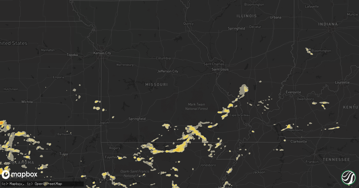
Hail Map on June 11, 2011
Get this storm
June 11 map
$229
one time, instant access
Download today. No call, no setup
Keep the $229
Bought the map and want the full workflow? Apply the entire $229 to a subscription within 7 days. None of it is wasted.
Every map, not just this one
This buys you this map. Subscription and you get every map we run, in the markets you choose from a few cities to whole states to nationwide. Plus real-time alerts the moment a storm fires.
Contact data
Name, contact info, occupancy, even credit band for addresses in the footprint. You go from where it hit to who to call.
Become the source they trust
Unlimited branding weather history reports on demand. You already have the documented answer ready for the property owner, and you are the one who showed up with it.
Property data and RoofTrace estimates
Pull up any address you have got, its value and the exact code rules for that jurisdiction, straight from One Click Code. Then RoofTrace estimates the squares, pitch, and roof value, priced the way you price.
States Impacted by Hail Map on June 11, 2011
Storm reports
Montana
| Date | Description |
|---|---|
| 06/10/20117:56 PM CDT | A local report indicates 1.00 inch wind near 3 ESE BELLE CREEK |
| 06/10/20117:52 PM CDT | Up to ping pong ball size hail |
Colorado
| Date | Description |
|---|---|
| 06/11/20116:48 PM CDT | A local report indicates 60 MPH wind near 18 N FLAGLER |
| 06/11/20116:41 PM CDT | Extensive blowing dust |
| 06/11/20116:10 PM CDT | A local report indicates 58 MPH wind near LAST CHANCE |
| 06/11/20115:11 PM CDT | 60 mph estimated wind gusts. |
| 06/11/20115:04 PM CDT | A local report indicates 1.00 inch wind near 2 SSE DEER TRAIL |
| 06/11/20114:22 PM CDT | A local report indicates 1.00 inch wind near 6 E LAMAR |
| 06/11/20114:07 PM CDT | Tornado on the ground for about 1-3 minutes. Cone with dust kicking up at the surface. |
| 06/11/20114:05 PM CDT | A local report indicates 62 MPH wind near LAMAR |
| 06/11/20113:25 PM CDT | A local report indicates 1.00 inch wind near 12 S LAS ANIMAS |
South Dakota
| Date | Description |
|---|---|
| 06/11/20116:40 PM CDT | A local report indicates 1.00 inch wind near OGLALA |
| 06/11/20116:25 PM CDT | A local report indicates 60 MPH wind near 11 S OELRICHS |
| 06/11/20114:55 PM CDT | 20 minutes of hail 355 pm to 415 pm |
| 06/10/20119:49 PM CDT | A local report indicates 1.00 inch wind near 18 N DOWNTOWN BELLE FOU |
Pennsylvania
| Date | Description |
|---|---|
| 06/11/20116:51 PM CDT | Tornado in north annville twsp. - extensive debris |
| 06/11/20116:25 PM CDT | Numerous trees down |
| 06/11/20116:05 PM CDT | 4 to 6 trees blown down...knocking down wires and power poles. Estimated wind speed 85 mph |
| 06/11/20116:00 PM CDT | A swath of corn stalks were blown down in a fanned out pattern. 4 trees blown down also. Estimated wind speed 85 mph |
| 06/10/20118:58 PM CDT | Wind gust at 753 pm. |
| 06/10/20118:39 PM CDT | Large tree limbs down on stanyon st. In york township |
| 06/10/20118:35 PM CDT | Large tree down in west manchester township |
| 06/10/20118:31 PM CDT | Trees down at w. College and trinity rd. In north codorus township |
| 06/10/20118:06 PM CDT | Large tree down at springwood rd. And n. Walnut |
| 06/10/20117:22 PM CDT | Tree fell and damaged several cars on wayne avenue |
| 06/10/20117:20 PM CDT | Barn blown onto roadway |
| 06/10/20117:19 PM CDT | A local report indicates 1.00 inch wind near GRANDVIEW HEIGHTS |
| 06/10/20117:19 PM CDT | A local report indicates 1.00 inch wind near YORK |
| 06/10/20117:15 PM CDT | Barn collapsed on prospect road |
Kansas
| Date | Description |
|---|---|
| 06/11/20116:48 PM CDT | Time estimate |
| 06/11/20116:35 PM CDT | A local report indicates 1.75 inch wind near 6 SSE HAYNE |
| 06/11/20116:27 PM CDT | A local report indicates 1.00 inch wind near 9 S HUGOTON |
| 06/11/20116:20 PM CDT | The hail was observed near the intersection of road 5 and road f. |
| 06/11/20116:20 PM CDT | A semi was blown over two miles north of the grant/kearny county line on k25. |
| 06/11/20116:15 PM CDT | Wind was measured by awos in ulysses. |
| 06/11/20116:15 PM CDT | Hail started at the above time and last 30 minutes. Hail piled up to a depth of 4 inches. Site also received 2.72 inches of rainfall. |
| 06/11/20116:15 PM CDT | Windows were blown from a house by high winds. A funnel cloud was reported. |
| 06/11/20116:10 PM CDT | A local report indicates 1.00 inch wind near 2 S JOHNSON CITY |
| 06/11/20116:05 PM CDT | Hail the size of quarters accompanied the storm. |
| 06/11/20116:05 PM CDT | A power pole was blown down. |
| 06/11/20115:40 PM CDT | A local report indicates 1.75 inch wind near 6 S ROLLA |
| 06/11/20115:10 PM CDT | A local report indicates 60 MPH wind near 17 N SYRACUSE |
| 06/11/20114:30 PM CDT | A local report indicates 1.00 inch wind near 9 WSW BUTTERMILK |
| 06/11/20114:30 PM CDT | A local report indicates 70 MPH wind near 9 WSW BUTTERMILK |
| 06/10/20118:43 PM CDT | A local report indicates 60 MPH wind near 13 N GOODLAND |
| 06/10/20118:25 PM CDT | Estimated 60mph winds also accompanied the thunderstorm. |
| 06/10/20118:05 PM CDT | Estimated 60mph winds also accompanied the thunderstorm. |
| 06/10/20118:00 PM CDT | A local report indicates 65 MPH wind near 9 W MEADE |
| 06/10/20118:00 PM CDT | Nickel size hail was also reported covering the ground. |
| 06/10/20118:00 PM CDT | A local report indicates 60 MPH wind near WNW INGALLS |
| 06/10/20117:35 PM CDT | A local report indicates 70 MPH wind near 1 E SHIELDS |
| 06/10/20117:25 PM CDT | A local report indicates 1.00 inch wind near 8 ESE HAYNE |
| 06/10/20117:20 PM CDT | Estimated thunderstorm winds gusts between 60 and 80 mph. |
| 06/10/20117:19 PM CDT | The observer reported strong outflow wind with a well defined shelf cloud. |
| 06/10/20117:12 PM CDT | A local report indicates 60 MPH wind near 13 N GOODLAND |
| 06/10/20117:10 PM CDT | A local report indicates 1.00 inch wind near 6 W LIBERAL |
Nebraska
| Date | Description |
|---|---|
| 06/11/20116:45 PM CDT | A local report indicates 1.00 inch wind near 12 NE SCOTTSBLUFF |
| 06/11/20116:45 PM CDT | A local report indicates 70 MPH wind near 12 NE SCOTTSBLUFF |
| 06/11/20116:04 PM CDT | A local report indicates 1.50 inch wind near MITCHELL |
| 06/11/20115:29 PM CDT | The spotter was a kimball spotter.thelocation was 4 to 5 miles north of bushnell. |
| 06/11/20115:00 PM CDT | Mostly dime size hail...but a few the size of a quarter. Ground was covered. |
| 06/11/20111:09 AM CDT | A convective cluster collapsed just south of valentine creating a downburst-like gust. It was associated with persistant sustained wind 35 to 45 mph. |
| 06/10/20118:08 PM CDT | A local report indicates 1.00 inch wind near 8 N LODGEPOLE |
| 06/10/20117:09 PM CDT | Hail covered the ground. |
Alabama
| Date | Description |
|---|---|
| 06/11/20114:50 PM CDT | Minor structure damage to a house in in steele alabama. Shutter blown off of house and minor porch damage. |
| 06/11/20114:45 PM CDT | Thunderstorms wind gust tore some metal sheathing off of a barn. Also blew a tree limb onto a transformer... Sparking a fire. Did not knock out power. Reported by conec |
| 06/11/20114:36 PM CDT | Several trees down around alpine. Winds estimated at 40 mph. |
| 06/11/20113:33 PM CDT | A local report indicates 1.00 inch wind near 3 E CARTERS HILL |
| 06/11/20113:19 PM CDT | A large tree was blown down on watts road. |
| 06/11/20113:05 PM CDT | Two power poles were blown down on cr 313. |
| 06/11/20113:04 PM CDT | Several trees down along hwy 170. |
| 06/11/20113:04 PM CDT | Several trees down in santuck. |
| 06/11/20112:48 PM CDT | A local report indicates 1.75 inch wind near SKIRUM |
| 06/11/20112:37 PM CDT | Tree down on powerline in roadway. |
| 06/11/20112:36 PM CDT | A local report indicates 1.25 inch wind near DADEVILLE |
| 06/11/20111:42 PM CDT | Several trees were reported down along hwy 48 in lineville. |
Illinois
| Date | Description |
|---|---|
| 06/11/20114:25 PM CDT | A local report indicates 1.00 inch wind near DU QUOIN |
Mississippi
| Date | Description |
|---|---|
| 06/10/20118:20 PM CDT | One tree down near jonathan. |
Georgia
| Date | Description |
|---|---|
| 06/11/20115:24 PM CDT | Jackson county 911 relayed a report of damage to a gymnasium and also a commercial building that had a roof collapse. The dispatcher also reported more than 10 trees do |
| 06/11/20113:30 PM CDT | Nws ffc relayed a report from one of their media partners of trees down at moccasin creek state park. Event time is estimated from radar. |
| 06/11/20113:10 PM CDT | Heard county 911 relayed a report of quarter sized hail and trees down countywide. |
| 06/11/20112:43 PM CDT | Heard county 911 relayed a report of two trees down west of centralhatchee. |
South Carolina
| Date | Description |
|---|---|
| 06/11/20116:40 PM CDT | Power lines down at rogers bridge rd and victor hill rd |
| 06/11/20115:55 PM CDT | One large tree down blocking lowndes hill road near the intersection with lowndes avenue. |
| 06/11/20115:35 PM CDT | Power lines down at rock rd and shoals rd in the pelham falls subdivision |
| 06/11/20115:30 PM CDT | Two trees and some other large limbs down on roper mountain road near anderson ridge road in the five forks area. |
| 06/10/20118:45 PM CDT | Many trees down across the city. Time estimated. |
| 06/10/20118:37 PM CDT | A couple trees down on catawba church road |
| 06/10/20118:30 PM CDT | Many trees down across the city. Time estimated. |
| 06/10/20118:20 PM CDT | The person also reports numerous trees down in the area. |
Maryland
| Date | Description |
|---|---|
| 06/11/20114:42 PM CDT | Several trees down in the lexington park area. |
| 06/11/20113:48 PM CDT | Multiple trees down...including one tree down on a residence near irving ave |
| 06/10/20117:57 PM CDT | Tree down on gunpowder rd near beckleysville rd. |
| 06/10/20117:46 PM CDT | Tree down on falls rd at beckleysville rd |
| 06/10/20117:43 PM CDT | Tree down on old fort schoolhouse rd. |
New Jersey
| Date | Description |
|---|---|
| 06/11/20112:45 PM CDT | Mostly quarter to half inch... A few up to the size of quarters |
Oklahoma
| Date | Description |
|---|---|
| 06/11/20116:10 PM CDT | A local report indicates 60 MPH wind near 3 SSE MANCHESTER |
| 06/11/20115:00 PM CDT | A local report indicates 60 MPH wind near 5 N SEMINOLE |
| 06/11/20114:55 PM CDT | Seminole fd |
| 06/11/20114:06 PM CDT | Power lines down |
| 06/11/201112:37 AM CDT | A wind gust in excess of 70 mph was reported approximately a 1/2 mile west of i-35. |
| 06/11/201112:35 AM CDT | A local report indicates 64 MPH wind near 5 SW BLACKWELL |
| 06/11/201112:28 AM CDT | A local report indicates 59 MPH wind near VANCE AIR FORCE BASE |
| 06/10/201111:55 PM CDT | A local report indicates 58 MPH wind near VANCE AIR FORCE BASE |
| 06/10/201111:30 PM CDT | A local report indicates 72 MPH wind near 1 SW MEDFORD |
| 06/10/201111:10 PM CDT | Several trees were blown down near the intersection of highways 38 and 11. |
| 06/10/201110:10 PM CDT | The hail was reported at the junction of highways 270 and 50. |
| 06/10/20119:50 PM CDT | A local report indicates 2.50 inch wind near 7 NNW SHATTUCK |
| 06/10/20119:40 PM CDT | A local report indicates 1.75 inch wind near 3 S TANGIER |
| 06/10/20119:25 PM CDT | A local report indicates 62 MPH wind near 3 SSW FREEDOM |
| 06/10/20119:22 PM CDT | Pea to quarter size hail. |
| 06/10/20119:20 PM CDT | A local report indicates 61 MPH wind near 3 SSW FREEDOM |
| 06/10/20118:52 PM CDT | A local report indicates 1.00 inch wind near 2 E GEARY |
| 06/10/20118:45 PM CDT | A local report indicates 1.75 inch wind near GEARY |
| 06/10/20118:43 PM CDT | A local report indicates 1.25 inch wind near FORGAN |
| 06/10/20118:40 PM CDT | A local report indicates 1.00 inch wind near BEAVER |
| 06/10/20118:40 PM CDT | Overturned irrigation equipment. Report relayed by broadcast media. |
| 06/10/20118:30 PM CDT | Tree limbs and power lines were downed near highway 15... 6.5 miles north of shattuck. Outbuilding damage was also reported a mile and a half west of this location. |
| 06/10/20118:29 PM CDT | A local report indicates 1.75 inch wind near BEAVER |
| 06/10/20118:25 PM CDT | A local report indicates 70 MPH wind near 1 SSW BEAVER |
| 06/10/20118:21 PM CDT | A local report indicates 1.50 inch wind near 2 S GREENFIELD |
| 06/10/20118:18 PM CDT | A local report indicates 1.00 inch wind near TYRONE |
| 06/10/20118:15 PM CDT | A local report indicates 1.75 inch wind near 4 W BEAVER |
| 06/10/20118:04 PM CDT | Golfball to softball size hail. |
| 06/10/20118:00 PM CDT | A local report indicates 66 MPH wind near 7 W WATONGA |
| 06/10/20117:55 PM CDT | Several three to four inch diameter limbs were blown down. An arm from a rr crossing sign was blown off. |
| 06/10/20117:54 PM CDT | A local report indicates 4.50 inch wind near 6 NNE DARROUZETT |
| 06/10/20117:52 PM CDT | Nickel to quarter size hail was reported. |
| 06/10/20117:50 PM CDT | Brief tornado and became rain wrapped. |
| 06/10/20117:15 PM CDT | A local report indicates 1.00 inch wind near FAY |
Wyoming
| Date | Description |
|---|---|
| 06/11/20116:25 PM CDT | A local report indicates 1.00 inch wind near ALBIN |
| 06/11/20114:50 PM CDT | Brief touchdown on north side of town |
| 06/11/20114:50 PM CDT | A south bound semi truck was blown over into the north bound ditch. 2 injuries. |
Tennessee
| Date | Description |
|---|---|
| 06/11/20113:15 PM CDT | Several trees down |
| 06/11/20111:35 PM CDT | Several trees down across the southern half of the county...especially around dayton and evensville. Reported by dispatch. |
| 06/11/201112:35 PM CDT | Several trees down on coburn road and highland avenue. Reported by dispatch. |
North Carolina
| Date | Description |
|---|---|
| 06/11/20116:57 PM CDT | One large tree down on a house in the 2600 block of blacksburg road...near new hope baptist church. |
| 06/11/20116:30 PM CDT | Also estimated 60 mph winds at this location. No noticable wind damage as of yet. |
| 06/11/20116:20 PM CDT | Three large trees down on catawba valley blvd |
| 06/11/20116:20 PM CDT | Covered ground |
| 06/11/20116:20 PM CDT | Tree limb down on car and broke windshield |
| 06/11/20116:20 PM CDT | A local report indicates 65 MPH wind near 1 S HICKORY |
| 06/11/20116:15 PM CDT | Tree down at 3732 old us 421 south. |
| 06/11/20116:15 PM CDT | Part of roof on backside of mobile home blown off |
| 06/11/20116:12 PM CDT | A local report indicates 1.00 inch wind near 2 S HICKORY |
| 06/11/20116:12 PM CDT | A local report indicates 60 MPH wind near 2 S HICKORY |
| 06/11/20116:12 PM CDT | Tree down on governors drive near mt carmel road. |
| 06/11/20116:12 PM CDT | Large tree limb down |
| 06/11/20116:02 PM CDT | Tree down on holly ridge road |
| 06/11/20116:00 PM CDT | Trees down along anderson prince road and along mlk hwy and shannon road. |
| 06/11/20115:54 PM CDT | Tree down on crawford dairy road. |
| 06/11/20115:44 PM CDT | Tree down at nc 87 and 64 east. |
| 06/11/20115:40 PM CDT | Several trees down in hillsborough. |
| 06/11/20115:38 PM CDT | Numerous trees down across orange county due to high winds. |
| 06/11/20115:21 PM CDT | Trees and power lines down. |
| 06/11/20115:18 PM CDT | Tree down |
| 06/11/20115:16 PM CDT | Tree down on reade drive. |
| 06/11/20115:15 PM CDT | Tree down on mill creek road. |
| 06/11/20114:55 PM CDT | Trees down near old highway 60. |
| 06/11/20114:50 PM CDT | Numerous trees down across mcleansville and in east greensboro. |
| 06/11/20114:42 PM CDT | Trees down on clingman road. |
| 06/11/20114:00 PM CDT | A tree fell taking down power lines. |
| 06/11/20113:56 PM CDT | Tree pierced the roof of a shed along carter mill road |
| 06/11/20113:55 PM CDT | Several large trees were blown down in the community of elkin. |
| 06/11/20113:50 PM CDT | Large trees were blown down in the town of stoneville. One tree fell across powerlines. |
| 06/11/20113:50 PM CDT | Large limbs down across quail trail road in norwood. |
| 06/11/20113:38 PM CDT | Numerous trees down along mountain park road |
| 06/11/20113:38 PM CDT | Occurred along mountain park road |
| 06/11/20113:38 PM CDT | Power lines were blown down at the intersection of pleasant ridge road and old highway 21. |
| 06/11/20113:27 PM CDT | A local report indicates 1.00 inch wind near 5 ESE SPARTA |
| 06/11/20113:25 PM CDT | Several trees were blown down in the community of siloam. |
| 06/11/20113:12 PM CDT | Tree down on blaine road near badin lake. Sailboat also requiring assistance on the lake due to high winds. |
| 06/11/20112:55 PM CDT | Three large poplar trees were blown down along hamlin ford road. |
| 06/11/20112:21 PM CDT | Tree down on powerlines near the intersection of hw-49 and robinson avenue. |
| 06/11/20111:38 PM CDT | Several trees down near blacksburg rd and south post rd. Also 0.5 inch hail. |
| 06/11/20111:30 PM CDT | Hail at least quarter size in poplar tent area...near intersection of poplar tent rd. And george liles pkwy. Dented cars. |
| 06/11/20111:25 PM CDT | Three trees down in concord area. Hail of unknown size along i-85. |
| 06/11/20111:04 PM CDT | A local report indicates 1.00 inch wind near 3 SSE ENNICE |
| 06/11/20111:00 PM CDT | A local report indicates 1.00 inch wind near ENNICE |
| 06/10/20118:10 PM CDT | Charlotte fd reports one large tree limb...six inches in diameter...down. |
| 06/10/20118:10 PM CDT | Charlotte fd reports one small tree down on huntingtowne farms lane. |
| 06/10/20117:54 PM CDT | Trees and power lines down on stewart road near dixon school road |
Kentucky
| Date | Description |
|---|---|
| 06/11/20115:25 PM CDT | Oak tree about 32 inches in diameter down across the road. Also...nickel sized hail fell during the storm. |
| 06/11/20114:45 PM CDT | Trees down in city of pikeville and a powerline has been blown down onto hwy 23 blocking the roadway. |
| 06/11/20113:40 PM CDT | Numerous trees down along highway 882. |
| 06/11/20113:36 PM CDT | A local report indicates 1.00 inch wind near POMEROYTON |
| 06/11/20112:26 PM CDT | A local report indicates 1.00 inch wind near WIND CAVE |
| 06/10/201110:12 PM CDT | Powerlines down in the lewisburg area |
| 06/10/201110:01 PM CDT | Couples of trees down in the olmstead area |
| 06/10/20119:44 PM CDT | Several trees down near glasgow |
| 06/10/20118:40 PM CDT | Tree blown down onto a truck |
| 06/10/20118:33 PM CDT | Reports of several large tree limbs down. |
| 06/10/20118:26 PM CDT | A local report indicates 60 MPH wind near 4 N CADIZ |
Virginia
| Date | Description |
|---|---|
| 06/11/20116:58 PM CDT | Several large trees down. |
| 06/11/20116:45 PM CDT | Numerous large trees down vicinity of nash road the highlands |
| 06/11/20116:15 PM CDT | Numerous large trees down vicinity of nash road the highlands |
| 06/11/20116:05 PM CDT | Numerous trees reported down on us 301 |
| 06/11/20116:00 PM CDT | Wind picked up trampoline and moved it about 1000 feet. The trampoline was mangled. A barn was also damaged in the same area. |
| 06/11/20116:00 PM CDT | Large tree down vicinity of nash and beach road |
| 06/11/20115:40 PM CDT | Empty tractor trailer overturned on old river drive along with several trees down. |
| 06/11/20115:40 PM CDT | A local report indicates 60 MPH wind near 6 ENE BELLWOOD |
| 06/11/20115:35 PM CDT | Trees down across a road. |
| 06/11/20115:34 PM CDT | Trees down. Small tool shed blown over. |
| 06/11/20115:30 PM CDT | Tree down across a road. |
| 06/11/20115:30 PM CDT | On courthouse road |
| 06/11/20115:30 PM CDT | Trees down at derbytown rd near laburnum ave. |
| 06/11/20115:20 PM CDT | A local report indicates 1.00 inch wind near 1 ESE CHULA |
| 06/11/20115:10 PM CDT | Multiple trees down along south oak avenue. |
| 06/11/20115:00 PM CDT | Numerous trees down east side of highland springs. |
| 06/11/20114:58 PM CDT | Vicinity of powhite pkwy and forest hill exit |
| 06/11/20114:52 PM CDT | Several trees down on route 20 |
| 06/11/20114:44 PM CDT | A local report indicates 1.00 inch wind near TOGA |
| 06/11/20114:31 PM CDT | Large tree down vicinity of route 60 and 522 |
| 06/11/20114:30 PM CDT | Several trees down near king william high school. |
| 06/11/20114:20 PM CDT | Tree down on route 24 |
| 06/11/20114:02 PM CDT | The campbell county sheriffs office reports that two trees were blown down on spring mill road...blocking the road. Dime size hail also reported at that location. |
| 06/11/20113:54 PM CDT | Golf ball size hail near tyro virginia |
| 06/11/20113:32 PM CDT | Pea to quarter size hail |
| 06/11/20113:31 PM CDT | Oblate hail the width of 2 nickels |
| 06/11/20113:15 PM CDT | A local report indicates 1.00 inch wind near 3 ESE PENHOOK |
| 06/11/20112:35 PM CDT | 5-6 trees blown down. |
| 06/11/20112:25 PM CDT | Occurred along webster road |
| 06/11/20112:25 PM CDT | Occurred along webster road |
| 06/11/20112:09 PM CDT | Power line down along idlewood road. |
| 06/11/20112:05 PM CDT | A local report indicates 1.00 inch wind near 5 ESE FRIES |
| 06/11/20112:04 PM CDT | One tree down on hardy road. |
| 06/11/20112:04 PM CDT | One tree down on eton road. |
| 06/11/20112:00 PM CDT | Several trees down along foley road |
| 06/11/20111:47 PM CDT | Large birch tree and bush on a residential property snapped in half. |
| 06/11/20111:46 PM CDT | A local report indicates 60 MPH wind near 3 ESE MARKHAM |
| 06/11/20111:43 PM CDT | Hail broke windows out. Tree limbs also downed. |
| 06/11/20111:35 PM CDT | Report relayed through the carroll county sheriffs office from a game warden who was in the area. |
| 06/11/20111:33 PM CDT | A local report indicates 1.00 inch wind near 1 NW ENDICOTT |
| 06/11/20111:33 PM CDT | One tree down. |
| 06/11/20111:32 PM CDT | Quarter to half-dollar size hail reported |
| 06/11/20111:00 PM CDT | Quarter size hail and a tree down between routes 311 and 419 within salem virginia |
| 06/11/201112:29 PM CDT | 1 to 3 inch branches snapped off in thunderstorm wind |
| 06/11/201112:15 PM CDT | Hail for 10 mins. |
| 06/11/201112:05 PM CDT | Trees down on hazel hollow road at radford bridge. |
| 06/10/20117:40 PM CDT | Numerous trees and powerlines down in the town of alberta and also along interstate 85 at mile marker 31. |
| 06/10/20117:35 PM CDT | Trees down near route 46. Numerous trees reported down in the county. |
Missouri
| Date | Description |
|---|---|
| 06/11/20113:35 PM CDT | A local report indicates 63 MPH wind near DONIPHAN |
| 06/11/20113:35 PM CDT | Numerous trees down in town. |
| 06/11/20111:55 PM CDT | A local report indicates 1.00 inch wind near 3 NNE VANZANT |
| 06/11/20111:55 PM CDT | A local report indicates 1.00 inch wind near 10 SSE MOUNTAIN GROVE |
| 06/10/201111:45 PM CDT | Much of the roof of an elementary school was blown off. A window was blown out of a store. A tree fell on a mobile home damaging the roof and a small steeple was blown |
Louisiana
| Date | Description |
|---|---|
| 06/11/20116:00 PM CDT | Several large trees were knocked down blocking louisiana highway 78 near highway 1 in oscar. |
Arkansas
| Date | Description |
|---|---|
| 06/11/20116:55 PM CDT | Quarter hail and gusty winds |
| 06/11/20115:35 PM CDT | An outflow boundary produced winds strong enough to knock some shingles off of a roof of an apartment building. |
| 06/11/20115:35 PM CDT | Several large tree limbs and branches down |
| 06/11/20114:40 PM CDT | Quarter sized hail along with a thunderstorm wind gust of estimated 60 mph. |
| 06/11/20114:24 PM CDT | Numerous quarter sized and slightly larger hail on county road 272 approx 2 miles west of piggott. |
New York
| Date | Description |
|---|---|
| 06/11/20116:20 PM CDT | Tree fell on car. No injuries |
| 06/11/20115:18 PM CDT | Numerous trees down on cleveland dr. |
| 06/11/20115:02 PM CDT | Nws storm survey confirmed downburst winds between 65 and 70 mph. Mainly smaller branches broken in the village addison but a few larger trees were uprooted. Damage pat |
| 06/11/20111:13 PM CDT | A local report indicates 1.00 inch wind near BATH |
| 06/11/20111:10 PM CDT | A local report indicates 1.00 inch wind near 2 NE BATH |
| 06/11/20111:10 PM CDT | Numerous large trees down between dundee and hiimrod |
| 06/11/20111:00 PM CDT | Numerous large trees down near crosby on highway 54 |
Texas
| Date | Description |
|---|---|
| 06/11/20116:57 PM CDT | A local report indicates 1.50 inch wind near WAKA |
| 06/11/20116:34 PM CDT | A local report indicates 1.00 inch wind near SPEARMAN |
| 06/11/20116:31 PM CDT | A local report indicates 1.50 inch wind near 5 ESE BOOKER |
| 06/11/20116:28 PM CDT | Dime to quarter size hail falling. |
| 06/11/20116:22 PM CDT | A local report indicates 1.75 inch wind near 4 E BOOKER |
| 06/11/20116:18 PM CDT | Nickel to quarter size hail falling. |
| 06/11/20116:16 PM CDT | A local report indicates 1.00 inch wind near 1 E BOOKER |
| 06/10/20119:28 PM CDT | A local report indicates 1.50 inch wind near 4 S FOLLETT |
| 06/10/20119:06 PM CDT | A local report indicates 4.50 inch wind near 8 S DARROUZETT |
| 06/10/20118:52 PM CDT | Pea size hail covering the ground. Some of the hail was quarter size. |
| 06/10/20118:31 PM CDT | Rotating wall cloud with this storm. |
| 06/10/20118:30 PM CDT | A local report indicates 1.00 inch wind near 1 S BOOKER |
| 06/10/20118:10 PM CDT | A local report indicates 1.75 inch wind near 3 S PERRYTON |
| 06/10/20117:57 PM CDT | A local report indicates 1.00 inch wind near PERRYTON |
| 06/10/20117:49 PM CDT | Off duty nws employee is reporting a rain wrapped tornado on the ground. |
| 06/10/20117:20 PM CDT | Barn roof blown off. |
| 06/10/20117:14 PM CDT | A local report indicates 2.00 inch wind near 3 N DARROUZETT |
Cities Impacted by Hail Map on June 11, 2011
- Newell, SD
- Belle Fourche, SD
- Holcomb, KS
- Brooks, GA
- Dillwyn, VA
- Pamplin, VA
- Appomattox, VA
- Farmville, VA
- Prospect, VA
- Roundup, MT
- Crossville, AL
- Rock Hill, SC
- Edgemoor, SC
- Chester, SC
- Grover, CO
- Otis, CO
- Geary, OK
- Calumet, OK
- Akron, CO
- Camden, AL
- Broadus, MT
- Alzada, MT
- West Memphis, AR
- Scottsbluff, NE
- Mitchell, NE
- Morrill, NE
- Branson, CO
- Kim, CO
- Piedmont, AL
- Syracuse, KS
- Holly, CO
- Patton, MO
- Marble Hill, MO
- West Blocton, AL
- Helena, AL
- Montevallo, AL
- Brierfield, AL
- Red Level, AL
- Tuthill, SD
- Martin, SD
- Batesville, AR
- Darrouzett, TX
- Gage, OK
- Follett, TX
- Perryton, TX
- Laverne, OK
- Booker, TX
- Balko, OK
- Woodward, OK
- Sharon, OK
- Fort Supply, OK
- Shattuck, OK
- Fargo, OK
- Arnett, OK
- Buckingham, VA
- Gibsonville, NC
- Whitsett, NC
- Frazer, MT
- Beech Grove, AR
- Chesterfield, VA
- Midlothian, VA
- Briggsdale, CO
- Mindenmines, MO
- Liberal, MO
- Crawfordville, GA
- Union Point, GA
- Fremont, MO
- Monticello, KY
- Heathsville, VA
- Warner, OK
- Hardy, AR
- Mammoth Spring, AR
- Clayton, DE
- Smyrna, DE
- Yadkinville, NC
- Eads, CO
- Thayer, MO
- Couch, MO
- Rawlings, VA
- Pinckneyville, IL
- Tamaroa, IL
- Hennessey, OK
- Waukomis, OK
- McDaniels, KY
- Falls Of Rough, KY
- Leitchfield, KY
- Forgan, OK
- Roseland, VA
- Tyro, VA
- Cartersville, GA
- Beatrice, AL
- Lindale, GA
- Cave Spring, GA
- Cedartown, GA
- Rome, GA
- Hartford, AR
- Mansfield, AR
- Letohatchee, AL
- Fort Deposit, AL
- Williamsville, MO
- Wappapello, MO
- Greenville, MO
- Dadeville, AL
- Harrisburg, NE
- Zortman, MT
- Ennice, NC
- Glade Valley, NC
- Sparta, NC
- Beaver, OK
- Tyrone, OK
- Kismet, KS
- Lakin, KS
- Deerfield, KS
- Guymon, OK
- Rolla, KS
- Turpin, OK
- Plains, KS
- Hooker, OK
- Hugoton, KS
- Richfield, KS
- Gate, OK
- Goodwell, OK
- Ulysses, KS
- Meade, KS
- Liberal, KS
- La Junta, CO
- Centreville, MS
- Colonial Beach, VA
- King George, VA
- Autaugaville, AL
- Jones, AL
- Alpha, KY
- Albany, KY
- Camp Hill, AL
- Waverly, AL
- Hopkinsville, KY
- Gracey, KY
- Princeton, KY
- Cadiz, KY
- Cerulean, KY
- Wellington, AL
- Jacksonville, AL
- Atmore, AL
- Whitwell, TN
- Goodland, KS
- Lucedale, MS
- Davenport, OK
- Stroud, OK
- Chandler, OK
- Solgohachia, AR
- Morrilton, AR
- Byers, CO
- Deer Trail, CO
- Calera, AL
- Jemison, AL
- Tyner, KY
- Manchester, KY
- Sextons Creek, KY
- Hodgen, OK
- Wister, OK
- Heavener, OK
- Howe, OK
- Poteau, OK
- Limon, CO
- Matheson, CO
- Genoa, CO
- Monroeville, AL
- Repton, AL
- Iola, KS
- Humboldt, KS
- Bowdon, GA
- Greenville, AL
- Searcy, AR
- Romance, AR
- Eglin Afb, FL
- Bogalusa, LA
- Georgiana, AL
- Forest Home, AL
- Sharon Springs, KS
- Manakin Sabot, VA
- Henrico, VA
- Morse, LA
- Frohna, MO
- Jacob, IL
- Rockwood, IL
- Pine Apple, AL
- Harrison, AR
- Rocky Mount, VA
- Wirtz, VA
- Mays Landing, NJ
- Vineland, NJ
- Milmay, NJ
- Richland, NJ
- Hardinsburg, KY
- Havana, AR
- Ezel, KY
- Piggott, AR
- Holcomb, MO
- Reddick, FL
- Grinnell, KS
- Gove, KS
- Healy, KS
- Millers Creek, NC
- Jefferson, NC
- South Williamson, KY
- Belfry, KY
- Canada, KY
- Sidney, KY
- Forest Hills, KY
- Huddy, KY
- Hardy, KY
- Amelia Court House, VA
- Powhatan, VA
- Chadron, NE
- Kit Carson, CO
- Burlington, CO
- Bethune, CO
- Woodruff, SC
- Marquand, MO
- Nicholson, GA
- Hull, GA
- Manchester, MD
- Upperco, MD
- Hampstead, MD
- Westminster, MD
- Parkton, MD
- Fayetteville, GA
- Tyrone, GA
- Coldwater, KS
- Buffalo, OK
- Protection, KS
- Crestview, FL
- Chappells, SC
- Cross Hill, SC
- Wray, CO
- El Reno, OK
- Okarche, OK
- Stevenson, AL
- Whitesville, KY
- Dinwiddie, VA
- Petersburg, VA
- Columbus, GA
- Fort Benning, GA
- Phenix City, AL
- Gladstone, VA
- Wingina, VA
- Magazine, AR
- Booneville, AR
- Paris, AR
- Enid, OK
- Ringwood, OK
- Carrier, OK
- Meno, OK
- Lahoma, OK
- Keota, OK
- Mccurtain, OK
- Bokoshe, OK
- Manchester, OK
- Corning, AR
- Pollard, AR
- Galax, VA
- Woodlawn, VA
- Whatley, AL
- Franklin, AL
- Jefferson, GA
- Athens, GA
- Yellville, AR
- Georgetown, DE
- Pisgah, AL
- Henagar, AL
- Boones Mill, VA
- Richmond, VA
- Paris, TN
- Glenallen, MO
- Lamar, CO
- Wrightsville, PA
- York, PA
- Marietta, PA
- Bainbridge, PA
- Maytown, PA
- Elizabethtown, PA
- Saint Joe, AR
- Sardis, AL
- Smiths Grove, KY
- Scottsville, KY
- Glasgow, KY
- Bowling Green, KY
- Sparks, OK
- Clermont, GA
- Lula, GA
- Cleveland, GA
- Kannapolis, NC
- Rockwell, NC
- China Grove, NC
- Collinsville, AL
- Memphis, TN
- Vergennes, IL
- Murphysboro, IL
- Ava, IL
- Medford, OK
- Lamont, OK
- White Plains, GA
- Greensboro, GA
- Moseley, VA
- Gravel Switch, KY
- Danville, KY
- Parksville, KY
- Hatfield, AR
- Pike Road, AL
- Mathews, AL
- Minatare, NE
- Saint Francis, KS
- McKee, KY
- Reidsville, NC
- Siler City, NC
- Pittsboro, NC
- Carmen, OK
- Waynoka, OK
- Aline, OK
- Eddyville, IL
- Harrisburg, IL
- Roxboro, NC
- Lodge Grass, MT
- Wetumpka, AL
- Clayton, GA
- Hayesville, NC
- Palmyra, PA
- Grantville, PA
- Hershey, PA
- Hummelstown, PA
- Belspring, VA
- Dublin, VA
- Radford, VA
- Roaring River, NC
- North Wilkesboro, NC
- Bigelow, AR
- Roland, AR
- Theodosia, MO
- Bridgeport, AL
- Erwinville, LA
- Lakeland, LA
- Oscar, LA
- Port Allen, LA
- Thomasville, AL
- Grove Hill, AL
- Hulett, WY
- Dahlonega, GA
- Vanzant, MO
- Jasper, AR
- Jasper, GA
- Fairmount, GA
- Ranger, GA
- Glade Hill, VA
- Cayuta, NY
- Erin, NY
- Van Etten, NY
- Forkland, AL
- Quitman, AR
- Drasco, AR
- Higden, AR
- Heber Springs, AR
- Alma, AR
- Muldrow, OK
- Lavaca, AR
- Roland, OK
- Blue Mountain, AR
- Fort Smith, AR
- Rudy, AR
- Chester, AR
- Cedarville, AR
- Van Buren, AR
- Ratcliff, AR
- Uniontown, AR
- Branch, AR
- Charleston, AR
- Greensboro, NC
- Norwood, NC
- Millington, TN
- Franklin, GA
- Kyle, SD
- Pine Ridge, SD
- Spearman, TX
- Morriston, FL
- Monroe, VA
- Bison, OK
- Makanda, IL
- Winona, MO
- Doniphan, MO
- Van Buren, MO
- Birch Tree, MO
- Alton, MO
- Qulin, MO
- Stony Point, NC
- Statesville, NC
- Rainsville, AL
- Lenoir, NC
- Taylorsville, NC
- Concord, NC
- Yuma, CO
- Fredericksburg, VA
- Rappahannock Academy, VA
- Stafford, VA
- Ashville, AL
- Carpenter, WY
- Hazelton, KS
- Waldron, KS
- Newark, NY
- Phelps, NY
- Clifton Springs, NY
- Tuskegee, AL
- Campton, KY
- Wellington, KY
- Kiowa, CO
- Elbert, CO
- Baker, LA
- Baton Rouge, LA
- Zachary, LA
- Scenic, SD
- Wanblee, SD
- Interior, SD
- Taloga, OK
- Reynolds Station, KY
- Fordsville, KY
- Semora, NC
- Leasburg, NC
- Carson, VA
- Rector, AR
- Cabot, AR
- Ripley, OK
- Yale, OK
- Stillwater, OK
- Merino, CO
- Sterling, CO
- Fancy Gap, VA
- Peel, AR
- Sylvania, AL
- Fort Payne, AL
- Dover, TN
- Wilmer, AL
- Eight Mile, AL
- Semmes, AL
- Mobile, AL
- Franklin, KS
- Arma, KS
- Pittsburg, KS
- Girard, KS
- Mutual, OK
- Mooreland, OK
- Vici, OK
- Concord, AR
- Jackson Springs, NC
- West End, NC
- Aberdeen, NC
- Opelika, AL
- Pelsor, AR
- Torrington, WY
- Veteran, WY
- Yoder, WY
- Kinta, OK
- Nellysford, VA
- Dodson, MT
- Agate, CO
- Lacombe, LA
- Abita Springs, LA
- Angie, LA
- Bush, LA
- Covesville, VA
- Springfield, CO
- Seminole, OK
- Gainesville, FL
- Red Oak, OK
- Koshkonong, MO
- Frontenac, KS
- Atlanta, GA
- Oxford, AR
- Wiseman, AR
- Ash Flat, AR
- Horseshoe Bend, AR
- Camp, AR
- Salem, AR
- Glencoe, AR
- Boyes, MT
- Nanjemoy, MD
- Lineville, AL
- Delta, AL
- Tylertown, MS
- Franklinton, LA
- Sandy Hook, MS
- Lapine, AL
- Highland Home, AL
- Freeman, VA
- Lawrenceville, VA
- Dolphin, VA
- Alberta, VA
- Brodnax, VA
- Tuckerman, AR
- Drummond, OK
- Douglas, OK
- Fairmont, OK
- Eagle Springs, NC
- Carthage, NC
- Gadsden, AL
- Ramer, AL
- Montgomery, AL
- Golconda, IL
- Johnson City, TN
- Piney Flats, TN
- Hamptonville, NC
- Malta, MT
- Parthenon, AR
- Oglala, SD
- Farrar, MO
- Perryville, MO
- Pawnee, OK
- Morrison, OK
- Birney, MT
- Lame Deer, MT
- Cherokee, OK
- Wewoka, OK
- Holdenville, OK
- Sasakwa, OK
- Sedgewickville, MO
- Friedheim, MO
- Jonesville, LA
- Mentone, AL
- Menlo, GA
- Millry, AL
- Chatom, AL
- Hickory, NC
- Custer, SD
- Commerce, GA
- Carnesville, GA
- Finley, TN
- Sandgap, KY
- Lavonia, GA
- Lower Peach Tree, AL
- Newton, NC
- Maiden, NC
- Vredenburgh, AL
- Coy, AL
- Range, AL
- Brewton, AL
- Castleberry, AL
- Frisco City, AL
- Columbia, PA
- Emigsville, PA
- Manchester, PA
- York Haven, PA
- Mount Joy, PA
- Mount Wolf, PA
- Dolph, AR
- Naylor, MO
- Ellsinore, MO
- Mountain Home, AR
- Mill Spring, MO
- Ellington, MO
- Oxly, MO
- Cherokee Village, AR
- Bexar, AR
- Calico Rock, AR
- Pineville, AR
- Elizabeth, AR
- Myrtle, MO
- Wideman, AR
- Ravenden, AR
- Success, AR
- Maynard, AR
- Norfork, AR
- Piedmont, MO
- Big Sandy, TN
- Honoraville, AL
- Geraldine, AL
- Dawson, AL
- Ames, OK
- Mountain View, AR
- Locust Grove, AR
- Roopville, GA
- Graham, AL
- Ranburne, AL
- Bath, NY
- Elkins, AR
- Wesley, AR
- Hindsville, AR
- Senoia, GA
- Kingfisher, OK
- Campbell, MO
- Greenville, SC
- Bronston, KY
- Salisbury, NC
- Du Quoin, IL
- Breaux Bridge, LA
- Chester, OK
- Badin, NC
- Albemarle, NC
- New London, NC
- Paden, OK
- Keysville, VA
- Drakes Branch, VA
- Meherrin, VA
- Chase City, VA
- Victoria, VA
- Carlisle, AR
- Hazen, AR
- Hudson, NC
- Watonga, OK
- Fay, OK
- Thomas, OK
- Glenville, PA
- Hanover, PA
- Billingsley, AL
- Selma, AL
- Hardy, VA
- Roanoke, VA
- Kimball, NE
- Sandston, VA
- Hartwell, GA
- Custer, MT
- Musselshell, MT
- Holyoke, CO
- Pine Bluffs, WY
- Bushnell, NE
- Warfield, VA
- Stuart, VA
- Union Grove, NC
- Ronda, NC
- Brusett, MT
- Tonkawa, OK
- Welda, KS
- Knobel, AR
- Delaplaine, AR
- Peach Orchard, AR
- Marland, OK
- Red Rock, OK
- Wiley, CO
- Smithville, OK
- Montebello, VA
- Lovingston, VA
- Arrington, VA
- Kadoka, SD
- Mena, AR
- Perry, OK
- Rison, AR
- Mount Gilead, NC
- Canton, OK
- Johnson, KS
- Lamar, AR
- Dover, AR
- Columbiana, AL
- Kellyton, AL
- Altoona, AL
- Boaz, AL
- Attalla, AL
- Hot Springs Village, AR
- Oelrichs, SD
- Newmanstown, PA
- Schaefferstown, PA
- Lebanon, PA
- Ono, PA
- Myerstown, PA
- Jonestown, PA
- Harrisburg, PA
- Annville, PA
- Washington, GA
- Tignall, GA
- Piedmont, SC
- Easley, SC
- Huntsville, AR
- Ralston, OK
- Colby, KS
- Monument, KS
- Hurtsboro, AL
- Nashua, MT
- Stuarts Draft, VA
- Dundee, NY
- Penn Yan, NY
- Pulteney, NY
- Hammondsport, NY
- Branchport, NY
- Prattsburgh, NY
- Keuka Park, NY
- Roe, AR
- De Valls Bluff, AR
- Amorita, OK
- McRae, AR
- Garner, AR
- Beebe, AR
- Idalia, CO
- Dalton, GA
- Resaca, GA
- Minotola, NJ
- Buena, NJ
- Landisville, NJ
- Gurley, NE
- Lodgepole, NE
- Crozet, VA
- Charlottesville, VA
- Jonesboro, GA
- Riverdale, GA
- Webbers Falls, OK
- Checotah, OK
- Merriman, NE
- Flippin, AR
- Lead Hill, AR
- Callao, VA
- Lottsburg, VA
- Kinsale, VA
- Scotland, MD
- Paragould, AR
- Steele, AL
- Omega, OK
- Marshall, OK
- Clanton, AL
- Sparks Glencoe, MD
- Reisterstown, MD
- Titus, AL
- Chatsworth, GA
- Blacksburg, SC
- Bragg City, MO
- Century, FL
- McDavid, FL
- Albin, WY
- Roxie, MS
- Natchez, MS
- Elkin, NC
- Harrisburg, NC
- Charlotte, NC
- Alvaton, KY
- Pond Creek, OK
- Nash, OK
- Frankford, DE
- Willards, MD
- Kenbridge, VA
- Blackstone, VA
- Dundas, VA
- Tribune, KS
- Angora, NE
- Bridgeport, NE
- Arnaudville, LA
- Eldorado, IL
- Kiowa, KS
- Kingston, GA
- Adairsville, GA
- Alachua, FL
- Harold, KY
- Osceola, AR
- Anniston, AL
- Alexandria, AL
- Ohatchee, AL
- Leeds, AL
- Mechanicsville, VA
- Guthrie, OK
- Leoti, KS
- Scott City, KS
- Dickinson, AL
- Beattyville, KY
- Eufaula, AL
- Carthage, MO
- Avilla, MO
- Golden City, MO
- Hollywood, MD
- Watauga, TN
- Worden, MT
- Fairfax, OK
- Hominy, OK
- Staunton, VA
- Fishersville, VA
- Waynesboro, VA
- McLeansville, NC
- Fredericktown, MO
- Zalma, MO
- Fairfield Bay, AR
- Edgemont, AR
- Ponca City, OK
- Billings, OK
- Ellsworth, NE
- Ashland, VA
- Bogart, GA
- Gay, GA
- Napoleonville, LA
- Granada, CO
- Freedom, OK
- Elizabeth, CO
- Union Hall, VA
- Penhook, VA
- Troy, NC
- Boley, OK
- Kremlin, OK
- Ellis, KS
- Caneyville, KY
- Millwood, KY
- Vesuvius, VA
- Prim, AR
- Shady Point, OK
- Seiling, OK
- Gillsville, GA
- Cheyenne Wells, CO
- Warsaw, VA
- Rapid City, SD
- Hermosa, SD
- Honobia, OK
- Cornelia, GA
- Sautee Nacoochee, GA
- Alto, GA
- Helen, GA
- Flat Rock, AL
- New Blaine, AR
- Delaware, AR
- Putnam, OK
- Hinton, OK
- Greenfield, OK
- Oakwood, OK
- Custer City, OK
- Bassett, VA
- Patrick Springs, VA
- Douglasville, GA
- Dallas, GA
- Villa Rica, GA
- Laurel Springs, NC
- Seale, AL
- Arlington, KY
- Bardwell, KY
- Stanford, KY
- Crab Orchard, KY
- Federalsburg, MD
- Bridgeville, DE
- Whitesboro, OK
- Dighton, KS
- Oakley, KS
- Whitmire, SC
- Dewey, OK
- Mount Airy, NC
- Clinton, AR
- Jerusalem, AR
- Leslie, AR
- Dennard, AR
- Laurel Fork, VA
- Hillsville, VA
- Raton, NM
- Springer, NM
- Gold Hill, NC
- Mount Pleasant, NC
- Wakita, OK
- Isabella, MO
- Pell City, AL
- Walsh, CO
- Seven Valleys, PA
- Colonial Heights, VA
- Chester, VA
- Aurora, CO
- Watkins Glen, NY
- Rock Stream, NY
- Chanute, KS
- Farlington, KS
- Fort Scott, KS
- Mulhall, OK
- Notasulga, AL
- Uriah, AL
- Glen Rock, PA
- Marble Falls, AR
- Compton, AR
- Alpena, AR
- Green Forest, AR
- Shelby, AL
- Carrollton, GA
- Statham, GA
- Traphill, NC
- Deatsville, AL
- Free Union, VA
- Mansfield, GA
- Newborn, GA
- Rock Spring, GA
- Rayle, GA
- Rockford, AL
- Glassboro, NJ
- Swedesboro, NJ
- Franklinville, NJ
- Clayton, NJ
- Monroeville, NJ
- Sewell, NJ
- Mickleton, NJ
- Mullica Hill, NJ
- Greensboro, AL
- Moundville, AL
- Forsyth, MT
- Homer, GA
- Maysville, GA
- Ponca, AR
- York New Salem, PA
- Thomasville, PA
- Spring Grove, PA
- Dallastown, PA
- Concord, VA
- Pritchett, CO
- Geismar, LA
- Gonzales, LA
- Prairieville, LA
- Cropwell, AL
- Riverside, AL
- Colbert, GA
- Lewisburg, KY
- Cope, CO
- Cana, VA
- Ararat, VA
- Greenville, VA
- Raphine, VA
- Saint Inigoes, MD
- Seaford, DE
- Ferrum, VA
- Lancaster, KY
- Leesburg, AL
- Marquette, NE
- Gering, NE
- Austin, AR
- Christiansburg, VA
- Piney River, VA
- Larned, KS
- Kinsley, KS
- Garfield, KS
- Lewis, KS
- Newburg, MD
- Faulkner, MD
- Bel Alton, MD
- Carencro, LA
- Mayflower, AR
- Upper Marlboro, MD
- Huntingtown, MD
- Owings, MD
- Sunderland, MD
- Brandywine, MD
- Dunkirk, MD
- Berlin, MD
- Whaleyville, MD
- Winnett, MT
- Monterey, LA
- Decker, MT
- Cushing, OK
- Depew, OK
- Nardin, OK
- Deer Creek, OK
- Stewart, TN
- Minter, AL
- Altenburg, MO
- Oak Ridge, MO
- Jackson, MO
- Worthington, IN
- Richton, MS
- Ovett, MS
- Burlington, NC
- Mebane, NC
- Saluda, NC
- Alliance, NE
- Harrison, NE
- Wasola, MO
- Graham, NC
- Haw River, NC
- Pelham, NC
- Yanceyville, NC
- Porum, OK
- West Point, MS
- Crosby, MS
- Salem, VA
- Garner, KY
- Pippa Passes, KY
- Woolwine, VA
- Clay City, IN
- Coal City, IN
- Ararat, NC
- Emmalena, KY
- Franktown, CO
- Dover, OK
- Blackwell, OK
- Coyle, OK
- Denton, NC
- Hustonville, KY
- Marshall, AR
- Broadwater, NE
- Auburn, AL
- Bessemer City, NC
- Gastonia, NC
- Larslan, MT
- Marion, AR
- Callands, VA
- Chatham, VA
- Connelly Springs, NC
- Willow Springs, MO
- Mountain View, MO
- Clarksville, VA
- Manter, KS
- Rydal, GA
- White, GA
- Springville, TN
- Kings Mountain, NC
- Grover, NC
- Pomona, MO
- Mulberry, KS
- Mount Judea, AR
- Vendor, AR
- Witts Springs, AR
- Hoisington, KS
- Mcalester, OK
- Hurdle Mills, NC
- Timberlake, NC
- South Boston, VA
- Virgilina, VA
- Talking Rock, GA
- Ellijay, GA
- Malaga, NJ
- Hodges, SC
- Abbeville, SC
- Greenwood, SC
- Browns Summit, NC
- Fyffe, AL
- Shirley, AR
- Amherst, VA
- Hatchechubbee, AL
- Pittsview, AL
- Saraland, AL
- Orlando, OK
- Creal Springs, IL
- Whitney, NE
- Glen Allen, VA
- Woodville, MS
- Weskan, KS
- Millsboro, DE
- Laurel, DE
- Montross, VA
- Shipman, VA
- Townsend, DE
- Orrville, AL
- Jarreau, LA
- Anthony, KS
- Brookneal, VA
- Wilsonville, AL
- Delaware, OK
- Drury, MO
- Lagrange, GA
- Hogansville, GA
- Benkelman, NE
- Des Arc, AR
- Perdido, AL
- Hardtner, KS
- Flat Rock, NC
- Newfield, NJ
- Bessemer, AL
- McCalla, AL
- Richfield, NC
- Vinton, VA
- Goodview, VA
- Trimble, TN
- Collins, MS
- Lenox, TN
- Centre, AL
- Ridgely, TN
- Cherry Log, GA
- Prattville, AL
- Oshkosh, NE
- Lisco, NE
- Florala, AL
- Andalusia, AL
- Hasty, AR
- El Paso, AR
- Wagoner, OK
- Aylett, VA
- Manquin, VA
- Dobson, NC
- State Road, NC
- Thurmond, NC
- Bear Creek, NC
- Hot Springs National Park, AR
- Jessieville, AR
- Lonsdale, AR
- Freedom, IN
- Bay Minette, AL
- Middletown, PA
- Hague, VA
- Defuniak Springs, FL
- Prague, OK
- Cumberland, VA
- Caret, VA
- Viola, AR
- Glendale Springs, NC
- Henderson, AR
- Gepp, AR
- Sutherland, VA
- Church Road, VA
- Vincent, KY
- Lebanon, KY
- Saint Martinville, LA
- Vernon, CO
- Union Center, SD
- Springfield, AR
- Bloomfield, IN
- Marmaduke, AR
- Lafe, AR
- Cataula, GA
- Midland, GA
- Livingston, KY
- Meadows Of Dan, VA
- Burlington, OK
- Ripley, TN
- Henning, TN
- Hitchcock, OK
- May, OK
- Dyersburg, TN
- Peterman, AL
- Hudson, KY
- Summerville, GA
- La Fayette, GA
- Chugwater, WY
- Obion, TN
- Hornbeak, TN
- Dora, MO
- Bremo Bluff, VA
- Eclectic, AL
- Port Royal, VA
- Waterford, MS
- Como, MS
- Campbell Hill, IL
- Cutler, IL
- Elon, NC
- Claremont, NC
- Catawba, NC
- West Plains, MO
- Crowley, LA
- Bazine, KS
- Gatewood, MO
- Lancaster, SC
- Waxhaw, NC
- Neosho Falls, KS
- Le Roy, KS
- Grass Range, MT
- Wellston, OK
- Suches, GA
- Avenue, MD
- Bushwood, MD
- Chaptico, MD
- Beaver Dams, NY
- Bradford, NY
- Okemah, OK
- Berwick, LA
- Anton, CO
- Opdyke, IL
- Belle Rive, IL
- Westview, KY
- Issue, MD
- Shelby, NC
- Toccoa, GA
- Jet, OK
- Orange, VA
- Arapaho, OK
- Jackson, AL
- Gainestown, AL
- McKenney, VA
- Green Bay, VA
- Ford, VA
- Wilsons, VA
- Dewitt, VA
- Crewe, VA
- Troutman, NC
- Poplar Bluff, MO
- Tulsa, OK
- Waleska, GA
- Berea, KY
- Lincoln, AL
- Cecil, AL
- Stratton, CO
- Alva, OK
- Summit, AR
- Prentiss, MS
- Chickamauga, GA
- Spencer, NY
- Danielsville, GA
- Arcadia, KS
- Garland, KS
- Fayetteville, AR
- Peachtree City, GA
- Elizabethton, TN
- Pikeville, KY
- Roanoke, AL
- Trussville, AL
- Eckley, CO
- Avoca, NY
- Haigler, NE
- Alexander City, AL
- Moravian Falls, NC
- Crofton, KY
- Bowling Green, VA
- Carriere, MS
- Poplarville, MS
- Bradfordsville, KY
- Liberty, KY
- Busby, MT
- Morganton, GA
- Maxwell, NM
- Lusk, WY
- Proctor, AR
- Weir, MS
- Milton, FL
- Daleville, VA
- Troutville, VA
- McKenzie, AL
- Wilburn, AR
- Pangburn, AR
- Talihina, OK
- Siloam, NC
- Wadesboro, NC
- Norman, AR
- Cave City, KY
- Hiram, GA
- Catawba, SC
- Granite Falls, NC
- Cleveland, OK
- Faber, VA
- Lincolnton, NC
- Denver, NC
- Conover, NC
- Navarre, FL
- Alton, VA
- Newbern, TN
- Edmond, OK
- Red Lion, PA
- Rocky Mount, NC
- Tyler, AL
- Lowndesboro, AL
- East Flat Rock, NC
- Jacksons Gap, AL
- Goltry, OK
- Crouse, NC
- Cleo Springs, OK
- Piqua, KS
- Stanfield, NC
- Valley Springs, AR
- Omaha, AR
- Cotter, AR
- California, MD
- Leonardtown, MD
- Carrie, KY
- Rocky Face, GA
- Street, MD
- Forest Hill, MD
- Bel Air, MD
- Darlington, MD
- Jarrettsville, MD
- Churchville, MD
- Agra, OK
- Campbell, NY
- Savona, NY
- Eastaboga, AL
- Stony Creek, VA
- Isabella, OK
- Trenton, GA
- Mount Pleasant, AR
- Sherrills Ford, NC
- Junction City, KY
- Goodwater, AL
- Vilonia, AR
- Ward, AR
- Higginson, AR
- Little Rock Air Force Base, AR
- Rose Bud, AR
- Jacksonville, AR
- Griffithville, AR
- Grand Rivers, KY
- Kuttawa, KY
- Gainesville, MO
- Protem, MO
- Stigler, OK
- Estell Manor, NJ
- Woodbine, NJ
- Dorothy, NJ
- East Bend, NC
- Grundy, VA
- Big Rock, VA
- Minco, OK
- Marion, IL
- Carrier Mills, IL
- Stonefort, IL
- Iron Station, NC
- Hasty, CO
- Mayo, FL
- Live Oak, FL
- Smiths Station, AL
- Blue Ridge, VA
- Harned, KY
- Garfield, KY
- Calhoun, GA
- Hudson, KS
- Ellinwood, KS
- Garber, OK
- Tallassee, AL
- Dayton, TN
- Snow Camp, NC
- Liberty, NC
- Floral, AR
- Stuttgart, AR
- Hammond, MT
- Cedar Grove, NC
- Locust Grove, GA
- Simla, CO
- Greenway, AR