Hail Map in Virginia on June 10, 2026
Get this storm
June 10 map
$229
one time, instant access
Download today. No call, no setup
Keep the $229
Bought the map and want the full workflow? Apply the entire $229 to a subscription within 7 days. None of it is wasted.
Every map, not just this one
This buys you this map. Subscription and you get every map we run, in the markets you choose from a few cities to whole states to nationwide. Plus real-time alerts the moment a storm fires.
Contact data
Name, contact info, occupancy, even credit band for addresses in the footprint. You go from where it hit to who to call.
Become the source they trust
Unlimited branding weather history reports on demand. You already have the documented answer ready for the property owner, and you are the one who showed up with it.
Property data and RoofTrace estimates
Pull up any address you have got, its value and the exact code rules for that jurisdiction, straight from One Click Code. Then RoofTrace estimates the squares, pitch, and roof value, priced the way you price.
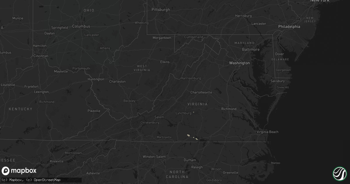
Storm reports in Virginia
Virginia
| Date | Description |
|---|---|
| 06/10/20263:00 PM CDT | Downed trees and power lines. Time is estimated from radar. |
| 06/10/20262:29 PM CDT | Two separate reports of one tree down each across chatmoss court... Near martinsville... Va. One was on a power line. Time is estimated from radar. |
| 06/10/20262:27 PM CDT | A large tree was blown down by thunderstorm winds along king richard lane. |
| 06/10/20262:26 PM CDT | A large tree was blown down by thunderstorm winds along s. Terrys bridge road. |
| 06/10/20262:19 PM CDT | Power lines down along kentuck road. |
| 06/10/20262:19 PM CDT | Corrects previous tstm wnd dmg report from 5 e keeling. Tree down on power lines down along kentuck road. |
| 06/10/20262:07 PM CDT | A large tree was blown down by thunderstorm winds near the intersection of swain road and chatham road. |
| 06/10/20261:45 PM CDT | Large tree limb hanging in power lines on hodnetts mill road. Time estimated from radar. |
| 06/10/202612:51 PM CDT | One tree down along cartersville road near its intersection with coles creek lane. Time estimated from radar. |
| 06/10/202612:21 PM CDT | Several trees were downed by thunderstorm winds on clover creek road... And multiple large limbs. One tree fell across the road. |
All States Impacted by Hail Map on June 10, 2026
Cities Impacted by Hail Map on June 10, 2026
- Granton, WI
- Chili, WI
- Dorchester, WI
- Athens, WI
- Stetsonville, WI
- Edgar, WI
- Stratford, WI
- Marshfield, WI
- Neillsville, WI
- Marathon, WI
- Mosinee, WI
- Black River Falls, WI
- Medford, WI
- Land O'Lakes, WI
- Merrillan, WI
- Watersmeet, MI
- Wausau, WI
- Auburndale, WI
- Gallatin, MO
- Jameson, MO
- Pittsville, WI
- Arpin, WI
- Gower, MO
- Greenwood, WI
- Loyal, WI
- Spencer, WI
- Curtiss, WI
- Colby, WI
- Unity, WI
- Owen, WI
- Abbotsford, WI
- Schofield, WI
- Rothschild, WI
- Merrill, WI
- Brokaw, WI
- Aniwa, WI
- Ringle, WI
- Irma, WI
- Gleason, WI
- Antigo, WI
- Tigerton, WI
- Junction City, WI
- Stevens Point, WI
- Amherst Junction, WI
- Chula, MO
- Leopolis, WI
- Caroline, WI
- Marion, WI
- Iola, WI
- Hamilton, MO
- Gresham, WI
- Shawano, WI
- Ogdensburg, WI
- Manawa, WI
- Clintonville, WI
- Wheeling, MO
- Meadville, MO
- Tilleda, WI
- Crivitz, WI
- Embarrass, WI
- Shiocton, WI
- Bonduel, WI
- Pulaski, WI
- Green Castle, MO
- Black Creek, WI
- Seymour, WI
- Woodward, IA
- Ogden, IA
- Boone, IA
- Waupaca, WI
- Amherst, WI
- Nekoosa, WI
- Nevada, IA
- Ames, IA
- Nelsonville, WI
- Bancroft, WI
- Story City, IA
- Gilbert, IA
- Roland, IA
- Ellsworth, IA
- Radcliffe, IA
- McCallsburg, IA
- Hubbard, IA
- Garden City, IA
- Zearing, IA
- Colo, IA
- State Center, IA
- Saint Anthony, IA
- Clemons, IA
- Union, IA
- New Providence, IA
- Scandinavia, WI
- Eldora, IA
- Iowa Falls, IA
- Montour, IA
- Toledo, IA
- Tama, IA
- Mount Pleasant, IA
- Wayland, IA
- Almond, WI
- Ainsworth, IA
- Kewaunee, WI
- Fairfield, IA
- Lockridge, IA
- Brighton, IA
- Crawfordsville, IA
- Winfield, IA
- Olds, IA
- Columbus Junction, IA
- Columbus City, IA
- Conesville, IA
- Algoma, WI
- Clutier, IA
- Craig, MO
- Letts, IA
- Muscatine, IA
- Wapello, IA
- Fruitland, IA
- Fairfax, MO
- Washington, IA
- Riverside, IA
- Kalona, IA
- Wellman, IA
- Lone Tree, IA
- Keota, IA
- Nichols, IA
- Hills, IA
- Iowa City, IA
- West Liberty, IA
- West Branch, IA
- Solon, IA
- Atalissa, IA
- Illinois City, IL
- Moscow, IA
- Tipton, IA
- Wilton, IA
- Cowgill, MO
- Kingston, MO
- Polo, MO
- Cameron, MO
- Kidder, MO
- Breckenridge, MO
- Braymer, MO
- Goodhue, MN
- Lake City, MN
- Red Wing, MN
- Cedar Rapids, IA
- Durant, IA
- Montpelier, IA
- Blue Grass, IA
- Lisbon, IA
- Stockton, IA
- Taylor Ridge, IL
- Walcott, IA
- Buffalo, IA
- Rock Island, IL
- Davenport, IA
- Mount Vernon, IA
- Bennett, IA
- Milan, IL
- Moline, IL
- New Liberty, IA
- Mechanicsville, IA
- Dixon, IA
- Donahue, IA
- Calamus, IA
- Dunkerton, IA
- Jesup, IA
- Waterloo, IA
- Bettendorf, IA
- Clarence, IA
- Stanwood, IA
- Hampton, IL
- Port Byron, IL
- East Moline, IL
- Long Grove, IA
- Rapids City, IL
- Eldridge, IA
- Lowden, IA
- Pleasant Valley, IA
- Wheatland, IA
- Le Claire, IA
- Lost Nation, IA
- Morley, IA
- Anamosa, IA
- Cascade, IA
- Wyoming, IA
- Oxford Junction, IA
- Onslow, IA
- Baldwin, IA
- Olin, IA
- Grand Mound, IA
- Princeton, IA
- Center Junction, IA
- De Witt, IA
- Monmouth, IA
- Monticello, IA
- Delmar, IA
- Maquoketa, IA
- Bernard, IA
- Camanche, IA
- Welton, IA
- Charlotte, IA
- McCausland, IA
- Cordova, IL
- Zwingle, IA
- Elmwood, WI
- Maiden Rock, WI
- Stockholm, WI
- Plum City, WI
- Manchester, IA
- Masonville, IA
- Winthrop, IA
- Appomattox, VA
- La Motte, IA
- Goose Lake, IA
- Fulton, IL
- Clinton, IA
- Andrew, IA
- Bryant, IA
- Low Moor, IA
- Albany, IL
- Spragueville, IA
- Preston, IA
- Bellevue, IA
- Peosta, IA
- Dubuque, IA
- Miles, IA
- East Dubuque, IL
- Arkansaw, WI
- Dundee, IA
- Menomonie, WI
- Eau Galle, WI
- Hazel Green, WI
- Cuba City, WI
- Sabula, IA
- Galena, IL
- Teeds Grove, IA
- Savanna, IL
- Hanover, IL
- Kieler, WI
- Thomson, IL
- Morrison, IL
- Dickeyville, WI
- Platteville, WI
- Potosi, WI
- Elizabeth, IL
- Shullsburg, WI
- Scales Mound, IL
- Benton, WI
- Fargo, ND
- Moorhead, MN
- Mount Carroll, IL
- Stockton, IL
- Lanark, IL
- Belmont, WI
- Apple River, IL
- Pearl City, IL
- Mineral Point, WI
- Darlington, WI
- Georgetown, MN
- Chadwick, IL
- Sterling, IL
- Gratiot, WI
- Clarence, MO
- Colfax, WI
- Bloomer, WI
- New Auburn, WI
- Kent, IL
- Warren, IL
- Rewey, WI
- Lena, IL
- Nora, IL
- Shannon, IL
- Winslow, IL
- Dodgeville, WI
- Blanchardville, WI
- Freeport, IL
- Argyle, WI
- Hollandale, WI
- South Wayne, WI
- Baileyville, IL
- Browntown, WI
- Forreston, IL
- McConnell, IL
- Lancaster, WI
- Newfolden, MN
- Middle River, MN
- Milledgeville, IL
- Mount Hope, WI
- Cairo, MO
- Livingston, WI
- Stitzer, WI
- Fennimore, WI
- Linden, WI
- Montfort, WI
- Cobb, WI
- Highland, WI
- Muscoda, WI
- Woodford, WI
- Monroe, WI
- Orangeville, IL
- Macomb, IL
- Sherrill, IA
- Durango, IA
- Strathcona, MN
- Wannaska, MN
- Badger, MN
- Roseau, MN
- Mount Morris, IL
- Leaf River, IL
- Polo, IL
- German Valley, IL
- Thief River Falls, MN
- Osseo, WI
- Paris, MO
- Shelbina, MO
- Marietta, IL
- Blue River, WI
- Boscobel, WI
- Arena, WI
- Ridgeway, WI
- Avoca, WI
- Dakota, IL
- Lone Rock, WI
- Cedarville, IL
- Barneveld, WI
- Spring Green, WI
- Ridott, IL
- Rockford, IL
- Winnebago, IL
- Pecatonica, IL
- Rock City, IL
- Byron, IL
- North Freedom, WI
- Loganville, WI
- Hillpoint, WI
- Richland Center, WI
- Monticello, WI
- Plain, WI
- Belleville, WI
- Mount Horeb, WI
- Black Earth, WI
- New Glarus, WI
- Blue Mounds, WI
- Durand, IL
- Prairie Du Sac, WI
- Mazomanie, WI
- Brodhead, WI
- Davis, IL
- Sauk City, WI
- Juda, WI
- Gotham, WI
- Cazenovia, WI
- Gary, MN
- Fairchild, WI
- Fertile, MN
- Oregon, IL
- Red Lake Falls, MN
- Alma Center, WI
- Madison, WI
- Verona, WI
- Augusta, WI
- Middleton, WI
- Evansville, WI
- Cross Plains, WI
- Oregon, WI
- Albany, WI
- Orfordville, WI
- Lodi, WI
- Merrimac, WI
- Waunakee, WI
- Dane, WI
- Brooklyn, WI
- Baraboo, WI
- Deforest, WI
- Beloit, WI
- Footville, WI
- Rockton, IL
- Janesville, WI
- Shirland, IL
- South Beloit, IL
- Stoughton, WI
- Mcfarland, WI
- Goodridge, MN
- Melrose, WI
- Hillsboro, WI
- Amboy, IL
- Franklin Grove, IL
- Dixon, IL
- Eldena, IL
- Lenox, IA
- Sharpsburg, IA
- Chana, IL
- Cottage Grove, WI
- Humbird, WI
- Stillman Valley, IL
- Deerfield, WI
- Milton, WI
- Edgerton, WI
- Cambridge, WI
- Bedford, IA
- Rochelle, IL
- Gatzke, MN
- Grygla, MN
- South Boston, VA
- Clearfield, IA
- Sun Prairie, WI
- Monroe Center, IL
- Davis Junction, IL
- Halifax, VA
- Princeville, IL
- Fort Atkinson, WI
- Lake Mills, WI
- Diagonal, IA
- New Hampton, MO
- Bethany, MO
- Waterman, IL
- Steward, IL
- Mcintosh, MN
- Trail, MN
- Fosston, MN
- Esmond, IL
- Malta, IL
- Clare, IL
- Jamesport, MO
- Lindenwood, IL
- Cherry Valley, IL
- Kirkland, IL
- Gully, MN
- Afton, WI
- Windsor, WI
- Marshall, WI
- Waterloo, WI
- Loves Park, IL
- Jefferson, WI
- Clinton, WI
- Whitewater, WI
- Roscoe, IL
- Watertown, WI
- Machesney Park, IL
- Johnson Creek, WI
- Caledonia, IL
- Sharon, WI
- Helenville, WI
- Avalon, WI
- Darien, WI
- Delavan, WI
- Poplar Grove, IL
- Capron, IL
- Belvidere, IL
- Salol, MN
- Dekalb, IL
- Tingley, IA
- Shannon City, IA
- Nelson, VA
- Buffalo Junction, VA
- Murray, IA
- Afton, IA
- Thayer, IA
- Ellston, IA
- Shabbona, IL
- Earlville, IL
- Genoa, IL
- Sycamore, IL
- Kingston, IL
- Cortland, IL
- Maple Park, IL
- Mount Ayr, IA
- Virgilina, VA
- Savannah, MO
- Saint Joseph, MO
- Grant City, MO
- Lee, IL
- Yates City, IL
- Elmwood, IL
- Canton, IL
- Farmington, IL
- Morton, IL
- Mapleton, IL
- East Peoria, IL
- Glasford, IL
- Groveland, IL
- Hanna City, IL
- Creve Coeur, IL
- Trivoli, IL
- Pekin, IL
- Peoria, IL
- Peoria Heights, IL
- Washington, IL
- Brimfield, IL
- Metamora, IL
- Edwards, IL
- Goodfield, IL
- Deer Creek, IL
- Lengby, MN
- Danvers, IL
- Bloomington, IL
- Big Rock, IL
- Hinckley, IL
- Elburn, IL
- Sugar Grove, IL
- Balmorhea, TX
- Naytahwaush, MN
- Mahnomen, MN
- Helena, MO
- Osceola, IA
- Grand River, IA
- Lamoni, IA
- Van Wert, IA
- Winchester, IL
- Murrayville, IL
- Plano, IL
- Weldon, IA
- Hatfield, MO
- Kellerton, IA
- Bolckow, MO
- Rea, MO
- Guilford, MO
- Union Star, MO
- Cosby, MO
- Ridgeway, MO
- Somonauk, IL
- Sandwich, IL
- Hampshire, IL
- Dunlap, IL
- Mossville, IL
- Edelstein, IL
- Chillicothe, IL
- Speer, IL
- Sparland, IL
- Lowpoint, IL
- Eureka, IL
- Granville, IL
- Lacon, IL
- Hennepin, IL
- Magnolia, IL
- Putnam, IL
- Henry, IL
- La Rose, IL
- McNabb, IL
- Washburn, IL
- Roanoke, IL
- Varna, IL
- Toluca, IL
- Rutland, IL
- Secor, IL
- Long Point, IL
- Tonica, IL
- Congerville, IL
- Wenona, IL
- Ransom, IL
- El Paso, IL
- Dana, IL
- Ancona, IL
- Lostant, IL
- Grand Ridge, IL
- Minonk, IL
- Benson, IL
- Streator, IL
- Leonore, IL
- Cornell, IL
- Flanagan, IL
- Seneca, IL
- Blackstone, IL
- Ottawa, IL
- Oglesby, IL
- Gridley, IL
- Pontiac, IL
- Mendota, IL
- La Moille, IL
- Paw Paw, IL
- Compton, IL
- Sublette, IL
- Moberly, MO
- King City, MO
- Stanberry, MO
- Bristol, IL
- Yorkville, IL
- Aurora, IL
- Montgomery, IL
- Cainsville, MO
- Chariton, IA
- Lucas, IA
- Woodburn, IA
- Madison, MO
- Clark, MO
- Newark, IL
- Amity, MO
- Mooseheart, IL
- Batavia, IL
- Geneva, IL
- North Aurora, IL
- Bagley, MN
- Princeton, MO
- Jacksonville, IL
- Elgin, IL
- Fort Davis, TX
- Eden, WI
- Clarksdale, MO
- Sheridan, IL
- Leland, IL
- Utica, IL
- Peru, IL
- Cedar Point, IL
- Wedron, IL
- Serena, IL
- Marseilles, IL
- Maysville, MO
- Waubun, MN
- Ponsford, MN
- Decatur, IA
- Leon, IA
- Holliday, MO
- Oak Creek, WI
- McLean, IL
- Waynesville, IL
- Denver, MO
- Warrenville, IL
- Saint Charles, IL
- West Chicago, IL
- Oswego, IL
- Winfield, IL
- Plainfield, IL
- Naperville, IL
- Carol Stream, IL
- Gardner, IL
- Dwight, IL
- Derby, IA
- Odell, IL
- Mequon, WI
- Milwaukee, WI
- Plainfield, WI
- Darlington, MO
- Albany, MO
- Gentry, MO
- Graymont, IL
- Coal City, IL
- Elwood, IL
- Channahon, IL
- Millbrook, IL
- Minooka, IL
- Mazon, IL
- Kinsman, IL
- Wilmington, IL
- Braidwood, IL
- Braceville, IL
- Millington, IL
- Morris, IL
- Verona, IL
- Lombard, IL
- Chicago, IL
- Lisle, IL
- Homer Glen, IL
- Lincolnwood, IL
- Des Plaines, IL
- Stone Park, IL
- Evanston, IL
- Glendale Heights, IL
- Wheaton, IL
- Western Springs, IL
- Park Ridge, IL
- Oak Park, IL
- Broadview, IL
- Hines, IL
- Palos Park, IL
- Maywood, IL
- Willow Springs, IL
- Franklin Park, IL
- Lyons, IL
- Bensenville, IL
- Lockport, IL
- Justice, IL
- Brookfield, IL
- Romeoville, IL
- River Forest, IL
- La Grange Park, IL
- Clarendon Hills, IL
- Orland Park, IL
- Westmont, IL
- Berwyn, IL
- Bridgeview, IL
- River Grove, IL
- Skokie, IL
- Hillside, IL
- Manhattan, IL
- Westchester, IL
- Addison, IL
- Woodridge, IL
- Villa Park, IL
- Elmwood Park, IL
- Harwood Heights, IL
- Shorewood, IL
- Summit Argo, IL
- Hinsdale, IL
- Forest Park, IL
- Darien, IL
- Bloomingdale, IL
- Bolingbrook, IL
- Riverside, IL
- Cicero, IL
- Oak Brook, IL
- Glen Ellyn, IL
- Joliet, IL
- Wood Dale, IL
- New Lenox, IL
- Schiller Park, IL
- Niles, IL
- Bellwood, IL
- Melrose Park, IL
- Crest Hill, IL
- Willowbrook, IL
- Elmhurst, IL
- Lemont, IL
- Berkeley, IL
- Downers Grove, IL
- La Grange, IL
- Hickory Hills, IL
- Mokena, IL
- Itasca, IL
- Hanover Park, IL
- Russell, IA
- Humeston, IA
- Martinsville, MO
- Pattonsburg, MO
- Weatherby, MO
- Emington, IL
- Cabery, IL
- Bussey, IA
- Gilman City, MO
- Garden Grove, IA
- Monroe City, MO
- Stoutsville, MO
- Omro, WI
- Markesan, WI
- Eldorado, WI
- Clyman, WI
- Friesland, WI
- Rosendale, WI
- Morrisonville, WI
- Columbus, WI
- Waupun, WI
- Lowell, WI
- Oshkosh, WI
- Brandon, WI
- Pickett, WI
- Rio, WI
- Fox Lake, WI
- Arlington, WI
- Horicon, WI
- Juneau, WI
- Fairwater, WI
- Ripon, WI
- Beaver Dam, WI
- Randolph, WI
- Fall River, WI
- Burnett, WI
- Doylestown, WI
- Poynette, WI
- Reeseville, WI
- Cambria, WI
- Blue Island, IL
- Evergreen Park, IL
- Palos Heights, IL
- Oak Lawn, IL
- Frankfort, IL
- Tinley Park, IL
- Chicago Ridge, IL
- Robbins, IL
- Hometown, IL
- Oak Forest, IL
- Crestwood, IL
- Midlothian, IL
- Burbank, IL
- Country Club Hills, IL
- Markham, IL
- Palos Hills, IL
- Worth, IL
- Alsip, IL
- Kingston, WI
- Montello, WI
- Dalton, WI
- Berlin, WI
- Pardeeville, WI
- Marquette, WI
- Green Lake, WI
- Portage, WI
- Princeton, WI
- Wyocena, WI
- Lovilia, IA
- Rock Springs, WI
- Wisconsin Dells, WI
- Reedsburg, WI
- Malone, WI
- Fond Du Lac, WI
- Oakfield, WI
- Hustisford, WI
- Dousman, WI
- Elkhart Lake, WI
- New Holstein, WI
- Lebanon, WI
- Theresa, WI
- West Bend, WI
- Lomira, WI
- Saint Cloud, WI
- Hilbert, WI
- Palmyra, WI
- Chilton, WI
- Rubicon, WI
- Ashippun, WI
- Neosho, WI
- Kiel, WI
- Allenton, WI
- Campbellsport, WI
- Kewaskum, WI
- Reedsville, WI
- Hartford, WI
- Potter, WI
- Van Dyne, WI
- Elkhorn, WI
- Iron Ridge, WI
- Sullivan, WI
- Stockbridge, WI
- Glenbeulah, WI
- Brownsville, WI
- Brillion, WI
- Ixonia, WI
- Mayville, WI
- Oconomowoc, WI
- Collins, WI
- Mount Calvary, WI
- Menasha, WI
- Forest Junction, WI
- Sherwood, WI
- Greenleaf, WI
- Neenah, WI
- Melrose, IA
- Corydon, IA
- Pecos, TX
- Hamilton, IA
- Shevlin, MN
- Eagleville, MO
- Hancock, MN
- Cyrus, MN
- Starbuck, MN
- Solway, MN
- Unionville, MO
- Lucerne, MO
- Saint Nazianz, WI
- Delafield, WI
- Eagle, WI
- Cascade, WI
- Hartland, WI
- Elm Grove, WI
- Saukville, WI
- Sheboygan Falls, WI
- Wales, WI
- Burlington, WI
- Menomonee Falls, WI
- Sussex, WI
- Lannon, WI
- Grafton, WI
- Muskego, WI
- Cedarburg, WI
- Slinger, WI
- Colgate, WI
- Brookfield, WI
- Jackson, WI
- Pewaukee, WI
- New Berlin, WI
- Random Lake, WI
- Butler, WI
- Adell, WI
- Belgium, WI
- Mukwonago, WI
- Valders, WI
- Okauchee, WI
- North Prairie, WI
- Waldo, WI
- East Troy, WI
- Nashotah, WI
- Big Bend, WI
- Walworth, WI
- Germantown, WI
- Richfield, WI
- Plymouth, WI
- Hubertus, WI
- Fredonia, WI
- Waukesha, WI
- Coffey, MO
- Altamont, MO
- McFall, MO
- Waterford, WI
- Oostburg, WI
- Cleveland, WI
- Port Washington, WI
- Cedar Grove, WI
- Hales Corners, WI
- Kohler, WI
- Newton, WI
- Whitelaw, WI
- Sheboygan, WI
- Manitowoc, WI
- Sturgeon Lake, MN
- Moose Lake, MN
- Clinton, IL
- Pella, IA
- Bemidji, MN
- Boyceville, WI
- Pollock, MO
- Powersville, MO
- Wisconsin Rapids, WI
- Rudolph, WI
- Custer, WI
- Rosholt, WI
- Wittenberg, WI
- South English, IA
- Webster, IA
- Dewitt, IL
- Menahga, MN
- Durand, WI
- Byron, MN
- Davis City, IA
- Blythedale, MO
- Courtenay, ND
- Buchanan, ND
- Millerton, IA
- Harper, IA
- Glenwood, MN
- Lowry, MN
- Rochester, MN
- Lineville, IA
- Sebeka, MN
- Kelliher, MN
- Hines, MN
- Tenstrike, MN
- Waskish, MN
- Bluffton, MN
- Deer Creek, MN
- Wadena, MN
- Trenton, MO
- Winston, MO
- Pepin, WI
- Bowler, WI
- North English, IA
- Park Rapids, MN
- Van Horn, TX
- Albia, IA
- Illiopolis, IL
- New York Mills, MN
- New Sharon, IA
- Henning, MN
- Verndale, MN
- Blackduck, MN
- Villard, MN
- Floodwood, MN
- Montezuma, IA
- Eyota, MN
- Mystic, IA
- Ottumwa, IA
- Latham, IL
- Warrensburg, IL
- Niantic, IL
- Morrisonville, IL
- Harvel, IL
- Hedrick, IA
- Spickard, MO
- Butler, IL
- Litchfield, IL
- Birnamwood, WI
- Alexandria, MN
- Osakis, MN
- Sauk Centre, MN
- West Union, MN
- Grey Eagle, MN
- Long Prairie, MN
- Big Falls, MN
- Raymond, IL
- Moravia, IA
- Elgin, MN
- Richland, IA
- Ollie, IA
- Galt, MO
- Laredo, MO
- Packwood, IA
- Nokomis, IL
- Exline, IA
- Moulton, IA
- Burtrum, MN
- Posen, IL
- Thornton, IL
- Gary, IN
- Whiting, IN
- Dolton, IL
- Harvey, IL
- Lansing, IL
- Riverdale, IL
- Hammond, IN
- South Holland, IL
- Hazel Crest, IL
- Calumet City, IL
- East Chicago, IN
- Matteson, IL
- Homewood, IL
- Westville, IN
- Valparaiso, IN
- Wanatah, IN
- Union Mills, IN
- Swanville, MN
- La Porte, IN
- Hanna, IN
- Hamlet, IN
- Kingsford Heights, IN
- Atlanta, MO
- Petersburg, ND
- Humphreys, MO
- Guthrie Center, IA
- Pomeroy, OH
- Langsville, OH
- Rutland, OH
- Staples, MN
- Hibbing, MN
- Stewartville, MN
- Racine, MN
- Spring Valley, MN
- Casey, IA
- Meadowlands, MN
- Milan, MO
- Browning, MO
- Sodus, MI
- Coloma, MI
- Watervliet, MI
- Covert, MI
- Saint Joseph, MI
- Stevensville, MI
- Benton Harbor, MI
- Eau Claire, MI
- South Haven, MI
- Hartford, MI
- Grand Junction, MI
- Lawrence, MI
- Bangor, MI
- Fennville, MI
- Pullman, MI
- Douglas, MI
- Holland, MI
- Saugatuck, MI
- Hamilton, MI
- Macatawa, MI
- Northome, MN
- Forest Lake, MN
- Stacy, MN
- Wyoming, MN
- Bloomfield, IA
- Dearborn, MI
- Dearborn Heights, MI
- White Cloud, KS
- Westpoint, IN
- Menlo, IA
- Cedar, MN
- Bouton, IA
- Minburn, IA
- Alma, WI
- Oregon, MO
- Maitland, MO
- Graham, MO
- Stuart, IA
- Independence, WI
- Dallas Center, IA
- Winona, MN
- Green City, MO
- Chatfield, MN
- Wykoff, MN
- La Belle, MO
- Knox City, MO
- Barnard, MO
- Chisago City, MN
- Middleton, MI
- Larimore, ND
- Taylor, MI
- Mount Airy, NC
- Houston, MN
- Lafayette, IN
- Salina, KS
- Novelty, MO
- Edina, MO
- Udell, IA
- Mondovi, WI
- Detroit, MI
- Mound City, MO
- Monroeville, OH
- Norwalk, OH
- Dexter, IA
- Tolono, IL
- Philo, IL
- Plano, IA
- Fremont, IA
- Holyoke, MN
- Lindstrom, MN
- Shafer, MN
- Center City, MN
- Dresser, WI
- Taylors Falls, MN
- Saint Croix Falls, WI
- Downing, MO
- Leonardville, KS
- Green, KS
- Bena, MN
- Sidney, IL
- Fontanelle, IA
- Greenfield, IA
- Cincinnati, IA
- Adel, IA
- Winigan, MO
- Grimes, IA
- Adair, IA
- North Branch, MN
- Randolph, KS
- Ithaca, MI
- Centerville, IA
- Seymour, IA
- Hugo, MN
- Aitkin, MN
- Maryville, MO
- Skidmore, MO
- Harris, MN
- Bennington, KS
- New Cambria, KS
- Wellington, OH
- New London, OH
- Solomon, KS
- Longford, KS
- Clay Center, KS
- Carleton, MI
- Redfield, IA
- Osage, MN
- Centuria, WI
- Mercer, MO
- Lewistown, MO
- Allen Park, MI
- Inkster, MI
- Highland Park, MI
- Hamtramck, MI
- Trempealeau, WI
- Dakota, MN
- Galesville, WI
- Fountain, MN
- Earlham, IA
- Side Lake, MN
- New Boston, MO
- Purdin, MO
- Nevis, MN
- Lanesboro, MN
- Wakefield, KS
- Cook, MN
- Great Bend, KS
- Milltown, WI
- Luck, WI
- Williamstown, MO
- Kahoka, MO
- Angora, MN
- Granger, IA
- De Soto, IA
- Anita, IA
- Conception Junction, MO
- Effie, MN
- Novinger, MO
- Ellinwood, KS
- Holmen, WI
- Onalaska, WI
- Scandia, MN
- Marine On Saint Croix, MN
- Hiawatha, KS
- Melvindale, MI
- Worth, MO
- Rockwell, IA
- Redding, IA
- Deer River, MN
- Peterson, MN
- Conception, MO
- Kirksville, MO
- Tescott, KS
- Newark, MO
- Saint Patrick, MO
- Shelbyville, MO
- Bethel, MO
- Leonard, MO
- Rosendale, MO
- Roseville, MI
- Warren, MI
- Olsburg, KS
- Delphi, IN
- Palmer, IL
- Orr, MN
- Hixton, WI
- Bovey, MN
- Wadsworth, OH
- Abilene, KS
- Claflin, KS
- Bushton, KS
- Littlefork, MN
- Bigfork, MN
- Tamarack, MN
- La Crosse, WI
- Mcgregor, MN
- Balsam Lake, WI
- Amery, WI
- Fraser, MI
- Mindoro, WI
- Belding, MI
- Ettrick, WI
- West Des Moines, IA
- Onamia, MN
- Cohasset, MN
- Urbandale, IA
- Rulo, NE
- Collins, OH
- Fountain City, WI
- Hudson, KS
- Dayton, IA
- Waukee, IA
- Arcadia, WI
- Van Meter, IA
- Cumming, IA
- Allegan, MI
- Bloomingdale, MI
- Hopkins, MI
- Zeeland, MI
- North Judson, IN
- Knox, IN
- La Crosse, IN
- San Pierre, IN
- Wheatfield, IN
- Kouts, IN
- New Richmond, WI
- Webster City, IA
- Huron, OH
- Berlin Heights, OH
- Vermilion, OH
- Ravenwood, MO
- Kettle River, MN
- Doylestown, OH
- Barberton, OH
- Harris, MO
- Newtown, MO
- West Salem, WI
- Rushford, MN
- Plymouth, IN
- Grovertown, IN
- Walkerton, IN
- Des Moines, IA
- Norwalk, IA
- Talmage, KS
- Comstock, WI
- Turtle Lake, WI
- Lyons, KS
- Geneseo, KS
- Chase, KS
- Manhattan, KS
- McGrath, MN
- Finlayson, MN
- Willow River, MN
- Macon, MO
- Pilot Mound, IA
- Stratford, IA
- Hurdland, MO
- Wright, MN
- La Plata, MO
- Ewing, MO
- Brashear, MO
- Gibbs, MO
- Wakeman, OH
- Stanton, MI
- Edmore, MI
- Clear Lake, WI
- Warba, MN
- Askov, MN
- North Liberty, IN
- Lakeville, IN
- Dougherty, IA
- Sheffield, IA
- Bremen, IN
- Raymond, KS
- Almena, WI
- Cumberland, WI
- Sandstone, MN
- Stanhope, IA
- Jewell, IA
- Kamrar, IA
- Saint Johns, MI
- Enterprise, KS
- Marble Rock, IA
- Greene, IA
- Deer Park, WI
- Floyd, IA
- Rudd, IA
- Cromwell, MN
- Allerton, IA
- Forest City, MO
- Clyde, MO
- Parnell, MO
- Osage, IA
- Monticello, MO
- Marble, MN
- Calumet, MN
- Medina, OH
- Ashley, MI
- Lagrange, OH
- Rock Falls, IL
- Frankfort, KS
- Glenwood City, WI
- Barron, WI
- Little River, KS
- Sterling, KS
- Alden, KS
- Brookville, KS
- Canton, MO
- Rutledge, MO
- Kerrick, MN
- Elyria, OH
- Saint George, KS
- Chapman, KS
- Amherst, OH
- Bruno, MN
- Harmon, IL
- Ellsworth, KS
- Tomah, WI
- Blairsburg, IA
- Star Prairie, WI
- Clayton, WI
- Prairie Farm, WI
- Centralia, KS
- Vermillion, KS
- Akron, OH
- Sheridan, MO
- Nashwauk, MN
- Newton, IA
- Colfax, IA
- Prairie City, IA
- Williams, IA
- Litchfield, OH
- Grafton, OH
- Riceville, IA
- Pengilly, MN
- Caledonia, MN
- Westmoreland, KS
- Wamego, KS
- Wyaconda, MO
- Orient, IA
- Oberlin, OH
- Marcell, MN
- Kipton, OH
- Jacobson, MN
- Orchard, IA
- Rice Lake, WI
- Cameron, WI
- Windom, KS
- Macksburg, IA
- Pleasantville, IA
- Swan, IA
- Alden, IA
- Lorain, OH
- Seneca, KS
- Woodbine, KS
- Camp Douglas, WI
- Fillmore, MO
- Munger, MI
- Bay City, MI
- Saginaw, MI
- Lorimor, IA
- Winterset, IA
- Greenbush, MN
- New Market, IA
- Sheffield Lake, OH
- Morrill, KS
- Belvue, KS
- Junction City, KS
- Gypsum, KS
- Paxico, KS
- Carlton, MN
- Amazonia, MO
- Greentop, MO
- Reese, MI
- Fairgrove, MI
- Uniontown, OH
- Booneville, IA
- Sabetha, KS
- Milford, KS
- Clarksville, IA
- Hutchinson, KS
- Inman, KS
- Herington, KS
- Hope, KS
- Saint Charles, MN
- Queen City, MO
- Baring, MO
- Cleveland, OH
- Dover, MN
- Frazee, MN
- North Canton, OH
- Plainfield, IA
- Waverly, IA
- Linden, MI
- South Elgin, IL
- Worthington, MO
- Ackley, IA
- Altura, MN
- White City, KS
- New Lisbon, WI
- Necedah, WI
- Aplington, IA
- Dumont, IA
- Kesley, IA
- Arbela, MO
- Memphis, MO
- Warsaw, IL
- Mcpherson, KS
- Blockton, IA
- Allison, IA
- Fenton, MI
- Luray, MO
- Eastlake, OH
- Wickliffe, OH
- Euclid, OH
- Willoughby, OH
- Alma, KS
- Sutter, IL
- Ottertail, MN
- Plover, WI
- Silvis, IL
- Carbon Cliff, IL
- Colona, IL
- Erie, IL
- Chardon, OH
- Mentor, OH
- Hillsdale, IL
- Fenton, IL
- Huntsburg, OH
- Montville, OH
- Painesville, OH
- Windsor, OH
- Geneseo, IL
- Madison, OH
- Thompson, OH
- Prophetstown, IL
- Hooppole, IL
- Topeka, KS
- Maple Hill, KS
- Rome, OH
- Rock Creek, OH
- Geneva, OH
- Atkinson, IL
- Annawan, IL
- Mineral, IL
- Tampico, IL
- Sheffield, IL
- New Bedford, IL
- Walnut, IL
- Princeton, IL
- Manlius, IL
- Wyanet, IL
- Ohio, IL
- Hinckley, OH
- Gorin, MO
- Riley, KS
- Fort Riley, KS
- Orwell, OH
- Ferryville, WI
- Oelwein, IA
- Fairbank, IA
- Sumner, IA
- Westgate, IA
- Readlyn, IA
- Oran, IA
- Austinburg, OH
- Benton, IA
- Wayland, MO
- Viroqua, WI
- Alexandria, MO
- Tampa, KS
- Ramona, KS
- Eskridge, KS
- Jal, NM
- Conneaut, OH
- Ashtabula, OH
- North Kingsville, OH
- Richfield, OH
- Wilsey, KS
- Jefferson, OH
- Ipava, IL
- Lost Springs, KS
- Burdick, KS
- Maynard, IA
- Blair, WI
- Whitehall, WI
- Basco, IL
- Carthage, IL
- Soldiers Grove, WI
- Council Grove, KS
- Good Hope, IL
- Blandinsville, IL
- Sciota, IL
- Plymouth, IL
- West Springfield, PA
- East Springfield, PA
- Kingsville, OH
- Burlington Junction, MO
- Pickering, MO
- Cornell, WI
- Lewistown, IL
- Sutton, WV
- Lincolnville, KS
- Hopkins, MO
- Avon, IL
- Bushnell, IL
- Bardolph, IL
- Adair, IL
- Prairie City, IL
- Table Grove, IL
- Smithfield, IL
- Stanley, WI
- Thorp, WI
- Tennessee, IL
- Colchester, IL
- Strong City, KS
- Cuba, IL
- Prairie Du Chien, WI
- La Crescent, MN
- La Grange, MO
- Jamestown, PA
- Hartstown, PA
- Buhler, KS
- Cooperstown, ND
- Hannaford, ND
- Emporia, KS
- Conneaut Lake, PA
- Atlantic, PA
- Havana, IL
- Lisbon, OH
- Lublin, WI
- Cottonwood Falls, KS
- Topeka, IL
- Woodman, WI
- Liverpool, IL
- Linneus, MO
- Erie, PA
- Harborcreek, PA
- North East, PA
- Cochranton, PA
- Nickerson, KS
- South Hutchinson, KS
- Livonia, MO
- Ripley, NY
- Titusville, PA
- Easton, IL
- Bath, IL
- Glenwood, MO
- Rochester, PA
- New Brighton, PA
- Ethel, MO
- Elmer, MO
- Brookfield, MO
- Westfield, NY
- Zelienople, PA
- Evans City, PA
- Cranberry Township, PA
- Burrton, KS
- Moundridge, KS
- Kilbourne, IL
- Bucklin, MO
- New Cambria, MO
- Callao, MO
- San Jose, IL
- New Holland, IL
- Halstead, KS
- Butler, PA
- Mason City, IL
- Williamsville, IL
- Middletown, IL
- Lincoln, IL
- Mount Pulaski, IL
- Greenview, IL
- Beason, IL
- Sherman, IL
- Riverton, IL
- Cantrall, IL
- Athens, IL
- Elkhart, IL
- Petersburg, IL
- Buffalo, IL
- Springfield, IL
- Hesston, KS
- Newton, KS
- Sedgwick, KS
- Stanford, IL
- Templeton, PA
- North Newton, KS
- Atlanta, IL
- Kittanning, PA
- New Bethlehem, PA
- Dawson, IL
- Mechanicsburg, IL
- Mount Auburn, IL
- Decatur, IL
- Rochester, IL
- Pleasant Plains, IL
- Chestnut, IL
- Stonington, IL
- Macon, IL
- Harristown, IL
- Forsyth, IL
- Boody, IL
- Moweaqua, IL
- Maroa, IL
- Argenta, IL
- Blue Mound, IL
- Kenney, IL
- Oreana, IL
- Edinburg, IL
- Cisco, IL
- Taylorville, IL
- Hunnewell, MO
- Emden, MO
- Dayton, PA
- Weldon, IL
- Lane, IL
- Monticello, IL
- De Land, IL
- Mt Zion, IL
- Bondville, IL
- Cerro Gordo, IL
- Pesotum, IL
- Gays, IL
- La Place, IL
- Villa Grove, IL
- Ivesdale, IL
- Mansfield, IL
- Sadorus, IL
- Dalton City, IL
- Arcola, IL
- Sullivan, IL
- Milmine, IL
- Tuscola, IL
- Bement, IL
- Champaign, IL
- Saint Joseph, IL
- Atwood, IL
- Urbana, IL
- Hammond, IL
- Savoy, IL
- Windsor, IL
- Lovington, IL
- Arthur, IL
- Humboldt, IL
- White Heath, IL
- Bethany, IL
- Mattoon, IL
- Seymour, IL
- Findlay, IL
- Palmyra, MO
- Hannibal, MO
- Farmersville, IL
- Hull, IL
- New London, MO
- West Lafayette, IN
- Maywood, NE
- Moorefield, NE
- Curtis, NE
- Eustis, NE
- Cozad, NE
- Farnam, NE
- Elwood, NE
- Lexington, NE
- Overton, NE
- Kearney, NE
- Gibbon, NE
- Shelton, NE
- Wood River, NE
- Alda, NE
- Doniphan, NE
- Bertrand, NE
- Aurora, NE
- Giltner, NE
- Odessa, NE
- Elm Creek, NE
- Smithfield, NE
- Riverdale, NE
- Ravenna, NE
- Pleasanton, NE
- Hastings, NE
- Phillips, NE
- Amherst, NE
- Grand Island, NE
- Holdrege, NE
- Loomis, NE
- Henderson, NE
- Sutton, NE
- Hampton, NE
- Trumbull, NE
- Roseland, NE
- Juniata, NE
- Bradshaw, NE
- McCool Junction, NE
- Fairmont, NE
- York, NE
- Maxwell, NE
- Waco, NE
- Harvard, NE
- Axtell, NE
- Funk, NE
- Cairo, NE
- Benedict, NE
- Kenesaw, NE
- Marquette, NE
- Polk, NE
- Chapman, NE
- Minden, NE
- Utica, NE
- Beaver Crossing, NE
- Seward, NE
- Gresham, NE
- Saronville, NE
- Ulysses, NE
- Bee, NE
- Staplehurst, NE
- Heartwell, NE
- Grafton, NE
- Shelby, NE
- Stromsburg, NE
- Surprise, NE
- Friend, NE
- Milford, NE
- Dorchester, NE
- Martell, NE
- Crete, NE
- Garland, NE
- Raymond, NE
- Malcolm, NE
- Pleasant Dale, NE
- Holstein, NE
- Exeter, NE
- Valparaiso, NE
- Lincoln, NE
- Hallam, NE
- Ayr, NE
- Denton, NE
- Roca, NE
- Panama, NE
- Bennet, NE
- Sprague, NE
- Cordova, NE
- Goehner, NE
- Walton, NE
- Hickman, NE
- Inland, NE
- David City, NE
- Brainard, NE
- Syracuse, NE
- Douglas, NE
- Palmyra, NE
- Lathrop, MO
- Turney, MO
- Eagle, NE
- Adams, NE
- Unadilla, NE
- Otoe, NE
- Burr, NE
- Firth, NE
- Alvo, NE
- Davey, NE
- Glenvil, NE
- Ceresco, NE
- Waverly, NE
- Dunbar, NE
- Dwight, NE
- Nebraska City, NE
- Greenwood, NE
- Wahoo, NE
- Rock Port, MO
- Avoca, NE
- Peru, NE
- Hamburg, IA
- Auburn, NE
- Brock, NE
- Northboro, IA
- Shenandoah, IA
- Coin, IA
- Union, NE
- Nehawka, NE
- Sidney, IA
- Weeping Water, NE
- Percival, IA
- Thurman, IA
- Miller, NE
- Riverton, IA
- Westboro, MO
- Farragut, IA
- Watson, MO
- Tabor, IA
- Elmwood, NE
- Randolph, IA
- South Bend, NE
- Springfield, NE
- Ashland, NE
- Murdock, NE
- Gretna, NE
- Louisville, NE
- Pacific Junction, IA
- Glenwood, IA
- Essex, IA
- Clarinda, IA
- Yorktown, IA
- Manley, NE
- Malvern, IA
- Imogene, IA
- Cedar Creek, NE
- Plattsmouth, NE
- Murray, NE
- Gravity, IA
- Ithaca, NE
- Papillion, NE
- Bellevue, NE
- Council Bluffs, IA
- Silver City, IA
- Henderson, IA
- Hastings, IA
- Emerson, IA
- Villisca, IA
- Red Oak, IA
- Corning, IA
- Nodaway, IA
- Stanton, IA
- Elliott, IA
- Prescott, IA
- Treynor, IA
- Mineola, IA
- Hancock, IA
- Carson, IA
- Oakland, IA
- Macedonia, IA
- Atlantic, IA
- Cumberland, IA
- Elk Horn, IA
- Avoca, IA
- Exira, IA
- Marne, IA
- Lewis, IA
- Walnut, IA
- Brayton, IA
- Griswold, IA
- Grant, IA
- Harlan, IA
- Kimballton, IA
- Shelby, IA
- Wiota, IA
- Massena, IA
- Carbon, IA
- Bridgewater, IA
- Audubon, IA
- Hamlin, IA
- Creston, IA
- Cromwell, IA
- Braddyville, IA
- College Springs, IA
- Shambaugh, IA
- Blanchard, IA
- Bayard, IA
- Coon Rapids, IA
- Irwin, IA
- Kirkman, IA
- Clearmont, MO
- Elmo, MO
- Lehigh, IA
- Tarkio, MO
- Panora, IA
- Bagley, IA
- Yale, IA
- Jefferson, IA
- Peru, IA
- Kenosha, WI
- Mount Prospect, IL
- Carpentersville, IL
- Wauconda, IL
- Palatine, IL
- Kenilworth, IL
- Waukegan, IL
- Morton Grove, IL
- Streamwood, IL
- Schaumburg, IL
- Northbrook, IL
- Fontana, WI
- Lake Zurich, IL
- Rolling Meadows, IL
- Prospect Heights, IL
- Lake Villa, IL
- Ashton, IL
- Mundelein, IL
- Gilberts, IL
- Zion, IL
- Glenview, IL
- Mchenry, IL
- Richmond, IL
- Wheeling, IL
- Trevor, WI
- West Brooklyn, IL
- Williams Bay, WI
- Harvard, IL
- Lake In The Hills, IL
- Algonquin, IL
- Flossmoor, IL
- Wilmot, WI
- Glencoe, IL
- Golf, IL
- Elk Grove Village, IL
- Ingleside, IL
- Lake Geneva, WI
- Vernon Hills, IL
- Arlington Heights, IL
- Pleasant Prairie, WI
- Hoffman Estates, IL
- Highwood, IL
- Island Lake, IL
- Crystal Lake, IL
- Holcomb, IL
- Winnetka, IL
- Wasco, IL
- Barrington, IL
- Libertyville, IL
- Ringwood, IL
- Bristol, WI
- Winthrop Harbor, IL
- Grayslake, IL
- Burlington, IL
- Union, IL
- Lake Forest, IL
- Marengo, IL
- Genoa City, WI
- Lake Bluff, IL
- Buffalo Grove, IL
- Wonder Lake, IL
- Antioch, IL
- Silver Lake, WI
- Wilmette, IL
- Cary, IL
- Union Grove, WI
- Deerfield, IL
- Great Lakes, IL
- Round Lake, IL
- Lincolnshire, IL
- North Chicago, IL
- Dundee, IL
- Woodstock, IL
- Highland Park, IL
- Twin Lakes, WI
- Medinah, IL
- Roselle, IL
- Garden Prairie, IL
- Wayne, IL
- Woosung, IL
- Salem, WI
- Fox River Grove, IL
- Hebron, IL
- Huntley, IL
- Bartlett, IL
- Wadsworth, IL
- Spring Grove, IL
- Fox Lake, IL
- Gurnee, IL
- Peotone, IL
- South Wilmington, IL
- Griffith, IN
- Grant Park, IL
- Crete, IL
- Lake Station, IN
- University Park, IL
- Highland, IN
- Chicago Heights, IL
- Merrillville, IN
- Lowell, IN
- Essex, IL
- Crown Point, IN
- Beecher, IL
- Park Forest, IL
- Cedar Lake, IN
- Manteno, IL
- Schererville, IN
- Kankakee, IL
- Steger, IL
- Dyer, IN
- Bonfield, IL
- Munster, IN
- Reddick, IL
- Monee, IL
- Bourbonnais, IL
- Saint John, IN
- Glenwood, IL
- Richton Park, IL
- Olympia Fields, IL
- Deer Grove, IL
- Bradley, IL
- Momence, IL
- Neshkoro, WI
- Endeavor, WI
- Larsen, WI
- Butte Des Morts, WI
- Winneconne, WI
- Greenville, WI
- Appleton, WI
- Hortonville, WI
- Redgranite, WI
- Kaukauna, WI
- Combined Locks, WI
- Little Chute, WI
- Kimberly, WI
- Wrightstown, WI
- Culver, IN
- Mill Creek, IN
- Goshen, IN
- Elkhart, IN
- Tippecanoe, IN
- Nappanee, IN
- Argos, IN
- Boone Grove, IN
- Pierceton, IN
- Monterey, IN
- Etna Green, IN
- Middlebury, IN
- Mishawaka, IN
- Atwood, IN
- Hobart, IN
- Portage, IN
- Wakarusa, IN
- Thayer, IN
- North Webster, IN
- Larwill, IN
- Chesterton, IN
- Columbia City, IN
- Albion, IN
- Kimmell, IN
- Bourbon, IN
- Warsaw, IN
- Schneider, IN
- New Paris, IN
- South Bend, IN
- Osceola, IN
- Leesburg, IN
- Demotte, IN
- Shipshewana, IN
- Cromwell, IN
- Millersburg, IN
- Lake Village, IN
- Winona Lake, IN
- Wawaka, IN
- Topeka, IN
- Hebron, IN
- Milford, IN
- Ligonier, IN
- Shelby, IN
- Syracuse, IN
- Chenoa, IL
- Mentone, IN
- Rochester, IN
- Winamac, IN
- Ora, IN
- Medaryville, IN
- Michigan City, IN
- Beverly Shores, IN
- Rolling Prairie, IN
- New Carlisle, IN
- Norris, IL
- Kingston Mines, IL
- Mogadore, OH
- Hartville, OH
- Tallula, IL


