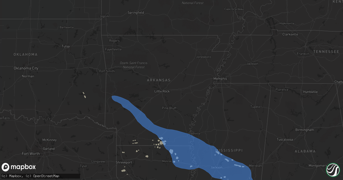
Hail Map in Arkansas on June 10, 2022
Get this storm
June 10 map
$229
one time, instant access
Download today. No call, no setup
Keep the $229
Bought the map and want the full workflow? Apply the entire $229 to a subscription within 7 days. None of it is wasted.
Every map, not just this one
This buys you this map. Subscription and you get every map we run, in the markets you choose from a few cities to whole states to nationwide. Plus real-time alerts the moment a storm fires.
Contact data
Name, contact info, occupancy, even credit band for addresses in the footprint. You go from where it hit to who to call.
Become the source they trust
Unlimited branding weather history reports on demand. You already have the documented answer ready for the property owner, and you are the one who showed up with it.
Property data and RoofTrace estimates
Pull up any address you have got, its value and the exact code rules for that jurisdiction, straight from One Click Code. Then RoofTrace estimates the squares, pitch, and roof value, priced the way you price.
Storm reports in Arkansas
Arkansas
| Date | Description |
|---|---|
| 06/10/202211:09 AM CDT | Downed trees. |
| 06/10/202210:00 AM CDT | Overturned 18 wheeler due to wind gusts. |
| 06/10/20229:54 AM CDT | Corrects previous tstm wnd dmg report from 5 nnw lakeport. Overturned 18 wheeler due to wind gusts. |
| 06/10/20229:40 AM CDT | Measured at private airport weather station. |
| 06/10/20229:02 AM CDT | Downed trees. |
| 06/10/20229:02 AM CDT | Downed tree. |
| 06/10/20229:00 AM CDT | Corrects previous tstm wnd dmg report from 4 se north crossett. Downed trees. |
| 06/10/20229:00 AM CDT | Downed tree. |
| 06/10/20229:00 AM CDT | Downed trees. |
| 06/10/20228:44 AM CDT | Trees blown down over highway 278 west of warren. |
| 06/10/20228:42 AM CDT | Trees down blocking the westbound lanes of hwy 82 just east of u.s. Hwy 167. |
| 06/10/20228:40 AM CDT | Tree down at hwy 63 and pigeon hill landing road. |
| 06/10/20227:50 AM CDT | Trees down at the intersection of hwy 29 and hwy 67. |
| 06/10/20227:44 AM CDT | Tress across highway 67 in gum springs. |
| 06/10/20227:43 AM CDT | Trees blown over in arkadelphia via social media. |
| 06/10/20224:42 AM CDT | At 942 AM CDT, severe thunderstorms were located along a line extending from 6 miles east of Dermott to near Chicot Junction to 9 miles west of Gassoway, moving east at 35 mph. HAZARD...60 mph wind gusts. SOURCE...Radar indicated. IMPACT...Expect damage to roofs, siding, and trees. Severe thunderstorms will be near... Lake Village and Chicot Junction around 945 AM CDT. Eudora around 955 AM CDT. Avon around 1005 AM CDT. Wayside and Winterville around 1010 AM CDT. Greenville and Metcalfe around 1015 AM CDT. Glen Allan around 1020 AM CDT. Hollandale and Estill around 1025 AM CDT. Tribbett and Darlove around 1035 AM CDT.Other locations impacted by these severe thunderstorms includeArcola. |
| 06/10/20224:38 AM CDT | At 937 AM CDT, severe thunderstorms were located along a line extending from 8 miles west of Eudora to 6 miles south of Galion to Sterlington, moving southeast at 55 mph. HAZARD...60 mph wind gusts. SOURCE...Radar indicated. IMPACT...Expect damage to roofs, siding, and trees. Severe thunderstorms will be near... Gassoway around 950 AM CDT. Start, Millikin and Shelburn around 955 AM CDT. Lake Providence, Rayville, Warden, Holly Ridge and Alto around 1000 AM CDT. Delhi and Archibald around 1005 AM CDT. Mangham around 1010 AM CDT.Other locations impacted by these severe thunderstorms includePerryville, Collinston, Pioneer, Kilbourne, Forest, Oak Ridge andEpps. |
| 06/10/20224:26 AM CDT | At 924 AM CDT, severe thunderstorms were located along a line extending from near Beekman to 11 miles northwest of Bastrop to near Farmerville to near Cooley to 7 miles southwest of Wesson, moving south at 40 mph. Downed trees were reported earlier with this line of storms. HAZARD...60 mph wind gusts. SOURCE...Radar indicated. IMPACT...Expect damage to roofs, siding, and trees. Locations impacted include... Monroe, Ruston, Claiborne, West Monroe, Grambling, Junction City, Swartz, Brownsville-Bawcom, Brownsville-Bawcomville, Farmerville, Richwood, Bernice, Sterlington, Wesson, Cooley, Dubach, Choudrant, Simsboro, Marion and Chatham. |
| 06/10/20223:40 AM CDT | At 839 AM CDT, severe thunderstorms were located along a line extending from near Ingalls to 10 miles northwest of West Crossett to near Huttig, moving east at 30 mph. HAZARD...60 mph wind gusts. SOURCE...Radar indicated. IMPACT...Expect damage to roofs, siding, and trees. Severe thunderstorms will be near... West Crossett around 855 AM CDT. North Crossett, Fountain Hill and Old Milo around 905 AM CDT. Hamburg around 920 AM CDT. Snyder around 935 AM CDT.Other locations impacted by these severe thunderstorms includeBlanchton. |
| 06/10/20223:37 AM CDT | At 837 AM CDT, a severe thunderstorm was located near Harrell, or 10 miles southeast of Hampton, moving southeast at 55 mph. HAZARD...60 mph wind gusts. SOURCE...Radar indicated. IMPACT...Expect damage to roofs, siding, and trees. Locations impacted include... Monticello... Warren... Hampton... Hermitage... Wilmar... Calion... Harrell... Ingalls... Hilo... Ellisville... Hampton Municipal Airport... Moro Bay... Ladelle... Green Hill... Weeks... Moro Bay State Park... Lanark... Marks Mill State Park... Prairie Grove... Banks... |
| 06/10/20223:10 AM CDT | At 809 AM CDT, severe thunderstorms were located along a line extending from near Highland Industrial Park to near Cullendale to 7 miles southwest of Poison Springs State Park to near Willisville to 6 miles southwest of Bodcaw, moving southeast at 50 mph. HAZARD...60 mph wind gusts and penny size hail. SOURCE...Radar indicated. IMPACT...Expect damage to roofs, siding, and trees. Locations impacted include... El Dorado, Magnolia, Hope, Smackover, Stamps, Waldo, Norphlet, McNeil, Strong, Calion, Emerson, Buckner, Rosston, Louann, Willisville, Bodcaw, Bluff City, Smithland, Wesson and Village. |
| 06/10/20222:55 AM CDT | At 755 AM CDT, a severe thunderstorm was located 7 miles south of Sparkman, or 16 miles north of Camden, moving southeast at 60 mph. HAZARD...60 mph wind gusts. SOURCE...Radar indicated. IMPACT...Expect damage to roofs, siding, and trees. Locations impacted include... Camden... Monticello... Warren... Fordyce... Hampton... Bearden... Stephens... Hermitage... Wilmar... Calion... Sparkman... Thornton... Chidester... Harrell... Louann... Bluff City... Ingalls... White Oak Lake State Park... Hampton Municipal Airport... Moro Bay... |
| 06/10/20222:31 AM CDT | At 730 AM CDT, severe thunderstorms were located along a line extending from near Halfway to Okolona to near Blevins to 6 miles northwest of Washington, moving southeast at 50 mph. HAZARD...60 mph wind gusts. SOURCE...Radar indicated. IMPACT...Expect damage to roofs, siding, and trees. Locations impacted include... Hope, Prescott, Emmet, Blevins, Perrytown, Rosston, Washington, Willisville, Bodcaw, Bluff City, White Oak Lake State Park, McCaskill, Ozan, Cale, Oakhaven, Young, Sutton, Waterloo, Falcon and Boughton. |
| 06/10/20222:28 AM CDT | At 727 AM CDT, a severe thunderstorm was located over Okolona, or 15 miles north of Prescott, moving southeast at 50 mph. HAZARD...60 mph wind gusts. SOURCE...Radar indicated. IMPACT...Expect damage to roofs, siding, and trees. Locations impacted include... Arkadelphia... Gurdon... Caddo Valley... Sparkman... Chidester... Okolona... Whelen Springs... Beirne... Gum Springs in Clark County... Poison Springs State Park... White Oak Lake State Park... Halfway... Richwoods... Delight... Antoine... Curtis... Ouachita... Reader... Vaden... Dalark...This includes Interstate 30 between mile markers 53 and 78. |
| 06/10/20221:54 AM CDT | At 652 AM CDT, severe thunderstorms were located along a line extending from near Oden to near Norman to near Albert Pike Recreation Area, moving southeast at 60 mph. HAZARD...60 mph wind gusts. SOURCE...Radar indicated. IMPACT...Expect damage to roofs, siding, and trees. Locations impacted include... Hot Springs... Arkadelphia... Mount Ida... Glenwood... Mountain Pine... Amity... Caddo Valley... Norman... Oden... Okolona... Daisy... Gum Springs in Clark County... Daisy State Park... Narrows Dam... Meyers... Lofton... Rockwell... DeGray Lake State Park... Mauldin... Albert Pike Recreation Area...This includes Interstate 30 between mile markers 63 and 87. |
| 06/10/20221:31 AM CDT | At 631 AM CDT, severe thunderstorms were located along a line extending from 13 miles southeast of Waldron to near Opal to near Cossatot River State Park, moving east at 55 mph. HAZARD...60 mph wind gusts. SOURCE...Radar indicated. IMPACT...Expect damage to roofs, siding, and trees. Locations impacted include... Mount Ida... Glenwood... Norman... Oden... Daisy... Opal... Mimosa... Little Missouri Falls Recreatio... Cossatot River State Park... Daisy State Park... Mccauley... Shady... Hartley... Bard Springs Recreation Area... Caney Creek Wilderness... Mauldin... Albert Pike Recreation Area... Black Springs... Big Fork... Board Camp... |
All States Impacted by Hail Map on June 10, 2022
Cities Impacted by Hail Map on June 10, 2022
- Stringer, MS
- Emerson, AR
- Magnolia, AR
- Nashoba, OK
- Vaughan, MS
- Benton, MS
- Ellisville, MS
- Moselle, MS
- Oconomowoc, WI
- Ashippun, WI
- Ixonia, WI
- Watertown, WI
- Gibbs, MO
- Kirksville, MO
- Brashear, MO
- La Plata, MO
- Petal, MS
- Ovett, MS
- Jackson, AL
- Gainestown, AL
- Lower Peach Tree, AL
- Franklin, AL
- Maurepas, LA
- Gonzales, LA
- French Settlement, LA
- Saint Amant, LA
- Prairieville, LA
- Forest, MS
- Lena, MS
- Elberta, AL
- Lena, LA
- Novelty, MO
- Atlanta, MO
- Hornbeck, LA
- Florien, LA
- Fort Polk, LA
- Slagle, LA
- Anacoco, LA
- Leesville, LA
- Pitkin, LA
- Magee, MS
- Atmore, AL
- Uriah, AL
- Metairie, LA
- Little River, AL
- Benton, LA
- Plain Dealing, LA
- Dubach, LA
- Arcadia, LA
- Spearsville, LA
- Taylorsville, MS
- Mount Olive, MS
- Collins, MS
- Dothan, AL
- Bastrop, LA
- Neosho, WI
- Sugartown, LA
- Dry Creek, LA
- Frisco City, AL
- Grand Cane, LA
- Frierson, LA
- Gloster, LA
- Flomaton, AL
- Hattiesburg, MS
- Defuniak Springs, FL
- Milwaukee, WI
- Alexandria, LA
- Taylor, AR
- Ponce De Leon, FL
- McKenzie, AL
- Whatley, AL
- Richfield, WI
- Slinger, WI
- Hartford, WI
- West Bend, WI
- Jackson, WI
- Haynesville, LA
- Rayville, LA
- Colfax, LA
- Cloutierville, LA
- Shreveport, LA
- Pachuta, MS
- Vossburg, MS
- Deridder, LA
- Braxton, MS
- Cantonment, FL
- Sumrall, MS
- Columbia, MS
- Newton, MS
- Lake, MS
- Lawrence, MS
- Laurel, MS
- Richton, MS
- State Line, MS
- Many, LA
- Zwolle, LA
- Mendenhall, MS
- Soso, MS
- Donalsonville, GA
- Mount Vernon, AL
- Baton Rouge, LA
- Bassfield, MS
- Bay Minette, AL
- Buckatunna, MS
- Marion, LA
- Hartland, WI
- Oak Ridge, LA
- Huttig, AR
- Strong, AR
- Evergreen, AL
- El Dorado, AR
- Okauchee, WI
- Morton, MS
- Brandon, MS
- Provencal, LA
- Seminary, MS
- Waynesboro, MS
- Tallulah, LA
- Junction City, AR
- Saint Stephens, AL
- Mer Rouge, LA
- Chatom, AL
- Wagarville, AL
- Leroy, AL
- Millry, AL
- Elkton, FL
- Saint Augustine, FL
- Vero Beach, FL
- Westville, FL
- Eunice, LA
- Minden, LA
- Tuskahoma, OK
- Clayton, OK
- Basile, LA
- Natchitoches, LA
- Melrose, LA
- Atlanta, LA
- Montgomery, LA
- Natchez, LA
- Bentonia, MS
- Ormond Beach, FL
- Frankville, AL
- Silas, AL
- Shelbyville, MO
- Canton, MS
- Franklin, LA
- Pensacola, FL
- Paris, MO
- Boyce, LA
- Mansfield, LA
- Stapleton, AL
- Mena, AR
- Conehatta, MS
- Pioneer, LA
- Anguilla, MS
- Leakesville, MS
- Hickory, MS
- Rose Hill, MS
- Redwood, MS
- Collinston, LA
- Warren, AR
- Lake Village, AR
- Belzoni, MS
- Ridgeland, MS
- Oak Grove, LA
- Parkdale, AR
- Camden, MS
- Shubuta, MS
- Hampton, AR
- Flora, MS
- Mayersville, MS
- Silver City, MS
- Florence, MS
- Jones, LA
- Norman, AR
- Heidelberg, MS
- Lexington, MS
- Paulding, MS
- Yazoo City, MS
- Beaumont, MS
- Wilmar, AR
- Pelahatchie, MS
- Glen Allan, MS
- Monticello, AR
- Amity, AR
- Harrisville, MS
- Harrell, AR
- Banks, AR
- Oden, AR
- Hollandale, MS
- Flowood, MS
- Cary, MS
- Newellton, LA
- Eudora, AR
- Pearl, MS
- Jersey, AR
- Sparkman, AR
- Crystal Springs, MS
- Delight, AR
- New Augusta, MS
- Rolling Fork, MS
- Byram, MS
- Baskin, LA
- Murfreesboro, AR
- Pulaski, MS
- Greenville, MS
- Wilmot, AR
- Edwards, MS
- Enterprise, MS
- Prescott, AR
- Mount Ida, AR
- Decatur, MS
- Crossett, AR
- Utica, MS
- Terry, MS
- Bolton, MS
- Mize, MS
- Caddo Gap, AR
- Vicksburg, MS
- Raymond, MS
- Quitman, MS
- Gurdon, AR
- Bonita, LA
- Delhi, LA
- Louin, MS
- Okolona, AR
- Bonnerdale, AR
- Valley Park, MS
- Camden, AR
- Chidester, AR
- Tinsley, MS
- Clinton, MS
- Tougaloo, MS
- Satartia, MS
- Fountain Hill, AR
- Glenwood, AR
- Jackson, MS
- Langley, AR
- Chatham, MS
- Hermitage, AR
- Louise, MS
- Hamburg, AR
- Lake Providence, LA
- Bay Springs, MS
- Portland, AR
- Kirby, AR
- Epps, LA
- Arkadelphia, AR
- Chunky, MS
- Richland, MS
- Bearden, AR
- Neely, MS
- Holly Bluff, MS
- Sondheimer, LA
- Madison, MS
- Montrose, AR
- Raleigh, MS
- Winnsboro, LA
- Dermott, AR
- Transylvania, LA
- Bluff City, AR
- Simpson, LA
- Elizabeth, LA
- Fisher, LA
- Oakdale, LA
- Pineville, LA
- Ball, LA
- Grant, LA
- Lebanon, WI


