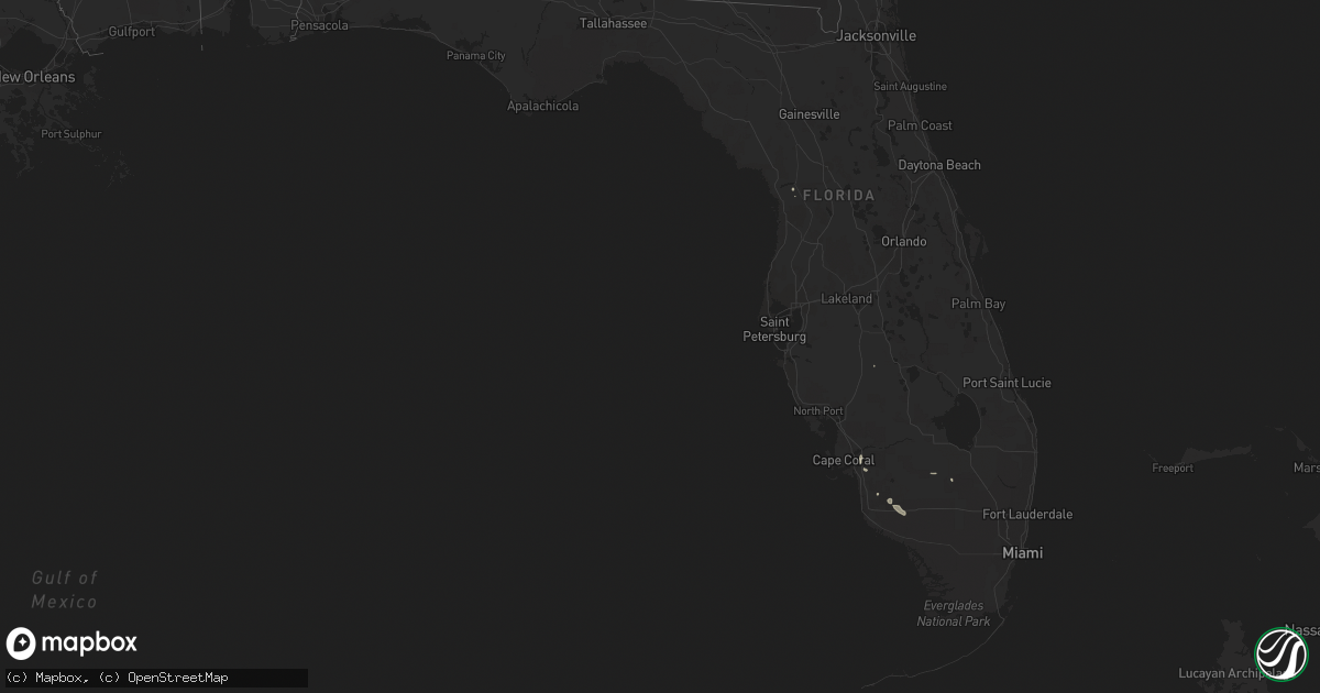
Hail Map in Florida on June 10, 2020
Get this storm
June 10 map
$229
one time, instant access
Download today. No call, no setup
Keep the $229
Bought the map and want the full workflow? Apply the entire $229 to a subscription within 7 days. None of it is wasted.
Every map, not just this one
This buys you this map. Subscription and you get every map we run, in the markets you choose from a few cities to whole states to nationwide. Plus real-time alerts the moment a storm fires.
Contact data
Name, contact info, occupancy, even credit band for addresses in the footprint. You go from where it hit to who to call.
Become the source they trust
Unlimited branding weather history reports on demand. You already have the documented answer ready for the property owner, and you are the one who showed up with it.
Property data and RoofTrace estimates
Pull up any address you have got, its value and the exact code rules for that jurisdiction, straight from One Click Code. Then RoofTrace estimates the squares, pitch, and roof value, priced the way you price.
Storm reports in Florida
Florida
| Date | Description |
|---|---|
| 06/10/20202:45 PM CDT | Emergency manager relayed a report from a ham radio opertator of a wires down near mahogany blvd and evergreen ave with power outages near the area. Time based on radar |
| 06/10/20202:26 AM CDT | At 725 PM EDT, a severe thunderstorm was located over East Dunbar, or over Fort Myers, moving north at 15 mph. HAZARD...60 mph wind gusts and penny size hail. SOURCE...Radar indicated. IMPACT...Expect damage to roofs, siding, and trees. Locations impacted include... Fort Myers, San Carlos Park, McGregor, East Dunbar, Pine Manor, Palmona Park, Southwest Florida Airport, Harlem Heights, Lochmoor Waterway Estates, Cypress Lake, Buckingham, Villas, Three Oaks, Olga, Iona, Whiskey Creek, Fort Myers Shores, Page Park, North Fort Myers and Page Field Airport. |
| 06/10/20202:01 AM CDT | At 700 PM EDT, a severe thunderstorm was located over Southwest Florida Airport, or near Fort Myers, moving northwest at 15 mph. HAZARD...60 mph wind gusts. SOURCE...Radar indicated. IMPACT...Expect damage to roofs, siding, and trees. Locations impacted include... Fort Myers, San Carlos Park, McGregor, East Dunbar, Pine Manor, Southwest Florida Airport, Cypress Lake, Villas, Three Oaks, Buckingham, Whiskey Creek, Page Park, Page Field Airport, Fort Myers Villas, Tice, Estero, Gateway and North Fort Myers. |
| 06/09/202011:55 PM CDT | At 455 PM EDT, a severe thunderstorm was located over Copeland, or 7 miles northeast of Everglades City, moving southwest at 5 mph. HAZARD...60 mph wind gusts and quarter size hail. SOURCE...Radar indicated. IMPACT...Hail damage to vehicles is expected. Expect wind damage to roofs, siding, and trees. Locations impacted include... Chokoloskee, Everglades City, Plantation Island, Carnestown and Copeland. |
| 06/09/202010:47 PM CDT | At 347 PM EDT, a severe thunderstorm was located near Parrish, or 14 miles northeast of Palmetto, moving north at 15 mph. HAZARD...60 mph wind gusts. SOURCE...Radar indicated. IMPACT...Expect damage to roofs, siding, and trees. Locations impacted include... Tampa, Ruskin, Parrish, Greater Sun Center, Little Manatee River State Park, Wimauma, Sun City Center and Gibsonton. |
All States Impacted by Hail Map on June 10, 2020
Cities Impacted by Hail Map on June 10, 2020
- Fort Wayne, IN
- Leo, IN
- Auburn, IN
- Grabill, IN
- New Haven, IN
- Fredericktown, OH
- Bellville, OH
- Mount Vernon, OH
- Butler, OH
- Lyons, MI
- Wabash, IN
- Sharpsville, IN
- Goldsmith, IN
- Urbana, IN
- Tipton, IN
- Marion, IN
- Churubusco, IN
- Amboy, IN
- Columbia City, IN
- Albion, IN
- North Manchester, IN
- Andrews, IN
- Kokomo, IN
- Converse, IN
- Huntington, IN
- Lagro, IN
- Windfall, IN
- La Fontaine, IN
- Greentown, IN
- South Whitley, IN
- Goshen, IN
- Middlebury, IN
- Bristol, IN
- New Paris, IN
- Nappanee, IN
- Sparta, MI
- Marne, MI
- Grand Rapids, MI
- Conklin, MI
- Akron, MI
- Fairgrove, MI
- Caro, MI
- Oxford, MI
- Leonard, MI
- Greenup, KY
- Kalamazoo, MI
- West Olive, MI
- Zeeland, MI
- Holland, MI
- Frankfort, OH
- South Salem, OH
- Garrett, IN
- Huntertown, IN
- Grant Park, IL
- Peotone, IL
- Steger, IL
- Crete, IL
- Calumet City, IL
- Glenwood, IL
- Hammond, IN
- Chicago Heights, IL
- Lansing, IL
- Munster, IN
- Dyer, IN
- Beecher, IL
- Falmouth, KY
- Foster, KY
- Butler, KY
- Harrisburg, PA
- Hummelstown, PA
- Brooksville, KY
- Cairo, WV
- Petroleum, WV
- Walker, WV
- Decker, MI
- Snover, MI
- North Fairfield, OH
- Plymouth, OH
- Greenwich, OH
- Shiloh, OH
- Willard, OH
- West Milton, OH
- Troy, OH
- Conover, OH
- Rosewood, OH
- Casstown, OH
- De Graff, OH
- Vandalia, OH
- Saint Paris, OH
- Quincy, OH
- Fletcher, OH
- Tipp City, OH
- Logan, OH
- McArthur, OH
- Nelsonville, OH
- New Plymouth, OH
- Springport, MI
- Albion, MI
- Parma, MI
- Merrill, MI
- Saginaw, MI
- Hemlock, MI
- Freeland, MI
- Sturgis, MI
- Burr Oak, MI
- Markle, IN
- Montpelier, IN
- Liberty Center, IN
- Bluffton, IN
- Warren, IN
- Oakland, MI
- Rochester, MI
- Essexville, MI
- Rochester, IN
- Urbana, OH
- Bronson, MI
- Wolcottville, IN
- Lagrange, IN
- Ligonier, IN
- Howe, IN
- Topeka, IN
- Oconomowoc, WI
- Sandusky, MI
- Brown City, MI
- Marlette, MI
- Saint Johns, MI
- Pewamo, MI
- Ithaca, MI
- Elsie, MI
- Perrinton, MI
- Middleton, MI
- Ashley, MI
- Maple Rapids, MI
- Sunfield, MI
- Pompeii, MI
- Fowler, MI
- Bannister, MI
- North Star, MI
- Mulliken, MI
- Westphalia, MI
- Portland, MI
- Lake Odessa, MI
- Cheshire, OH
- Gallipolis, OH
- Bidwell, OH
- Kenton, OH
- Milford, IN
- Union City, MI
- Coldwater, MI
- Homer, MI
- Tekonsha, MI
- Marshall, MI
- Lancaster, OH
- Somerset, OH
- Pleasantville, OH
- Thornville, OH
- Mount Perry, OH
- Roseville, OH
- Glenford, OH
- Rushville, OH
- Sand Lake, MI
- Cedar Springs, MI
- New Lexington, OH
- Forest, OH
- Bryan, OH
- Alvordton, OH
- West Unity, OH
- Sherwood, OH
- Ney, OH
- Hartland, WI
- Colgate, WI
- Lima, OH
- Beaverdam, OH
- South Bloomingville, OH
- Creola, OH
- Upper Sandusky, OH
- Tiffin, OH
- Shelby, OH
- Saint John, IN
- Gary, IN
- Cedar Lake, IN
- Schererville, IN
- Crown Point, IN
- Griffith, IN
- Highland, IN
- Larwill, IN
- Pierceton, IN
- Port Hope, MI
- Port Austin, MI
- Burkesville, KY
- Albany, KY
- Lexington, KY
- Mansfield, OH
- Waynesfield, OH
- Harrod, OH
- Columbus Grove, OH
- Bluffton, OH
- Wapakoneta, OH
- Olive Hill, KY
- Garrison, KY
- Emerson, KY
- Grayson, KY
- South Shore, KY
- Vanceburg, KY
- Hudson, MI
- Saugatuck, MI
- Douglas, MI
- Pleasant City, OH
- Byesville, OH
- Augusta, WV
- Romney, WV
- Points, WV
- Springfield, WV
- Levels, WV
- Pierson, MI
- Newaygo, MI
- Howard City, MI
- Lawton, MI
- Mattawan, MI
- Portage, MI
- Plainwell, MI
- Corinth, KY
- Felicity, OH
- Berry, KY
- Georgetown, OH
- Portsmouth, OH
- Columbus, OH
- Constantine, MI
- White Pigeon, MI
- Bourbon, IN
- Bremen, IN
- Etna Green, IN
- Climax, MI
- Bellevue, MI
- Battle Creek, MI
- Leonidas, MI
- East Leroy, MI
- Vicksburg, MI
- Fulton, MI
- Scotts, MI
- Dunnellon, FL
- Wawaka, IN
- Rome City, IN
- Pittsford, MI
- Osseo, MI
- Silver Grove, KY
- Newport, KY
- Melbourne, KY
- Cincinnati, OH
- Russia, OH
- Versailles, OH
- Clifton, IL
- Naples, FL
- Bremen, OH
- New Philadelphia, OH
- Bay City, MI
- Bay Port, MI
- Pigeon, MI
- Sebewaing, MI
- Unionville, MI
- Munger, MI
- Ridgeway, OH
- Great Cacapon, WV
- Paw Paw, WV
- Delton, MI
- Hastings, MI
- Moscow, OH
- Somerset, KY
- Leesburg, IN
- Cromwell, IN
- Kimmell, IN
- North Webster, IN
- Newcomerstown, OH
- Fresno, OH
- Coshocton, OH
- Stone Creek, OH
- Franklin Furnace, OH
- Ironton, OH
- Kinde, MI
- Uniopolis, OH
- Kendallville, IN
- Avilla, IN
- Elizabeth, PA
- Stockdale, PA
- Fayette City, PA
- Coal Center, PA
- Donora, PA
- Charleroi, PA
- Elco, PA
- Webster, PA
- Roscoe, PA
- Allenport, PA
- Monongahela, PA
- Belle Vernon, PA
- Monessen, PA
- Dunlevy, PA
- Sutersville, PA
- West Union, OH
- Manchester, OH
- Ionia, MI
- Roanoke, IN
- Decatur, IN
- Craigville, IN
- Ossian, IN
- Shepherd, MI
- Mount Pleasant, MI
- Olivet, MI
- Millfield, OH
- Bethel, OH
- Howell, MI
- Fenton, MI
- Hartland, MI
- Brighton, MI
- Patriot, OH
- Ray, MI
- South Solon, OH
- South Charleston, OH
- Stanton, MI
- Pennsylvania Furnace, PA
- Reese, MI
- Vassar, MI
- Frankenmuth, MI
- Amanda, OH
- Carroll, OH
- Marengo, OH
- Sparta, OH
- Centerburg, OH
- Perrysville, OH
- Delaware, OH
- Wharton, OH
- Kirby, OH
- Carey, OH
- McCutchenville, OH
- Sycamore, OH
- Rebersburg, PA
- Woodward, PA
- Byron, MI
- Gaines, MI
- Stryker, OH
- Pioneer, OH
- Auburn Hills, MI
- Lake Orion, MI
- Detroit, MI
- East Chicago, IN
- Kankakee, IL
- Chebanse, IL
- Sussex, WI
- Eagle, MI
- Burlington, MI
- Quincy, MI
- Wauseon, OH
- Spencerville, IN
- Eaton Rapids, MI
- Fostoria, MI
- Kingston, MI
- Silverwood, MI
- Mayville, MI
- Columbiaville, MI
- Clifford, MI
- Lapeer, MI
- North Branch, MI
- Otter Lake, MI
- Millington, MI
- Cardington, OH
- Chesterville, OH
- Mount Gilead, OH
- Fort Loramie, OH
- Houston, OH
- Yorkshire, OH
- Attica, MI
- Imlay City, MI
- Grand Haven, MI
- Spring Lake, MI
- Charlotte, MI
- Augusta, KY
- Bellefontaine, OH
- Utica, MI
- Clinton Township, MI
- Macomb, MI
- Sterling Heights, MI
- Montpelier, OH
- Waldron, MI
- Hoagland, IN
- Mark Center, OH
- Camden, MI
- Nunica, MI
- Fruitport, MI
- Bridgeport, MI
- Montrose, MI
- Birch Run, MI
- Burt, MI
- Oak Hill, OH
- London, OH
- Cedarville, OH
- Jamestown, OH
- Jeffersonville, OH
- Waterloo, OH
- Wheeler, MI
- Butler, IN
- Saint Joe, IN
- Hudsonville, MI
- Belmont, MI
- Comstock Park, MI
- Rockford, MI
- Grant, MI
- Kent City, MI
- Allendale, MI
- Jenison, MI
- Grandville, MI
- Coopersville, MI
- Dousman, WI
- Defiance, OH
- Trenton, MI
- Leetonia, OH
- Salem, OH
- Fremont, IN
- Angola, IN
- Deford, MI
- Fisher, WV
- Quincy, KY
- Elkton, MI
- Clarksburg, OH
- Chillicothe, OH
- Winchester, KY
- Potterville, MI
- Mendon, MI
- Beverly Hills, FL
- Leslie, MI
- Sherwood, MI
- Concord, MI
- Jackson, MI
- Athens, MI
- Rives Junction, MI
- Onondaga, MI
- Blue Rock, OH
- Petersburg, WV
- Akron, OH
- West Newton, PA
- Brownsville, PA
- California, PA
- Grindstone, PA
- Newell, PA
- Woodburn, IN
- Harlan, IN
- Lansing, MI
- Grand Ledge, MI
- Dewitt, MI
- Grosse Ile, MI
- Stoutsville, OH
- Botkins, OH
- Anna, OH
- Lafayette, OH
- Pandora, OH
- Morenci, MI
- New Springfield, OH
- North Lima, OH
- Columbiana, OH
- Archbold, OH
- Napoleon, OH
- Hicksville, OH
- Edgerton, OH
- South Webster, OH
- Thurman, OH
- Manitou Beach, MI
- Hillsdale, MI
- Edon, OH
- Fayette, OH
- Clayton, MI
- Nicholasville, KY
- Zolfo Springs, FL
- Chicago, IL
- Hamersville, OH
- New Cumberland, PA
- Mechanicsburg, PA
- Camp Hill, PA
- Middletown, PA
- Piper City, IL
- Millersburg, OH
- Fredericksburg, OH
- Brant, MI
- Saint Charles, MI
- Breckenridge, MI
- Richmond, KY
- Englewood, OH
- Yoder, IN
- Uniondale, IN
- Ashkum, IL
- Silver Lake, IN
- Roann, IN
- Lowell, IN
- Merrillville, IN
- Clewiston, FL
- Cynthiana, KY
- Galena, OH
- Westerville, OH
- Ashley, OH
- Filion, MI
- Carlisle, KY
- Antwerp, OH
- Cecil, OH
- Warsaw, IN
- Ruth, MI
- Peru, IN
- Jackson, WI
- Cedarburg, WI
- West Lafayette, OH
- Conesville, OH
- Port Washington, OH
- Dresden, OH
- Rio Grande City, TX
- Slanesville, WV
- New Lothrop, MI
- Cope, SC
- Branchville, SC
- Forest, IN
- Kempton, IN
- Galveston, IN
- Frankfort, IN
- Russiaville, IN
- Bunker Hill, IN
- Denver, IN
- Fort Myers, FL
- Circleville, OH
- Zanesville, OH
- White Cottage, OH
- Eubank, KY
- Warren, MI
- Harrison Township, MI
- Eastpointe, MI
- Harper Woods, MI
- Roseville, MI
- Greenville, OH
- Bradford, OH
- Laotto, IN
- Harbor Beach, MI
- Minden City, MI
- Pontiac, MI
- Bloomfield Hills, MI
- Romeo, MI
- Waterford, MI
- Almont, MI
- Nashotah, WI
- Okauchee, WI
- Hubertus, WI
- Delafield, WI
- Zionsville, IN
- Swayzee, IN
- Atlanta, IN
- Lebanon, IN
- Sheridan, IN
- Kirklin, IN
- Whitestown, IN
- Leesburg, VA
- Ashburn, VA
- Finleyville, PA
- Freeport, MI
- Woodland, MI
- Aaronsburg, PA
- Mifflinburg, PA
- Laurelton, PA
- Pine Grove, PA
- South Portsmouth, KY
- Otisville, MI
- Burton, MI
- Davison, MI
- Flint, MI
- Bellevue, OH
- Ray, OH
- New Marshfield, OH
- Pinckney, MI
- Mason, WV
- West Columbia, WV
- Vinton, OH
- Middleport, OH
- Carlisle, PA
- Wheelersburg, OH
- Midland, MI
- West Bend, WI
- Richfield, WI
- Pleasant Lake, IN
- Ashley, IN
- Waterloo, IN
- Arcola, IN
- Corunna, IN
- Linwood, MI
- Pinconning, MI
- Bloomville, OH
- Republic, OH
- Attica, OH
- Morral, OH
- Harpster, OH
- Alexandria, KY
- Deckerville, MI
- Palms, MI
- University Park, IL
- Manteno, IL
- Park Forest, IL
- Monee, IL
- Bourbonnais, IL
- Fennville, MI
- Claypool, IN
- Syracuse, IN
- Bonfield, IL
- Neville, OH
- Richton Park, IL
- Matteson, IL
- Caseville, MI
- Ceresco, MI
- Cement City, MI
- Clarklake, MI
- Addison, MI
- Brooklyn, MI
- New Baltimore, MI
- New Haven, MI
- Hamilton, MI
- Morley, MI
- Caledonia, MI
- Dorr, MI
- South Haven, MI
- Wyoming, MI
- Big Rapids, MI
- Ada, MI
- Stanwood, MI
- Byron Center, MI
- Carrollton, MI
- Chesaning, MI
- Omer, MI
- Riverdale, MI
- Greenville, MI
- Gowen, MI
- Alma, MI
- Crystal, MI
- Au Gres, MI
- Standish, MI
- Vestaburg, MI
- East Tawas, MI
- Sidney, MI
- Saint Louis, MI
- Elwell, MI
- Turner, MI
- Sheridan, MI
- National City, MI
- Tawas City, MI
- Edmore, MI
- Sanford, MI
- Twining, MI
- Rhodes, MI
- Carson City, MI
- Fenwick, MI
- Belding, MI
- Three Rivers, MI
- Centreville, MI
- Auburn, MI
- Kawkawlin, MI
- Hanover, MI
- Litchfield, MI
- Jonesville, MI
- Dansville, MI
- Stockbridge, MI
- Munith, MI
- Pleasant Lake, MI
- Spring Arbor, MI
- Allen, MI
- Montgomery, MI
- North Adams, MI
- Reading, MI
- Jerome, MI
- Whitmore Lake, MI
- Hamburg, MI
- South Lyon, MI
- Mount Morris, MI
- Swartz Creek, MI
- Flushing, MI
- Applegate, MI
- Peck, MI
- Chelsea, MI
- Tipton, MI
- Ann Arbor, MI
- Manchester, MI
- Grass Lake, MI
- Clinton, MI
- Onsted, MI
- Dexter, MI
- Adrian, MI
- Saline, MI
- Washington, MI
- Saint Clair Shores, MI
- Grosse Pointe, MI
- Liberty Mills, IN
- Miami, IN
- Servia, IN
- Orland, IN
- Gaston, IN
- Muncie, IN
- Upland, IN
- Hartford City, IN
- New Bremen, OH
- New Knoxville, OH
- Minster, OH
- Huntsville, OH
- Marysville, OH
- Plain City, OH
- Milford Center, OH
- Mechanicsburg, OH
- South Vienna, OH
- Irwin, OH
- Hilliard, OH
- West Jefferson, OH
- North Baltimore, OH
- Benton Ridge, OH
- Pemberville, OH
- Mount Cory, OH
- Perrysburg, OH
- Martin, OH
- Findlay, OH
- Rudolph, OH
- Jerry City, OH
- Genoa, OH
- Luckey, OH
- McComb, OH
- Rawson, OH
- Cygnet, OH
- Portage, OH
- Bowling Green, OH
- Wayne, OH
- Jenera, OH
- Graytown, OH
- Van Buren, OH
- Woodville, OH
- Hillsboro, OH
- Lynchburg, OH
- Leesburg, OH
- Greenfield, OH
- Rockbridge, OH
- Laurelville, OH
- Hopewell, OH
- Kingston, OH
- Tarlton, OH
- Crooksville, OH
- Williamsport, OH
- Clyde, OH
- Oberlin, OH
- Amherst, OH
- Huron, OH
- Monroeville, OH
- Berlin Heights, OH
- Vermilion, OH
- Milan, OH
- Sandusky, OH
- New Riegel, OH
- Wakeman, OH
- Norwalk, OH
- Castalia, OH
- Green Springs, OH
- Lorain, OH
- Collins, OH
- Pataskala, OH
- Ashville, OH
- Grove City, OH
- Alexandria, OH
- Pickerington, OH
- Blacklick, OH
- New Albany, OH
- Commercial Point, OH
- Lockbourne, OH
- Reynoldsburg, OH
- Canal Winchester, OH
- Granville, OH
- Groveport, OH
- Orient, OH
- Johnstown, OH
- Mount Sterling, OH
- Sunbury, OH
- Dublin, OH
- Lewis Center, OH
- Adelphi, OH
- Londonderry, OH
- Sugar Grove, OH
- Valley City, OH
- Brookpark, OH
- Grand River, OH
- Polk, OH
- Galion, OH
- Wickliffe, OH
- Chardon, OH
- Crestline, OH
- North Ridgeville, OH
- Ashland, OH
- Rocky River, OH
- Medina, OH
- Mentor, OH
- West Salem, OH
- Chagrin Falls, OH
- North Olmsted, OH
- Eastlake, OH
- Nova, OH
- Painesville, OH
- Lakewood, OH
- Strongsville, OH
- Willoughby, OH
- Olmsted Falls, OH
- Brunswick, OH
- Cleveland, OH
- Litchfield, OH
- Berea, OH
- Grafton, OH
- Elyria, OH
- Euclid, OH
- Homerville, OH
- Sullivan, OH
- Columbia Station, OH
- Chesterland, OH
- Lagrange, OH
- Beachwood, OH
- Spencer, OH
- Wellington, OH
- New London, OH
- Gates Mills, OH
- Bucyrus, OH
- Chesterhill, OH
- Cambridge, OH
- Flushing, OH
- Senecaville, OH
- Trimble, OH
- Kipling, OH
- Belmont, OH
- Alledonia, OH
- Dillonvale, OH
- Stockport, OH
- Caldwell, OH
- Corning, OH
- Adena, OH
- Bethesda, OH
- Barnesville, OH
- Lewisville, OH
- Martins Ferry, OH
- Morristown, OH
- Jacksonville, OH
- Cadiz, OH
- Belle Valley, OH
- Bellaire, OH
- Mcconnelsville, OH
- Salesville, OH
- Chandlersville, OH
- Hamden, OH
- Lore City, OH
- Malta, OH
- Jacobsburg, OH
- Saint Clairsville, OH
- New Straitsville, OH
- Cumberland, OH
- Woodsfield, OH
- Wellston, OH
- Jerusalem, OH
- Summerfield, OH
- Bridgeport, OH
- Glouster, OH
- Beallsville, OH
- Union Furnace, OH
- Beaver, OH
- Buchtel, OH
- Rayland, OH
- Haydenville, OH
- Jackson, OH
- Sarahsville, OH
- Zaleski, OH
- Mount Pleasant, OH
- Coalton, OH
- Quaker City, OH
- Murray City, OH
- Gambier, OH
- Navarre, OH
- Warsaw, OH
- Danville, OH
- Walhonding, OH
- Brewster, OH
- Glenmont, OH
- Mount Eaton, OH
- Holmesville, OH
- Dalton, OH
- Massillon, OH
- Beach City, OH
- Wilmot, OH
- Howard, OH
- Apple Creek, OH
- Brinkhaven, OH
- Killbuck, OH
- Dundee, OH
- Knox, PA
- Karns City, PA
- East Brady, PA
- Polk, PA
- Darlington, PA
- Portersville, PA
- Grove City, PA
- Shippenville, PA
- Bergholz, OH
- Leesville, OH
- Dover, OH
- Boyers, PA
- Hanoverton, OH
- Kossuth, PA
- Norwich, OH
- Bruin, PA
- New Middletown, OH
- Tippecanoe, OH
- West Pittsburg, PA
- East Rochester, OH
- Midvale, OH
- Adamsville, OH
- Youngstown, OH
- Harmony, PA
- Emlenton, PA
- Sigel, PA
- New Waterford, OH
- Mercer, PA
- Tuscarawas, OH
- Clintonville, PA
- Amsterdam, OH
- Franklin, PA
- Malvern, OH
- Kimbolton, OH
- Struthers, OH
- Mechanicstown, OH
- Jewett, OH
- Piedmont, OH
- Enon Valley, PA
- Kennerdell, PA
- West Sunbury, PA
- Rimersburg, PA
- Salineville, OH
- Cranberry, PA
- Dennison, OH
- Slippery Rock, PA
- Mineral City, OH
- Edinburg, PA
- Parker, PA
- Petersburg, OH
- Strattanville, PA
- Hilliards, PA
- Corsica, PA
- New Galilee, PA
- East Butler, PA
- Harrisville, PA
- Sherrodsville, OH
- Sligo, PA
- Carrollton, OH
- Minerva, OH
- Chicora, PA
- Lowellville, OH
- Prospect, PA
- Eau Claire, PA
- Hammondsville, OH
- Dellroy, OH
- Uhrichsville, OH
- Lisbon, OH
- Fenelton, PA
- Negley, OH
- New Concord, OH
- Ellwood City, PA
- Plainfield, OH
- Hillsville, PA
- Volant, PA
- Foxburg, PA
- Pulaski, PA
- New Castle, PA
- Rogers, OH
- Hopedale, OH
- Clarion, PA
- Summitville, OH
- East Liverpool, OH
- Scio, OH
- Callensburg, PA
- Canfield, OH
- Leeper, PA
- Worthington, PA
- Freeport, OH
- Wampum, PA
- Bowerston, OH
- Nashport, OH
- Washingtonville, OH
- Marble, PA
- Bessemer, PA
- Lucinda, PA
- Gnadenhutten, OH
- East Palestine, OH
- Petrolia, PA
- Magnolia, OH
- Cowansville, PA
- Butler, PA
- Kensington, OH
- Washington, WV
- Portland, OH
- Pomeroy, OH
- Racine, OH
- Hartford, WV
- Point Pleasant, WV
- Waverly, WV
- Letart, WV
- Syracuse, OH
- Long Bottom, OH
- Mineral Wells, WV
- New Haven, WV
- Belleville, WV
- Parkersburg, WV
- Ravenswood, WV
- Reedsville, OH
- Saint Marys, WV
- Davisville, WV
- Steubenville, OH
- Aliquippa, PA
- Toronto, OH
- New Cumberland, WV
- Burgettstown, PA
- Georgetown, PA
- Clinton, PA
- Weirton, WV
- Hookstown, PA
- Richmond, OH
- New Brighton, PA
- Industry, PA
- Beaver, PA
- Fombell, PA
- Beaver Falls, PA
- Allison Park, PA
- Glenshaw, PA
- Cheswick, PA
- Indianola, PA
- Pittsburgh, PA
- Oakmont, PA
- New Kensington, PA
- Tarentum, PA
- Russellton, PA
- Gibsonia, PA
- Natrona Heights, PA
- Pine Grove Mills, PA
- State College, PA
- Petersburg, PA
- Huntingdon, PA
- Florence, KY
- Covington, KY
- Independence, KY
- Ft Mitchell, KY
- Latonia, KY
- Union, KY
- Erlanger, KY
- Walton, KY
- Mount Vernon, KY
- Brodhead, KY
- Orlando, KY
- Livingston, KY
- Crab Orchard, KY
- Pedro, OH
- Webbville, KY
- Elkfork, KY
- Denton, KY
- Louisa, KY
- Kenova, WV
- Catlettsburg, KY
- Rush, KY
- Prichard, WV
- Isonville, KY
- West Liberty, KY
- Sandy Hook, KY
- Huntington, WV
- Genoa, WV
- Lowmansville, KY
- Hurricane, WV
- Yawkey, WV
- Fort Gay, WV
- Hamlin, WV
- Ranger, WV
- Kiahsville, WV
- Ulysses, KY
- Griffithsville, WV
- East Lynn, WV
- Myra, WV
- Sod, WV
- Branchland, WV
- Dunlow, WV
- Dayton, OH


