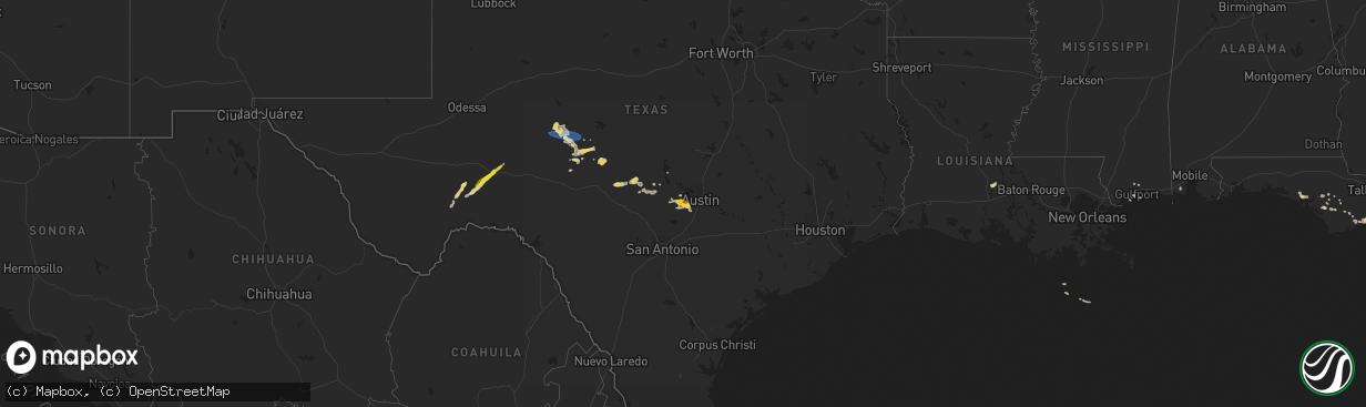
Hail Map on June 9, 2023
The weather event on June 9, 2023 includes Hail, Tornado, and Wind maps. 18 states and 474 cities were impacted and suffered possible damage. The total estimated number of properties impacted is 13,815.
Want more than just the map?
Turn this storm into a full workflow.
- Owner + property data so you know who to knock
- OnDemand branded weather history reports to win the "did we even have hail?" argument
- RoofTrace estimate so reps stop guessing numbers at the door
Bought this map? Upgrade within 7 days and we'll credit the $230. (10-15 min setup call)
Hail
Tornado
Wind
13,815
Estimated number of impacted properties by a 1.00" hail or larger597
Estimated number of impacted properties by a 1.75" hail or larger19
Estimated number of impacted properties by a 2.50" hail or largerStates Impacted by Hail Map on June 9, 2023
Storm reports
Colorado
| Date | Description |
|---|---|
| 06/08/20237:51 PM CDT | Hail could have been larger... Hard to see in the heavy rainfall while driving. |
Oklahoma
| Date | Description |
|---|---|
| 06/09/20236:58 PM CDT | Report from mping: quarter |
| 06/09/20236:45 PM CDT | Power lines down on hwy 82 south of locust grove...tree blown over and took out power line. |
| 06/09/20236:29 PM CDT | Tree damage on hwy 51 between tahlequah and stilwell; location/time estimated by radar. |
| 06/09/20236:12 PM CDT | Tree damage sent in via twitter by storm tracker; location and time estimated by radar. |
| 06/09/20236:34 AM CDT | 2 inch tree branches broken on spring creek drive in the road. |
| 06/09/20232:55 AM CDT | A local report indicates 60 MPH wind near 5 SE Dover |
| 06/09/20232:50 AM CDT | A local report indicates 68 MPH wind near 5 SE Dover |
| 06/09/20232:35 AM CDT | 2-3 inch tree branches broken. Picture on twitter. |
| 06/09/20231:10 AM CDT | Ahead of the storms along the gust front. |
| 06/08/20239:00 PM CDT | Damage to building on port rd north of catoosa; time/location estimated by radar. |
| 06/08/20238:47 PM CDT | Report from mping: tree down over redbud road in catoosa time estimated by radar. |
| 06/08/20237:00 PM CDT | Measured at wynona mesonet. |
Texas
| Date | Description |
|---|---|
| 06/09/20235:07 PM CDT | A local report indicates 1.25 inch wind near 5 SE Mackenzie Reservoi |
| 06/09/20235:07 PM CDT | A local report indicates 1.50 inch wind near 4 ESE Mackenzie Reservo |
| 06/09/20234:33 AM CDT | Report from mping: quarter |
| 06/09/20234:33 AM CDT | A local report indicates 1.00 inch wind near 5 E Dripping Springs |
| 06/09/20234:21 AM CDT | Report from mping: golf ball |
| 06/08/202311:05 PM CDT | Wake-low winds behind thunderstorm. |
| 06/08/20239:45 PM CDT | Multiple large tree limbs snapped. Damage to carport. |
| 06/08/20239:40 PM CDT | Tree blown down onto parked car. |
| 06/08/20239:40 PM CDT | Roof damage with shingles blown of a section of roof. |
| 06/08/20239:30 PM CDT | Large parts of several fences knocked down. |
| 06/08/20239:30 PM CDT | Usgs gage recorded a 65.6 mph wind gust. |
| 06/08/20239:25 PM CDT | Multiple large tree branches snapped. |
| 06/08/20239:20 PM CDT | Large tree limbs snapped |
Montana
| Date | Description |
|---|---|
| 06/09/20236:20 PM CDT | Multiple trained spotters confirmed multiple funnel clouds... One of which was observed touching the ground and lofting a dirt cloud at its base. Tornado lasted for les |
| 06/09/20236:17 PM CDT | Corrects previous tornado report from 2 ne hinsdale |
Nebraska
| Date | Description |
|---|---|
| 06/09/20233:45 PM CDT | A local report indicates 1.00 inch wind near 4 SW Cedar Rapids |
| 06/09/20231:42 PM CDT | A local report indicates 1.25 inch wind near 8 NW Bartlett |
| 06/08/20237:56 PM CDT | Mesonet/personal weather station. |
Kansas
| Date | Description |
|---|---|
| 06/09/20236:40 PM CDT | Corrects previous hail report from sedan. Lots of dime-size hail. Biggest from video looked to be half-dollar size. |
| 06/09/20234:44 PM CDT | Via social media. |
| 06/09/20233:14 PM CDT | Public report of ping pong ball sized hail to start with... Dropping down to pea size hail by the end. Time estimated. |
| 06/09/20233:04 PM CDT | Trained spotter reports estimated 50-60 mph winds... Pea sized hail in lenora. |
| 06/09/20232:58 PM CDT | Report of quarter sized hail covering the ground at 21st and 199th. |
| 06/09/20232:38 PM CDT | A local report indicates 1.00 inch wind near 5 NNW Goddard |
| 06/08/202311:45 PM CDT | Numerous large trees and branches downed and power lines down in herington. |
| 06/08/20237:12 PM CDT | A local report indicates 1.00 inch wind near 10 S Sharon Springs |
| 06/08/20237:00 PM CDT | Lots of dime-size hail. Biggest from video looked to be half-dollar size. |
Idaho
| Date | Description |
|---|---|
| 06/09/20236:25 PM CDT | Report relayed from latah county dispatch. Highway department sent to clear downed trees at mile post 27 on highway 6 in southern benewah county. |
| 06/09/20236:12 PM CDT | Latah county dispatch reported numerous large trees down at pines rv park. Several vehicles and rvs were damaged by fallen trees. |
| 06/09/20236:12 PM CDT | Facebook pictures of several large trees down in harvard and roof damage from strong wind. |
| 06/09/20234:24 PM CDT | Downed power lines and blown transformers during thunderstorm. Time estimated from radar. |
| 06/09/20234:24 PM CDT | Downed power pole on snake river avenue. Time based on radar. |
Florida
| Date | Description |
|---|---|
| 06/09/20232:11 PM CDT | Asos station kecp panama city measured 63mph gust. |
| 06/09/20231:33 PM CDT | Tree downed along s county rd 315. Time of event estimated via radar. |
North Dakota
| Date | Description |
|---|---|
| 06/09/20234:15 PM CDT | Tree down along road: twitter picture. |
Cities Impacted by Hail Map on June 9, 2023
- Hill City, SD
- Newcastle, NE
- Youngstown, FL
- Colby, KS
- Selden, KS
- Ewing, NE
- Chambers, NE
- Bartlett, NE
- Hoxie, KS
- Sopchoppy, FL
- Ericson, NE
- Colwich, KS
- Andale, KS
- Goddard, KS
- Garden Plain, KS
- Bassett, NE
- Long Pine, NE
- Greeley, NE
- Wolbach, NE
- Spalding, NE
- Saint Paul, NE
- Elba, NE
- Burwell, NE
- Oakley, KS
- Wellington, KS
- Scotia, NE
- North Loup, NE
- Primrose, NE
- Cedar Rapids, NE
- Ord, NE
- Rexford, KS
- Gove, KS
- Morland, KS
- Palco, KS
- Hill City, KS
- Plainville, KS
- Natoma, KS
- Arcadia, NE
- Woodston, KS
- Stockton, KS
- Miller, NE
- Mason City, NE
- Silverton, TX
- Benton, KS
- Hazard, NE
- Litchfield, NE
- Winona, KS
- Woodrow, CO
- Limon, CO
- Gaylord, KS
- Cedar, KS
- Kensington, KS
- Sterling, KS
- Hoisington, KS
- Claflin, KS
- Tribune, KS
- Genoa, CO
- Cozad, NE
- Rapid City, SD
- Lyons, KS
- Claremore, OK
- Comstock, NE
- Salina, OK
- Spavinaw, OK
- Bagley, MN
- Bliss, ID
- Levant, KS
- Loup City, NE
- Siloam Springs, AR
- Fayetteville, AR
- Holbrook, NE
- Hendley, NE
- Cambridge, NE
- Beaver City, NE
- Wilsonville, NE
- Norton, KS
- Valentine, NE
- Gothenburg, NE
- Witter, AR
- Broken Bow, NE
- Douglas, WY
- Panama City Beach, FL
- Panama City, FL
- Riverdale, NE
- Amherst, NE
- Kearney, NE
- Summers, AR
- Hyannis, NE
- Lingle, WY
- Lexington, NE
- Overton, NE
- Danville, AR
- Belleville, AR
- Carrabelle, FL
- Lanark Village, FL
- Ozark, AR
- San Jon, NM
- Pleasanton, NE
- Central City, NE
- Archer, NE
- Northwood, ND
- Larimore, ND
- Elm Creek, NE
- Orange Park, FL
- Jacksonville, FL
- Shawnee, WY
- Riverton, NE
- Bloomington, NE
- Smith Center, KS
- Port Barre, LA
- Arnaudville, LA
- Mcpherson, KS
- Calhan, CO
- Marquette, KS
- Kirwin, KS
- O'Brien, FL
- Branford, FL
- Palmer, NE
- Salol, MN
- Twin Falls, ID
- West Fork, AR
- American Falls, ID
- Elwood, NE
- Arapahoe, NE
- Edison, NE
- Hot Springs, SD
- Sargent, NE
- Colcord, OK
- Hettinger, ND
- Brewster, NE
- Biloxi, MS
- Saint Augustine, FL
- Hindsville, AR
- Elkins, AR
- Wesley, AR
- Old Town, FL
- Clayton, KS
- Norcatur, KS
- Jennings, KS
- Mena, AR
- Ansley, NE
- Orleans, NE
- Stamford, NE
- Lenora, KS
- Rudyard, MT
- Springdale, AR
- Chelsea, OK
- Walhalla, ND
- Cavalier, ND
- Neche, ND
- Rose, OK
- Dresden, KS
- Almena, KS
- Bunker Hill, KS
- Clearbrook, MN
- Eddyville, NE
- Paris, AR
- Saucier, MS
- Lindsborg, KS
- Inman, KS
- Torrington, WY
- Taylor, NE
- Clearwater, KS
- Grinnell, KS
- Wewahitchka, FL
- Grainfield, KS
- Anselmo, NE
- Brewster, KS
- Campbell, NE
- Kingston, AR
- Ponca, AR
- Chapman, NE
- Saint Libory, NE
- Combs, AR
- Huntsville, AR
- Hutchinson, KS
- Bruneau, ID
- Hoople, ND
- Bushton, KS
- Geneseo, KS
- Altus, AR
- Newell, SD
- Park, KS
- Bristol, FL
- Kanorado, KS
- Monument, KS
- Irvington, AL
- Middleburg, FL
- Prairie View, KS
- Fort White, FL
- Wood River, NE
- Watts, OK
- Westville, OK
- Gem, KS
- Alton, KS
- Lebanon, NE
- Pettigrew, AR
- Burlington, CO
- Prairie Grove, AR
- Lincoln, AR
- Cairo, NE
- Eastpoint, FL
- Russell, KS
- Aguilar, CO
- Hatton, ND
- Long Island, KS
- Perry, FL
- Trenton, FL
- Moreauville, LA
- East Palatka, FL
- Subiaco, AR
- Scranton, AR
- Wichita, KS
- Quinter, KS
- Magazine, AR
- Blue Mountain, AR
- Havana, AR
- Lake City, FL
- Gainesville, FL
- Middleboro, MA
- Stratton, CO
- Vona, CO
- Seibert, CO
- Sharon Springs, KS
- Weskan, KS
- Leoti, KS
- Karval, CO
- Hugo, CO
- Channing, TX
- Sedan, KS
- Syracuse, KS
- Kit Carson, CO
- Lakin, KS
- Dryden, TX
- Sheffield, TX
- Mertzon, TX
- San Angelo, TX
- Goodfellow Afb, TX
- Ulysses, KS
- Salina, KS
- Tescott, KS
- Brookville, KS
- Ozona, TX
- Wall, TX
- Vancourt, TX
- Eola, TX
- Canton, KS
- Galva, KS
- Laverne, OK
- Saint Francis, KS
- Tuthill, SD
- Hope, ND
- Coal Hill, AR
- Pretty Prairie, KS
- Haven, KS
- Arapahoe, CO
- Flagler, CO
- Clayton, NM
- Heartwell, NE
- Mcclusky, ND
- Belvidere, SD
- Long Valley, SD
- Hays, KS
- Victoria, KS
- Beloit, KS
- Locust Grove, OK
- Chouteau, OK
- Pryor, OK
- Holstein, NE
- Kenesaw, NE
- Glenrock, WY
- Rexburg, ID
- Esbon, KS
- Lebanon, KS
- Norris, SD
- Martin, SD
- Garden City, KS
- Jamestown, KS
- Concordia, KS
- La Crosse, KS
- St John, KS
- Lodgepole, NE
- Ipswich, SD
- Cedar Vale, KS
- Moline, KS
- Thedford, NE
- Catoosa, OK
- Tulsa, OK
- White River, SD
- Tahlequah, OK
- Fort Peck, MT
- Stafford, KS
- Peggs, OK
- Minneapolis, KS
- Minden, NE
- Bladen, NE
- Portis, KS
- Cody, NE
- Wynona, OK
- Kaycee, WY
- Alden, KS
- Brady, NE
- Merriman, NE
- Leonard, ND
- Proctor, OK
- Stilwell, OK
- Eldorado, TX
- Christoval, TX
- Scott City, KS
- Panacea, FL
- Fort Stockton, TX
- Vinita, OK
- Bluejacket, OK
- Harvard, ID
- Abilene, KS
- Solomon, KS
- Umpire, AR
- Grannis, AR
- Gillham, AR
- Smithville, OK
- Kansas, OK
- Moundridge, KS
- Caney, KS
- Glen Elder, KS
- Cheyenne Wells, CO
- Shelton, NE
- Ravenna, NE
- Newton, KS
- Goessel, KS
- Iraan, TX
- Eden, TX
- Hudson, KS
- Wallace, KS
- Menard, TX
- Inola, OK
- Kenton, OK
- Heavener, OK
- Hodgen, OK
- Kinta, OK
- Grand Island, NE
- Alda, NE
- Bennington, KS
- Melbourne, FL
- Grenville, NM
- Marienthal, KS
- Glasco, KS
- Jewell, KS
- Dardanelle, AR
- Independence, KS
- Wister, OK
- Princeton, ID
- Lockney, TX
- Wickes, AR
- Vandervoort, AR
- Cove, AR
- Pawhuska, OK
- Broken Arrow, OK
- Rose Hill, KS
- Okeechobee, FL
- Selby, SD
- Hillsboro, KS
- Lehigh, KS
- Geary, OK
- Brady, TX
- Mason, TX
- Ingalls, KS
- Jones, OK
- Moscow, KS
- Nickerson, KS
- Johnson, KS
- Redfield, SD
- Durham, KS
- Isabella, OK
- Follett, TX
- Seiling, OK
- Waldron, KS
- Marion, KS
- Tampa, KS
- Enid, OK
- Ringwood, OK
- Waukomis, OK
- Fairmont, OK
- Kingfisher, OK
- Plains, KS
- Long Beach, MS
- Ashton, SD
- Lahoma, OK
- Canton, OK
- New Cambria, KS
- Kremlin, OK
- Hunter, OK
- Liberal, KS
- Dripping Springs, TX
- Austin, TX
- Foss, OK
- Clinton, OK
- Bessie, OK
- Corn, OK
- Cordell, OK
- Lamar, OK
- Peru, KS
- Holdenville, OK
- Delaware, OK
- Lenapah, OK
- Johnson City, TX
- Newkirk, OK
- Saint Paul, AR
- El Reno, OK
- Paron, AR
- Little Rock, AR
- Tuttle, OK
- Longton, KS
- Erick, OK
- Sweetwater, OK
- Douglas, OK
- Scott, AR
- Bristow, OK
- Castle, OK
- Okemah, OK
- Okmulgee, OK
- Bethany, OK
- Oklahoma City, OK
- Arnett, OK
- Shattuck, OK
- Gage, OK
- Chester, OK
- Fairview, OK
- Pampa, TX
- Nowata, OK
- Butler, OK
- Llano, TX
- Elk City, OK
- Sayre, OK
- Cheyenne, OK
- Mcalester, OK
- Depew, OK
- Maysville, OK
- Wayne, OK
- Dustin, OK
- Niotaze, KS
- Watonga, OK
- Woodward, OK
- Shamrock, TX
- Wheeler, TX
- Beggs, OK
- Weleetka, OK
- Wetumka, OK
- Driftwood, TX
- Leedey, OK
- Baxter Springs, KS
- Riverton, KS
- Winslow, AR
- North Little Rock, AR
- Chickasha, OK
- Amber, OK
- Oxford, KS
- Ada, OK
- Loyal, OK
- Hulbert, OK
- Fredericksburg, TX
- Yukon, OK
- Okeene, OK
- Hammon, OK
- Buda, TX
- Stuart, OK
- Weatherford, OK
- Spicewood, TX
- Round Mountain, TX
- Willow City, TX
- Hydro, OK
- Burnet, TX
- Fargo, OK
- Union City, OK
- Minco, OK