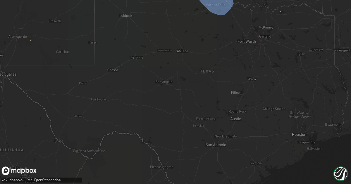
Hail Map in Texas on June 9, 2022
Get this storm
June 9 map
$229
one time, instant access
Download today. No call, no setup
Keep the $229
Bought the map and want the full workflow? Apply the entire $229 to a subscription within 7 days. None of it is wasted.
Every map, not just this one
This buys you this map. Subscription and you get every map we run, in the markets you choose from a few cities to whole states to nationwide. Plus real-time alerts the moment a storm fires.
Contact data
Name, contact info, occupancy, even credit band for addresses in the footprint. You go from where it hit to who to call.
Become the source they trust
Unlimited branding weather history reports on demand. You already have the documented answer ready for the property owner, and you are the one who showed up with it.
Property data and RoofTrace estimates
Pull up any address you have got, its value and the exact code rules for that jurisdiction, straight from One Click Code. Then RoofTrace estimates the squares, pitch, and roof value, priced the way you price.
Storm reports in Texas
Texas
| Date | Description |
|---|---|
| 06/09/20226:10 AM CDT | At 1109 PM CDT, severe thunderstorms were located along a line extending from Memphis to 11 miles north of Northfield to near Valley Schools, moving southeast at 40 mph. HAZARD...60 mph wind gusts and nickel size hail. SOURCE...Radar indicated. IMPACT...Expect damage to roofs, siding, and trees. Locations impacted include... Northfield, Swearingen, and Cee Vee. |
| 06/09/20223:57 AM CDT | At 857 PM CDT, severe thunderstorms were located along a line extending from 7 miles southeast of Perryton to 18 miles southwest of Wolf Creek Park to 12 miles northwest of Codman, moving east at 35 mph. HAZARD...60 mph wind gusts and quarter size hail. SOURCE...Radar indicated. IMPACT...Minor damage to roofs, siding, and trees is possible. Hail damage to vehicles is expected. Locations impacted include... Lipscomb, Canadian, Miami, Wolf Creek Park, New Mobeetie, Lora, Farnsworth, Glazier, Codman and Mobeetie. |
| 06/09/20223:41 AM CDT | At 840 PM CDT, severe thunderstorms were located along a line extending from 12 miles northeast of Skellytown to 4 miles east of Borger to 7 miles north of Panhandle, moving southeast at 35 mph. HAZARD...60 mph wind gusts and half dollar size hail. SOURCE...Radar indicated. IMPACT...Minor damage to roofs, siding, and trees is possible. Hail damage to vehicles is expected. Locations impacted include... Pampa, Borger, Panhandle, Fritch, White Deer, Groom, Lefors, Skellytown, Sanford, Lake Mcclellan and Kingsmill. |
| 06/09/20223:13 AM CDT | At 813 PM CDT, a severe thunderstorm was located over Stinnett, or 10 miles north of Borger, moving east at 35 mph. HAZARD...60 mph wind gusts and quarter size hail. SOURCE...Radar indicated. IMPACT...Minor damage to roofs, siding, and trees is possible. Hail damage to vehicles is expected. Locations impacted include... Borger, Fritch, Stinnett, Sanford and Lake Meredith. |
| 06/09/20222:41 AM CDT | At 740 PM CDT, severe thunderstorms were located along a line extending from 12 miles southwest of Hardesty to 4 miles southwest of Gruver to 10 miles west of Pringle, moving east at 20 mph. HAZARD...60 mph wind gusts and quarter size hail. SOURCE...Radar indicated. IMPACT...Minor damage to roofs, siding, and trees is possible. Hail damage to vehicles is expected. Locations impacted include... Spearman, Sunray, Gruver, Morse, Farnsworth, Waka and Pringle. |
| 06/09/20222:28 AM CDT | At 728 PM CDT, severe thunderstorms were located along a line extending from Dumas to 8 miles west of Four Way to 5 miles south of Channing, moving southeast at 20 mph. HAZARD...60 mph wind gusts and half dollar size hail. SOURCE...Radar indicated. IMPACT...Minor damage to roofs, siding, and trees is possible. Hail damage to vehicles is expected. Locations impacted include... Dumas, Channing, Boys Ranch, Masterson and Four Way. |
| 06/09/20222:12 AM CDT | At 711 PM CDT, severe thunderstorms were located along a line extending from 12 miles southeast of Stratford to 7 miles northwest of Cactus to 13 miles northeast of Hartley, moving east at 30 mph. HAZARD...60 mph wind gusts and quarter size hail. SOURCE...Radar indicated. IMPACT...Minor damage to roofs, siding, and trees is possible. Hail damage to vehicles is expected. Locations impacted include... Cactus, Sunray, Morse, Conlen and Pringle. |
| 06/09/20221:45 AM CDT | A local report indicates 72 MPH wind near 2 W CHILDRESS |
| 06/09/20221:35 AM CDT | A local report indicates 65 MPH wind near SHEPPARD AFB |
| 06/09/20221:34 AM CDT | A local report indicates 64 MPH wind near 3 NW LAKESIDE CITY |
| 06/09/20221:32 AM CDT | A local report indicates 73 MPH wind near 3 WSW WICHITA FALLS |
| 06/09/20221:27 AM CDT | At 627 PM CDT, a severe thunderstorm was located 6 miles southwest of Hartley, or 16 miles south of Dalhart, moving east at 25 mph. HAZARD...60 mph wind gusts and quarter size hail. SOURCE...Radar indicated. IMPACT...Minor damage to roofs, siding, and trees is possible. Hail damage to vehicles is expected. Locations impacted include... Dumas, Hartley and Channing. |
| 06/09/20221:26 AM CDT | A local report indicates 62 MPH wind near MANKINS |
| 06/09/20221:25 AM CDT | A local report indicates 60 MPH wind near 3 N WICHITA FALLS |
| 06/09/202212:55 AM CDT | A local report indicates 84 MPH wind near 4 N VERNON |
| 06/09/202212:51 AM CDT | West texas mesonet olton 6s. |
| 06/09/202212:50 AM CDT | West texas mesonet olton 6s. |
| 06/09/202212:30 AM CDT | A local report indicates 66 MPH wind near 4 ENE ODELL |
| 06/08/202211:39 PM CDT | West texas mesonet 2nne childress. |
| 06/08/202211:22 PM CDT | First gust was 2322 cdt with 66 mph. Peak gust of 67 mph was at 2327 cdt. Last gust of 58 mph was at 2329 cdt. |
| 06/08/202211:03 PM CDT | West texas mesonet memphis 1ne. |
| 06/08/202210:55 PM CDT | West texas mesonet 2wsw turkey. |
| 06/08/202210:45 PM CDT | West texas mesonet. |
| 06/08/202210:45 PM CDT | West texas mesonet |
| 06/08/202210:40 PM CDT | A local report indicates 60 MPH wind near 3 NNE UMBARGER |
| 06/08/202210:40 PM CDT | A local report indicates 60 MPH wind near 1 ENE MCLEAN |
| 06/08/202210:15 PM CDT | Both the 2215 and 2220 cdt 5 minute obs gusted to 51 kts. Asos station kbgd borger |
| 06/08/20229:45 PM CDT | Tool shed destroyed and large tree branches split. Report received via social media with photos. |
| 06/08/20229:14 PM CDT | West texas mesonet. Initial severe gust at 914 pm cdt with peak at 919 pm cdt. |
| 06/08/20228:44 PM CDT | West texas mesonet. |
| 06/08/20228:38 PM CDT | Asos station kbgd borger |
| 06/08/20228:20 PM CDT | Asos station kbgd borger |
| 06/08/20228:08 PM CDT | West texas mesonet. |
| 06/08/20227:44 PM CDT | A local report indicates 1.00 inch wind near CHANNING |
| 06/08/20227:37 PM CDT | West texas mesonet. Severe gusts lasted 4 minutes. |
| 06/08/20227:18 PM CDT | Multiple tree branches downed ranging from 1 to 3 inches in diameter. |
All States Impacted by Hail Map on June 9, 2022
Cities Impacted by Hail Map on June 9, 2022
- Williston, ND
- Epping, ND
- Arnegard, ND
- Killdeer, ND
- Watford City, ND
- Arcadia, NE
- Westerville, NE
- Ansley, NE
- Buffalo, SD
- Ludlow, SD
- Hoisington, KS
- North Platte, NE
- Groom, TX
- Sedgwick, KS
- Atwood, CO
- Sterling, CO
- Hershey, NE
- Sutherland, NE
- Norcatur, KS
- Jennings, KS
- Oberlin, KS
- Choctaw, OK
- Oklahoma City, OK
- Jones, OK
- Harrah, OK
- Miami, TX
- Mansfield, AR
- Huntington, AR
- Sunray, TX
- Gruver, TX
- Stinnett, TX
- Morse, TX
- Lindsborg, KS
- Marquette, KS
- Kissimmee, FL
- Wallace, KS
- Callaway, NE
- Luther, OK
- Kim, CO
- Moundridge, KS
- Mcpherson, KS
- Galva, KS
- Garden Plain, KS
- Winfield, KS
- Rock, KS
- Sterling, KS
- Wichita, KS
- Holyrood, KS
- Colwich, KS
- Goddard, KS
- Halstead, KS
- Andale, KS
- Little River, KS
- Geneseo, KS
- Hutchinson, KS
- Lyons, KS
- Haven, KS
- Derby, KS
- Bushton, KS
- Kanopolis, KS
- Burrton, KS
- Peck, KS
- Dorrance, KS
- Windom, KS
- Mcconnell Afb, KS
- Lorraine, KS
- Ellsworth, KS
- Chase, KS
- Wilson, KS
- Inman, KS
- Valley Center, KS
- Kechi, KS
- Clearwater, KS
- Mulvane, KS
- Hesston, KS
- Maize, KS
- Mount Hope, KS
- Viola, KS
- Haysville, KS
- Buhler, KS
- Newton, KS
- Ericson, NE
- Fort Pierce, FL
- Port Saint Lucie, FL
- Scotia, NE
- Raton, NM
- Prague, OK
- Stroud, OK
- Paden, OK
- Sparks, OK
- Arcadia, OK
- Meridian, OK
- Edmond, OK
- Guthrie, OK
- Des Moines, NM
- Geuda Springs, KS
- Arkansas City, KS
- Oxford, KS
- Vega, TX
- Hartley, TX
- Channing, TX
- Benton, KS
- Purdum, NE
- Brewster, NE
- Center, CO
- Jennings, OK
- Telephone, TX
- Russell, KS
- Damar, KS
- Walker, KS
- Bogue, KS
- Natoma, KS
- Palco, KS
- Catharine, KS
- Paradise, KS
- Victoria, KS
- Gorham, KS
- Stockton, KS
- Ellis, KS
- Plainville, KS
- Foss, OK
- Vona, CO
- Trinidad, CO
- Mosquero, NM
- Lebanon, NE
- Dumas, TX
- Pampa, TX
- Maxwell, NE
- Wellington, KS
- Okmulgee, OK
- Geary, OK
- Calumet, OK
- Hineston, LA
- Brookville, KS
- Wellington, TX
- Bethune, CO
- Stratton, CO
- Colony, OK
- Corn, OK
- Carnegie, OK
- Sayre, OK
- Willow, OK
- Morland, KS
- Hill City, KS
- Penokee, KS
- Greensburg, LA
- Norwood, LA
- Merna, NE
- Anselmo, NE
- Arnold, NE
- Stapleton, NE
- Conchas Dam, NM
- Trementina, NM
- Burwell, NE
- Shawnee, OK
- Meeker, OK
- Outlook, MT
- Raymond, MT
- Model, CO
- Bristow, OK
- Augusta, KS
- Seibert, CO
- Grenville, NM
- Navarre, FL
- Okemah, OK
- Castle, OK
- Sharon Springs, KS
- Maple Hill, KS
- Cameron, OK
- Eustis, NE
- Edison, NE
- Brady, NE
- Cambridge, NE
- Farnam, NE
- Moorefield, NE
- Arapahoe, NE
- Holbrook, NE
- Beaver City, NE
- Henryetta, OK
- Depew, OK
- Folkston, GA
- Gothenburg, NE
- Wolbach, NE
- Palmer, NE
- Hinton, OK
- Lookeba, OK
- Perkins, OK
- Grenora, ND
- Dagmar, MT
- Clayton, KS
- Presque Isle, MI
- Chandler, OK
- Wellston, OK
- El Reno, OK
- Belle Fourche, SD
- Vale, SD
- Nisland, SD
- Newell, SD
- Coffeyville, KS
- Mcloud, OK
- Dickens, NE
- Maywood, NE
- Curtis, NE
- Indianola, NE
- Wellfleet, NE
- McCook, NE
- Hayes Center, NE
- Solano, NM
- Wymore, NE
- Diller, NE
- Bremen, KS
- Wamego, KS
- Marysville, KS
- Oketo, KS
- Onaga, KS
- Western, NE
- Odell, NE
- Saint George, KS
- Burlingame, KS
- Allen, KS
- Topeka, KS
- Blue Springs, NE
- Westmoreland, KS
- Jansen, NE
- De Witt, NE
- Dorchester, NE
- Auburn, KS
- Hanover, KS
- Olsburg, KS
- Wilber, NE
- Alma, KS
- Burlington, KS
- Lebo, KS
- Belvue, KS
- Beatrice, NE
- Home, KS
- Frankfort, KS
- Paxico, KS
- Plymouth, NE
- Blue Rapids, KS
- Osage City, KS
- Reading, KS
- Swanton, NE
- Crete, NE
- Harveyville, KS
- Eskridge, KS
- Sumner, NE
- Oconto, NE
- Elm Creek, NE
- Eddyville, NE
- Broken Bow, NE
- Overton, NE
- Altus, OK
- Paducah, TX
- Defuniak Springs, FL
- Fort Walton Beach, FL
- Abita Springs, LA
- Lacombe, LA
- Mandeville, LA
- Lenora, KS
- Clarendon, TX
- Hedley, TX
- Childress, TX
- Quail, TX
- Shamrock, TX
- Savannah, GA
- Pooler, GA
- Raeford, NC
- Lakeview, TX
- Panhandle, TX
- Turkey, TX
- White Deer, TX
- Borger, TX
- Claude, TX
- Spencer, OK
- Ogallah, KS
- Covington, LA
- Freeport, FL
- Pensacola, FL
- Erick, OK
- Pawnee, OK
- Cleveland, OK
- Gotebo, OK
- Headrick, OK
- Loranger, LA
- Amite, LA
- Independence, LA
- Blair, OK
- Osyka, MS
- Kentwood, LA
- Weed, NM
- Pocola, OK
- Norton, KS
- Pritchett, CO
- Yukon, OK
- Poteau, OK
- Eglin Afb, FL
- Shalimar, FL
- Centreville, MS
- Liberty, MS
- Chipley, FL
- Mangum, OK
- Duke, OK
- Maysville, OK
- Lindsay, OK
- Westville, FL
- Caryville, FL
- Ponce De Leon, FL
- Bush, LA
- Lelia Lake, TX
- Memphis, TX
- Skellytown, TX
- Dodson, TX
- Paoli, OK
- Mountain View, OK
- Cordell, OK
- Lone Wolf, OK
- Granite, OK
- Parks, AR
- Spearman, TX
- Hardeeville, SC
- Stigler, OK
- Gulfport, MS
- Long Beach, MS
- Anadarko, OK
- Gracemont, OK
- Caddo Gap, AR
- Langley, AR
- Umpire, AR
- Bunker Hill, KS
- Butler, OK
- Muldrow, OK
- Bonifay, FL
- Sturgis, SD
- Nardin, OK
- Hominy, OK
- Kaw City, OK
- Cushing, OK
- South Haven, KS
- Maramec, OK
- Mannford, OK
- Medford, OK
- Ripley, OK
- Blackwell, OK
- Braman, OK
- Agra, OK
- Glencoe, OK
- Ponca City, OK
- Tonkawa, OK
- Newalla, OK
- Mulhall, OK
- Yale, OK
- Stillwater, OK
- Conway Springs, KS
- Milton, KS
- Davenport, OK
- Marland, OK
- Carney, OK
- Milan, KS
- Cheney, KS
- Coyle, OK
- Fairfax, OK
- Billings, OK
- Shidler, OK
- Belle Plaine, KS
- Caldwell, KS
- Newkirk, OK
- Morrison, OK
- Burbank, OK
- Orlando, OK
- Terlton, OK
- Ralston, OK
- Perry, OK
- Red Rock, OK
- Argonia, KS
- Tryon, OK
- Drumright, OK
- Mayfield, KS
- Bentley, KS
- McFarland, KS
- Jacksonville, FL
- Johnstown, NE
- Seneca, NE
- Thedford, NE
- Halsey, NE
- Masterson, TX
- Amarillo, TX
- Fritch, TX
- Hollis, OK
- Ryan, OK
- Byers, TX
- Davidson, OK
- Henrietta, TX
- Scotland, TX
- Hastings, OK
- Vernon, TX
- Frederick, OK
- Cache, OK
- Mclean, TX
- Tell, TX
- Wichita Falls, TX
- Tipton, OK
- Oklaunion, TX
- Quanah, TX
- Olustee, OK
- Vinson, OK
- Terral, OK
- Geronimo, OK
- Walters, OK
- Gould, OK
- Comanche, OK
- Odell, TX
- Altus Afb, OK
- Hollister, OK
- Nocona, TX
- Grandfield, OK
- Indiahoma, OK
- Devol, OK
- Ringgold, TX
- Chattanooga, OK
- Eldorado, OK
- Lawton, OK
- Temple, OK
- Holliday, TX
- Harrold, TX
- Bellevue, TX
- Randlett, OK
- Electra, TX
- Waurika, OK
- Loveland, OK
- Iowa Park, TX
- Elmer, OK
- Windthorst, TX
- Petrolia, TX
- Faxon, OK
- Burkburnett, TX
- Chillicothe, TX
- Sheppard Afb, TX
- Texola, OK
- Roosevelt, OK
- Sweetwater, OK
- Mountain Park, OK
- Wheeler, TX
- Carter, OK


