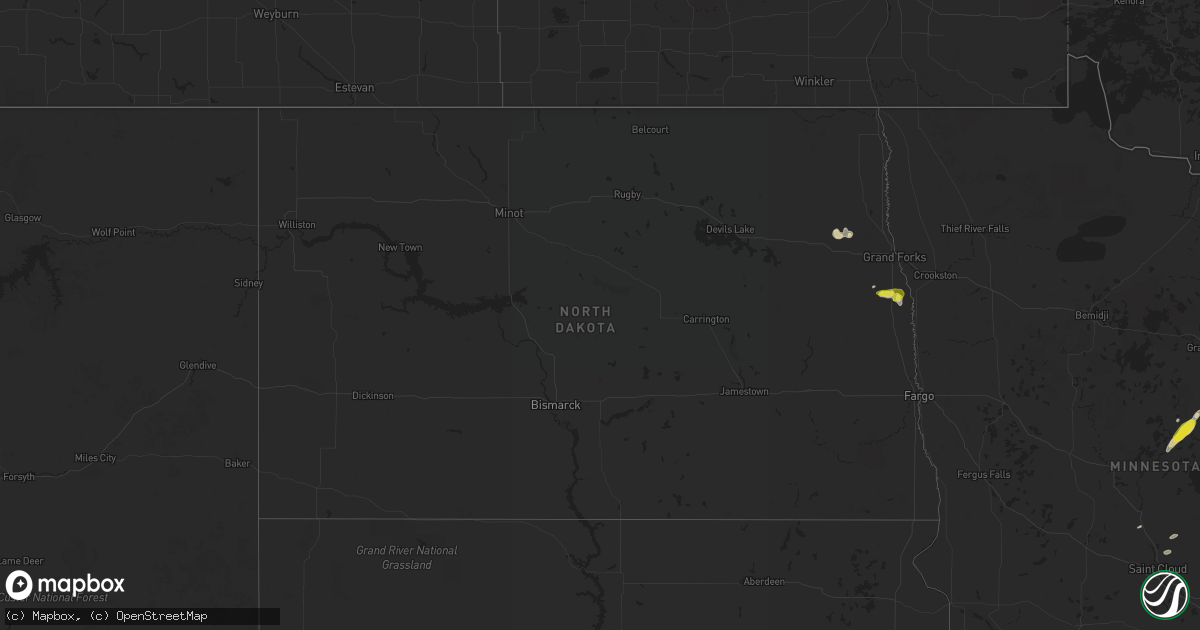
Hail Map in North Dakota on June 7, 2017
Get this storm
June 7 map
$229
one time, instant access
Download today. No call, no setup
Keep the $229
Bought the map and want the full workflow? Apply the entire $229 to a subscription within 7 days. None of it is wasted.
Every map, not just this one
This buys you this map. Subscription and you get every map we run, in the markets you choose from a few cities to whole states to nationwide. Plus real-time alerts the moment a storm fires.
Contact data
Name, contact info, occupancy, even credit band for addresses in the footprint. You go from where it hit to who to call.
Become the source they trust
Unlimited branding weather history reports on demand. You already have the documented answer ready for the property owner, and you are the one who showed up with it.
Property data and RoofTrace estimates
Pull up any address you have got, its value and the exact code rules for that jurisdiction, straight from One Click Code. Then RoofTrace estimates the squares, pitch, and roof value, priced the way you price.
Storm reports in North Dakota
North Dakota
| Date | Description |
|---|---|
| 06/07/20172:25 PM CDT | A few dime to quarter sized hail. |
| 06/07/20172:10 PM CDT | Numerous poplar trees were snapped in shelter belts and farm yards across eastern walshville and pulaski townships. |
| 06/07/20172:00 PM CDT | Numerous poplar trees broken down in shelter belts west of town. |
| 06/07/20172:00 PM CDT | Social media report. |
| 06/07/20171:50 PM CDT | Numerous poplar and ash trees broken down in shelter belts across southern levant township. |
| 06/07/20171:27 PM CDT | Brief touchdown noted near portland junction. |
| 06/07/20171:25 PM CDT | A local report indicates a tornado near 1 S HATTON |
| 06/07/20171:23 PM CDT | This tornado tracked to the northeast for about 2 miles to around 1 ssw of holmes by 130 pm cdt. No significant damage was detected. Peak winds estimated to 75 mph. Max |
| 06/07/20171:20 PM CDT | Brief touchdown noted and photo posted via social media. Location approximate based on radar and earlier funnel report cloud reports. |
| 06/07/20171:18 PM CDT | A deputy reported a touchdown around 2 miles south of the intersection of gf cr3 and cr6. The tornado appeared to tracked eastward for about a mile over a 2 to 3 minute |
| 06/07/20171:18 PM CDT | This tornado track east-northeast for nearly 4 miles to around 7 north of mayville by 128 pm cdt. This tornado produced a tall dust swirl but little to no apparent dama |
| 06/07/20171:17 PM CDT | A funnel cloud was reported by gfafb observers west-southwest of their location. A damage survey noted an apparent brief touchdown with broken braches in a shelter belt |
| 06/07/20171:15 PM CDT | A local report indicates a tornado near 1 N MAYVILLE |
| 06/07/20171:13 PM CDT | A tornado touched down and tracked for around 1.5 miles to about 3 miles north of mayville by 118 pm cdt. This tornado was viewed by local residents and the touchdown w |
| 06/07/20171:05 PM CDT | A local report indicates a tornado near 9 NW MAYVILLE |
| 06/07/20171:02 PM CDT | This tornado apparently touched down around 2 miles south of arvilla and tracked very slowly to the ene across cr2 for about a quarter of a mile... Ending by 104 pm cdt |
| 06/07/20171:00 PM CDT | This tornado was viewed by weather observers at gfafb and gfk airport until around 110 pm cdt. |
| 06/07/20171:00 PM CDT | Tornado tracked for 2.7 miles to around 1 mile north of hatton by 108 pm cdt. This tornado tracked within a mile of hatton but stayed mainly over opened fields. Fields |
| 06/07/20171:00 PM CDT | A local report indicates a tornado near 7 SW GRAND FORKS |
| 06/07/201712:59 PM CDT | This tornado was viewed by gfk atc for nearly 11 minutes until about 110 pm cdt and was initially estimated at 7 sw gfk. This tornado tracked nearly 3 miles from about |
| 06/07/201712:49 PM CDT | Reported by atc gfk...quickly dissipated. |
| 06/07/201712:49 PM CDT | This tornado was originally reported by gfk/atc and gfafb officials. A damage survey found that the tornado tracked to the east-northeast over largely open fields. It l |
All States Impacted by Hail Map on June 7, 2017
Cities Impacted by Hail Map on June 7, 2017
- Bayard, NE
- White Sulphur Springs, MT
- Moorcroft, WY
- Sidney, NE
- Hudson, CO
- Akron, CO
- Custer, SD
- Walsenburg, CO
- Crook, CO
- Lusk, WY
- Harrison, NE
- Lance Creek, WY
- Tribune, KS
- Bushnell, NE
- Kimball, NE
- Bridgeport, NE
- Snyder, CO
- Fort Morgan, CO
- Byers, CO
- Harrisburg, NE
- Potter, NE
- Dalton, NE
- Gurley, NE
- Gothenburg, NE
- Willow Island, NE
- Las Vegas, NM
- Serafina, NM
- Keenesburg, CO
- Capitan, NM
- Glencoe, NM
- Kim, CO
- Winona, KS
- Wallace, KS
- Leoti, KS
- Sterling, CO
- Grover, CO
- Riverton, WY
- Crosby, MN
- Palisade, MN
- Aitkin, MN
- Carrizozo, NM
- Nogal, NM
- Otis, CO
- Yuma, CO
- Hill City, SD
- Foley, MN
- Sauk Rapids, MN
- Wright, WY
- Peetz, CO
- Upton, WY
- Sundance, WY
- Big Springs, NE
- Chappell, NE
- Fulda, MN
- Reynolds, ND
- Hatton, ND
- Weldona, CO
- Cardwell, MT
- Harrison, MT
- Wetmore, CO
- Buxton, ND
- Belgrade, MT
- Atwood, CO
- Merino, CO
- Elida, NM
- Kersey, CO
- Magdalena, NM
- Tinnie, NM
- San Patricio, NM
- Ruidoso Downs, NM
- Aurora, CO
- Lander, WY
- Iliff, CO
- Torrington, WY
- Bennett, CO
- Ironton, MN
- Stoneham, CO
- Maxwell, NM
- Springer, NM
- Raton, NM
- Model, CO
- Woodland Park, CO
- Cummings, ND
- Vaughn, NM
- Wiggins, CO
- Cimarron, NM
- Jay Em, WY
- Sedgwick, CO
- Fleming, CO
- Red Lodge, MT
- Gillette, WY
- Inkster, ND
- Alamogordo, NM
- Pueblo, CO
- Beulah, CO
- Animas, NM
- Denver, CO
- Estes Park, CO
- Van Tassell, WY
- Lead, SD
- Morgan, MN
- Watkins, CO
- Cope, CO
- Belen, NM
- Veguita, NM
- Shevlin, MN
- Ribera, NM
- Fort Lupton, CO
- Avoca, MN
- Emily, MN
- Vermillion, SD
- Anton Chico, NM
- Platteville, CO
- Gilby, ND
- Ocate, NM
- Glenrock, WY
- Strasburg, CO
- Royalton, MN
- Little Falls, MN
- Westcliffe, CO
- Bagley, MN
- Broadwater, NE
- Lodgepole, NE
- Bosler, WY
- Ruidoso, NM
- Forest River, ND
- Larimore, ND
- Gardner, CO
- Hondo, NM
- Edgemont, SD
- Melrose, NM
- Alto, NM
- Arriba, CO
- Wray, CO
- Holyoke, CO
- Lewellen, NE
- Sedalia, CO
- Burbank, SD
- Beresford, SD
- Mescalero, NM
- Woodrow, CO
- Cascade, CO
- Crawford, NE
- Encino, NM
- Douglas, WY
- Ririe, ID
- Roggen, CO
- Floyd, NM
- Fort Sumner, NM
- Rice, MN
- Keystone, SD
- Penrose, CO
- La Veta, CO
- Deadwood, SD


