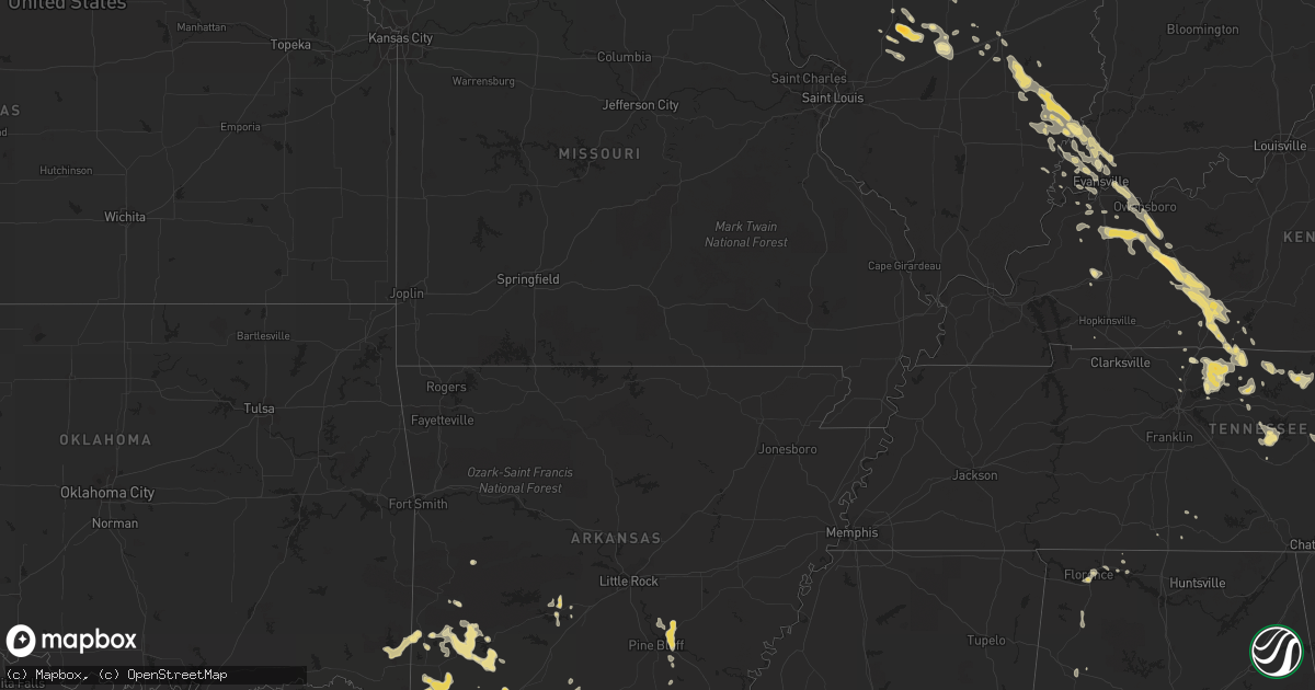
Hail Map in South Carolina on June 5, 2011
Get this storm
June 5 map
$229
one time, instant access
Download today. No call, no setup
Keep the $229
Bought the map and want the full workflow? Apply the entire $229 to a subscription within 7 days. None of it is wasted.
Every map, not just this one
This buys you this map. Subscription and you get every map we run, in the markets you choose from a few cities to whole states to nationwide. Plus real-time alerts the moment a storm fires.
Contact data
Name, contact info, occupancy, even credit band for addresses in the footprint. You go from where it hit to who to call.
Become the source they trust
Unlimited branding weather history reports on demand. You already have the documented answer ready for the property owner, and you are the one who showed up with it.
Property data and RoofTrace estimates
Pull up any address you have got, its value and the exact code rules for that jurisdiction, straight from One Click Code. Then RoofTrace estimates the squares, pitch, and roof value, priced the way you price.
Storm reports in South Carolina
South Carolina
| Date | Description |
|---|---|
| 06/05/20116:47 PM CDT | Dime to quarter size hail |
| 06/05/20116:43 PM CDT | Flattened corn |
| 06/05/20116:37 PM CDT | Sheriff dispatch reported trees down in the bush river road area. |
| 06/05/20116:35 PM CDT | Highway patrol reports a tree down on bush river road. |
| 06/05/20116:32 PM CDT | Tree blocking the roadway at pea creek road and us-76. |
| 06/05/20116:28 PM CDT | Tree blocking the roadway at allison circle and sc-274. |
| 06/05/20116:24 PM CDT | Tree blocking the roadway at sc-324 and boxwood court. |
| 06/05/20116:20 PM CDT | Tree blocking the roadway at the intersection of magnum branch road and sc-234. |
| 06/05/20116:15 PM CDT | Tree blocking the roadway at jefferson davis road and sc-56. |
| 06/05/20116:11 PM CDT | Tree blocking the roadway at sc-49 and clegg farm road. |
| 06/05/20116:09 PM CDT | Tree blocking the roadway at sutton spring road and kelly road. |
| 06/05/20116:03 PM CDT | Tree blocking the roadway at sc-49 and sc-274. |
| 06/05/20116:00 PM CDT | Tree blocking the roadway at stateline road and sc-274. |
| 06/05/20116:00 PM CDT | On dillon drive. |
| 06/05/20115:58 PM CDT | Tree blocking the roadway at the 1200 block of torrington road. |
| 06/05/20115:56 PM CDT | Tree blocking the roadway at a b jacks road and mill creek road. |
| 06/05/20115:40 PM CDT | Tree blocking the roadway at old seneca road in the clemson forest area. |
| 06/05/20115:30 PM CDT | Two instances of hail at this location. The first was nickel sized at 615 pm and the second was quarter sized at 630 pm. |
| 06/05/20115:30 PM CDT | Tree blocking the roadway at abner creek road and snow road. |
| 06/05/20115:27 PM CDT | Tree blocking the roadway at sc-92 and postell hughes road. |
| 06/05/20115:25 PM CDT | In the 300 block of falcons nest road. |
| 06/05/20115:20 PM CDT | Large branches down on woodruff road...just south of hw-14. |
| 06/05/20115:18 PM CDT | Two large trees blocking the roadway on lawson road in the monarch mills area of union county. |
| 06/05/20115:16 PM CDT | Tree blocking the roadway at durbin church road and gentry road. |
| 06/05/20115:10 PM CDT | Large trees down and blocking the roadway. |
| 06/05/20115:08 PM CDT | Tree blocking the roadway at brown drive and five forks road. |
| 06/05/20115:04 PM CDT | Tree blocking the roadway at e north street and mitchell road. |
| 06/05/20115:00 PM CDT | Update to the previous ping pong ball sized report. Occurred on edwards road in taylors. |
| 06/05/20114:56 PM CDT | A local report indicates 1.50 inch wind near TAYLORS |
| 06/05/20114:42 PM CDT | Trees down and snapped off in several locations in croft state park. |
| 06/05/20114:30 PM CDT | Tree knocked down power lines. Many large branches down. |
| 06/05/20114:15 PM CDT | Spartanburg county reports one tree down at the intersection of oakview drive and pineneedle drive. |
| 06/05/20114:05 PM CDT | Tree down across the roadway near mile marker 102 on i-85. |
| 06/05/20114:00 PM CDT | Trees and power lines down near hwy 9 and rainbow lake rd. |
| 06/05/20113:56 PM CDT | Trees down and metal roof off picnic shelter |
| 06/05/20113:48 PM CDT | Tree down across the roadway at 590 antioch road. |
| 06/05/20113:45 PM CDT | Tree blocking the roadway at ghost valley road and rainbow lake road. |
| 06/05/20118:31 AM CDT | Highway patrol reported a tree down along highway 12 at the congaree river bridge. |
| 06/05/20118:27 AM CDT | Highway patrol reported a tree down a glenn avenue and ryan street. |
| 06/05/20117:53 AM CDT | Sheriff dispatch reported trees down at the intersection of rosewood drive and assembly street. |
| 06/05/20117:51 AM CDT | Reported through wfo charleston. A pilot reported part of a room torn off at a building along huger street. |
| 06/04/20118:36 PM CDT | Tree in roadway. I-126 at greystone blvd. |
| 06/04/20118:20 PM CDT | Trees in roadway. Caulks ferry rd. And water tank rd. |
| 06/04/20118:17 PM CDT | Powerlines down in roadway. Pond branch rd and caulks ferry rd area. |
| 06/04/20118:11 PM CDT | Highway patrol reported a tree down at cedar creek road adn blume road. |
| 06/04/20118:10 PM CDT | Highway patrol reported tree in the roadway at cedar creek road and monticello road. |
| 06/04/20117:53 PM CDT | Sheriff dispatch reported a tree down on a house at florida st. |
| 06/04/20117:45 PM CDT | Trees and limbs down hwy 28 near hwy 20 nw of abbeville. |
| 06/04/20117:45 PM CDT | A local report indicates 1.75 inch wind near JOANNA |
| 06/04/20117:41 PM CDT | Highway patrol reported a tree down at i-126 and greystone boulevard. |
| 06/04/20117:36 PM CDT | Sheriff dispatch reported a tree down at marley drive. |
| 06/04/20117:35 PM CDT | Two trees down near hwy 76 and secondary 46 and torrington road on edge of clinton city limits. Few other limbs down. |
| 06/04/20117:20 PM CDT | Trees down on carolina circle. |
| 06/04/20117:20 PM CDT | Public reported shingles blown from roof of house along brewington road. Wind estimated around 60 mph. |
| 06/04/20117:20 PM CDT | Trees down on stephenson road. |
All States Impacted by Hail Map on June 5, 2011
Cities Impacted by Hail Map on June 5, 2011
- Ramsey, IL
- Northport, AL
- Berry, AL
- Marion, LA
- Dawson Springs, KY
- Madisonville, KY
- Summerdale, AL
- Robertsdale, AL
- Loxley, AL
- Silverhill, AL
- Georgetown, SC
- Pawleys Island, SC
- Hughes Springs, TX
- Avinger, TX
- Lone Star, TX
- Foreman, AR
- Slaughters, KY
- Calhoun, KY
- Rumsey, KY
- Sebree, KY
- Tyler, TX
- Mineola, TX
- Lindale, TX
- Long Branch, TX
- Garrison, TX
- Parkersburg, IL
- Olney, IL
- West Salem, IL
- Winnabow, NC
- Malakoff, TX
- Athens, TX
- Tomah, WI
- Camp Douglas, WI
- Warrens, WI
- Wilton, WI
- Norwalk, WI
- Sparta, WI
- East Bernard, TX
- Eagle Lake, TX
- Moss Point, MS
- Lucedale, MS
- Mount Sterling, IL
- Rosebud, TX
- Lott, TX
- Hartford, KY
- Owensboro, KY
- Utica, KY
- Ruston, LA
- Dubach, LA
- Lipan, TX
- Fairhope, AL
- Ashdown, AR
- Lockesburg, AR
- Wilton, AR
- Horatio, AR
- Mayslick, KY
- Flemingsburg, KY
- Noble, IL
- Clay City, IL
- Louisville, IL
- Ingraham, IL
- Mount Carmel, IL
- Browns, IL
- Bellmont, IL
- Monterey, TN
- Hooks, TX
- New Boston, TX
- Elroy, WI
- New Lisbon, WI
- Kendall, WI
- Mauston, WI
- Mindoro, WI
- Bangor, WI
- Gilmer, TX
- Cooper, TX
- Eustace, TX
- Canton, TX
- Mabank, TX
- Reform, AL
- Gordo, AL
- Riddleton, TN
- Lebanon, TN
- Carthage, TN
- Pleasant Shade, TN
- Fillmore, IL
- Bingham, IL
- Chappells, SC
- Thorndale, TX
- Pickton, TX
- Cottontown, TN
- Portland, TN
- Cross Plains, TN
- Fayetteville, TN
- Tatum, TX
- Havana, FL
- Pittsburg, TX
- Hillsboro, IL
- Butler, IL
- Garland City, AR
- Sparkman, AR
- Camden, AR
- Roxton, TX
- Uriah, AL
- Atmore, AL
- Lexington, TX
- Abbeville, SC
- Texarkana, TX
- Fouke, AR
- Rochester, MN
- Marshall, NC
- Malvern, AR
- Hot Springs National Park, AR
- Kirby, AR
- Owensville, IN
- Ben Wheeler, TX
- Eagletown, OK
- Richburg, SC
- Belmont, NC
- Cramerton, NC
- Whitleyville, TN
- Red Boiling Springs, TN
- Murfreesboro, AR
- Nashville, AR
- Lincoln, TX
- De Kalb, TX
- Tucumcari, NM
- Conchas Dam, NM
- Beaver Dam, KY
- Rayne, LA
- Camden, MS
- Dierks, AR
- Newhope, AR
- Haworth, OK
- Wellman, IA
- Smithville, TN
- Langley, AR
- Caddo Gap, AR
- Delight, AR
- Umpire, AR
- Glenwood, AR
- Decatur, TN
- Calhoun, TN
- Athens, TN
- Waverly, KY
- Brownsboro, TX
- Houston, TX
- McHenry, KY
- Rockfield, KY
- Bowling Green, KY
- Alvaton, KY
- Centertown, KY
- Scottsville, KY
- Woodburn, KY
- Westmoreland, TN
- Franklin, KY
- Adolphus, KY
- Lafayette, TN
- Morgantown, KY
- Rochester, KY
- Rockport, KY
- Ozan, AR
- Tylertown, MS
- Brookston, TX
- Paris, TX
- Plano, TX
- Carrollton, TX
- The Colony, TX
- Giddings, TX
- Gray Court, SC
- Laurens, SC
- Farmerville, LA
- Spearsville, LA
- Rogers, TX
- Rogersville, AL
- Mount Sterling, OH
- Grambling, LA
- Spring, TX
- Waseca, MN
- Chatham, LA
- Peebles, OH
- Latham, OH
- Killen, AL
- Cazenovia, WI
- Hillsboro, WI
- La Valle, WI
- North English, IA
- South English, IA
- Mount Vernon, IN
- Hope, AR
- Rosston, AR
- Stamps, AR
- Buckner, AR
- Wickes, AR
- Murchison, TX
- Timewell, IL
- Camden, IL
- Huntsville, IL
- Catawba, NC
- Winthrop, AR
- Denver, NC
- Greer, SC
- Greenville, SC
- Taylors, SC
- Kinards, SC
- Joanna, SC
- Jonesville, SC
- Union, SC
- Mount Vernon, TX
- Clinton, SC
- Newberry, SC
- Galesville, WI
- Holmen, WI
- Trempealeau, WI
- Livermore, KY
- Star City, AR
- Marietta, SC
- Pickens, SC
- Vancleave, MS
- Weatherford, TX
- Monticello, FL
- Newburgh, IN
- Reed, KY
- Chillicothe, IL
- Hico, TX
- Hamilton, TX
- Arrowsmith, IL
- Bellflower, IL
- Gainesboro, TN
- Fulshear, TX
- Richmond, TX
- Fisher, IL
- Gallatin, TN
- Bethpage, TN
- Coffeen, IL
- Litchfield, IL
- Taylor Springs, IL
- Columbia, SC
- Grover, NC
- Blacksburg, SC
- Sherrills Ford, NC
- Maiden, NC
- Alexis, NC
- Mount Holly, NC
- Stanley, NC
- Iron Station, NC
- Melrose, WI
- Gastonia, NC
- McAdenville, NC
- New Holland, OH
- Caldwell, TX
- Linden, TX
- Atlanta, TX
- Moody, TX
- Troy, TX
- Madisonville, TX
- Edelstein, IL
- Princeville, IL
- Altheimer, AR
- Wabbaseka, AR
- Grady, AR
- Pine Bluff, AR
- Simsboro, LA
- Charleston, TN
- Cleveland, TN
- Simms, TX
- Spring City, TN
- Evensville, TN
- Dayton, TN
- Edna, TX
- Gatesville, TX
- Oglesby, TX
- Douglassville, TX
- Wykoff, MN
- Chatfield, MN
- Evansville, IN
- Wadesville, IN
- Emmet, AR
- Arcadia, WI
- Bryan, TX
- Oak Island, NC
- Southport, NC
- Rutherfordton, NC
- Lake Lure, NC
- Nacogdoches, TX
- Reedsburg, WI
- Chillicothe, OH
- South Salem, OH
- Fort Branch, IN
- Vandalia, IL
- Saluda, SC
- Silverstreet, SC
- Saltillo, TX
- Wallis, TX
- Laurel Hill, FL
- Hollandale, MS
- Mangham, LA
- Rayville, LA
- Como, TX
- Fountain City, WI
- Winona, MN
- Hawkins, TX
- Wills Point, TX
- Dixon Springs, TN
- Loganville, WI
- Prairie Du Sac, WI
- Merrimac, WI
- Rock Springs, WI
- Baraboo, WI
- North Freedom, WI
- Leland, NC
- Quitman, TX
- Marietta, TX
- Naples, TX
- Blevins, AR
- Prescott, AR
- Ganado, TX
- Bolivia, NC
- Robards, KY
- Henderson, KY
- Hartsville, TN
- Sherrill, AR
- Muscle Shoals, AL
- Sheffield, AL
- Mantorville, MN
- Pine Island, MN
- West Concord, MN
- Dodge Center, MN
- Claremont, MN
- Fountain, MN
- Franklin, TX
- Mulberry Grove, IL
- Brocton, IL
- Leland, MS
- Greenville, MS
- Waldron, AR
- Meridian, TX
- Iredell, TX
- Baker, FL
- Sorento, IL
- Magnolia, TX
- Abbeville, LA
- Bone Gap, IL
- Hillpoint, WI
- Lodi, WI
- Poynette, WI
- Wonewoc, WI
- Point, TX
- Kasson, MN
- Byron, MN
- Hayfield, MN
- Fayetteville, TX
- Stockton, AL
- Racine, MN
- Dexter, MN
- Grand Meadow, MN
- Sargeant, MN
- Shreveport, LA
- Alexis, IL
- Belton, SC
- Roanoke, VA
- Troutville, VA
- Janesville, MN
- Salem, SC
- Albion, IL
- Ellery, IL
- Castalian Springs, TN
- Foley, AL
- Lexington, SC
- Tamassee, SC
- Clemson, SC
- Seneca, SC
- Walhalla, SC
- Central, SC
- West Union, SC
- Pendleton, SC
- Waltham, MN
- Blooming Prairie, MN
- Crawfordsville, IA
- Anderson, SC
- Honea Path, SC
- Jay, FL
- Ore City, TX
- Daingerfield, TX
- Mount Pleasant, TX
- Amity, AR
- Hot Springs Village, AR
- Little River, AL
- Temple, TX
- Fort Bliss, TX
- Mount Juliet, TN
- Normangee, TX
- Marquez, TX
- Altamont, IL
- Carrollton, AL
- Porter, TX
- Kaplan, LA
- Hilham, TN
- Cookeville, TN
- Whitesville, KY
- Richland, IN
- Rockport, IN
- Burnsville, NC
- Dadeville, AL
- Morristown, MN
- Spruce Pine, AL
- Phil Campbell, AL
- Russellville, AL
- McGregor, TX
- Hustler, WI
- Clarksburg, OH
- Washington Court House, OH
- Paige, TX
- Dodge, WI
- Medford, MN
- Faribault, MN
- Victoria, IL
- Williamsfield, IL
- Ainsworth, IA
- West Chester, IA
- Washington, IA
- Wayland, IA
- Winfield, IA
- Mount Pleasant, IA
- Olds, IA
- Keota, IA
- Mena, AR
- Bainbridge, OH
- Piketon, OH
- Rarden, OH
- Lexington, AL
- Anderson, AL
- Winnsboro, TX
- Omaha, TX
- Simpsonville, SC
- Fountain Inn, SC
- Crossville, TN
- Duson, LA
- Winfield, TX
- Trementina, NM
- Dieterich, IL
- Sailor Springs, IL
- Beasley, TX
- Rosenberg, TX
- Humble, TX
- Crosby, TX
- Barksdale Afb, LA
- Sulphur Springs, TX
- Cynthiana, IN
- Elberfeld, IN
- Princeton, IN
- Haubstadt, IN
- Bay City, TX
- Quitman, LA
- Broken Bow, OK
- Owatonna, MN
- Lafitte, LA
- Smithville, OK
- Louise, TX
- Hamburg, AR
- Florence, AL
- Pikeville, TN
- Grandview, TN
- Georgetown, TN
- Riceville, TN
- Rickman, TN
- Sparta, TN
- Pleasant Hill, TN
- Stony Point, NC
- Statesville, NC
- De Queen, AR
- Ogden, AR
- Maud, TX
- Texarkana, AR
- Wisconsin Dells, WI
- Lyndon Station, WI
- Oxford, WI
- Effingham, IL
- Jefferson, SC
- Jefferson, TX
- Cromwell, KY
- Island, KY
- Roundhill, KY
- Sacramento, KY
- Port Sulphur, LA
- New Harmony, IN
- Eureka, IL
- Secor, IL
- Hockley, TX
- Monticello, AR
- Ellijay, GA
- Nokomis, IL
- Mount Enterprise, TX
- Saratoga, TX
- McBee, SC
- McGrady, NC
- De Kalb, MS
- Waller, TX
- Calhoun, IL
- Tuscumbia, AL
- Unicoi, TN
- Erwin, TN
- Hokah, MN
- Blakely, GA
- Columbia, AL
- Bienville, LA
- Brownstown, IL
- Orient, OH
- Stewartville, MN
- Spring Valley, MN
- Marysville, OH
- Goodlettsville, TN
- Patoka, IN
- Mcminnville, TN
- Spartanburg, SC
- Pauline, SC
- Grannis, AR
- Ladora, IA
- Williamsburg, IA
- Frankfort, OH
- Gilbert, SC
- Pelion, SC
- Yorktown, AR
- Knoxville, IL
- Oneida, IL
- Scooba, MS
- Griffin, IN
- Poseyville, IN
- Inez, TX
- Covington, VA
- Orangeburg, SC
- Orlinda, TN
- Luling, TX
- Dalton, GA
- Rison, AR
- Hull, TX
- Laurel Springs, NC
- Hays, NC
- Corydon, KY
- Congerville, IL
- Pulaski, TN
- Frisco City, AL
- Columbus Junction, IA
- Petersburg, TN
- Gordonsville, TN
- Brush Creek, TN
- Watertown, TN
- Bearden, AR
- Chidester, AR
- Buffalo, SC
- Cut Off, LA
- Jamestown, SC
- McClellanville, SC
- Camp Hill, AL
- Bogata, TX
- Walshville, IL
- Briggsville, WI
- Endeavor, WI
- Pittsville, WI
- Greenwell Springs, LA
- Dixon, KY
- Morganfield, KY
- Daphne, AL
- Lewisville, AR
- Fayette, AL
- Rocky Face, GA
- Brilliant, AL
- Winfield, AL
- Holland, KY
- Rushford, MN
- Chandler, IN
- Winona, TX
- Beecher City, IL
- Whitehouse, TX
- Troup, TX
- Gatlinburg, TN
- Donalds, SC
- Due West, SC
- Williamston, SC
- Austin, MN
- Herndon, KY
- Winnsboro, SC
- Newton, IL
- Watson, OK
- Millsap, TX
- Wilmer, AL
- Theriot, LA
- Mount Hermon, LA
- Kings Mountain, NC
- Mobile, AL
- Gillham, AR
- Fairfield, IL
- Golden Gate, IL
- Mason, IL
- Columbia, LA
- Oronoco, MN
- Brownsdale, MN
- Lansing, MN
- Vanceburg, KY
- Manchester, OH
- Stout, OH
- Cloudcroft, NM
- Sacramento, NM
- Jonesborough, TN
- Johnson City, TN
- Mount Union, IA
- Clayton, IL
- Cashton, WI
- Ontario, WI
- Metamora, IL
- Roanoke, IL
- Mill Spring, NC
- Grayson, LA
- Irving, IL
- Rushville, IL
- Hempstead, TX
- Waterville, MN
- Granger, TX
- Bartlett, TX
- Claremont, NC
- Carmi, IL
- Taylorville, IL
- Owaneco, IL
- Jasper, GA
- Talking Rock, GA
- Dowelltown, TN
- Victor, IA
- Lonsdale, AR
- Fort Lawn, SC
- Gonzales, TX
- Necedah, WI
- El Campo, TX
- Springfield, TN
- Bernice, LA
- Toulon, IL
- Woodbury, TN
- Liberty, TN
- Elgin, MN
- Lincolnton, NC
- Tallahassee, FL
- North Henderson, IL
- Denham Springs, LA
- Myrtle Beach, SC
- Ettrick, WI
- Maysville, KY
- Ewing, KY
- Kingsport, TN
- Kentwood, LA
- Wister, OK
- Hudson, IL
- Carlock, IL
- Coal Township, PA
- Mount Carmel, PA
- Marion Heights, PA
- Shamokin, PA
- Kulpmont, PA
- Petty, TX
- Inman, SC
- Chesnee, SC
- Easley, SC
- Mahomet, IL
- Danville, IA
- Burlington, IA
- West Burlington, IA
- Witt, IL
- Clover, SC
- Charlotte, NC
- Lowell, NC
- Locust Gap, PA
- Ashland, PA
- Elysburg, PA
- Baylis, IL
- Versailles, IL
- Chambersburg, IL
- Griggsville, IL
- Dunlap, IL
- Peoria, IL
- White House, TN
- Russellville, KY
- Auburn, KY
- Dike, TX
- Colfax, IL
- Liberty, TX
- Grand Bay, AL
- Larue, TX
- Maurice, LA
- Pana, IL
- Las Cruces, NM
- Mesilla Park, NM
- Peterson, MN
- York, SC
- Crouse, NC
- Bessemer City, NC
- West Point, MS
- Lanesboro, MN
- Nebo, KY
- Earlington, KY
- Wilmington, NC
- Industry, IL
- Plymouth, IL
- Littleton, IL
- Livingston, TN
- Gillespie, IL
- Andrews, SC
- Wataga, IL
- Rio, IL
- Henderson, IL
- Galesburg, IL
- Ten Mile, TN
- La Grange, TX
- Pittsfield, IL
- Grayville, IL
- Columbus, NC
- Downsville, LA
- Tucker, AR
- Jonesboro, LA
- Guin, AL
- Eddy, TX
- Saint Elmo, IL
- Clifton, TX
- Cranfills Gap, TX
- Dime Box, TX
- Raymond, IL
- Harvel, IL
- Tower Hill, IL
- Newton, NC
- New Douglas, IL
- Greenville, IL
- Bayard, NM
- Gueydan, LA
- Choudrant, LA
- Walker, LA
- Kilkenny, MN
- Edgewood, TX
- Lime Ridge, WI
- Mansfield, IL


