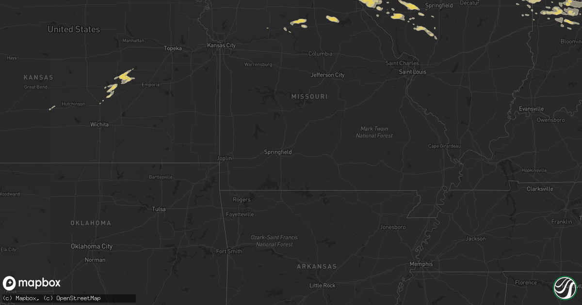
Hail Map on June 4, 2011
Get this storm
June 4 map
$229
one time, instant access
Download today. No call, no setup
Keep the $229
Bought the map and want the full workflow? Apply the entire $229 to a subscription within 7 days. None of it is wasted.
Every map, not just this one
This buys you this map. Subscription and you get every map we run, in the markets you choose from a few cities to whole states to nationwide. Plus real-time alerts the moment a storm fires.
Contact data
Name, contact info, occupancy, even credit band for addresses in the footprint. You go from where it hit to who to call.
Become the source they trust
Unlimited branding weather history reports on demand. You already have the documented answer ready for the property owner, and you are the one who showed up with it.
Property data and RoofTrace estimates
Pull up any address you have got, its value and the exact code rules for that jurisdiction, straight from One Click Code. Then RoofTrace estimates the squares, pitch, and roof value, priced the way you price.
States Impacted by Hail Map on June 4, 2011
Storm reports
West Virginia
| Date | Description |
|---|---|
| 06/04/20111:22 AM CDT | Tree blown down onto power lines. |
| 06/04/20111:17 AM CDT | One tree blown down along davis stuart road. |
| 06/04/20111:15 AM CDT | 2 to 3 mintues of hail |
| 06/04/20111:15 AM CDT | Part of tree blown down at carnegie hall |
| 06/04/20111:14 AM CDT | One tree blown down near greenbrier valley medical center. |
| 06/04/20111:06 AM CDT | Tree down on a vehicle on judyville road |
Missouri
| Date | Description |
|---|---|
| 06/04/20115:05 PM CDT | A local report indicates 60 MPH wind near 5 N GRANGER |
Ohio
| Date | Description |
|---|---|
| 06/04/20116:55 PM CDT | Trees down and transformer fire |
| 06/04/20116:52 PM CDT | Tree donw lynwood/broad streets blocking broad st. Dime size hail reported. |
| 06/04/20116:49 PM CDT | Event occurred between 734 pm 06 04 2011 and 749 pm 06 04 2011 |
| 06/04/20116:40 PM CDT | A local report indicates 1.00 inch wind near COSHOCTON |
| 06/04/20116:33 PM CDT | A local report indicates 1.00 inch wind near NEW PHILADELPHIA |
| 06/04/20116:33 PM CDT | 16 inch trees limbs down avery/davidson roads near hilliard |
| 06/04/20116:30 PM CDT | Large branches down at pearl and kossuth. Time estimated from radar. |
| 06/04/20116:30 PM CDT | Trees reported down in the city and along sr 416 just outside of the city |
| 06/04/20116:30 PM CDT | A local report indicates 1.00 inch wind near DOVER |
| 06/04/20116:23 PM CDT | Large tree uprooted. Time estimated from radar. |
| 06/04/20116:15 PM CDT | Quarter size to golf ball size hail. |
| 06/04/20116:10 PM CDT | A local report indicates 1.00 inch wind near DOVER |
| 06/04/20116:07 PM CDT | A local report indicates 1.00 inch wind near BOLIVAR |
| 06/04/20116:00 PM CDT | Tree down |
| 06/04/20116:00 PM CDT | Barn roof blown off. Lrg tree down. 2x4 driven into siding of house. Dime size hail |
| 06/04/20115:55 PM CDT | Trees reported down |
| 06/04/20115:54 PM CDT | A local report indicates 1.00 inch wind near BOLIVAR |
| 06/04/20115:45 PM CDT | Trees and powerlines down |
| 06/04/20115:45 PM CDT | A local report indicates 1.75 inch wind near 3 S CANTON |
| 06/04/20115:45 PM CDT | Greater than one inch hail reported at intersection of cool rd and sandusky rd |
| 06/04/20115:44 PM CDT | A local report indicates 65 MPH wind near RADNOR |
| 06/04/20115:36 PM CDT | A local report indicates 1.75 inch wind near PERRY HEIGHTS |
| 06/04/20115:36 PM CDT | A local report indicates 1.75 inch wind near 2 SE PERRY HEIGHTS |
| 06/04/20115:31 PM CDT | A local report indicates 1.75 inch wind near 1 S MASSILLON |
| 06/04/20115:23 PM CDT | 60 mph wind gust |
| 06/04/20115:15 PM CDT | Several trees and power lines down on cars. |
| 06/04/20115:11 PM CDT | Few small limbs down |
| 06/04/20115:05 PM CDT | A local report indicates 1.00 inch wind near MCGUFFEY |
| 06/04/20115:05 PM CDT | Nickel to quarter size hail. |
| 06/04/20115:02 PM CDT | A local report indicates 1.00 inch wind near KENTON |
| 06/04/20114:55 PM CDT | A local report indicates 1.00 inch wind near ALGER |
| 06/04/20114:45 PM CDT | Trees and power lines down east of the city |
| 06/04/20112:10 AM CDT | Nickel to quarter size hail. |
| 06/04/20111:30 AM CDT | A few limbs down. |
| 06/03/20119:30 PM CDT | Few trees and power lines down in zanesville and around county. |
| 06/03/20119:05 PM CDT | Hail ranging in size from 1/2 inch to 2 inches at central center. |
| 06/03/20118:50 PM CDT | A local report indicates 1.00 inch wind near WOODSFIELD |
| 06/03/20118:45 PM CDT | Trees down in ems backyard and other locations around woodsfield |
| 06/03/20118:45 PM CDT | Trees down. |
| 06/03/20118:34 PM CDT | A local report indicates 1.00 inch wind near HUBER HEIGHTS |
| 06/03/20118:31 PM CDT | Large 32-inch diameter healthy tree down near intersection of woodman dr and airway rd. |
| 06/03/20118:30 PM CDT | Trees down |
| 06/03/20118:26 PM CDT | A local report indicates 1.75 inch wind near 3 SSW CIRCLEVILLE |
| 06/03/20118:21 PM CDT | Shed blown over along with several branches down at residence on tarlton rd. Time estimated from radar...damage occurred with evening storms. |
| 06/03/20118:15 PM CDT | Large tree down blocking state route 379 |
| 06/03/20117:23 PM CDT | Trees down. Parts of roofs blown off of houses. |
| 06/03/20117:20 PM CDT | Several tree limbs down. |
| 06/03/20117:20 PM CDT | Trees down. |
| 06/03/20117:17 PM CDT | Large tree down. Time estimated from radar. |
| 06/03/20117:03 PM CDT | Trees down |
Louisiana
| Date | Description |
|---|---|
| 06/04/20116:38 PM CDT | Public reported wind damage along i-49 between sunset and opelousas. Several trees and highway signs were blown down. |
| 06/04/20116:16 PM CDT | Trees down in the new roads area. |
| 06/04/20116:16 PM CDT | Several trees down blocking roads in zachary. Also trees down on at least three houses. |
| 06/04/20116:16 PM CDT | Trees down in the ventress area se of new roads. |
| 06/04/20116:11 PM CDT | A few reports of hail up to quarter size in the new roads area. |
| 06/04/20115:54 PM CDT | 6 trees were blown down near the intersection of highway 764 and state line road. |
| 06/04/20115:25 PM CDT | Trees and power lines down between jackson and wilson on hwys 68 and 963. Delayed report. Time estimated based on radar. |
| 06/04/20114:30 PM CDT | Trees down on a few homes in addis. Also one house fire due to lightning strike. Time estimated based on radar. |
| 06/04/20114:14 PM CDT | Power pole blown over from winds. |
| 06/04/20114:02 PM CDT | Shingles...siding...and roofing material blowing from car dealerships and other businesses across the intersection of sherwood forest and airline hwy. Trees down on ced |
| 06/04/20114:02 PM CDT | Roof damage to home on hwy 42 on the north side of prairieville. Time estimated based on radar. |
| 06/04/20114:02 PM CDT | Power outages at the mall of louisiana. Time estimated based on radar. |
| 06/04/20113:57 PM CDT | Roof damage to albertsons supermarket on george oneal and jones creek. Time estimated based on radar. |
| 06/04/20113:57 PM CDT | Car port torn off of home in shanendoah area of baton rouge. Time estimated based on radar. |
| 06/04/20113:42 PM CDT | Hail half an inch to an inch reported in southern denham springs near range road and vincent road. |
| 06/04/20111:40 AM CDT | Nws storm survey found a microburst struck areas north of holmwood along bullwhip rd and wrangler rd. One sheet metal patio was ripped off a mobile home causing damage |
| 06/03/20118:45 PM CDT | Tree fell onto carport damaging two cars. |
| 06/03/20118:06 PM CDT | Trees reported blown down |
| 06/03/20118:00 PM CDT | Public reported four power poles blown down blocking a road near lauderdale |
| 06/03/20117:56 PM CDT | Trees reported blown down. |
| 06/03/20117:50 PM CDT | Shed blown into highway 3068. |
| 06/03/20117:43 PM CDT | Power pole blown over from winds. |
| 06/03/20117:40 PM CDT | Shed blown into highway 3068. |
| 06/03/20117:40 PM CDT | Tree fell onto carport damaging two cars. |
| 06/03/20117:25 PM CDT | Power pole blown over from winds. |
| 06/03/20117:20 PM CDT | Public reported widespread wind damage across eunice. Numerous trees blown down with some falling on homes and cars. Several roofs blown off homes and one mobile home w |
| 06/03/20117:05 PM CDT | Melville pd reports trees down on jackson lane. |
Texas
| Date | Description |
|---|---|
| 06/04/20116:35 PM CDT | Trees and power lines down in gladewater. Tree down on a brick home. |
| 06/03/201110:06 PM CDT | A local report indicates 68 MPH wind near 4 S PINE SPRINGS |
| 06/03/20119:28 PM CDT | A local report indicates 71 MPH wind near 4 S PINE SPRINGS |
| 06/03/20119:15 PM CDT | Unfilled 20 foot above ground pool blown over. |
| 06/03/20118:30 PM CDT | Em reports alot of tree damage near fm road 1735. Signs blown down at chapel hill school. Roof blown off mobile home as well. |
| 06/03/20118:25 PM CDT | A local report indicates 1.00 inch wind near WINFIELD |
| 06/03/20118:00 PM CDT | A few reports of powerlines down due to wind damage. |
| 06/03/20117:50 PM CDT | Trees reported down by sheriffs office near woodlawn. |
Arkansas
| Date | Description |
|---|---|
| 06/04/20116:38 PM CDT | Trees and power lines down in danville. |
Indiana
| Date | Description |
|---|---|
| 06/04/20116:55 PM CDT | Estimated 65 to 70 mph winds. Dime sized hail also reported |
| 06/04/20116:46 PM CDT | Estimated 60 mph winds with outflow boundary. |
| 06/04/20116:45 PM CDT | 8 inch diameter live tree downed across sr 225 just east of battle ground. |
| 06/04/20116:45 PM CDT | Preliminary report of roofs peeled off of commercial buildings. Time estimated. |
| 06/04/20116:40 PM CDT | 4 inch diameter tree limbs on road. |
| 06/04/20116:36 PM CDT | Numerous trees and power lines down over the southern portion of the county. |
| 06/04/20116:35 PM CDT | Also estimated wind gusts of 55 to 60 mph...relayed by wlfi |
| 06/04/20116:35 PM CDT | Possible wind gust to 60 mph on the west side of anderson. |
| 06/04/20116:26 PM CDT | Relayed by wlfi |
| 06/04/20116:25 PM CDT | Trees and power lines down in peru and in southern portions of county |
| 06/04/20116:25 PM CDT | Accompanied by 45 mph winds. |
| 06/04/20116:16 PM CDT | Several trees down or uprooted. One 30 inch diameter tree snapped off 3 feet from base. |
| 06/04/20116:16 PM CDT | Relayed via wfo ind to wfo ilx |
| 06/04/20116:15 PM CDT | Trees down along 700 w south of marshfield. Home near 700 w and 650 s sustained minor roof damage. Time estimated. |
| 06/04/20116:12 PM CDT | 60 mph measured gust on sr 38 near the clinton county border. |
| 06/04/20116:10 PM CDT | Southwest kokomo...at lincoln and dixon. |
| 06/04/20116:10 PM CDT | Numerous power lines and trees down on roadways. |
| 06/04/20116:06 PM CDT | Multiple trees down in battle ground and americus. |
| 06/04/20116:06 PM CDT | Shingles blown off of state farm building due to outflow winds. |
| 06/04/20116:06 PM CDT | Measured with passage of gust front. |
| 06/04/20116:05 PM CDT | Estimated winds of 70 mph with limbs down at 350 s and 300 e. |
| 06/04/20116:05 PM CDT | At intersection of 900s and 400w |
| 06/04/20115:52 PM CDT | A local report indicates 1.00 inch wind near LIBERTY CENTER |
| 06/04/20115:50 PM CDT | Trees and power lines down in yorktown. Likely caused power outages on the east side of daleville. Time estimated. |
| 06/04/20115:50 PM CDT | 60 mph gust measured at 600 n and 150 w...on howard and miami county line. |
| 06/04/20115:46 PM CDT | Just north of sr 218. |
| 06/04/20115:45 PM CDT | Power lines down on 500 n between 800 w and 900 w. |
| 06/04/20115:44 PM CDT | Public reports possible tornado on ground near broken arrow campground. |
| 06/04/20115:43 PM CDT | A local report indicates 1.00 inch wind near RIPLEY |
| 06/04/20115:43 PM CDT | Trees down. Power outages. Part of roof taken off. Possible tornado. |
| 06/04/20115:40 PM CDT | Numerous power lines and trees down on roadways. |
| 06/04/20115:40 PM CDT | Carport blown into roadway in rockfield indiana. |
| 06/04/20115:38 PM CDT | A local report indicates 1.00 inch wind near FLORA |
| 06/04/20115:35 PM CDT | Numerous power lines and trees down on roadways in oakdale dam area. |
| 06/04/20115:32 PM CDT | Grain bin blown down and roof blown off a barn |
| 06/04/20115:31 PM CDT | Estimated 50 to 65 mph wind gusts |
| 06/04/20115:30 PM CDT | A local report indicates 60 MPH wind near 2 SE ALEXANDRIA |
| 06/04/20115:30 PM CDT | Power lines down. Part of roof off barn |
| 06/04/20115:25 PM CDT | Trees down in northern portion of county near the starke co line...relayed by wndu |
| 06/04/20115:22 PM CDT | Trees down. Time estimated. |
| 06/04/20115:19 PM CDT | Trees and powerlines down across the city |
| 06/04/20115:17 PM CDT | Power lines...telephone poles and trees down in elwood. Specifically along hwy 128 at 500 w...100 w and 200 w. Also on sr 37 north of elwood. |
| 06/04/20115:16 PM CDT | Power lines down in elwood. |
| 06/04/20115:11 PM CDT | 40 ft tall tree and billboard down. Us 41 and rt 2. |
| 06/04/20115:11 PM CDT | Measured at state road 37 and 26 |
| 06/04/20115:10 PM CDT | 6 inch diameter tree branches down and tree blocking lane state rd 2. |
| 06/04/20115:07 PM CDT | Small branches blown down from breezy point to scarlet oaks. |
| 06/04/20114:50 PM CDT | 8 foot diameter tree down. Time estimated from radar imagery. |
| 06/04/20114:50 PM CDT | Highway 2 from lake into porter county was impassable due to many downed trees and snapped power poles. 50-60 trees were damaged or down in hebron. Trees and structures |
| 06/04/20114:45 PM CDT | Many trees and power lines down in southern part of the county. |
| 06/04/20114:44 PM CDT | A local report indicates 82 MPH wind near LOWELL |
| 06/04/20114:43 PM CDT | East of the mile 240 exit on i65 a semi was flipped. A weigh scale lost its roof near mile 243. Damage was also reported in lowell. |
| 06/04/20114:42 PM CDT | 60 mph wind gust accompanied by pea size hail. Phone lines down at 400 e and 400 s. |
| 06/04/20114:40 PM CDT | 40 ft tall tree and billboard down. Us 41 and rt 2. |
| 06/04/20114:37 PM CDT | 70 mph gust estimate at 181st and white oak. With pea size hail. |
| 06/04/20114:35 PM CDT | A local report indicates 62 MPH wind near KOKOMO |
| 06/04/20114:25 PM CDT | 2 to 3 foot diameter trees downed. Pine trees top taken off. |
| 06/04/20114:23 PM CDT | Nickel size hail also reported. |
| 06/04/20114:22 PM CDT | Near the chrysler plant at 300 n and us 31. |
| 06/04/20114:20 PM CDT | Measured via wunderground station. |
| 06/04/20114:15 PM CDT | Semi blown over. Time estimated. |
| 06/04/20114:14 PM CDT | In cutler...time estimated from radar. |
| 06/04/20113:40 PM CDT | Trees down throughout the city. Windows blown out of businesses downtown. Time estimated by radar |
| 06/04/201112:00 PM CDT | Intermittant power outages |
| 06/04/201112:00 AM CDT | Intermittent power outages. |
| 06/03/20117:30 PM CDT | Multiple trees down in bluffton. Time estimated from radar. |
| 06/03/20117:15 PM CDT | 2 foot diameter live tree downed...received report at 815 pm edt. |
| 06/03/20117:15 PM CDT | Trees down along 700 w south of marshfield. Home near 700 w and 650 s sustained minor roof damage. Time estimated. |
| 06/03/20117:15 PM CDT | Large tree downed blocking road at allisonville and 56th st. |
| 06/03/20117:11 PM CDT | Large tree down across road at u.s. 231 s just north of putnam county line. |
| 06/03/20117:10 PM CDT | 6 inch limbs down at n park st. And e washington st. |
| 06/03/20117:10 PM CDT | 4-5 inch diameter tree limbs downed. |
| 06/03/20117:05 PM CDT | 2 trees onto houses. 4.5 inches of rain reported. |
| 06/03/20117:00 PM CDT | 1700 block of crimson lane...chimney into roof...shingles blown off and swing set knocked over. |
Illinois
| Date | Description |
|---|---|
| 06/04/20116:32 PM CDT | A local report indicates 1.00 inch wind near RUSHVILLE |
| 06/04/20116:30 PM CDT | A local report indicates 1.00 inch wind near ASTORIA |
| 06/04/20115:56 PM CDT | Lots of hail covering ground. |
| 06/04/20115:56 PM CDT | Golf ball sized hail reported at weinberg-king state park. |
| 06/04/20115:45 PM CDT | Large trees down estimated wind 60 mph us 24 and kay street. |
| 06/04/20115:40 PM CDT | School mesonet site |
| 06/04/20115:10 PM CDT | Tree branches and whole trees down approx 2 ft diameter blocking streets. Time estimated. |
| 06/04/20115:10 PM CDT | 6 inch diameter tree branches down and tree blocking lane state rd 2. |
| 06/04/20114:58 PM CDT | Utility poles snapped and down at 4000n and 7500 east. |
| 06/04/20114:58 PM CDT | Tree down near intersection of i-55 and il-116. |
| 06/04/20114:56 PM CDT | Rt 17 and 14500 east |
| 06/04/20114:40 PM CDT | Rte 45 and cnty rd 9000. 62 mph measured gusts. |
| 06/04/20114:40 PM CDT | 3/4 to 1 inch sized hail. Rte 45 and cnty rd 9000. |
| 06/04/20114:38 PM CDT | Kentucky and stateline road |
| 06/04/20114:21 PM CDT | Us 30 and harlem |
| 06/04/20114:16 PM CDT | Golf ball sized hail |
| 06/04/20114:15 PM CDT | A local report indicates 1.75 inch wind near TINLEY PARK |
| 06/04/20114:12 PM CDT | Rt 52 and white feather drive |
| 06/04/20114:02 PM CDT | 70 mph estimated wind gust |
| 06/04/20114:01 PM CDT | 80 mph gust. Lots of debris. |
| 06/04/20114:00 PM CDT | A local report indicates 1.00 inch wind near 1 ESE LOCKPORT |
| 06/04/20114:00 PM CDT | 71 mph gust. 1/4 to 1/2 inch diameter branches down. Brief pea sized hail. |
| 06/04/20114:00 PM CDT | Delayed report. Significant tree damage. 2 to 3 foot trees uprooted and downed...some on houses. Minor sign damage to a business on 95th st. Time estimated. |
| 06/04/20114:00 PM CDT | Theodore and essington |
| 06/04/20113:55 PM CDT | Approximately 50 trees down in an area from central to pulaski between 95th and 109th streets. Most concentrated damage along 107th st between cicero ave and kostner. T |
| 06/04/20113:52 PM CDT | At nws office |
| 06/04/20113:51 PM CDT | Route 30 and renwick |
| 06/04/20113:45 PM CDT | A local report indicates 1.75 inch wind near 1 W PLAINFIELD |
| 06/04/20113:43 PM CDT | 135th and route 30 |
| 06/04/20113:29 PM CDT | Collins and grove streets |
| 06/04/20113:26 PM CDT | A local report indicates 1.00 inch wind near 2 NW SUGAR GROVE |
| 06/04/20114:55 AM CDT | Trees and power lines down at numerous locations throughout the county |
| 06/04/20114:30 AM CDT | Power lines down |
| 06/04/20114:28 AM CDT | Road sides blown down along highway 24 between paloma and coatsburg |
| 06/04/20114:27 AM CDT | A local report indicates 74 MPH wind near 4 NE BURTON |
| 06/04/20114:27 AM CDT | A local report indicates 1.75 inch wind near PALOMA |
| 06/04/20114:25 AM CDT | 3.5 foot diameter tree with at least a 10 foot diameter root ball uprooted on the north edge of camp point on th ecorner of n2000 and e2300. |
| 06/04/20114:18 AM CDT | Trees down along route 336 |
| 06/03/20119:20 PM CDT | Trees and power lines down at the corner of 300 n and 1270 e road. |
| 06/03/20119:20 PM CDT | Large tree down across il route 1. |
| 06/03/20118:36 PM CDT | Power lines down in danville...on gilbert street. From trained spotters from county emergency management. |
| 06/03/20118:35 PM CDT | Numerous trees blown down. |
| 06/03/20118:35 PM CDT | Numerous trees blown down on grape creek road. |
| 06/03/20118:15 PM CDT | 5 power poles down. Reported by ford county sheriff. |
| 06/03/20118:15 PM CDT | A local report indicates 1.25 inch wind near MAROA |
| 06/03/20117:56 PM CDT | A local report indicates 60 MPH wind near WARRENSBURG |
| 06/03/20117:50 PM CDT | Power lines blown down. |
| 06/03/20117:48 PM CDT | Il route 54 closed due to power lines down across road. |
| 06/03/20117:42 PM CDT | 2 trees knocked down power lines. |
| 06/03/20117:39 PM CDT | Several metal power poles toppled and high tension power lines snapped on old route 36. |
| 06/03/20117:36 PM CDT | Power lines down in danville...on gilbert street. From trained spotters from county emergency management. |
| 06/03/20117:30 PM CDT | Large tree blown into power pole which took down power line. |
| 06/03/20117:25 PM CDT | 2 trees blown into power pole and took the power lines down. |
| 06/03/20117:20 PM CDT | A local report indicates 1.00 inch wind near 4 NE MIDDLETOWN |
| 06/03/20117:18 PM CDT | Numerous trees blown down. |
| 06/03/20117:18 PM CDT | Numerous trees blown down. |
| 06/03/20117:15 PM CDT | Numerous trees blown down |
| 06/03/20117:15 PM CDT | Numerous trees blown down. |
| 06/03/20117:12 PM CDT | Power poles blown down. |
Iowa
| Date | Description |
|---|---|
| 06/04/20115:40 PM CDT | Nickel to quarter size. Winds 30 to 40 mph. |
| 06/04/20113:44 PM CDT | From iowa state patrol. |
| 06/04/20113:35 PM CDT | Quarter sized hail and 45 mph. Hail covering ground. |
| 06/04/20116:28 AM CDT | On the west side of west burlington near the intersection of gear and agency avenue. |
| 06/04/20116:15 AM CDT | Relayed from wfo dvn |
| 06/04/20116:15 AM CDT | Relayed from poweshiek county dispatch |
| 06/04/20114:45 AM CDT | A local report indicates 2.00 inch wind near BEACON |
| 06/04/20114:45 AM CDT | Relayed from who tv |
| 06/04/20114:44 AM CDT | A local report indicates 1.75 inch wind near BEACON |
| 06/04/20114:41 AM CDT | A local report indicates 1.00 inch wind near BEACON |
Pennsylvania
| Date | Description |
|---|---|
| 06/04/20111:18 PM CDT | A local report indicates 1.00 inch wind near WEST FREEDOM |
| 06/04/201111:51 AM CDT | Trees and large branches down. |
| 06/04/201111:50 AM CDT | One tree down near centerville. |
| 06/04/201111:45 AM CDT | A tree down. |
| 06/04/201111:40 AM CDT | Some trees down. |
| 06/04/201111:35 AM CDT | A foot and a half diameter limb fell unto two mobile homes. |
| 06/04/201111:35 AM CDT | A local report indicates 1.00 inch wind near WATERFORD |
| 06/04/201111:20 AM CDT | A local report indicates 1.00 inch wind near ERIE |
| 06/04/201111:18 AM CDT | Some trees down. |
| 06/04/201111:17 AM CDT | A local report indicates 1.00 inch wind near ERIE |
| 06/04/201111:15 AM CDT | Hail was in mill creek. |
| 06/04/201111:15 AM CDT | A local report indicates 1.25 inch wind near ERIE |
Cities Impacted by Hail Map on June 4, 2011
- Oskaloosa, IA
- New Sharon, IA
- Murrysville, PA
- Export, PA
- Irwin, PA
- Monroeville, PA
- Trafford, PA
- West Terre Haute, IN
- Washington, LA
- Ville Platte, LA
- Liberty Center, IN
- Markle, IN
- Bluffton, IN
- Chillicothe, OH
- Keithville, LA
- Oswego, IL
- Plainfield, IL
- Hedrick, IA
- Ollie, IA
- Batavia, IA
- Packwood, IA
- Fairfield, IA
- Grenville, NM
- Maroa, IL
- South English, IA
- Titusville, PA
- Guys Mills, PA
- Kalona, IA
- Linn, WV
- Salisbury, MO
- Middletown, IL
- Athens, IL
- Elkhart, IL
- Greenview, IL
- Kentland, IN
- Sheldon, IL
- Glenwood, IL
- Saint John, IN
- Crown Point, IN
- Lansing, IL
- Grant Park, IL
- Thornton, IL
- Beecher, IL
- Dyer, IN
- Lowell, IN
- Hebron, IN
- Crete, IL
- Chicago Heights, IL
- Cedar Lake, IN
- Van Buren, IN
- Warren, IN
- Brook, IN
- Rensselaer, IN
- Watseka, IL
- Morocco, IN
- Donovan, IL
- Earl Park, IN
- New Philadelphia, OH
- Dover, OH
- Cantril, IA
- Milton, IA
- Keosauqua, IA
- Iowa, LA
- Richwood, WV
- Craigsville, WV
- Basco, IL
- Carthage, IL
- Mills, NM
- Brighton, IA
- Harleton, TX
- Marshall, TX
- Jefferson, TX
- Monroeville, OH
- Willard, OH
- North Fairfield, OH
- Fairmount, IL
- Westville, IL
- Catlin, IL
- Danville, IL
- Indianola, IL
- Massillon, OH
- Louisville, OH
- Canton, OH
- North Canton, OH
- East Canton, OH
- East Sparta, OH
- Montrose, IA
- Wapello, IA
- Letts, IA
- Columbus Junction, IA
- Grandview, IA
- Muscatine, IA
- New Boston, IL
- Joy, IL
- McDonald, PA
- Cooperstown, PA
- Franklin, PA
- Perry, FL
- Greenville, FL
- Huntington, IN
- Andrews, IN
- Plain City, OH
- Cloudcroft, NM
- Big Sandy, TX
- Gilmer, TX
- Franklin, OH
- Newton, GA
- Leary, GA
- Talco, TX
- Sulphur Bluff, TX
- Mount Vernon, TX
- Opelousas, LA
- Montpelier, IN
- Pennville, IN
- Keystone, IN
- Eglin Afb, FL
- Waterford, PA
- Edinboro, PA
- Cambridge Springs, PA
- McKean, PA
- Minford, OH
- Amlin, OH
- Oak Hill, OH
- West Jefferson, OH
- Beaver, OH
- Grove City, OH
- Clarksburg, OH
- Thurman, OH
- Galloway, OH
- Groveport, OH
- Frankfort, OH
- Amanda, OH
- Harrisburg, OH
- Kingston, OH
- New Holland, OH
- Wilkesville, OH
- Lockbourne, OH
- Hilliard, OH
- Coalton, OH
- Greenfield, OH
- Pataskala, OH
- Pedro, OH
- Lucasville, OH
- Stoutsville, OH
- Circleville, OH
- Tarlton, OH
- McArthur, OH
- Lancaster, OH
- Dublin, OH
- Wheelersburg, OH
- Carroll, OH
- Williamsport, OH
- Hamden, OH
- Ashville, OH
- Commercial Point, OH
- London, OH
- Bidwell, OH
- Jackson, OH
- Portsmouth, OH
- Powell, OH
- Canal Winchester, OH
- Logan, OH
- South Vienna, OH
- South Bloomingville, OH
- Pickerington, OH
- South Webster, OH
- Orient, OH
- Franklin Furnace, OH
- Washington Court House, OH
- Laurelville, OH
- Waverly, OH
- Rockbridge, OH
- Ray, OH
- Reynoldsburg, OH
- Vinton, OH
- New Plymouth, OH
- Creola, OH
- Millersport, OH
- Piketon, OH
- Columbus, OH
- Baltimore, OH
- Mount Sterling, OH
- Wellston, OH
- Blacklick, OH
- Mount Pleasant, TX
- Colchester, IL
- Ambia, IN
- Wellington, IL
- Oxford, IN
- Boswell, IN
- Milford, IL
- Hoopeston, IL
- Fowler, IN
- Mount Pleasant, IA
- Ronceverte, WV
- Sinks Grove, WV
- Karnack, TX
- Golden, IL
- Littleton, IL
- Augusta, IL
- Plymouth, IL
- Huntsville, IL
- Camden, IL
- Rushville, IL
- La Prairie, IL
- Bowen, IL
- Goodfield, IL
- Carlock, IL
- Deer Creek, IL
- Secor, IL
- Congerville, IL
- Oakwood, IL
- Georgetown, IL
- Sidell, IL
- Ridge Farm, IL
- Tilton, IL
- Strong City, KS
- McDermott, OH
- Lagro, IN
- Lewisburg, WV
- Caldwell, WV
- White Sulphur Springs, WV
- Frankford, WV
- Maxwelton, WV
- Murrayville, IL
- West Milton, OH
- Laura, OH
- Englewood, OH
- Coatsburg, IL
- Mendon, IL
- Logansport, LA
- Grand Cane, LA
- Orland Park, IL
- Park Forest, IL
- Olympia Fields, IL
- Monee, IL
- University Park, IL
- Richton Park, IL
- Crestwood, IL
- Elwood, IL
- Midlothian, IL
- Flossmoor, IL
- Frankfort, IL
- New Lenox, IL
- Mokena, IL
- Country Club Hills, IL
- Oak Forest, IL
- Hazel Crest, IL
- Manhattan, IL
- Markham, IL
- Homewood, IL
- Matteson, IL
- Tinley Park, IL
- Pineland, TX
- Huntington, WV
- Ceredo, WV
- South Point, OH
- Kenova, WV
- Harpster, OH
- Demotte, IN
- Scottown, OH
- Chesapeake, OH
- Willow Wood, OH
- Cimarron, NM
- Wattsburg, PA
- Fairview, PA
- Erie, PA
- Union City, PA
- Gnadenhutten, OH
- Uhrichsville, OH
- Port Washington, OH
- Baltic, OH
- Millersburg, OH
- Fresno, OH
- Coshocton, OH
- Erbacon, WV
- Crawley, WV
- Dallas City, IL
- La Harpe, IL
- Wayland, IA
- Carrollton, MO
- Kenney, IL
- Chestnut, IL
- Mount Victory, OH
- Kenton, OH
- Marion, OH
- Richwood, OH
- Radnor, OH
- La Rue, OH
- New Bloomington, OH
- Tarrs, PA
- Ruffs Dale, PA
- Mount Pleasant, PA
- Darragh, PA
- Arona, PA
- New Stanton, PA
- Youngwood, PA
- Greensburg, PA
- Hunker, PA
- Waterford, OH
- Ironton, OH
- Morral, OH
- Cloverdale, IN
- Martinsville, IN
- Paragon, IN
- Quincy, IN
- Saint Francisville, LA
- Boyers, PA
- Kennerdell, PA
- Parker, PA
- Harrisville, PA
- Emlenton, PA
- Clintonville, PA
- Swayzee, IN
- Greentown, IN
- Timpson, TX
- Long Branch, TX
- Kaplan, LA
- Defuniak Springs, FL
- Newark, OH
- Heath, OH
- Nashport, OH
- Cincinnati, IA
- Centerville, IA
- Exline, IA
- Romeoville, IL
- Clinton, IN
- South Shore, KY
- West Portsmouth, OH
- South Portsmouth, KY
- Ladora, IA
- Williamsburg, IA
- Clayton, NM
- Tipton, IN
- Arlington, GA
- Damascus, GA
- Harper, IA
- Colquitt, GA
- Upper Sandusky, OH
- Nevada, OH
- Sycamore, OH
- Hillsboro, KS
- Marion, KS
- Lower Salem, OH
- Lewisville, OH
- Caldwell, OH
- Graysville, OH
- Springer, NM
- Baton Rouge, LA
- Dresden, OH
- Conesville, OH
- Winamac, IN
- North Judson, IN
- Medaryville, IN
- Shalimar, FL
- Salem, IA
- Mount Union, IA
- New London, IA
- Lockridge, IA
- Stockport, IA
- Beach City, OH
- Zoar, OH
- Dennison, OH
- Brewster, OH
- Canal Fulton, OH
- North Lawrence, OH
- Midvale, OH
- Marshallville, OH
- Bolivar, OH
- Dalton, OH
- Orrville, OH
- Navarre, OH
- Mineral City, OH
- Ethel, LA
- Batchelor, LA
- Jackson, LA
- New Roads, LA
- Ventress, LA
- Wilson, LA
- Morganza, LA
- Livonia, LA
- Fordoche, LA
- Kokomo, IN
- Glenmont, OH
- Killbuck, OH
- Brinkhaven, OH
- Alvin, IL
- Pittsburg, TX
- Lake Creek, TX
- Deport, TX
- Saltillo, TX
- Winfield, TX
- Washington, IA
- Roodhouse, IL
- Williamsport, IN
- Elwood, IN
- Saint Patrick, MO
- Kahoka, MO
- Burlington, IN
- Russiaville, IN
- Camden, IN
- Bringhurst, IN
- Cutler, IN
- Flora, IN
- Londonderry, OH
- Richmond Dale, OH
- Adelphi, OH
- Barry, IL
- Saltsburg, PA
- Auburn, IL
- Quincy, IL
- Paloma, IL
- Fowler, IL
- Solano, NM
- Yukon, PA
- Smithton, PA
- West Newton, PA
- Wyano, PA
- Dell City, TX
- Michigantown, IN
- Frankfort, IN
- Kirklin, IN
- Forest, IN
- Donnellson, IA
- Malta, OH
- Wever, IA
- Warsaw, OH
- Litchfield, IL
- Quaker City, OH
- Roy, NM
- Elton, LA
- Kinder, LA
- Basile, LA
- Jennings, LA
- Eunice, LA
- Magnetic Springs, OH
- Marysville, OH
- Prospect, OH
- Ostrander, OH
- Windfall, IN
- Fair Oaks, IN
- Wheatfield, IN
- Noblesville, IN
- Cicero, IN
- Arcadia, IN
- Webbville, KY
- Grayson, KY
- Denham Springs, LA
- Strasburg, OH
- Talcott, WV
- Wayside, WV
- Wolfcreek, WV
- Pence Springs, WV
- Union, WV
- New Kensington, PA
- Bloomfield, IA
- Fredericksburg, OH
- Peru, IN
- Greenup, KY
- Gary, TX
- Chandlersville, OH
- Blue Rock, OH
- Poneto, IN
- Tenaha, TX
- Farmington, IA
- Bonaparte, IA
- Burlington, IA
- Capitan, NM
- Nogal, NM
- Alderson, WV
- Asbury, WV
- Smoot, WV
- Carlinville, IL
- Revere, MO
- Wayland, MO
- Dola, OH
- Alger, OH
- Harrod, OH
- Columbus Grove, OH
- McGuffey, OH
- Lima, OH
- Cairo, OH
- Belle Center, OH
- Lafayette, OH
- Forest, OH
- Bluffton, OH
- Ada, OH
- Mayhill, NM
- Arbela, MO
- Brookville, OH
- Hartford City, IN
- Marion, IN
- La Fontaine, IN
- Port Barre, LA
- Sharpsville, IN
- Clifton Hill, MO
- Keytesville, MO
- Riverside, IA
- Holmesville, OH
- Hillsboro, IA
- West Point, IA
- Mount Sterling, IL
- Timewell, IL
- Alexandria, IN
- Frankton, IN
- Palmyra, IL
- Hettick, IL
- Greenfield, IL
- Girard, IL
- Nilwood, IL
- Fremont, IA
- Cedar, IA
- Pella, IA
- University Park, IA
- Beacon, IA
- Leighton, IA
- Durango, IA
- Peosta, IA
- Epworth, IA
- Waterloo, OH
- Crown City, OH
- Atlanta, IN
- Rainelle, WV
- Burdick, KS
- Lincolnville, KS
- Wilsey, KS
- Versailles, IL
- Sutton, WV
- Flatwoods, WV
- Vandalia, OH
- Dayton, OH
- Cumberland, OH
- Mansfield, LA
- Lafayette, IN
- Doylestown, OH
- Wadsworth, OH
- Clinton, OH
- Barberton, OH
- Akron, OH
- Broaddus, TX
- Kim, CO
- Palos Park, IL
- Baylis, IL
- Chambersburg, IL
- Plaquemine, LA
- Union City, OH
- Ansonia, OH
- Greenville, OH
- Athens, OH
- Batavia, IL
- West Chicago, IL
- Warrenville, IL
- Geneva, IL
- Hope, NM
- Weed, NM
- Pinon, NM
- Winchester, IL
- Pearl, IL
- Pittsfield, IL
- Milton, IL
- Wyaconda, MO
- Mosquero, NM
- Tennessee, IL
- Caryville, FL
- Burnsville, WV
- Tipp City, OH
- Glouster, OH
- Greencastle, IN
- Brazil, IN
- Wellman, IA
- Keota, IA
- Astoria, IL
- Martinton, IL
- Rosedale, IN
- Many, LA
- Rockville, IN
- Ponce De Leon, FL
- Freeport, FL
- Kouts, IN
- San Pierre, IN
- Sullivan, OH
- Danville, OH
- Poland, IN
- Spencer, IN
- Chalmers, IN
- Brooklyn, IA
- Malcom, IA
- Victor, IA
- Grinnell, IA
- Joaquin, TX
- Maringouin, LA
- Saint Martinville, LA
- Shiloh, OH
- Ashland, OH
- Putnamville, IN
- Reelsville, IN
- Browning, IL
- Senecaville, OH
- Kewanna, IN
- Salesville, OH
- Friendly, WV
- Belle Valley, OH
- Middlebourne, WV
- Barnesville, OH
- Dexter City, OH
- Woodsfield, OH
- New Matamoras, OH
- Sistersville, WV
- Summerfield, OH
- Saint Louisville, OH
- Frazeysburg, OH
- Zanesville, OH
- Adamsville, OH
- Dry Creek, LA
- Buckley, IL
- West Lebanon, IN
- Covington, IN
- Branson, CO
- Bath, IL
- Kilbourne, IL
- Somerset, PA
- Rockwood, PA
- Latrobe, PA
- Hostetter, PA
- Franklin, IL
- Waverly, IL
- Bainbridge, IN
- Pittsboro, IN
- Ladoga, IN
- Danville, IN
- North Salem, IN
- Indianapolis, IN
- Avon, IN
- Roachdale, IN
- Lizton, IN
- Brownsburg, IN
- New Ross, IN
- Francesville, IN
- Sedan, NM
- What Cheer, IA
- Upperglade, WV
- Heaters, WV
- Exchange, WV
- Cowen, WV
- Forrest, IL
- Fairbury, IL
- South Salem, OH
- Mount Nebo, WV
- Quinwood, WV
- Leivasy, WV
- Wabash, IN
- Camp Point, IL
- Plainville, IL
- Payson, IL
- Liberty, IL
- Brookeland, TX
- Aledo, IL
- New Market, IN
- Crawfordsville, IN
- New Holland, IL
- Gladewater, TX
- Mount Pulaski, IL
- Patriot, OH
- Proctorville, OH
- Mcconnelsville, OH
- Stockport, OH
- Garrison, KY
- Carmel, IN
- Moulton, IA
- Williamsburg, WV
- West Chester, IA
- La Grange, IL
- Melrose Park, IL
- Lyons, IL
- Harvey, IL
- Berwyn, IL
- Blue Island, IL
- River Forest, IL
- Bellwood, IL
- Dolton, IL
- Oak Lawn, IL
- Posen, IL
- Summit Argo, IL
- Chicago, IL
- Brookfield, IL
- Robbins, IL
- Forest Park, IL
- Riverside, IL
- Riverdale, IL
- South Holland, IL
- Evergreen Park, IL
- Burbank, IL
- Alsip, IL
- Maywood, IL
- Broadview, IL
- Hometown, IL
- Hines, IL
- Hosford, FL
- Ebro, FL
- Vernon, FL
- Troy, WV
- New Milton, WV
- Loda, IL
- Paxton, IL
- Roanoke, IN
- Arnaudville, LA
- Baconton, GA
- Camilla, GA
- Sierra Blanca, TX
- Copen, WV
- Sand Fork, WV
- Wilmington, IL
- Connellsville, PA
- Herminie, PA
- Stahlstown, PA
- Donegal, PA
- White, PA
- Rillton, PA
- Scottdale, PA
- Adamsburg, PA
- Madison, PA
- Acme, PA
- Normalville, PA
- Concord, IL
- Clayton, IL
- Chapin, IL
- Luray, MO
- Loraine, IL
- West Burlington, IA
- Meredosia, IL
- Clinton, IL
- Warsaw, IL
- Mediapolis, IA
- Niota, IL
- Havana, IL
- Hull, IL
- Sutter, IL
- Yarmouth, IA
- Saint Paul, IA
- Mason City, IL
- Hamilton, IL
- Lomax, IL
- Blandinsville, IL
- Gladstone, IL
- Arenzville, IL
- Macomb, IL
- Argenta, IL
- Lincoln, IL
- Petersburg, IL
- Alexandria, MO
- Jacksonville, IL
- West Point, IL
- Beason, IL
- Oreana, IL
- Danville, IA
- Fort Madison, IA
- Alexander, IL
- Easton, IL
- Pulaski, IA
- Oquawka, IL
- Ursa, IL
- Latham, IL
- Gorin, MO
- Industry, IL
- Memphis, MO
- Argyle, IA
- Keokuk, IA
- Mount Sterling, IA
- Canton, MO
- Frederick, IL
- Sperry, IA
- Oakford, IL
- Beardstown, IL
- Denmark, IA
- Taylor, MO
- Birmingham, IA
- Oakville, IA
- Olive Hill, KY
- Sandy Hook, KY
- Sigourney, IA
- Belpre, OH
- Somerdale, OH
- De Witt, MO
- Nacogdoches, TX
- Wapakoneta, OH
- Uniopolis, OH
- Walhonding, OH
- Yorkville, IL
- Joliet, IL
- Kankakee, IL
- Carey, OH
- McCutchenville, OH
- Paris, IL
- Wilmot, OH
- Sugarcreek, OH
- Apple Creek, OH
- Dundee, OH
- Rossville, IN
- Goldsmith, IN
- Gosport, IN
- Leesburg, TX
- Fillmore, IN
- Clayton, IN
- Amo, IN
- Stilesville, IN
- Coatesville, IN
- Galveston, IN
- Grissom Arb, IN
- Walton, IN
- Morning Sun, IA
- Winchester, IN
- Douds, IA
- Shreve, OH
- Kingman, IN
- Hartwick, IA
- North English, IA
- Guernsey, IA
- Peabody, KS
- Van Horn, TX
- Bryant, IN
- Lone Star, TX
- Daingerfield, TX
- Rossville, IL
- Creston, OH
- West Salem, OH
- Burbank, OH
- Jakin, GA
- Gordon, AL
- Champion, PA
- Cochranton, PA
- Remington, IN
- Carthage, TX
- Keatchie, LA
- Big Rock, IL
- Renick, WV
- Charmco, WV
- Grosse Tete, LA
- Holliday, MO
- Paris, MO
- Port Allen, LA
- Carbon, IN
- Bridgeton, IN
- Townville, PA
- Centerville, PA
- Oil City, PA
- Utica, PA
- West Lafayette, OH
- Wood Dale, IL
- Itasca, IL
- North East, PA
- Garrett, PA
- Berlin, PA
- Palmetto, LA
- Newton, KS
- Homer Glen, IL
- Lockport, IL
- Tioga, WV
- Little Birch, WV
- Coxs Mills, WV
- Nallen, WV
- Gassaway, WV
- Orlando, WV
- Alum Bridge, WV
- Canvas, WV
- Rupert, WV
- Fenwick, WV
- Camden On Gauley, WV
- Webster Springs, WV
- Glenville, WV
- Calvin, WV
- Napier, WV
- Nettie, WV
- Summersville, WV
- Kellogg, IA
- Delphi, IN
- Chrisman, IL
- Cayuga, IN
- Dana, IN
- Hillsdale, IN
- Stone Creek, OH
- Cerro Gordo, IL
- Gonzales, LA
- Prairieville, LA
- Saint Gabriel, LA
- Geismar, LA
- Bunker Hill, IN
- Amboy, IN
- Converse, IN
- Fairmount, IN
- Miami, IN
- Lost Springs, KS
- Elmdale, KS
- Schererville, IN
- Steger, IL
- Peotone, IL
- Chicago Ridge, IL
- Crawfordville, FL
- Encino, NM
- Mechanicsburg, OH
- Irwin, OH
- Walton, KS
- Waveland, IN
- Piedmont, OH
- Metcalf, IL
- Fithian, IL
- Homer, IL
- Florien, LA
- Westlake, LA
- Zachary, LA
- Reynolds, IN
- Wolcott, IN
- Grassy Meadows, WV
- Catlettsburg, KY
- Lavalette, WV
- Hume, IL
- Tippecanoe, OH
- Omaha, TX
- Minerva, OH
- Alliance, OH
- Homeworth, OH
- Paris, OH
- Freeport, OH
- Converse, LA
- Shelbyville, TX
- Warrensburg, IL
- Madison, MO
- Griggsville, IL
- New Salem, IL
- Rose Hill, IA
- Delta, IA
- Bourbonnais, IL
- Sylvia, KS
- Perrysville, IN
- Lakeville, OH
- Big Prairie, OH
- Lore City, OH
- Byesville, OH
- Pleasant City, OH
- Sarahsville, OH
- New Concord, OH
- Cambridge, OH
- Kipling, OH
- Kimbolton, OH
- Old Washington, OH
- Norwich, OH
- Newcomerstown, OH
- Plainfield, OH
- Goodland, IN
- Jamestown, IN
- Swiss, WV
- Phillipsburg, OH
- Clayton, OH
- Melvin, IL
- San Augustine, TX
- Wooster, OH
- Battle Ground, IN
- West Lafayette, IN
- Brookston, IN
- Venedocia, OH
- Tuscarawas, OH
- Sterling, OH
- Council Grove, KS
- Sheridan, IN
- Manteno, IL
- Carrizozo, NM
- Iroquois, IL
- Lillie, LA
- Maysville, WV
- Gilman, IA
- Marshall, IN
- Millfield, OH
- Cutler, OH
- Richland, IA
- Shelbina, MO
- Stoutsville, MO
- Ainsworth, IA
- Ocate, NM
- Mckeesport, PA
- Plainfield, IN
- Veedersburg, IN
- Chireno, TX
- Waggoner, IL
- Destin, FL
- Seville, OH
- Westfield Center, OH
- Lodi, OH
- Ellenboro, WV
- Cairo, WV
- Saint Marys, WV
- Bronson, TX
- Blissfield, OH
- Little Hocking, OH
- Washington, WV
- Parkersburg, WV
- Vincent, OH
- Mooresville, IN
- Claysville, PA
- Secondcreekx, WV
- Trinway, OH
- Mount Perry, OH
- Sardis, OH
- Whipple, OH
- Roseville, OH
- Crooksville, OH
- Philo, OH
- Smithville, OH
- Sherrodsville, OH
- Magnolia, OH
- Marietta, OH
- Rittman, OH
- White Cottage, OH
- Sandyville, OH
- Pennsboro, WV
- Jerusalem, OH
- Macksburg, OH
- Hopewell, OH
- Flushing, OH
- Utica, OH
- Duncan Falls, OH
- Pullman, WV
- West Union, WV
- Polk, OH
- Greenwich, OH
- Chandlerville, IL
- Munster, IN
- Cicero, IL
- Stone Park, IL
- Shelby, IN
- Toronto, OH
- Avinger, TX
- Hughes Springs, TX
- Saegertown, PA
- Sopchoppy, FL
- Nova, OH
- Jeromesville, OH
- Trinchera, CO
- Mount Enterprise, TX
- Bismarck, IL
- Attica, IN
- Cropsey, IL
- Sibley, IL
- Strawn, IL
- Parnell, IA
- Nauvoo, IL
- Hillsboro, IN
- Elburn, IL
- Hinckley, IL
- Sugar Grove, IL
- Pride, LA
- Upland, IN
- Carol Stream, IL
- Glendale Heights, IL
- Cairo, GA
- Arcanum, OH
- Jeannette, PA
- Salisbury, PA
- Meyersdale, PA
- Young America, IN
- Logansport, IN
- New Waverly, IN
- Kempton, IN
- Onward, IN
- Wellington, OH
- Homerville, OH
- Spencer, OH
- New London, OH
- Lewisburg, OH
- Bolingbrook, IL
- Onarga, IL
- Crescent City, IL
- Star City, IN
- Bridgeview, IL
- Momence, IL
- Plano, IL
- Hammond, IN
- Oak Park, IL
- Lemont, IL
- La Crosse, IN
- Monon, IN
- Woodridge, IL
- Calumet City, IL
- Merrillville, IN
- Palos Hills, IL
- Gilman, IL
- Hickory Hills, IL
- Highland, IN
- Mount Ayr, IN
- Worth, IL
- Franklin Park, IL
- Elmwood Park, IL
- River Grove, IL
- Palos Heights, IL
- Crest Hill, IL
- Plevna, KS
- Addis, LA
- White Castle, LA
- Rosedale, LA
- Sunshine, LA
- Krotz Springs, LA
- Bradford, OH
- Winfield, IA
- Crawfordsville, IA
- Zionsville, IN
- Milan, MO
- Hartville, OH
- Ottumwa, IA
- Martinsburg, IA
- Mount Vernon, OH
- New Canton, IL
- Donalsonville, GA
- Westpoint, IN
- Waynesfield, OH
- Monticello, IN
- Union City, IN
- Uniontown, OH
- Corry, PA
- La Belle, MO
- Harborcreek, PA
- Pansey, AL
- Pearson, GA
- Avonmore, PA
- Apollo, PA
- Dixie, WV