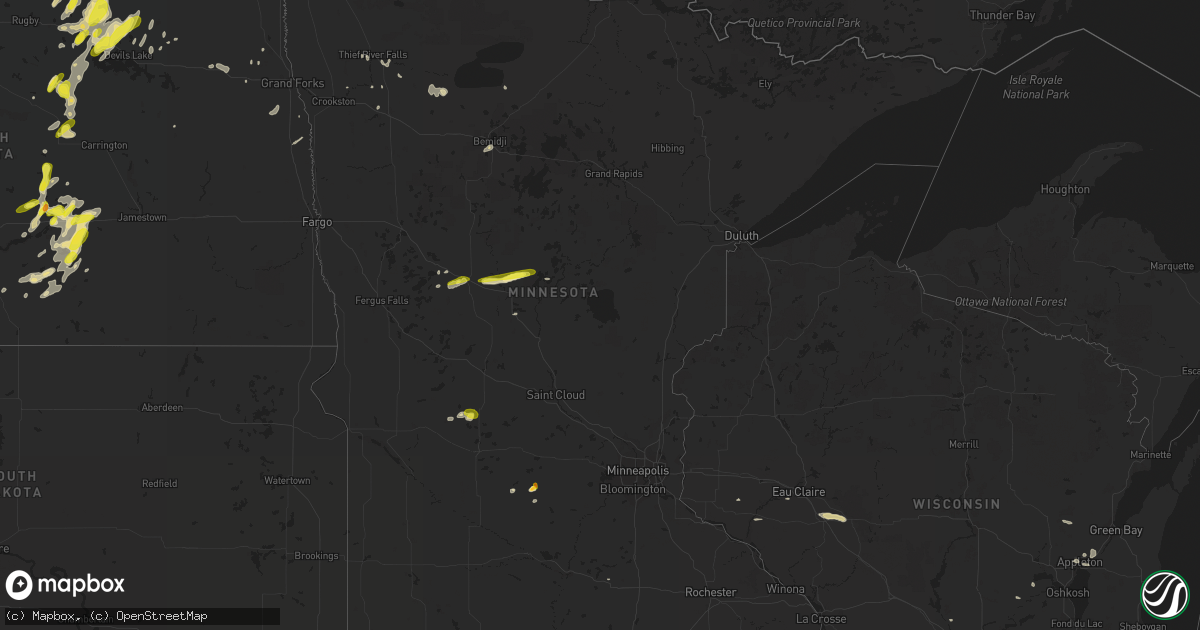
Hail Map in Minnesota on June 2, 2017
Get this storm
June 2 map
$229
one time, instant access
Download today. No call, no setup
Keep the $229
Bought the map and want the full workflow? Apply the entire $229 to a subscription within 7 days. None of it is wasted.
Every map, not just this one
This buys you this map. Subscription and you get every map we run, in the markets you choose from a few cities to whole states to nationwide. Plus real-time alerts the moment a storm fires.
Contact data
Name, contact info, occupancy, even credit band for addresses in the footprint. You go from where it hit to who to call.
Become the source they trust
Unlimited branding weather history reports on demand. You already have the documented answer ready for the property owner, and you are the one who showed up with it.
Property data and RoofTrace estimates
Pull up any address you have got, its value and the exact code rules for that jurisdiction, straight from One Click Code. Then RoofTrace estimates the squares, pitch, and roof value, priced the way you price.
Storm reports in Minnesota
Minnesota
| Date | Description |
|---|---|
| 06/02/20176:49 PM CDT | Trees blown over and power poles snapped off. Radar estimated time. |
| 06/02/20176:35 PM CDT | A local report indicates 1.50 inch wind near 1 S HUTCHINSON |
| 06/02/20175:36 PM CDT | A local report indicates 1.00 inch wind near 5 SW BELGRADE |
| 06/01/201711:10 PM CDT | A few large 4 to 8 inch diameter tree branches and limbs were broken down in farmsteads across southeast sanders township. Tin roofing was blown off of one farm outbuil |
| 06/01/201710:44 PM CDT | A farm drive-through shed was blown down. Several large tree branches were also broken down. Time estimated based on radar and nearby mesonet observations. |
| 06/01/201710:40 PM CDT | Several large 4 to 8 inch diamter tree branches and limbs were broken down at various farmsteads in western angus township. A few 10 diamter poplar trees were snapped. |
| 06/01/201710:30 PM CDT | Several large 4 to 8 inch diameter tree barnches broken down in various homestead yards. One 12 inch diameter box elder tree was snapped. |
| 06/01/201710:25 PM CDT | Quarter sized hail in wadena. |
| 06/01/201710:25 PM CDT | A local report indicates 64 MPH wind near 8 SE EAST GRAND FORKS |
| 06/01/201710:11 PM CDT | Quarter sized hail in wadena. |
All States Impacted by Hail Map on June 2, 2017
Cities Impacted by Hail Map on June 2, 2017
- Arvilla, ND
- Robinson, ND
- Big Spring, TX
- Enning, SD
- Wasta, SD
- Howes, SD
- Thief River Falls, MN
- Bisbee, ND
- York, ND
- Faith, SD
- Haigler, NE
- Minnewaukan, ND
- Starkweather, ND
- Webster, ND
- Devils Lake, ND
- Penn, ND
- Churchs Ferry, ND
- Leeds, ND
- Cando, ND
- Kintyre, ND
- Napoleon, ND
- Strasburg, ND
- Fessenden, ND
- Bowdon, ND
- Cathay, ND
- Jonesboro, TX
- Del Rio, TX
- Tappen, ND
- Medina, ND
- Streeter, ND
- Levelland, TX
- Ropesville, TX
- Grand Prairie, TX
- Rocklake, ND
- Perth, ND
- Hutchinson, MN
- Berlin, WI
- Augusta, WI
- Osseo, WI
- Fairchild, WI
- Gonvick, MN
- Dallas, TX
- Mesquite, TX
- Reynolds, ND
- Merriman, NE
- White River, SD
- Odonnell, TX
- Tahoka, TX
- Ralls, TX
- Gail, TX
- Coahoma, TX
- Ira, TX
- Kiowa, CO
- Sunnyvale, TX
- Forney, TX
- Rowlett, TX
- Garland, TX
- Rockwall, TX
- Tarzan, TX
- Appleton, WI
- Kaukauna, WI
- Pearsall, TX
- Steele, ND
- Eden, WI
- Fond Du Lac, WI
- Hatton, ND
- Chadron, NE
- Lorenzo, TX
- Slaton, TX
- Lubbock, TX
- Gilby, ND
- Mylo, ND
- Rolla, ND
- Wolford, ND
- Hansboro, ND
- Agate, ND
- Stewart, MN
- Oberon, ND
- Maddock, ND
- Box Elder, SD
- Welch, TX
- Lamesa, TX
- Ackerly, TX
- Canyon, TX
- Sterling City, TX
- Westbrook, TX
- Motley, MN
- Pequot Lakes, MN
- Verndale, MN
- Staples, MN
- Wanblee, SD
- Amarillo, TX
- Comstock, TX
- Dryden, TX
- Sanderson, TX
- White Owl, SD
- New Underwood, SD
- Roscoe, TX
- Long Valley, SD
- Stanton, TX
- Linton, ND
- Selfridge, ND
- Arlington, TX
- Red Lake Falls, MN
- Redgranite, WI
- Saint John, ND
- Esmond, ND
- New York Mills, MN
- Wadena, MN
- Harvey, ND
- Meadow, TX
- Kadoka, SD
- Athens, TX
- Eustace, TX
- Lampasas, TX
- Dawson, ND
- Durand, WI
- Saint Francis, SD
- Bigfoot, TX
- Egeland, ND
- La Coste, TX
- San Antonio, TX
- Castroville, TX
- Thompson, ND
- Mission, SD
- Hart, TX
- Midland, TX
- Marsland, NE
- Hemingford, NE
- Brooten, MN
- Wildorado, TX
- Irving, TX
- Wray, CO
- Yuma, CO
- Akron, CO
- Haswell, CO
- Ovid, CO
- Julesburg, CO
- Henning, MN
- Driscoll, ND
- Norris, SD
- Cleveland, ND
- Haxtun, CO
- Holyoke, CO
- Rapid City, SD
- Hillsboro, ND
- Fort Stockton, TX
- Minto, ND
- Burnett, WI
- Lawton, ND
- Earth, TX
- Larimore, ND
- Niagara, ND
- Rocksprings, TX
- Brackettville, TX
- Karval, CO
- Dupree, SD
- Hereford, TX
- Imperial, TX
- New London, MN
- Belgrade, MN
- Buffalo Lake, MN
- Wylie, TX
- Sachse, TX
- Parmelee, SD
- Crosbyton, TX
- Idalou, TX
- Cushing, MN
- Desoto, TX
- Duncanville, TX
- Sunburg, MN
- Bethune, CO
- Crary, ND
- Natalia, TX
- Argyle, TX
- Plummer, MN
- Waseca, MN
- Kit Carson, CO
- Brocket, ND
- Belcourt, ND
- Murdock, MN
- Mentor, MN
- Pollock, SD
- Wakpala, SD
- Keystone, SD
- Brownton, MN
- Devine, TX
- McIntosh, SD
- Deer Creek, MN
- Fort Yates, ND
- Caledonia, ND
- Meadow, SD
- Bemidji, MN
- Eckley, CO
- Wishek, ND
- Petersburg, ND
- Shiocton, WI
- Black Creek, WI
- Goldfield, IA
- Gackle, ND
- Pettibone, ND
- Fort Davis, TX
- Marathon, TX
- Woodworth, ND
- Eau Claire, WI
- Brainerd, MN
- Post, TX
- Binford, ND
- Lytle, TX
- Oakfield, WI
- Blackduck, MN
- Elmwood, WI
- Grand Marsh, WI
- Wisconsin Dells, WI
- Jacksonville, TX
- Palestine, TX
- Frankston, TX
- Nisswa, MN
- Bluffton, MN
- Alpine, TX


